Cloudy, rainy, se winds, and fog at times and very dense fog at times. In north eastern Somerset County and Eastern Cambria County, a little snow fell in the morning (pics in the video of pics of the day)
Temp profile this afternoon
Radar with estimates 9pm to 9pm
Satellite
Flow
Surface features and 500mb height anomalies and flow
Pics
Webcam near Claysburg and Bacock Mt this morning
The continuing PITT NWS struggle with temp forecast in this setup. From forecasting mid 50s for Friday a few days ago, to still forecasting low 50s for this afternoon just 24 hours ago, to forecasting upper 40s yet this morning, and finally changing it to lower 40s this afternoon. In which some areas never broke 40. Then forecasting max temps low 40s finally this afternoon, but forecasting temps holding steady mid 40s overnight. The same type of setup that has been their failure in many freezing rain setups this past winter and previous winters
Party to mostly sunny day, very dry air mass in place. Very windy today as well.
Temp profile this afternoon
Radar void of precip
Satellite
Flow
Surface features and 500mb height anomalies and flow
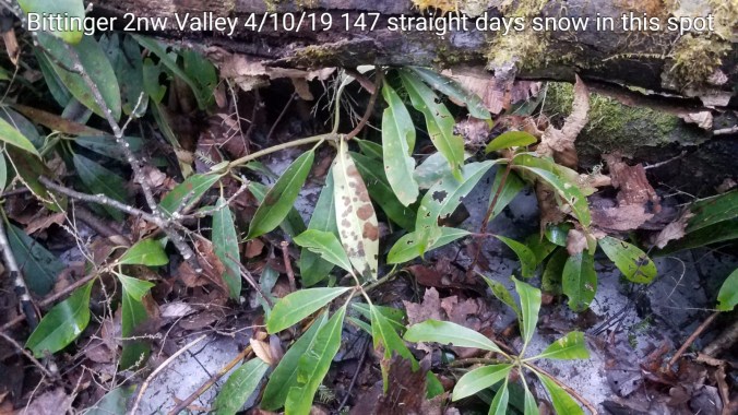
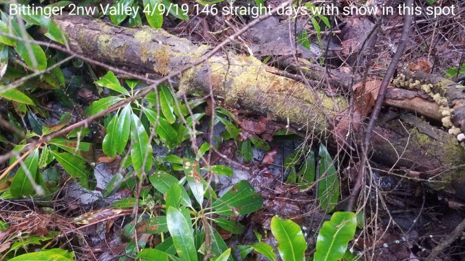
The last remaining snow- Drifts, piles, and sheltered areas(high protected valleys, and rock crevices, mini caves) Speaking of those, on Meadow Mt at Deep Creek State Park, a large rock outcropping is one of those sheltered areas. Temps within some of those areas, rock temps 27-30°. At Bittinger 2nw Valley, some snow remains in the rhodedendron, and one location at 140 straight days of snow cover(since Nov 15)
Soil temp in the pines at Bittinger 2nw Valley, 1inch depth the soil is still frozen
Way Back Wednesday-
Back to April 3, 2016. A nice upslope fluff event occurred. Around 4-5″, not as impressive what occurred several days (almost a week) after, that I’ll post on in several days
Partly sunny start, periods of high cloudiness and at times a lowering cloud deck, and back to intervals of sun. A strong Nor Easter developing off the Va coast, leaving behind snow in parts of the Carolinas east of the Mts which is fairly rare for April. 6th time in Charlottes recorded history with April snowfall.
Temp profile this afternoon
Radar
Satellite
Flow
Surface features and 500mb height anomalies and flow
Day started with light snowshowers, some lingered through mid morning with flurries until mid to late morning before skies cleared. Breezy. Below 0 windchills early across high Wv ground
Temp profile this afternoon
Radar
Snowfall- picked up .2″ overnight and this morning. 89.6″ on the season Depth around 1.1″ in non melted areas to start today. These measurements off multiple snowboards. Snow depth on ground varied as it is that time of year where some locations melt off faster. Snow melted off today in sunny areas, remained in shady areas.
Satellite
Flow
Surface features and 500mb height anomalies and flow
Pics today
Glade Run at Bittinger 2nw Valley water temp- at morning check 37.0, evening check 40.3. Despite cold temps today, afternoon sun had a positive change in stream temp