bJuly 7, 2019
Canaan cam offline
July 7(Sun) min max. avg
Bitt 2nw Valley 61.9 75.7 68.8
Garrett College 65.0 80.7 72.8
New Germany SP 65 80 72.5
Can-Heights 63 78 70.5
CRN-Canaan 63.6 76.6 70.1
Cabin Mt 62.2 75.3 68.7
Cabin Mt N 62.4 75.7 69.0
Spruce Knob 60.8 72.8 66.8
Snowshoe 62 70 66
Can-Valley Floor N 58.8 78.9 68.8
7Springs no data
Cumberland AP 69.6 84.7 77.2
Mainly cloudy a.m, few showers, then some sun breaking in the afternoon and scattered heavy downpours, causing small stream flooding.
Temp profile this afternoon


Radar
Satellite
Flow
Surface features and 500mb height anomalies and flow


Pics


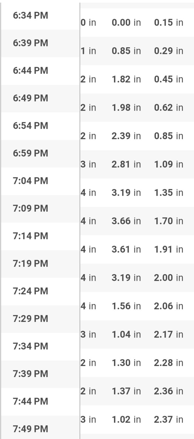
A closer look at 2 individual “dumpers”. Relatively small in size, but intense.
First is the Canaan Valley storm which basically centered over the Timberline area. For example- Bald Knob picked up .33 on the day, northern Cabin Mt picked up .02, Resort area at the CRN station .10. The cell centered in between in a small area picked up 1 to nearly 3″. The cell put down nearly 2.5″ at the old Timberline site with 2.3″ in 1 hour. The station picked up a total of 2.89 on the day. Radar estimates coincide with area gauges pretty well.


Another heavy cell existed in the Meyersdale vicinity. Again looking like a 2-3″ quick event.


A WU station gauge at Salisbury Street Meyserdale