November 27, 2019
Nov 27(Wed)
Few light showers overnight, cloudy start to afternoon sunshine with increasing strong winds with high wind warnings issued. A very mild afternoon. A few flakes after dark, with ice pellets.
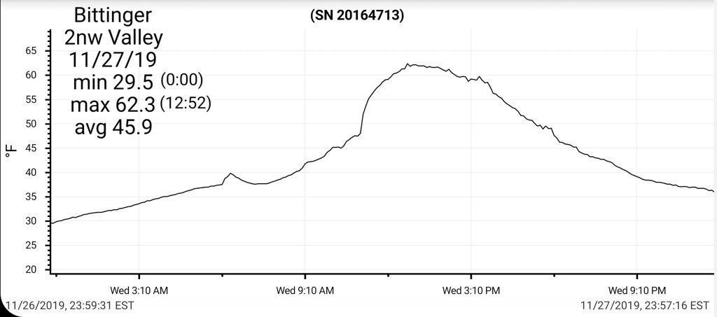
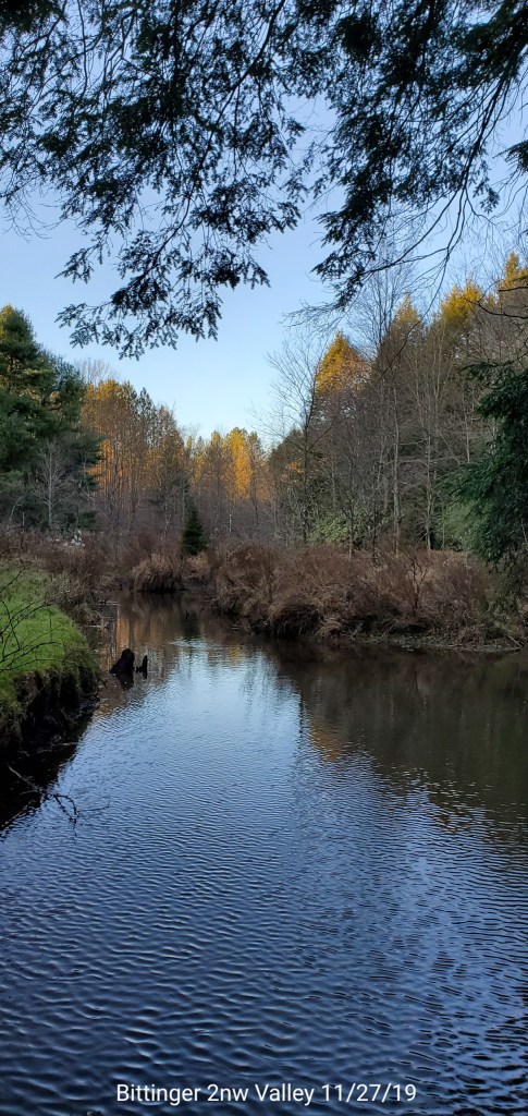
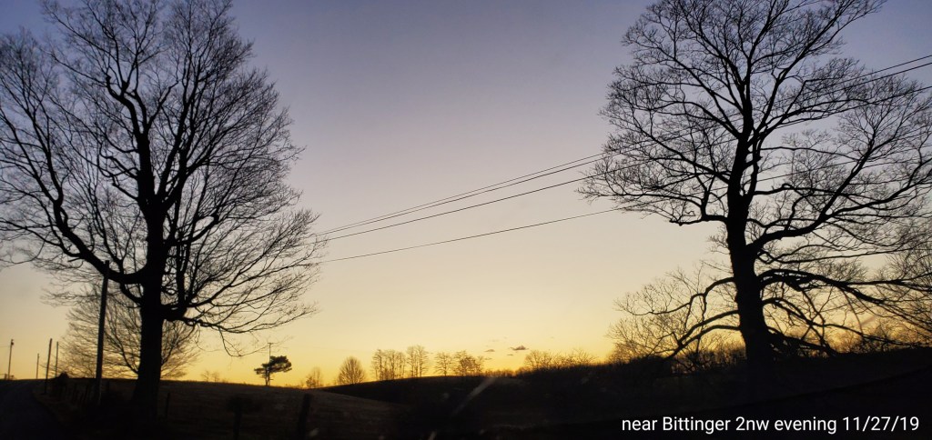
Bittinger 2nw Valley
MIN[29.5]–MAX[62.3]–AVG[45.9]–PRECIP[.05]7am
Season to date snowfall 5.3″
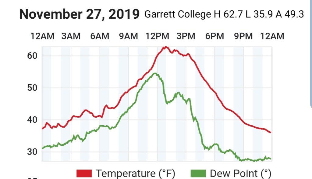
Garrett College
MIN[35.9]—MAX[62.7]—AVG[49.3]—PRECIP[.05]
Canaan Heights/Davis 3SE
MIN[31.9]–MAX[57.3]–AVG[44.6]–PRECIP[.04]7am
Season to date snowfall 8.9″
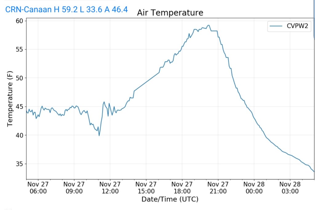
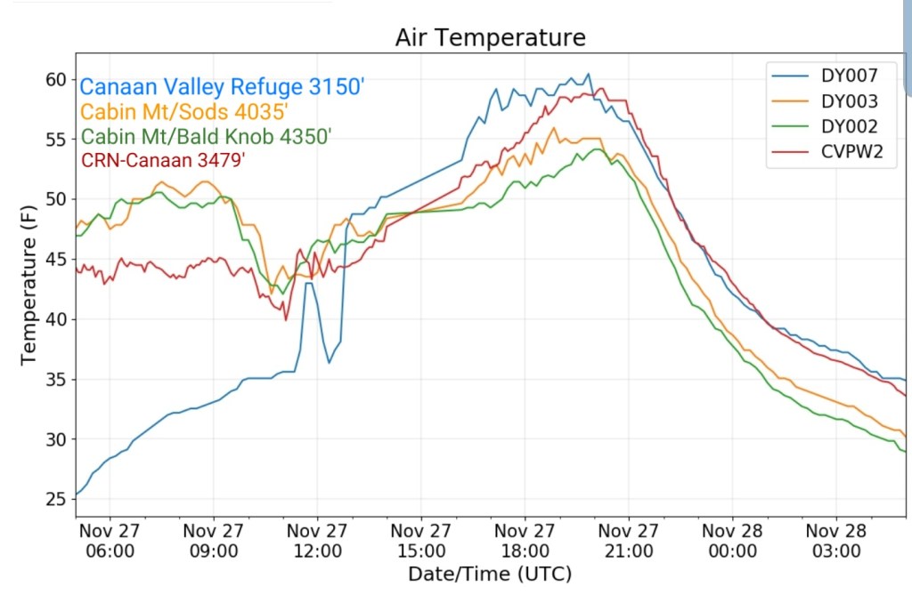
Climate Reference Network Canaan State Park
MIN[33.6]—MAX[59.2]—AVG[46.4]—PRECIP
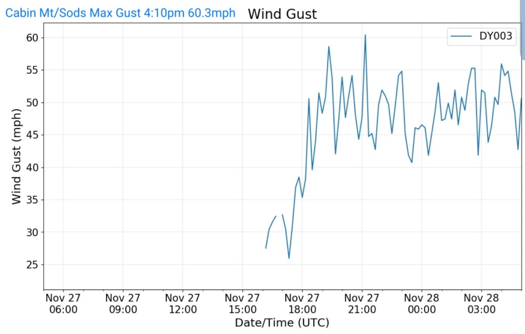
Cabin Mt at Bald Knob
MIN[29.1]—MAX[54.1]—AVG[41.6]—PRECIP[.11]

Cabin Mt – western Dolly Sods
MIN[30.7]—MAX[55.9]—AVG[43.3]—PRECIP[.06]
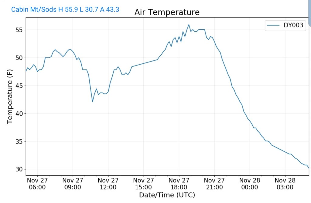
Peak wind gust to 60.3mph
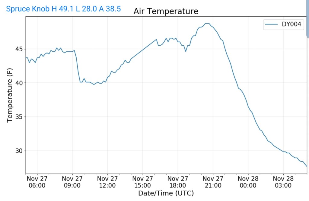
Spruce Knob
MIN[28.0]—MAX[49.1]—AVG[38.5]—PRECIP[.10]
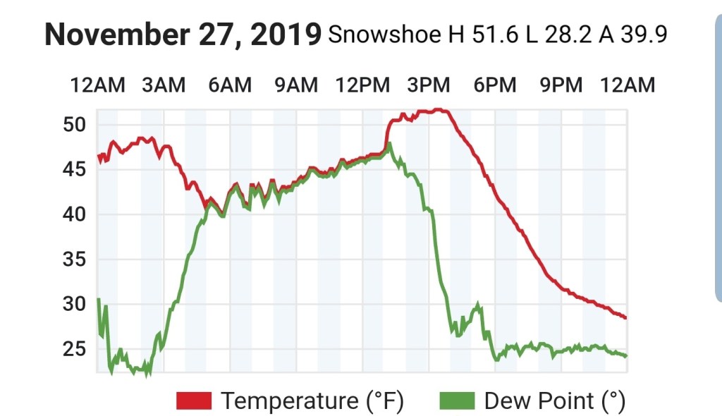
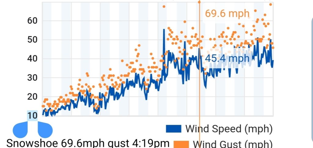
Snowshoe
MIN[28.2]—MAX[51.6]—AVG[39.9]
Peak wind gust at this station at 69.6mph. However I will include a huge * because the siting of this station is unknown and therefore wind data may be enhanced, if this station is poorly sited and enhanced by artificial surroundings enhancing wind funneling. This is not to say the data is incorrect. It’s an unknown.
Canaan Valley Refuge
MIN[25.3]—MAX[60.4]—AVG[42.8]

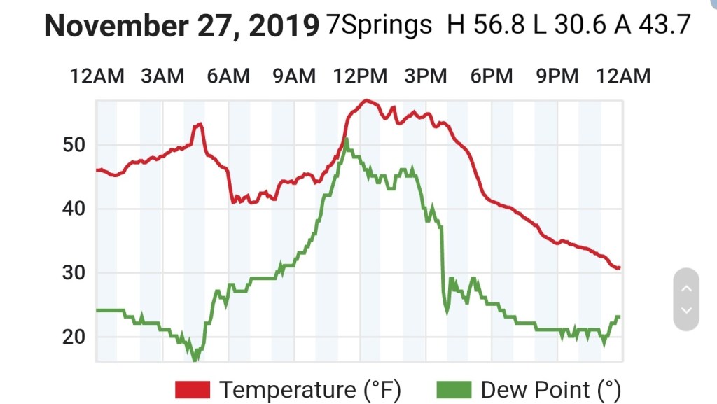
7Springs
MIN[30.6]—MAX[56.8]—AVG[43.7]
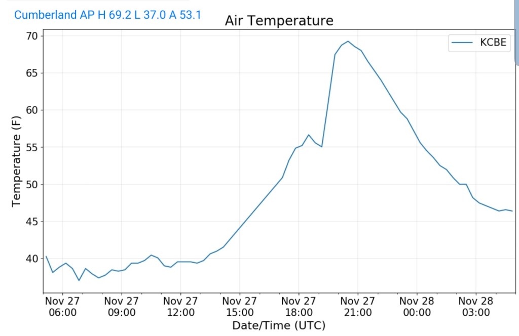
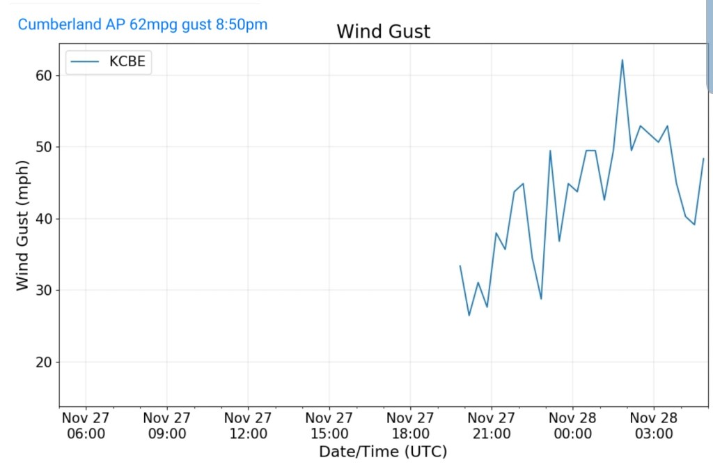
Cumberland Airport
MIN[37.0]—MAX[69.2]—AVG[53.1]
Peak wind gust 62mph at 8:50pm. Again, anemometer siting is unknown. Therefore data quality may be good or poor.
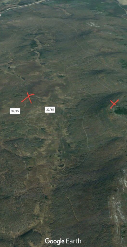
The Valley vs Cabin Mt
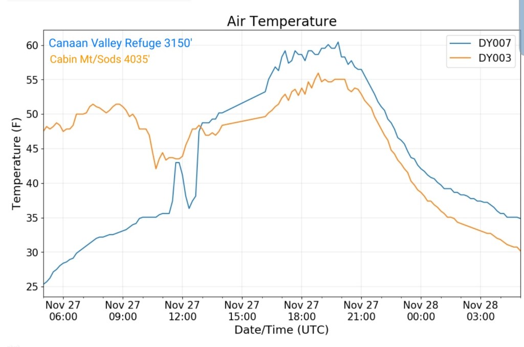
Canaan area temps
Comparison view
RTMA
Radar
Satellite
Flow
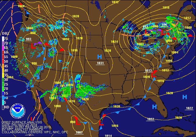
Surface features and 500mb height anomalies and flow


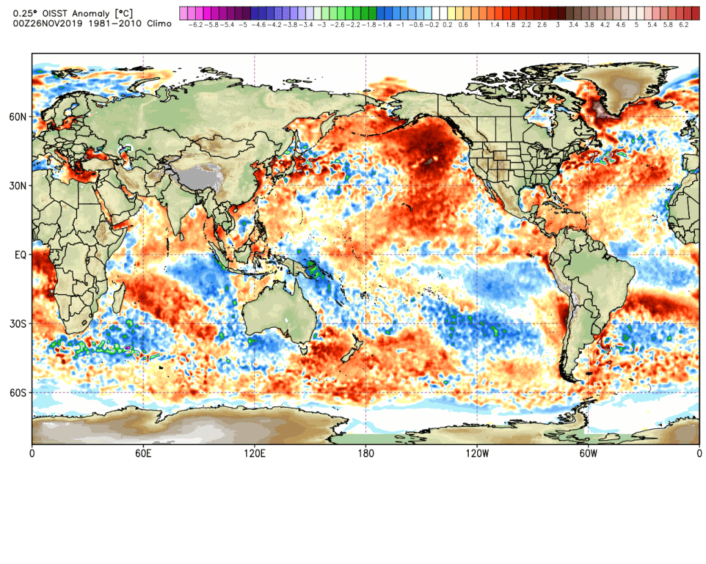
Sea Surface Temperature Anomalies
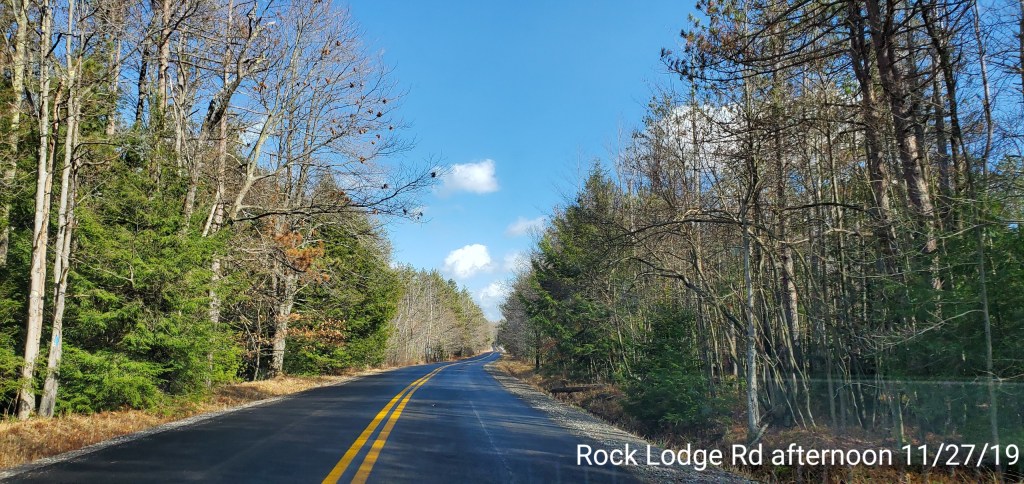
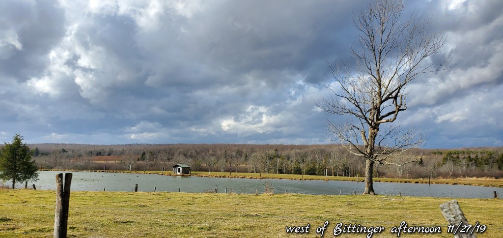
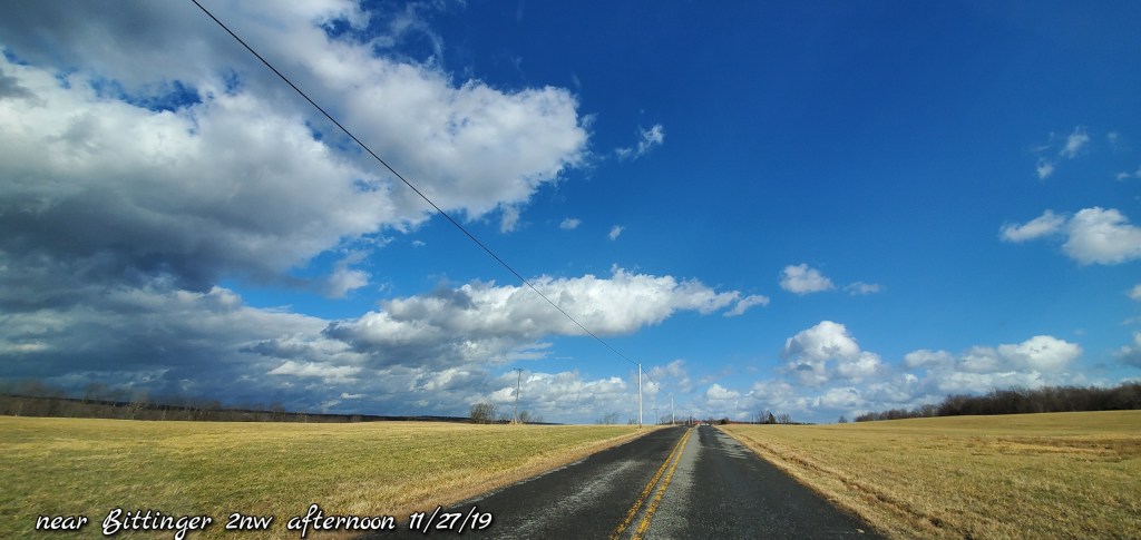
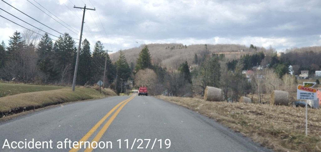
Pics today-
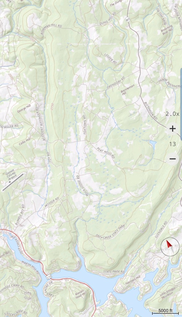
Deep Creek Lake/McHenry to Bittinger area


Winds a blowin… .
After dark, some flakes flying as temps fell, but very limited overnight and changing to light freezing drizzle. Models blew this….
