December 2, 2019
Dec 2(Mon)
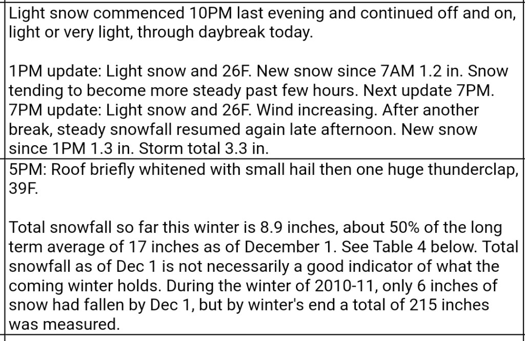
Snowshowers on and off through the day. Mostly light, at times moderate. Picked up some after nightfall.
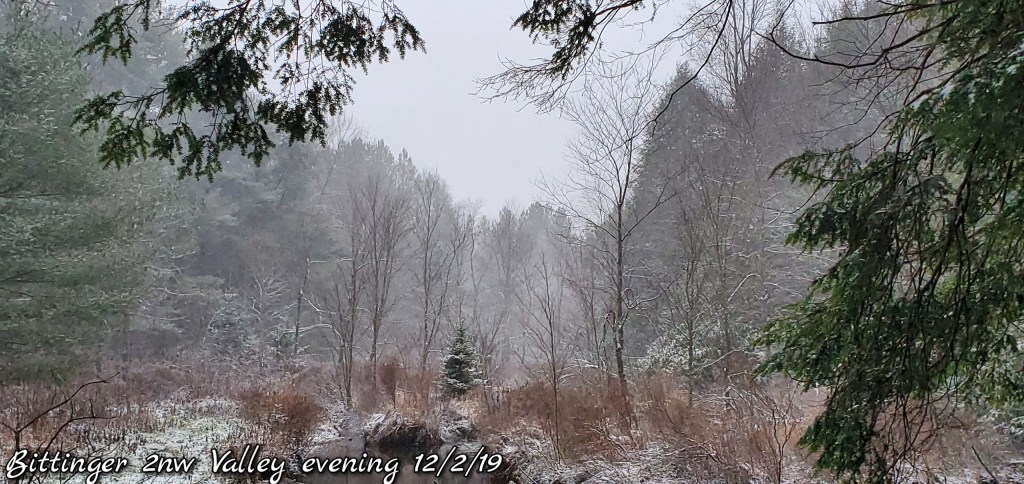
Bittinger 2nw Valley
MIN[27.5]—MAX[31.8]—AVG[29.6]—PRECIP[.43]7am
Snowfall today at 1.3″ at 6pm boardsweep
Snowfall season to date at 6.6″


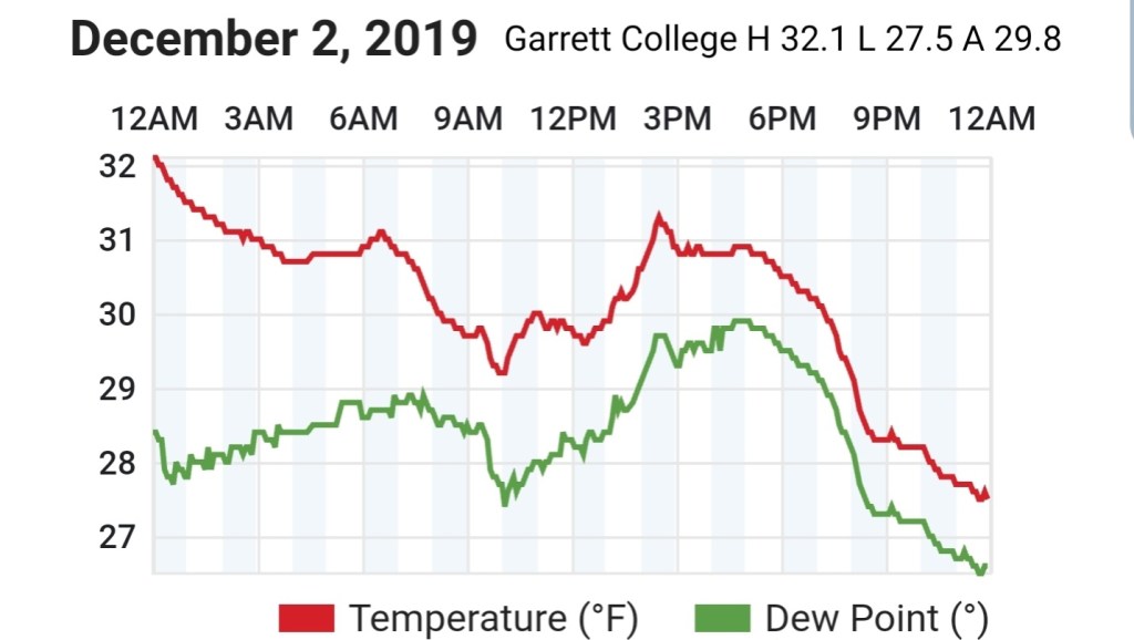
Garrett College
MIN[27.5]—MAX[32.1]—AVG[29.8]—PRECIP[F]
Canaan Heights/Davis 3SE
MIN[24.3]—MAX[28.7]—AVG[26.5]—[.79]7am
Snowfall through 7pm 3.3″
Snowfall season to date 12.2″
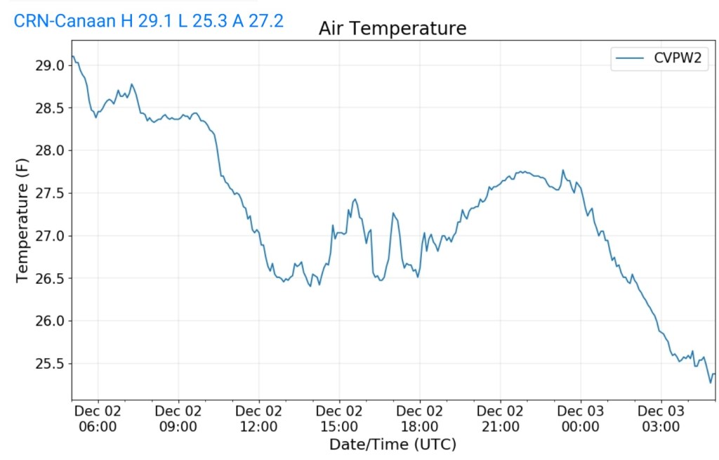
Climate Reference Network Canaan
MIN[25.3]—MAX[29.1]—AVG[27.2]—PRECIP[
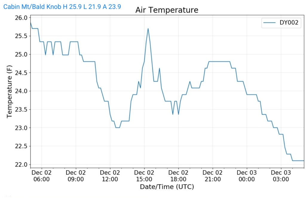
Cabin Mt at Bald Knob
MIN[21.9]—MAX[25.9]—AVG[23.9]—PRECIP[F]
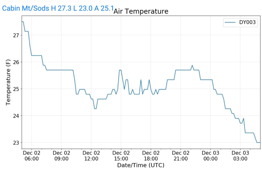
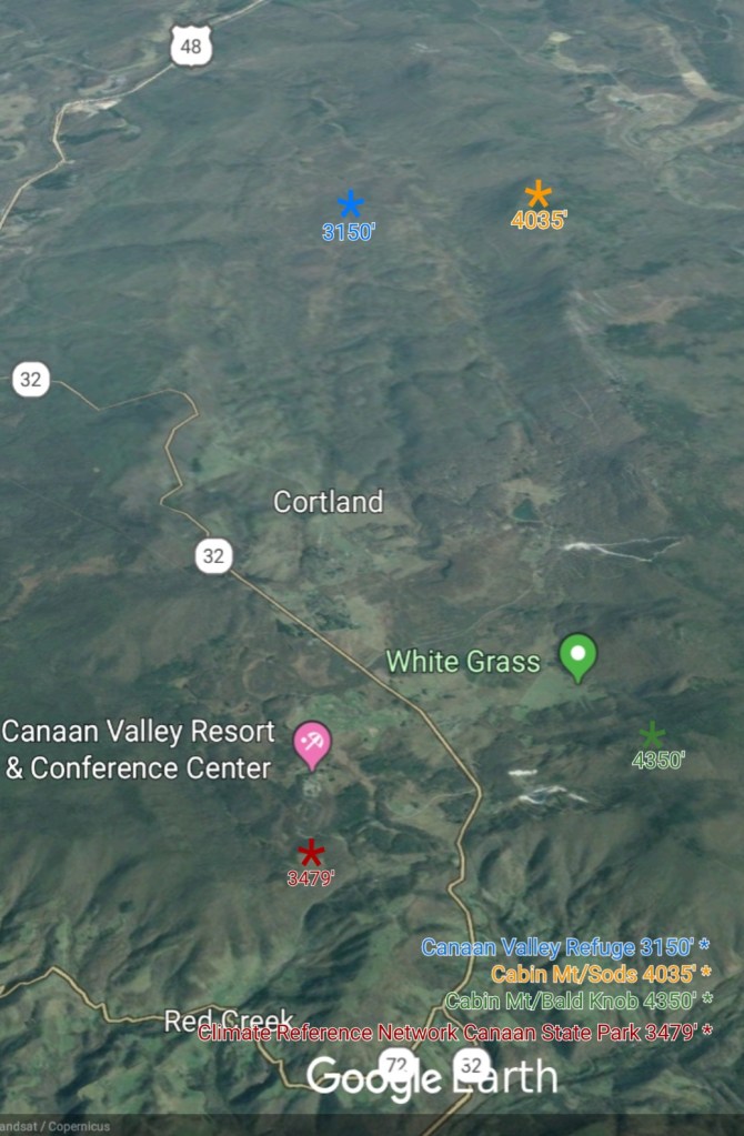
Cabin Mt-Western Sods
MIN[23.0]—MAX[27.3]—AVG[25.1]—PRECIP[F]
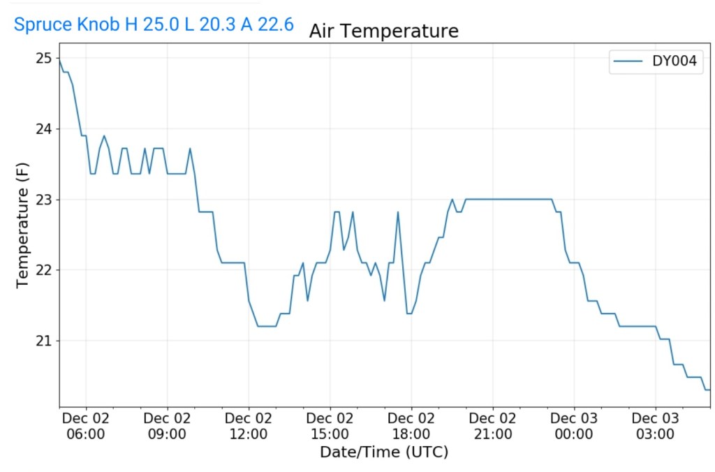
Spruce Knob
MIN[20.3]—MAX[25.0]—AVG[22.6]—PRECIP[F]
Snowshoe
MIN[20.5]—MAX[24.3]—AVG[22.4]

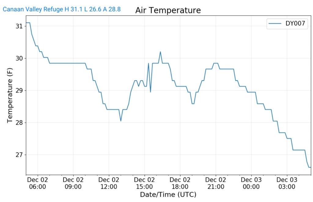
Canaan Valley Refuge
MIN[26.6]—MAX[31.1]—AVG[28.8
7Springs
MIN[25.6]—MAX[29.4]—AVG[27.5]

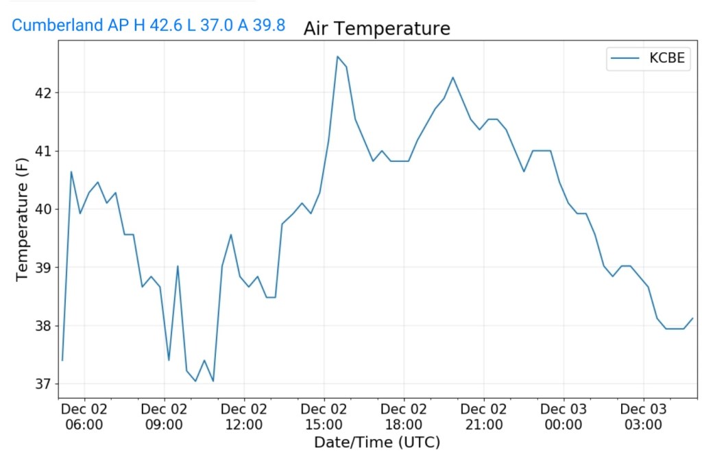
Cumberland Airport
MIN[37.0]—MAX[42.6]—AVG[39.8]
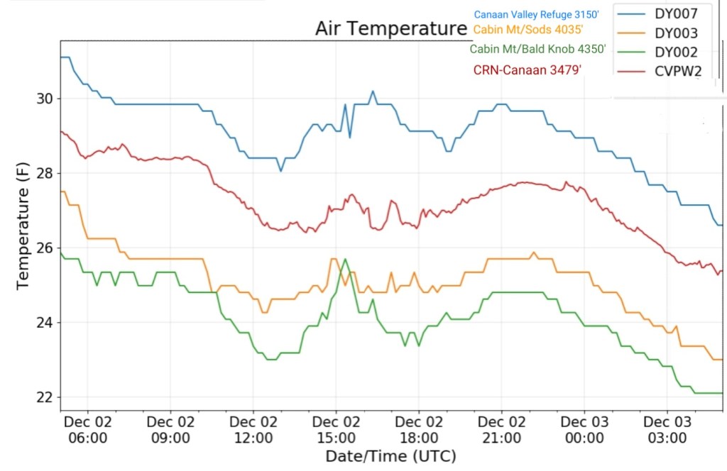
The Valley vs Cabin Mt
Results on a windy day
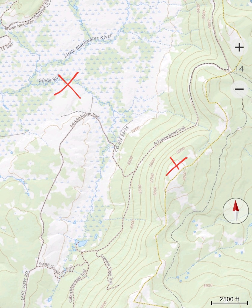
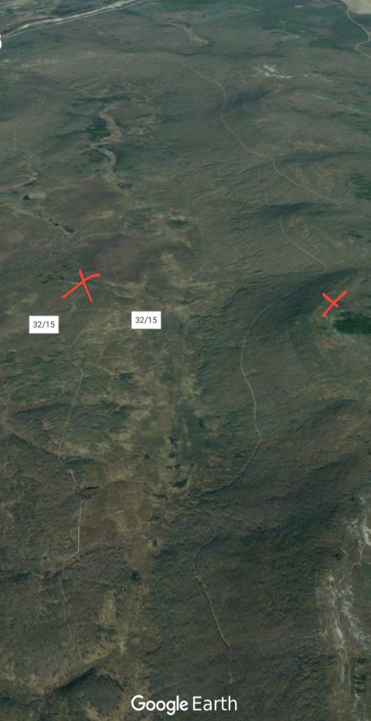
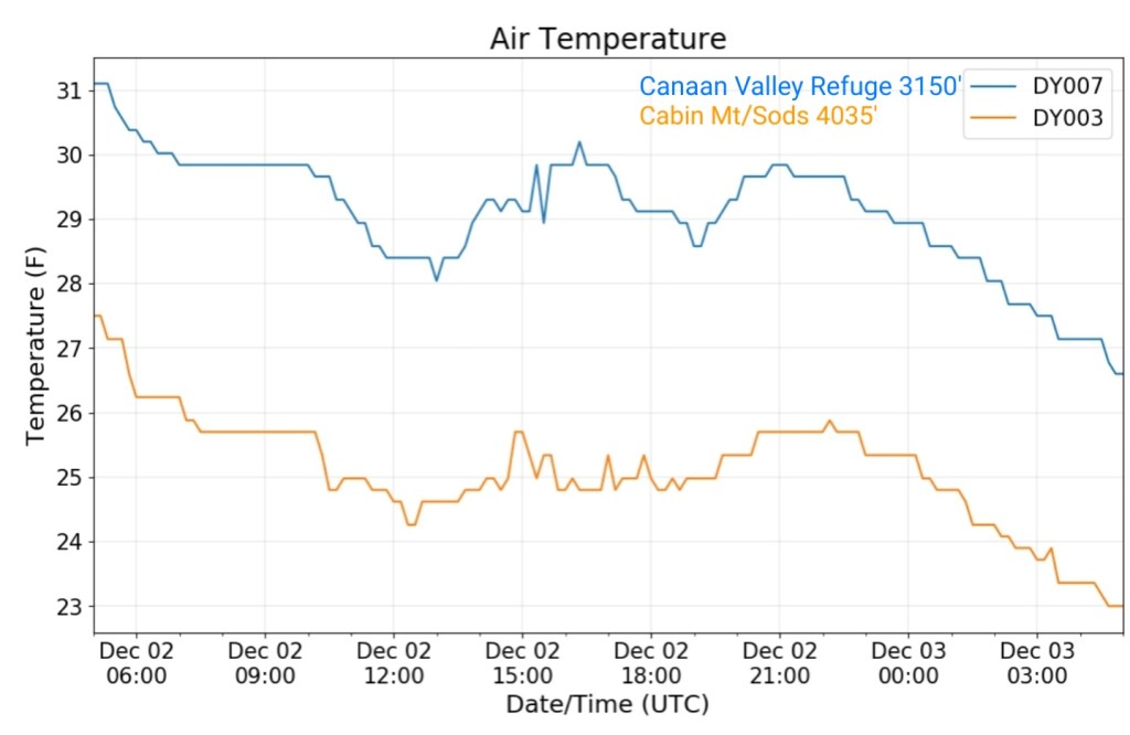
Canaan area temps
Comparison view
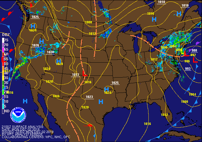
RTMA
Radar
Satellite
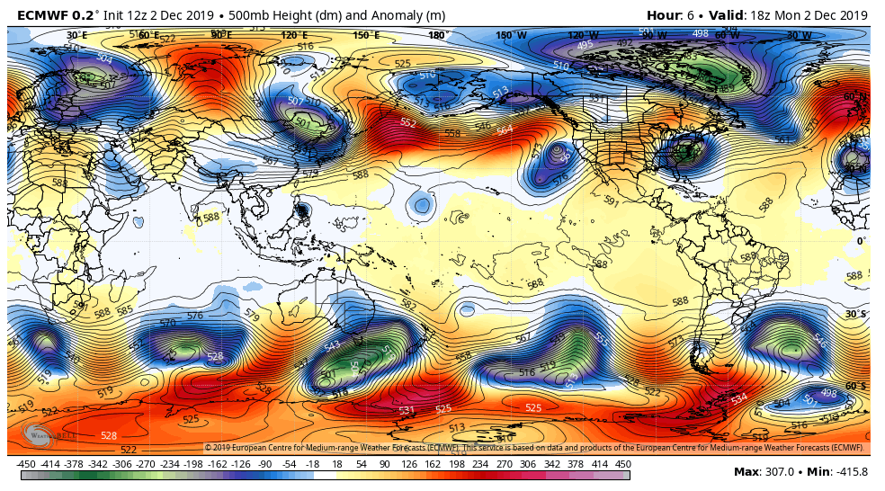
Flow
Surface features and 500mb height anomalies and flow

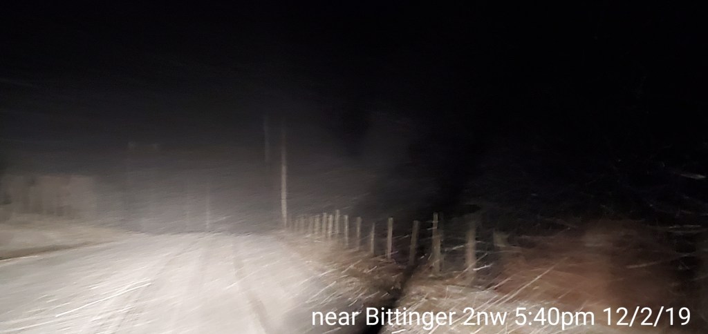
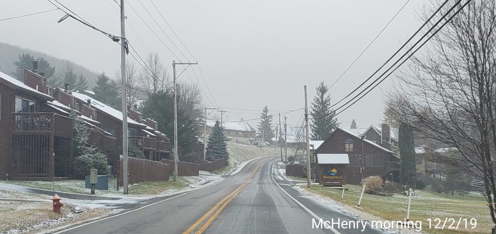
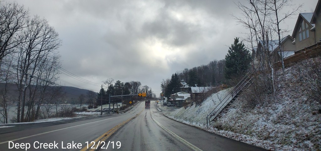
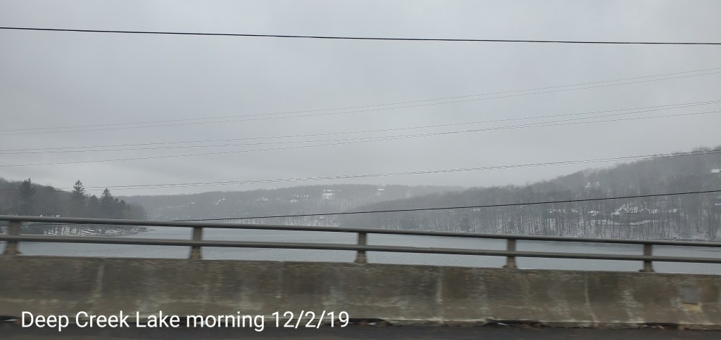
Pics today-
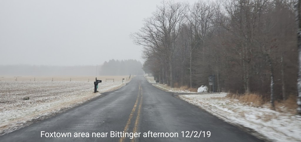
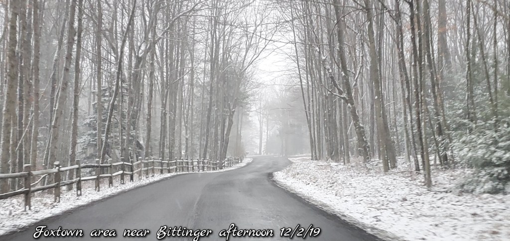
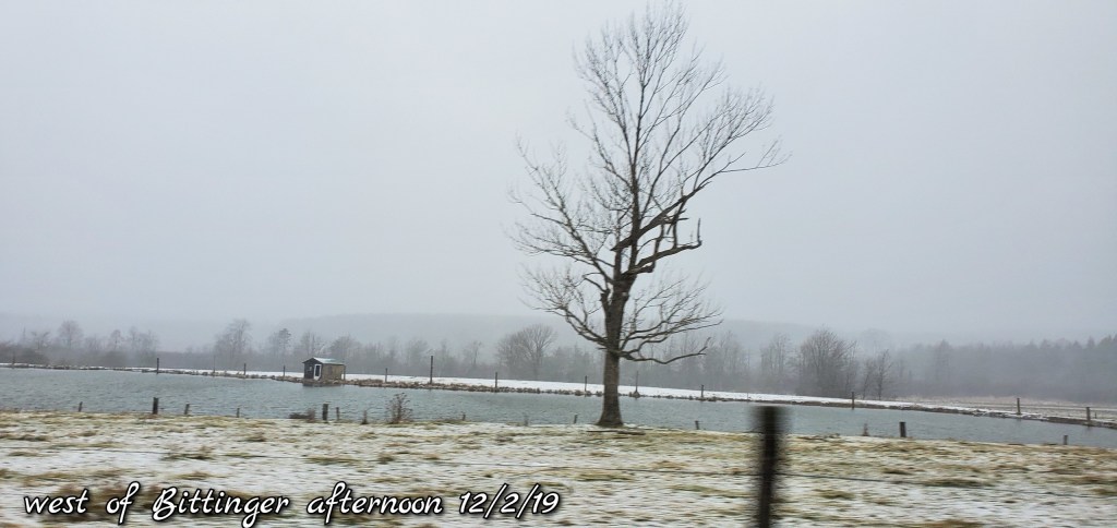
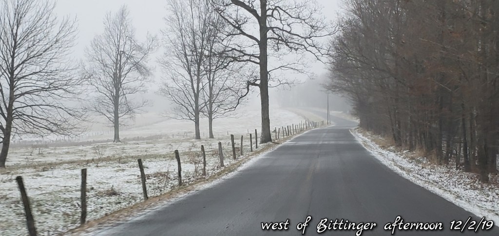
Bittinger area

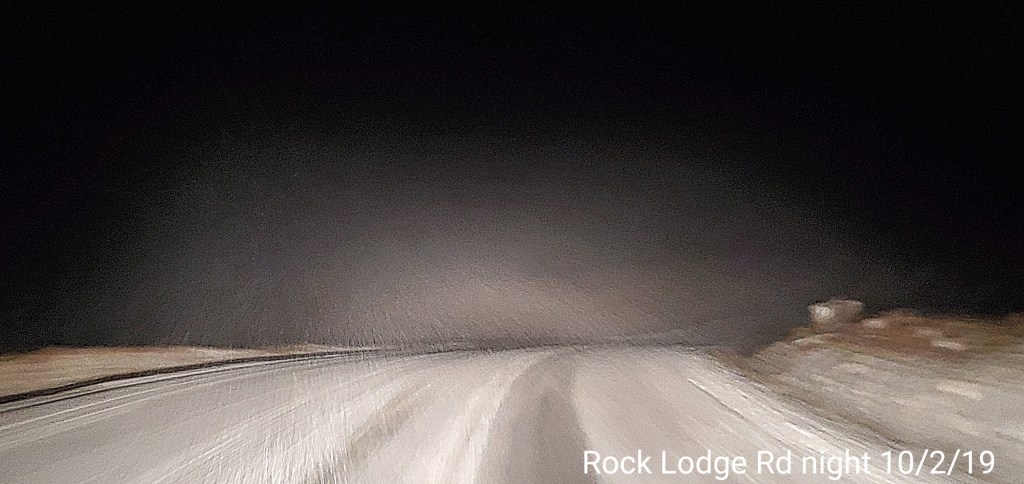
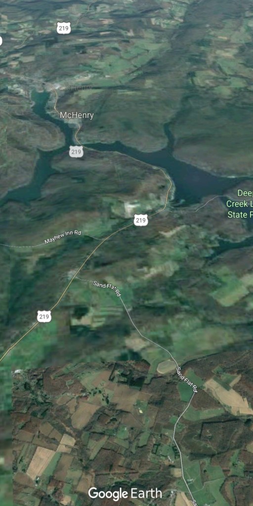
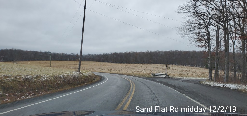
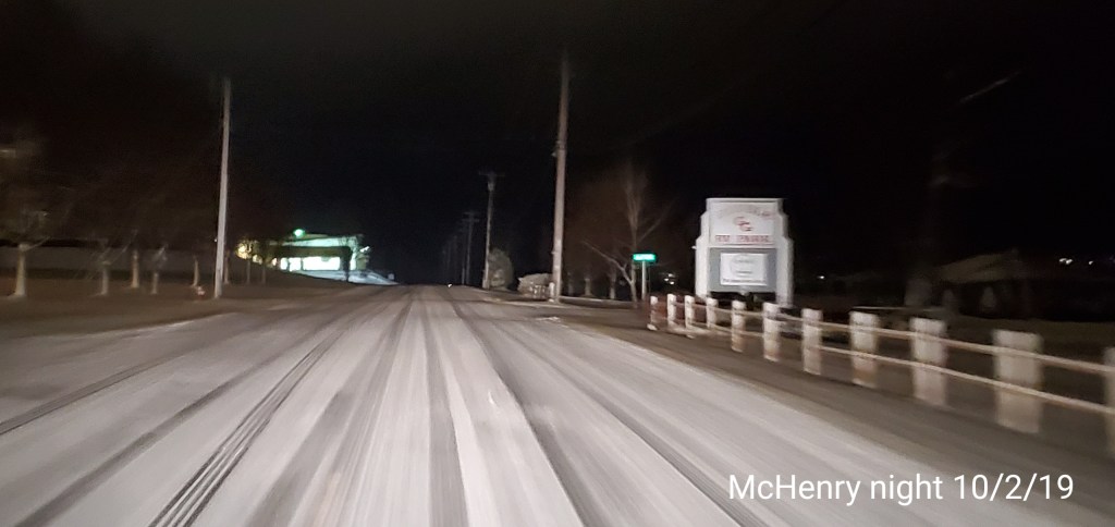
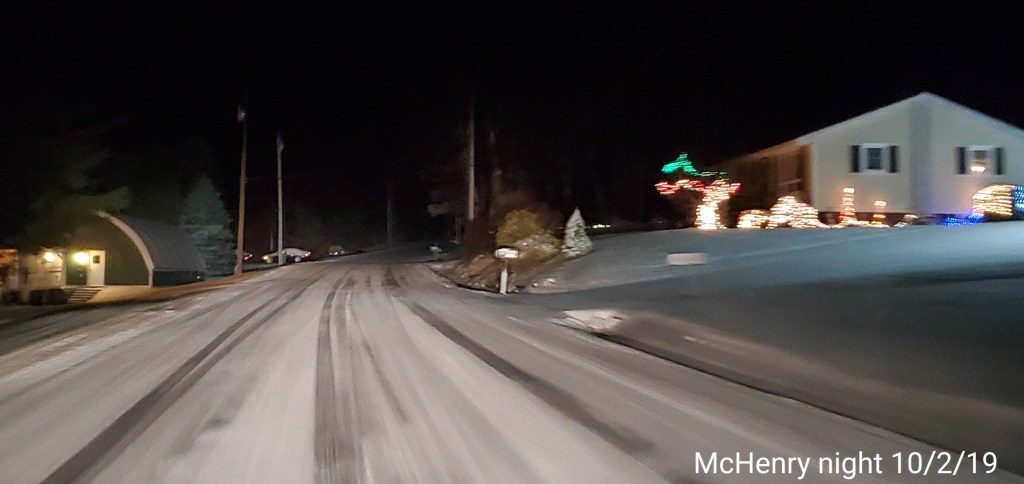
McHenry/Deep Creek/Sand Flat/ North of Oakland areas


Morning outlook-
Post generated 8am:
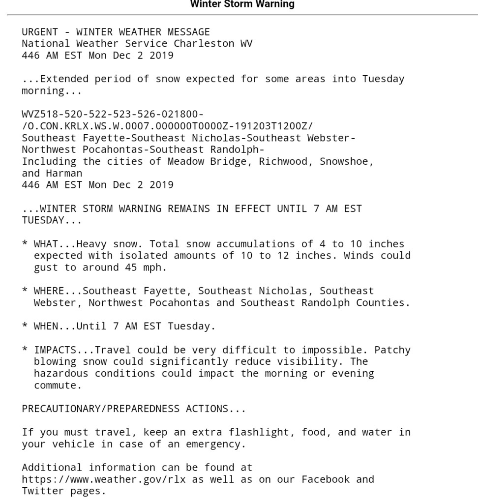
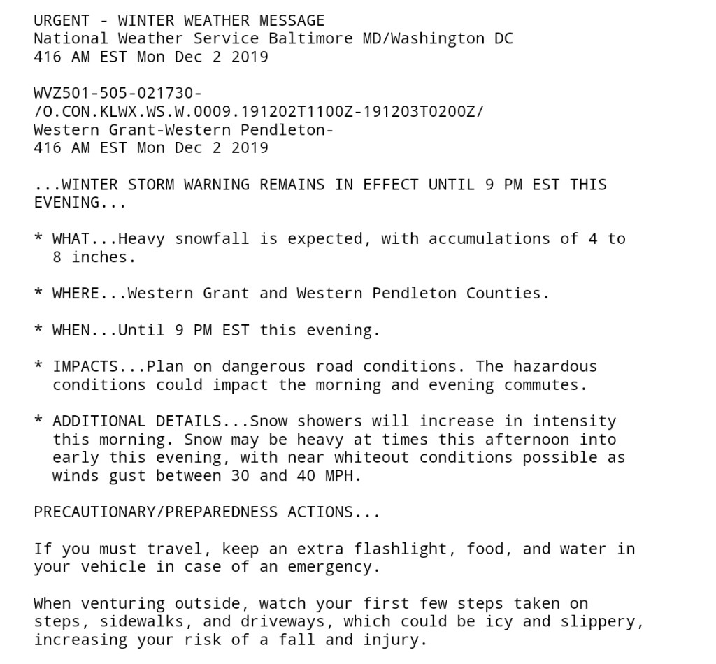
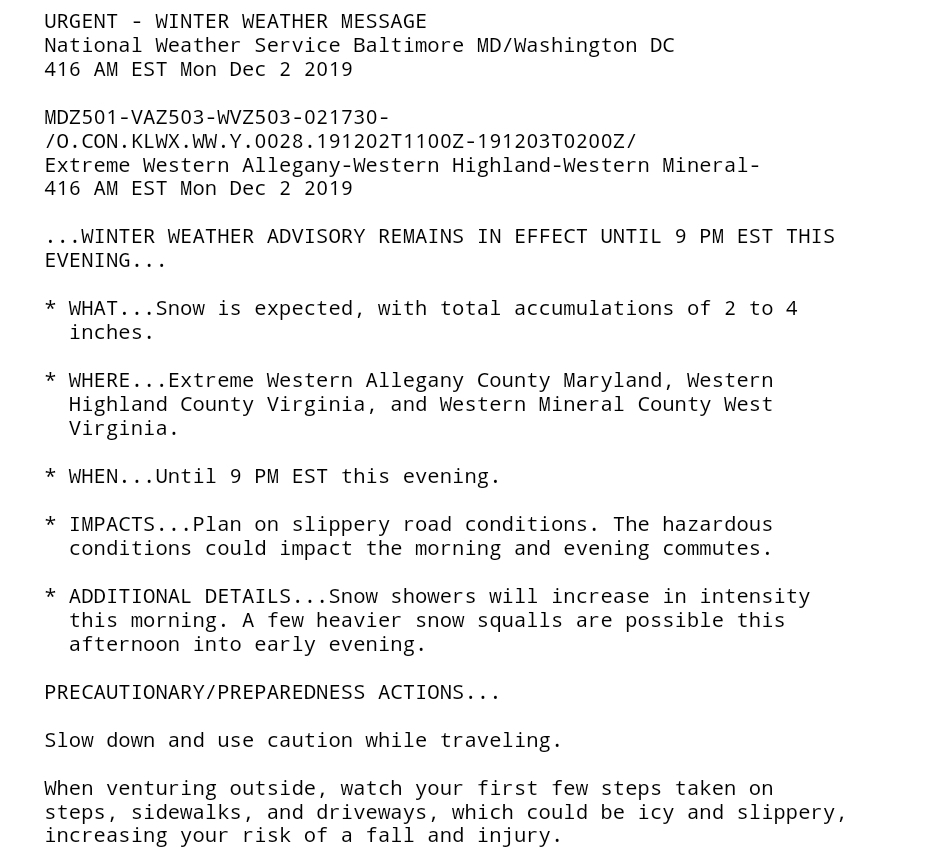
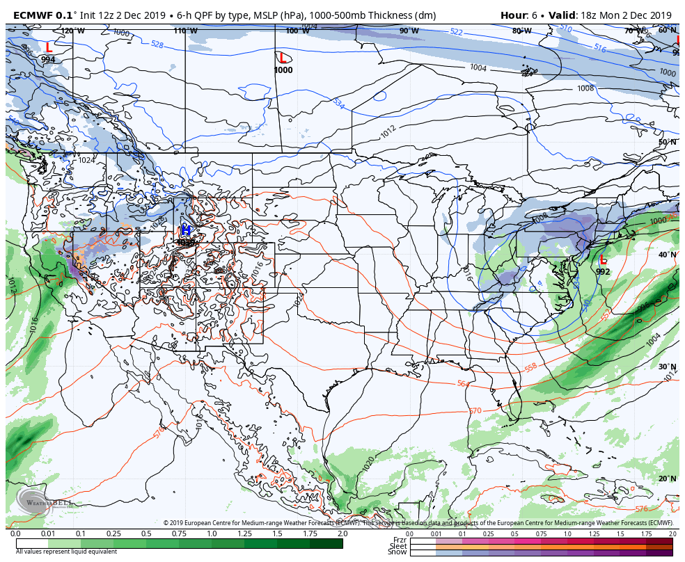
Backside snows kick in today and increase through the day. Areas in the southern Alleghenies, down through the Smokies have the best upslope trajectory with this initially today. As we progress into the afternoon, evening, snow activity increases north into Garrett County, Preston County into southern Pa(Fayette, Westmoreland, Somerset, Cambria) as winds become more NW. Moderate pockets do exist in this area this morning though.
Winds turning NW-
(6ZGFS-Ventusky images, 0zECMWF-Weatherbell)
Overall thoughts on accumulation from now through Tuesday morning really has not changed.
4-8″ WV upslope High Ground and lean low to mid range as always in expected totals, if things perform well, the upper ranges can be met, or even exceeded.
2-5″ Preston, Garrett, Somerset, Cambria, eastern Fayette, eastern Westmoreland. West is best, east it least.
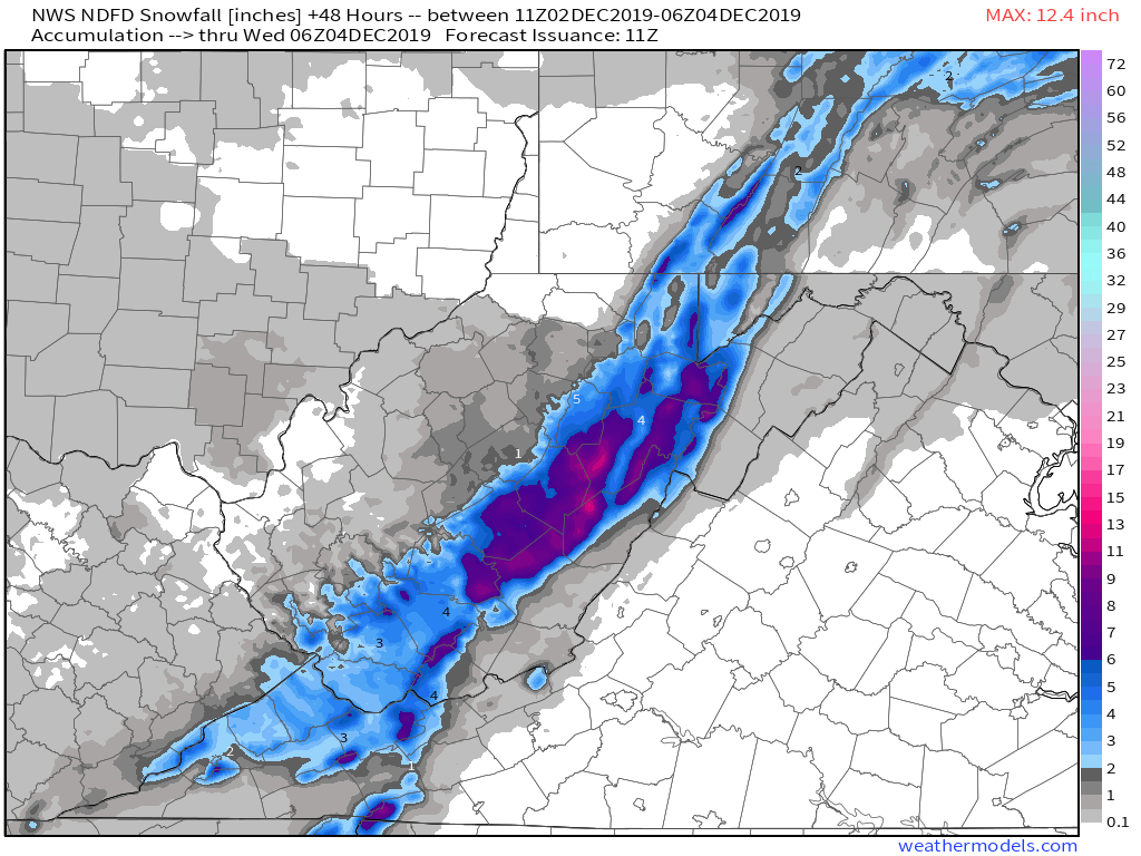
The WFO(weather forecast office)snowfall map looks like –
(Image-weather.us)
Off the models(6z GFS, 0z ECMWF)

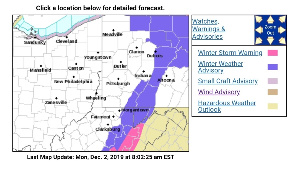
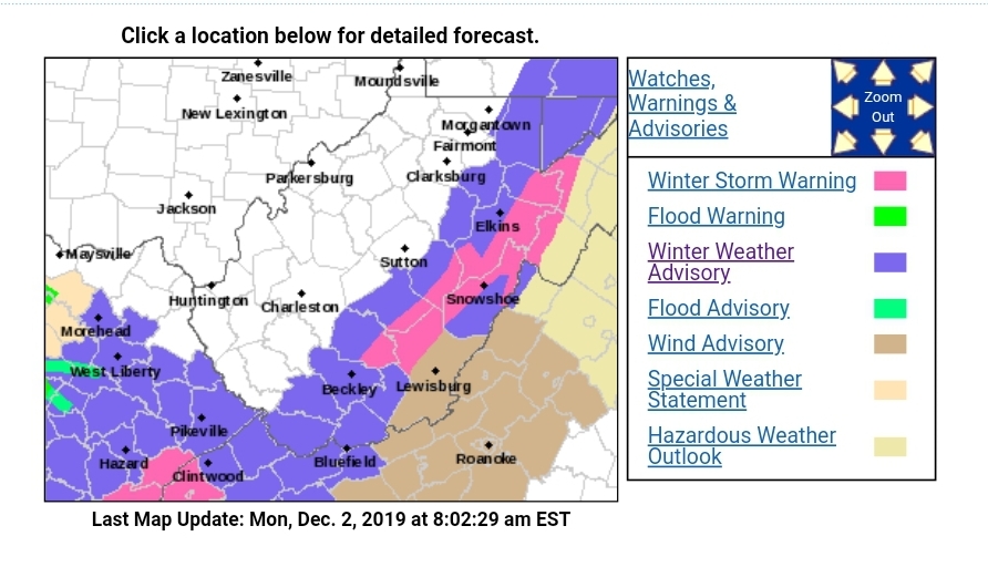
NWS detailed outlooks

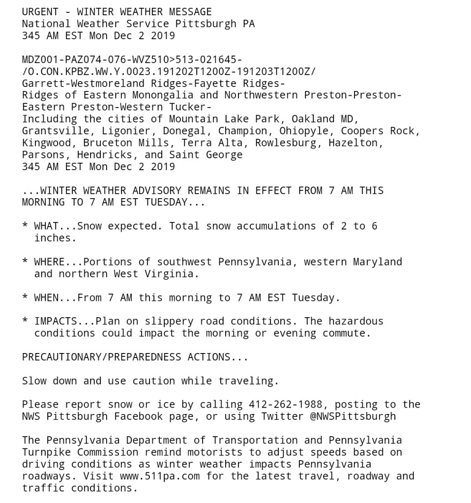
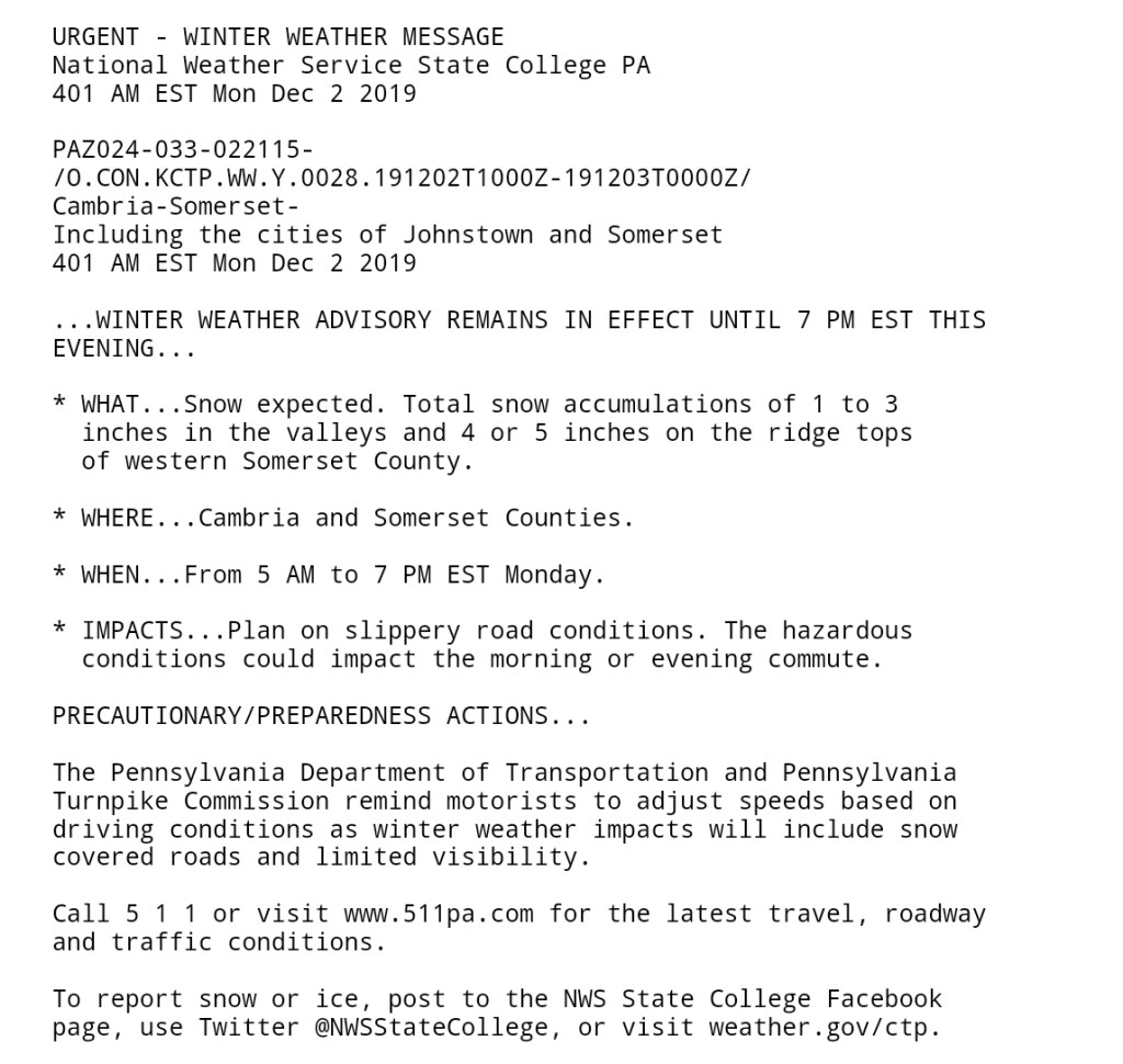
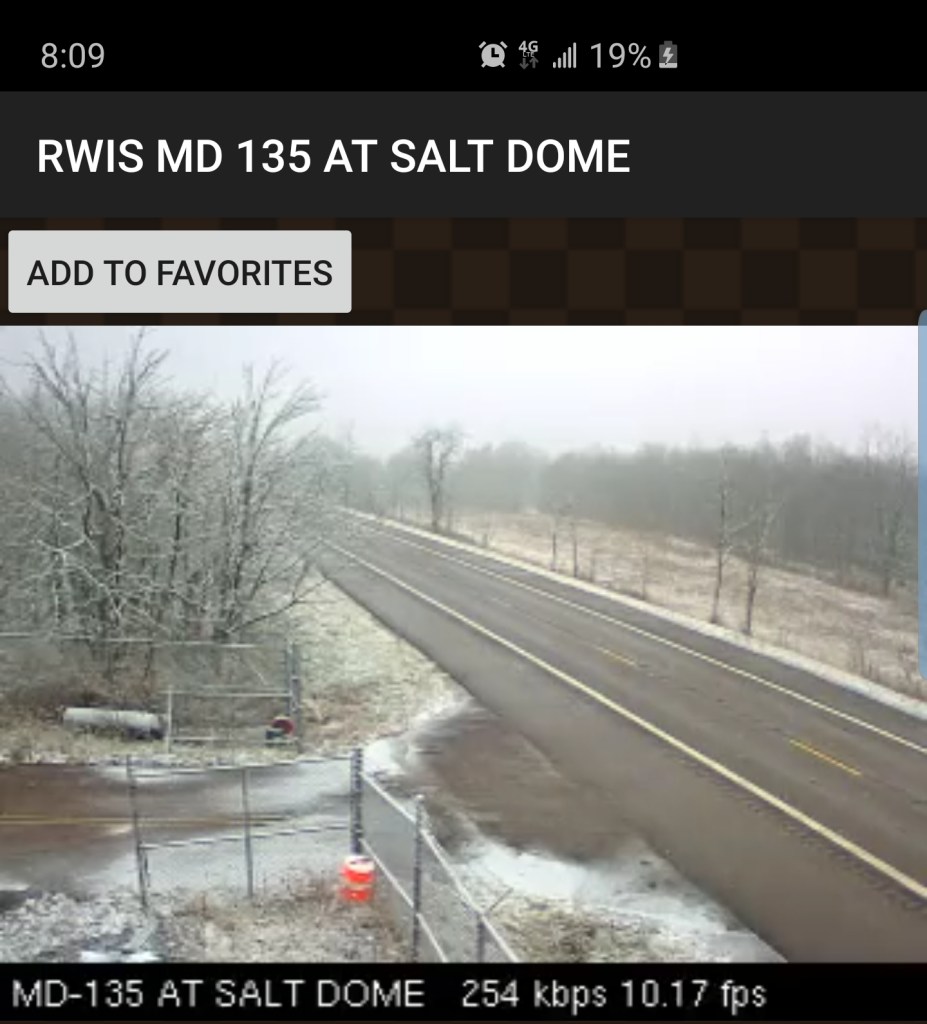
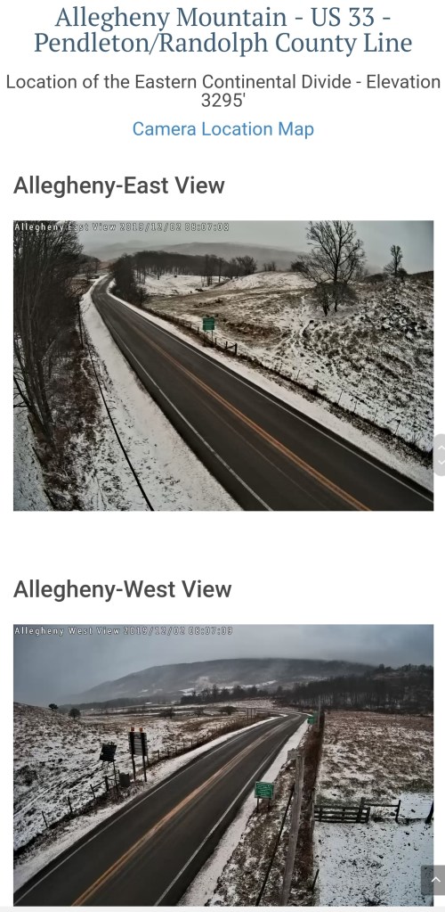
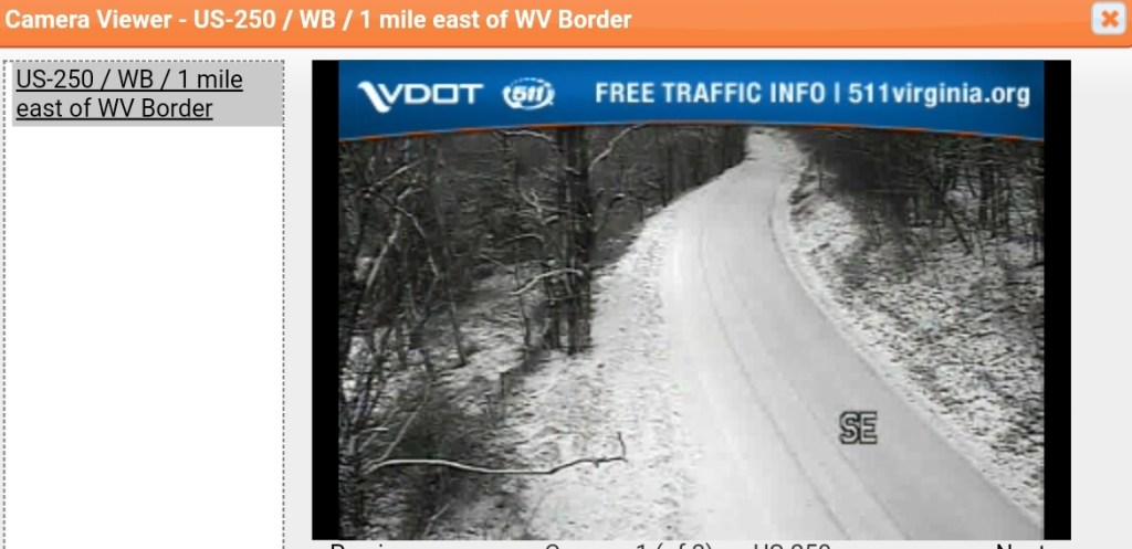
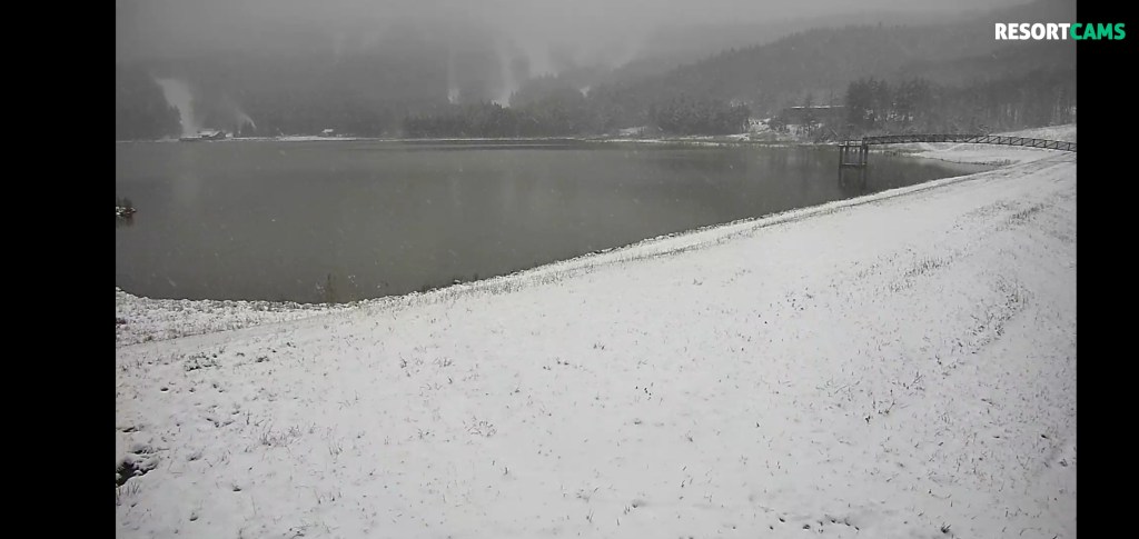
Morning traffic cams, 8am
Keysers Ridge, Deep Creek Lake, Savage Mt(ice remains on trees here from yesterday) and 135 on Backbone

219 Centennial Park Tucker County

Out on 33, east of Harman at the divide
Up and over North Fork from Judy Gap to Franklin, a snowy ride over the top
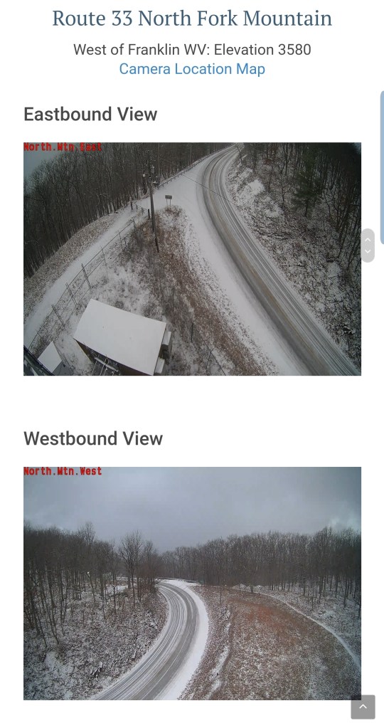
A view west to Spruce Knob and east to Snowy Mt

Across Allegheny Mt on 250 west of Monterey
Snow coming down at Snowshoe
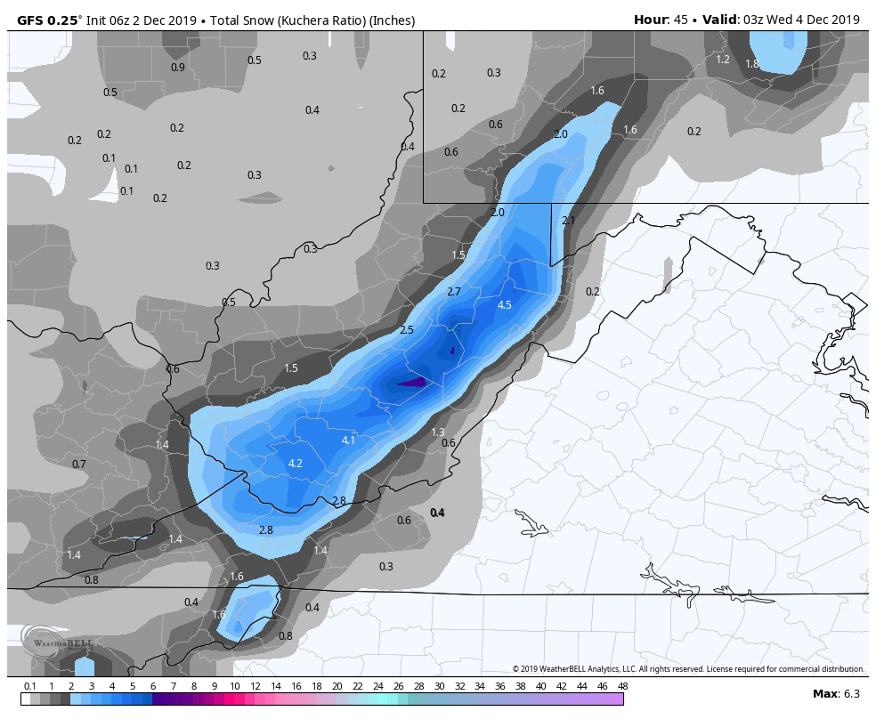
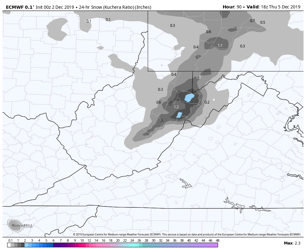
Then on to Wednesday, a light disturbance north early followed by another round of snow later, into Thursday. This round looks like 1-3″/2-4″ type deal as of now , the GFS is a little more pumped for it than those numbers.
0z ECMWF Snowfall for the Wednesday/night event(Image- 0z ECMWF Kuchera Ratio Weatherbell)
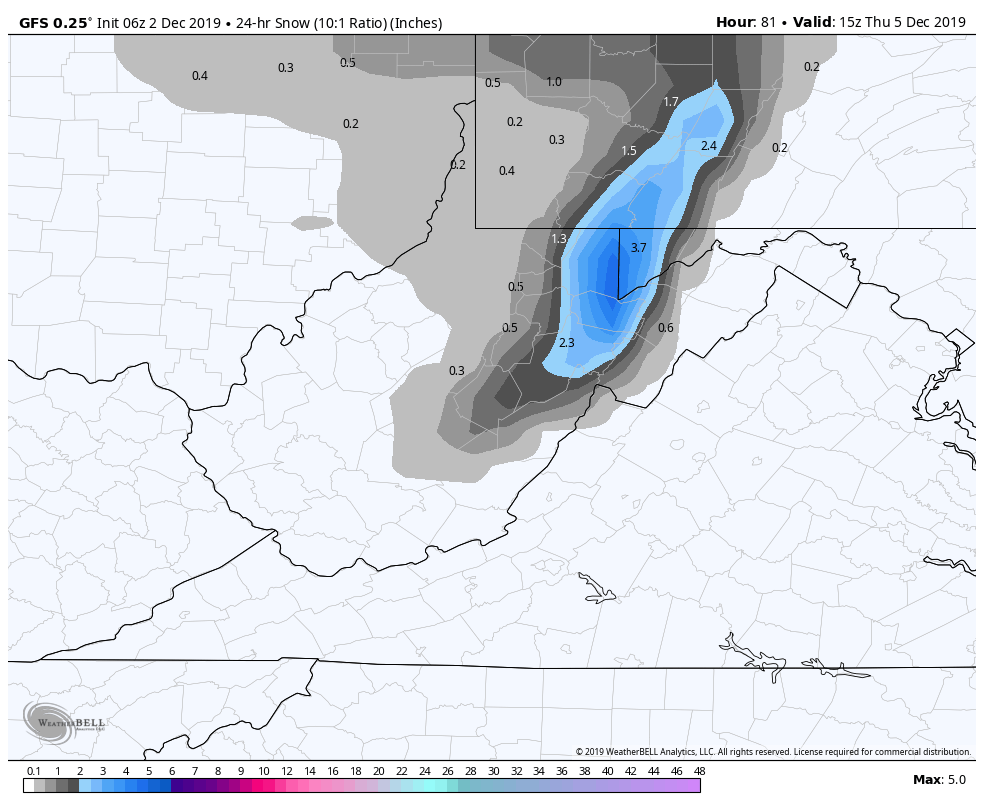
The 6z GFS is a bit more pumped. This is a 10-1 view, with reality ratios would be more in the 12-15 to 1. (Image-6z GFS 10-1 snowfall). Likeky overdone.
Temperatures look pretty stable all week with lows generally in the 20s, the Wv high ground upper teens at times, highs generally 28-35, with the Wv high ground holding a notch under that.
The unreliable long range….
Further out into next week, the European model suggest more Pacific air into the pattern and that equals a more mild W/SW flow regime. This pattern can bring ice on the leading edge of systems, where we just saw it yesterday, followed by brief bout of cold with backsides snows, with a quick exit of the cold and back to mild. Not a blow torch warm pattern, but one mild enough next week that has more wet overall vs white.
Long range 7 days plus is sketchy at best. These things do change, and do so frequently. As of now though, it does not look wintry week next week after out general wintry week this week. Ski resorts should maximize opportunity this week,,some will exist next week, but it may be minimized with mild intrusions.
0z ECMWF, the 500mb pattern flattens out and rebuilds that dreaded SE Ridge.(dreaded for snow lovers). While it’s been stronger, the existence of it, is not a snowy look. The MJO off the ECMWF agrees with this feature as well.
MJO off the ECMWF


The 0z ECMWF 500mb Heights/Wind
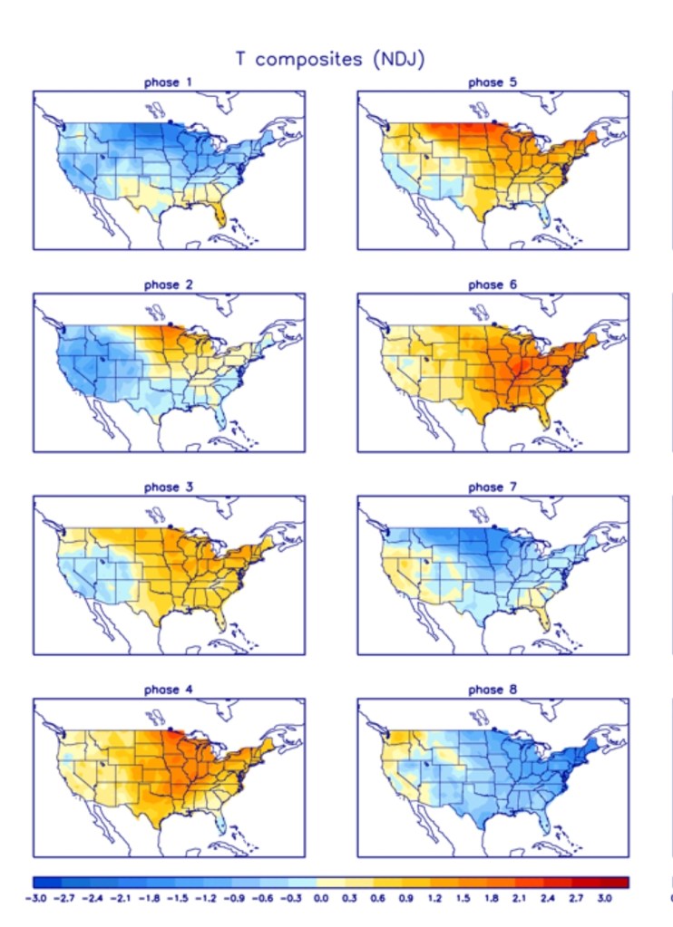
The ECMWF ensemble mean 5 day temperature anomalies looks almost exactly like what a phase 3 MJO for early to mid December would look like.
The American GFS does not take the MJO into phase 3 and does not agree with the Euro completely. It keeps a little more cold in the overall pattern and holds the MJO into phase 2. That pattern would allow a battle to persist within the Ohio river valley into our area, with the area being the war zone of mild vs cold. That would still likely be leading edge ice, rain, backside snows type pattern. The main difference is, more cold intrusions vs what the ECMWF shows
The GFS MJO
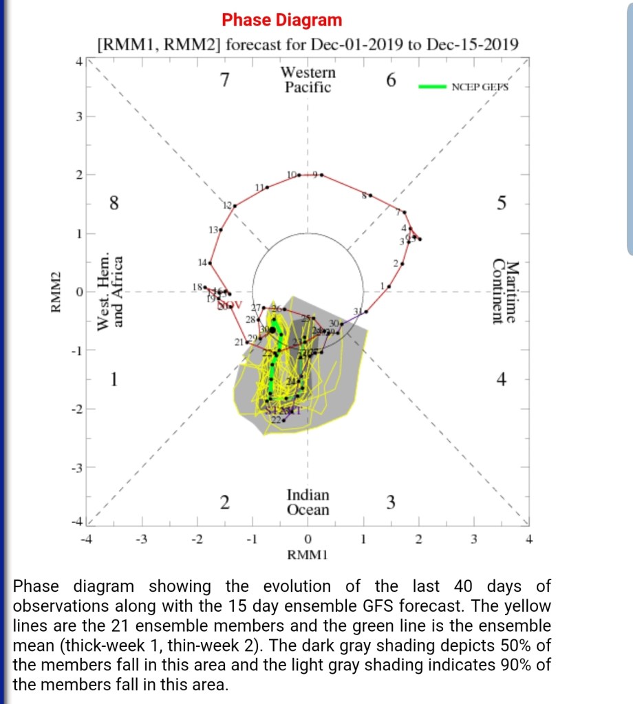
And the precipitation composite, phase 2

6z GFS ensemble 5 day temperature mean
6z GFS 500mb Heights/wind
Some variance in the 7-14 day window..
