Dec 3(Tues)
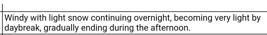
A fine light snow at times today, high ground fog. Some time, to around 2700′.
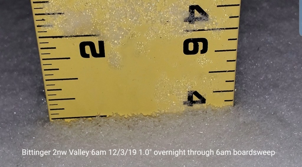
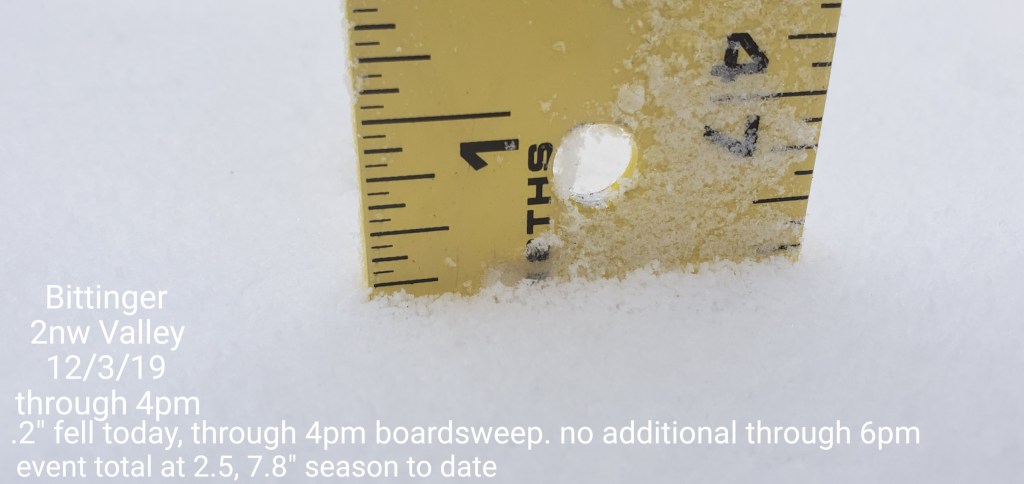
Bittinger 2nw Valley
MIN[26.2]—MAX[28.3]—AVG[27.2]—PRECIP[.12]7am
Snowfall- 1.0″ overnight, .2 today through 6pm boardsweep..measurement took at 4pm, no additional through 6pm
Snowfall season to date 7.8″

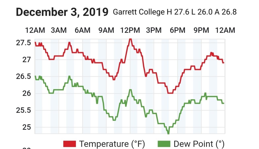
Garrett College
MIN[26.0]—MAX[27.6]—AVG[26.8]—PRECIP[F]
Canaan Heights/Davis 3SE
MIN[22.5]—MAX[24.6]—AVG[23.5]—PRECIP[.23]7am
Snowfall 4.5″ through 7am
Snowfall season to date 14.2″
Comments by Dave Lesher
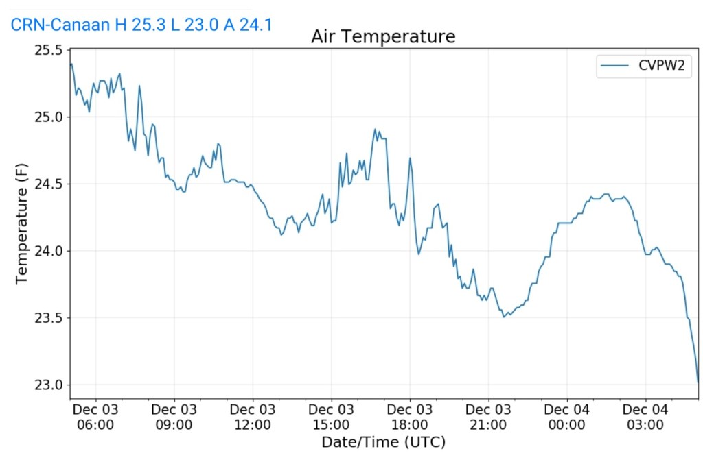
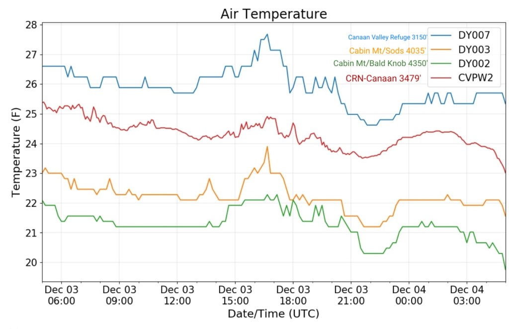
Climate Reference Network Canaan
MIN[23.0]—MAX[25.3]—AVG[24.1]—PRECIP[
Cabin Mt at Bald Knob
MIN[20.1]—MAX[22.3]—AVG[21.2]—PRECIP[F]

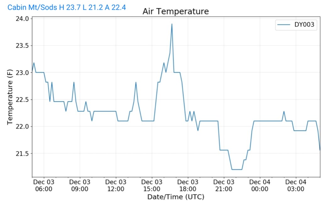
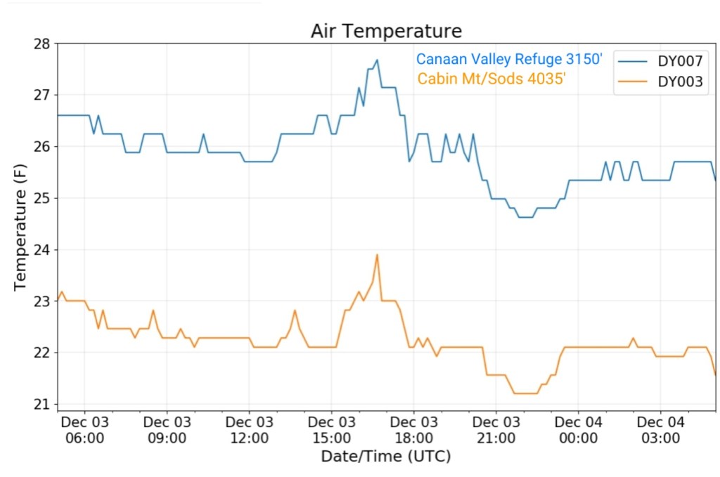
Cabin Mt-Western Sods
MIN[21.2]—MAX[23.7]—AVG[22.4]—PRECIP[F]
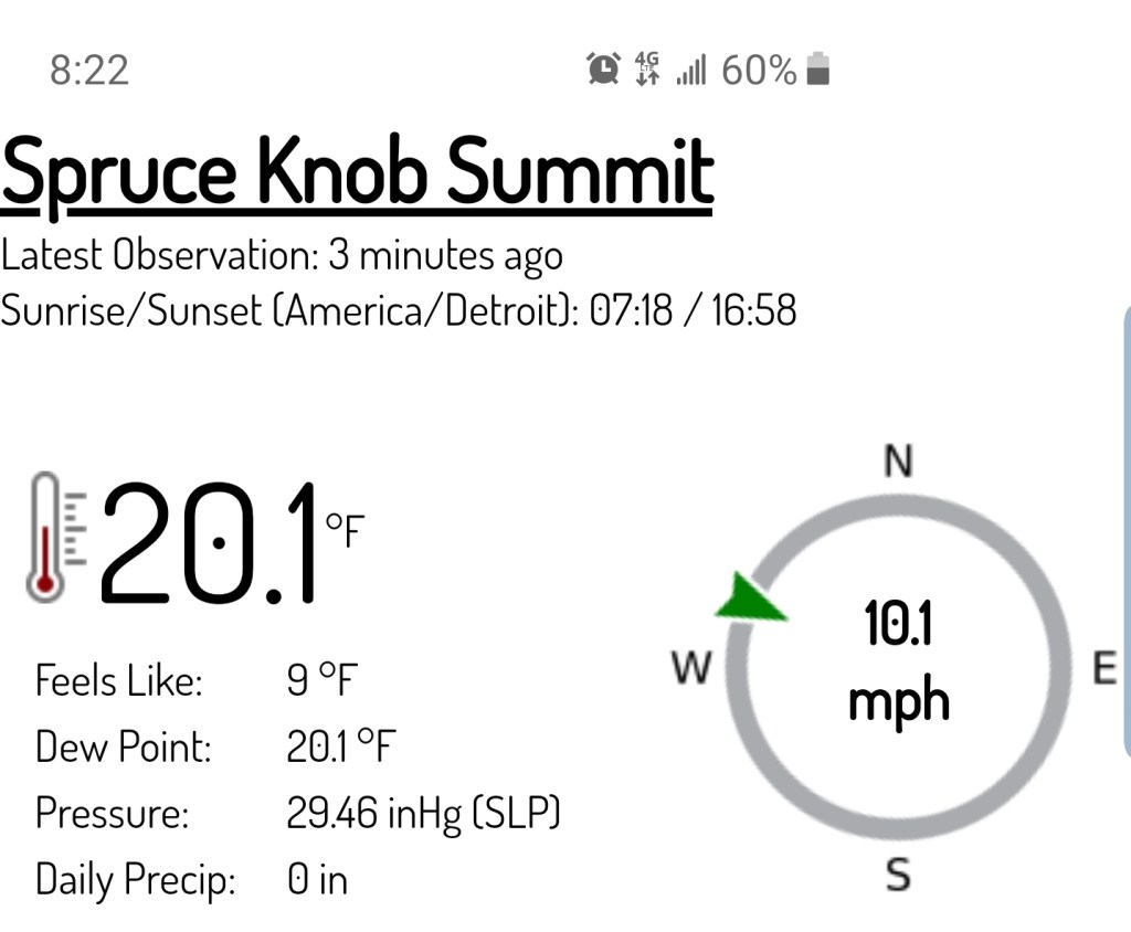
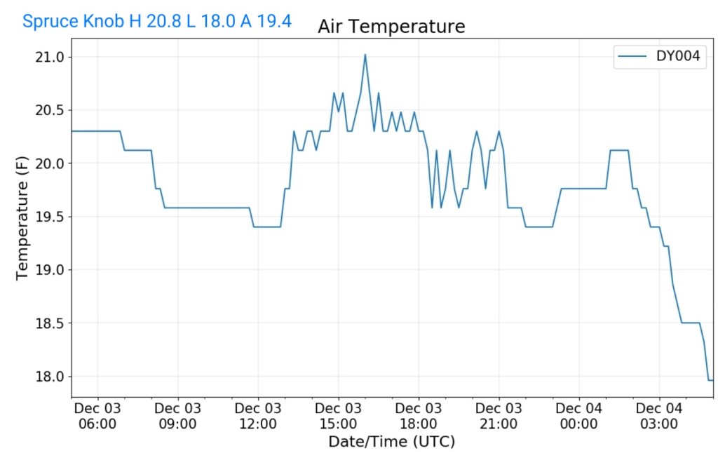
Spruce Knob
MIN[18.0]—MAX[20.8]—AVG[19.4]—PRECIP[F]
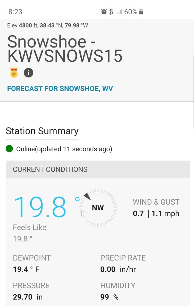
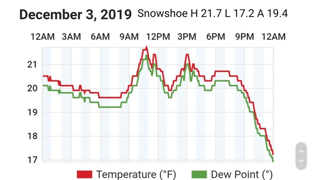
Snowshoe
MIN[17.2]—MAX[21.7]—AVG[19.4]
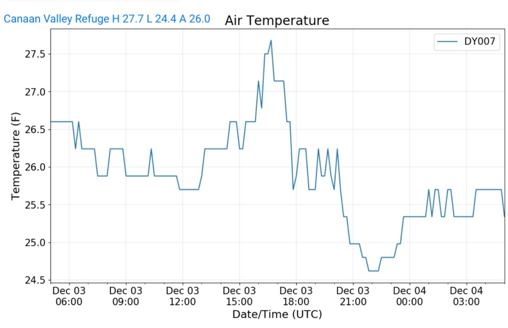
Canaan Valley Refuge
MIN[24.4]—MAX[27.7]—AVG[26.0]
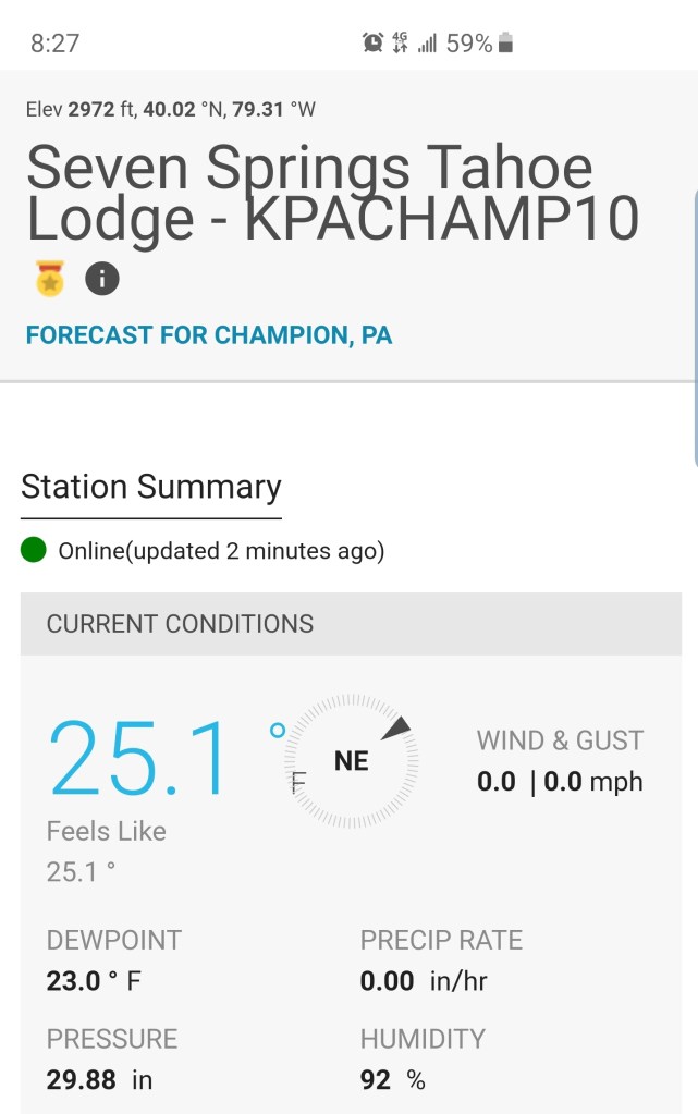
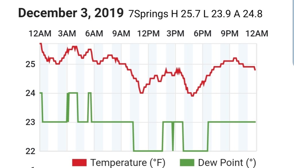
7Springs
MIN[23.9]—MAX[25.7]—AVG[24.8]
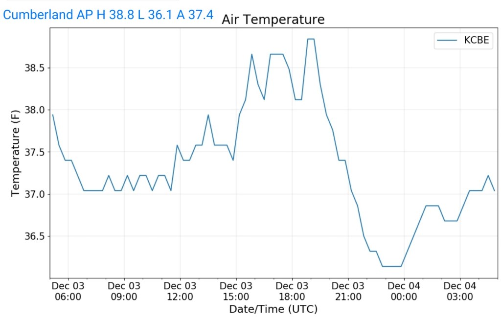
Cumberland Airport
MIN[36.1]—MAX[38.8]—AVG[37.4]
The valley vs Cabin Mt
Canaan area temps

RTMA
Radar
Satellite
Flow
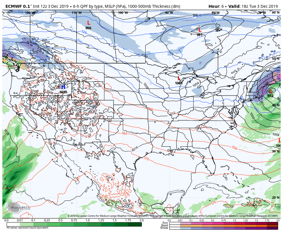
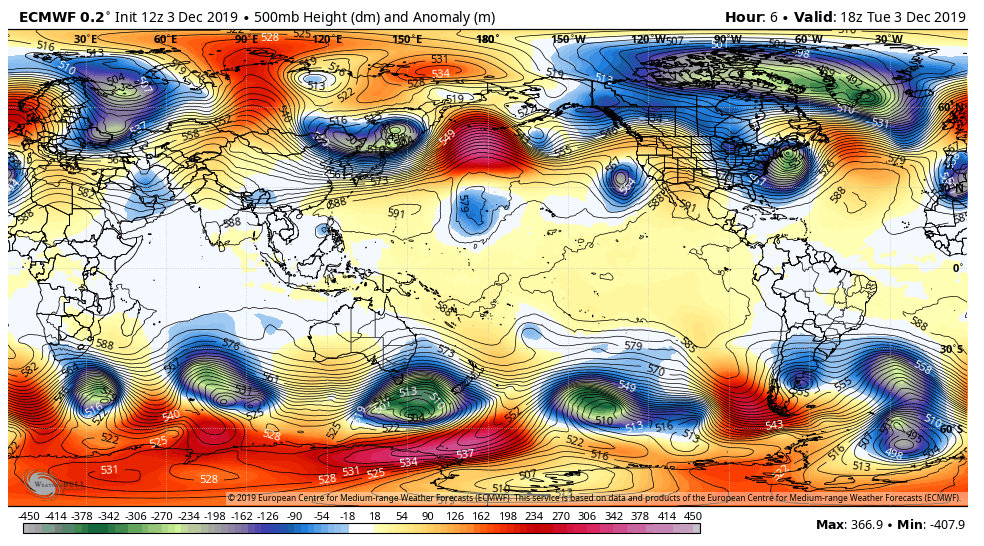
Surface features and 500mb height anomalies and flow

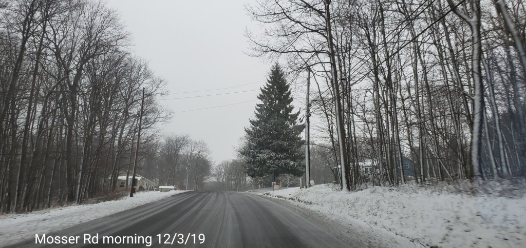
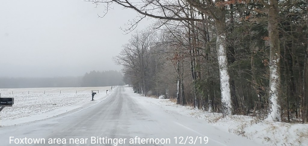
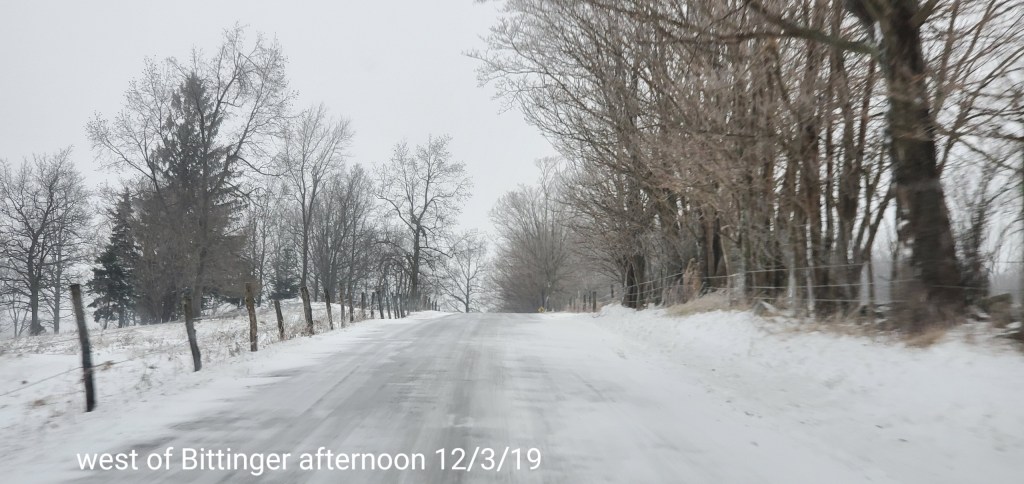
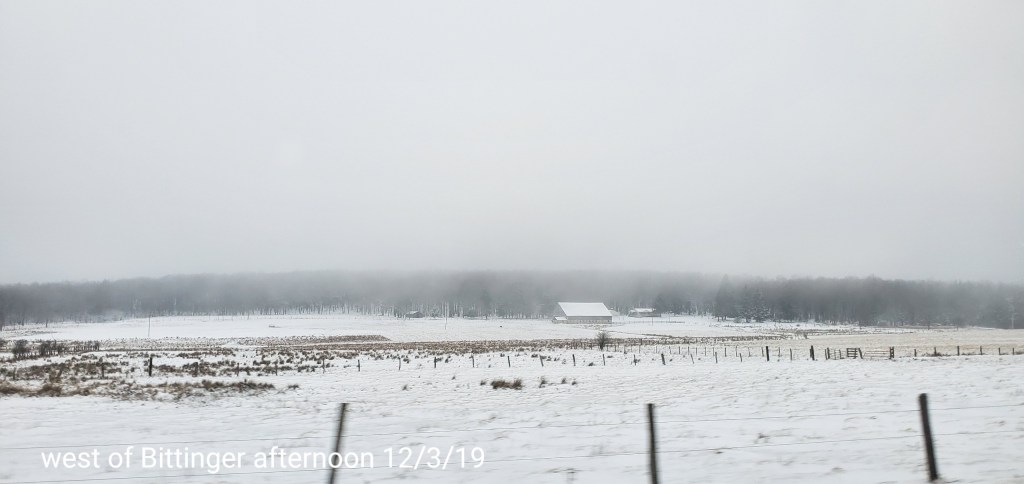
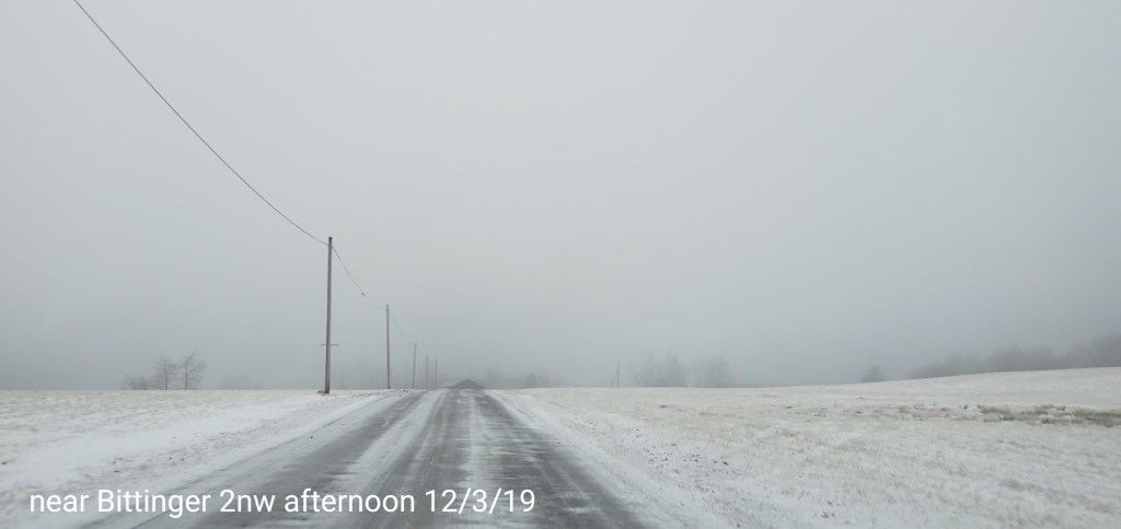
Pics today-
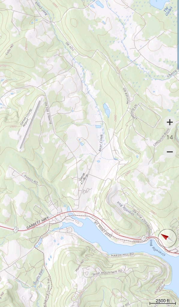
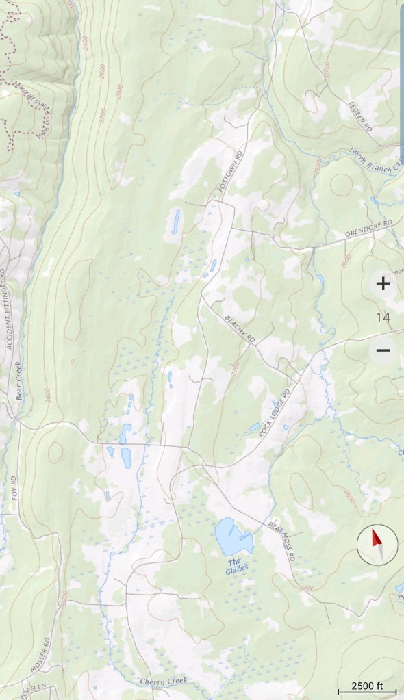
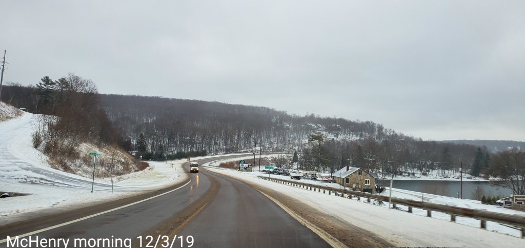
McHenry – Bittinger area
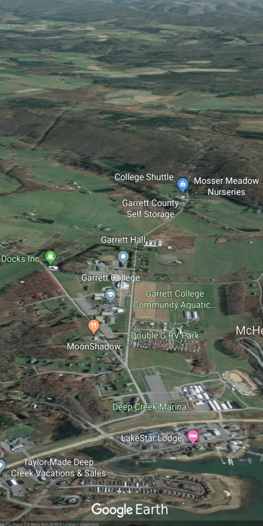


Oakland area


Morning outlook:
Post generated at 8:20am 12/3/19
December 3, 2019
A snowfall recap through this morning for total event snow(minimal may yet occur)
Bittinger 2nw Valley 2.3″
Accident 3.9e 2.1″
Mt. Lake Park 1.5″
Canaan Heights/Davis 3SE 5.3″
Snowshoe 4.0″ from the coop observer, the resort reports 5.5″
Overall totals for this event were in the low end range of expectations.
Going forward…
This morning’s fine light snow may end as a touch of freezing mist/drizzle today. Not a big deal, but as always, be alert if that occurs.
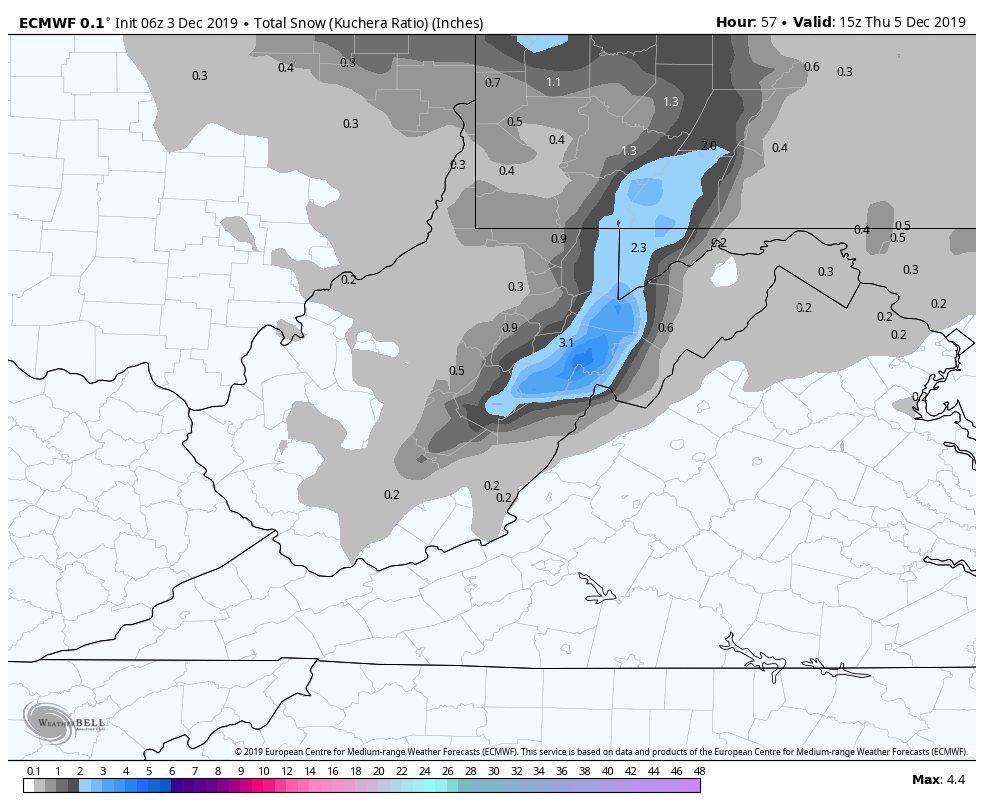
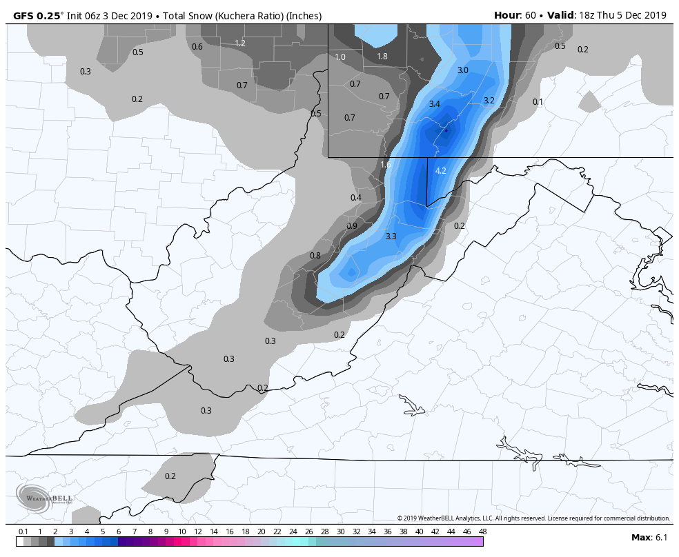
A little snow activity may pass through tomorrow morning, this looks very light. The better wave pushes through late day into the overnight hours. This one looks to be a general 2-4″ (again lean low to mid totals,,if it performs well, high mark may be reached). There should be though pops of 4″+ with this. If a few pockets picked up 5, 6″ that would not be surprising. That ends during the day Thursday.
6z ECMWF
Snowfall amounts off the model – a minimal portion of this total is from now until tomorrow morning. Primarily late tomorrow into Thursday
6z GFS
Snowfall amounts off the model. Again, the same as above. A minimal amount is from ow until tomorrow morning. Primarily late tomorrow into Thursday.
Looking into next week
Early week, winter lovers need to go hibernate. It does not look pretty. Early week looks like a wet, mild period.
Temps off the 6Z GFS and 0Z ECMWF for Garrett Airport.
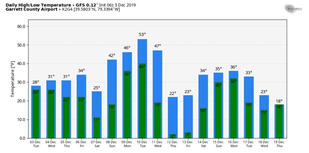
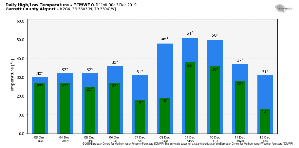
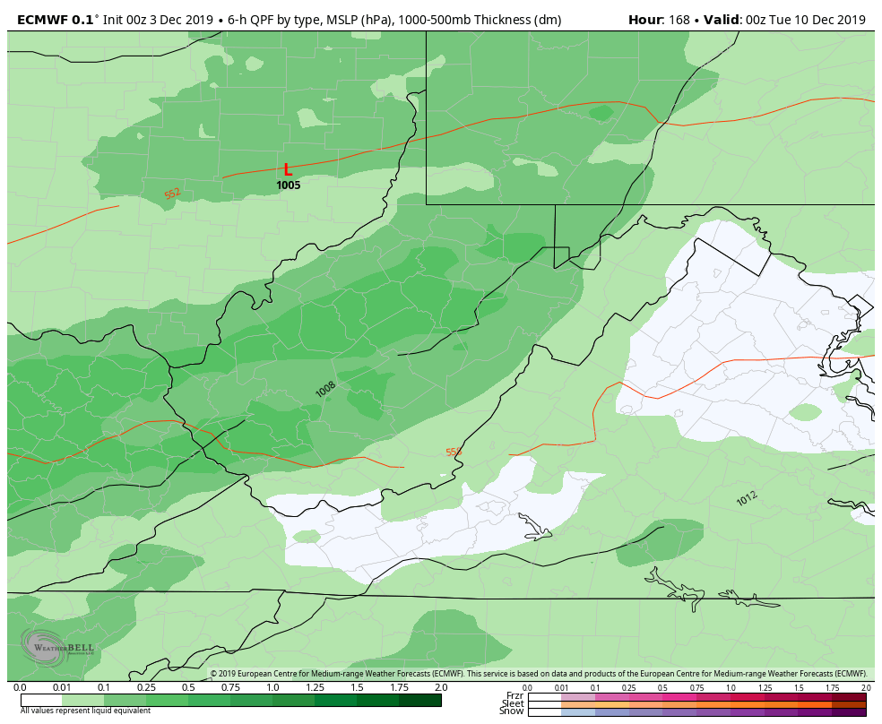
And a snippet of what the surface looks like Monday, this continues into Tuesday and may change to snow during the day.
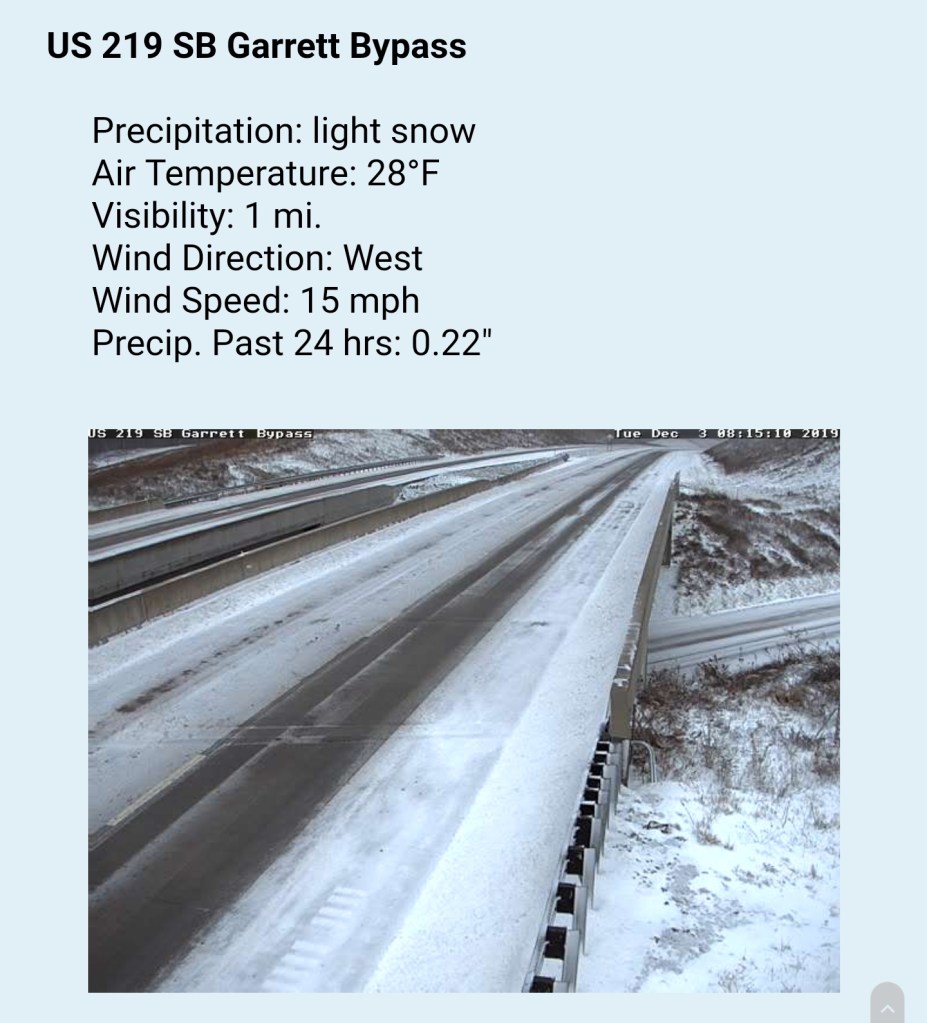
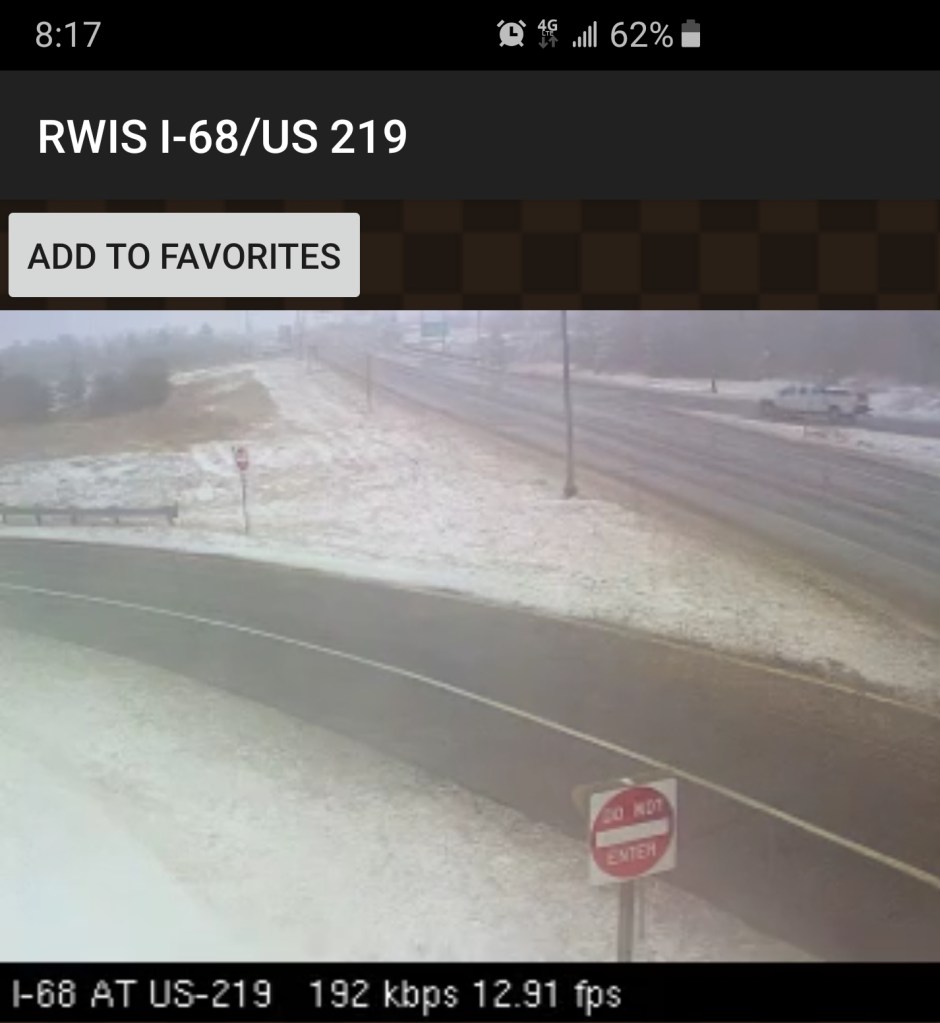
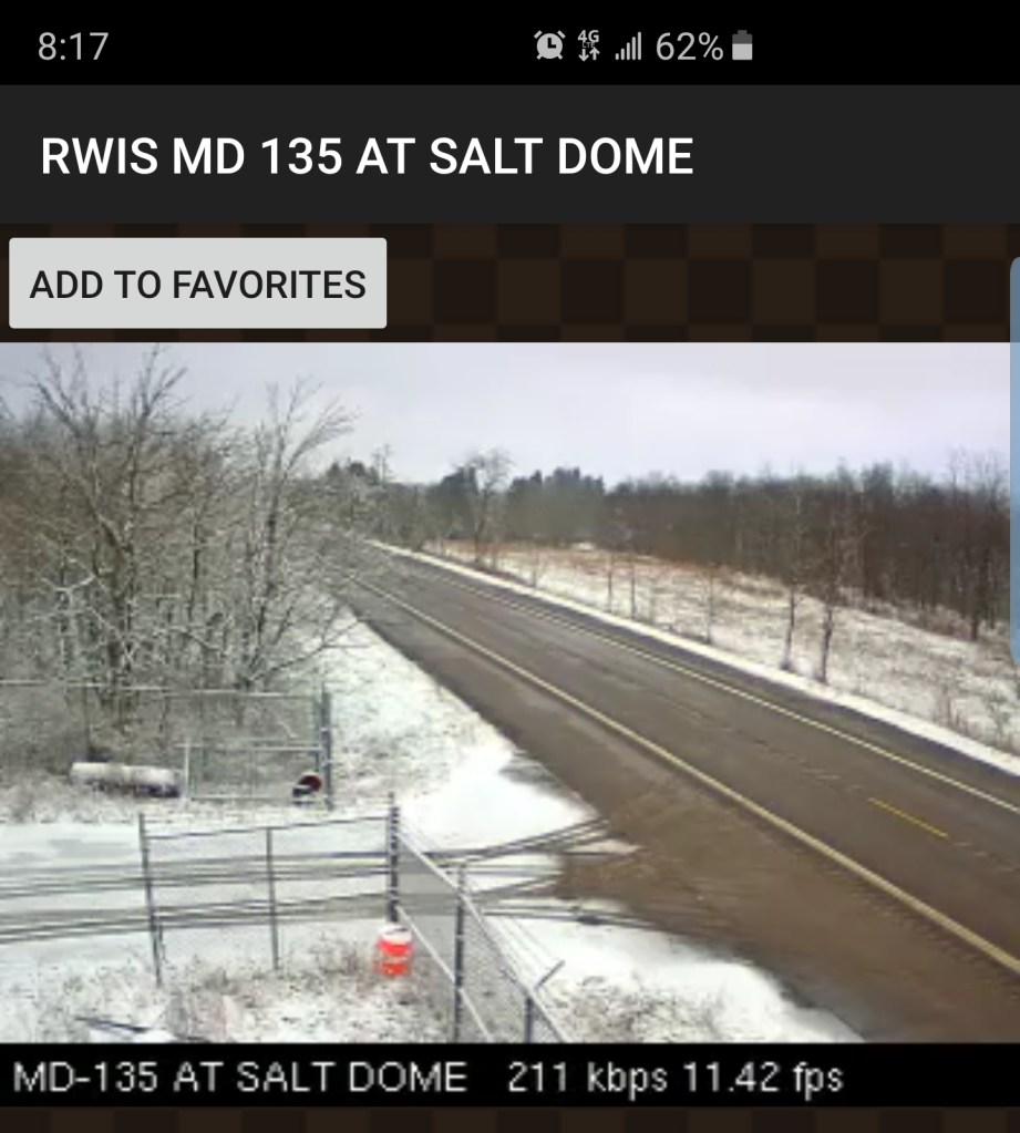
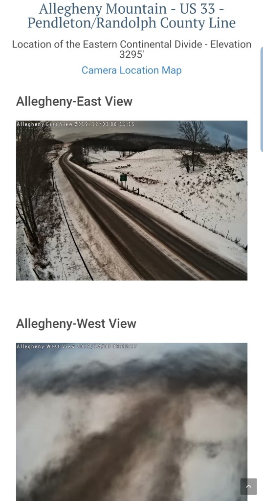
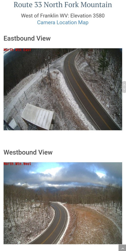
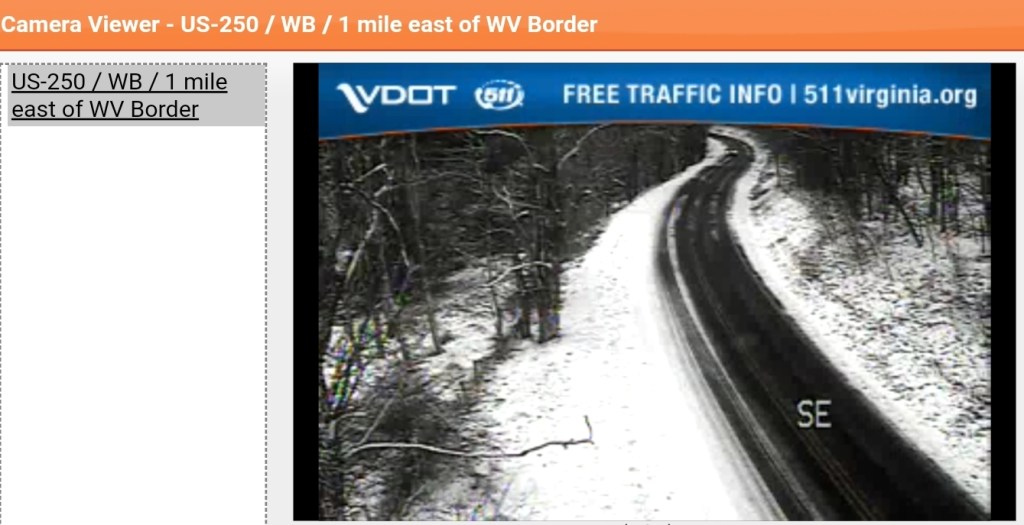
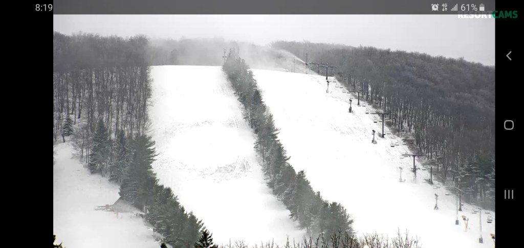
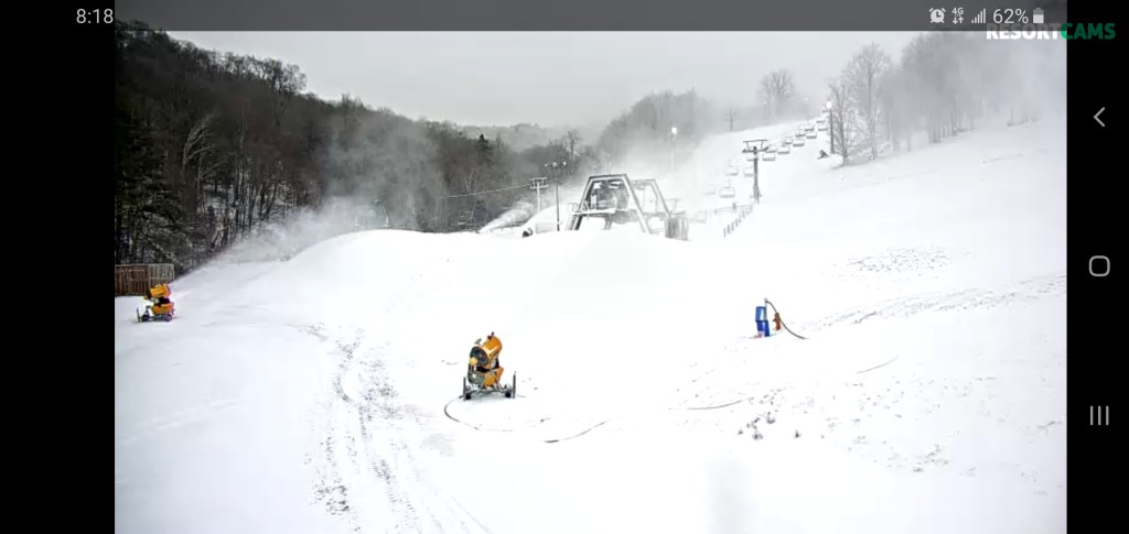
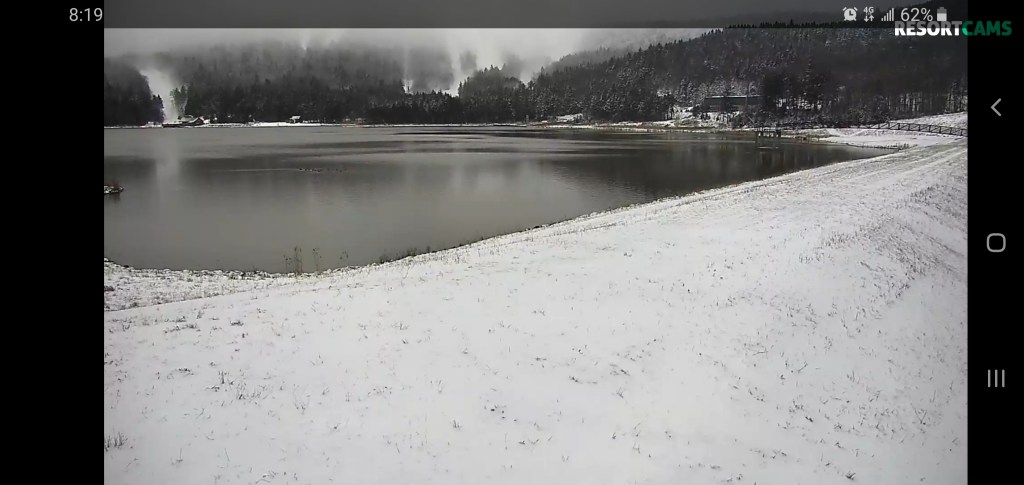
Morning cams
Roads-north to south


Resorts-7Springs, Wisp, Canaan, Snowshoe


Temps this a.m