December 6, 2019
Dec 6(Fri)
After an awesome sunrise, and a cold valley night, clouds rolled in and temps quickly rose into 40s by midday before backsliding in the afternoon. Light precip began, that was some snow up high, above 4000′, and for a time snow mixed to 2500′, but that went to liquid and remained so through 7pm to about 3500 it appeared. Snowshoe recieved a coating.
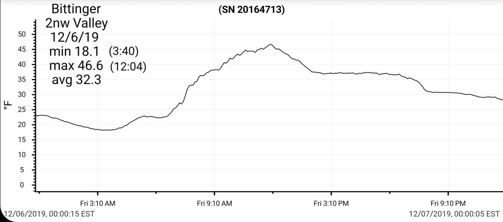
Bittinger 2nw Valley
MIN[18.1]—MAX[46.6]—AVG[32.3]—PRECIP[0]7am
Snowfall season to date 11.9″
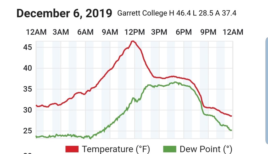
Garrett College
MIN[28.5]—MAX[46.4]—AVG[37.4]—PRECIP*[.19]
Precip- melt + precip today
Canaan Heights/Davis 3SE
MIN[24.4]—MAX[40.9]—AVG[32.6]—PRECIP[T]7am
Snowfall season to date 19.2″
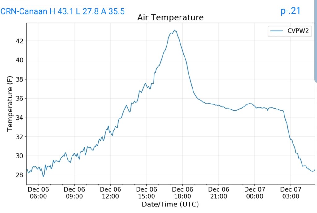
CRN-Canaan
MIN[27.8]—MAX[43.1]—AVG[35.5]—PRECIP[.21]
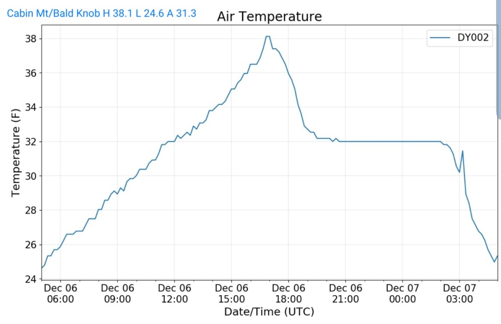
Cabin Mt at Bald Knob
MIN[24.6]—MAX[38.1]—AVG[31.3]—PRECIP*[.26]
*melt plus daily precip
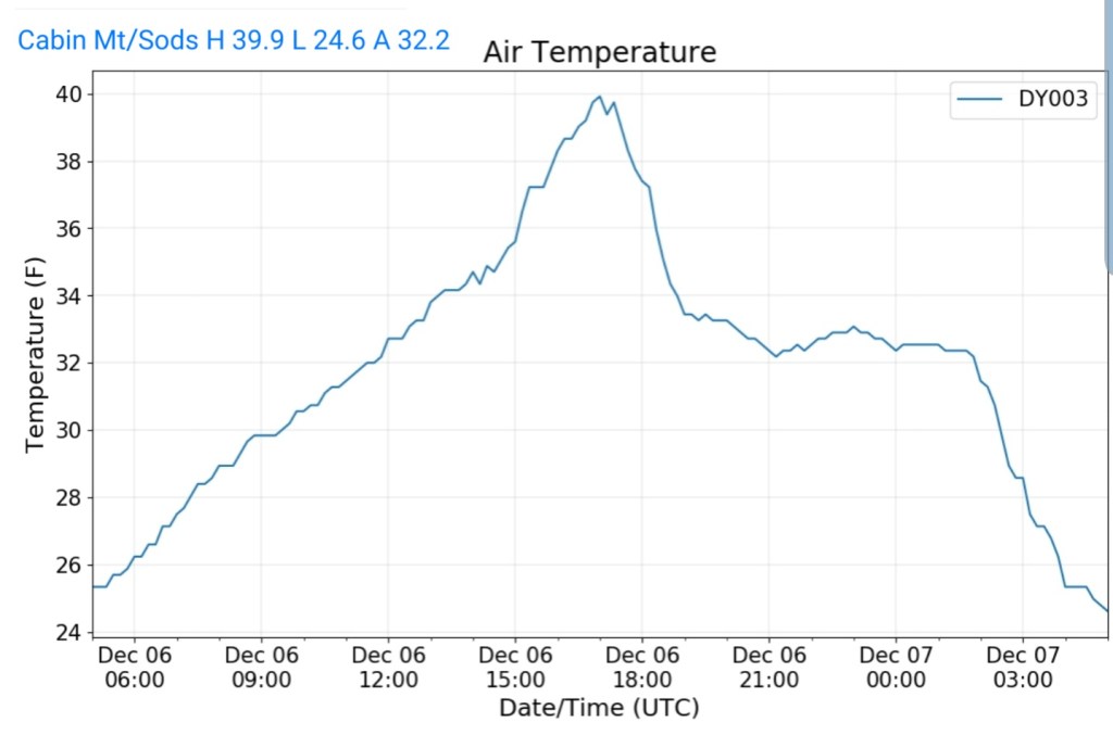
Cabin Mt-Western Sods
MIN[24.6]—MAX[39.9]—AVG[32.2]—PRECIP*[.17]
*melt plus daily precip
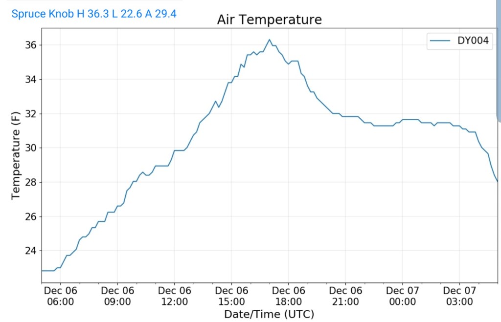
Spruce Knob
MIN[22.6]—MAX[36.3]—AVG[29.4]—PRECIP*[.01]
Snowshoe
MIN[22.6]—MAX[38.5]—AVG[30.5]
Primary precip today-snow

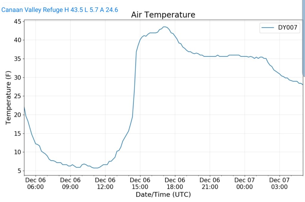
Canaan Valley Refuge
MIN[5.7]—MAX[43.5]—AVG[24.6]
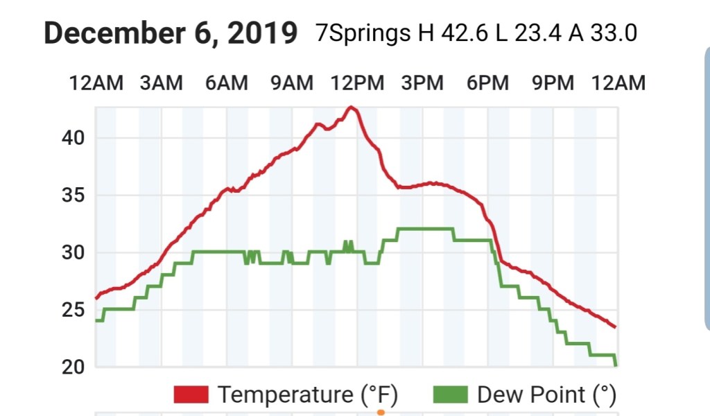
7Springs
MIN[23.4]—MAX[42.6]—[33.0]
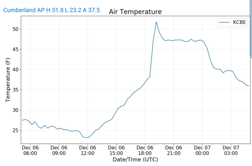
Cumberland Airport
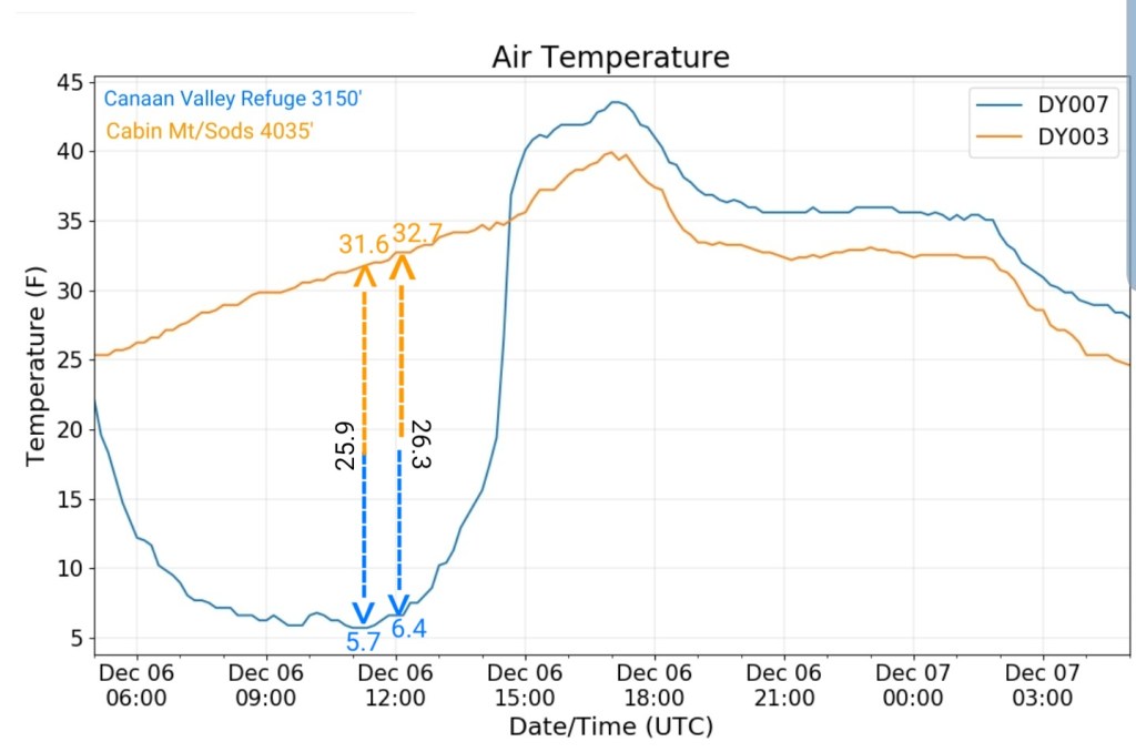
The Valley vs Cabin Mt

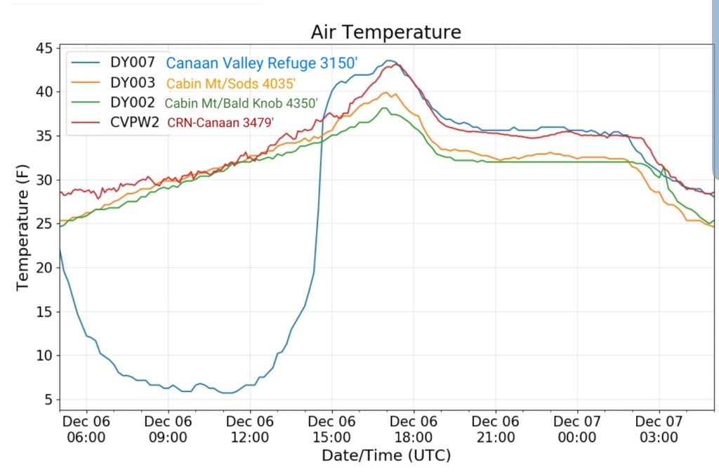
Canaan area temps
Comparison view

RTMA
Radar
Satellite
Flow
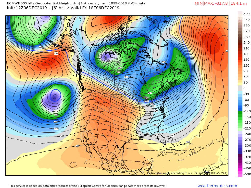
Surface features and 500mb height anomalies and flow


webcam videos today
Snowshoe
Canaan
Wisp
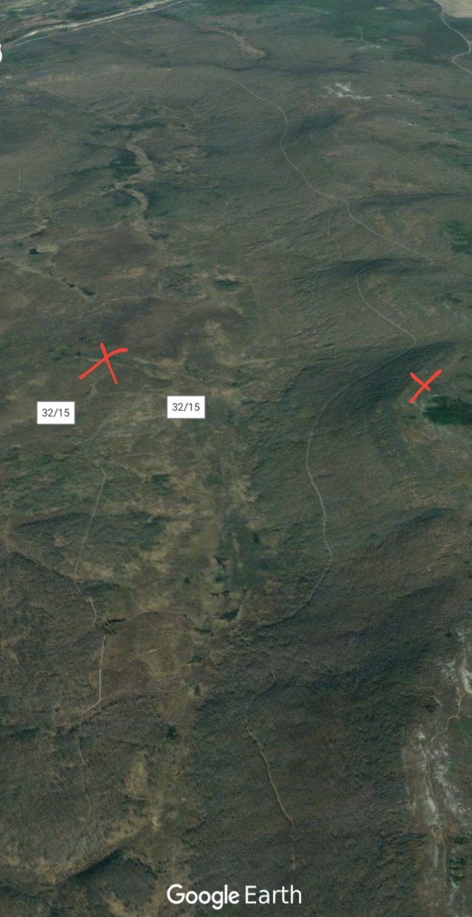
33 east of Harman at the divide
Morning outlook update:
A WIDE variety of temperatures this morning, as low as a single digit lonely 6° at the Canaan Valley Refuge station in the northern end of Canaan Valley, while Cabin Mt is sitting at 32°, other sites in the area vary from upper teens to the upper 30s.
As we go through the morning, all of these will become more uniform and rise into the upper 30s to mid 40s. Relatively low dew points in tack, however the snowpack will likely compact a get a bit sticky. As we progress into the afternoon, some precip will try to push in and that initially will cause evaporative cooling and daytime max temps likely will be reached late morning to early afternoon with temps then slowly backsliding to reach the dewpoints in the low to mid 30 .
Precip should begin to reach the surface later in the day. Above 2500, this may begin briefly as rain drops but transition to light snow activity that may put down a new coating in spots, with some light accumulation possible above 3000-3500. Minor event, snow accumulation +/- 1″. If anything more impressive than that occurs, I will update.
Here is the 6z ECMWF temps today and tonight ,
The mild surge this morning evident
6z ECMWF MSLP/6HR/PRECIP TYPE
Precip with this minor event
We chill down a notch tomorrow vs today. Sunday a mild surge with eastern zones holding chillier. Monday is a ruination day for winter lovers, and some of the winter dreams returning on Tuesday.
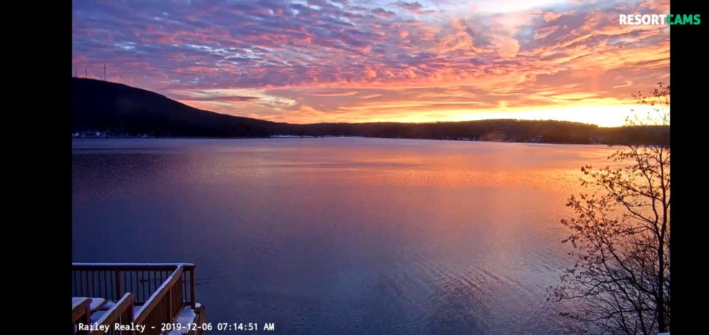
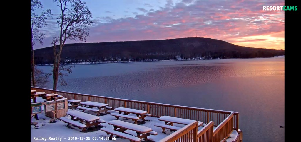
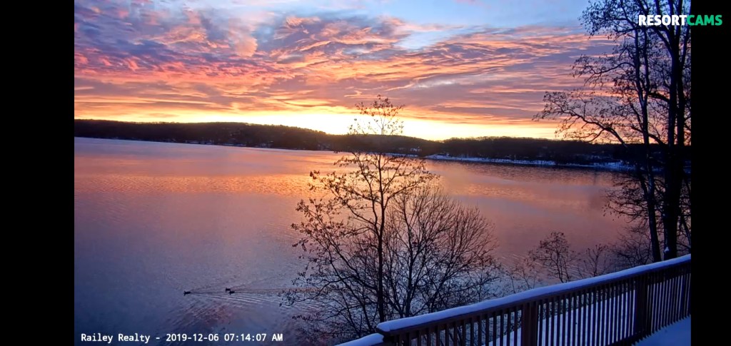
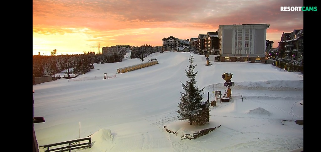
Webcam shots this morning…
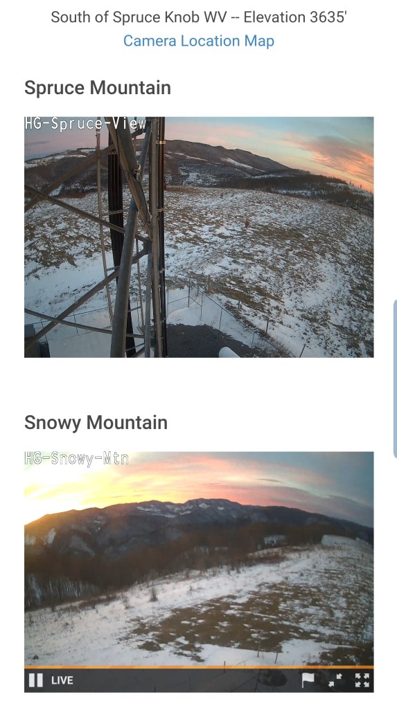
That sunrise!
Deep Creek Lake
Out on 33 at the divide east of Harman

A view of Spruce Knob and Snowy Mt
Canaan Valley Resort
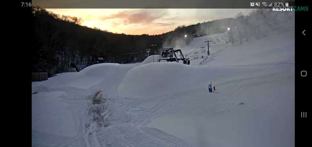
Snowshoe
Roadways all good, secondary roads will still have some snowcover from yesterday morning, but cindered…
