Dec 10(Tues)
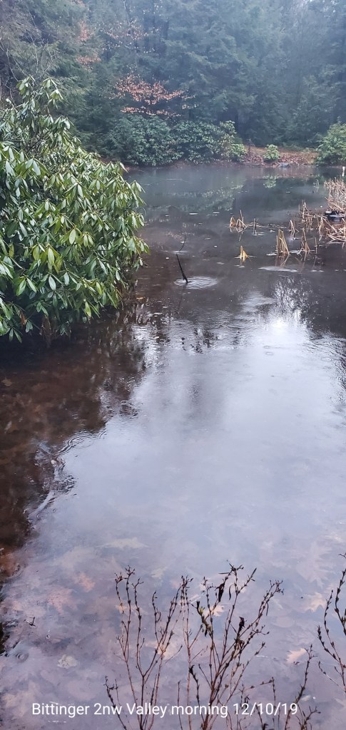
Mild, wet early ,falling temps , snow late. High water in areas, some small creeks over backfill in areas that saw 1-2″ of rain.
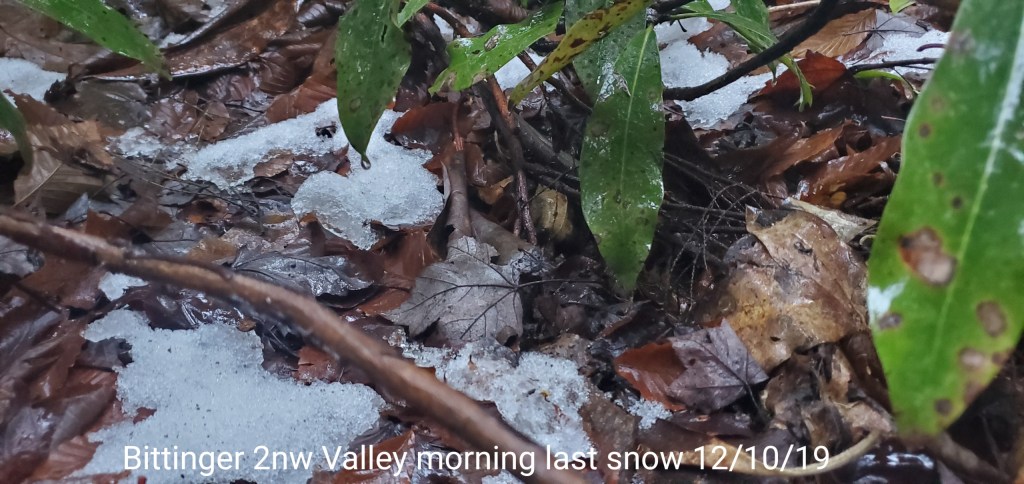
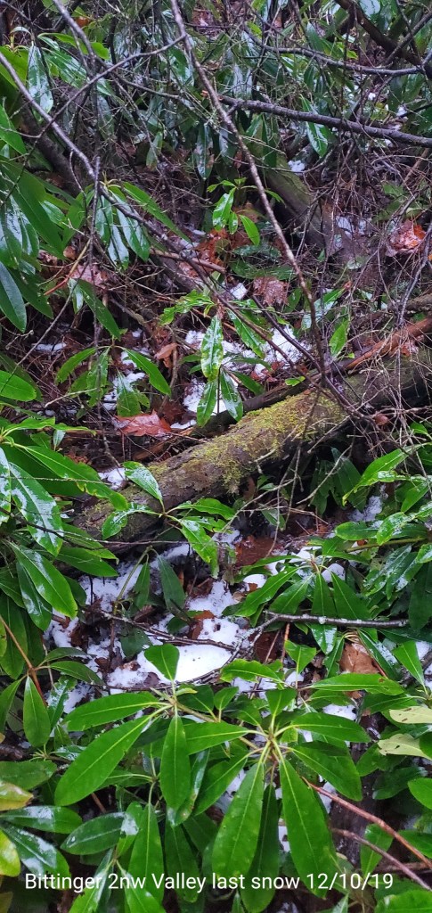
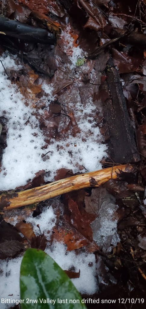
Bittinger 2nw Valley
MIN[22.1]—MAX[52.1]—AVGERAGE MEAN[37.1]—TRUE AVERAGE[39.9]—PRECIP[1.21]7am
Snowfall season to date 11.9″

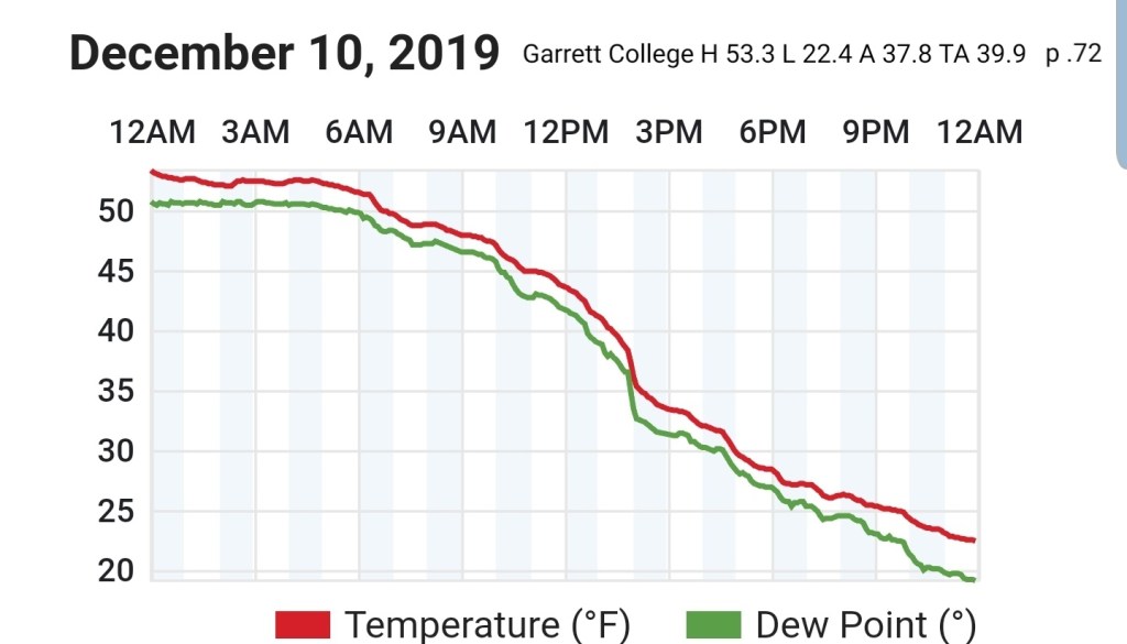
Garrett College
MIN[22.4]—MAX[53.3]—AVGERAGE MEAN[37.8]—TRUE AVERAGE[39.9]—PRECIP[.72]
Canaan Heights/Davis 3SE
MIN[17.7]—MAX[51.8]—AVG[34.7]
Snowfall season to date 19.2″(todays will be added on totals tally tomorrow)
Comments by Dave Lesher

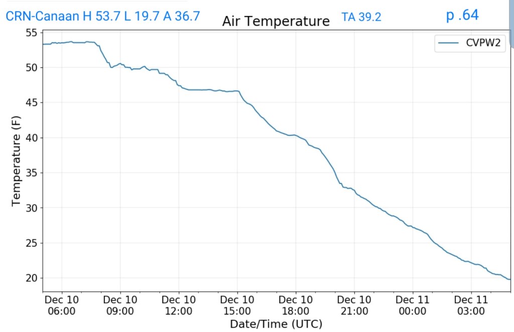
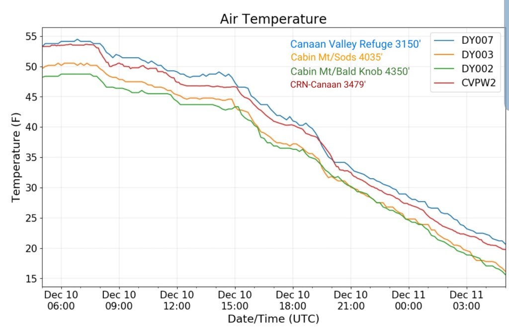
Climate Reference Network Canaan
MIN[19.7]—MAX[53.7]—AVERAGE MEAN[36.7]—TRUE AVERAGE[39.2]—PRECIP[.64]
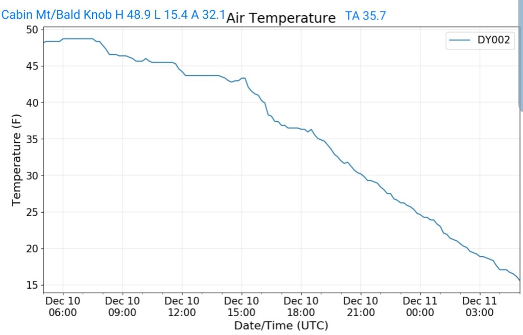
Cabin Mt at Bald Knob
MIN[16.0]—MAX[48.9]—AVGERAGE MEAN[32.4]—TRUE AVERAGE[35.8]—PRECIP[.62]
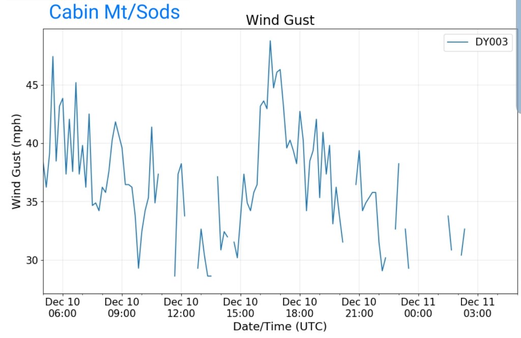
Cabin Mt-Western Sods
MIN[15.9]—MAX[50.5]—AVERAGE MEAN[33.2]—TRUE AVERAGE[36.6]—PRECIP[.28]

MAX GUST [47.4MPH]
Spruce Knob
MIN[16.3]—MAX[44.8]—AVERAGE MEAN[30.5]—TRUE AVERAGE[35.4]—PRECIP[.33]

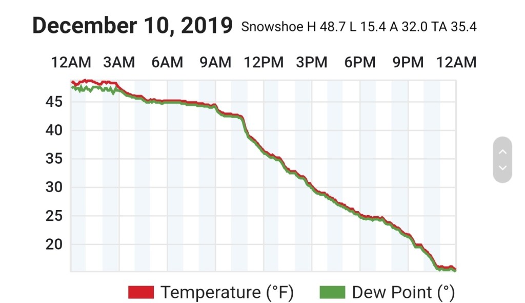
Snowshoe
MIN[15.4]—MAX[48.7]—AVERAGE MEAN[32.0]—TRUE AVERAGE[35.4]
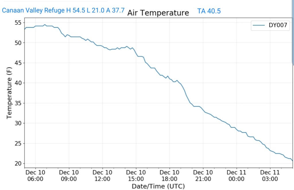
Canaan Valley Refuge
MIN[21.0]—MAX[54.5]—AVERAGE MEAN[37.7]—TRUE AVERAGE[40.5]
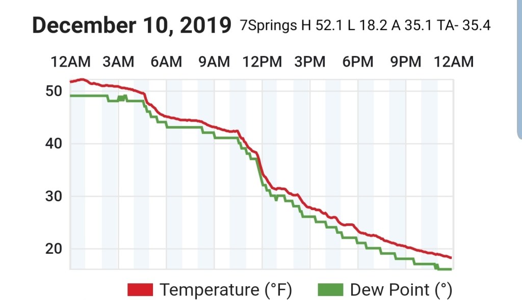
7Springs
MIN[18.2]—MAX[52.1]—AVERAGE MEAN[35.1]—TRUE AVERAGE[35.4]
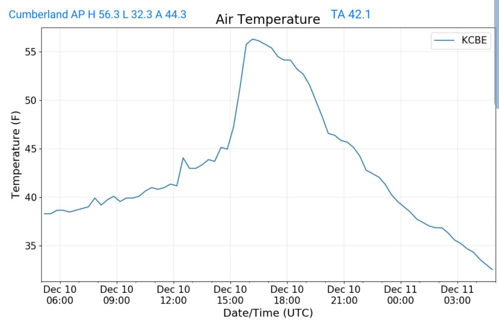
Cumberland Airport
MIN[32.3]—MAX[56.3]—AVERAGE MEAN[44.3]—TRUE AVERAGE[42.1]
The Valley vs Cabin Mt


Canaan area temps
Comparison view

RTMA
Radar
Satelite
Flow
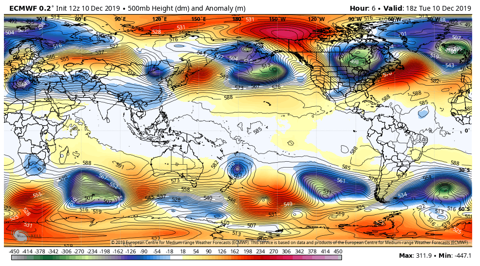
Surface features and 500mb height anomalies and flow
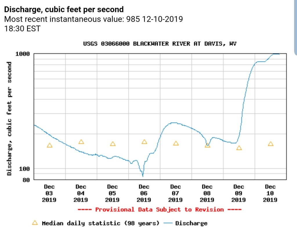
Blackwater River at Davis
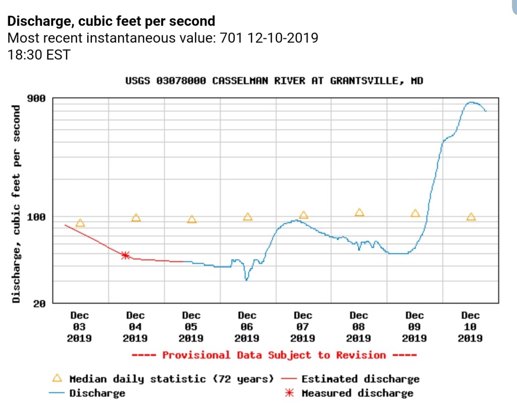
Cassleman River at Grantsville
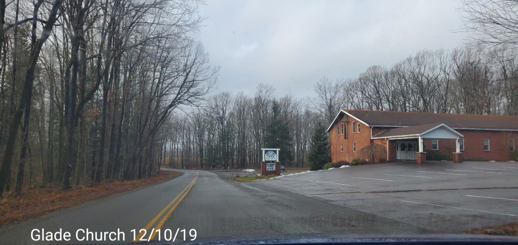
Pics today-
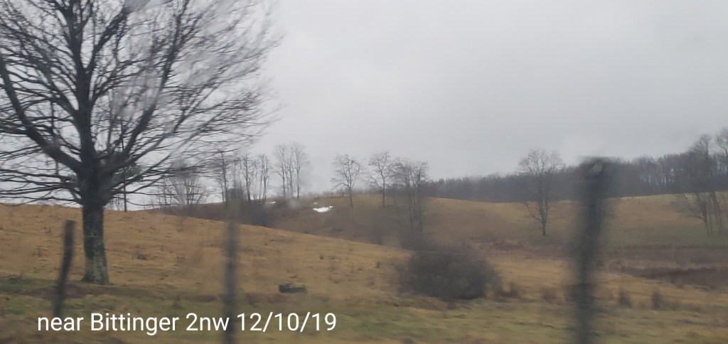
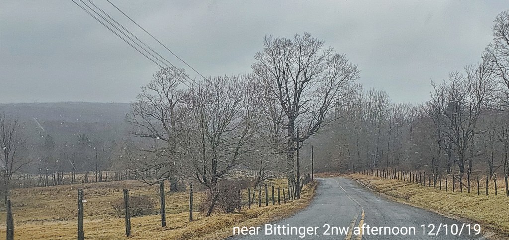
Bittinger area


McHenry area afternoon
Swallow Falls by Derek Buckel
Afternoon update 1:15pm 12/10/19
December 10, 2019
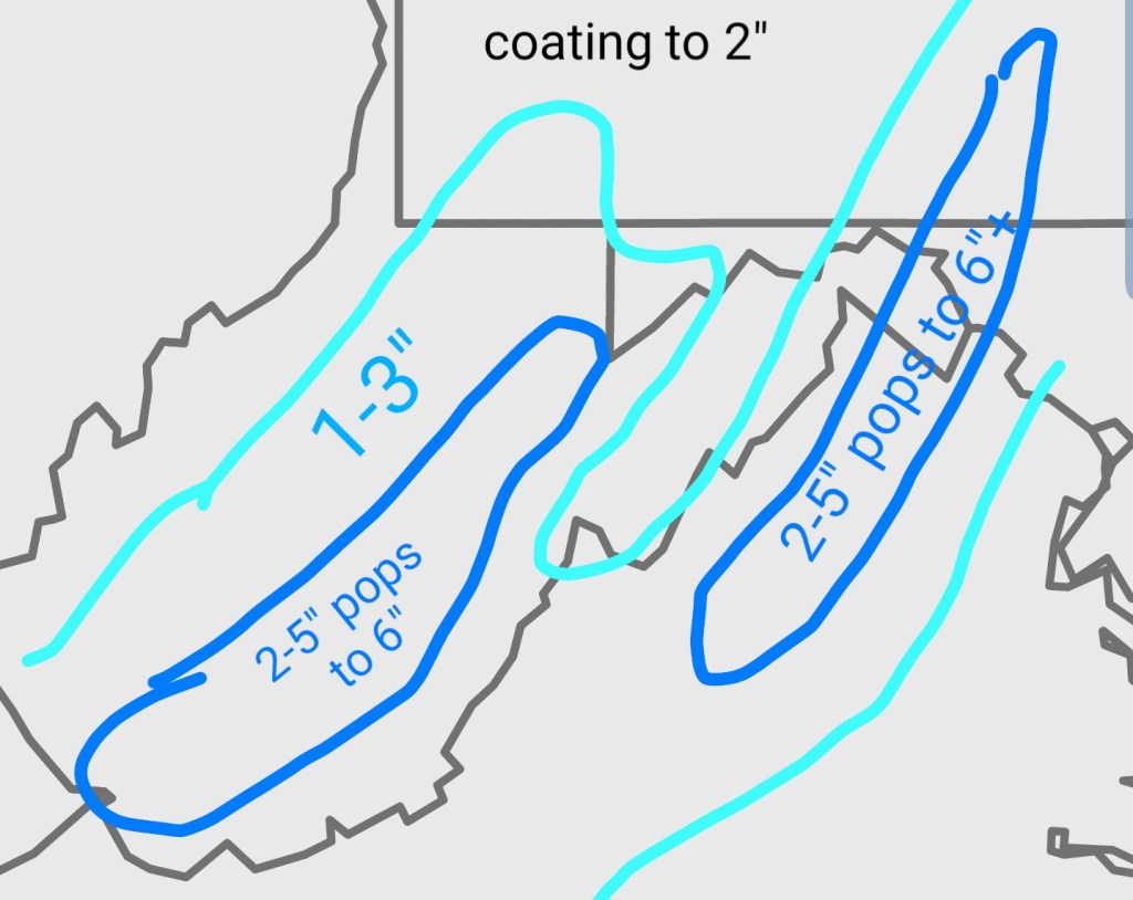
Colder air pushing back in after the mild 24 hours and in some areas 48 hours. The mild rain pretty well wiped out the snow cover that existed in the high ground, except for a few patches here and there. Now the question is, how much returns?
Thoughts have no changed drastically off this doodle map posted from yesterday. One thing to note, a strong leaning to the lower side of the numbers are in play. East of the Alleghenies, still a wild card.
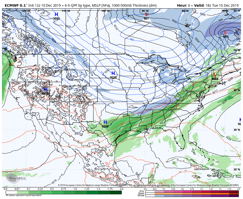
The models
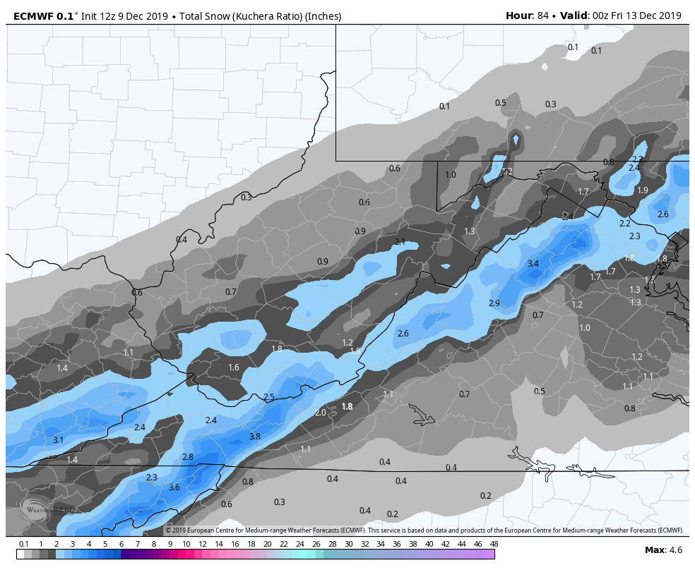
Here is yesterdays 12z ECMWF
Today’s 12z ECMWF
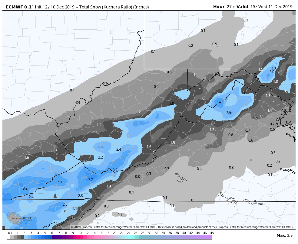
Not a great deal of change in the Euro.
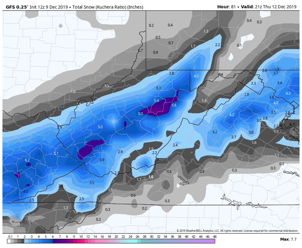
Yesterday 12z GFS
Today’s 12z GFS
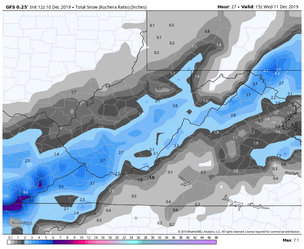
more in line with the ECMWF in lowering totals, but likely overdone yet in the immediate area.
Yesterdays 12z Nam vs today’s
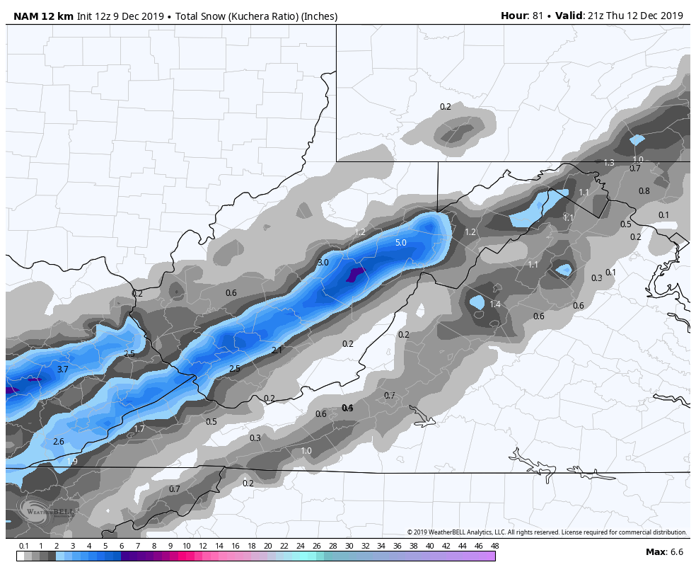
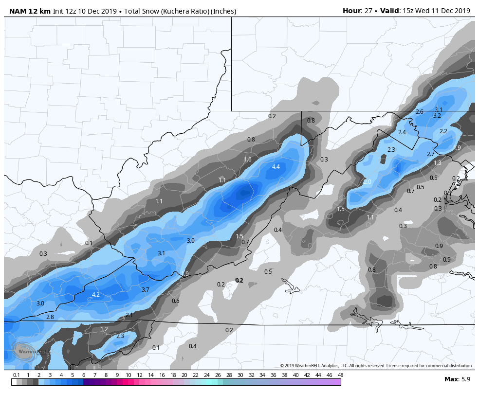
showing that area east much better and that area still may be the area the models adjust too later on.
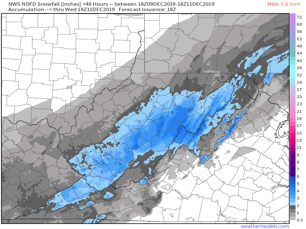
The NWS forecast yesterday
The NWS forecast today
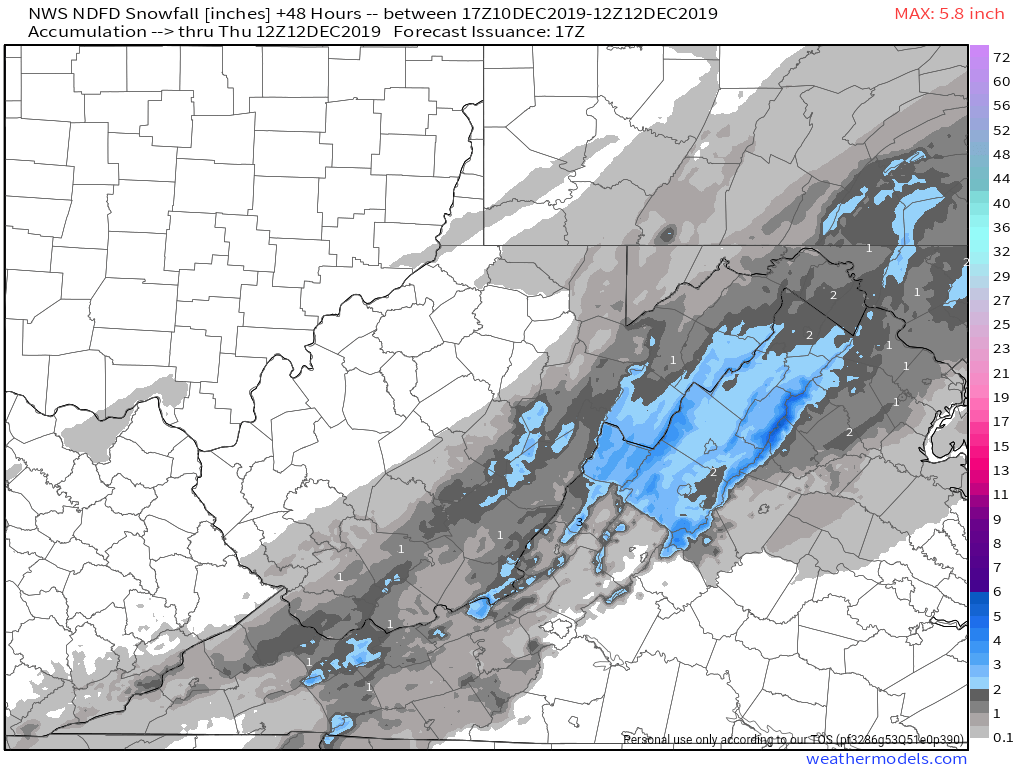
While overall I agree with local totals being lowered and still in the low range of the window on the doodle map, the NWS, mainly Sterling sticks the best accumulation in between where most modeling has it.
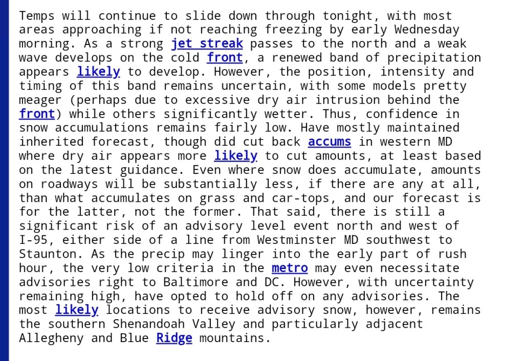
Sterlings forecast discussion
Sleeper area in the event still remains the Blue Ridge and north into Pa, east of the Alleghenies.
