December 17, 2019
Dec 17(Tues)
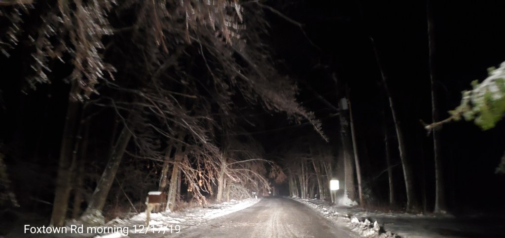
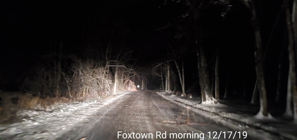
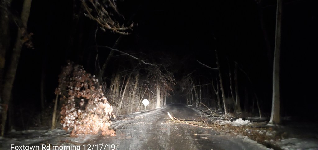
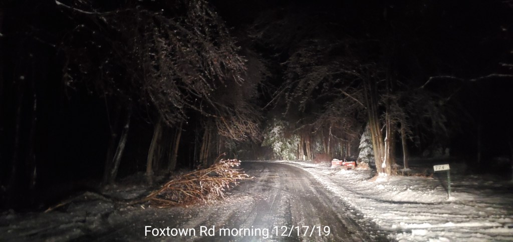
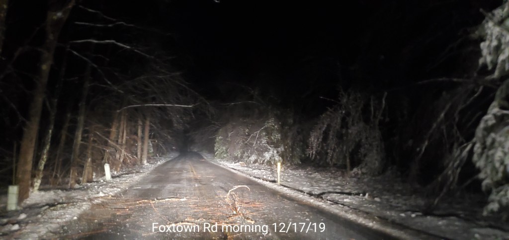
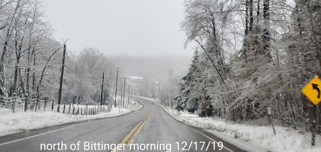
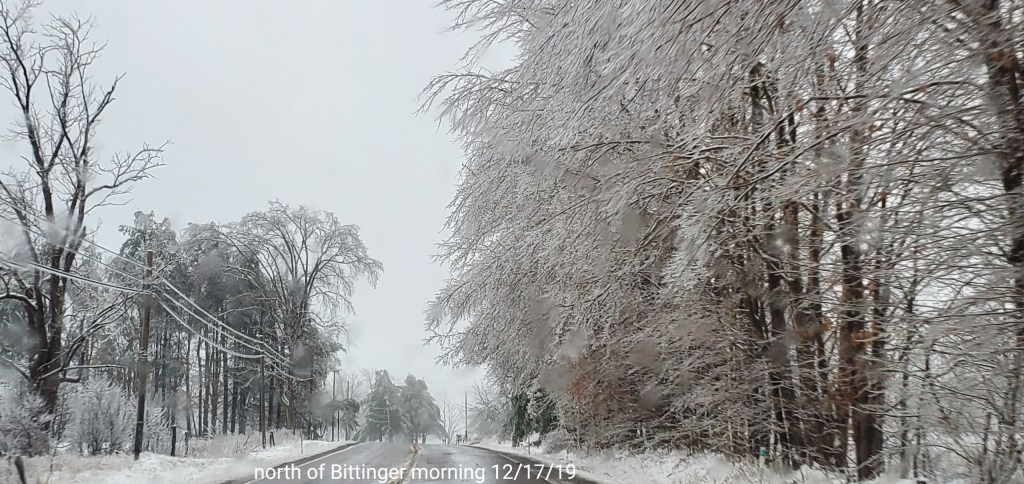
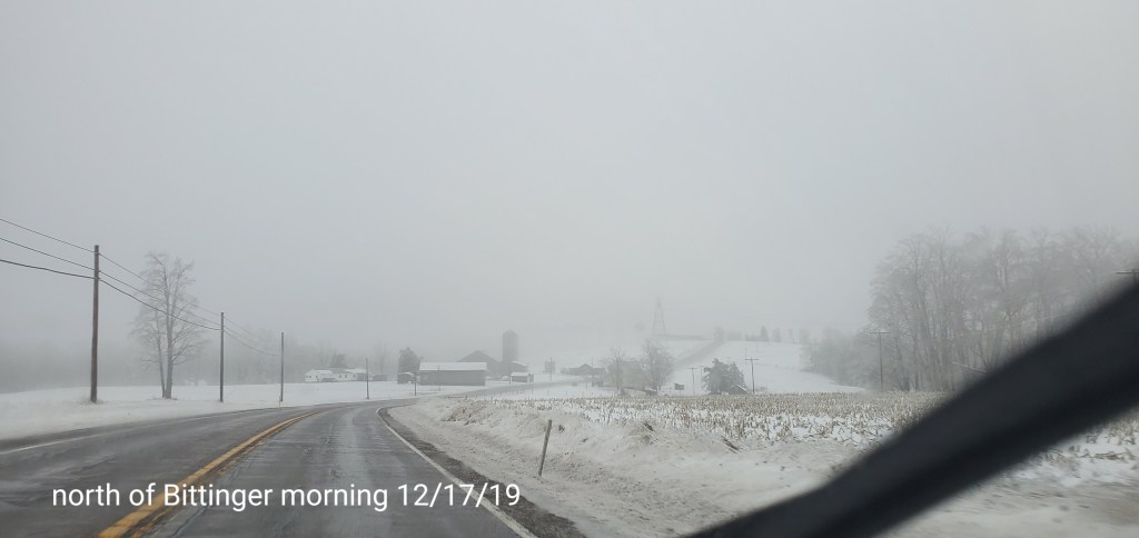
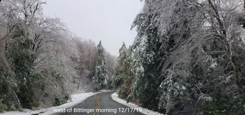
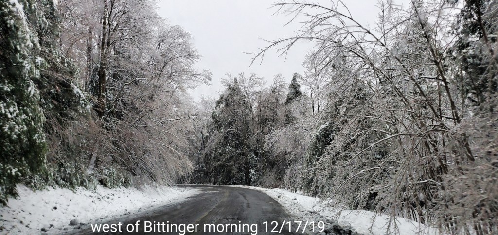
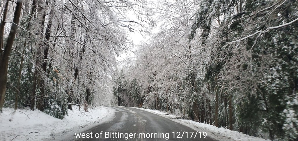
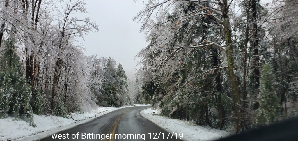
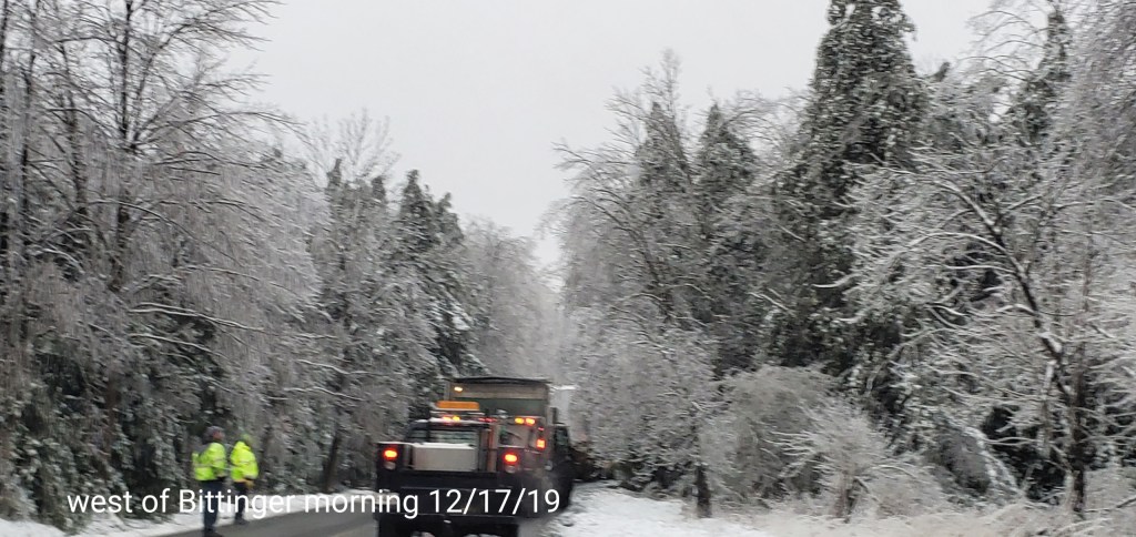
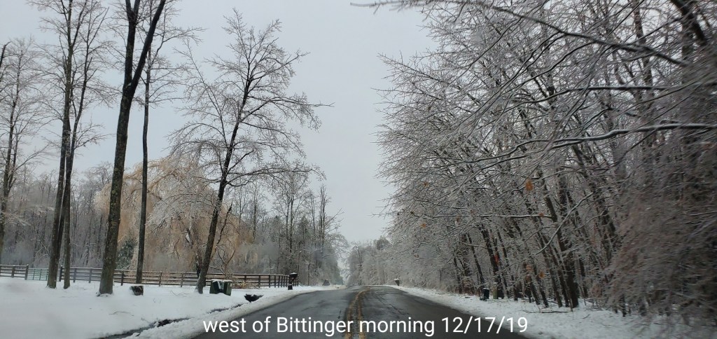
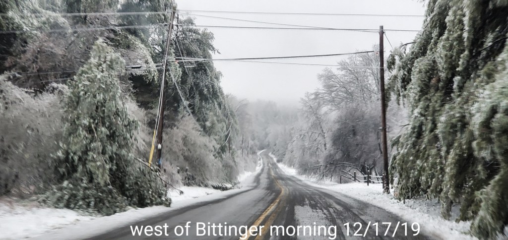
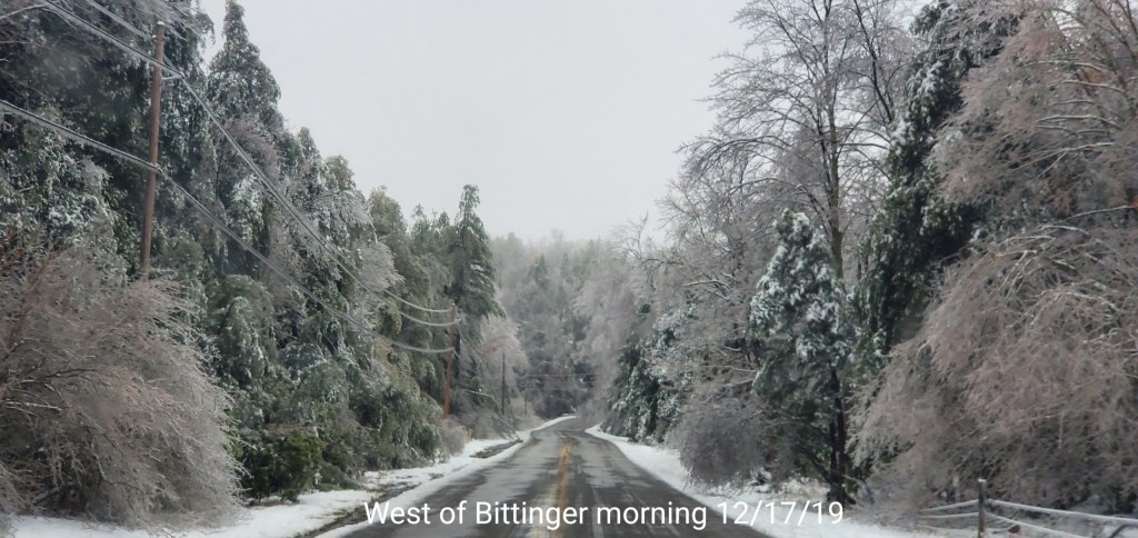
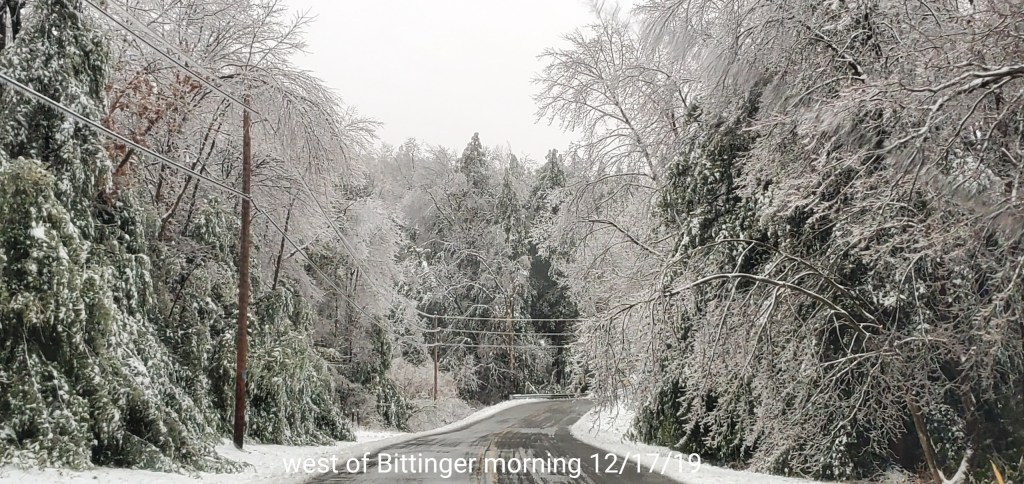
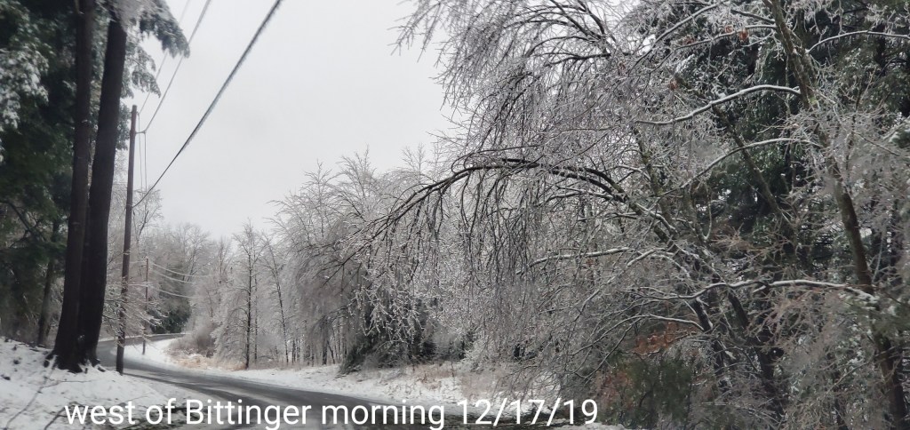
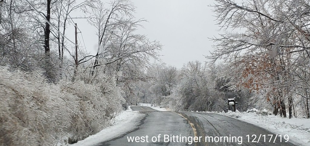
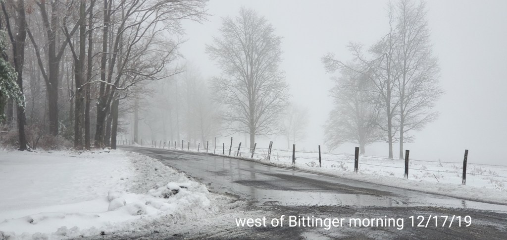
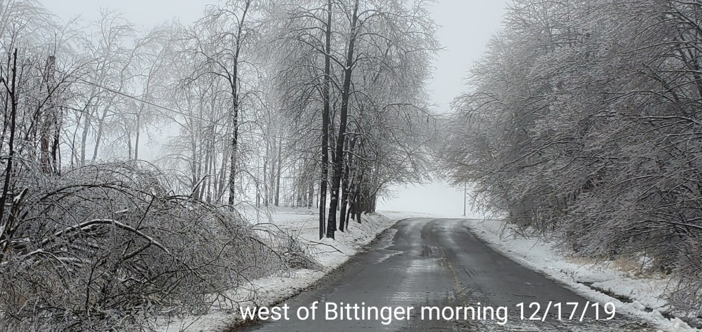
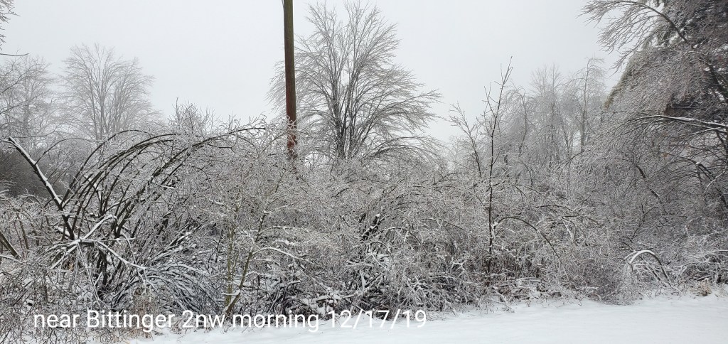
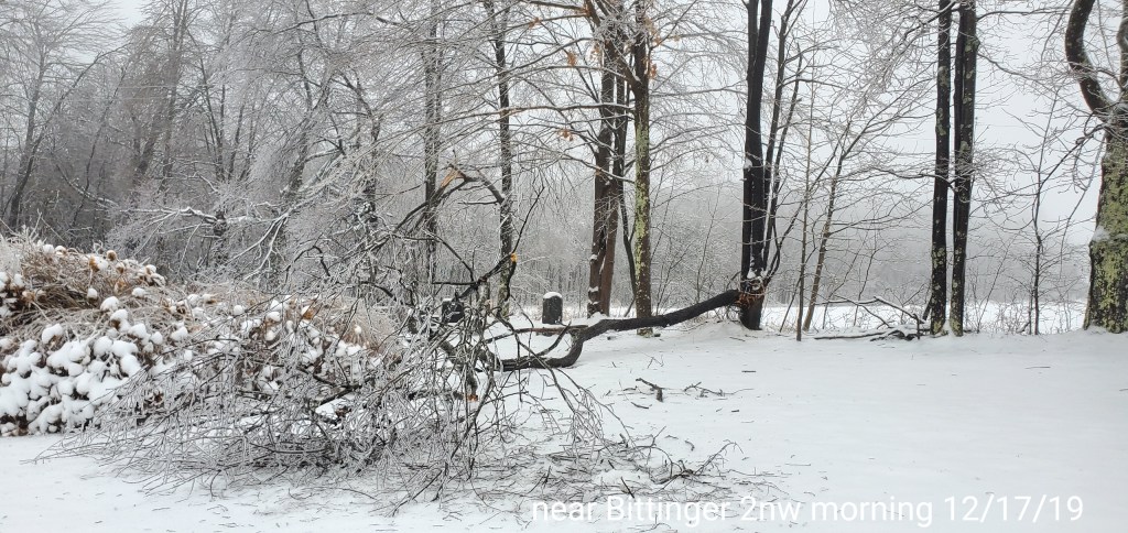
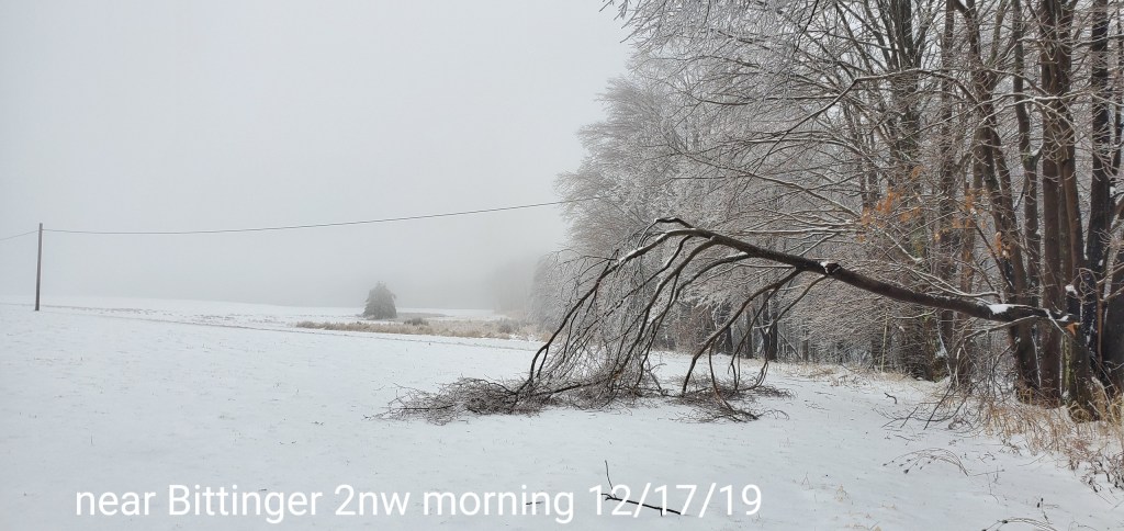
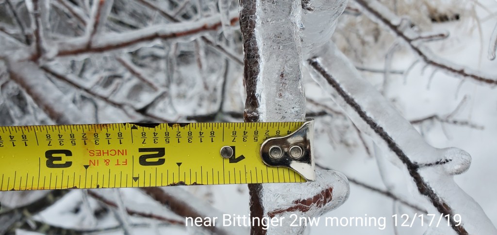
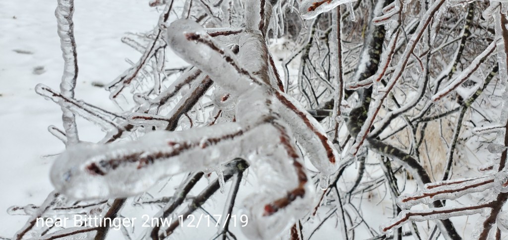
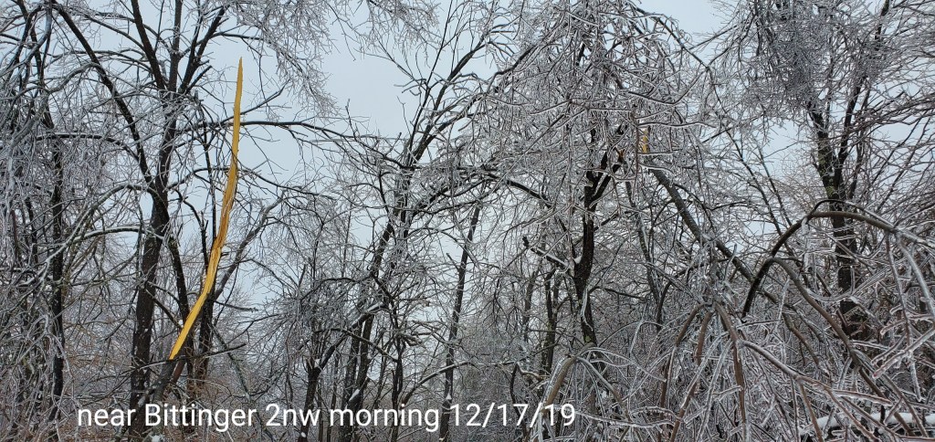
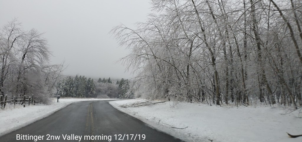
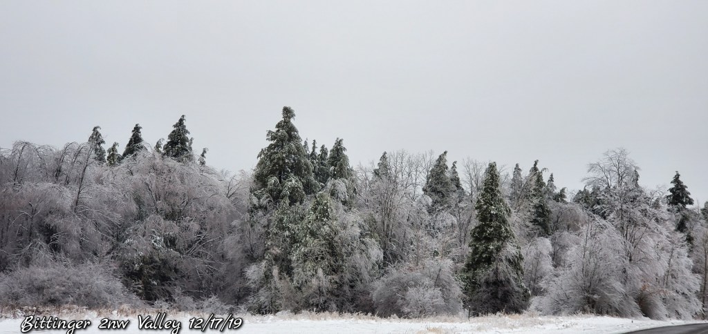
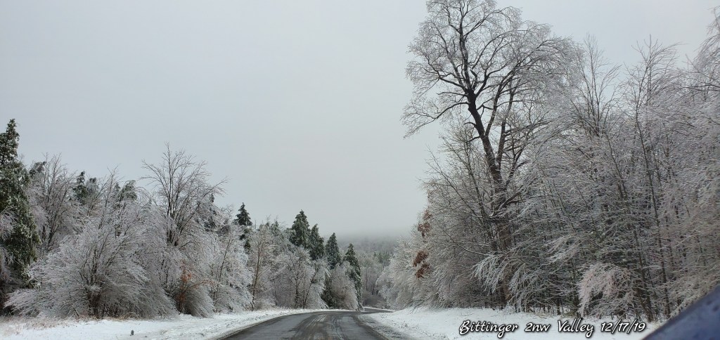
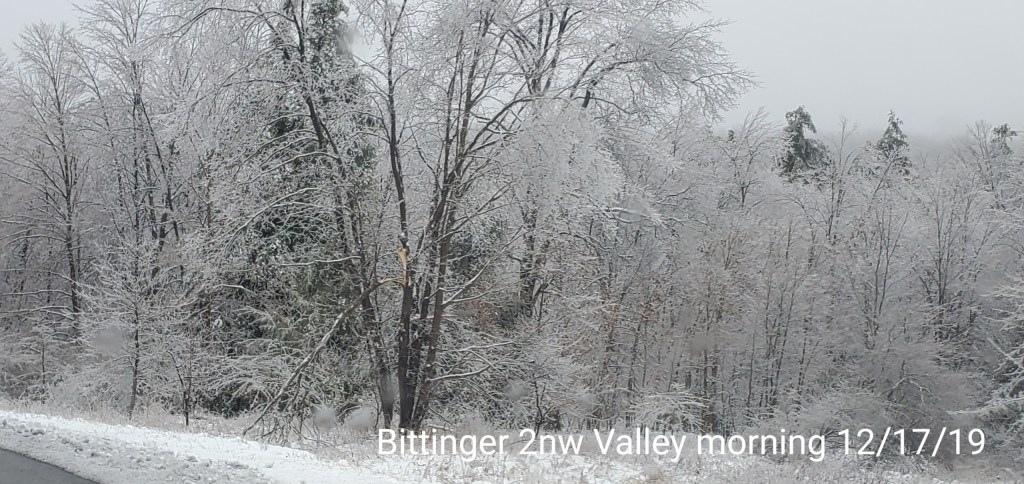
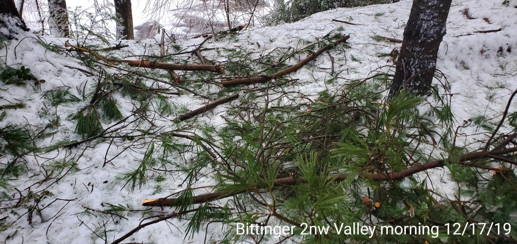
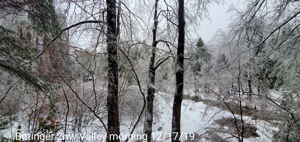
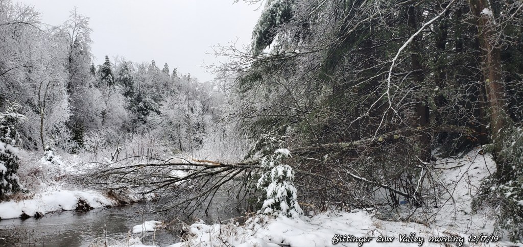
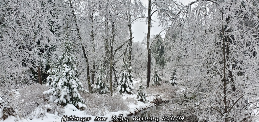
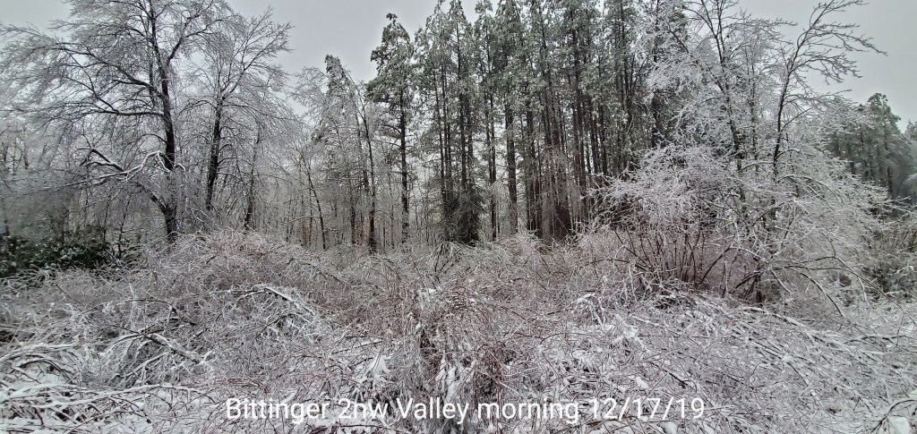
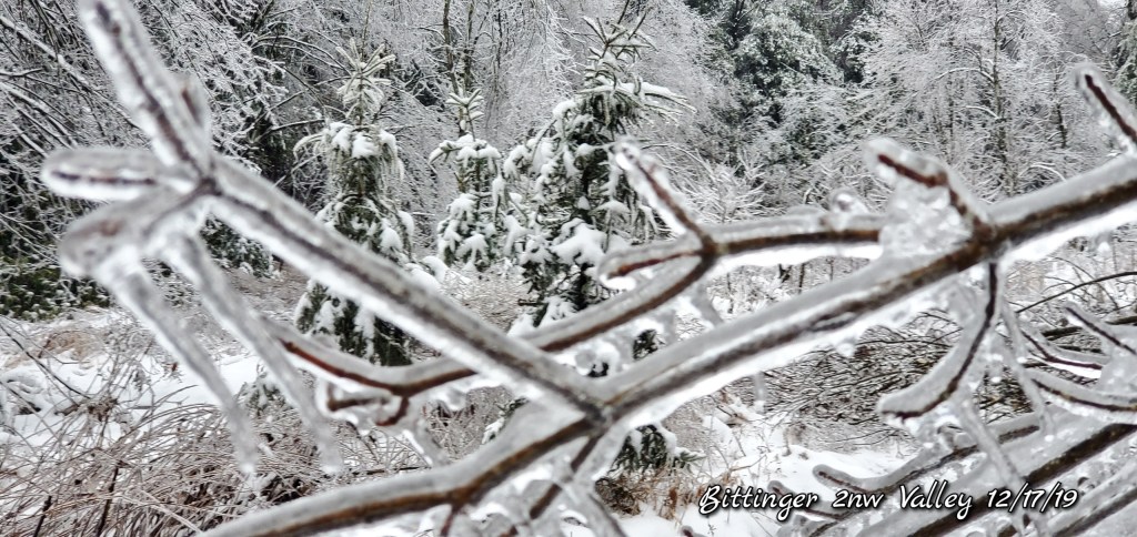
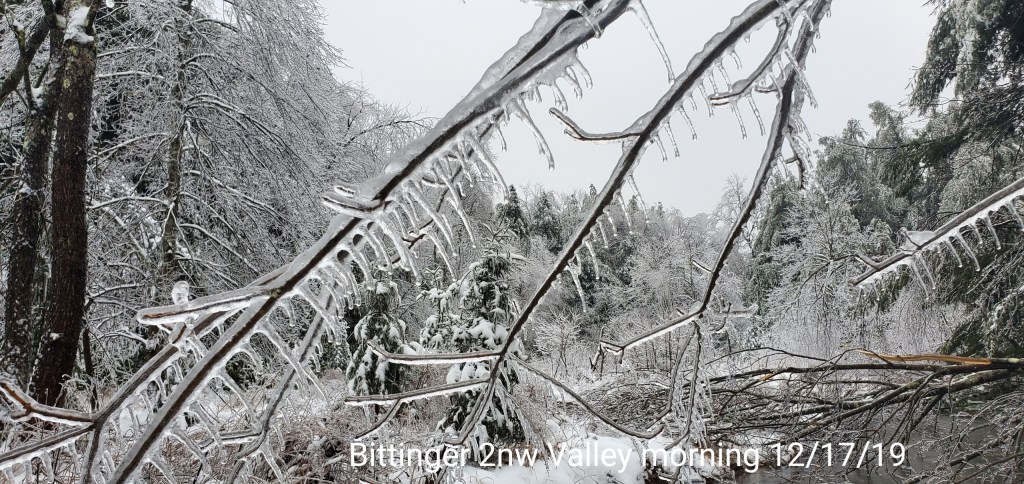
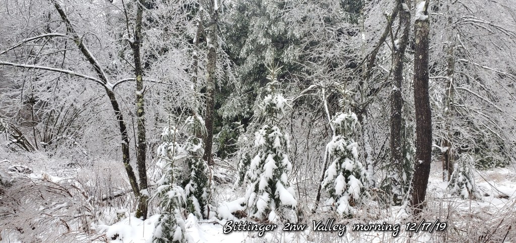
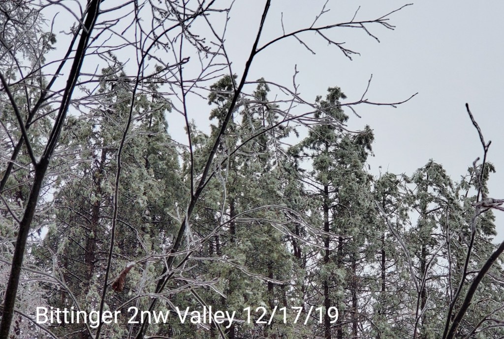
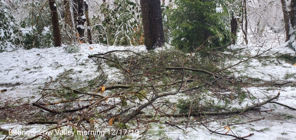
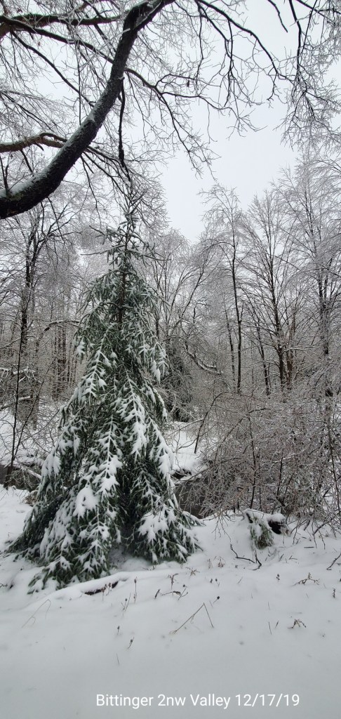
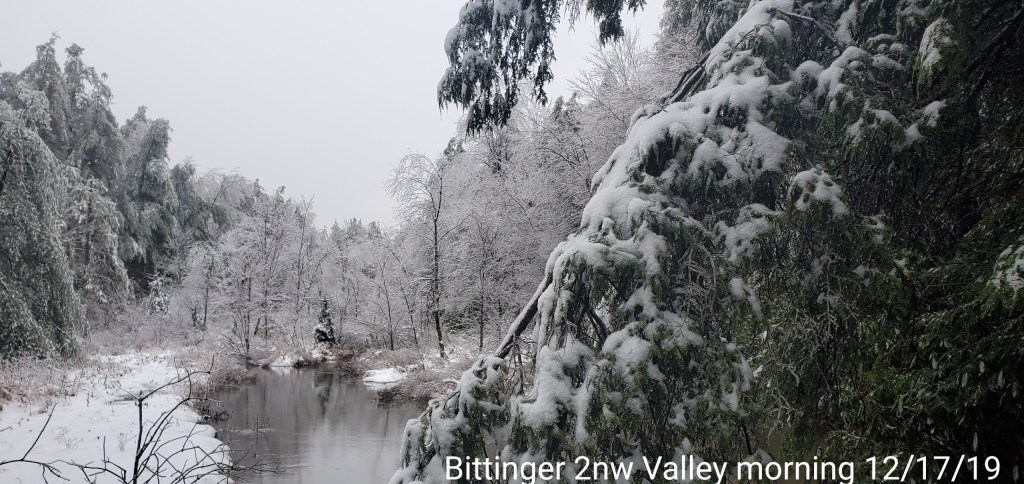
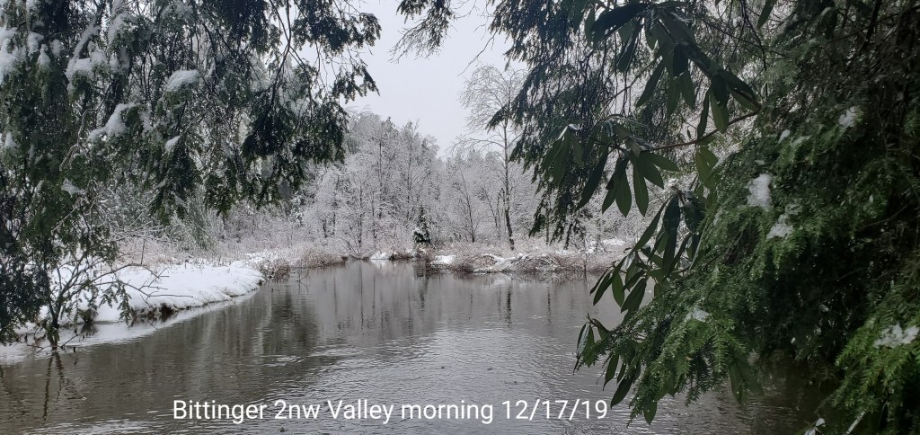
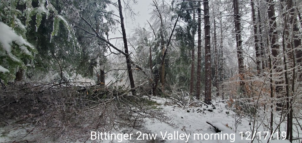
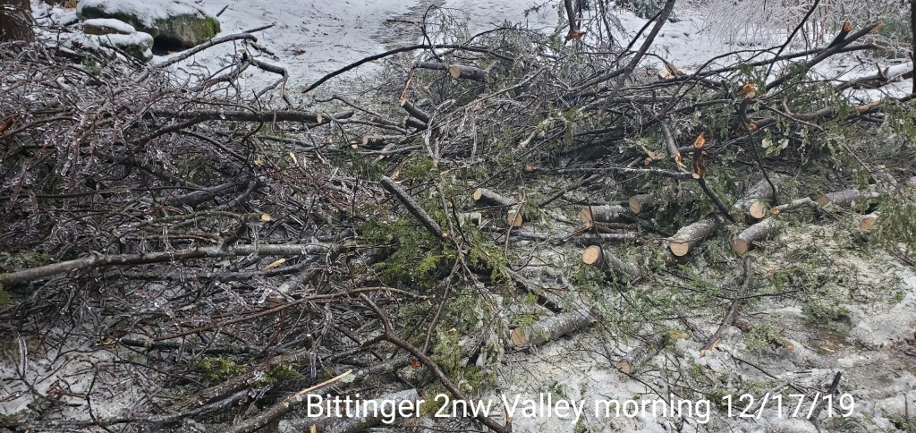
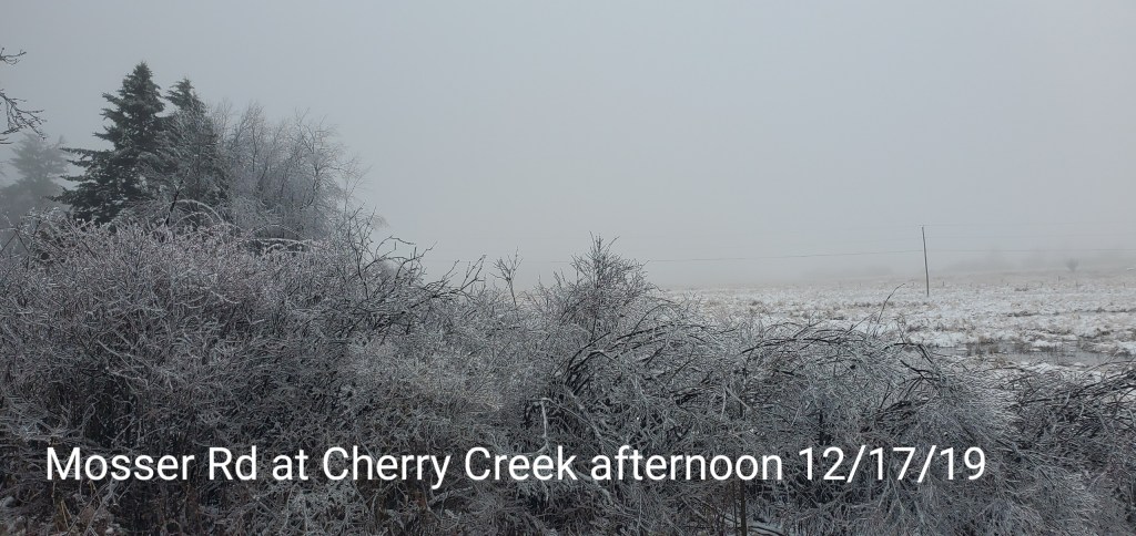
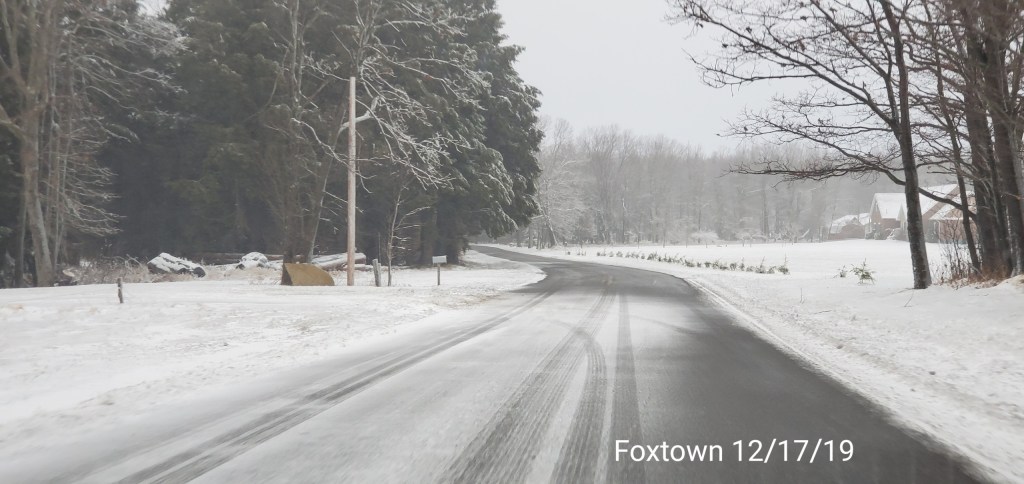
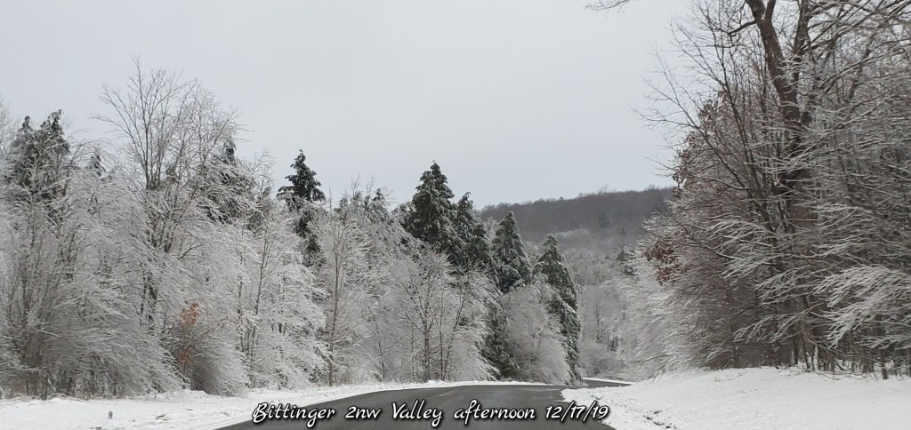
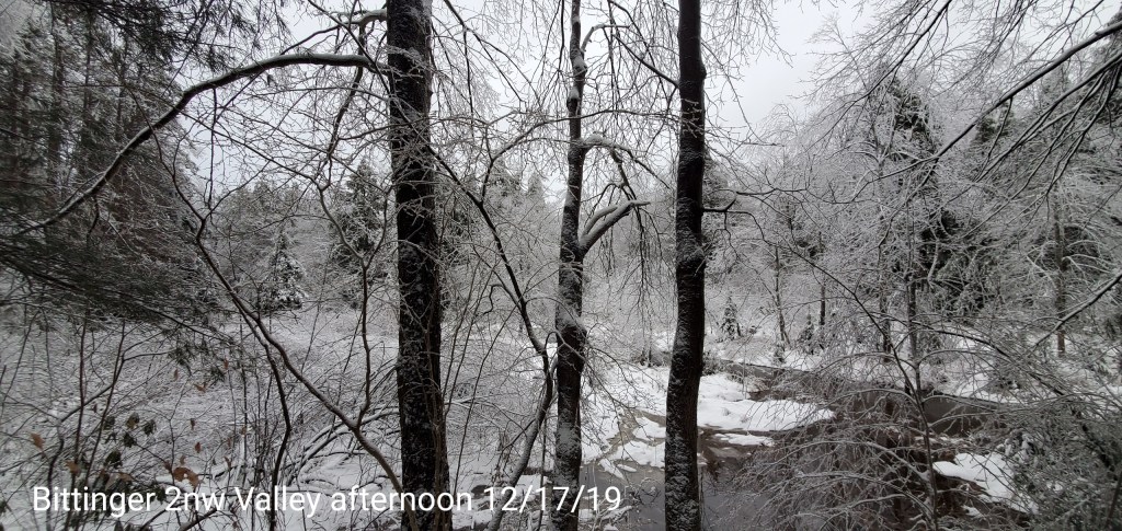
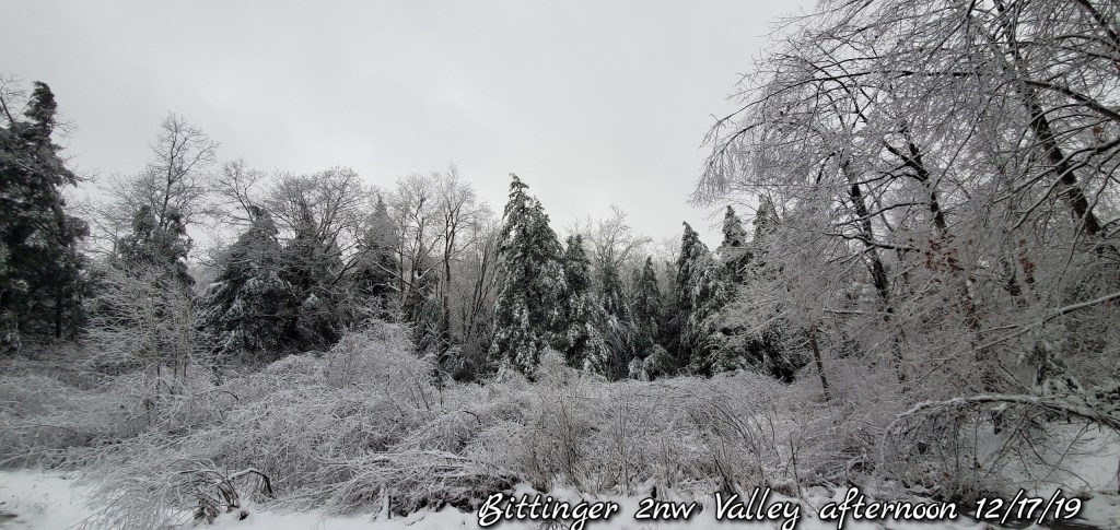
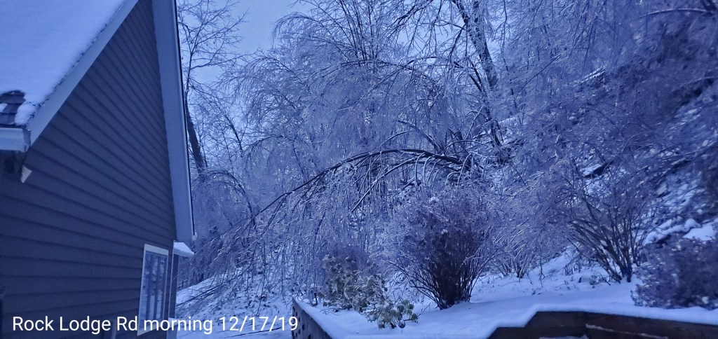
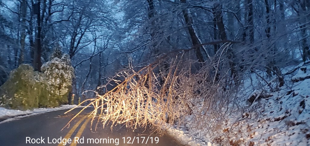
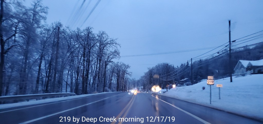
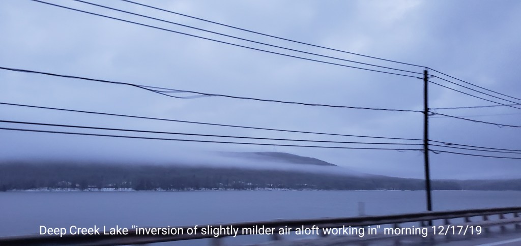
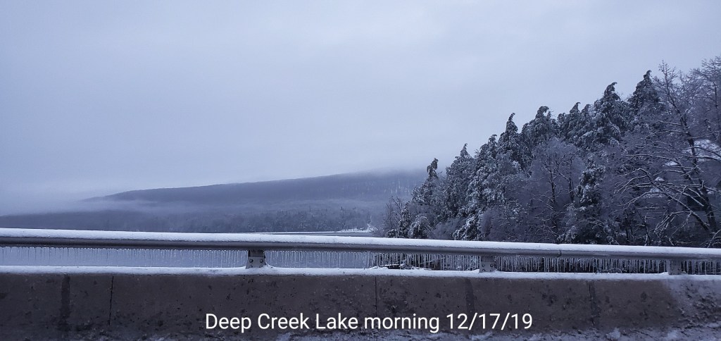
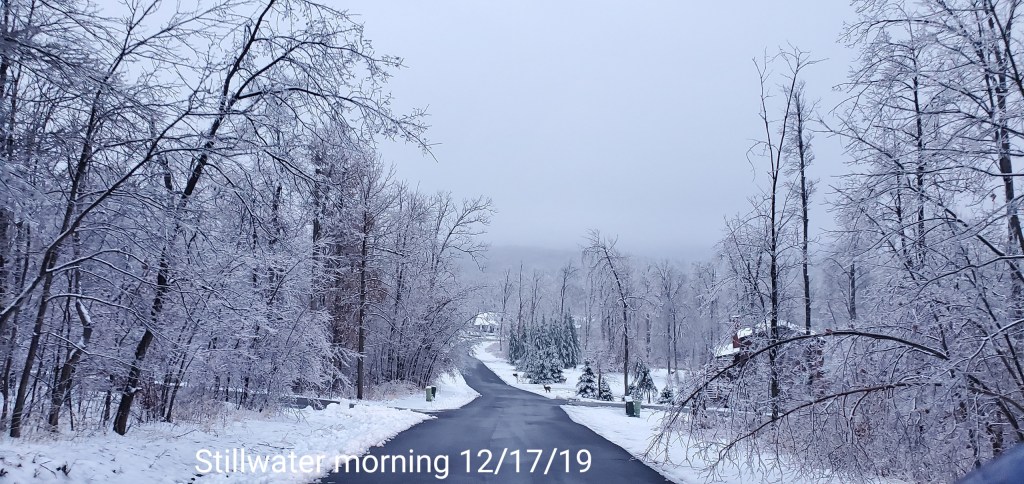
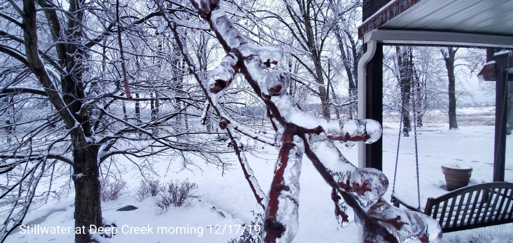
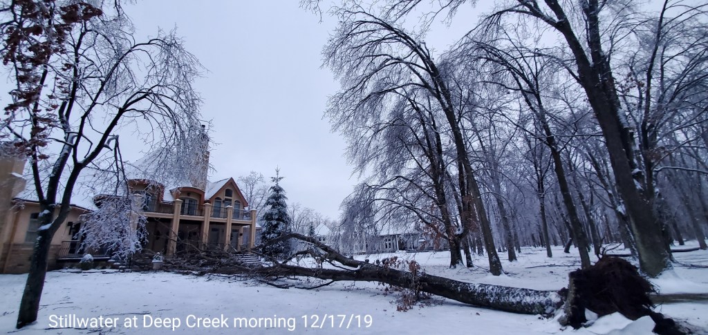
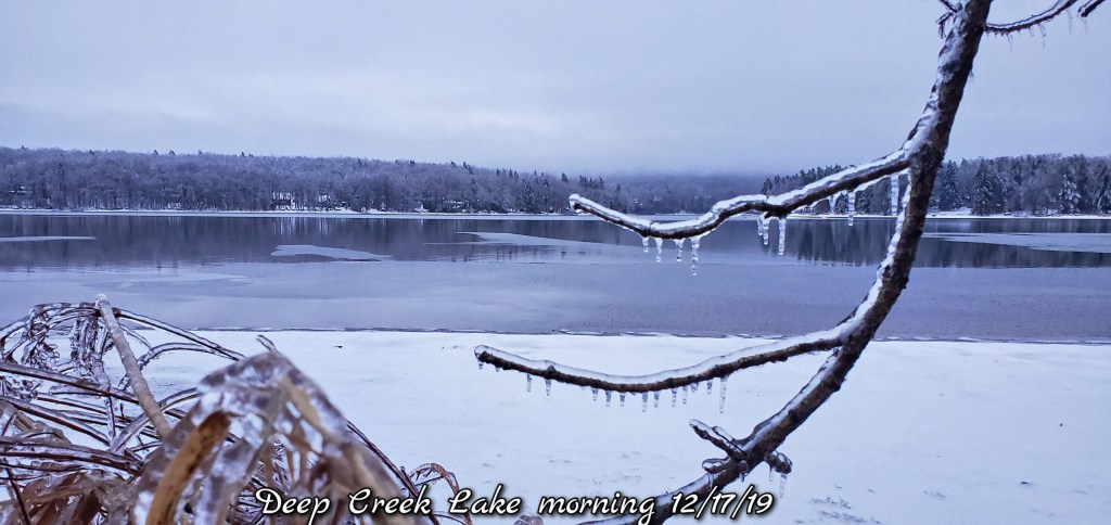
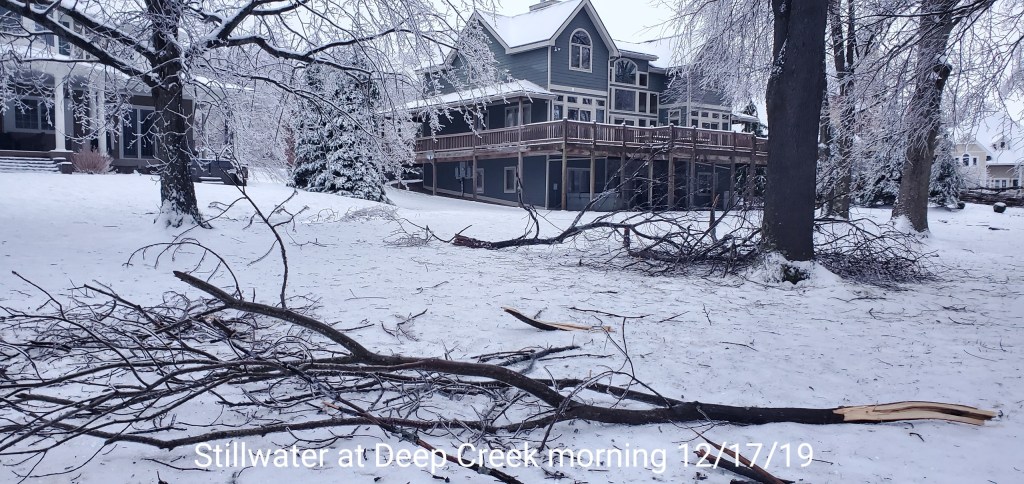
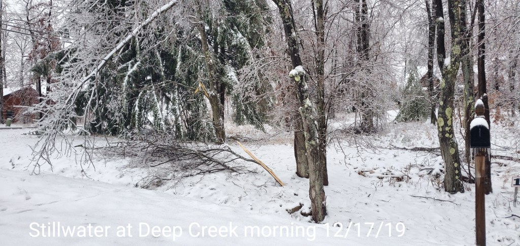
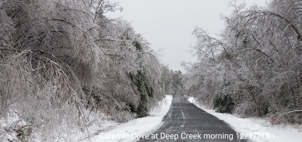
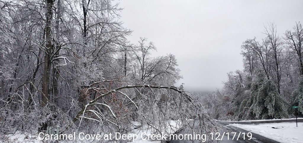
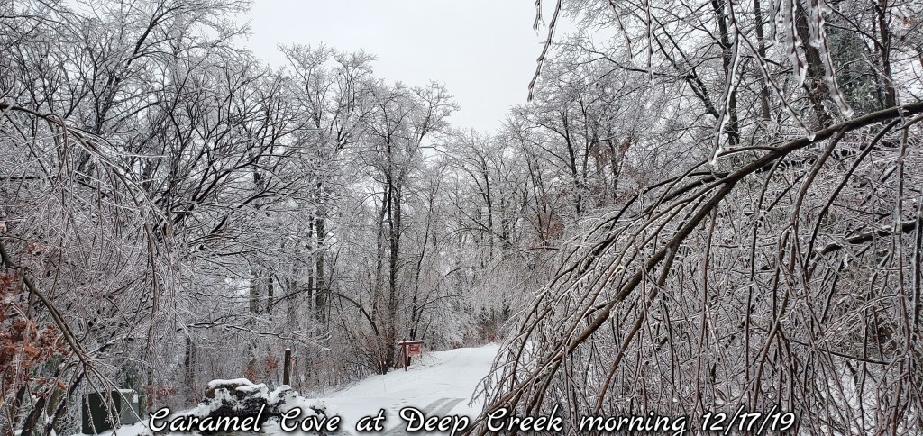
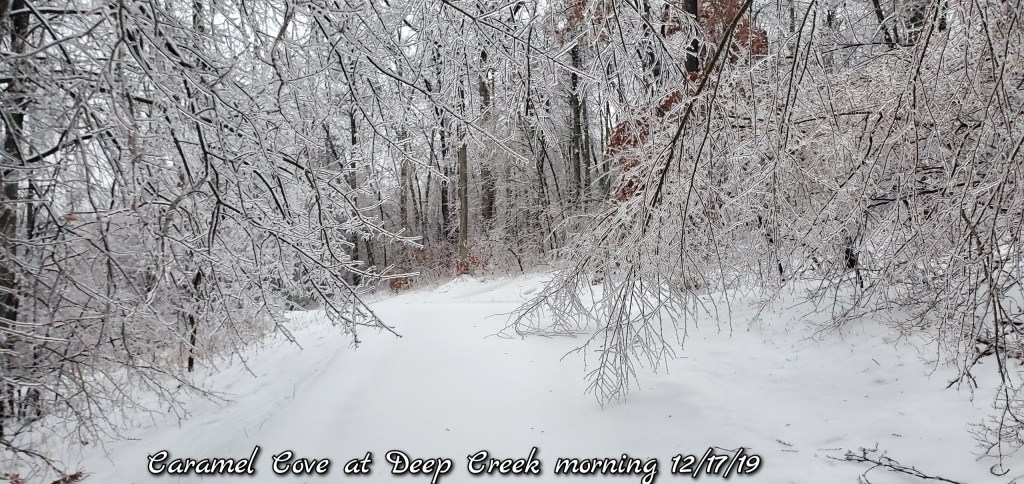
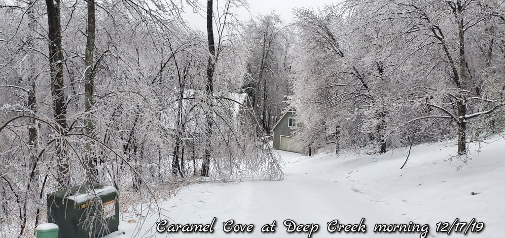
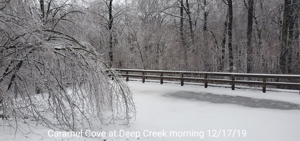
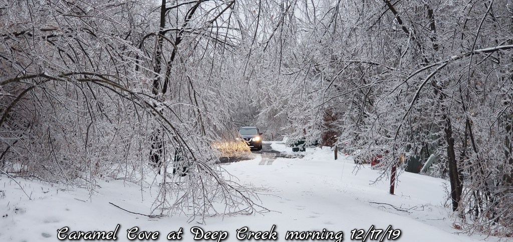
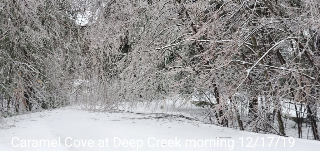
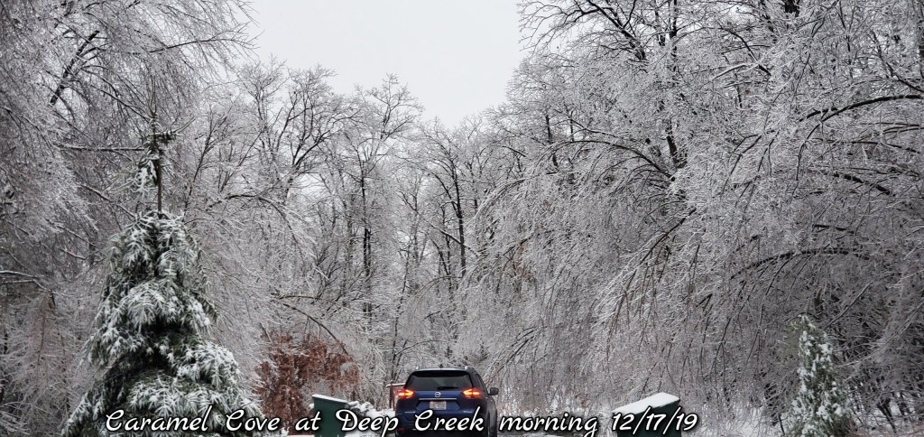
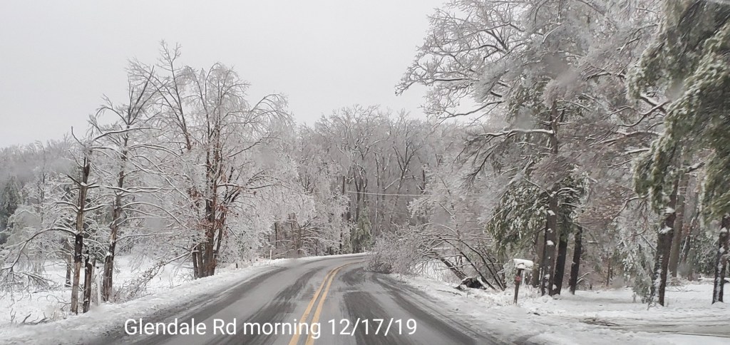
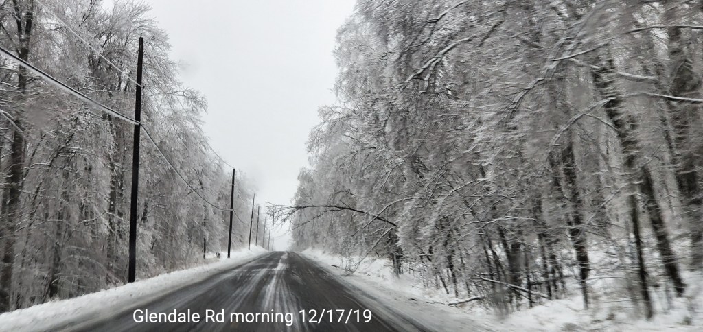
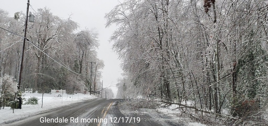
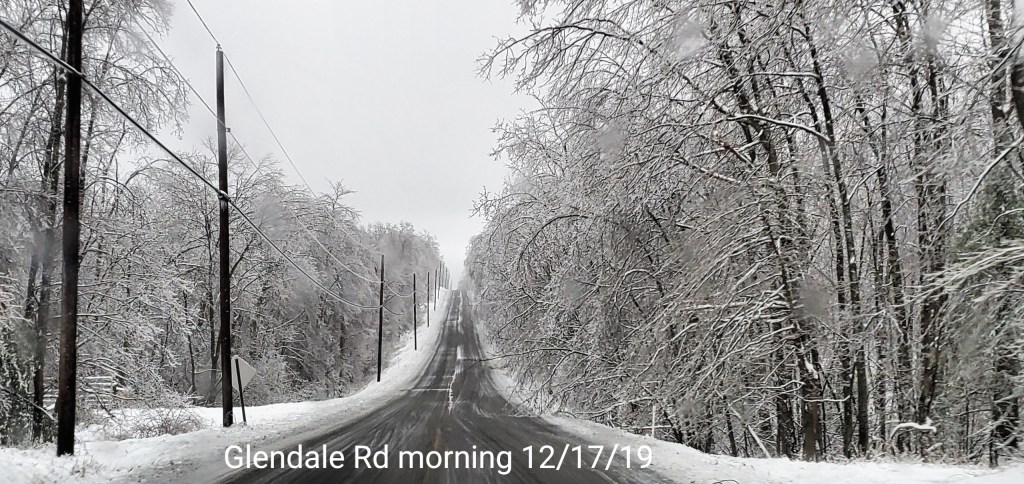
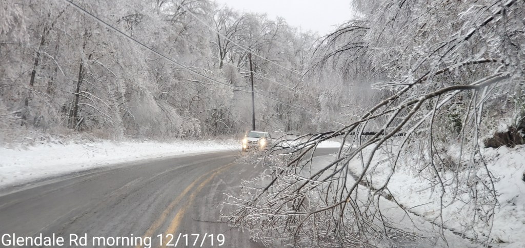
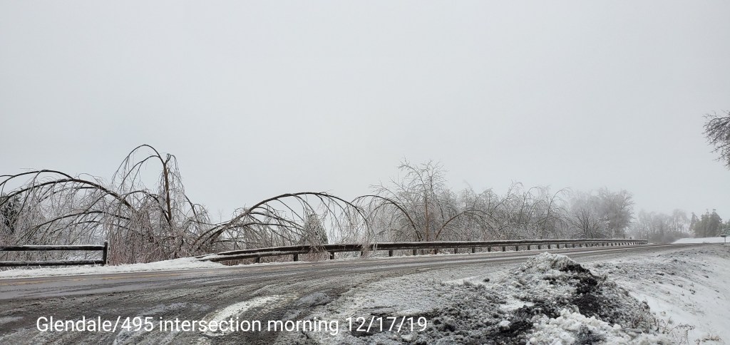
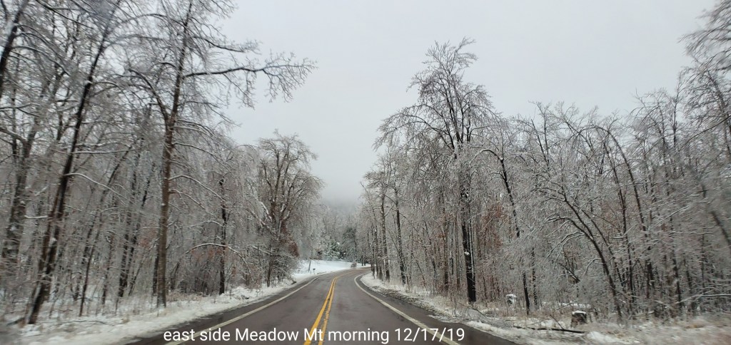
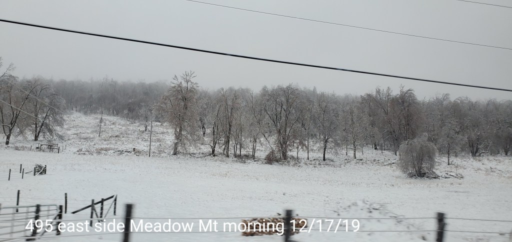
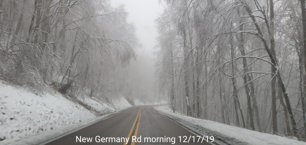
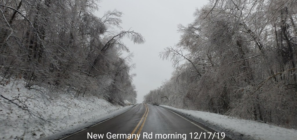
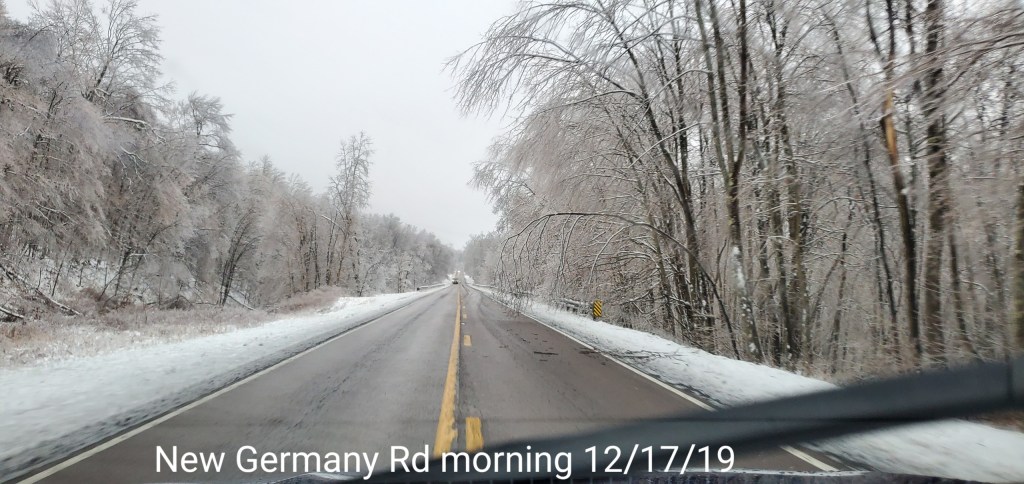
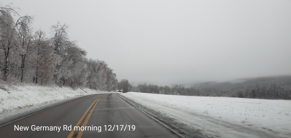
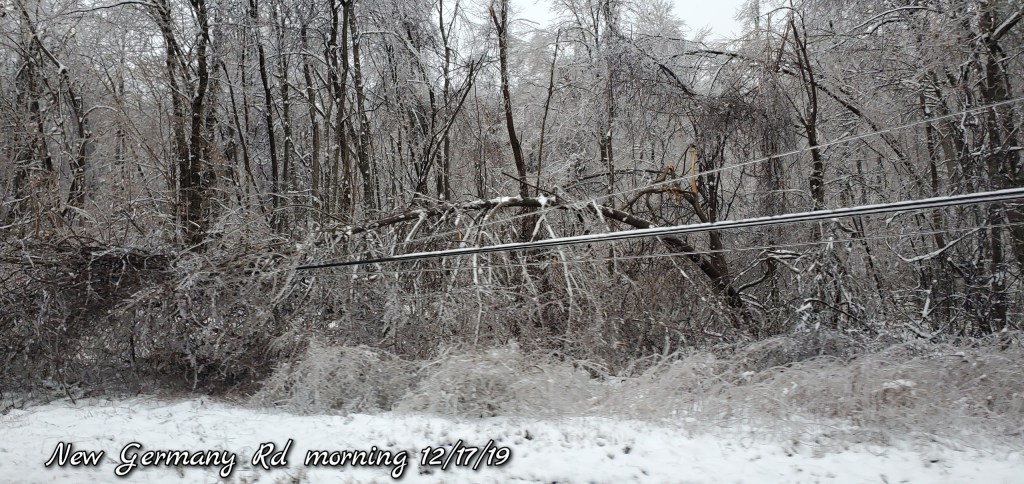
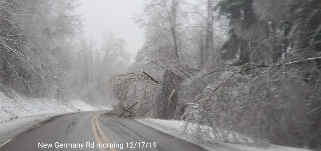
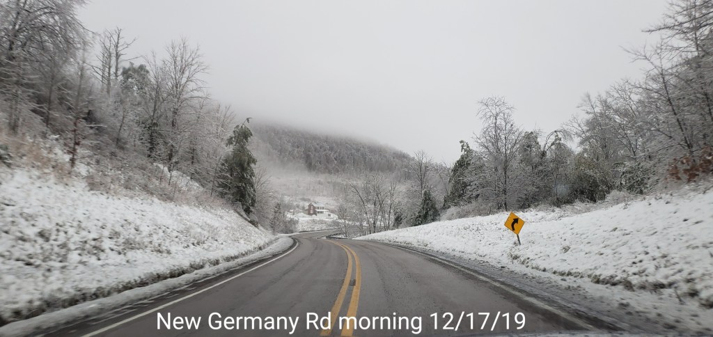
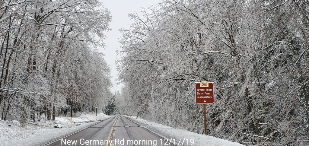
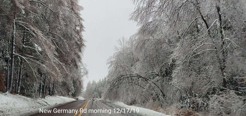
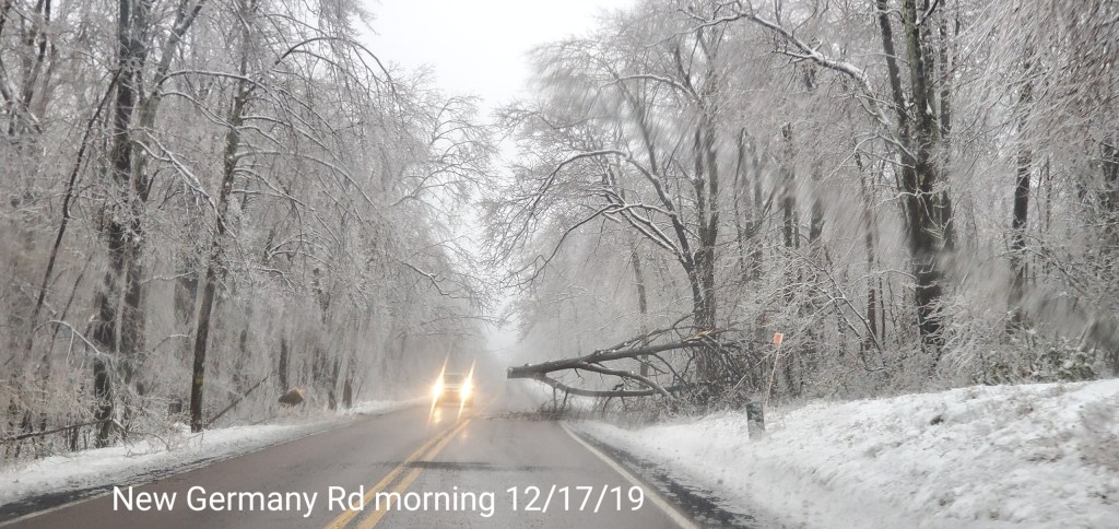
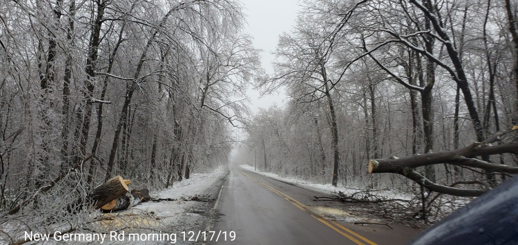
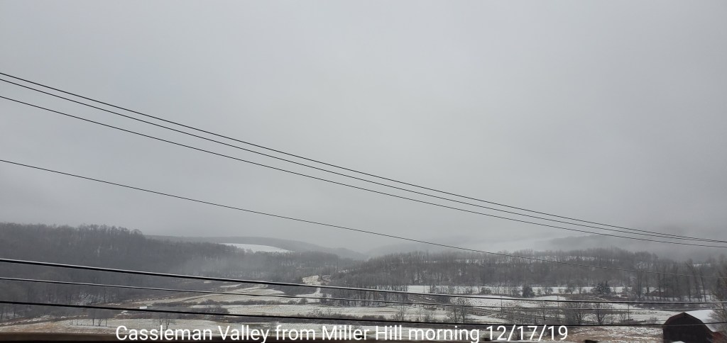
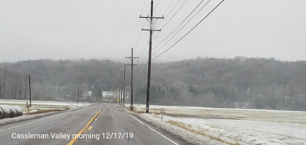
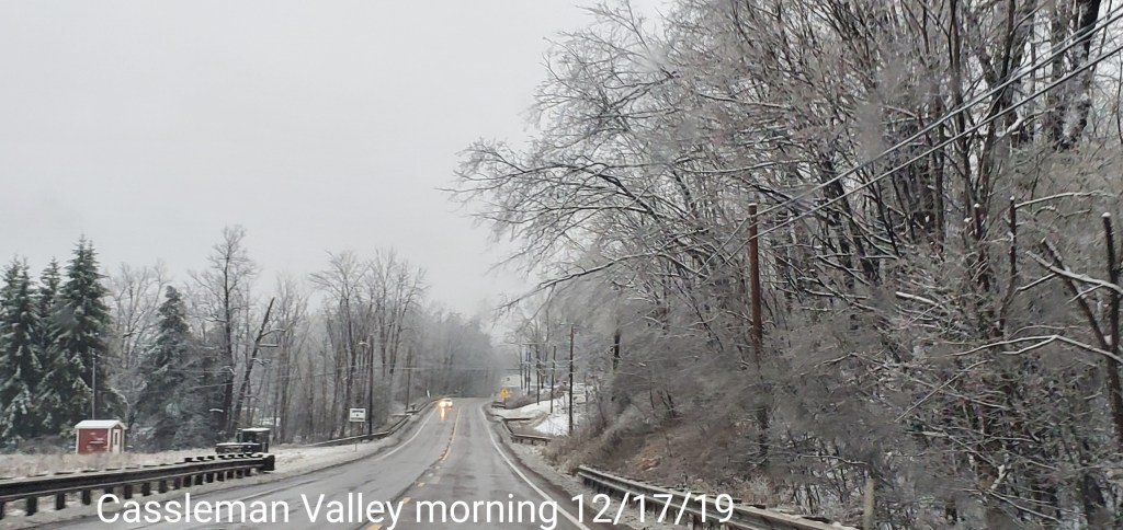
Ice ice baby. Major ice event across the eastern half of Garrett, and in some instances stretched into western Garrett. Overnight as far west as Preston County, before temps moderated there. Trees, limbs began falling 9-10pm and with that, power outages began. Some roadways blocked. All the while, very mild air and a rain out just to the south in Wv. Temps fell to the upper 20s at Mt.Storm early overnight last night, but sat at 50 this morning while below freezing remained in areas in Garrett. A brief surge of milder air came across mid morning, however not enough to scour out the cold in the high valleys in Garrett. The highest elevated areas in the ice zone lost more ice than the lower elevated areas with the brief mild surge that was followed by wind and colder air by midday. Leftover rain today changed to snow early afternoon as the colder air returned. Ice never came off the trees. Some high ground saw a little more melt than valleys in central Garrett with the slightest intrusion of mild air mid morning.
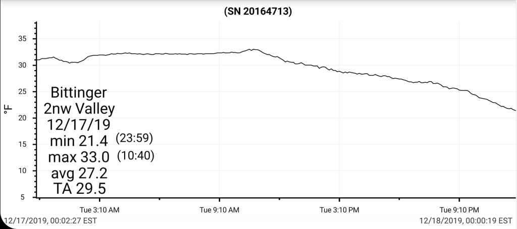
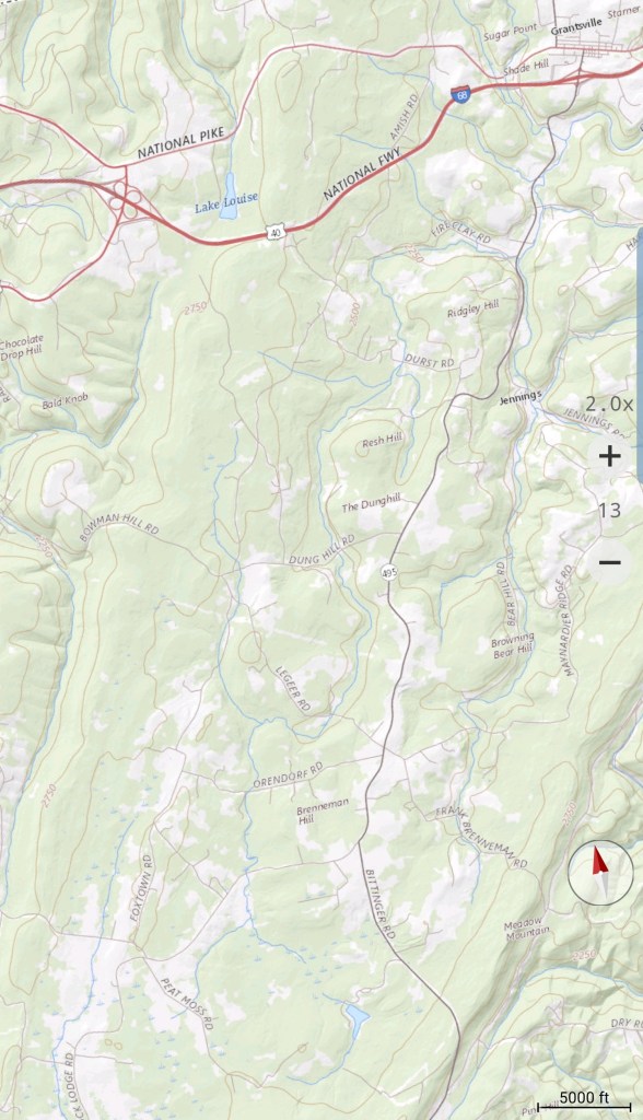
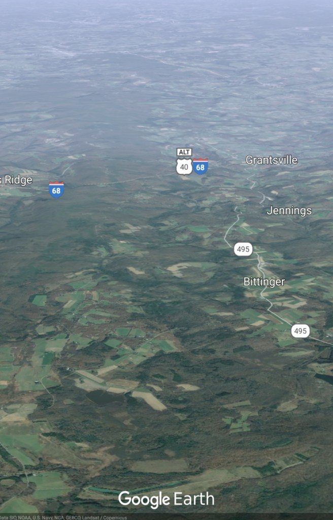
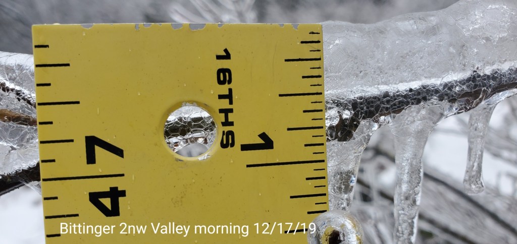
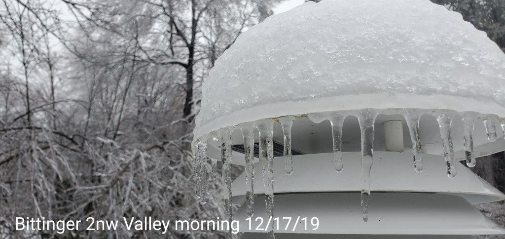
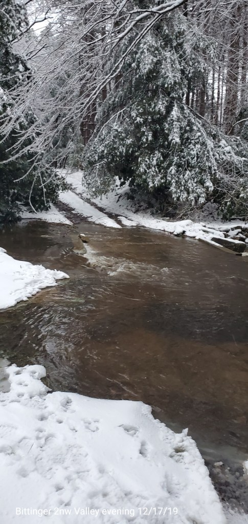
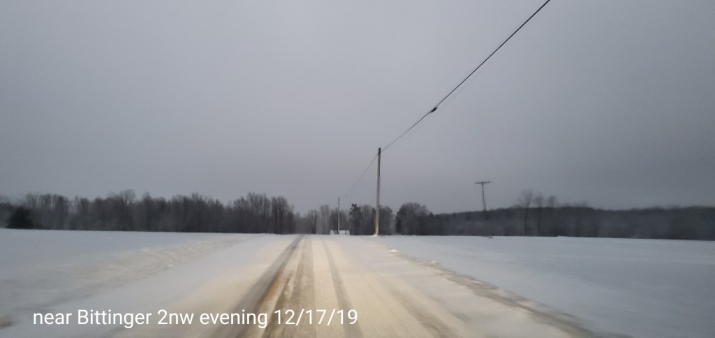
Bittinger 2nw Valley
MIN[21.4]—MAX[33.0]—AVERAGE MEAN[27.2]—TRUE AVERAGE[29.5]—PRECIP[1.03]
Snowfall season to date total 16.7, minor accumulation through nightfall to be added tomorrow
Freezing rain amounts, always a difficult judgement as freezing rain varies object to object. If its wind faced, if its marginal more can run to the end of tree limbs vs the upper parts etc…that said .4 to .6 range was common.
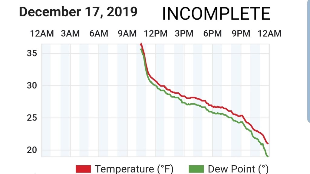
Garrett College
Due to the power outage, data is missing for the first 10 hours today. That leaves today’s data incomplete at GCC. The min temp does stand as the min as that occured after power was restored.
Canaan Heights/Davis 3SE
This zone remained in the rain
MIN[14.2]—MAX[48.3]—AVERAGE MEAN[31.2]
Snowfall stands at 26.3″ additional today will be added in the morning
Comments by Dave Lesher

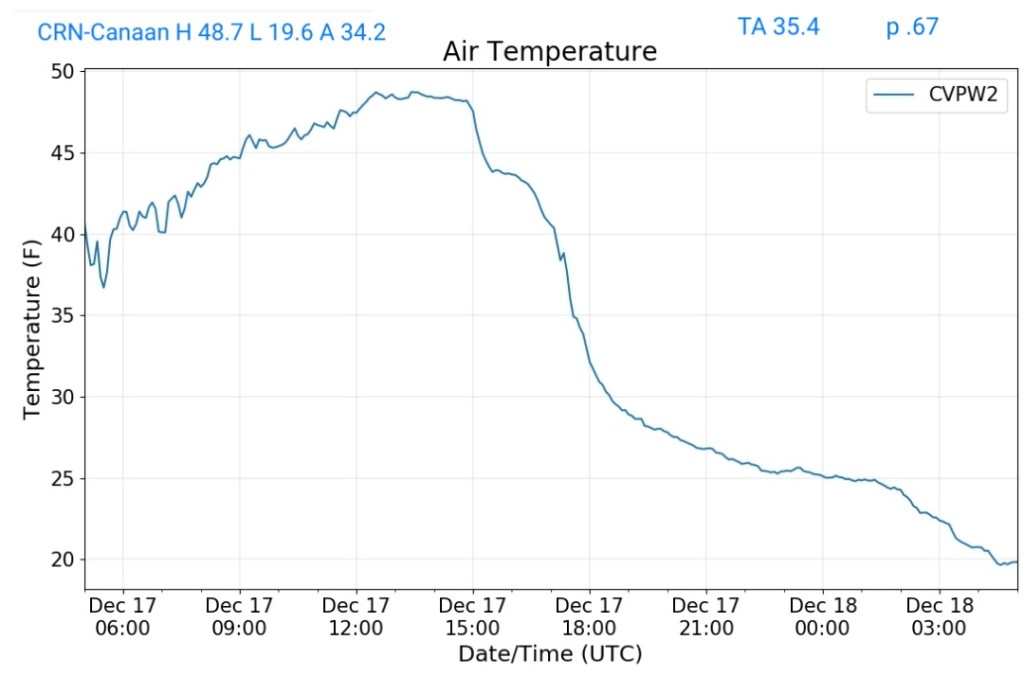
Climate Reference Network Canaan
MIN[19.6]—MAX[48.7]—AVERAGE MEAN[34.2]—TRUE AVERAGE[35.4]AVERAGE[35 —PRECIP[.67]
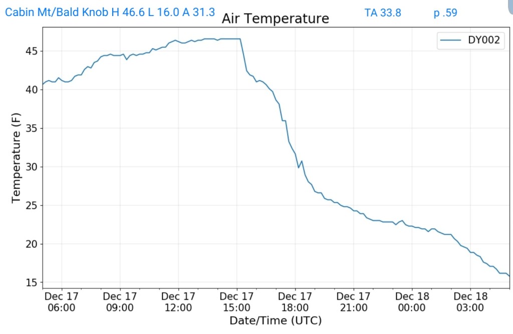
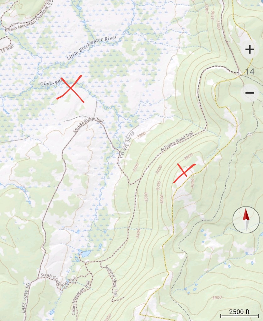
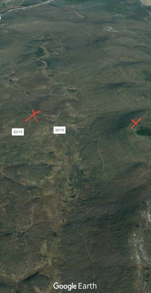
Cabin Mt at Bald Knob
MIN[16.0]—MAX[46.6]—AVERAGE MEAN[31.3]—TRUE AVERAGE[33.8]—PRECIP[.59]*before cold air returned
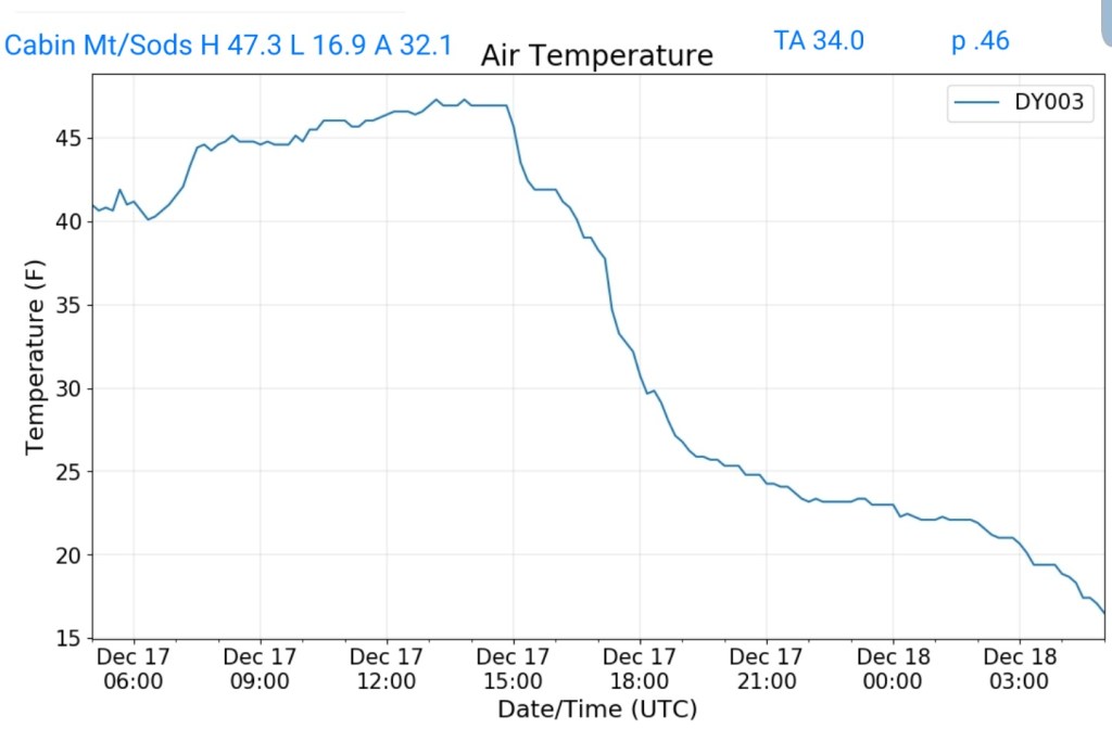
Cabin Mt-Western Sods
MIN[16.9]—MAX[47.3]—AVERAGE MEAN[32.1]—TRUE AVERAGE[34.0]—PRECIP[.46]*before cold returned
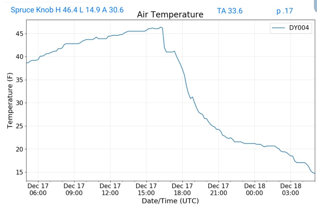
Spruce Knob
MIN[14.9]—MAX[46.4]—AVERAGE MEAN[30.6]—TRUE AVERAGE[33.6]—PRECIP[.17]*before cold returned
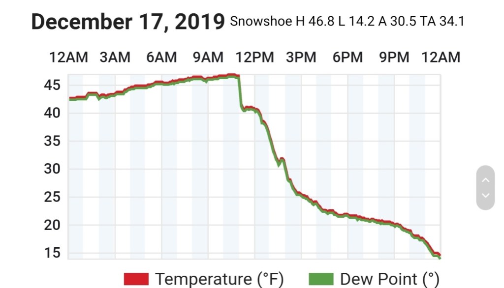
Snowshoe
MIN[14.2]—MAX[46.8]—AVERAGE MEAN[30.5]—TRUE AVERAGE[34.1]
Canaan Valley Refuge
MIN[21.0]—MAX[50.2]—AVERAGE MEAN[35.6]—TRUE AVERAGE[35.3]

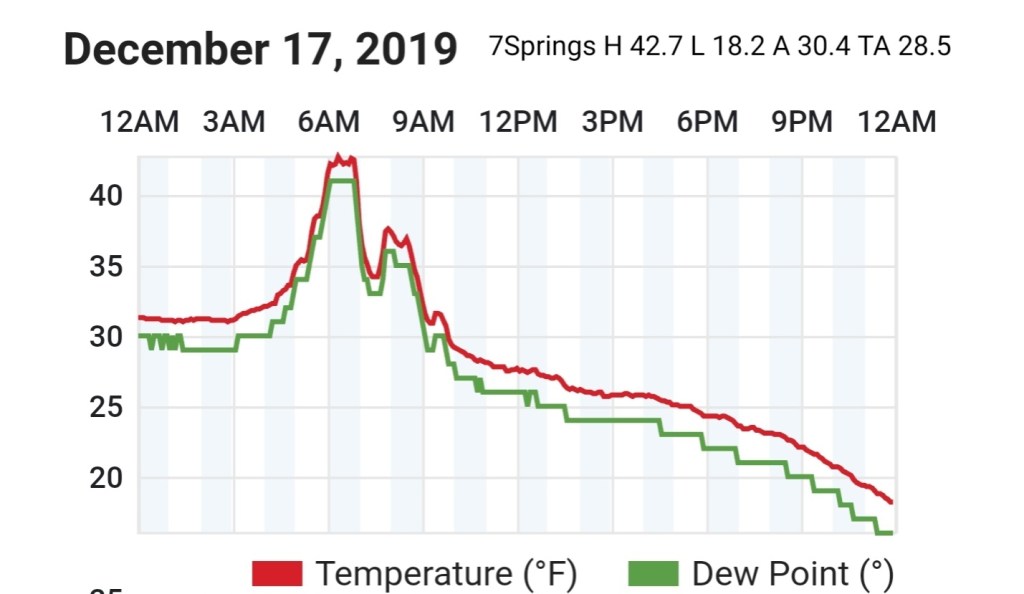
7Springs
MIN[18.2]—MAX[42.7]—AVERAGE MEAN[30.4]—TRUE AVERAGE[28.5]
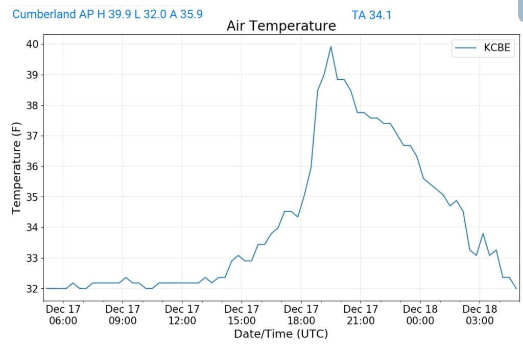
Cumberland Airport
MIN[32.0]—MAX[39.9]—AVERAGE MEAN[35.9]—TRUE AVERAGE[34.1]
The Valley vs Cabin Mt
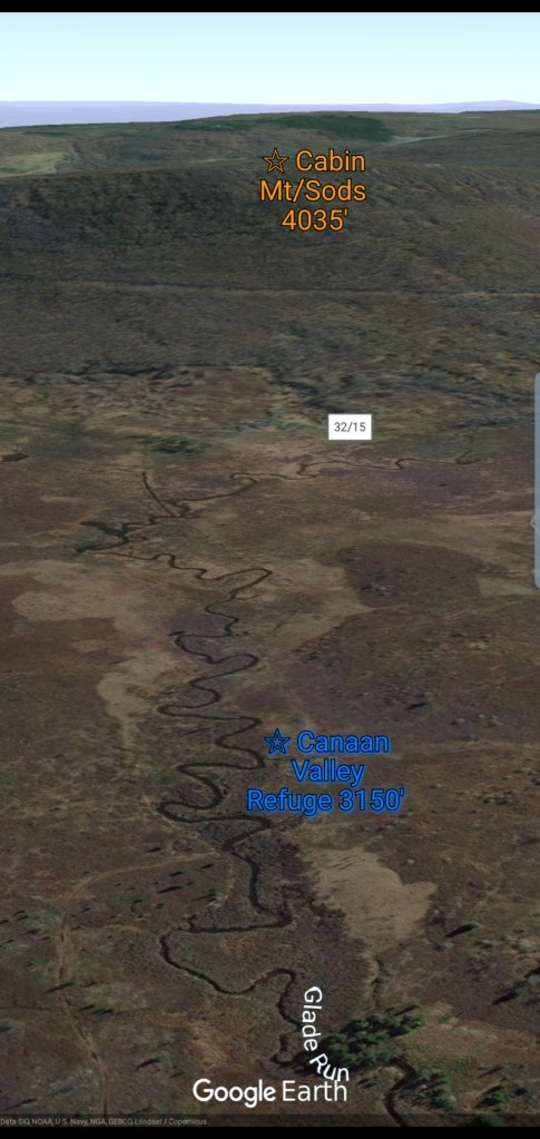
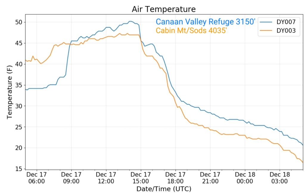
Canaan area temps
Comparison view


RTMA
Radar
Satellite
Flow
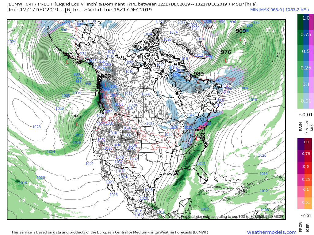
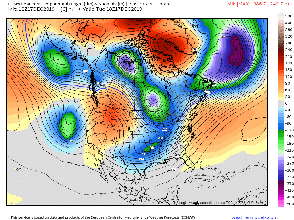
Surface features and 500mb height anomalies and flow
Pics to come…
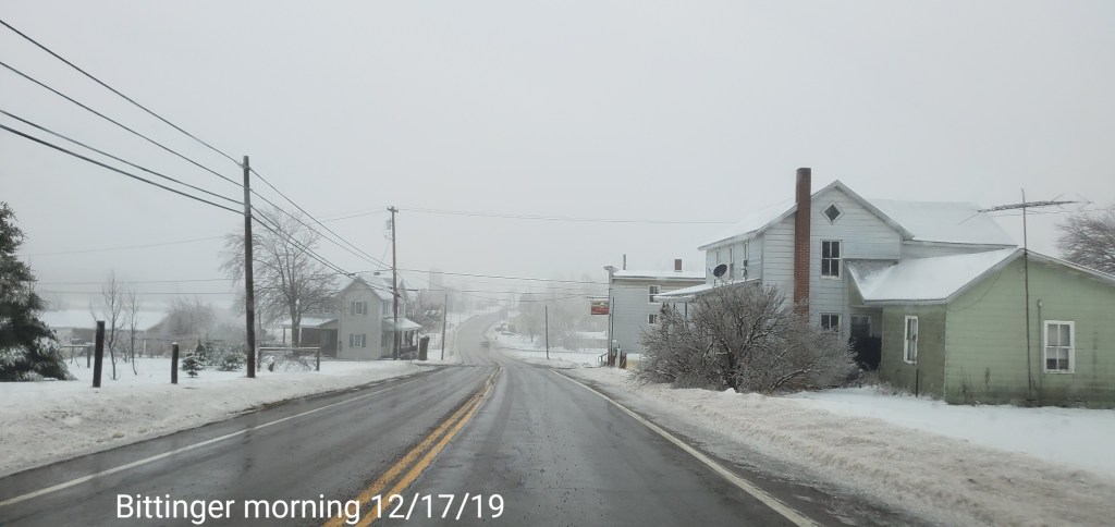
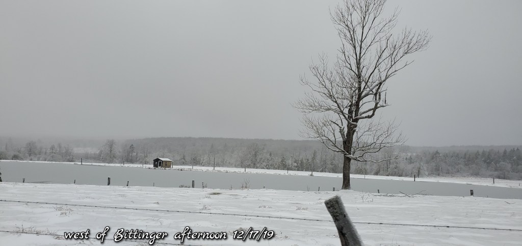
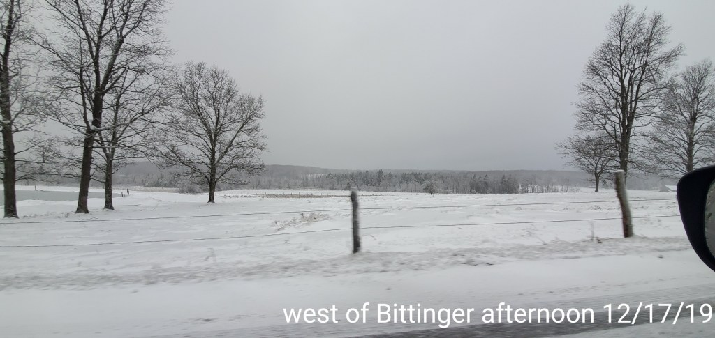
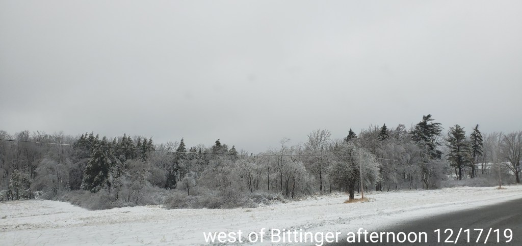
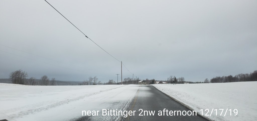
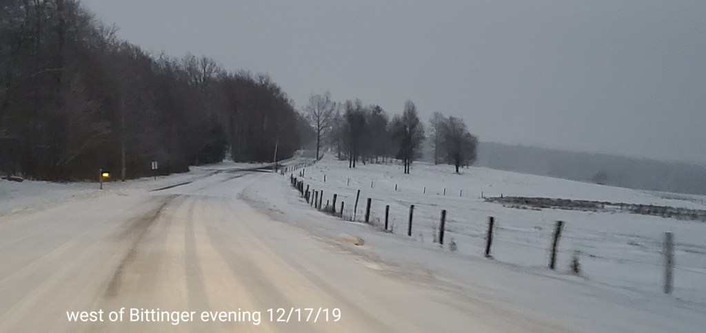
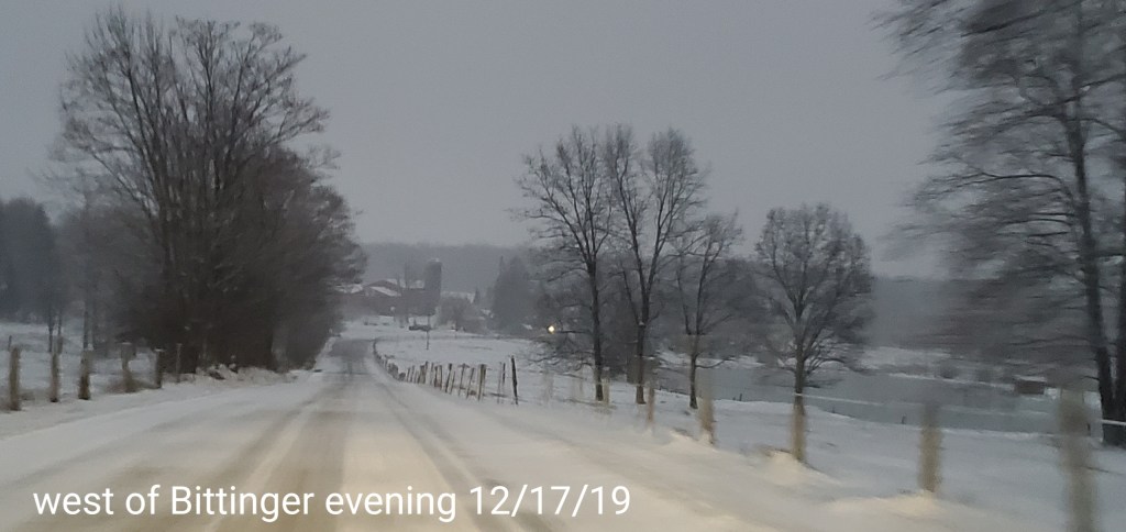
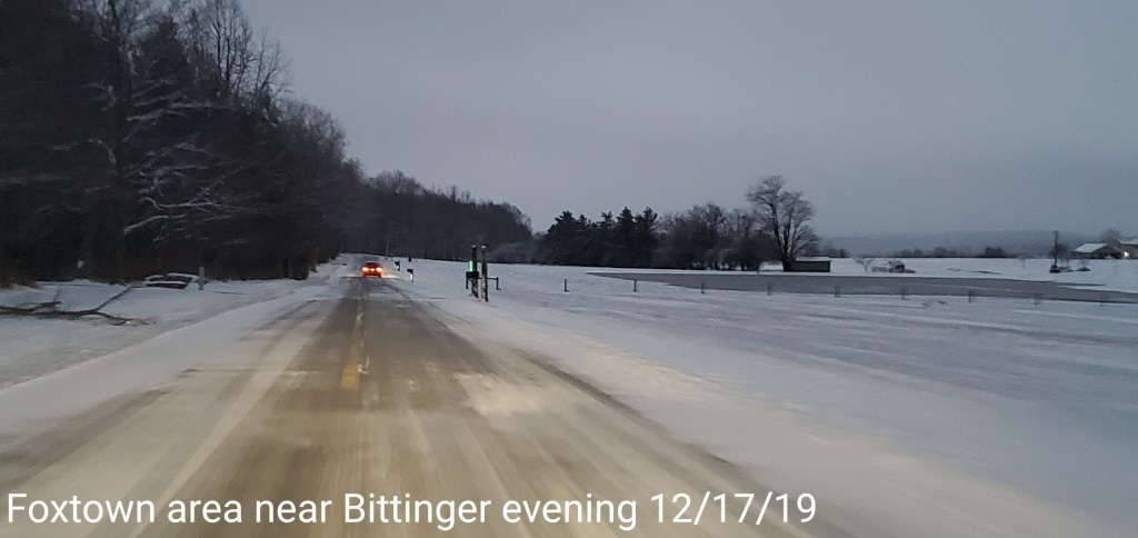
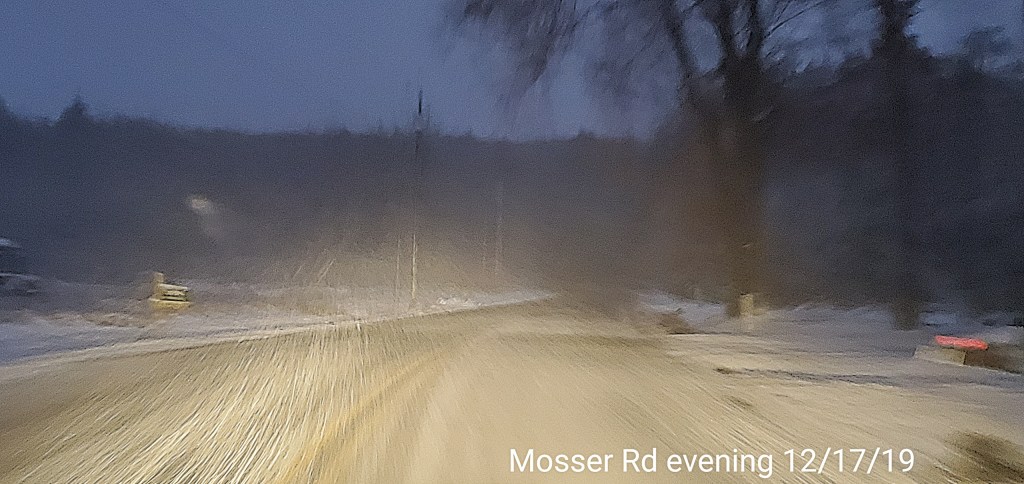
Bittinger area


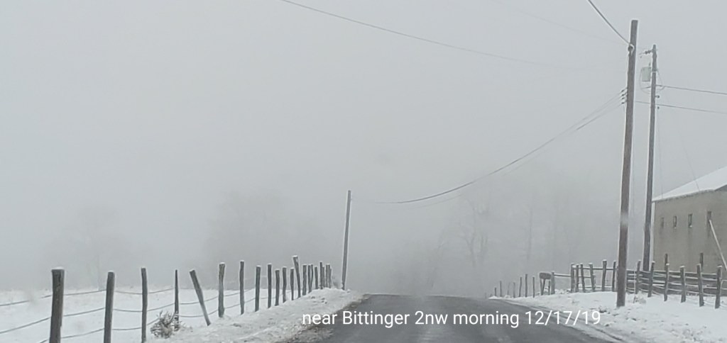


Early a.m pic

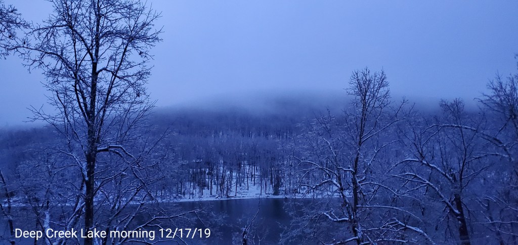
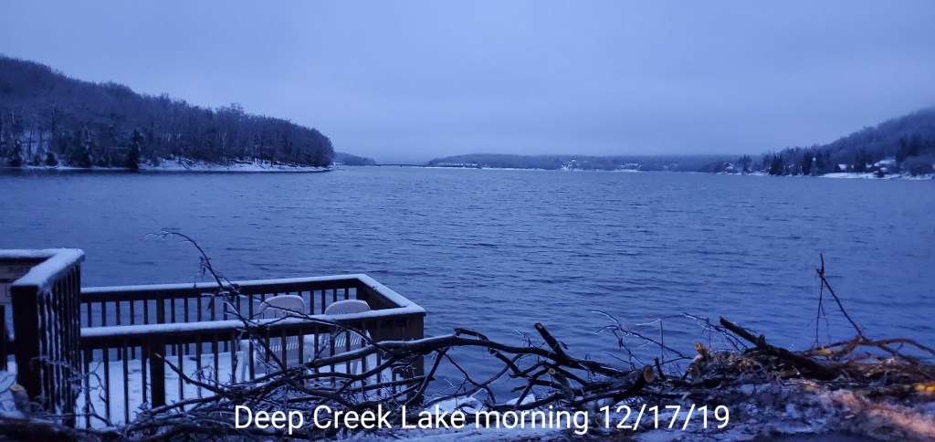
Deep Creek Area


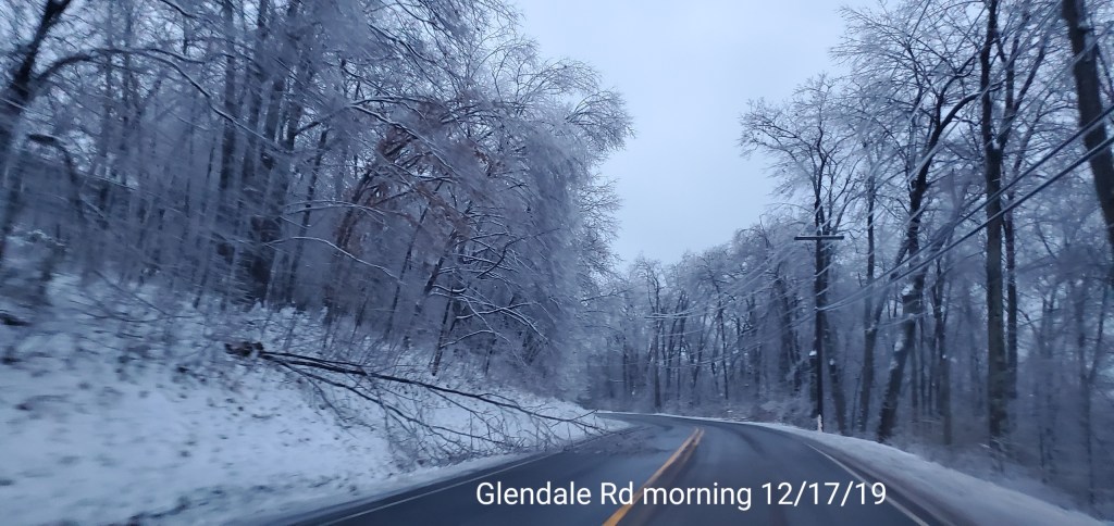
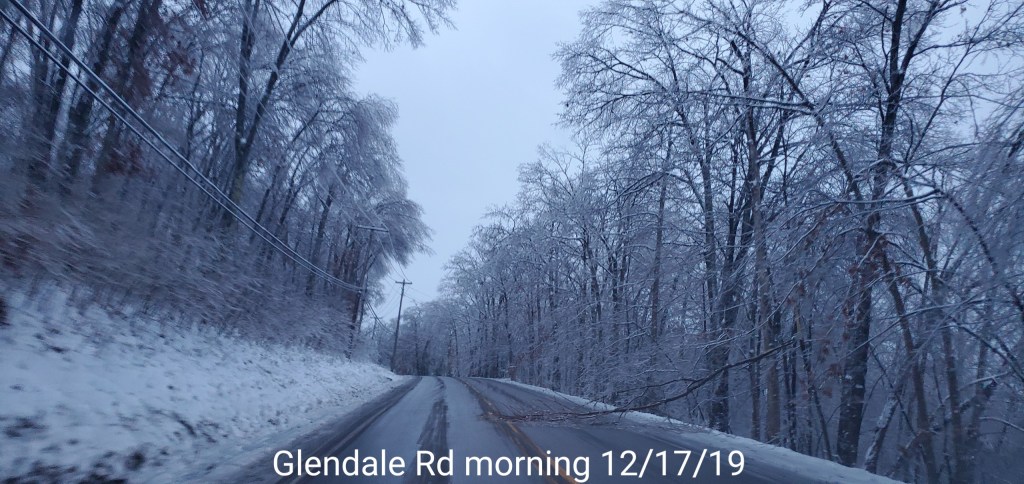
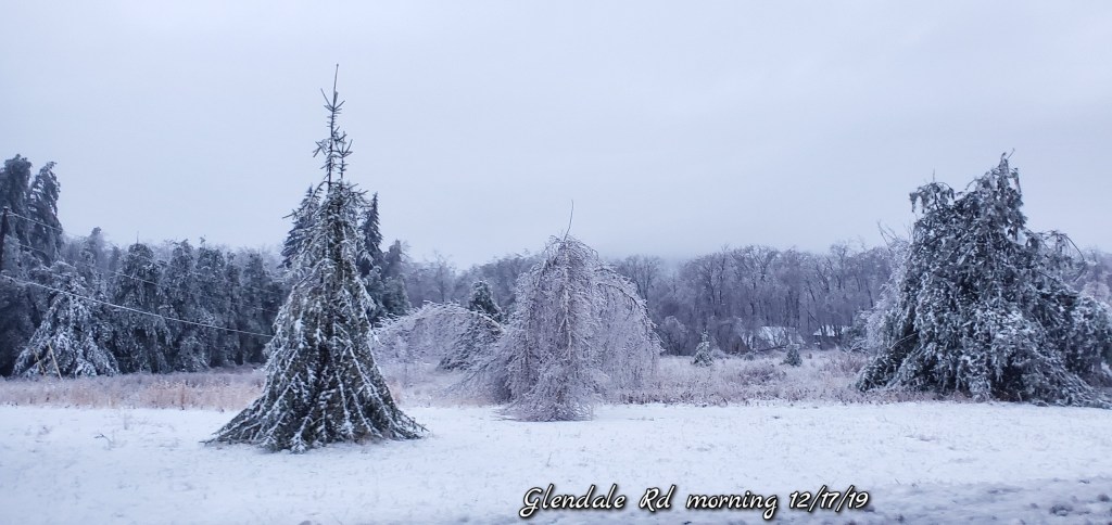
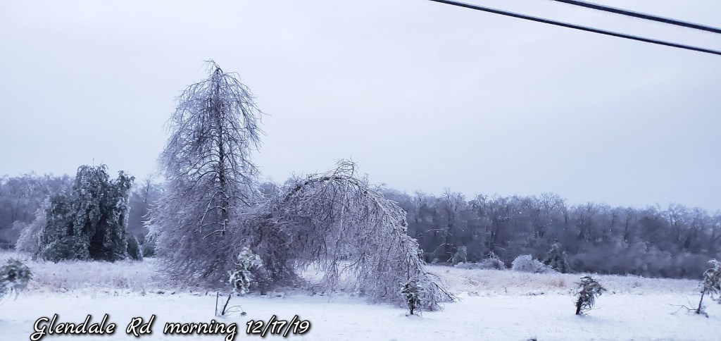

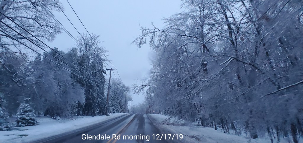


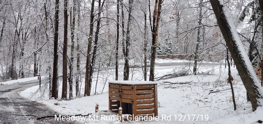


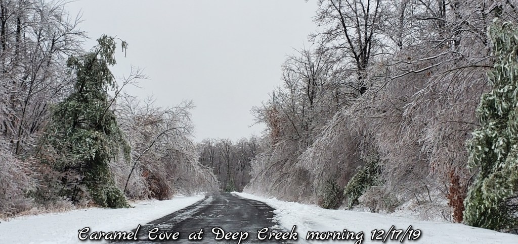
On out Glendale


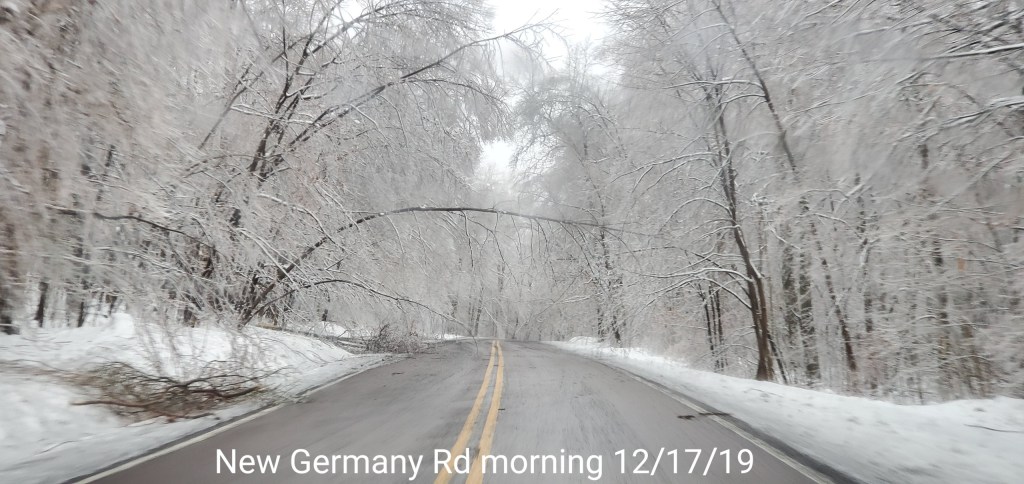
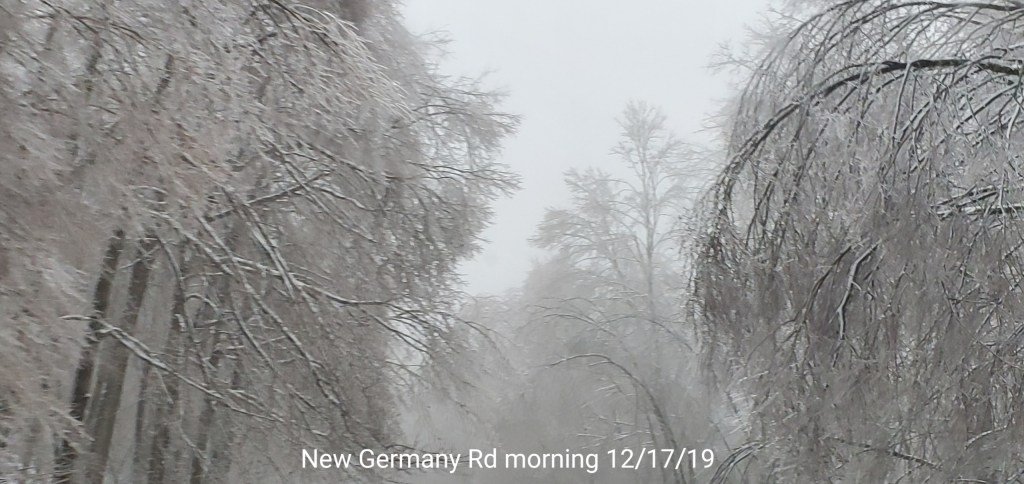
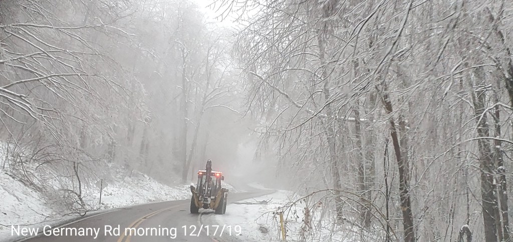
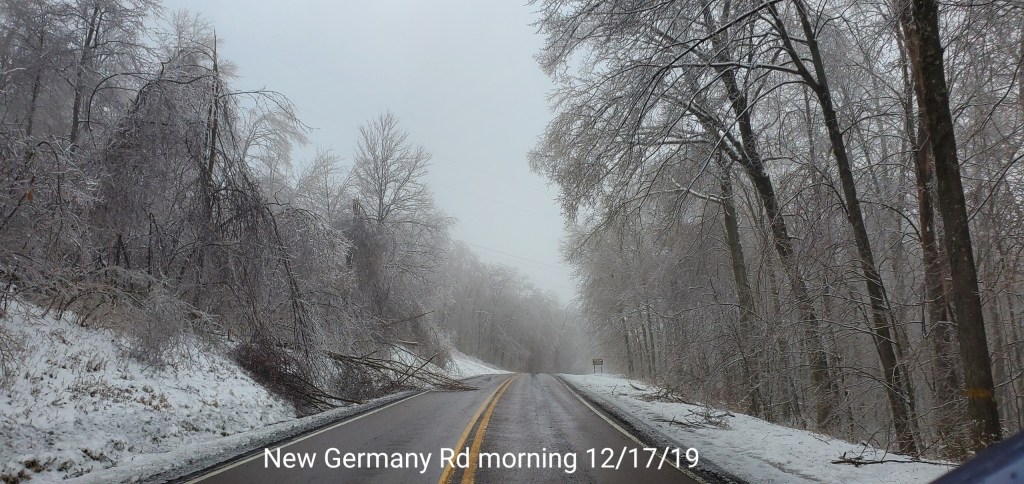
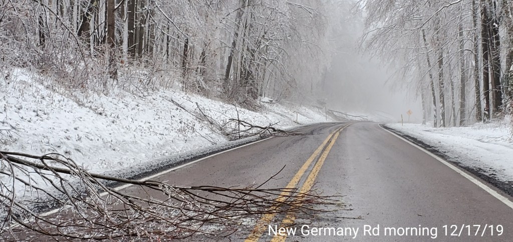
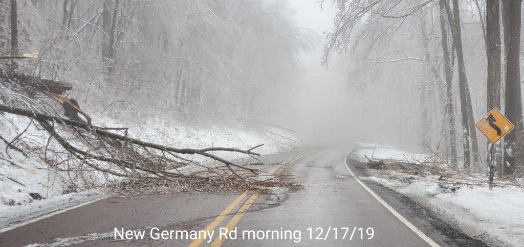
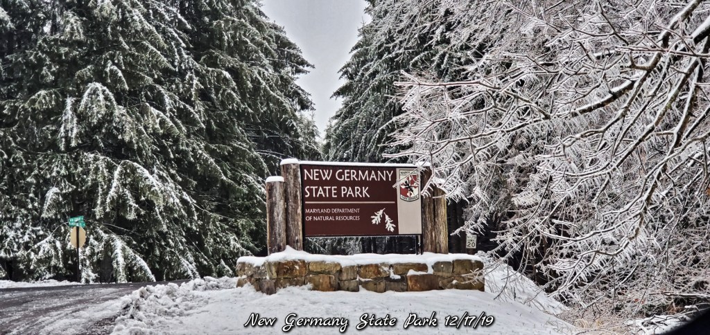
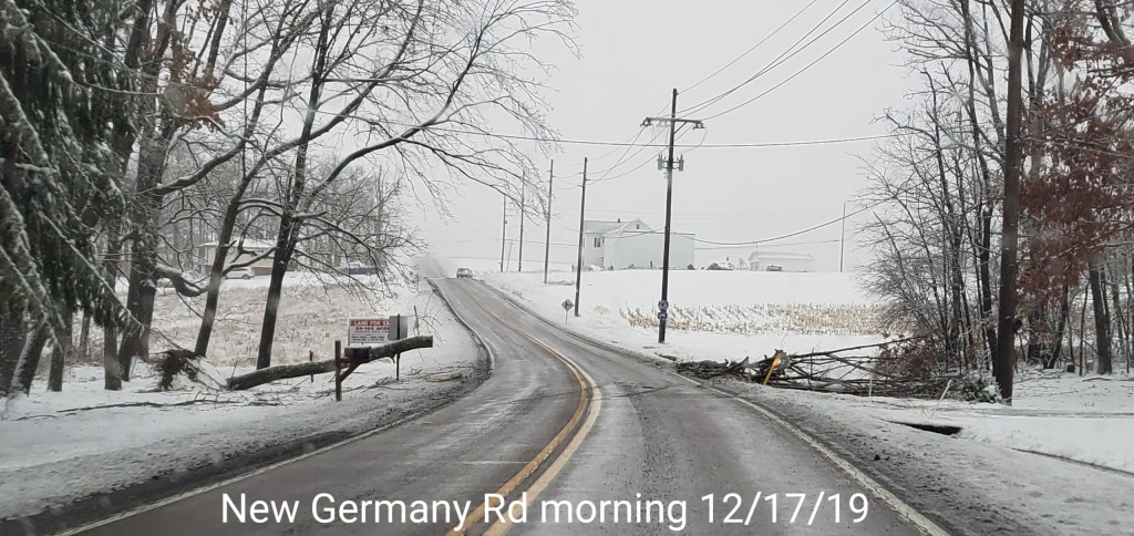
New Germany Rd towards Grantsville


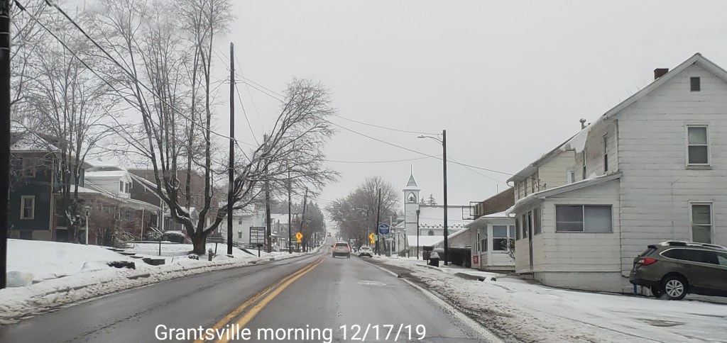
Grantsville area


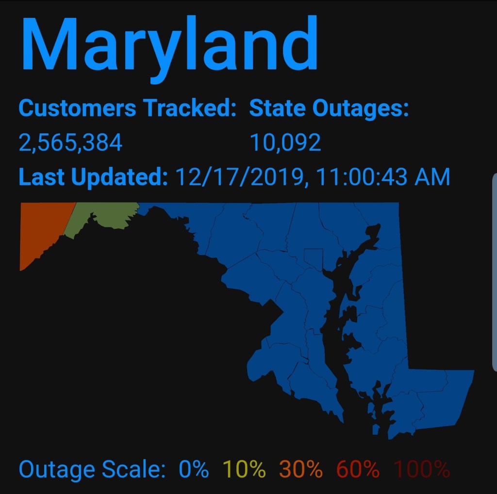
Power Outages

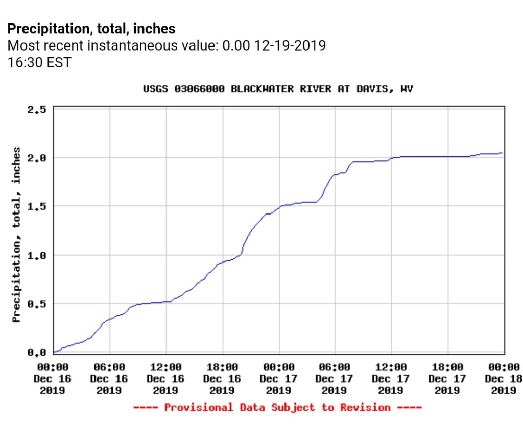
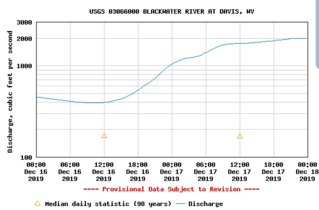
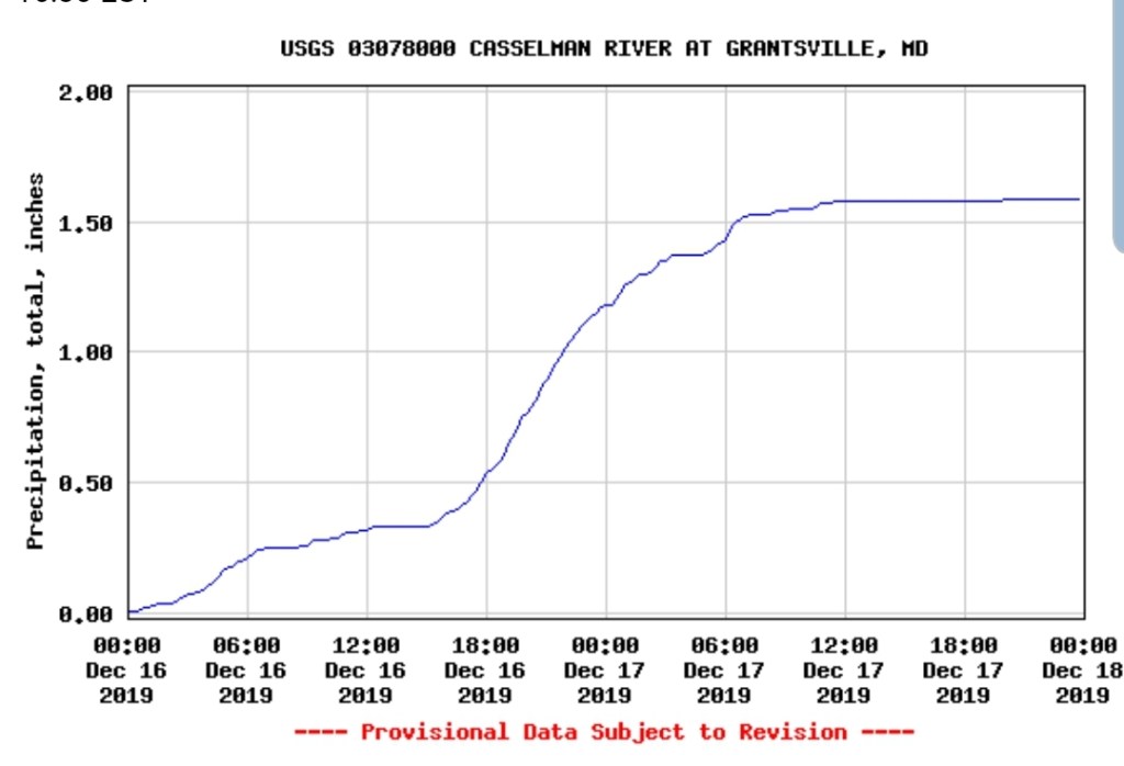
High water side of the event.
1-2″+ of rain sent area water ways well above typical flow. This occurred even in the ice zones as well, however some of that was limited with a lot of ice remaining on the trees. In other areas, such as Blackwater, flow surged to 2000cfs prior to midnight.
Blackwater, Cassleman