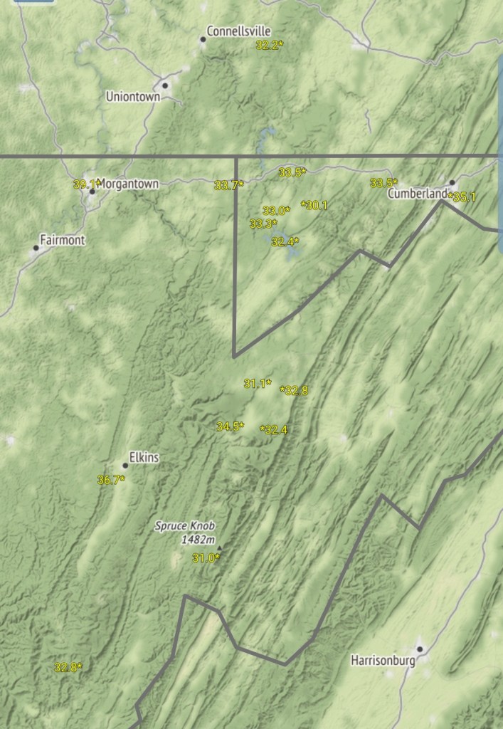
December 31, 2019
Dec 31(Tues)
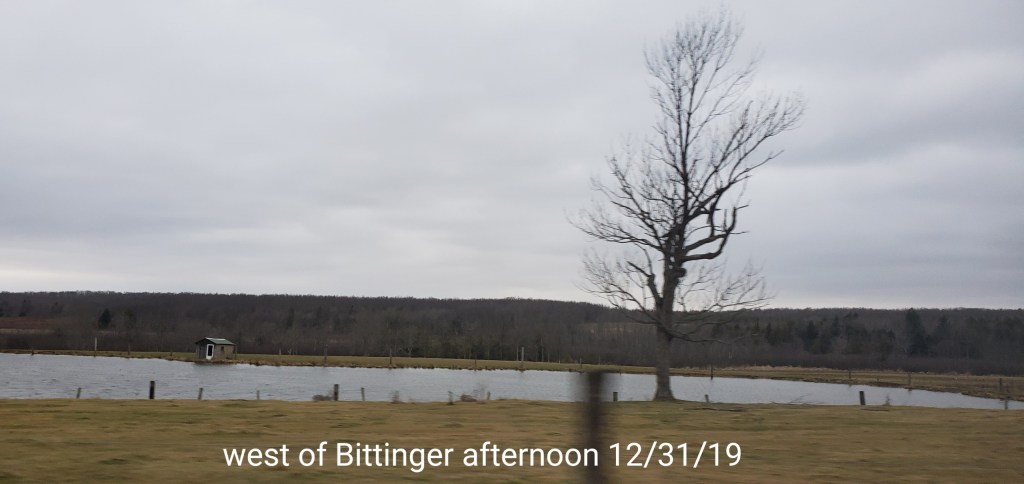
Some very fine light snow early, mainly just cloudy, windy, few peaks of sun and much colder today. All models except the ECMWF over doing the snow today. Almost all remained north until after dark some into Garrett.
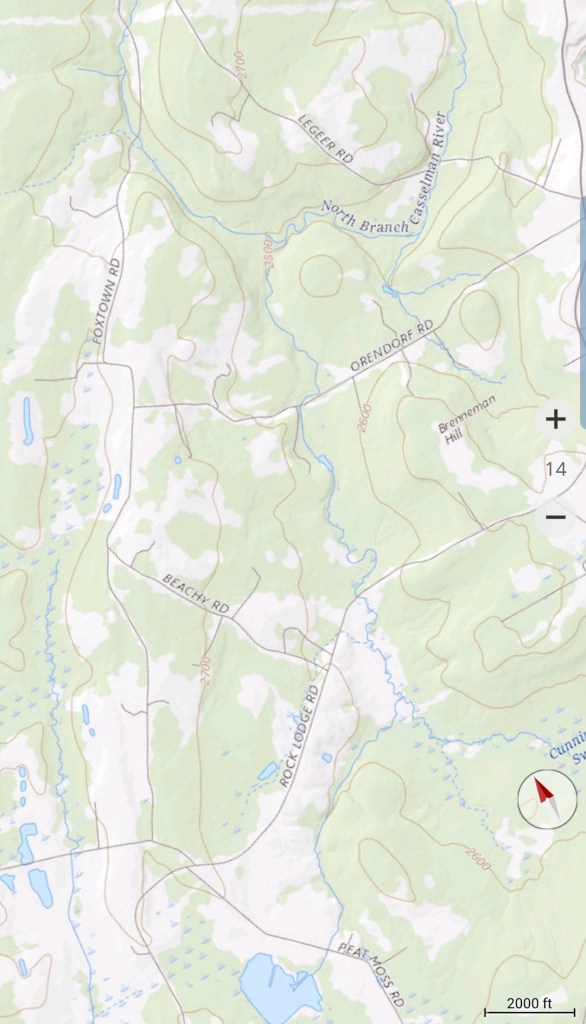
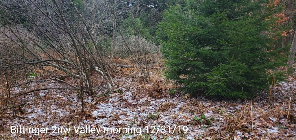
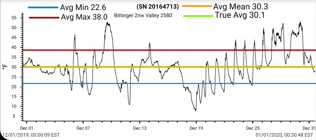
Bittinger 2nw Valley
MIN[27.4]—MAX[36.2]—AVERAGE MEAN[31.8]—TRUE AVERAGE[32.1]—PRECIP[.01]
Snowfall-trace
Snowfall season to date 20.8″

Garrett College
MIN[27.7]—MAX[36.0]—AVERAGE MEAN[31.8]—TRUE AVERAGE[32.0]—PRECIP[T]

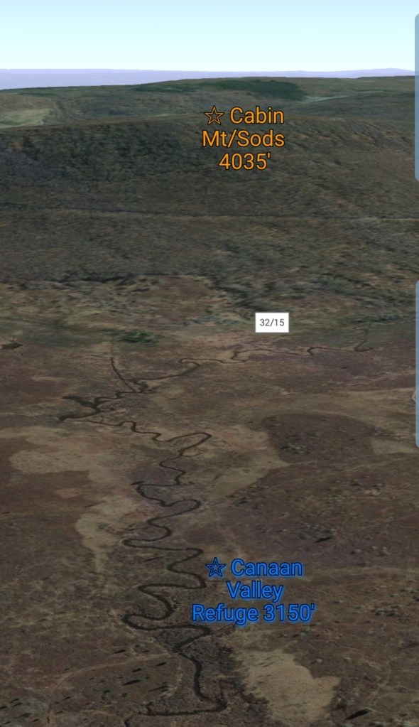
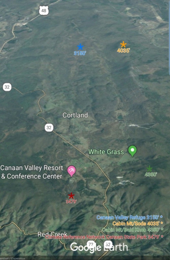
Canaan Heights/Davis 3SE
Data not reported yet
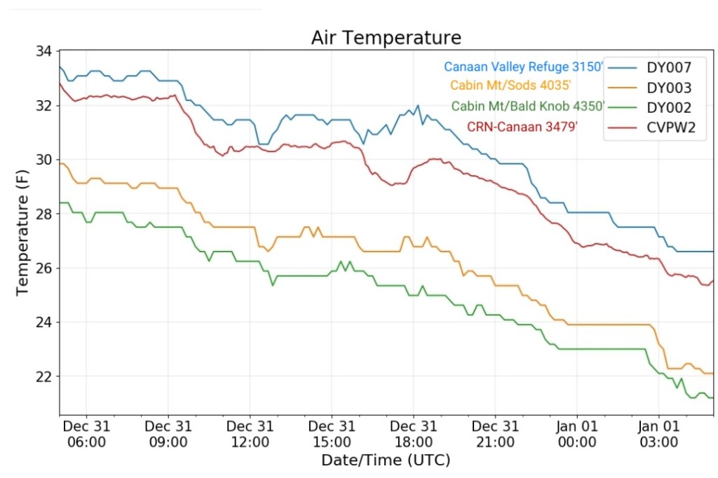
Climate Reference Network Canaan
MIN[26.8]—MAX[32.7]—AVERAGE MEAN[29.7]—TRUE AVERAGE[30.1]—PRECIP[.01]

Cabin Mt at Bald Knob
MIN[21.2]—MAX[28.4]—AVERAGE MEAN[24.8]—TRUE AVERAGE[25.0]—PRECIP[F]

Cabin Mt-Western Sods
MIN[22.1]—MAX[29.7]—AVERAGE MEAN[25.9]—TRUE AVERAGE[26.3]—PRECIP[F]

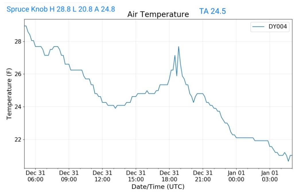
Spruce Knob
MIN[20.8]—MAX[28.8]—AVERAGE MEAN[24.8]—TRUE AVERAGE[24.5]—PRECIP[F]
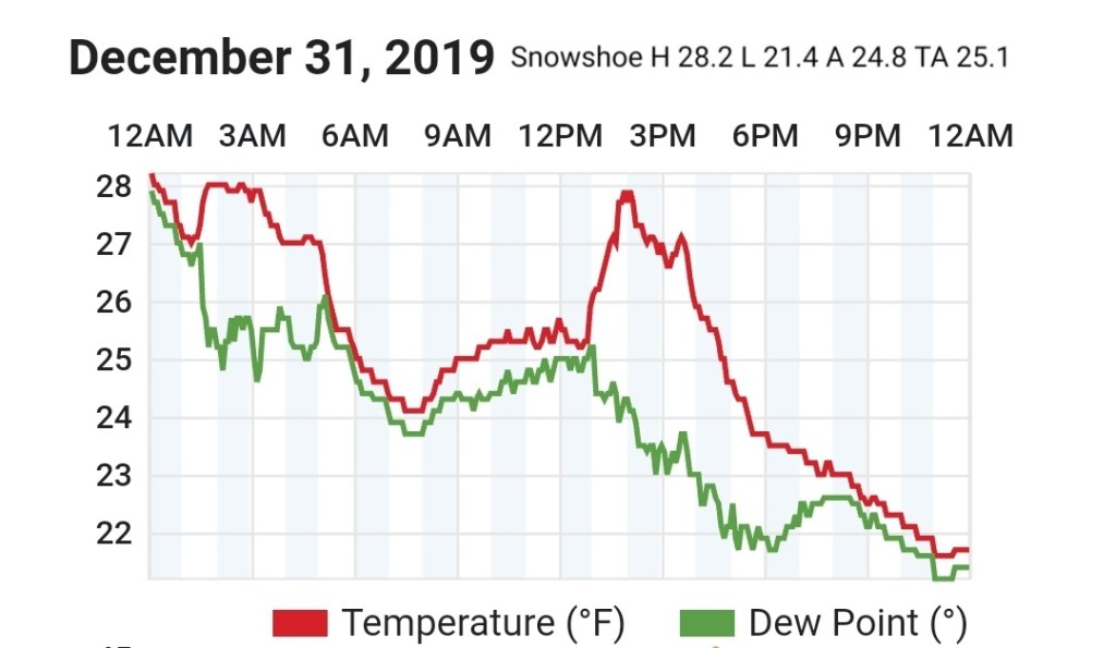
Snowshoe
MIN[21.4]—MAX[28.2]—AVERAGE MEAN[24.8]—TRUE AVERAGE[25.1]
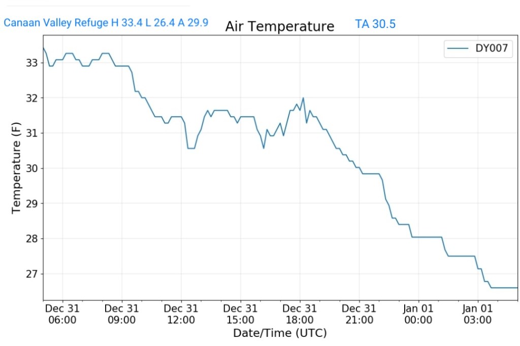
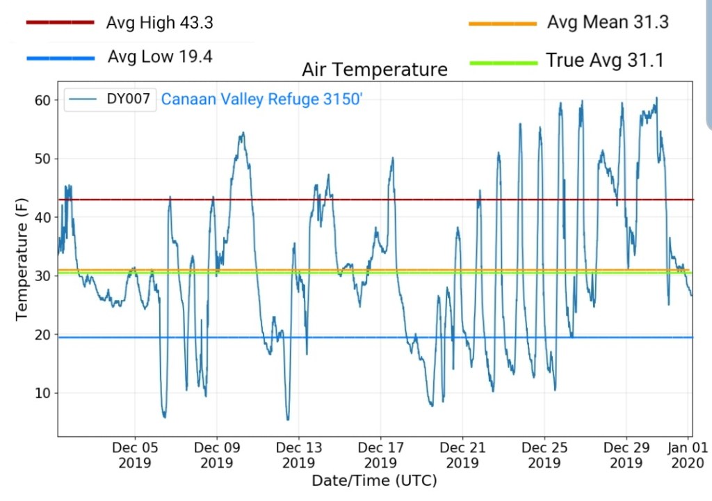
Canaan Valley Refuge
MIN[26.4]—MAX[33.4]—AVERAGE MEAN[29.9]—TRUE AVERAGE[30.5]
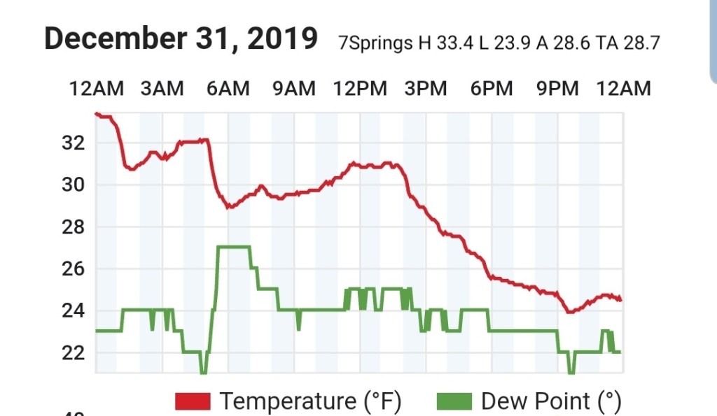
7Springs
MIN[23.9]—MAX[33.4]—AVERAGE MEAN[28.6]—TRUE AVERAGE[28.7]
Cumberland Airport
MIN[35.2]—MAX[47.6]—AVERAGE MEAN[41.4]—TRUE AVERAGE[42.3]

The Valley vs Cabin Mt


Canaan area temps
Comparison view
RTMA
Radar
Satellite
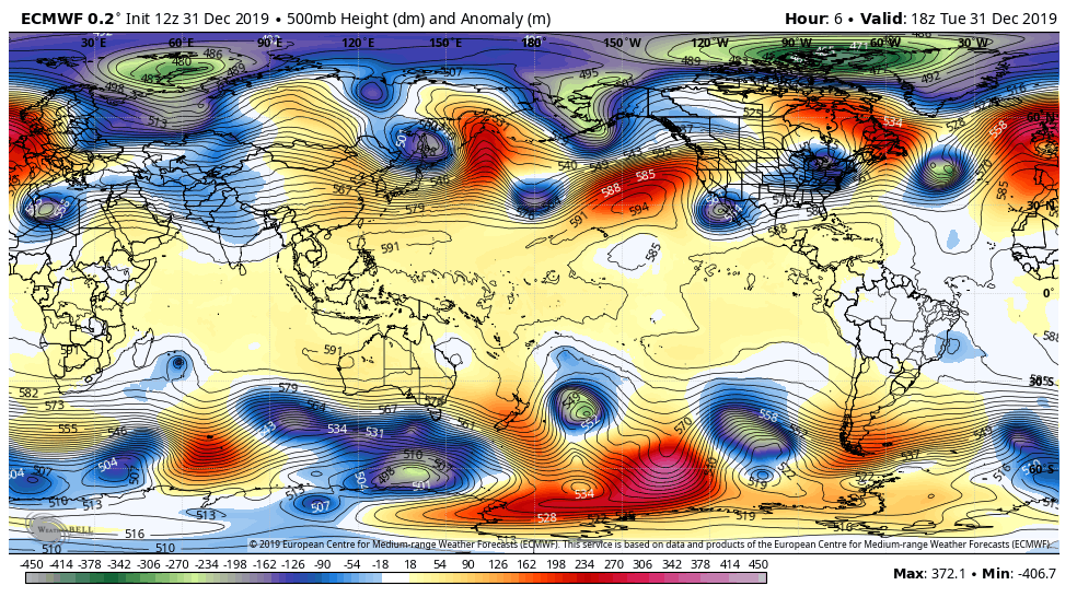
Flow
Surface features and 500mb height anomalies and flow

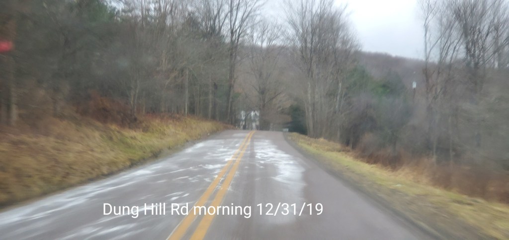
Pics today-
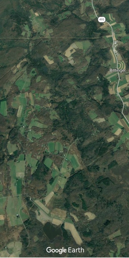
Bittinger area


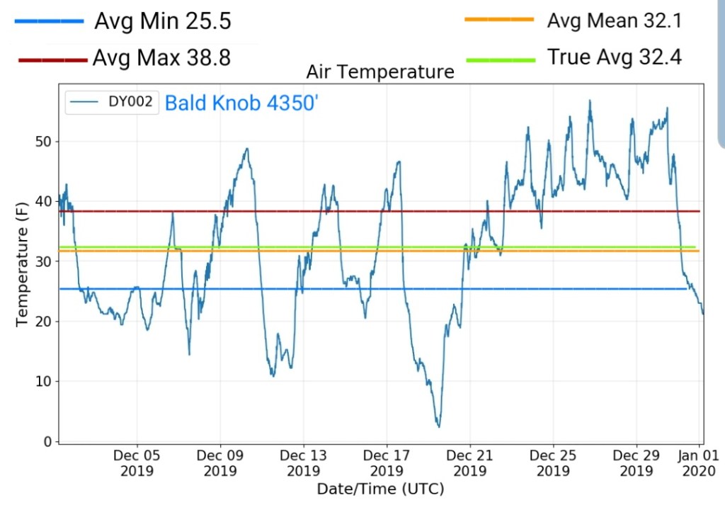
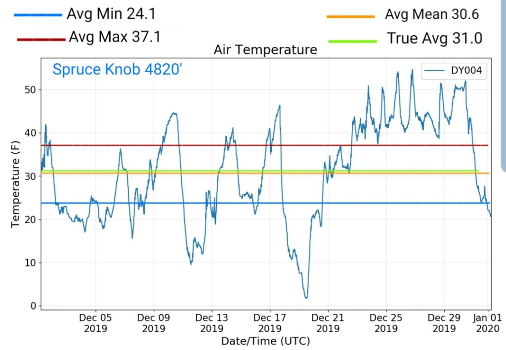
December 2019
TEMPS

some of the sites
Overall monthly true average(all readings divided by the number of readings)
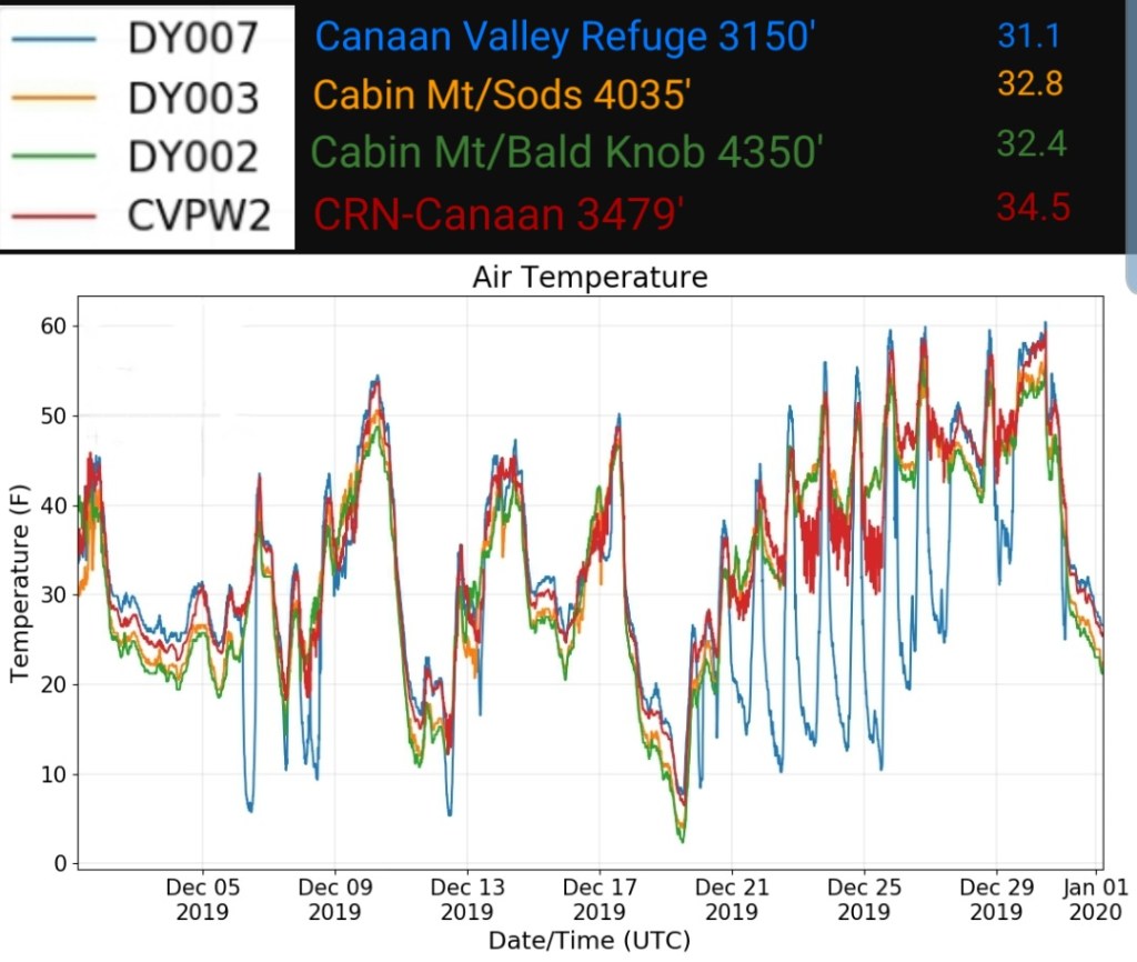
Bittinger 2nw Valley
Canaan Valley Refuge
Bald Knob
Spruce Knob
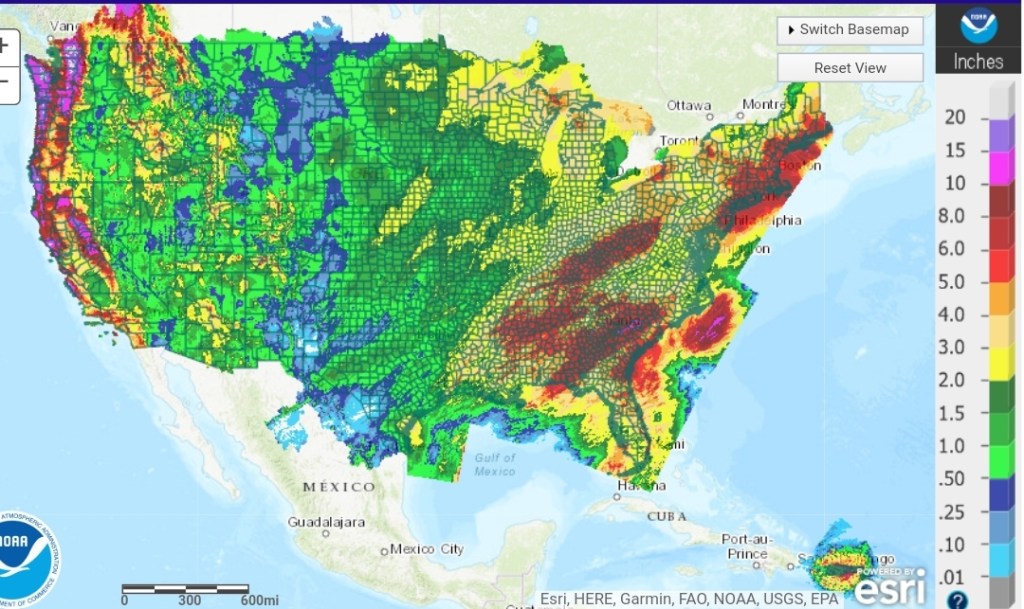
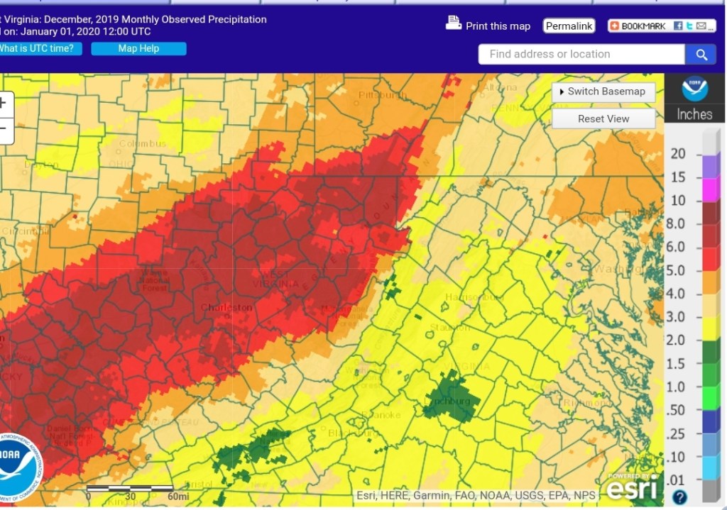
Precip
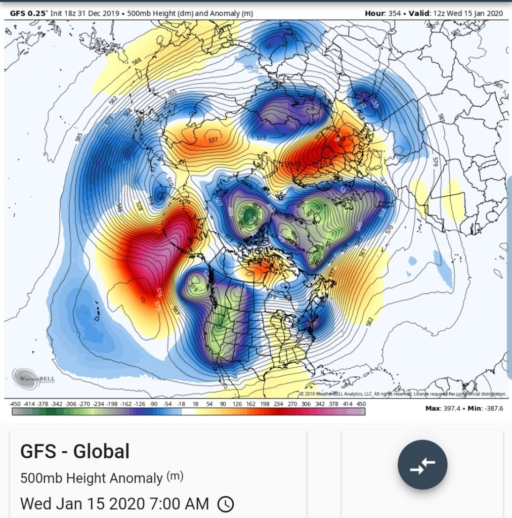
GFS OPERATIONAL ON ITS OWN……
The GFS operational recieved an upgrade over this past year, the GFS ensemble package did not. This new upgrade is going to score big or continue to look lost in the long term. The model had performed poorly. Today was a prime example. The ECMWF performed much better with most of its runs showing minimal snow. The 6z, 12z GFS today was showing accumulation directly off initialization of the run. The short range Canadian products and ECMWF had the better idea.
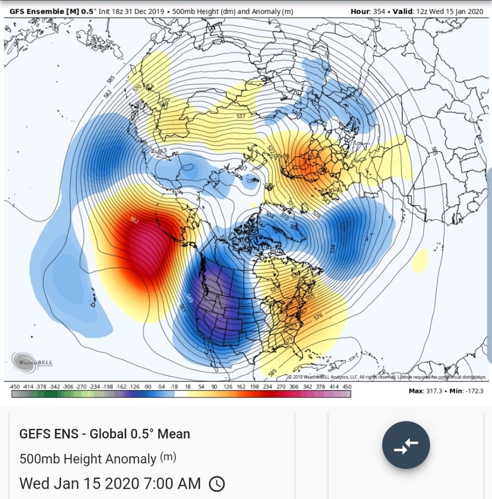
Now on the long range. The GFS operational has been consistent with a progressive pattern allowing cold to overwhelm the pattern mid mont . Its entirely on it’s own in this scenario. A few CFSV2 runs have done this but backed off. The 18Z GFS on January 15th
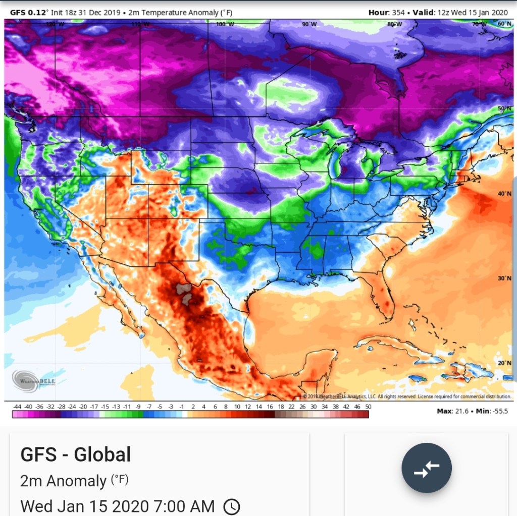
the entire look at the run
It’s own teleconnections look like
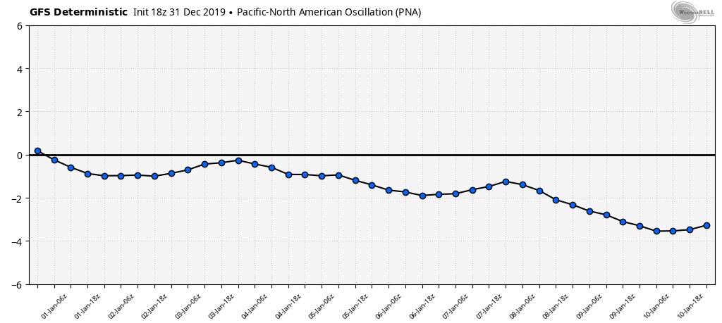
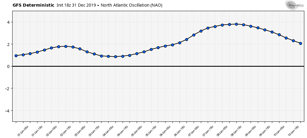
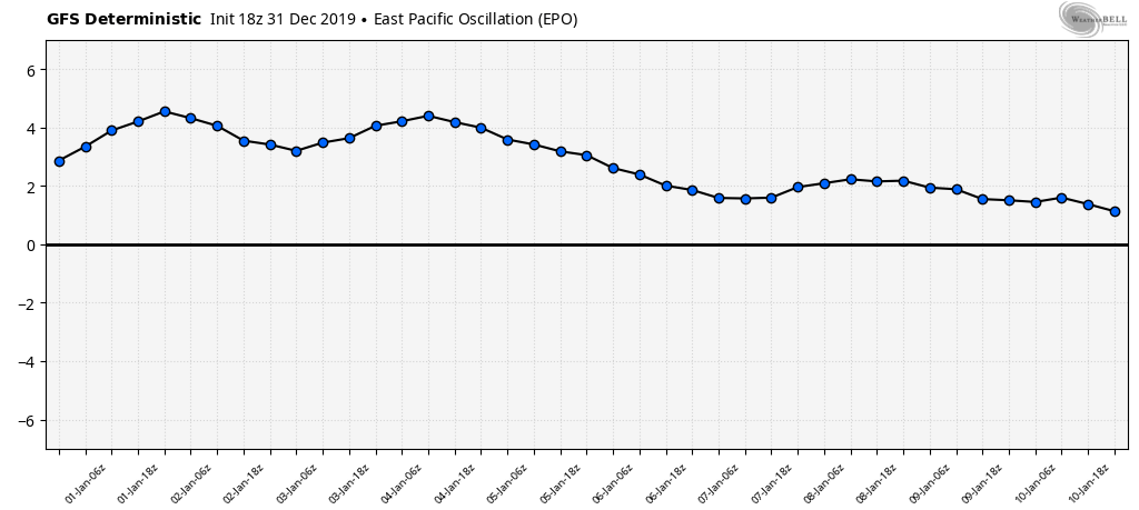
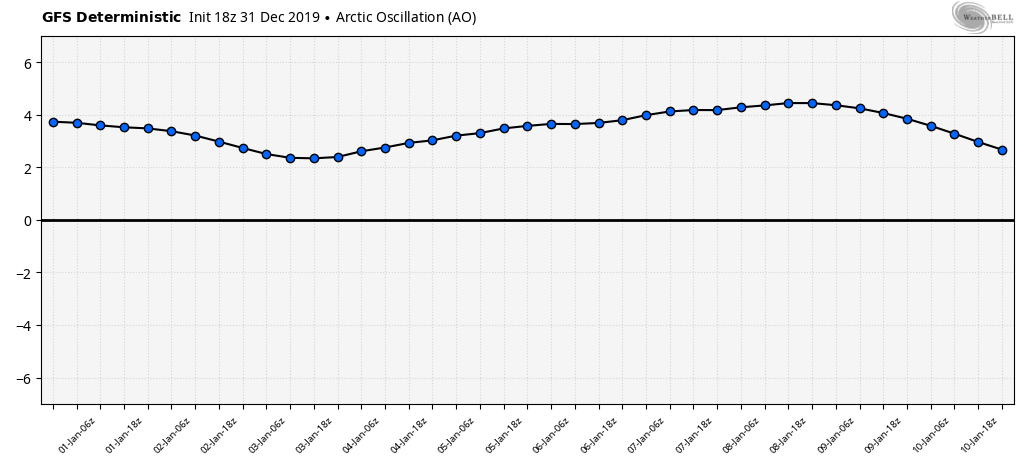
All anti eastern cold.
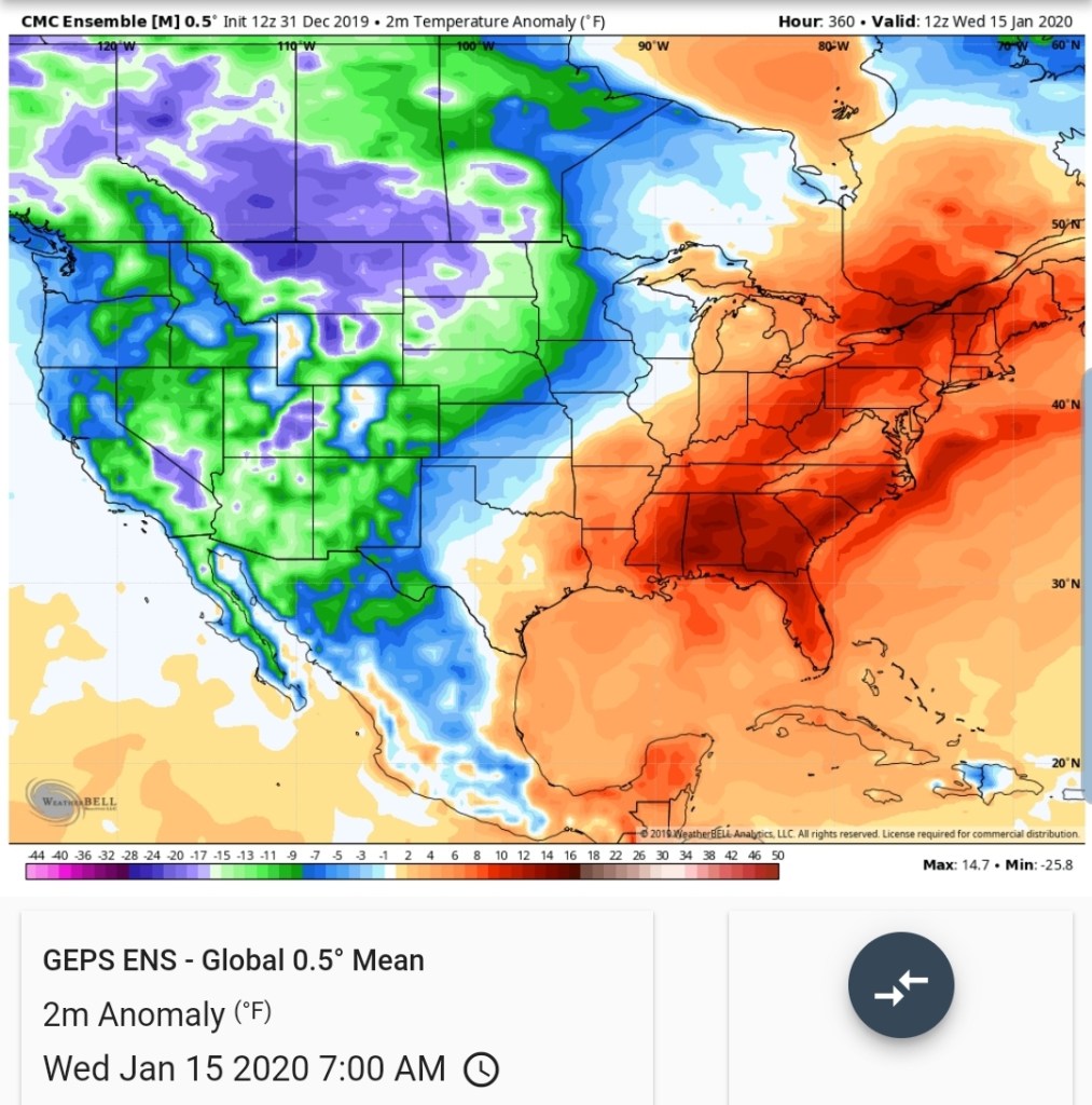
The GEFS for the time period the GFS op shows the cold pushing

That also looks like
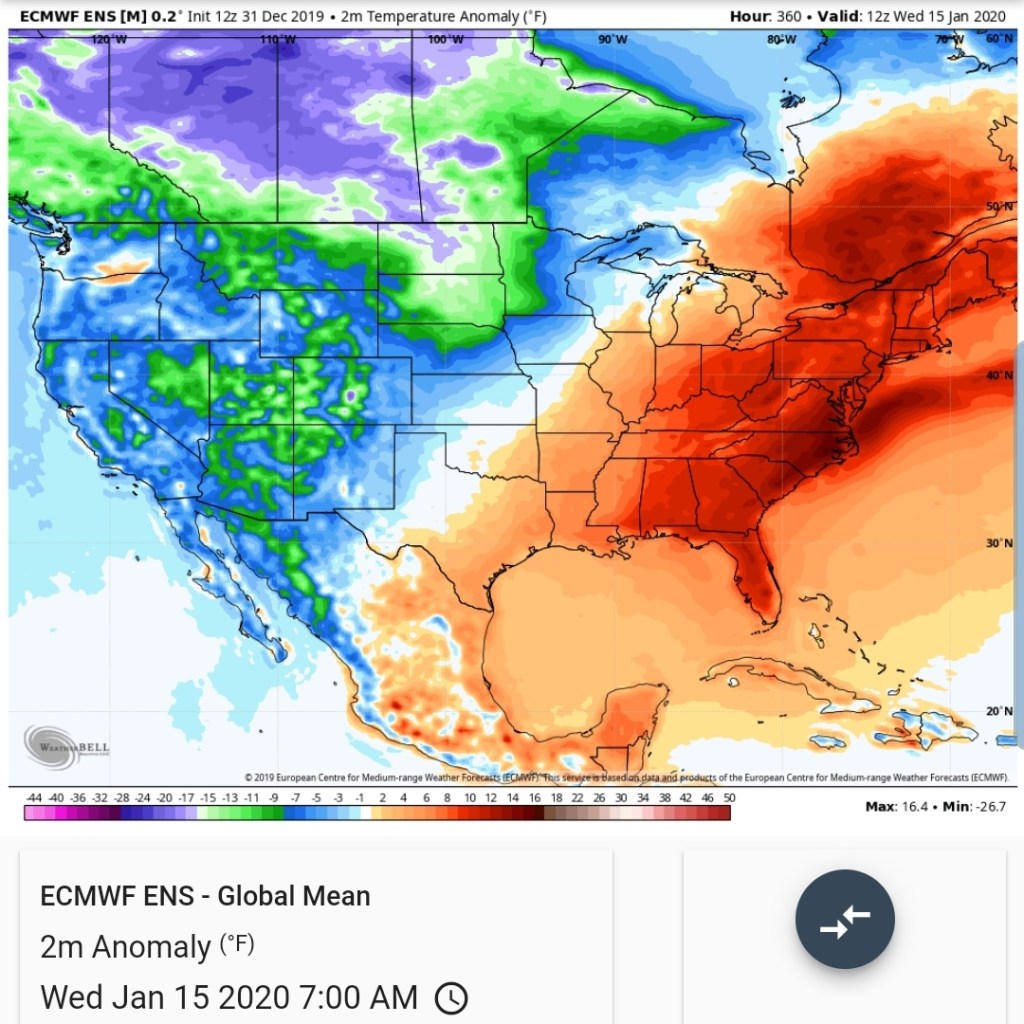
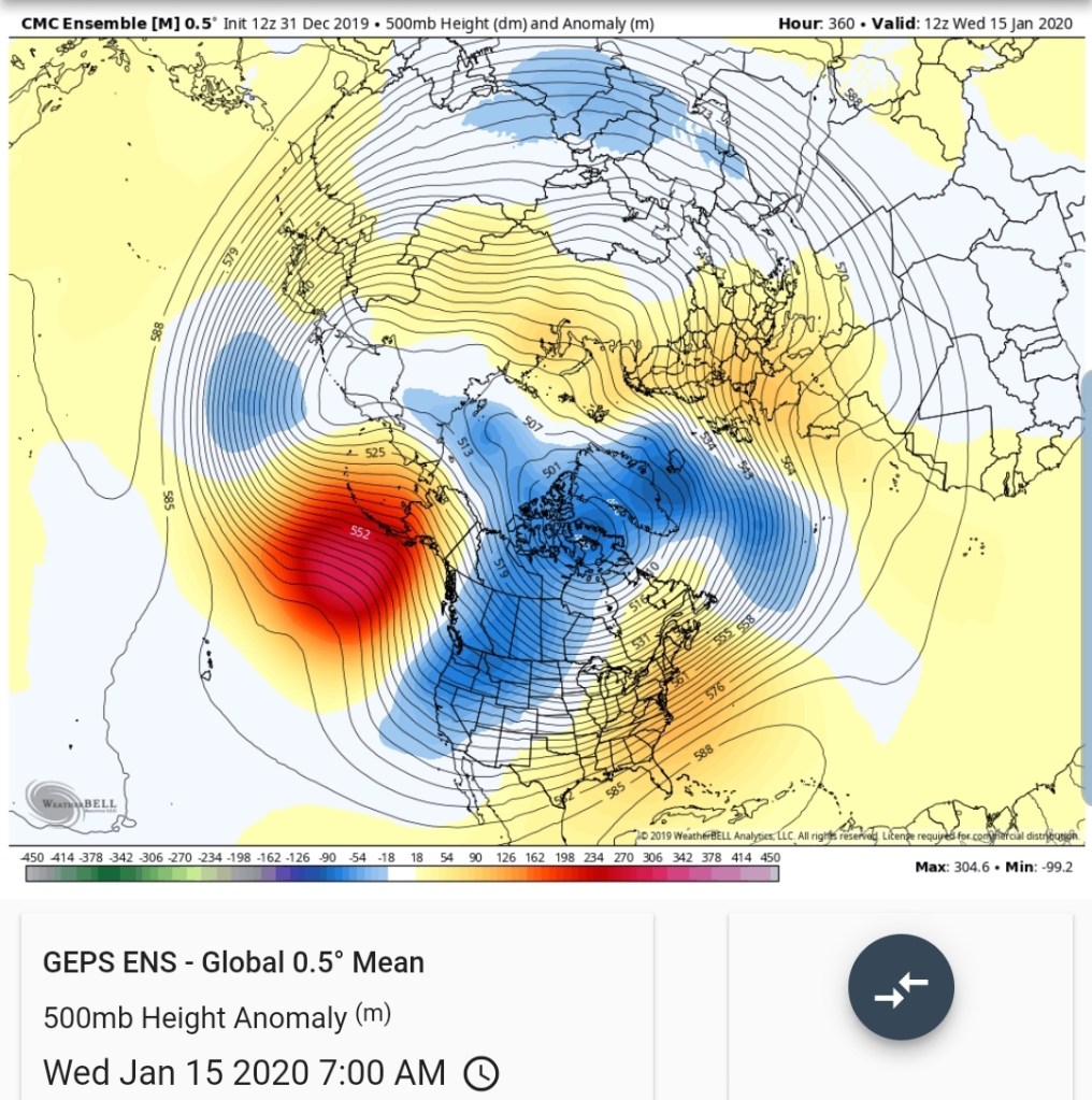
The ECMWF ensemble mean
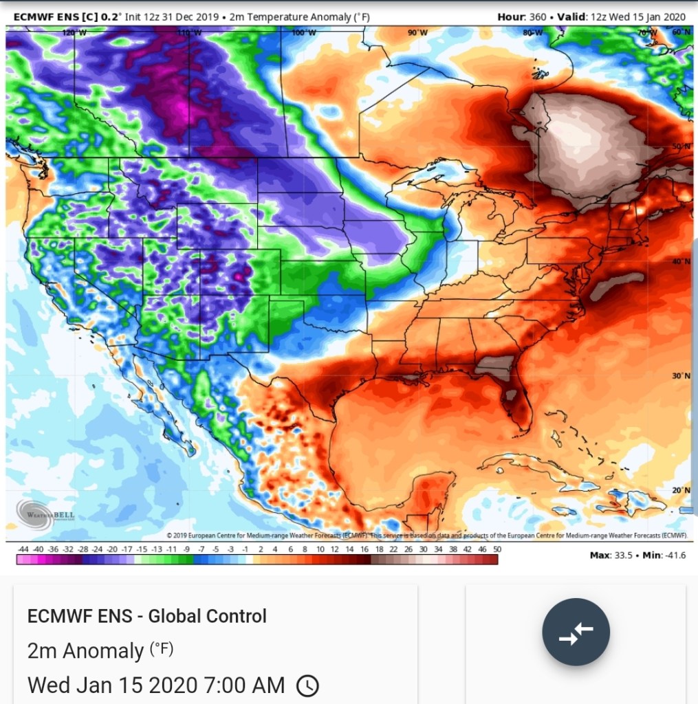
ECMWF control
Canadian
This pattern is all supported by
The 500mb look

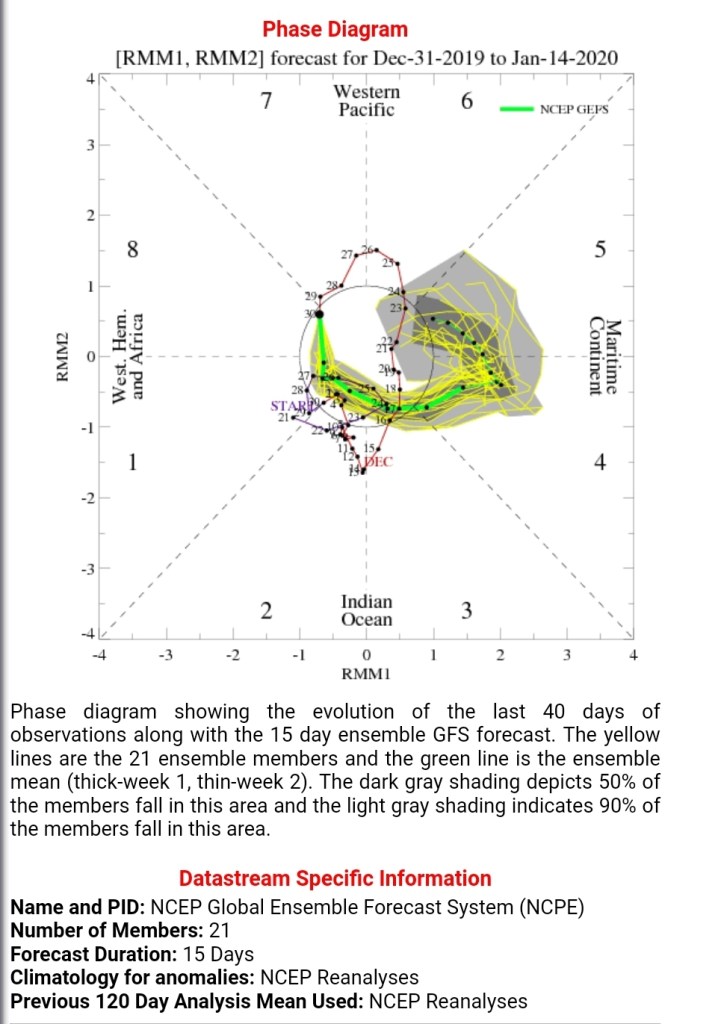
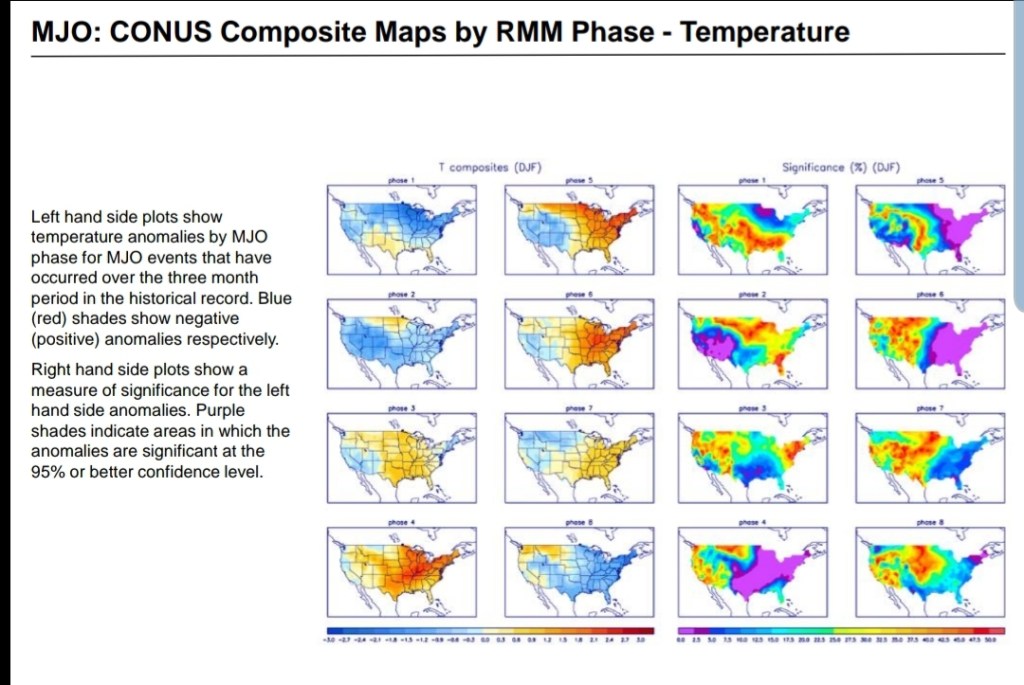
MJO
GFS and ECMWF

The operational has been consistent in ideas already with a progressive pattern where the cold fights and pushes, unlikely thats the case. It does at least look pretty for hope….and anything is possible…
Prior to this period, the snow threats. One this weekend after the rain and mild weather Friday into Saturday, and one mid week next week. Both of these have potential to be the best snow makers of the season so far.
12z ECMWF MSLP/6HR/PRECIP
18z GFS MSLP/6HR/PRECIP
12z Canadian
