January 31, 2020
Jan 31(Fri)
A mainly cloudy day, a tad milder. Some afternoon, evening flakes, once again, not enough for a trace.
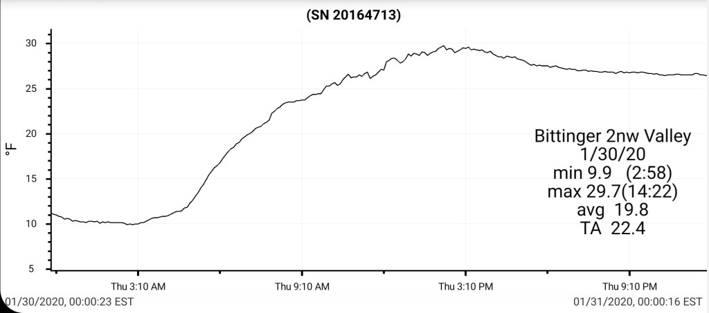
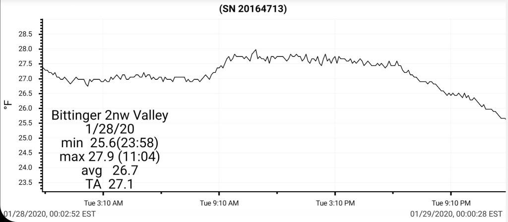
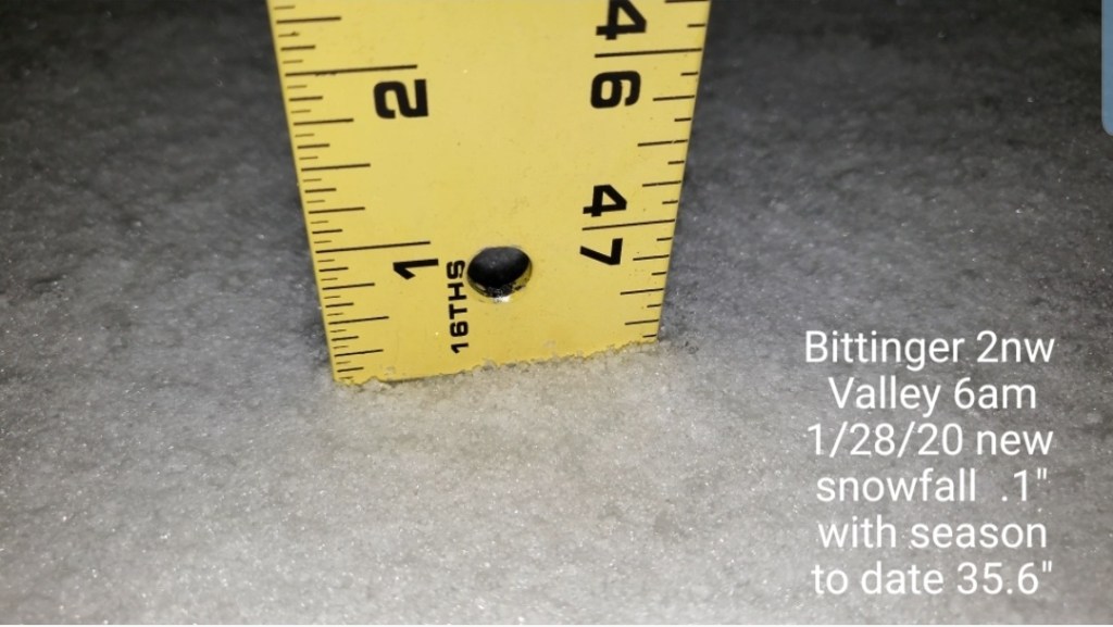
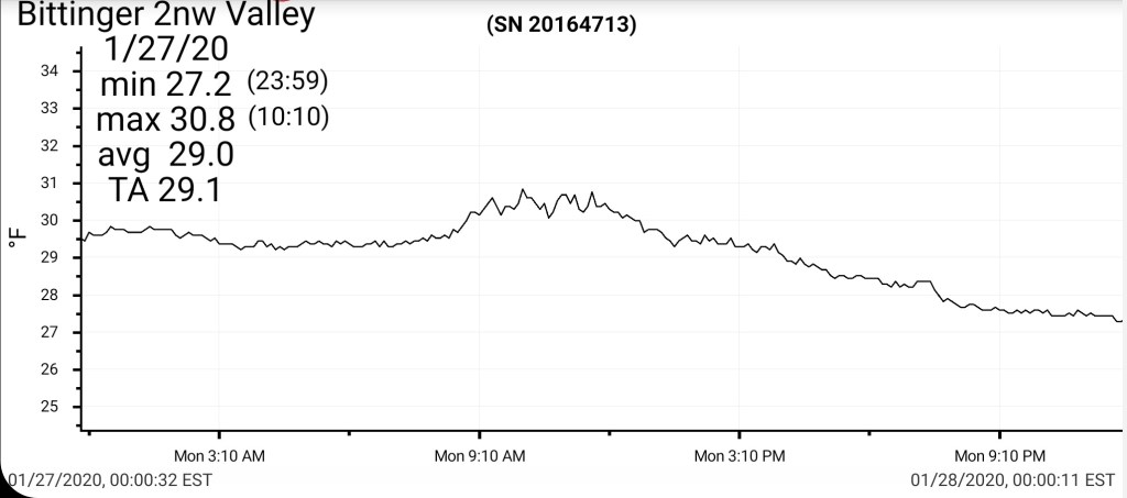
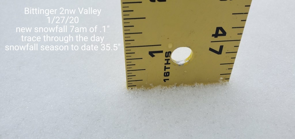
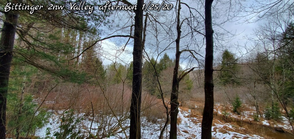
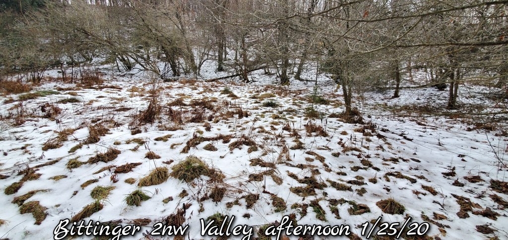
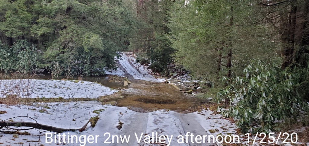
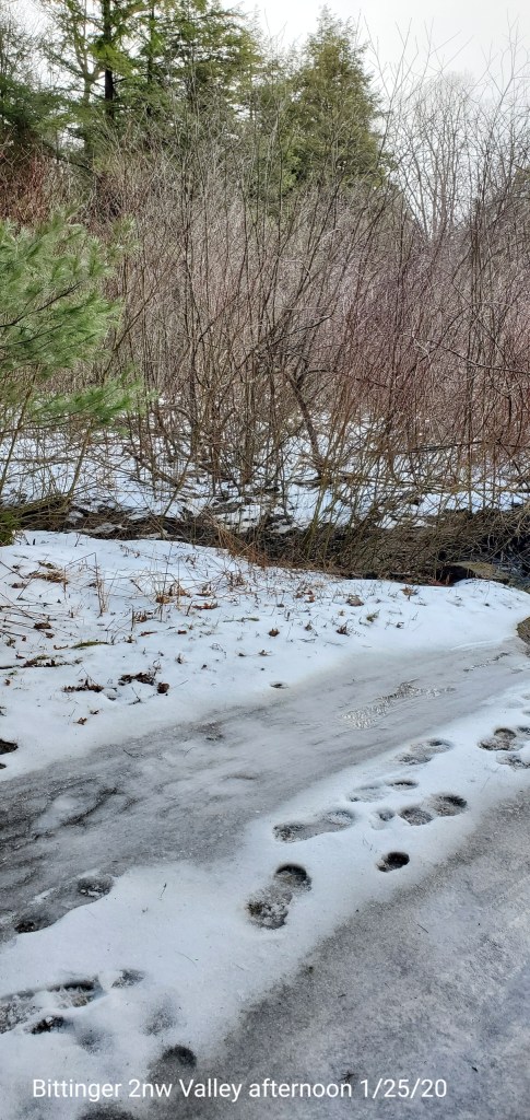
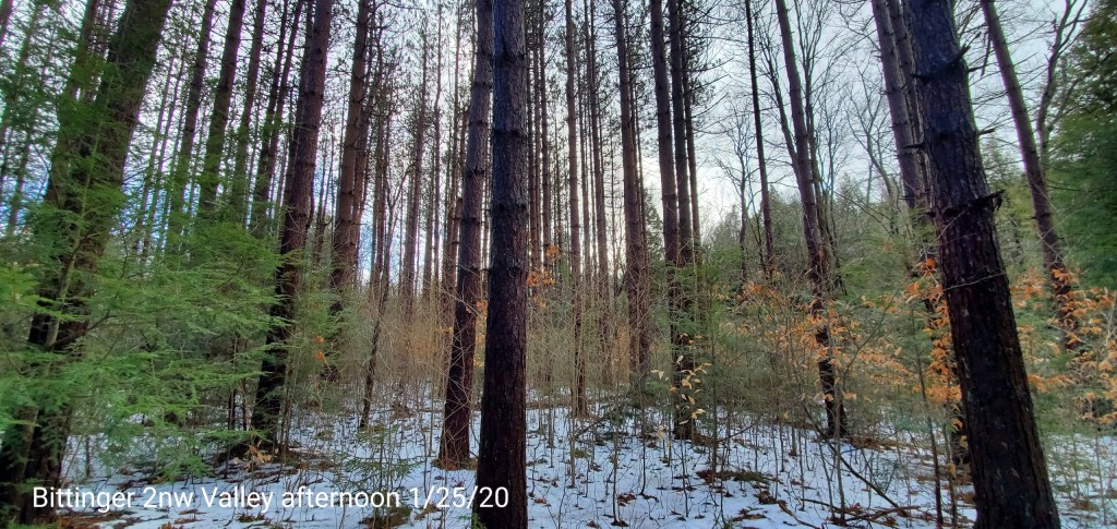
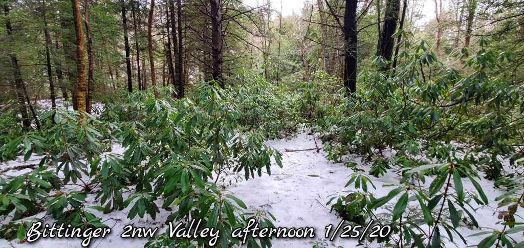
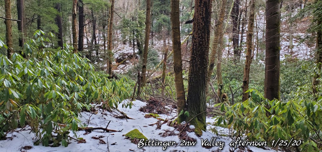
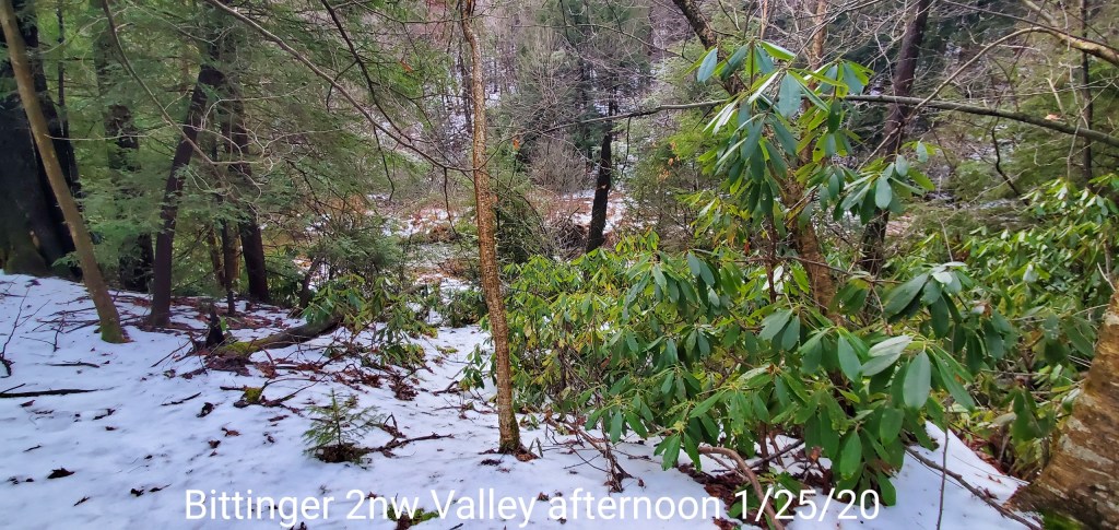
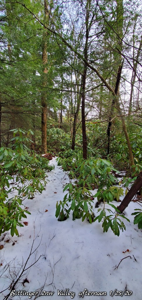
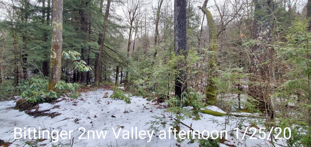
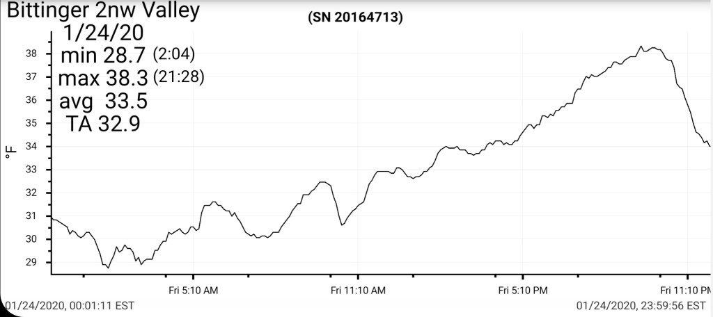
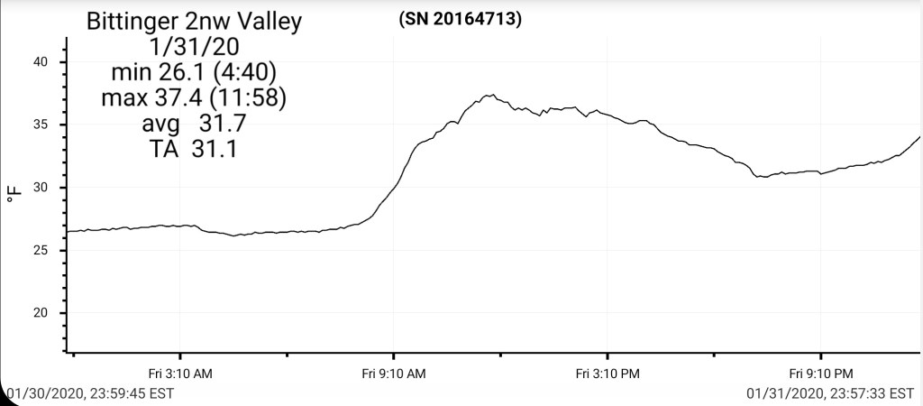
Bittinger 2nw Valley
MIN[26.1]—MAX[37.4]—AVERAGE MEAN[31.7]—TRUE AVERAGE[31.1]
Snowfall season to date 35.8″
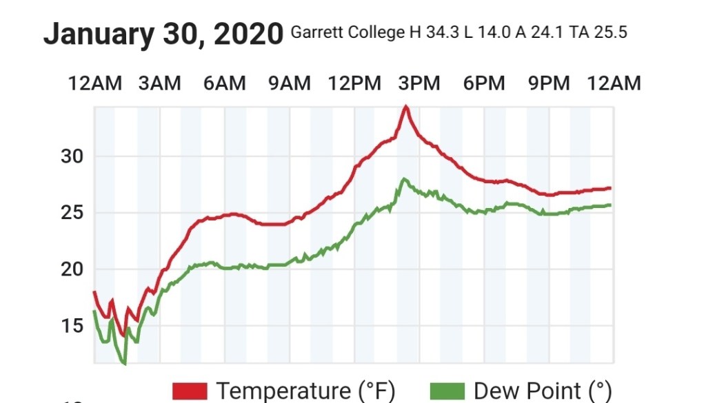
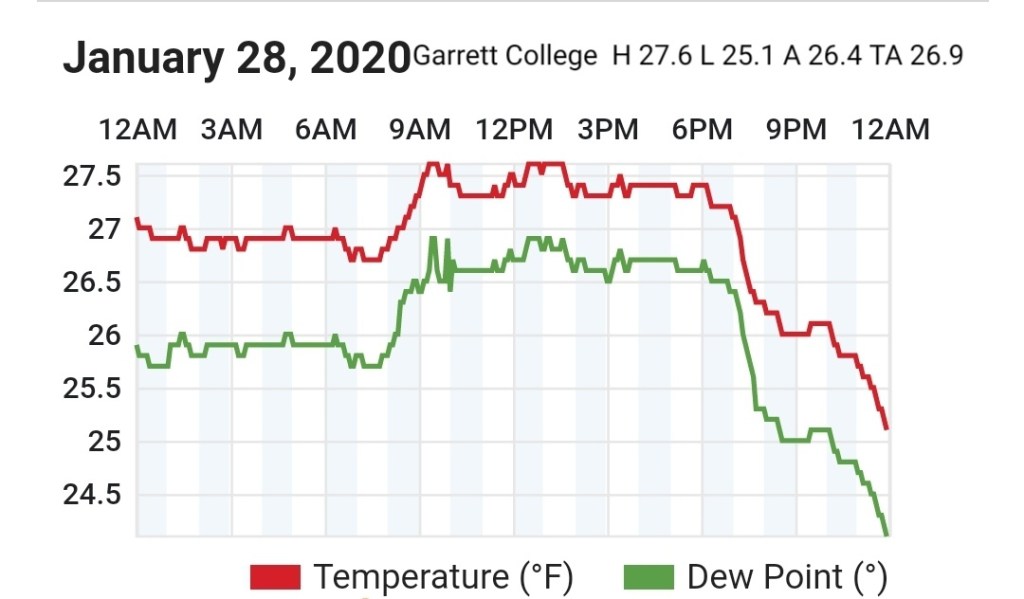
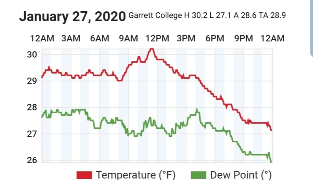
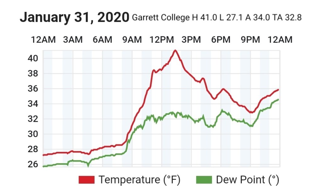
Garrett College
MIN[27.1]—MAX[41.0]—AVERAGE MEAN[34.0]—TRUE AVERAGE[32.8]—PRECIP[0]
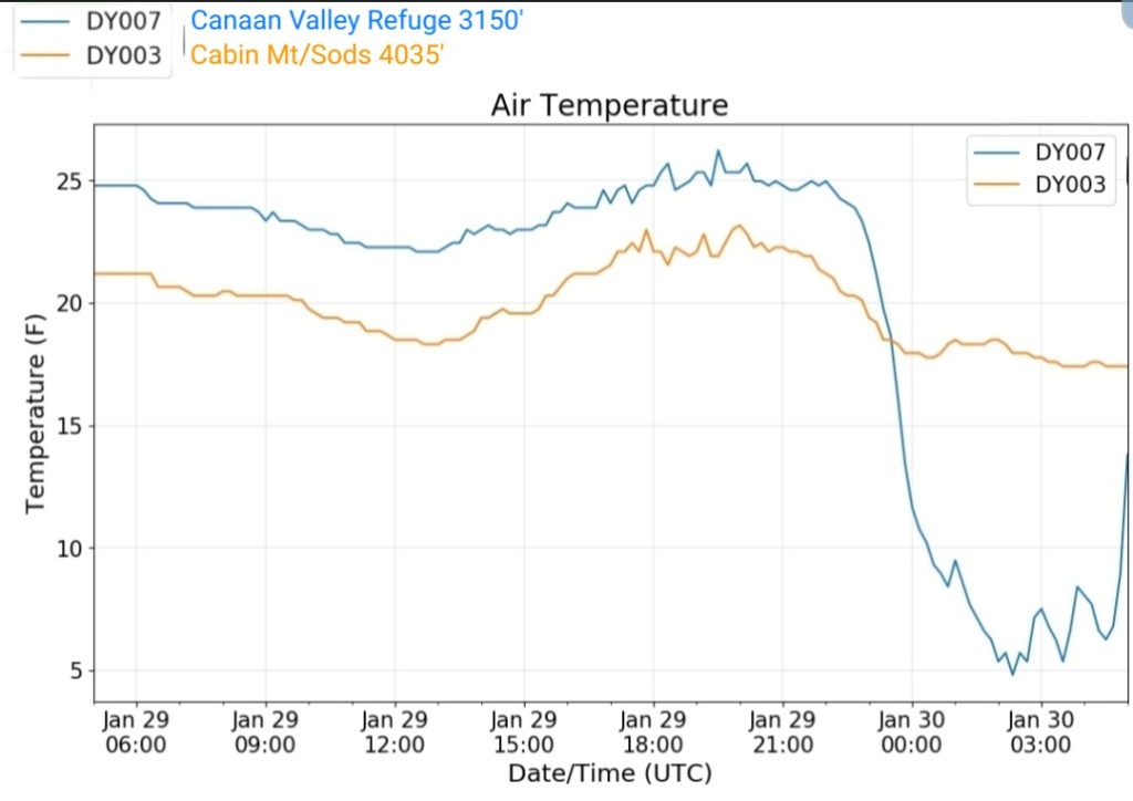
Canaan Heights/Davis 3SE
MIN[28.0]—MAX[36.0]—AVERAGE MEAN[32.0]—PRECIP[T]
Snowfall season to date 48.8″
Comments by Dave Lesher at:
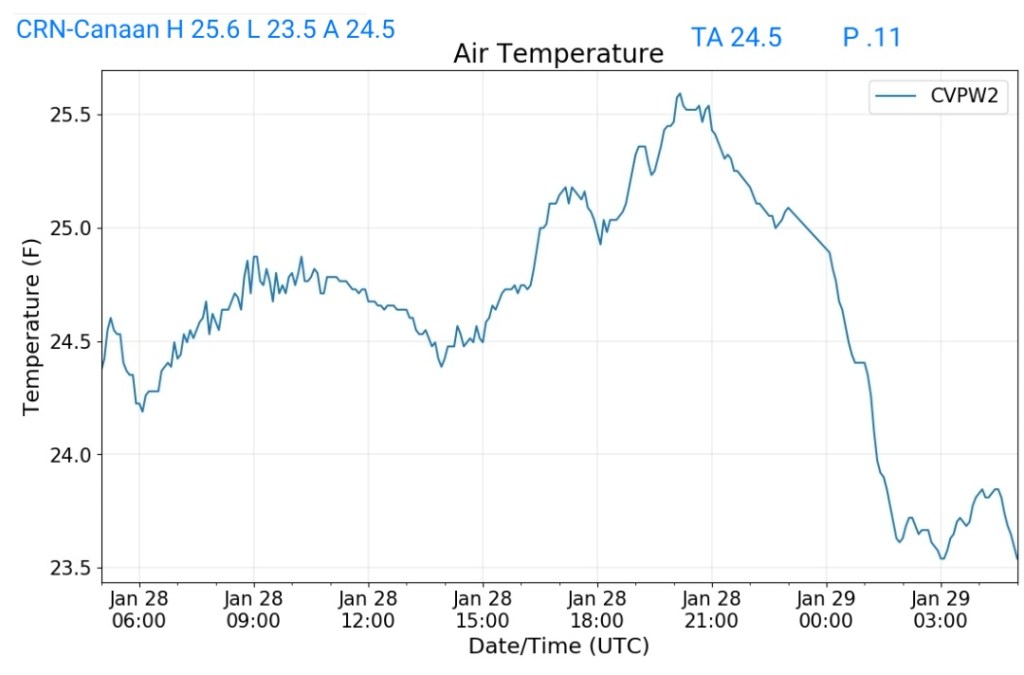
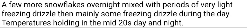
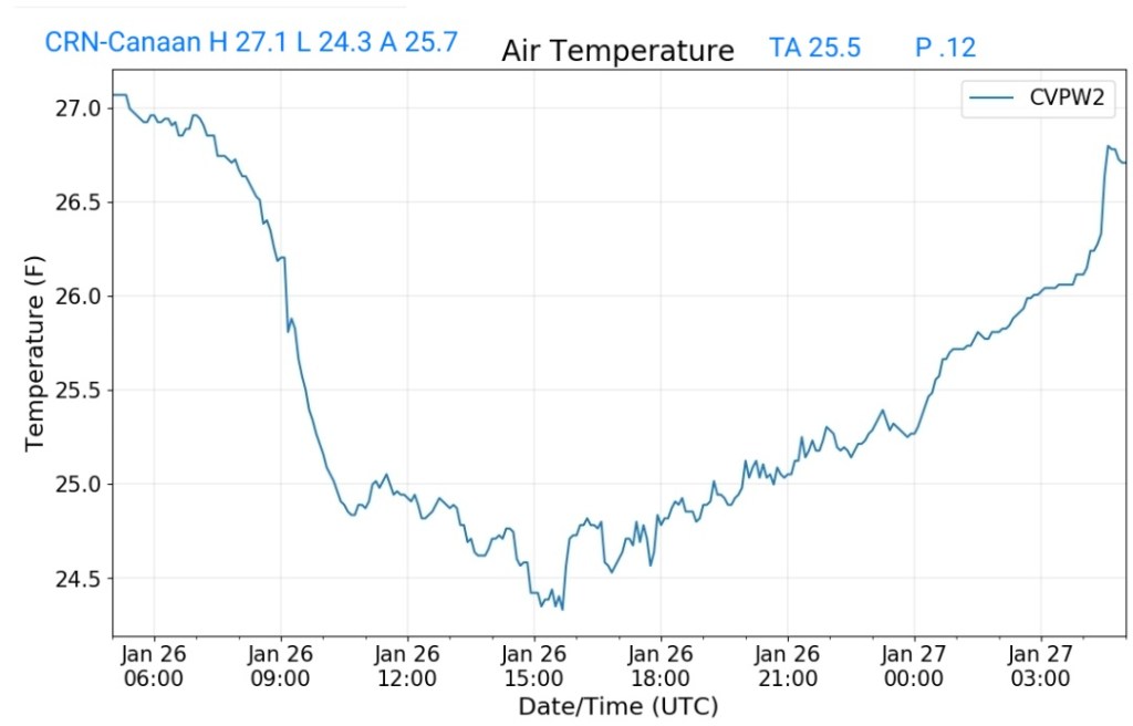
Climate Reference Network Canaan
MIN[27.7]—MAX[37.5]—AVERAGE MEAN[32.6]—TRUE AVERAGE[32.0]—PRECIP[0]

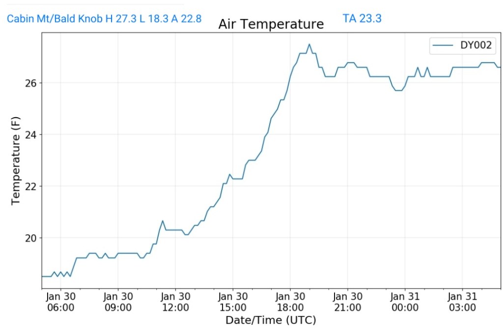
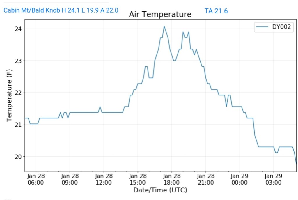
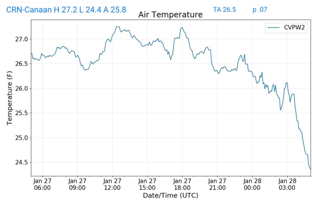
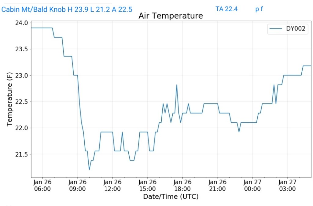
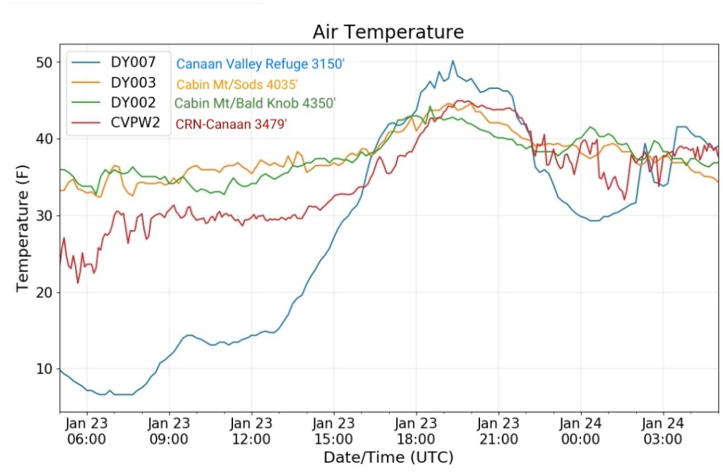
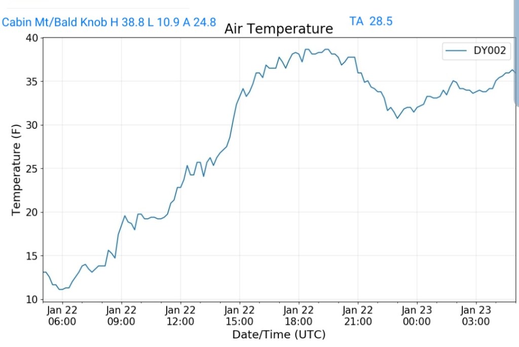
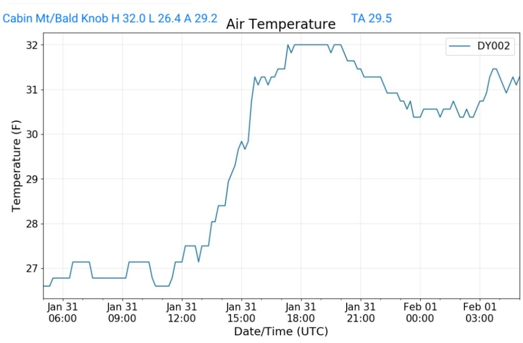
Cabin Mt at Bald Knob
MIN[26.4]—MAX[32.0]—AVERAGE MEAN[29.2]—TRUE AVERAGE[29.5]—PRECIP[0]
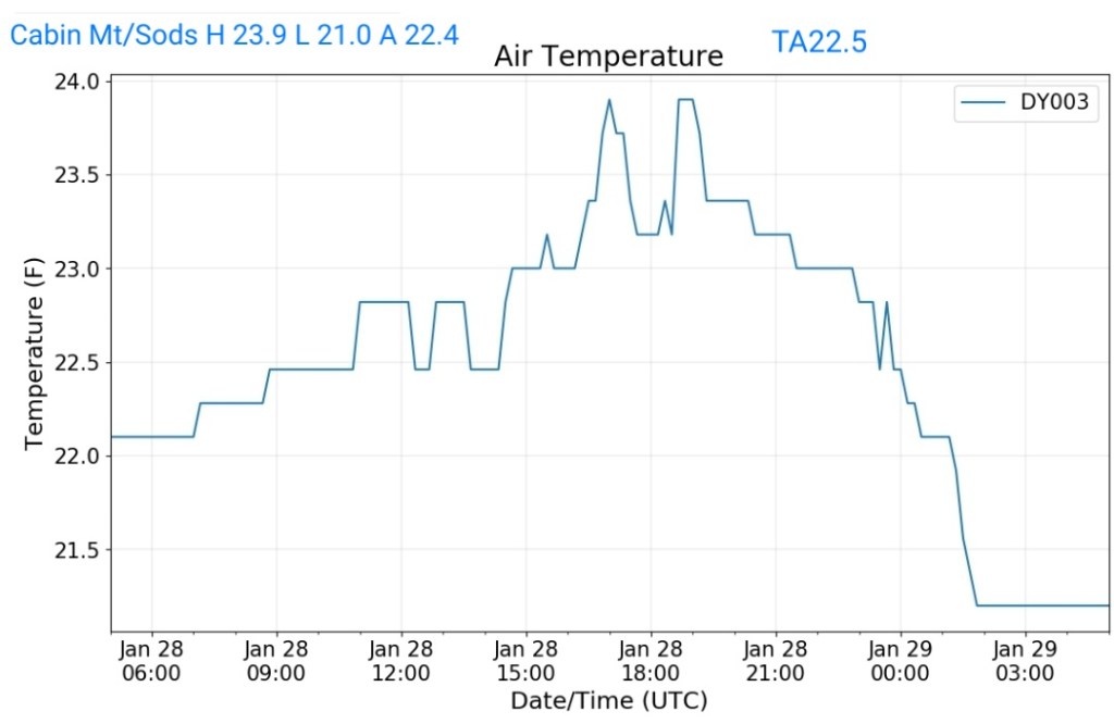
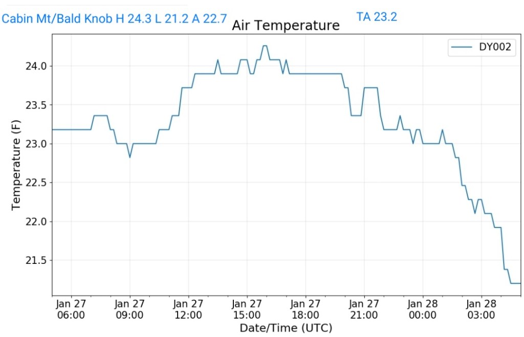
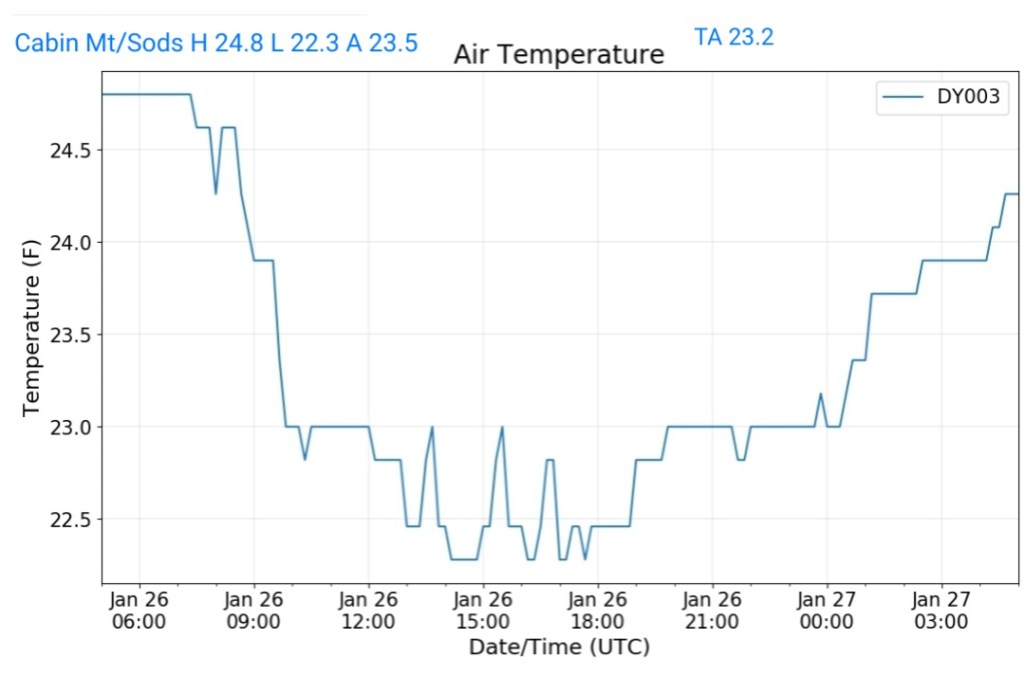
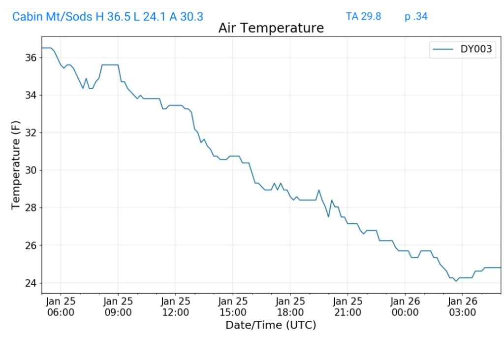
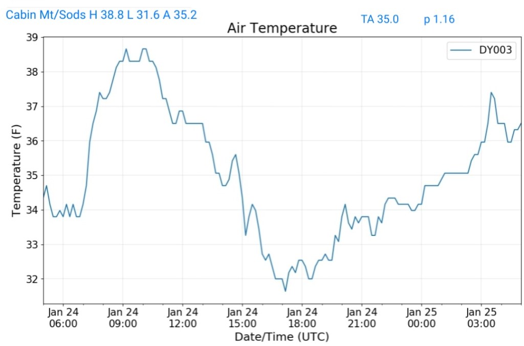
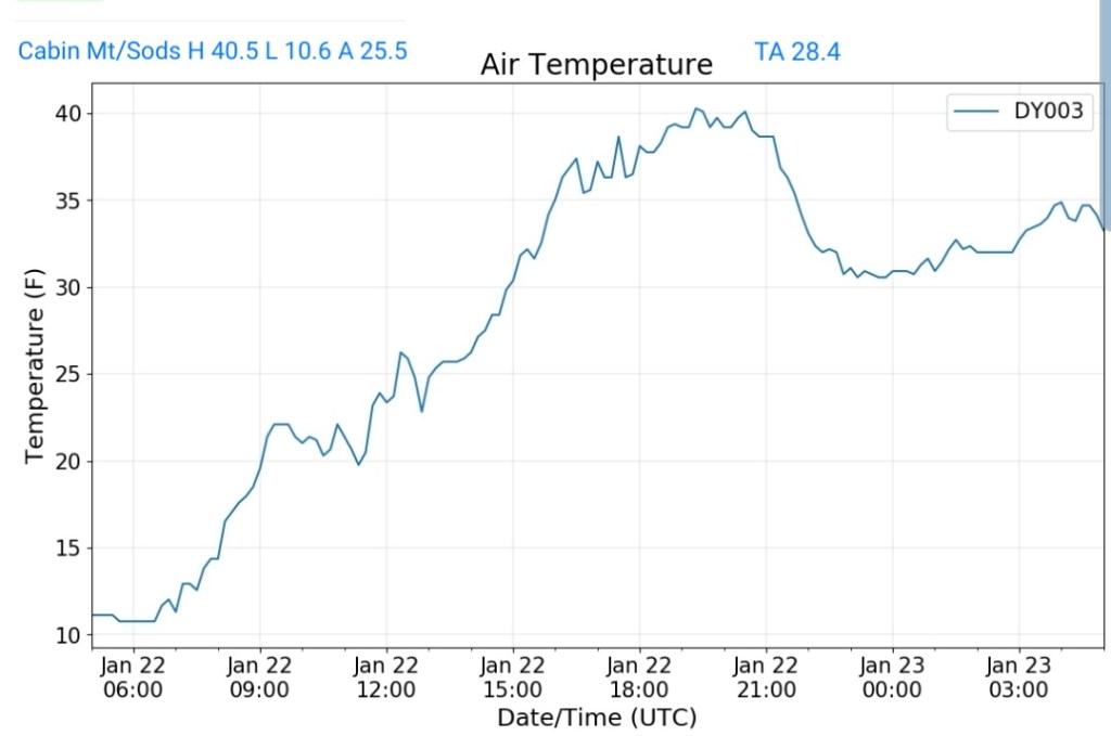
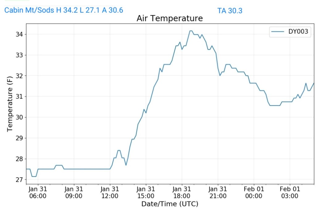
Cabin Mt-Western Sods
MIN[27.1]—MAX[34.2]—AVERAGE MEAN[30.6]—TRUE AVERAGE[30.3]
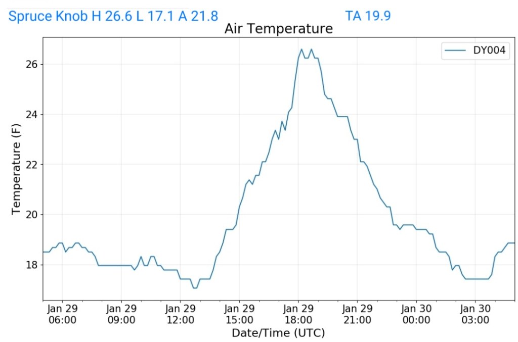
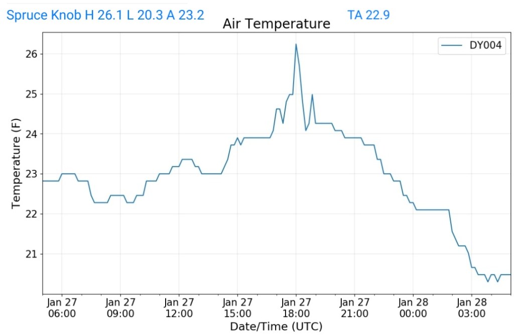
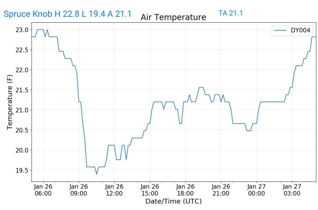
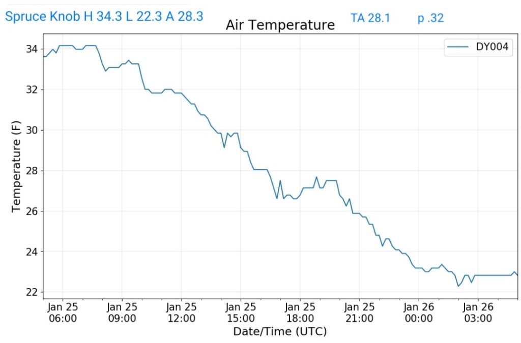
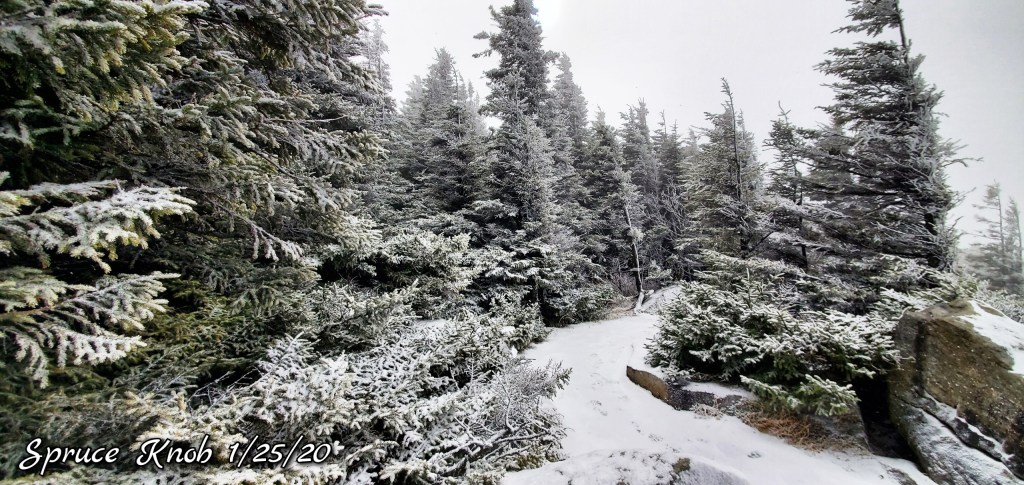
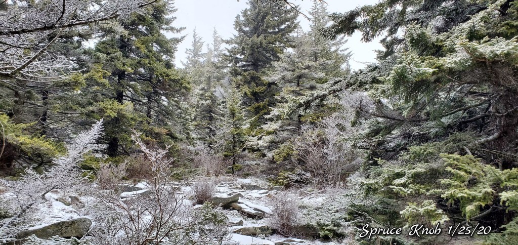
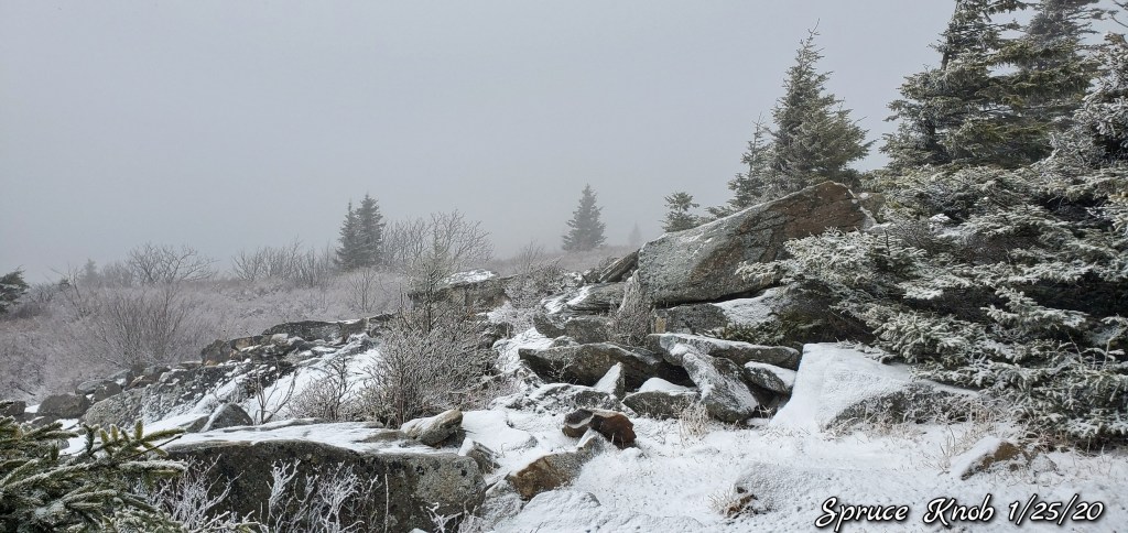
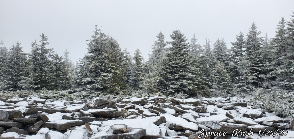
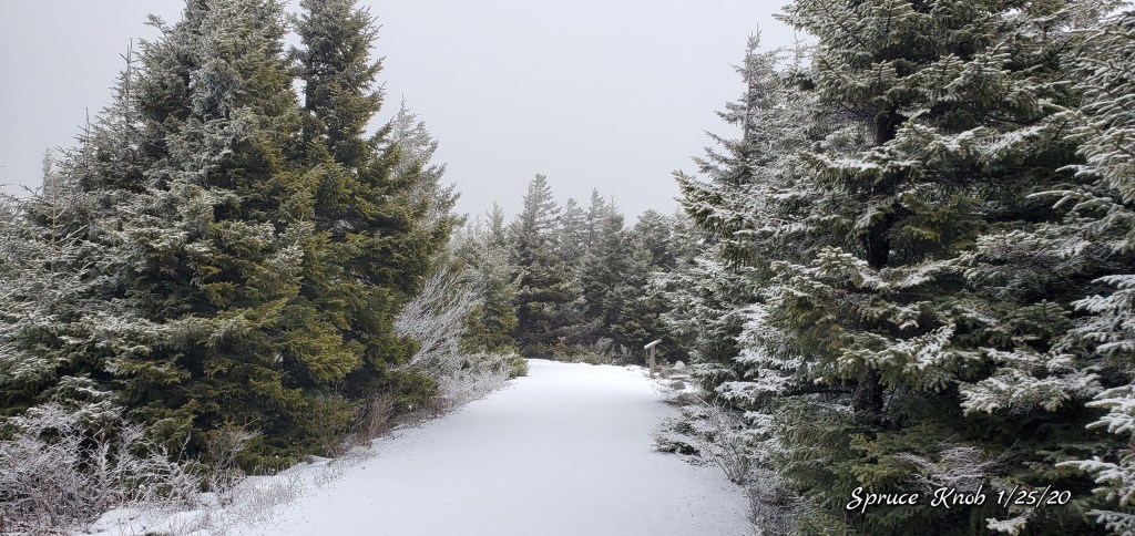
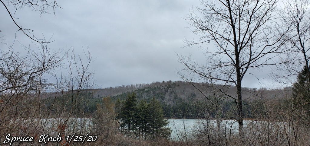
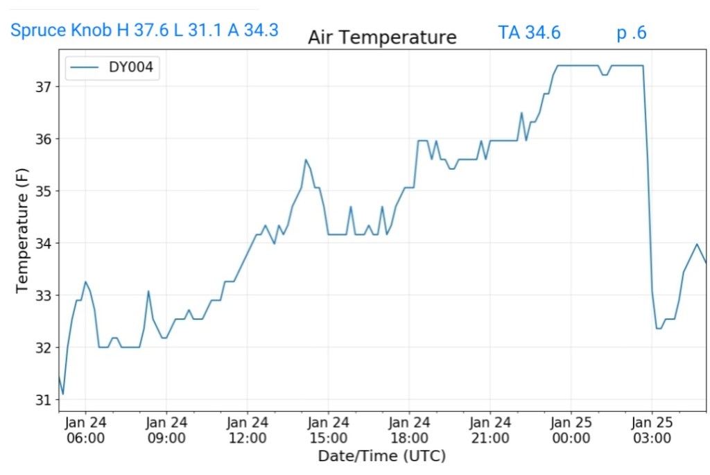
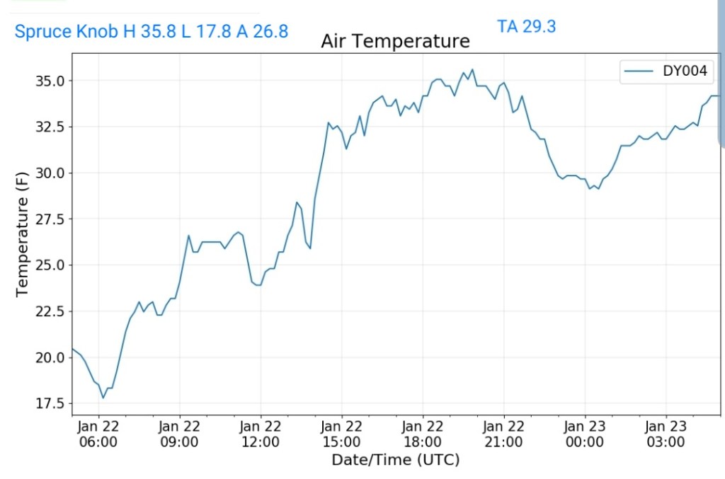
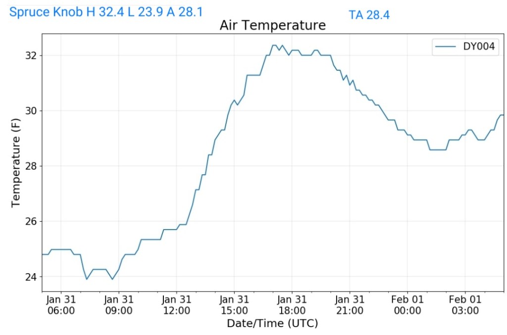
Spruce Knob
MIN[23.9]—MAX[32.4]—AVERAGE MEAN[28.1]—TRUE AVERAGE[28.4]—PRECIP[0]
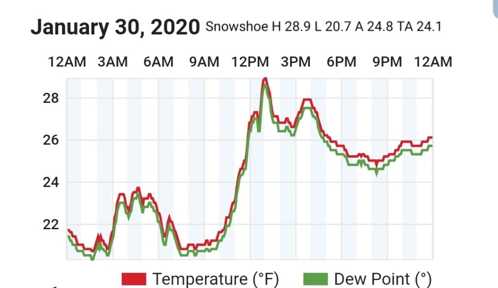
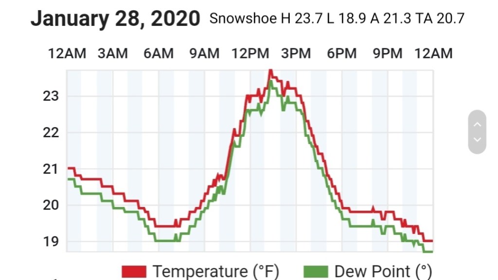
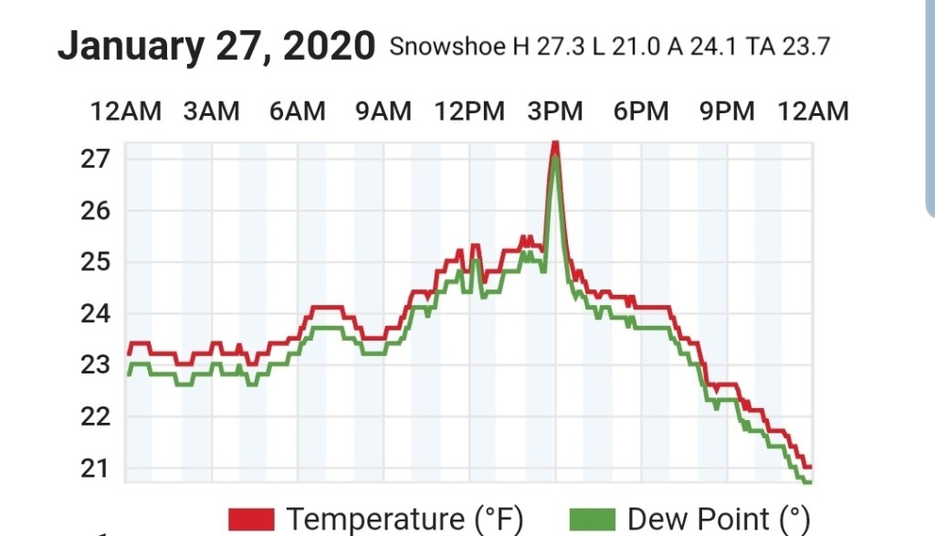
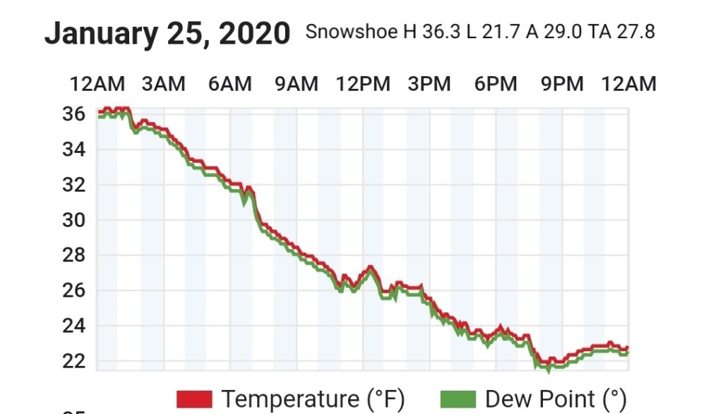
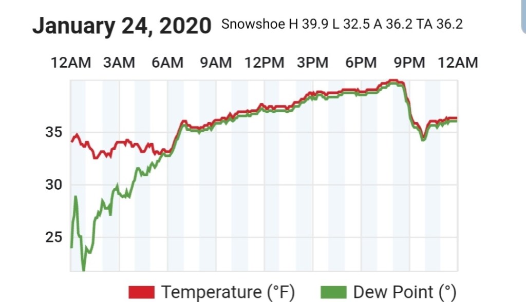
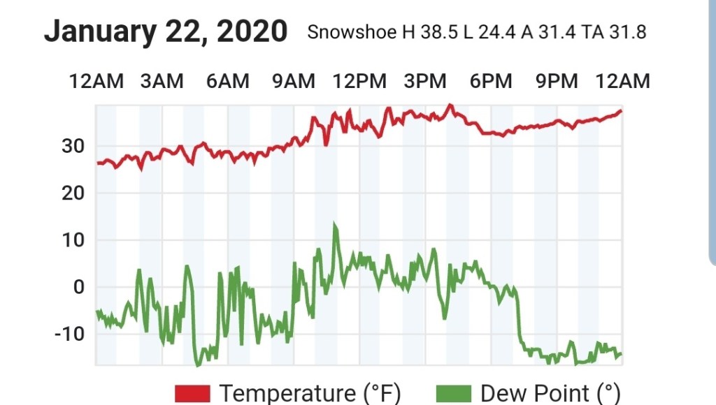
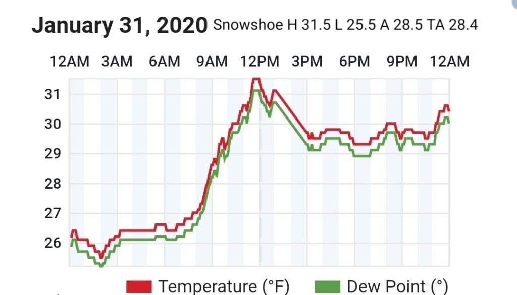
Snowshoe
MIN[25.5]—MAX[31.5]—AVERAGE MEAN[28.5]—AVERAGE MEAN[28.4]
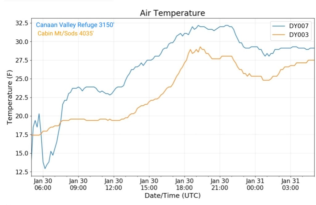
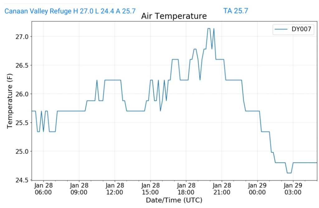
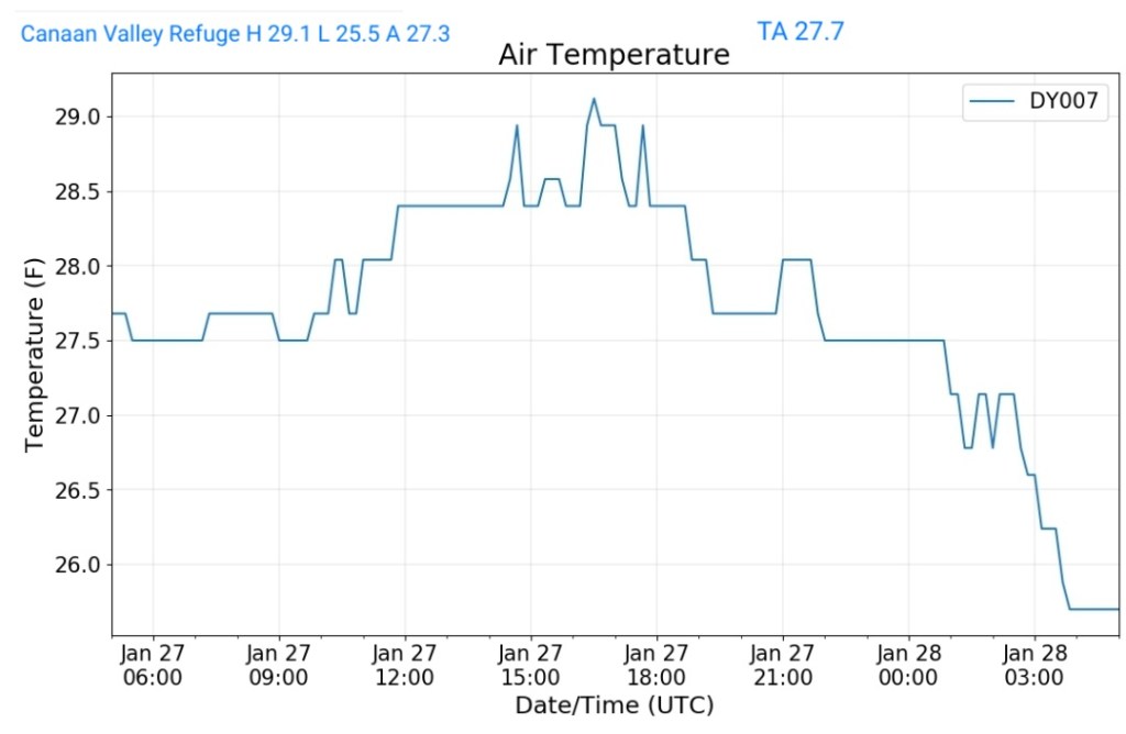
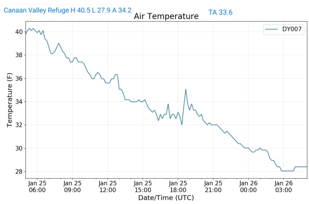
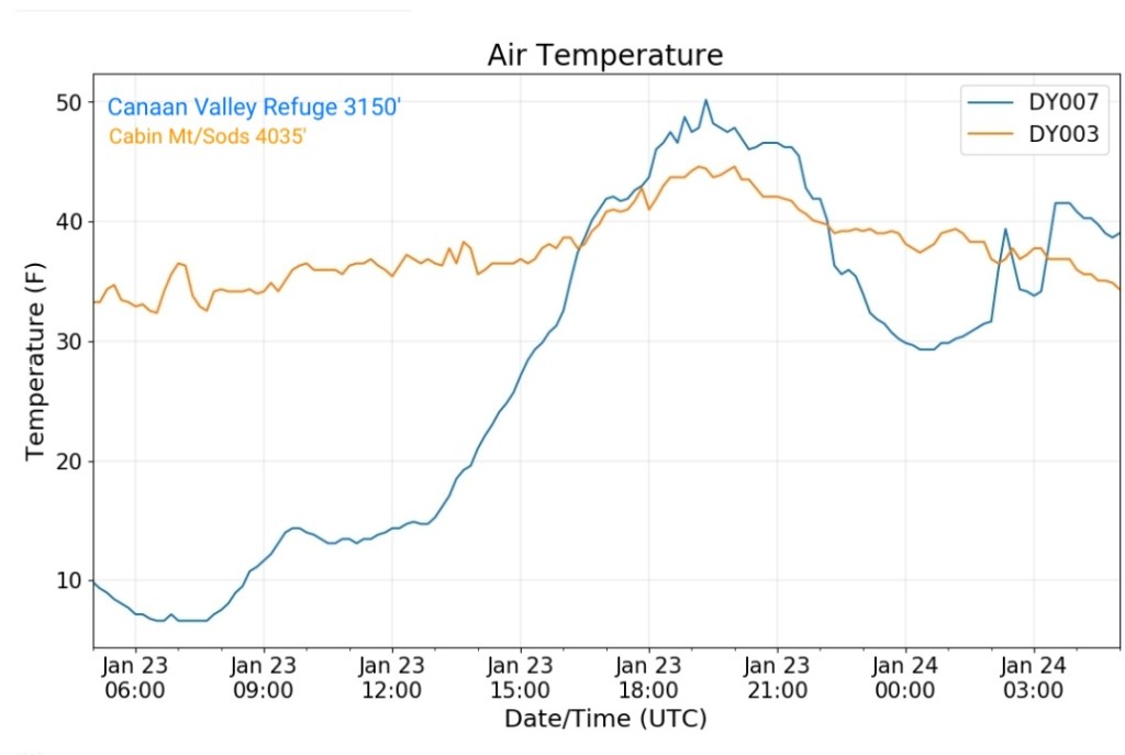
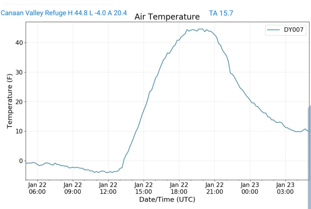
Canaan Valley Refuge
MIN[27.3]—MAX[40.3]—AVERAGE MEAN[33.8]—TRUE AVERAGE[33.4]

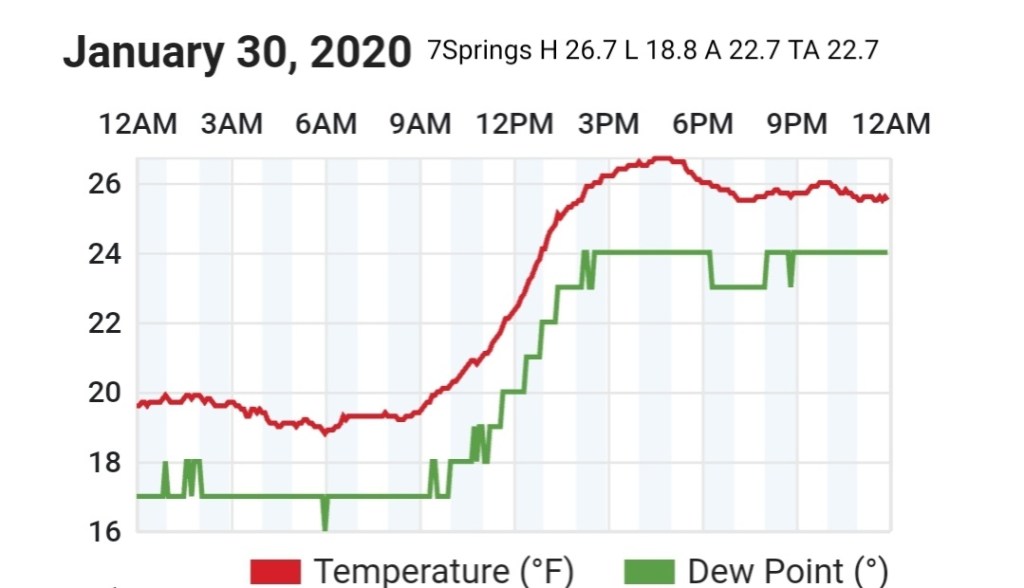
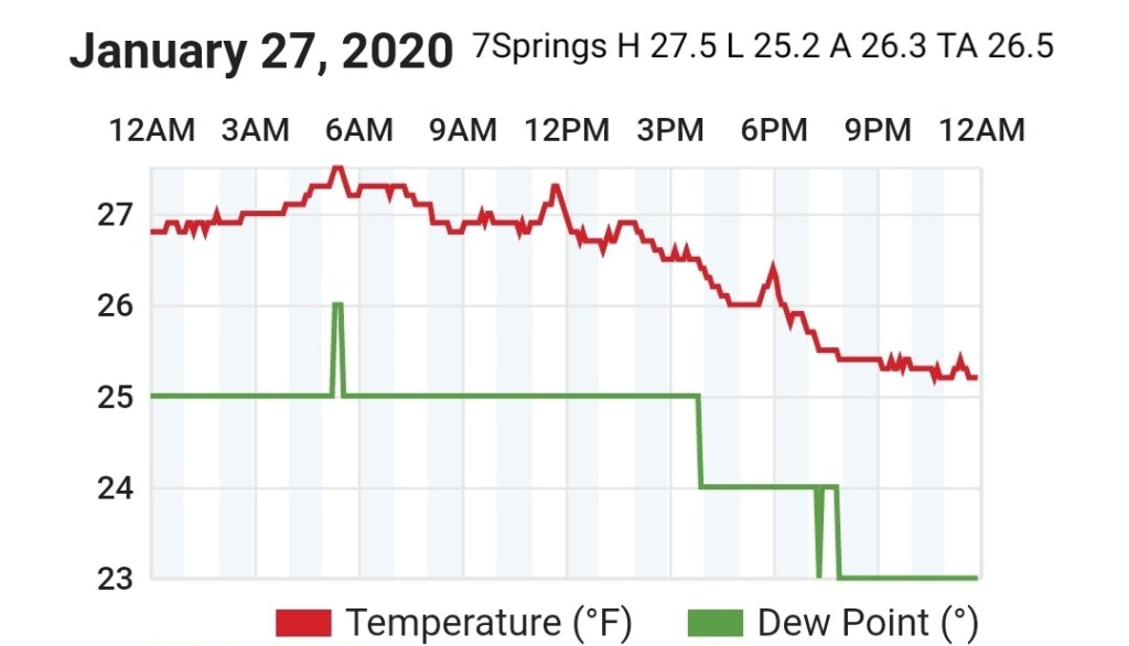
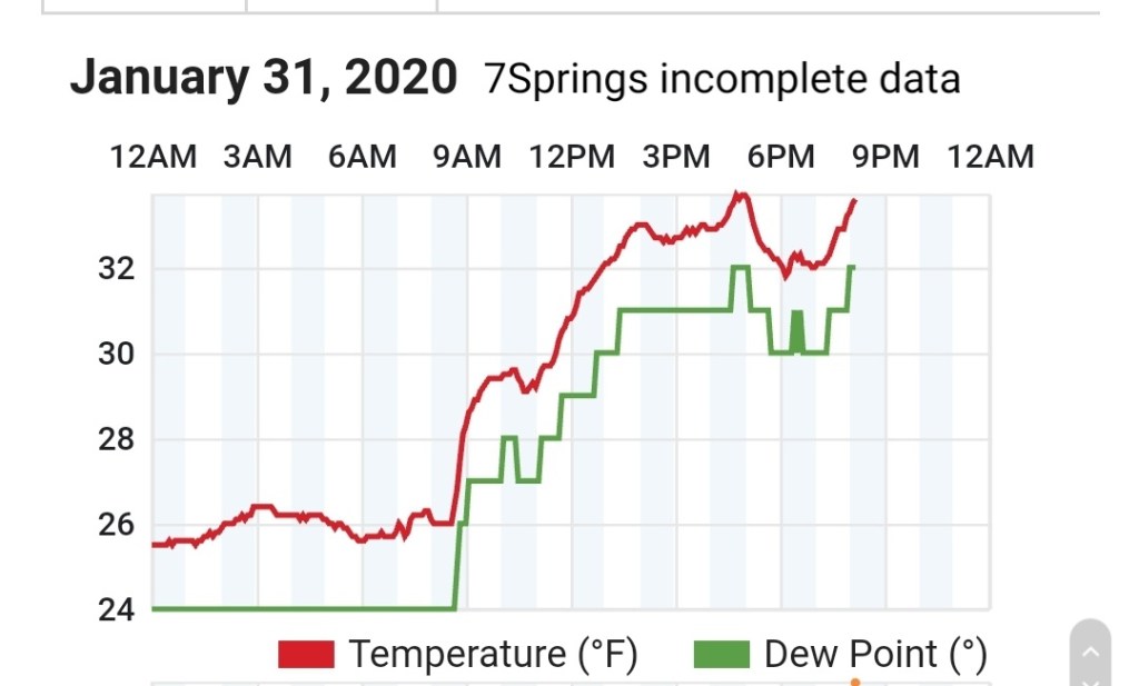
7Springs
Missing data again
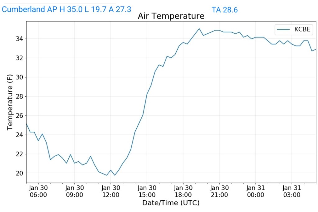
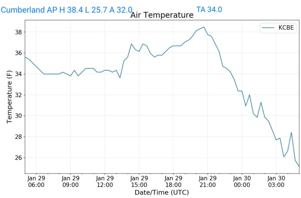
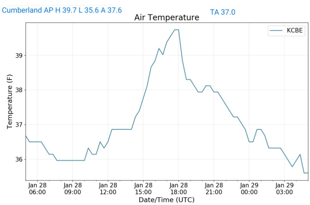
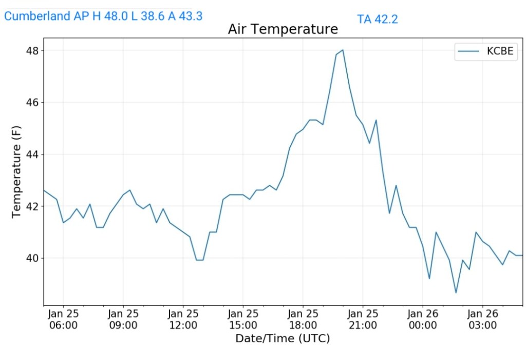
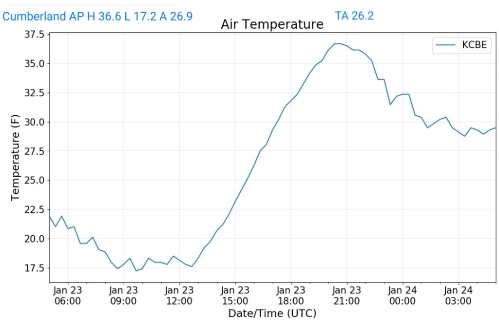
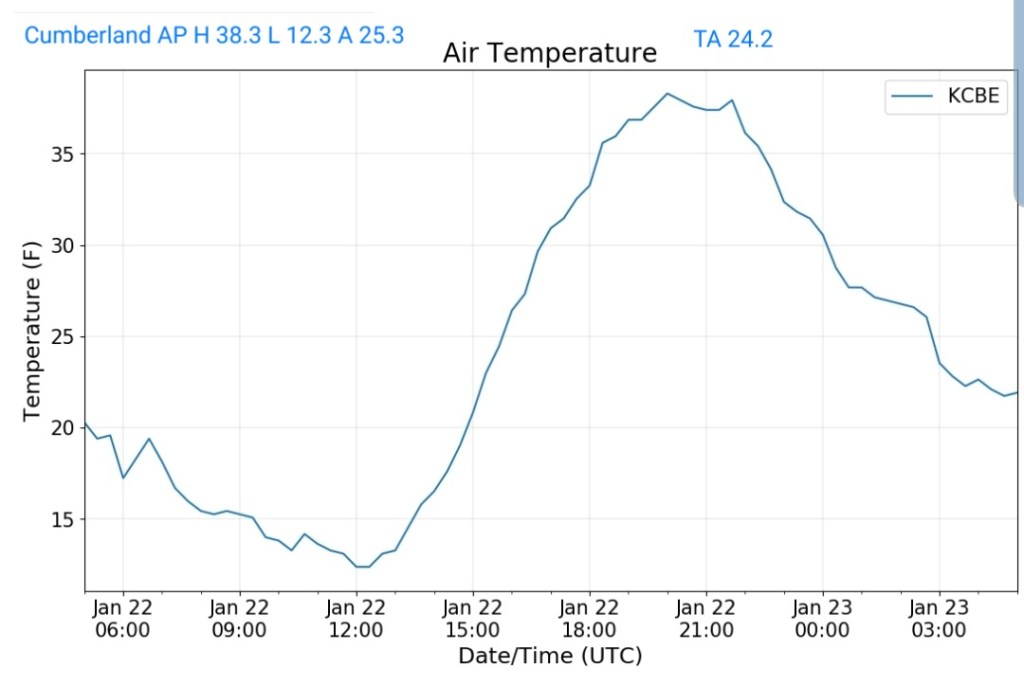
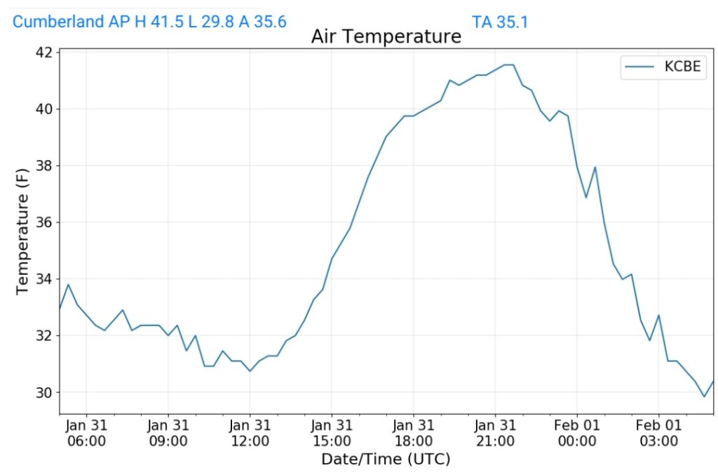
Cumberland Airport
MIN[29.8]—MAX[41.5]—AVERAGE MEAN[35.6]—TRUE AVERAGE[35.1]
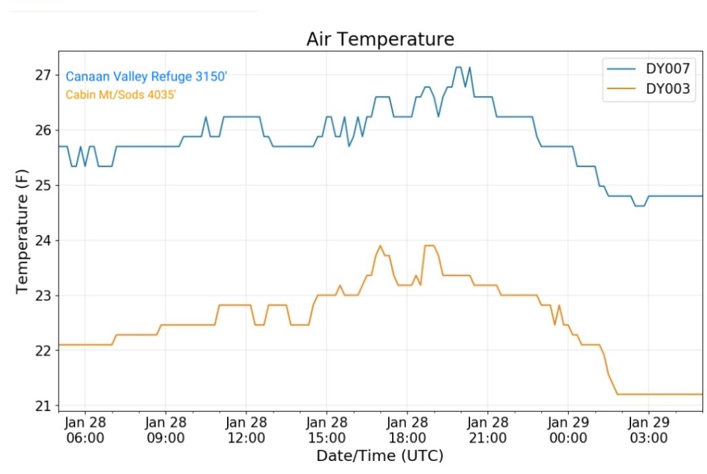
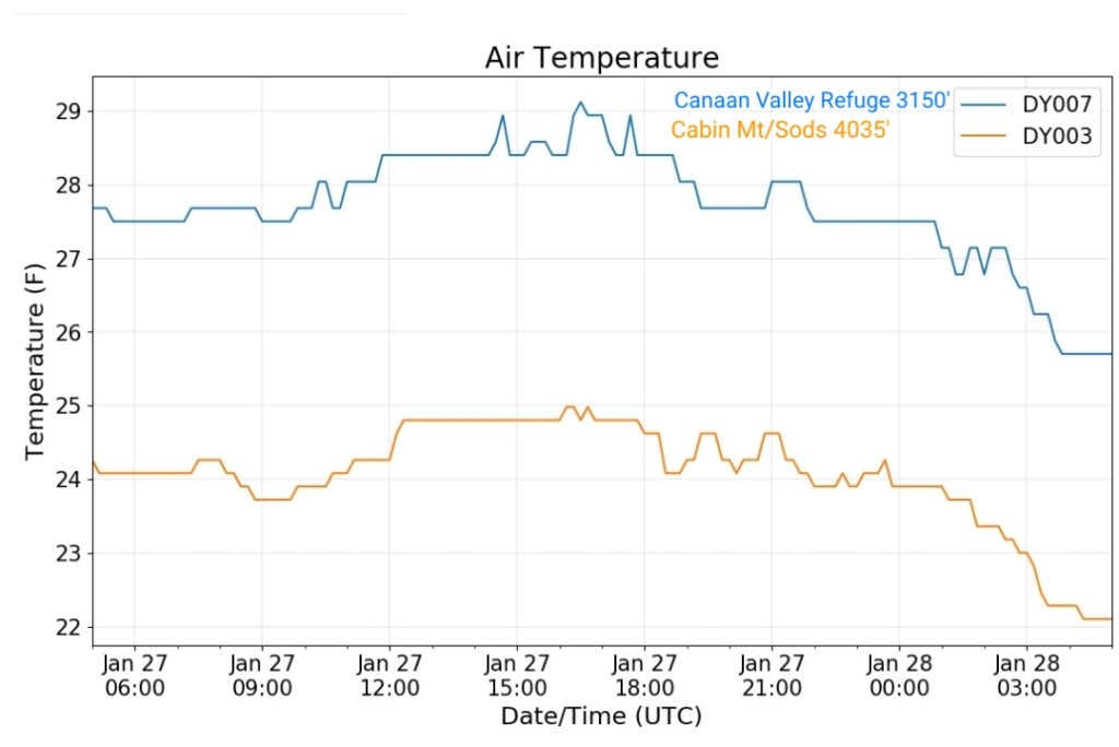
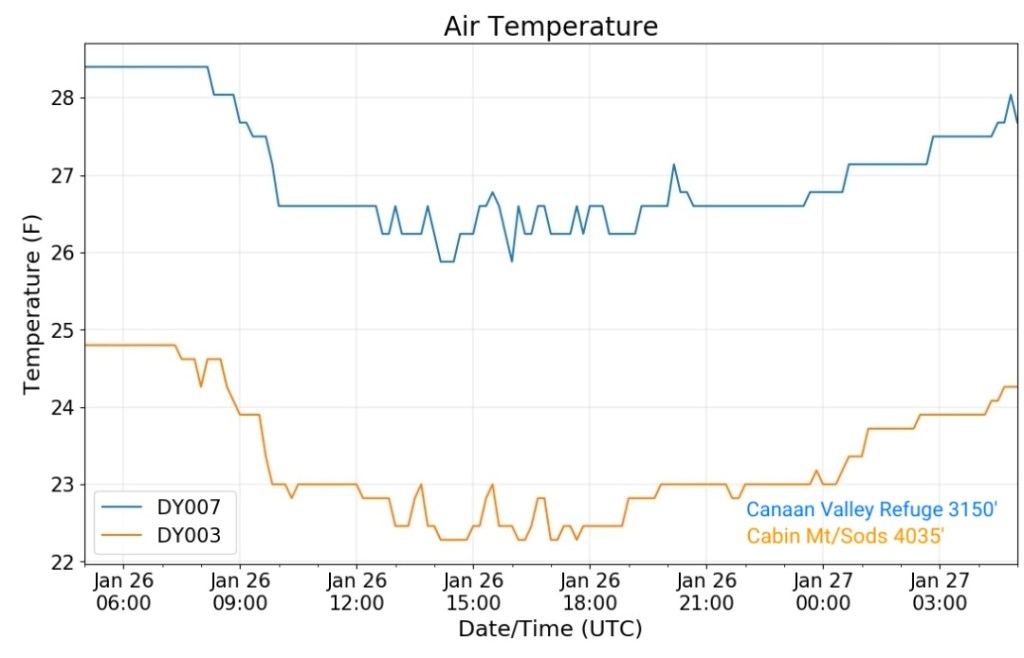
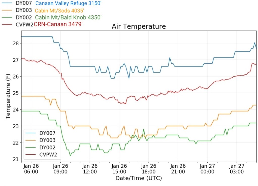
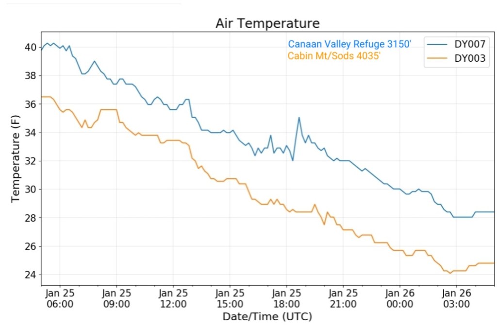
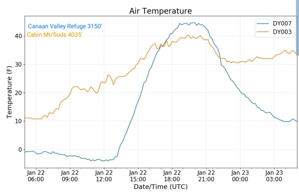
The Valley vs Cabin Mt

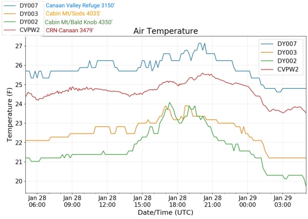
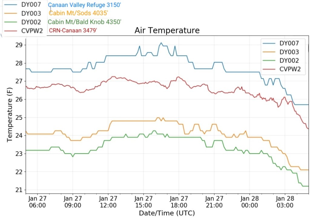
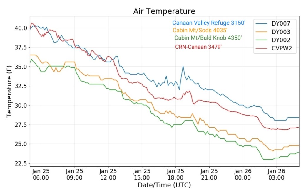
Canaan area temps
Comparison view

RTMA
Radar
Satellite
Flow
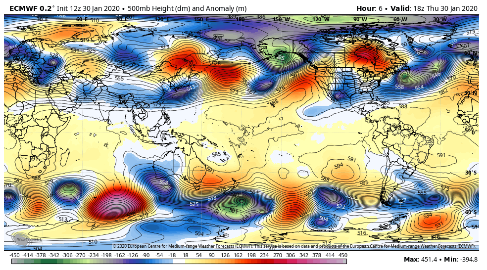
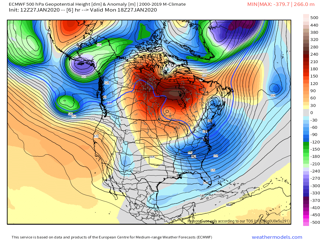
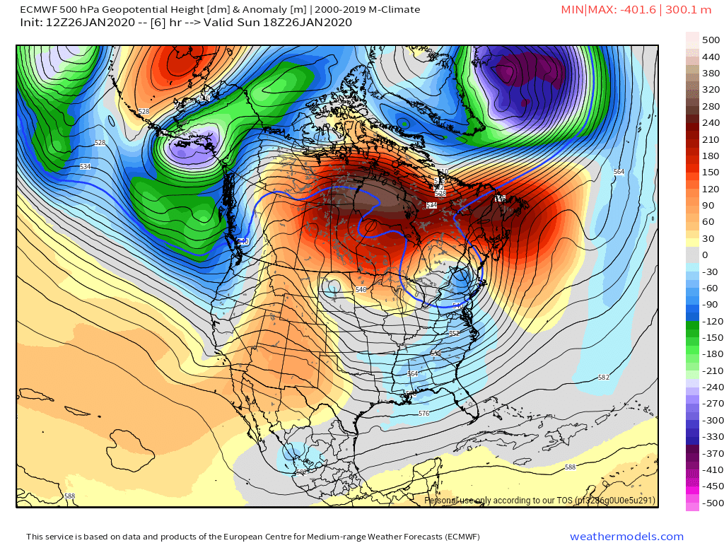
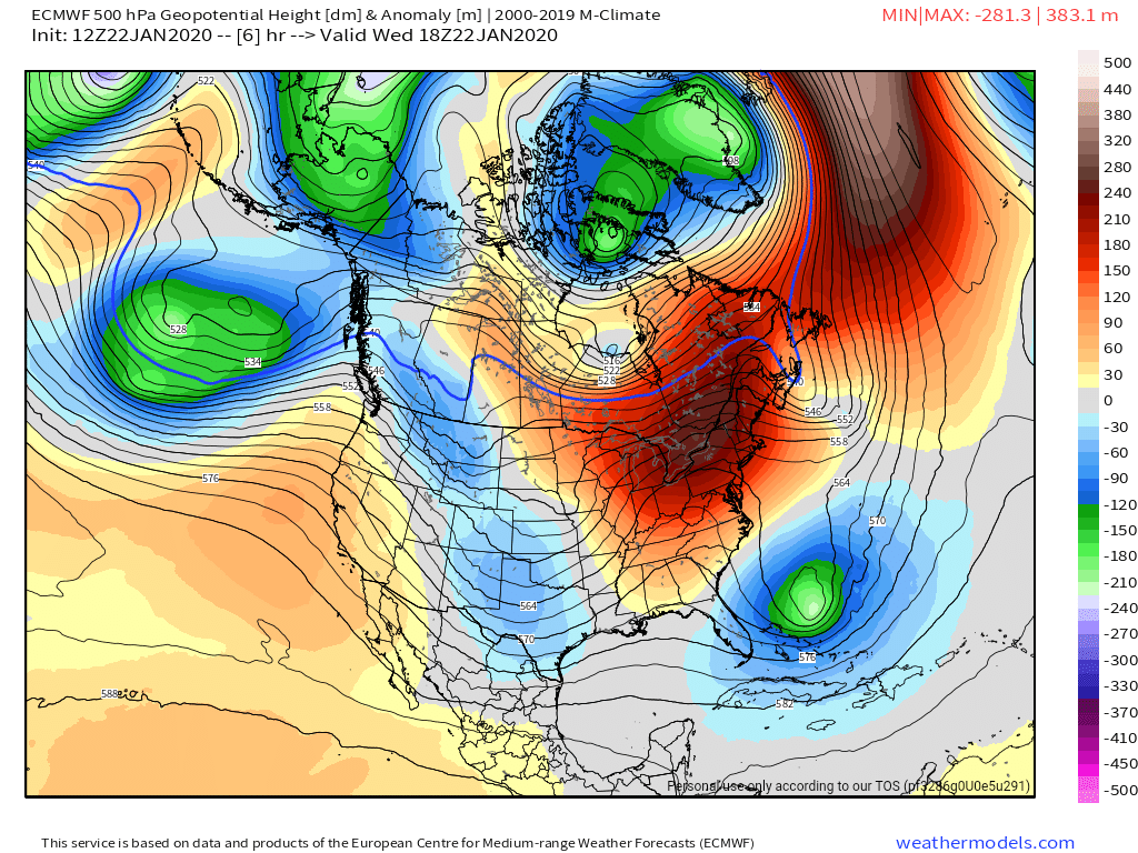
Surface features and 500mb height anomalies and flow

Can we trust the models??
Models have forever struggled with long range events. Recently, models have as well struggled in the short term. Models have even initialized wrong. Meaning they are off from the get go. Over the next 3-6 hours they’ve been off. Their value of late has been very poor and in the years I’ve had model watching, I do not recall any other period being this poor in the model world. The ECMWF is not what it used to be. The upgraded GFS has been very poor. The mesoscale models overdue qpf on an almost consistent basis and of late, almost all modeling has to some degree. That brings the question, what can we trust?
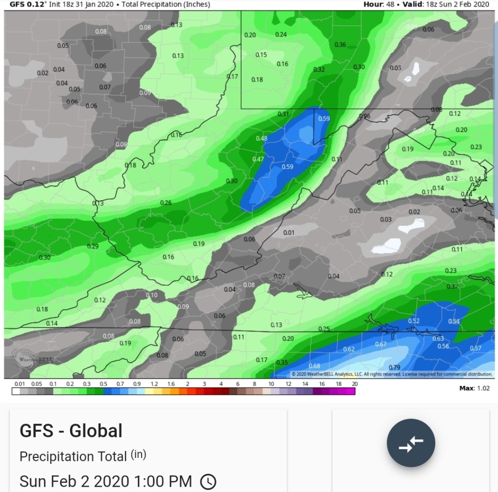
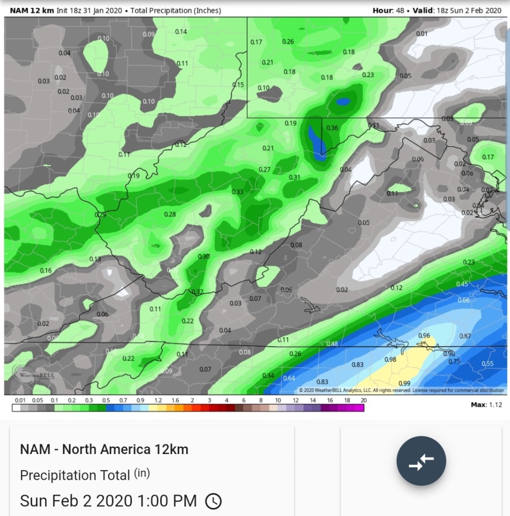
Current guidance suggest a 1-3″ snow 1800-2500 Saturday afternoon through mid morning Sunday. 2-4″- 2500-3500′ and 3-6″ above 3500′.
Step by step
By late morning to early afternoon tomorrow, the 12z ECMWF put out .05 to .1 precip. That should be in the form of a liquid, snow mix below 2500′-3000′ initially. So at that time any new accumulation should be minimal unless precip arrives ahead of schedule.
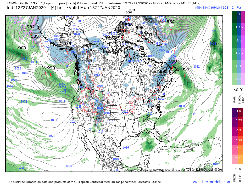
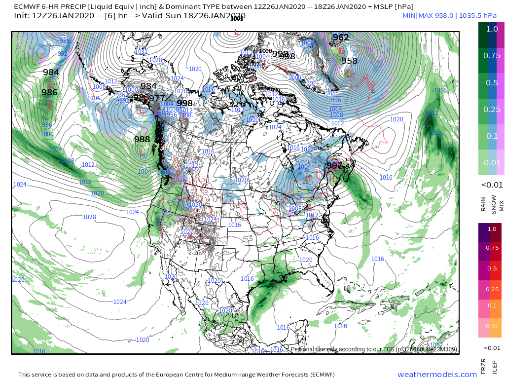
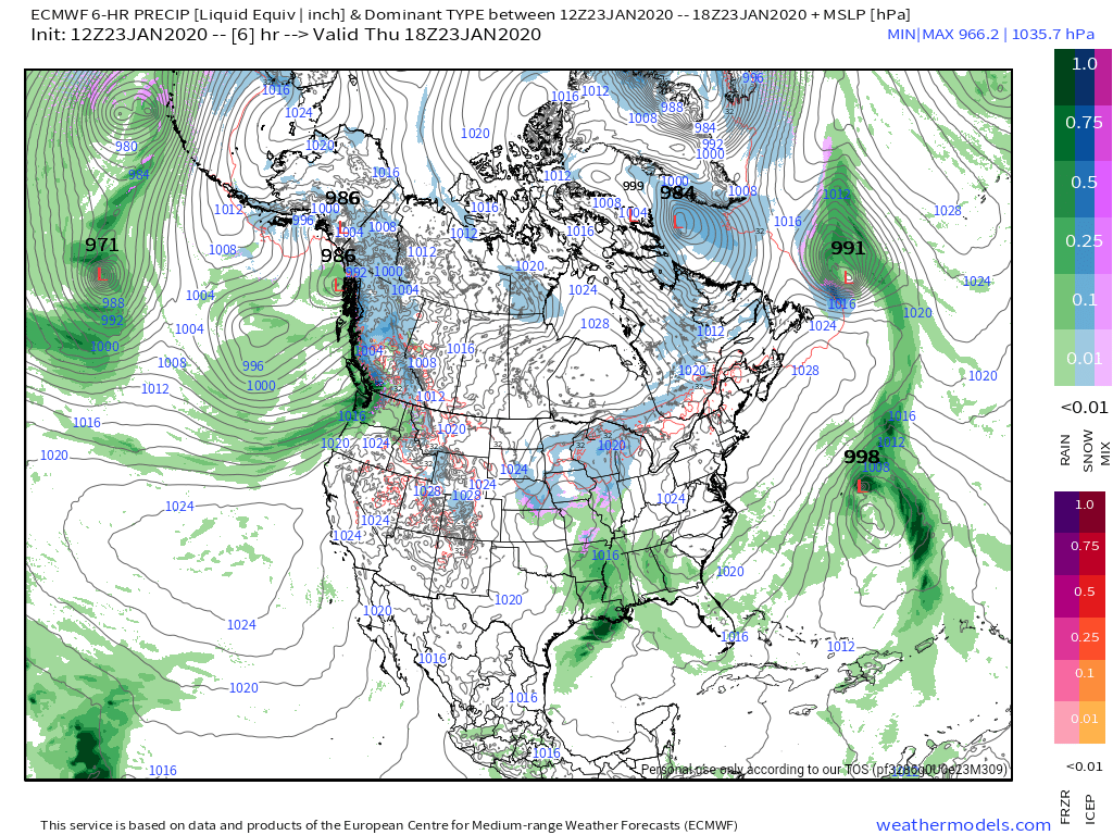
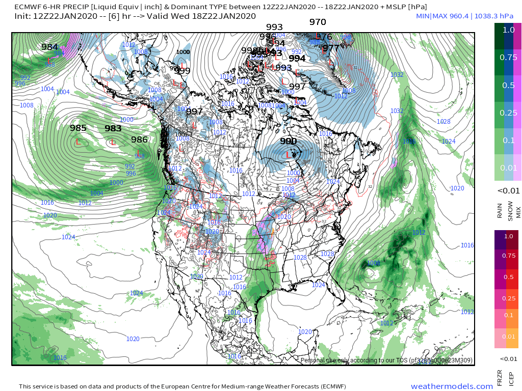
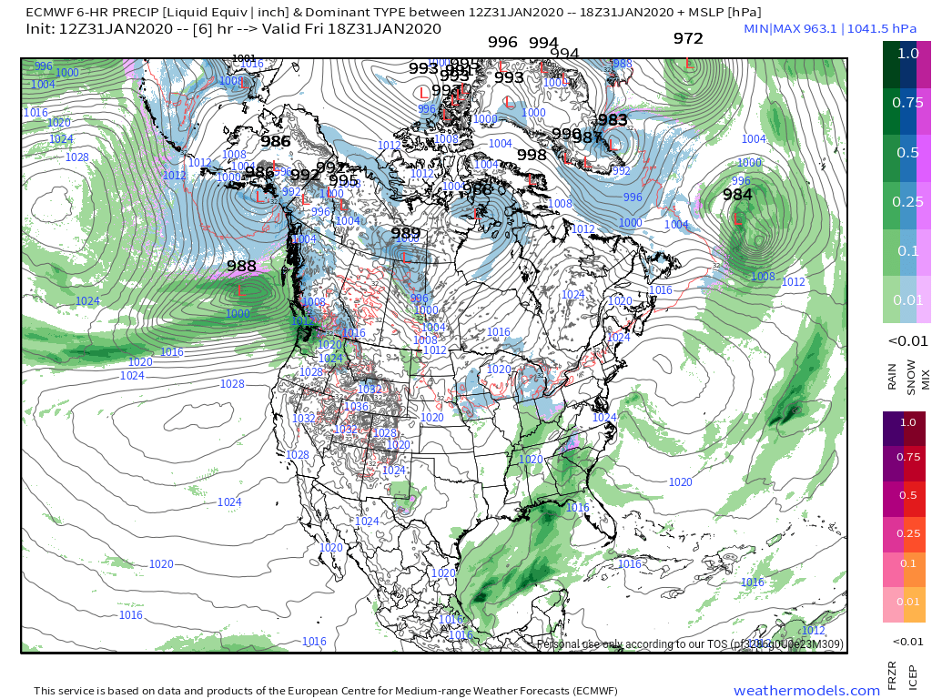
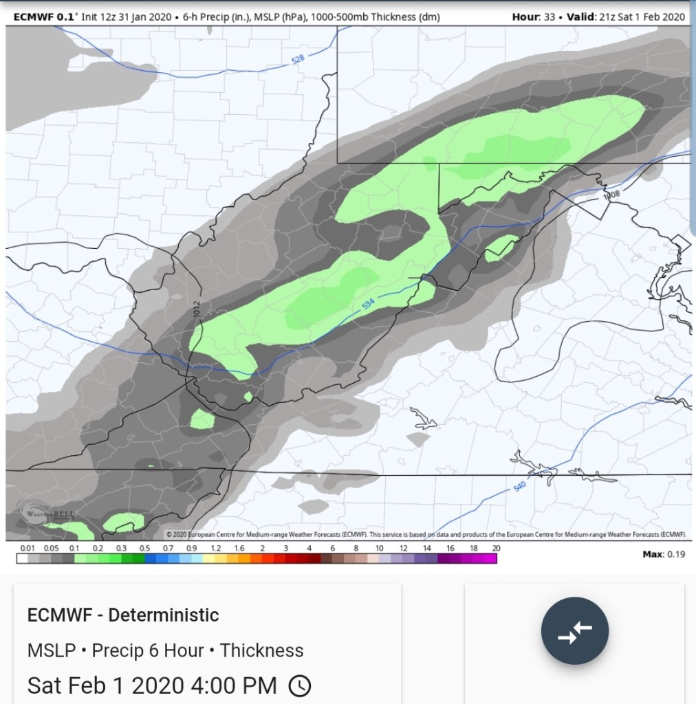
6 hour precip

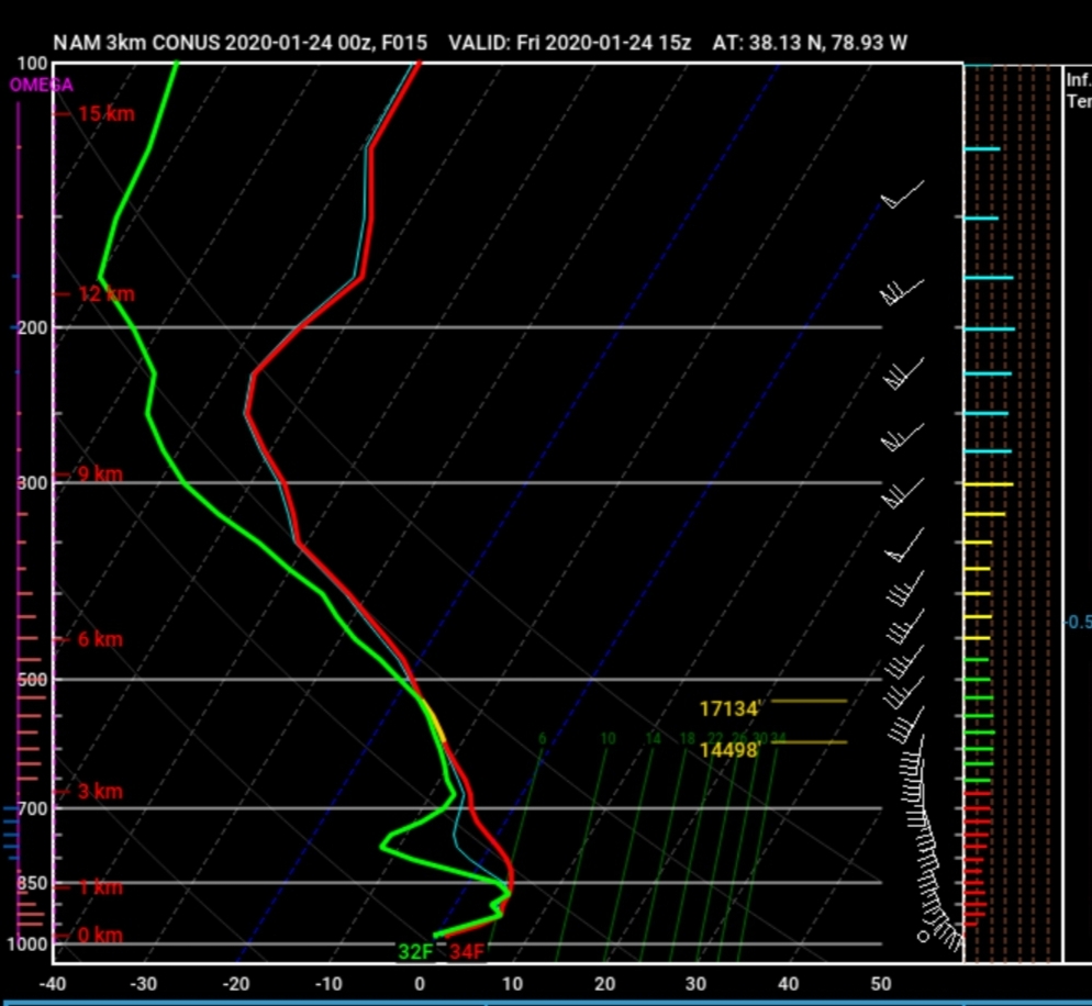
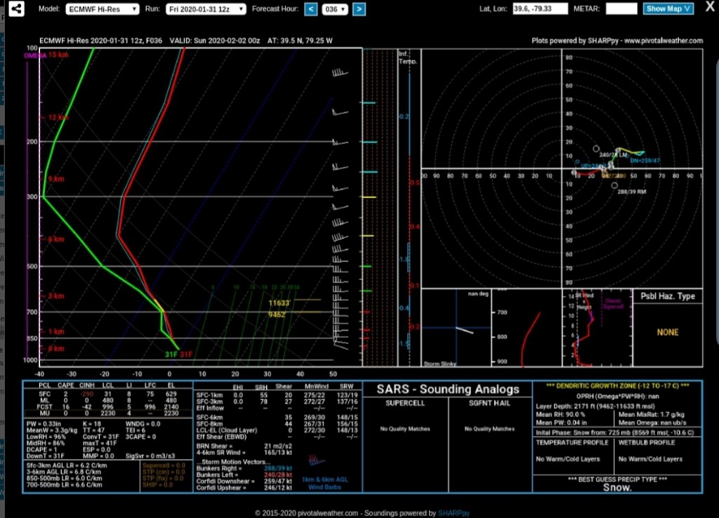
The soundings support a rapid surface cooling through the afternoon(soundings off the ECMWF over Garrett) leaving the high ground in snow business…

By 4pm the ECMWF looks like
With a precip type looking like
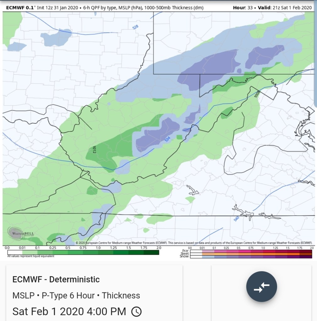
With surface temps in the afternoon, evening lower 30s 2500-3000, upper 20s- lower 30s above 3000′ at 4pm. Initially a wet compact snow, and as we drift towards midnight all areas above 2500 fall below 30°, with areas above 3500-4000 24-28.
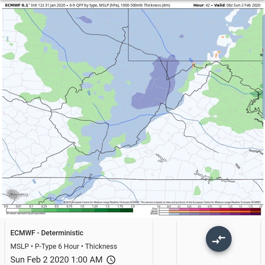
models pumping out the most precip from 2pm through 10am Sunday and that’s on the order of .2 to .5. The initial precip, the snow ratios will be lower but increase overnight as the 850s run -6 to -8c, with surface into the 20s. Winds will be gusty overnight, and that will lower ratios a bit settling the snow as it blows about.
Timeline


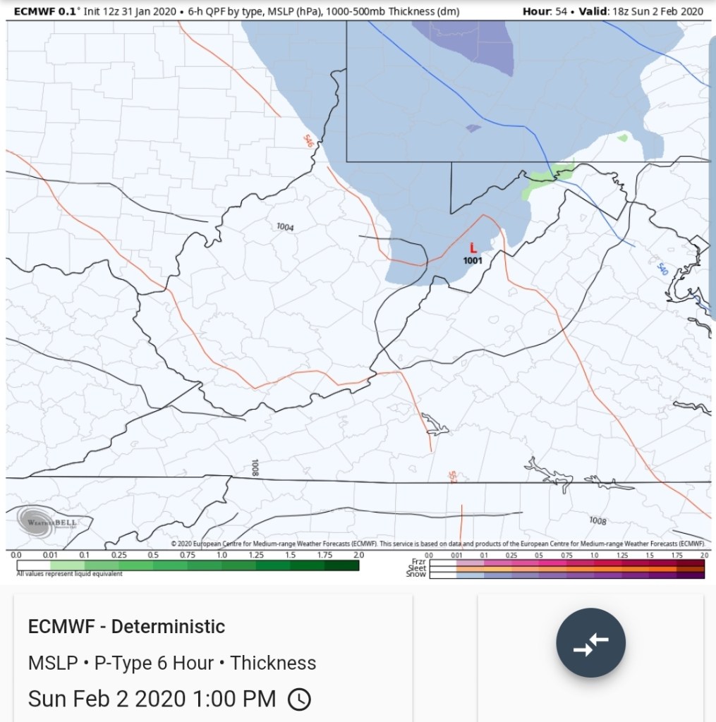
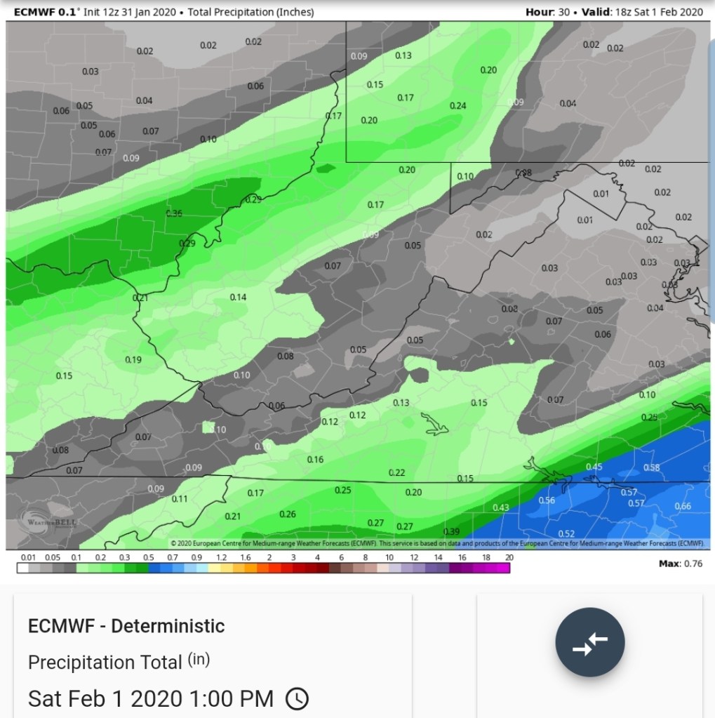
total qpf off the models through midday Sunday


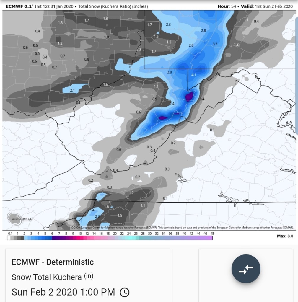
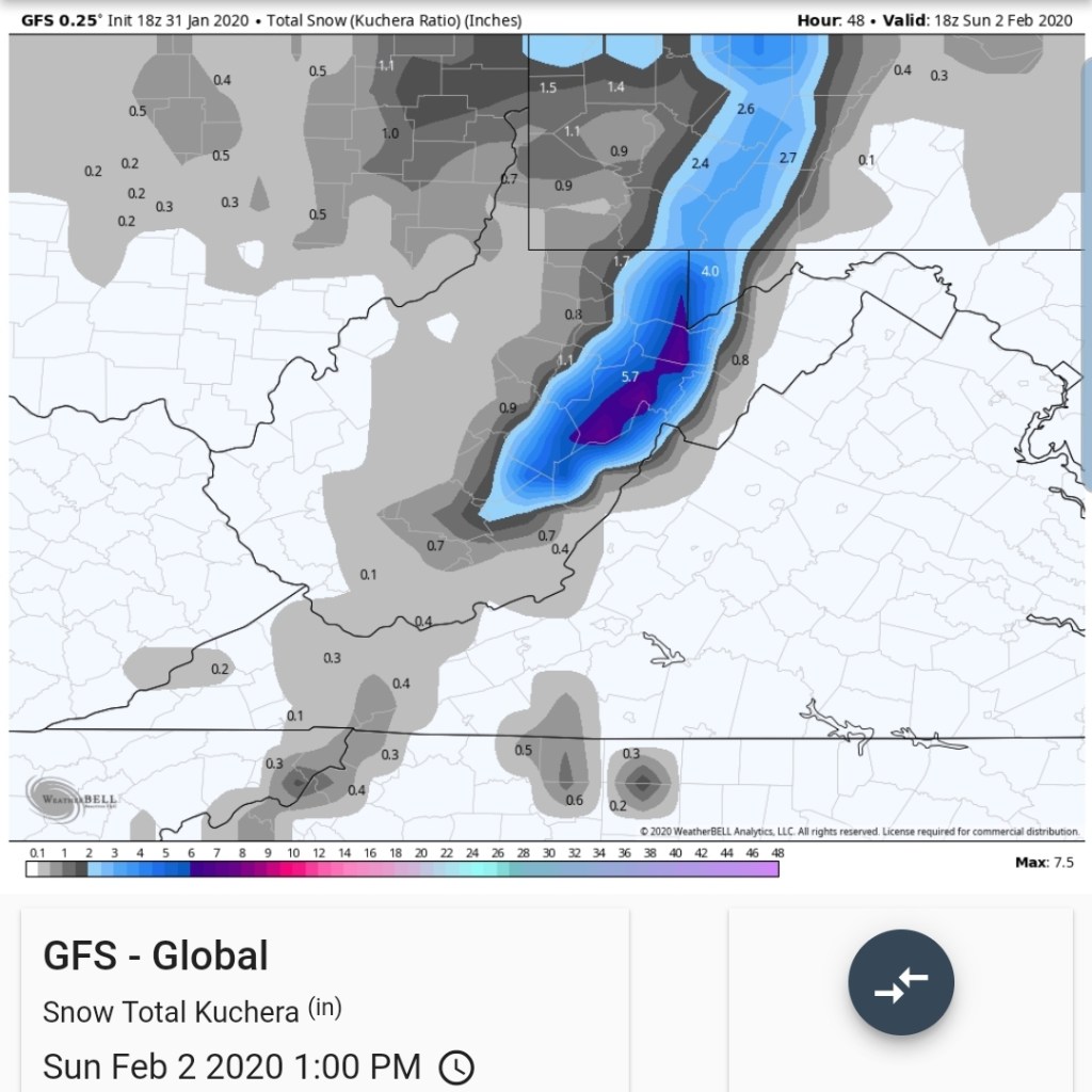
Kuchera snowfall- another aspect of modeling that has not been impressive


10 to 1 off the ICON

10 to 1 off the ECMWF

10 to 1 off the GFS
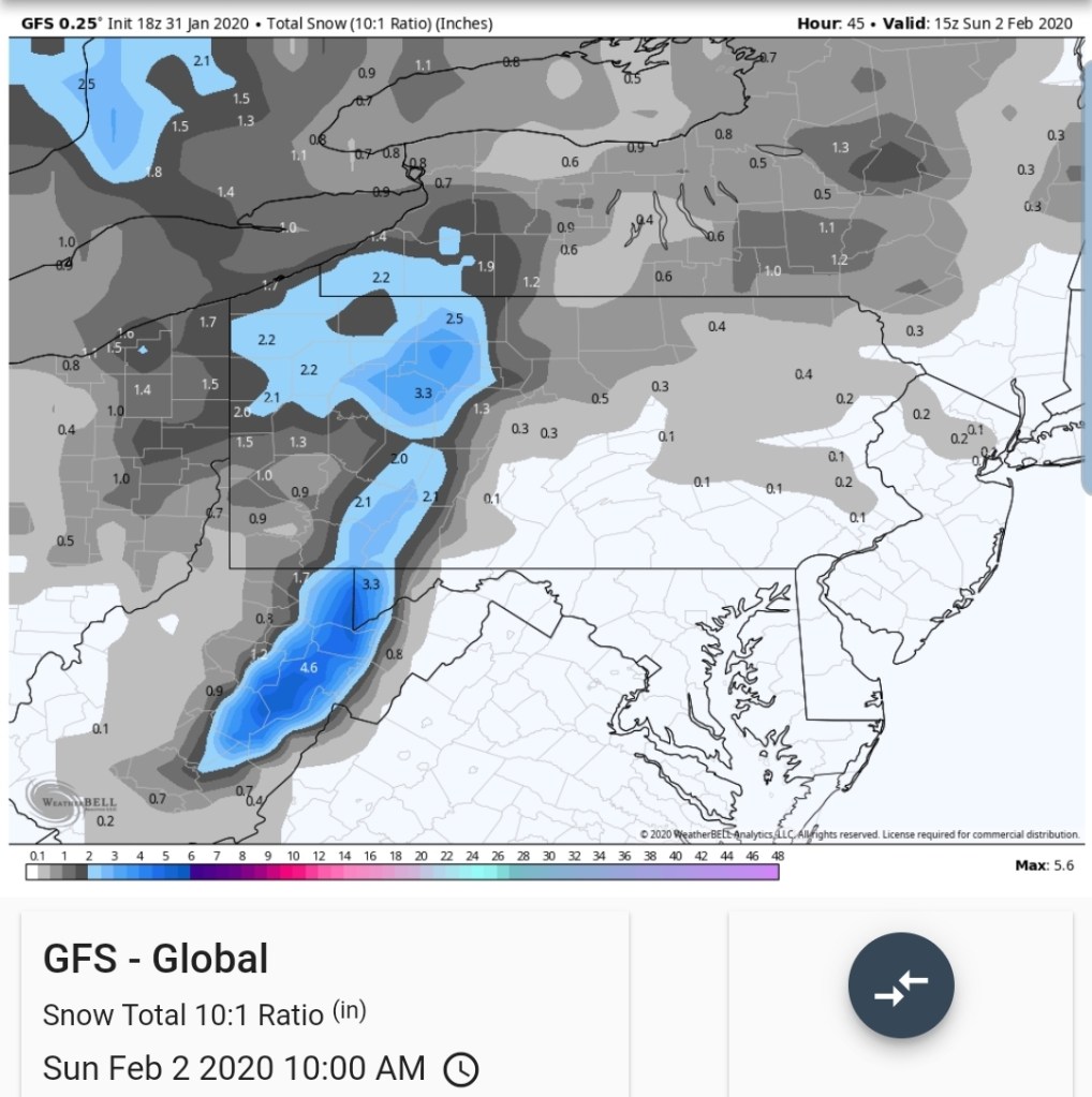
Looking at that, typically I would lean 1800-2500 1-3″, 2500-3500 2-4″, 3500’+ 3-6″ .With a strong leaning as always towards the low end, especially below 3500′ with onset temps, then with a good performance reaching the high end. But, can the models be trusted. It will be interesting tomorrow morning watching them initialize with current conditions.
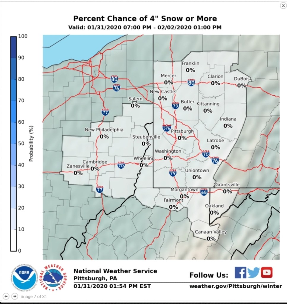
Pitts NWS graphics

With a 0 chance of 4″anywhere
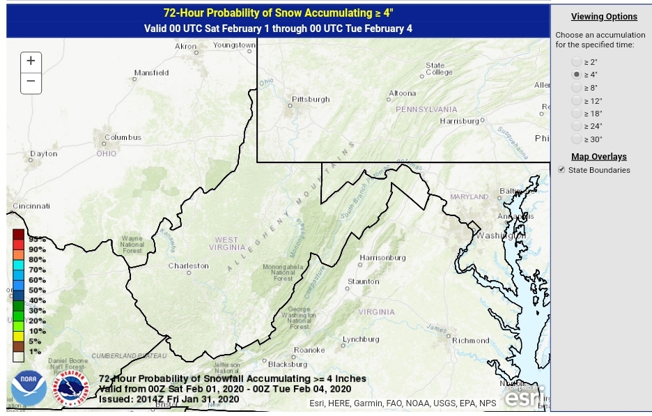
WPC
2″ and 4″

This has been a terrible week in the model world, the NWS world, while their initial snowfall forecast last week before they upped it worked out ok, other days such as mostly sunny all day on Wednesday when barely a glimpse of sun was seen in most areas. I do not recall a period as of late where the models have been this unreliable. They are unreliable enough, its almost a misrepresentation posting them.
Some disagreements I’d have with the Pitt discussion and this has been a repeated thing many times … precipitating with colder 850s pushing in does not lead to any diurnal warming across the high ground. Besides, colder air aloft moves in during the daytime, its mildest overnight and in the morning hours.

However this does play out through Sunday morning whether there is 1″ or 3″, or more in spots, it will be a rapid goodbye as temps mild up Sunday to upper 30s lower 40s, and 50s Monday. Monday does have low dewpoints yet,,but gusty winds. Temps remain up through Thursday with a chance at a day or 2 with slightly lower temps with cooler bit still above seasonal air fighting from the north. That wins out late week.