January 2, 2019
Jan 2(Thurs)
A beautiful sunrise and increasing cloudiness and milder through the day. Pockets of light rain late.
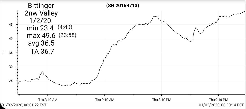
Bittinger 2nw Valley
MIN[23.4]—MAX[49.6]—AVERAGE MEAN[36.5]—TRUE AVERAGE[36.7]—PRECIP[0]7am
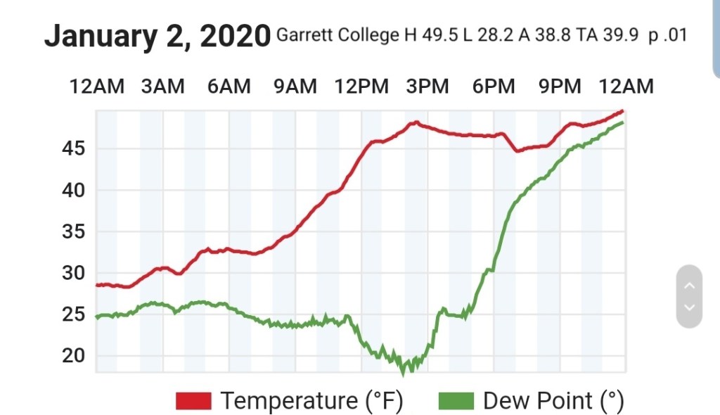
Garrett College
MIN[28.2]—MAX[49.5]—AVERAGE MEAN[38.8]—TRUE AVERAGE[39.9]—PRECIP[.01]
Canaan Heights/Davis 3SE
MIN[28.0]—MAX[47.0]—AVERAGE MEAN[37.5]—PRECIP[T]
Snowfall season to date 28.6″
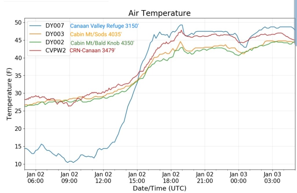
Climate Reference Network Canaan
MIN[26.3]—MAX[47.8]—AVERAGE MEAN[37.0]—TRUE AVERAGE[38.6]—PRECIP[0]

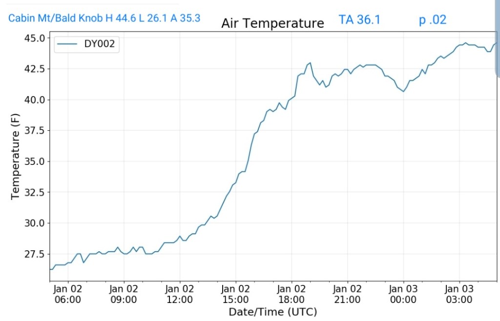
Cabin Mt at Bald Knob
MIN[26.1]—MAX[44.6]—AVERAGE MEAN[35.3]—TRUE AVERAGE[36.1]—PRECIP[.02]
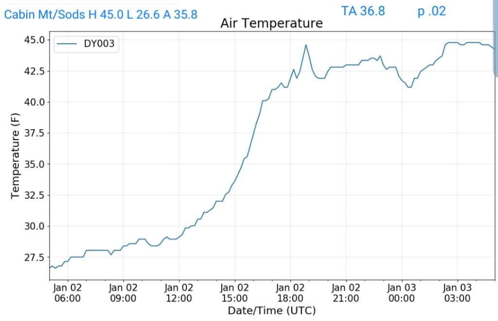
Cabin Mt-Western Sods
MIN[26.6]—MAX[45.0]—AVERAGE MEAN[35.8]—TRUE AVERAGE[36.8]—PRECIP[.02]
Spruce Knob
MIN[23.9]—MAX[41.9]—AVERAGE MEAN[32.9]—TRUE AVERAGE[34.1]—PRECIP[0]

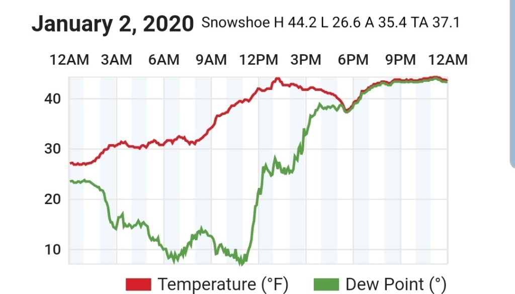
Snowshoe
MIN[26.6]—MAX[44.2]—AVERAGE MEAN[35.4]—TRUE AVERAGE[37.1]
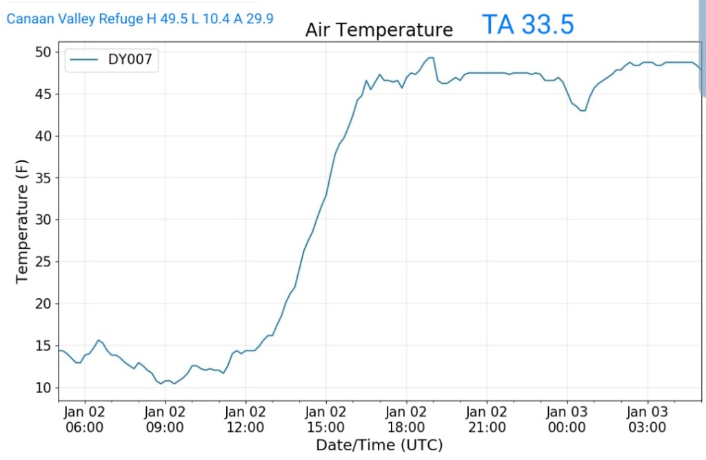
Canaan Valley Refuge
MIN[10.4]—MAX[49.5]—AVERAGE MEAN[29.9]—TRUE AVERAGE[33.5]
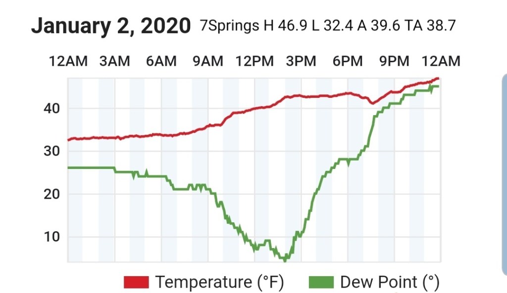
7Springs
MIN[32.4]—MAX[46.9]—AVERAGE MEAN[39.6]—TRUE AVERAGE[38.7]
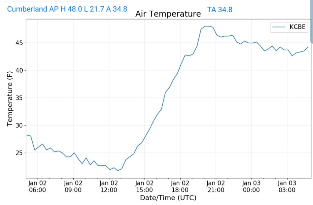
Cumberland Airport
MIN[21.7]—MAX[48.0]—AVERAGE MEAN[34.8]—TRUE AVERAGE[34.8]
The Valley vs Cabin Mt


Canaan area temps
Comparison view

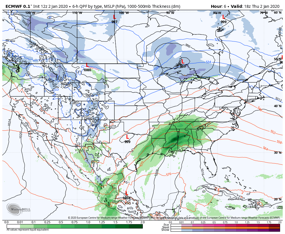
RTMA
Radar
Satellite
Flow
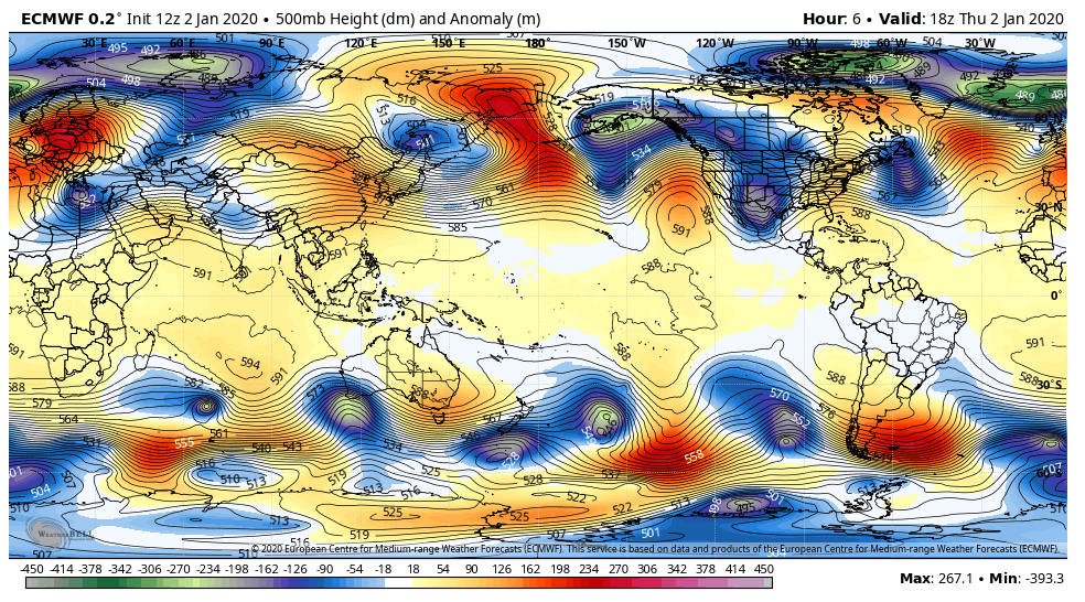
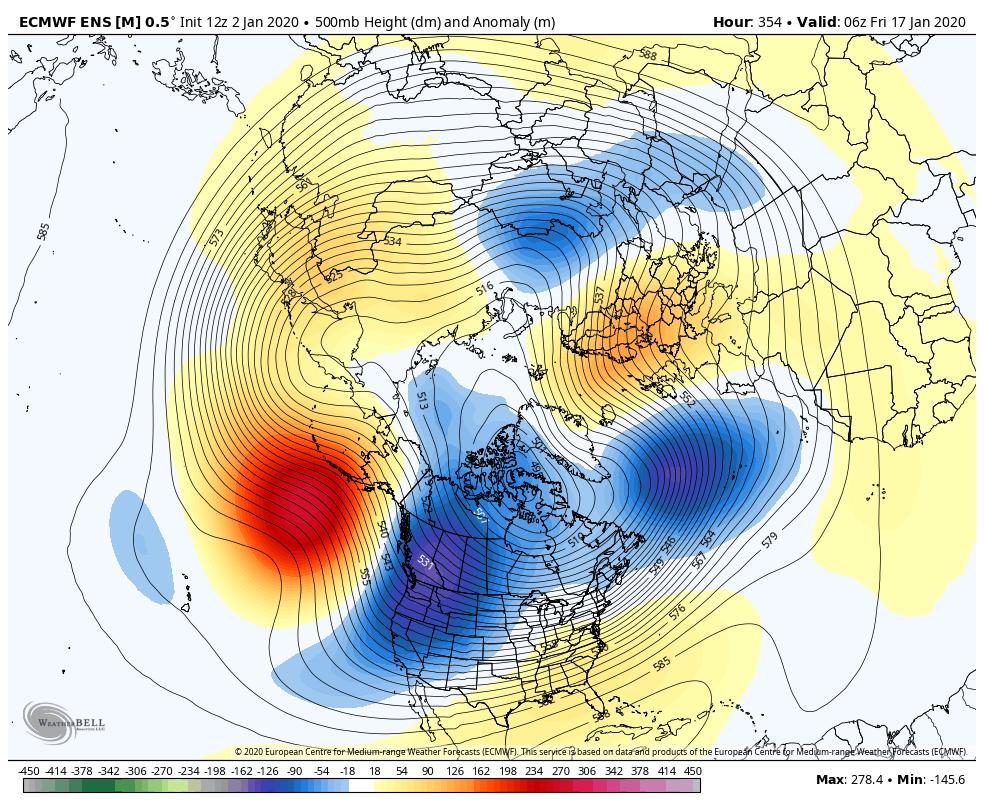
Surface features and 500mb height anomalies and flow
Pics today
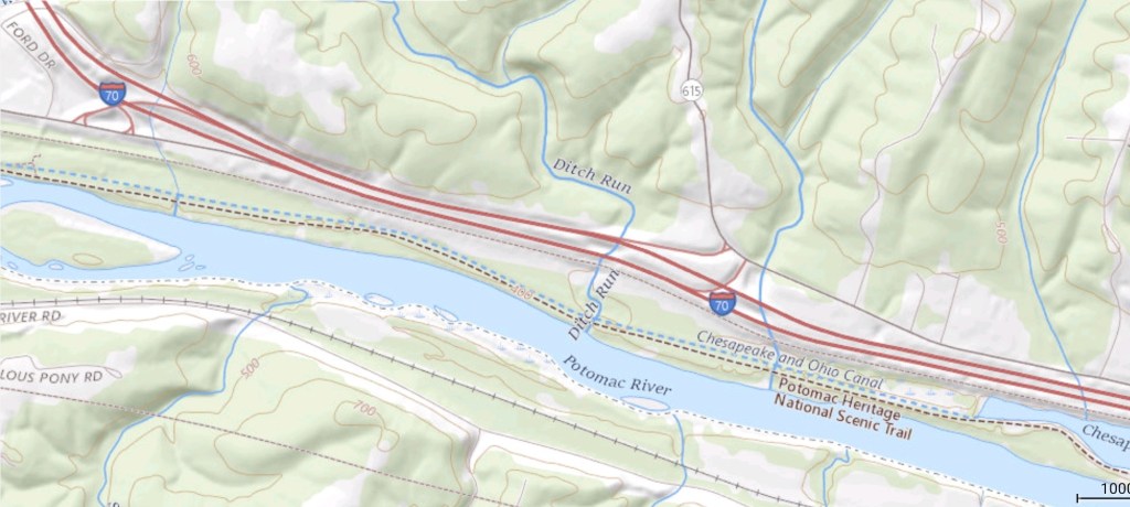
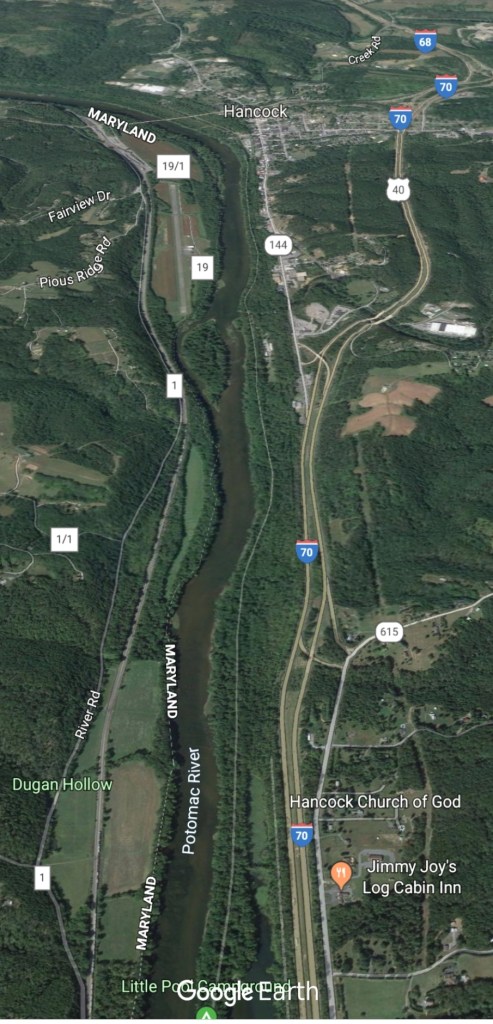
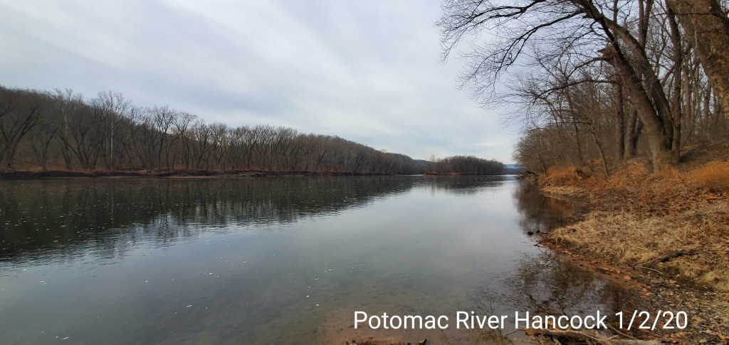
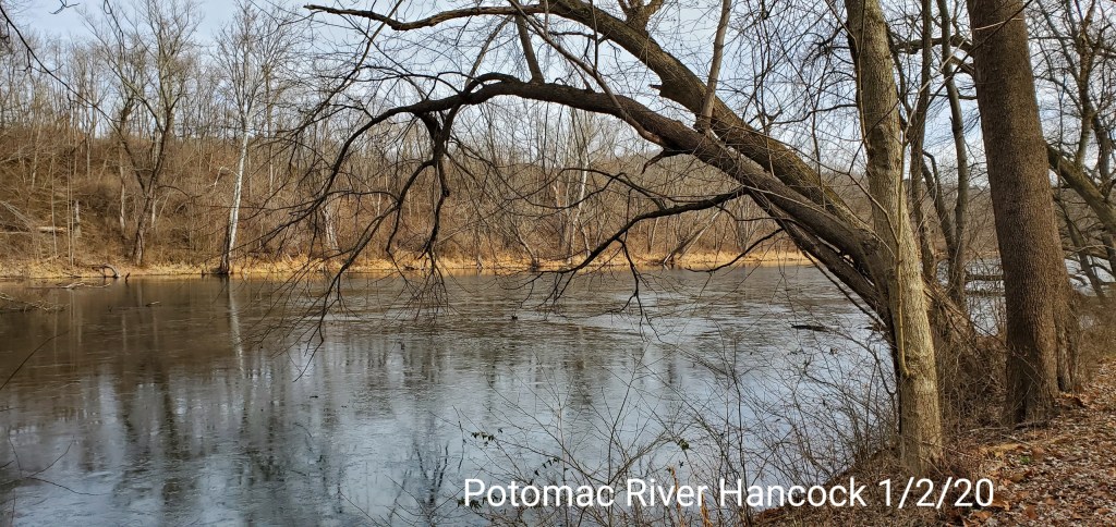
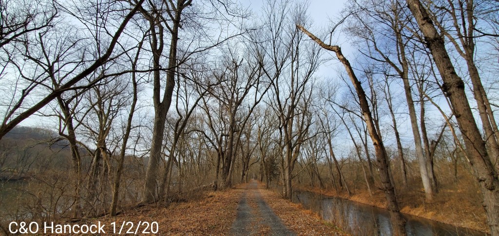
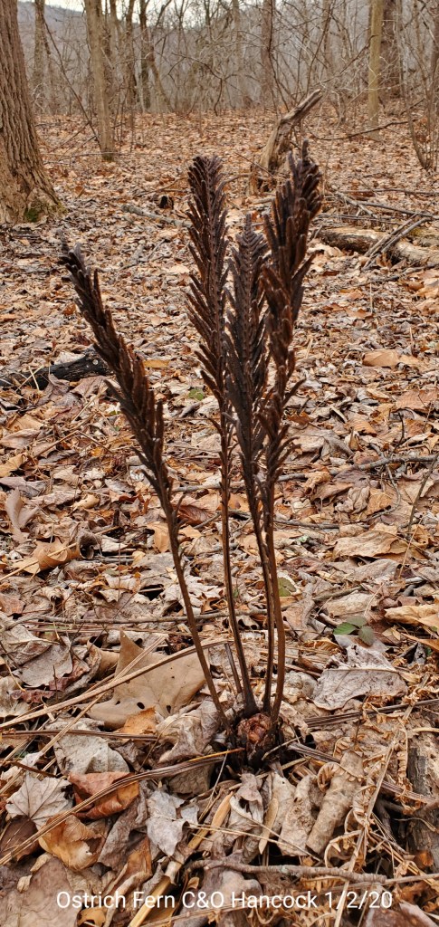
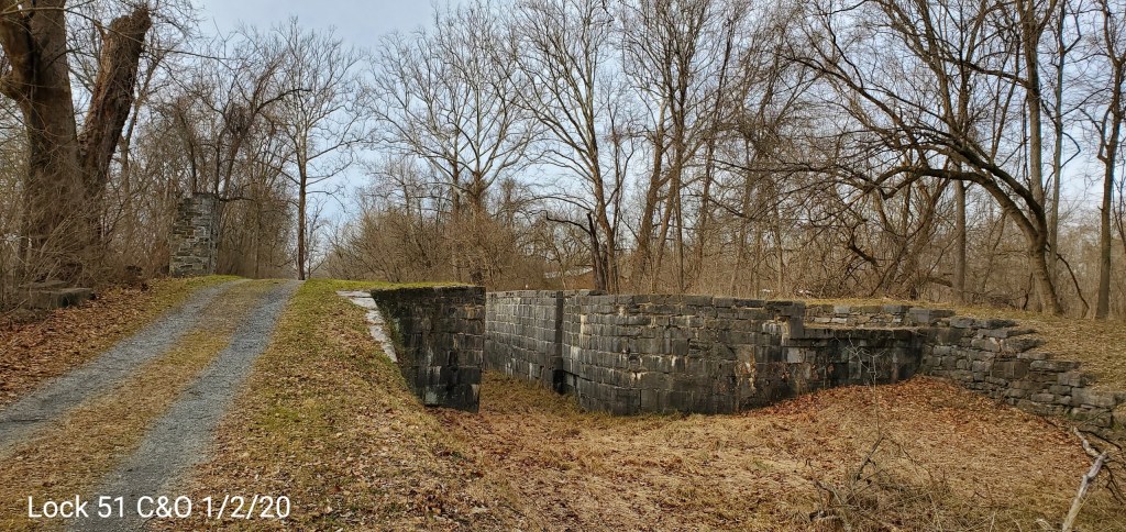
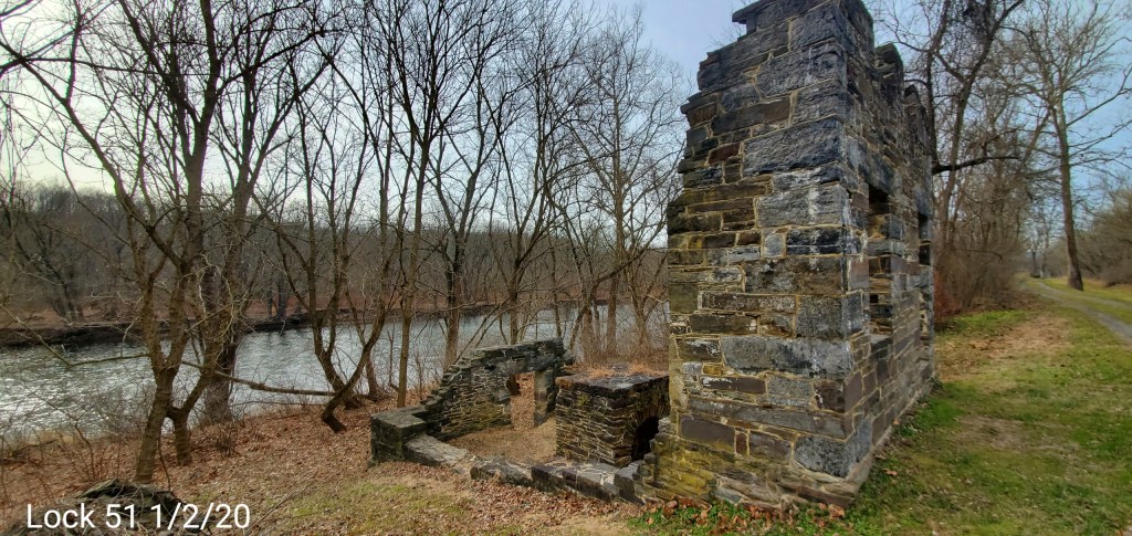
C&O Canal Hancock
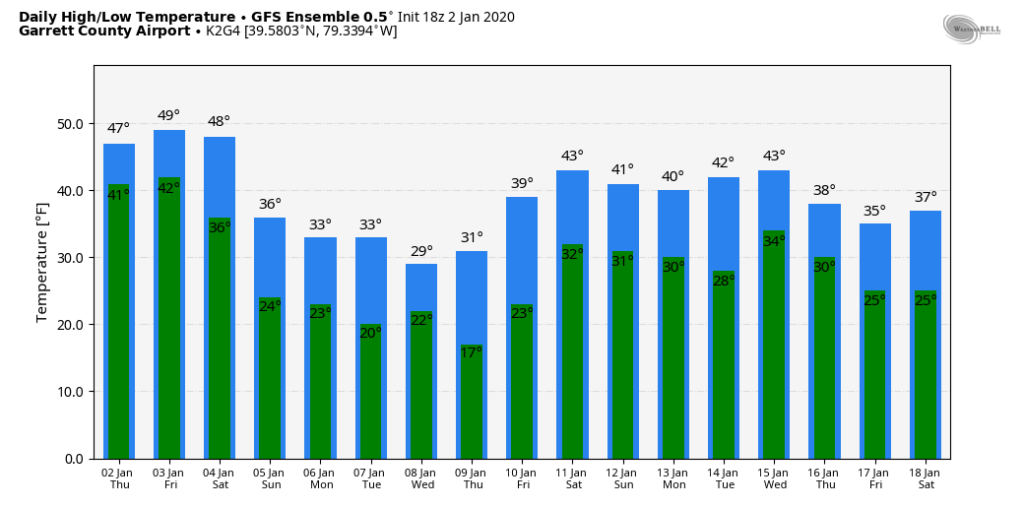
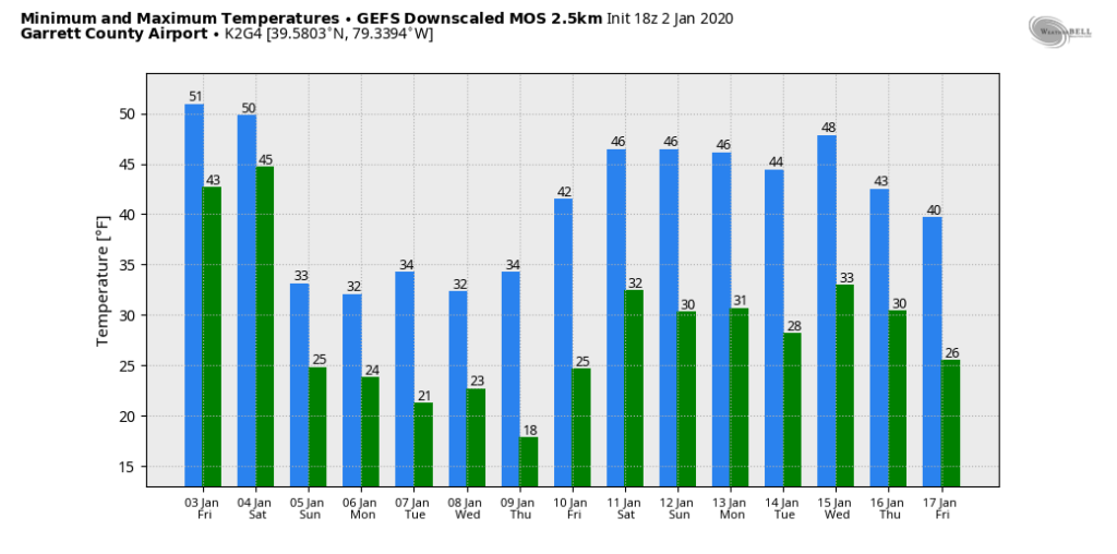
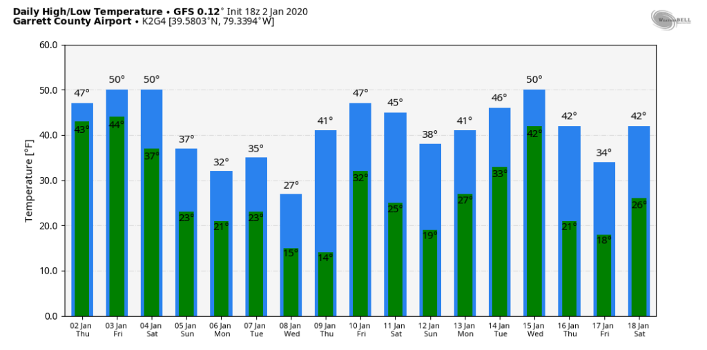
The 5th to 9th window remains open. 2 potential snow systems. 1- Saturday night/Sunday morning with an additional piece of energy Sunday night. How fast changeover occurs from rain to snow, available moisture and speed of the system will impact overall amounts. Several inches definently possible, especially above 3000′. Early call 3-6″ above 3000′, 2-4″ above 2500-3000, 1-3″ under 2500′ …expect tweaks.
System 2 comes in mid week- and details are sketchy yet on that. After at system passes, that’s when snow lovers need to bury there heads a little while. The trough west, ridge east theme dominates. This isn’t a shocker, and all signs have strongly pointed this way for awhile.
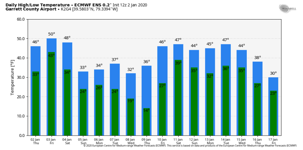
Temps off the 12z ECMWF ensemble mean. 12z GEFS mos, 12z GFS op, 12z GFS ensemble for Garrett. That 4-5 day window is it. Then beyond that, likely these temp numbers will be under done a few days. Likely a few 55°-60° days will show up.
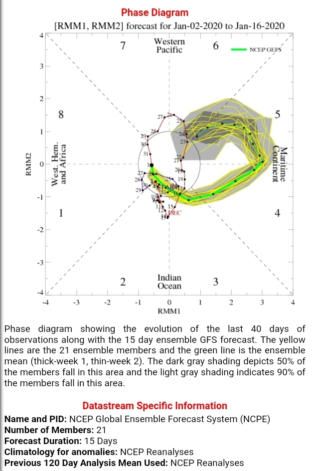
the MJO remain ugly

the theme of the 500mb height anomalies through the period hold to this look, that’s ugly
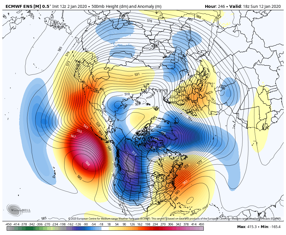
Then at 354, still ugh, but that is some improvement. The trough leans positive and the ridge pokes into Alaska some. That can finally feed some cold back in, in yet a overall mild pattern.
12z ECMWF 2m temp anomalies
12z ECMWF control
12z GEFS
Teleconnections are still unfavorable as well. …
