January 3, 2019
Jan 3(Fri)
A rainy day, mainly on the lighter side. Mild temps, both day and night due to the cloud cover and light winds.
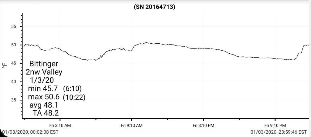
Bittinger 2nw Valley
MIN[45.7]—MAX[50.6]—AVERAGE MEAN[48.1]—TRUE AVERAGE[48.2]—PRECIP[.11]7am
*first date since late October that a daily min failed to drop below 40°
Snowfall season to date 21.3″
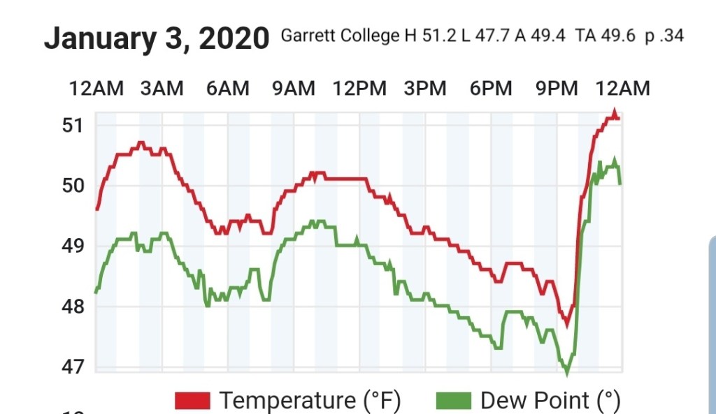
Garrett College
MIN[47.7]—MAX[51.2]—AVERAGE MEAN[49.4]—TRUE AVERAGE[49.6]—PRECIP[.34]
Canaan Heights/Davis 3SE
MIN[46.0]—MAX[49.0]—AVERAGE MEAN[47.5]—PRECIP[.30]7am
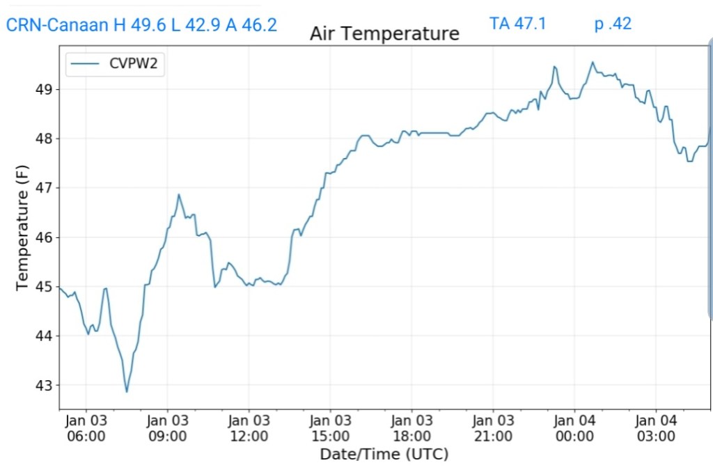
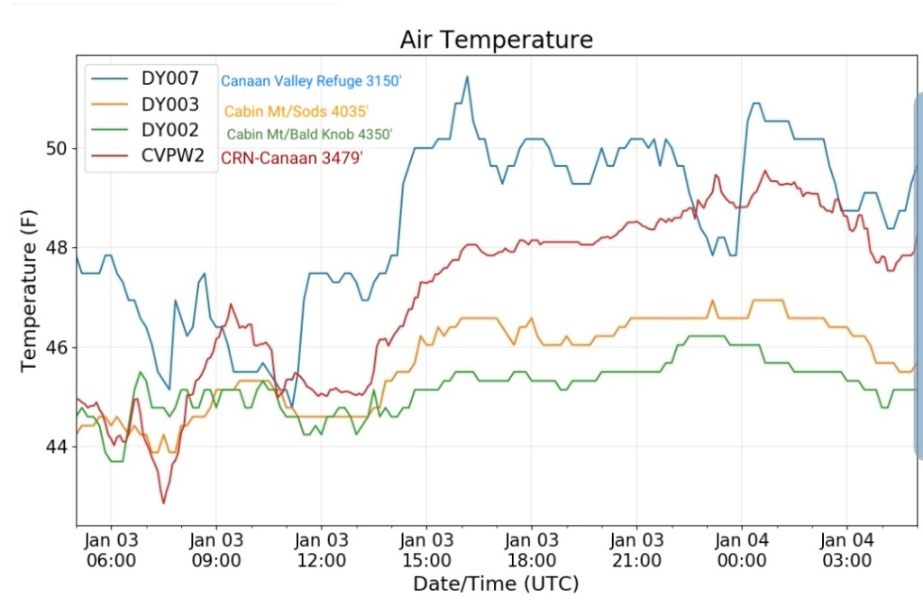
Climate Reference Network Canaan
MIN[42.9]—MAX[49.6]—AVERAGE MEAN[46.2]—TRUE AVERAGE[47.1]—PRECIP[.42]
Cabin Mt at Bald Knob
MIN[43.9]—MAX[46.2]—AVERAGE MEAN[45.0]—TRUE AVERAGE[45.3]—PRECIP[.45]

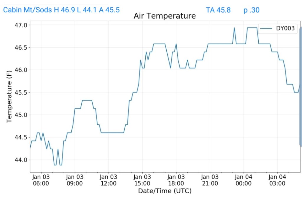
Cabin Mt-Western Sods
MIN[44.1]—MAX[46.9]—AVERAGE MEAN[45.5]—TRUE AVERAGE[45.8]—PRECIP[.30]
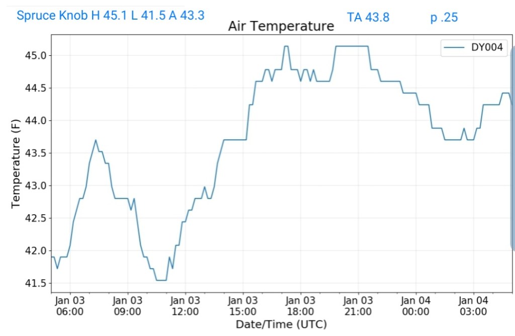
Spruce Knob
MIN[41.5]—MAX[45.1]—AVERAGE MEAN[43.3]—TRUE AVERAGE[43.8]—PRECIP[.25]
Snowshoe
MIN[43.0]—MAX[45.9]—AVERAGE MEAN[44.9]—TRUE AVERAGE[44.7]

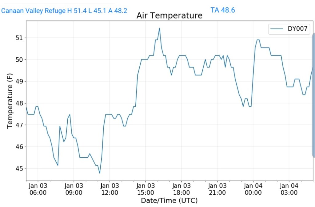
Canaan Valley Refuge
MIN[45.1]—MAX[51.4]—AVERAGE MEAN[48.2]—TRUE AVERAGE[48.6]
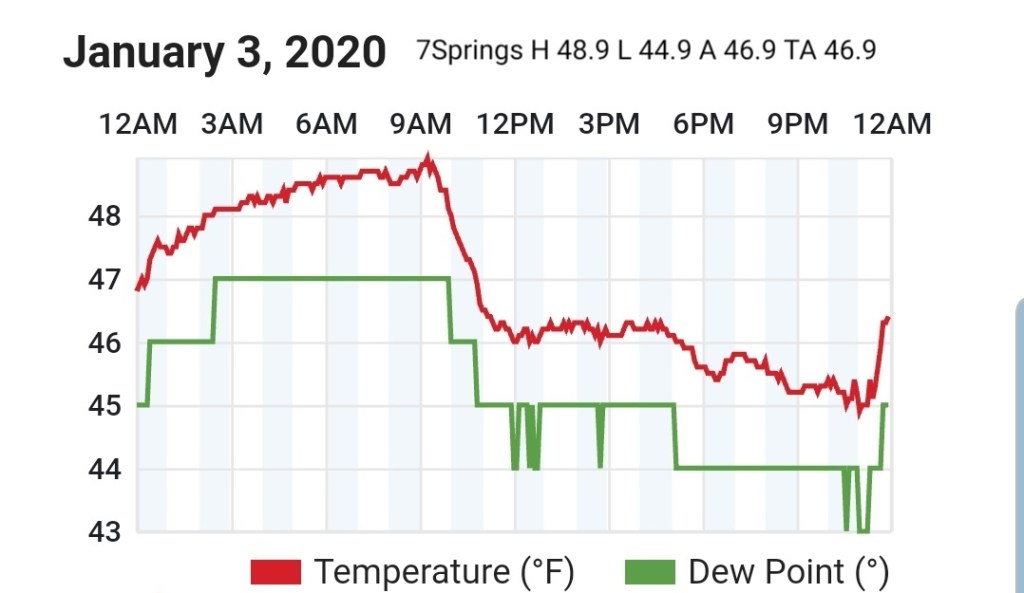
7Springs
MIN[44.9]—MAX[48.9]—AVERAGE MEAN[46.9]—TRUE AVERAGE[46.9]
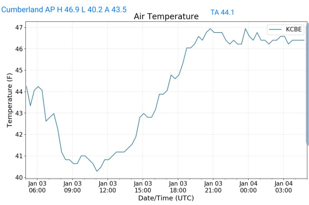
Cumberland Airport
MIN[40.2]—MAX[46.9]—AVERAGE MEAN[43.5]—TRUE AVERAGE[44.1]
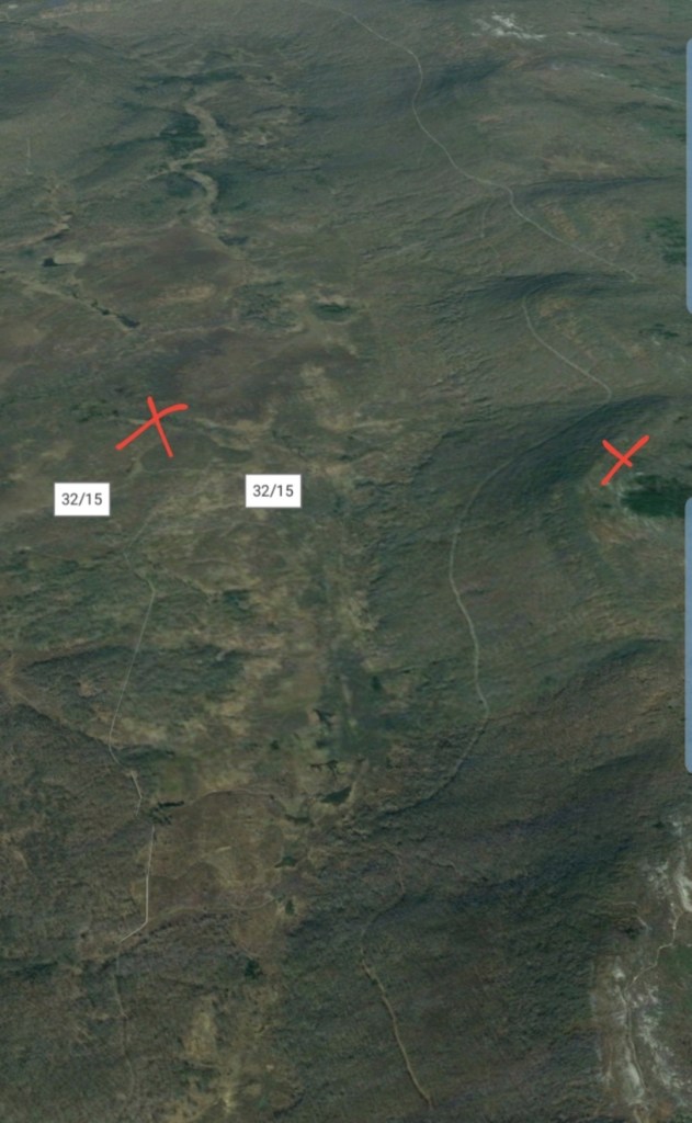
The Valley vs Cabin Mt

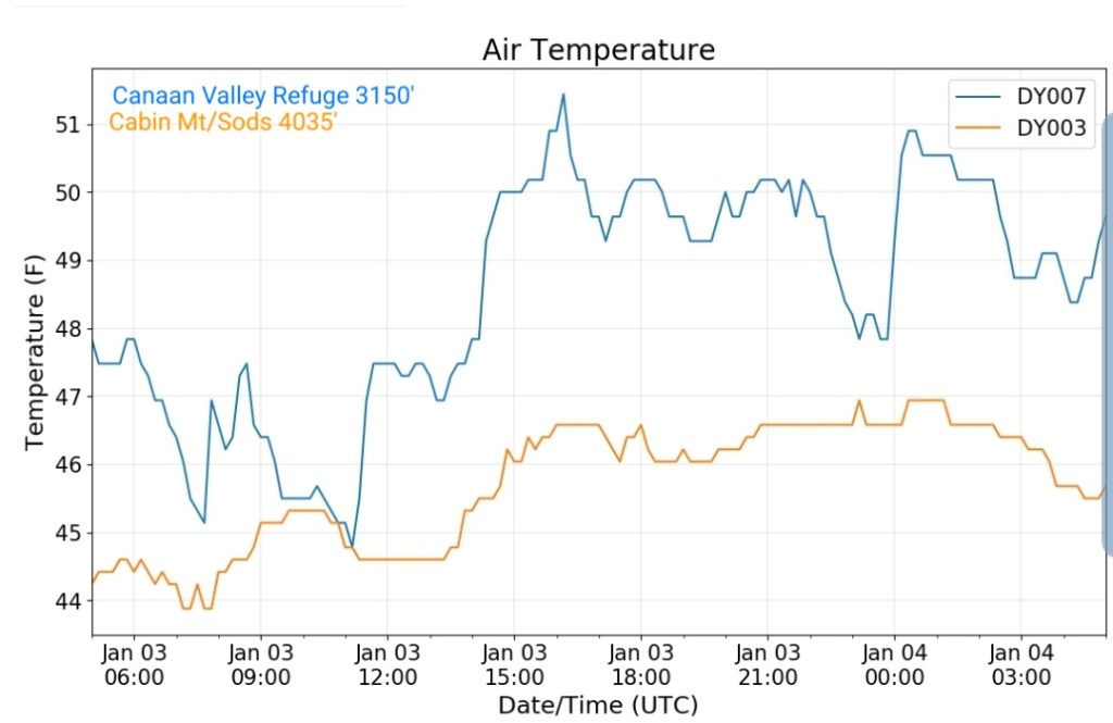
Canaan area temps

RTMA
Radar
Satellite
Flow
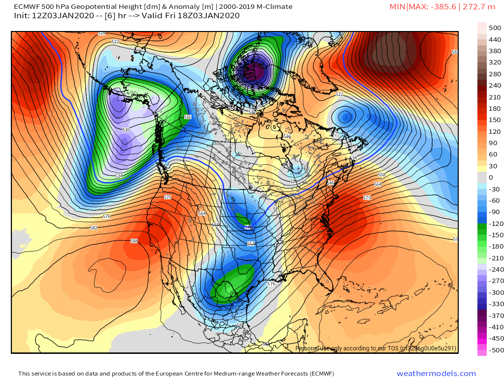
Surface features and 500mb height anomalies and flow
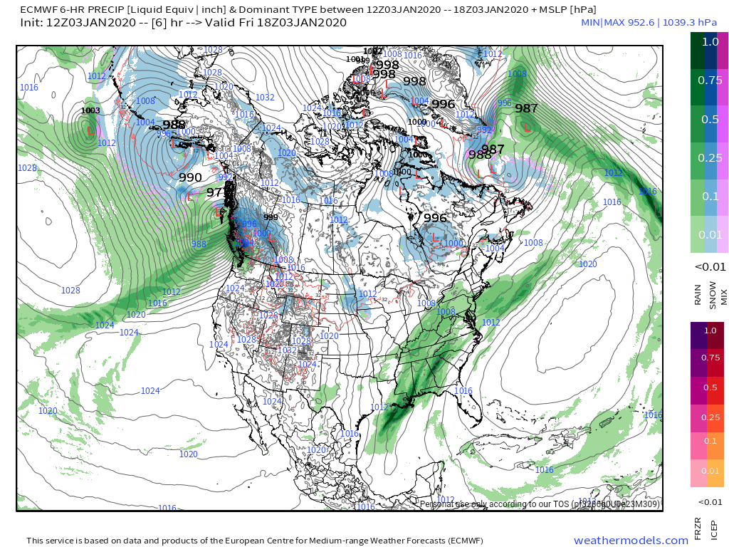
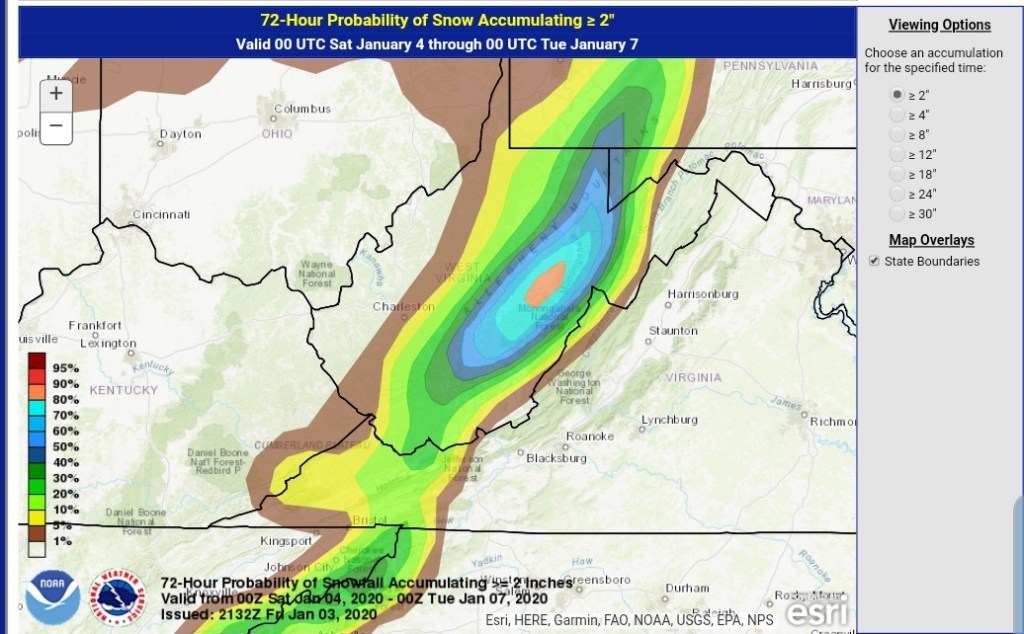
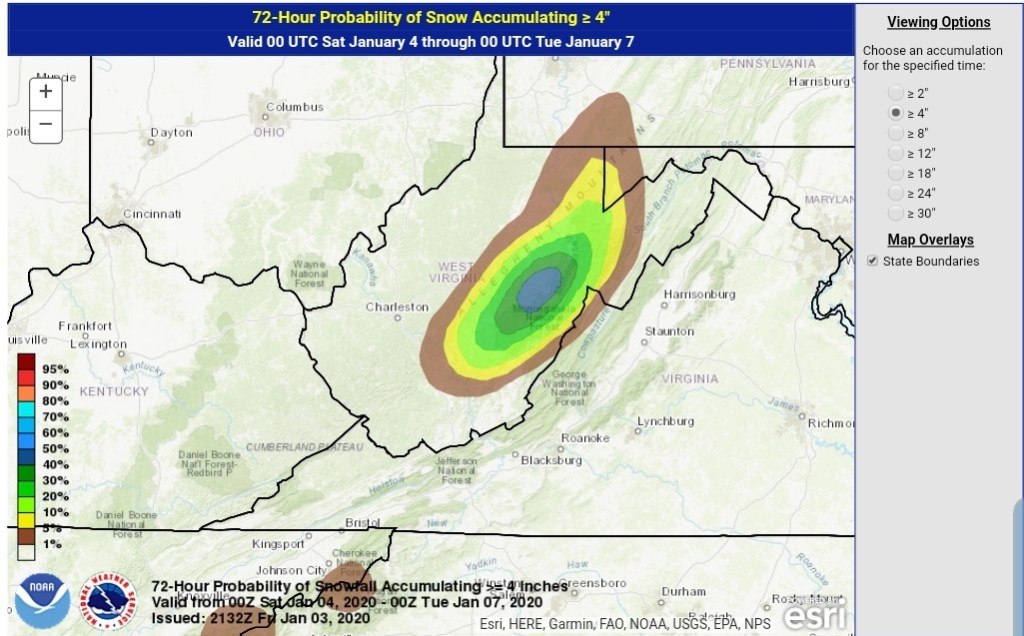
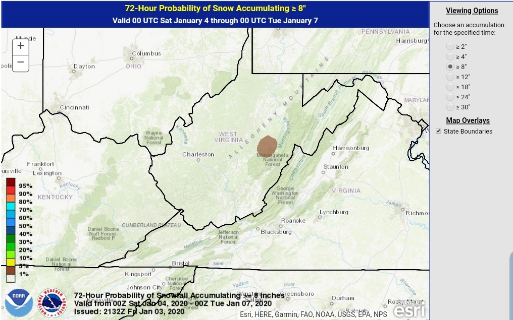
Cold air settles back in late tomorrow, rain goes over to snow in the evening and begins to accumulate, especially after nightfall across the high ground. Snow continues into Sunday a.m before stopping. Temps 26-33 through the event depending on elevation and location. The higher the colder and slightly better ratios. Overnight Sunday with a second surge of colder air, another brief bout of snow may add some light additional accumulation .
Snowfall amounts looks to be
Through midday Sunday-
Lean low to mid range and a good performance can put the high end in target.
3500’+ 3-6″
3000-3500′ 2-4″
2500-3000 1-3″
2000-2500 coating to 2″
Under 2000′ inch or less.
A second round comes through midweek with additional accumulation. Some locations across the high ground may end up with 2 of the better snows of the winter in what has been a poor snow season.
Beyond this, the ridge east, trough west pattern really looks to dominate and snow changes are very low, at best briefly on the tail end of a rain system before rapidly warming as it passes by. Temps and dewpoints both look to be up in the coming pattern beyond the 9th. Area resorts really need to take advantage of the colder snow making periods next week, a few optimal nights look to present themselves before the coming lengthy warm spell.
WPC OUTLOOK