January 5, 2019
Jan 5(Sun)
Snow overnight, heavier south. Few flurries left this a.m and there was patchy freezing drizzle. Brief but it existed this morning with temps lower to mid 20s. Breezy today as well. Fog and rime after the snow in some of the high Wv ground .
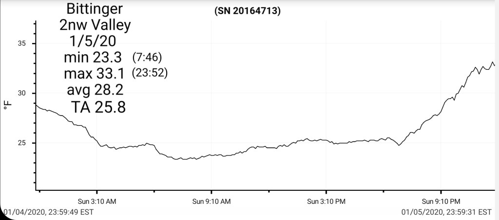
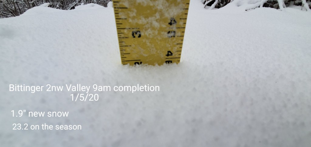
Bittinger 2nw Valley
MIN[23.3]—MAX[33.1]—AVERAGE MEAN[28.2]—TRUE AVERAGE[25.8]—PRECIP[M]
Snowfall 1.9″ new snow
Season to date 23.2
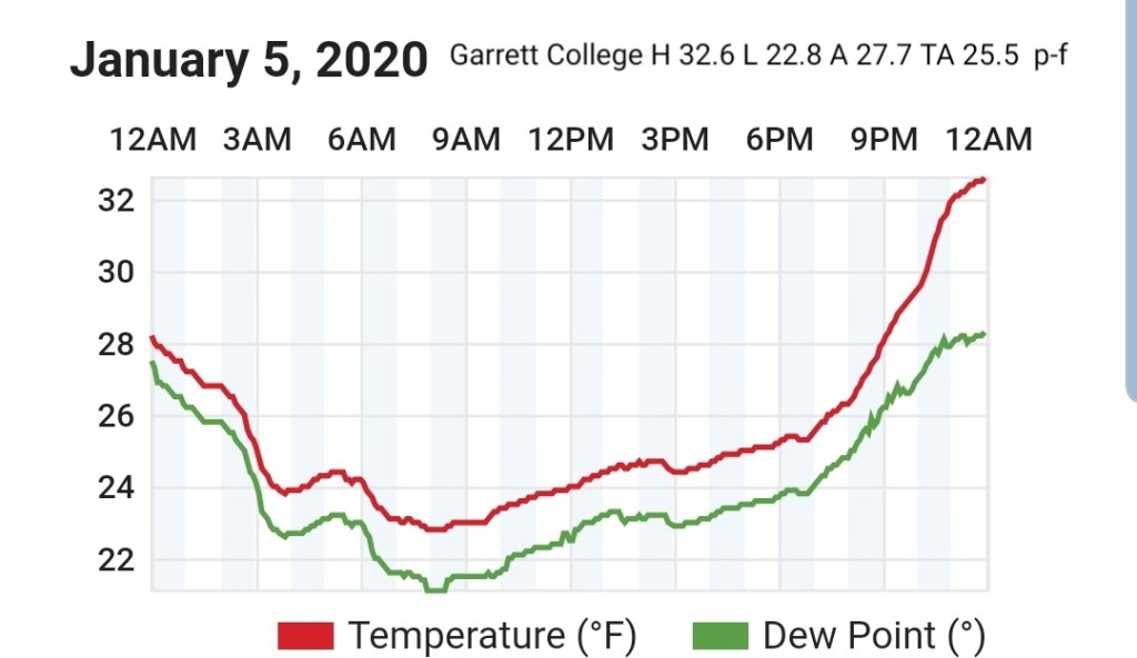
Garrett College
MIN[22.8]—MAX[32.6]—AVERAGE MEAN[27.7]—TRUE AVERAGE[25.5]—PRECIP[F]
Canaan Heights/Davis 3SE
MIN[20]—MAX[27.0]—AVERAGE MEAN[23.5]—PRECIP(.94]
New snowfall 7.8″
Season to date snowfall 36.4″
Comments by Dave Lesher

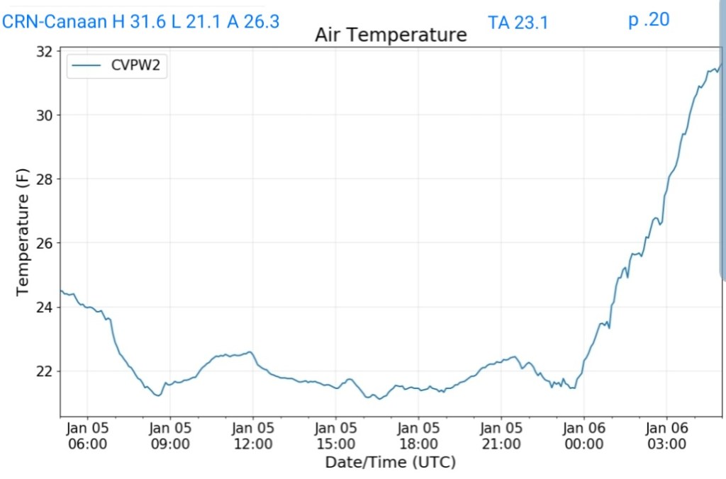
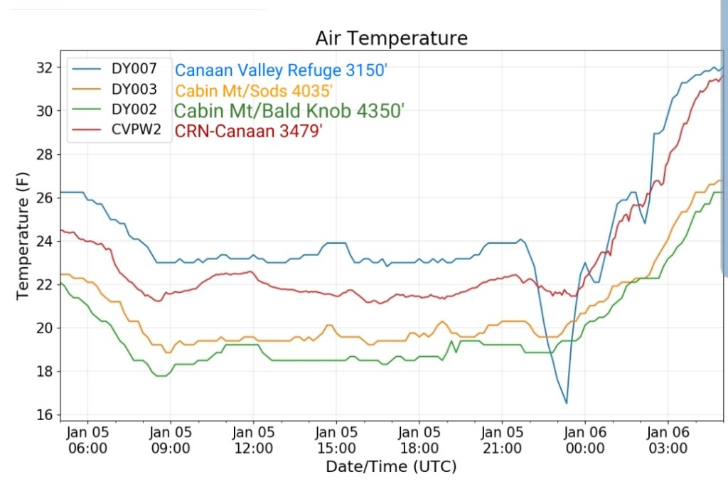
Climate Reference Network Canaan
MIN[21.1]—MAX[31.6]—AVERAGE MEAN[26.3]—TRUE AVERAGE[23.1]—PRECIP[.20]
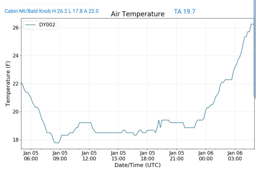
Cabin Mt at Bald Knob
MIN[17.8]—MAX[26.2]—AVERAGE MEAN[22.0]—TRUE AVERAGE[19.7]—PRECIP[F]
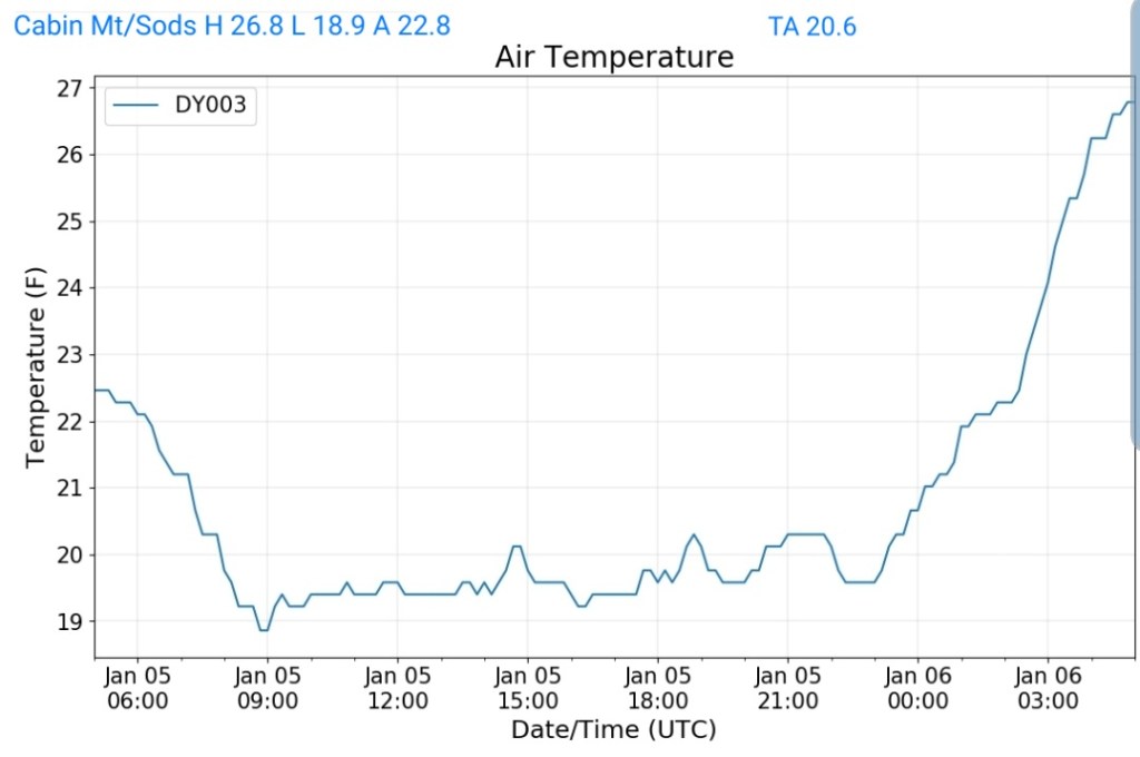
Cabin Mt-Western Sods
MIN[18.9]—MAX[26.8]—AVERAGE MEAN[22.8]—TRUE AVERAGE[20.6]—PRECIP[F]
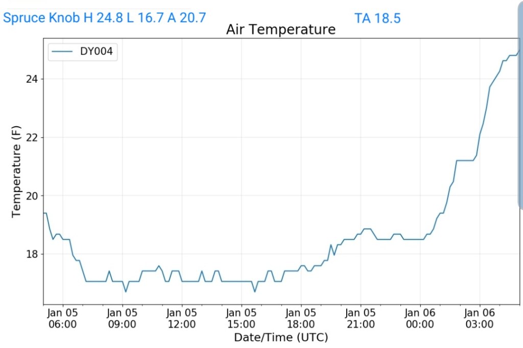
Spruce Knob
MIN[16.7]—MAX[24.8]—AVERAGE MEAN[20.7]—TRUE AVERAGE[18.5]—PRECIP[F]
Snowshoe
MIN[17.2]–MAX[25.7]—AVERAGE MEAN[21.4]—TRUE AVERAGE[19.6]

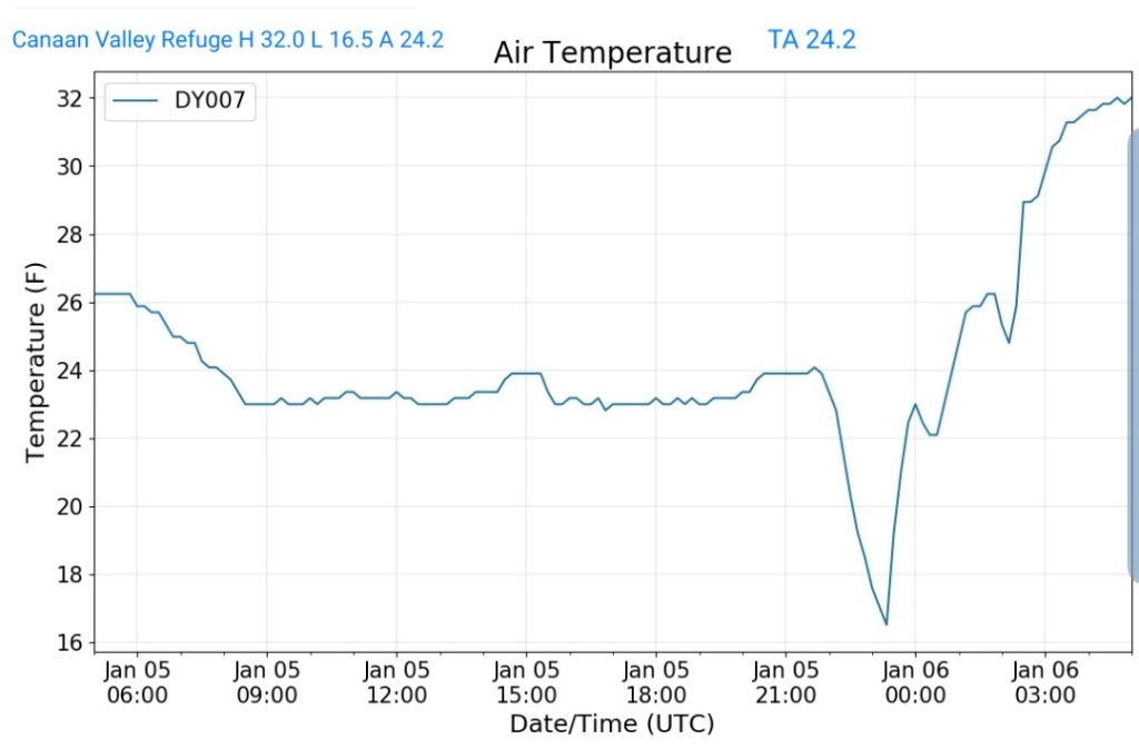
Canaan Valley Refuge
MIN[16.5]—MAX[32.0]—AVERAGE MEAN[24.2]—TRUE AVERAGE[24.2]
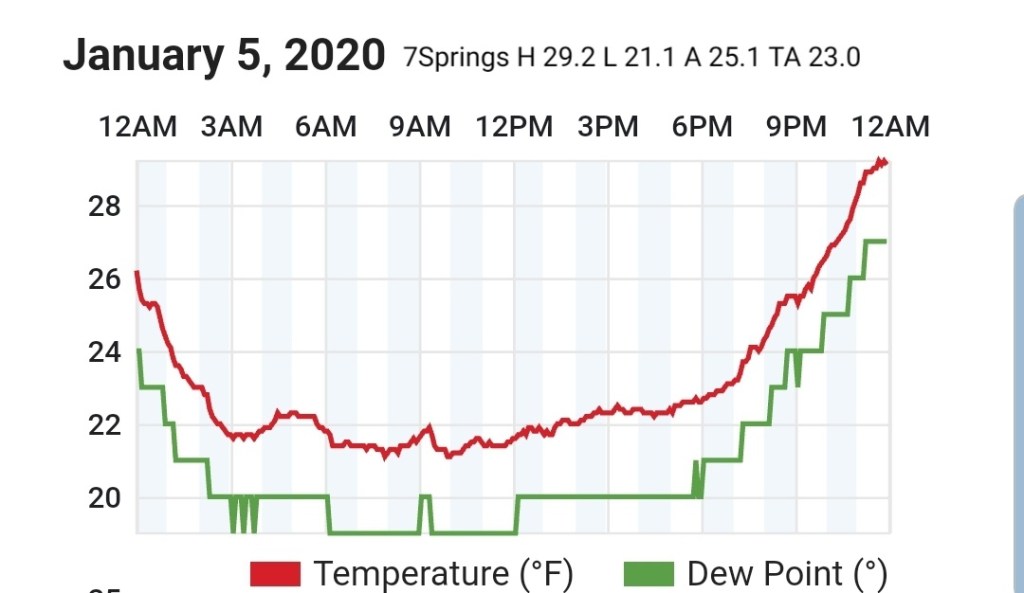
7Springs
MIN[21.1]—MAX[29.2]—AVERAGE MEAN[25.1]—TRUE AVERAGE[23.0]
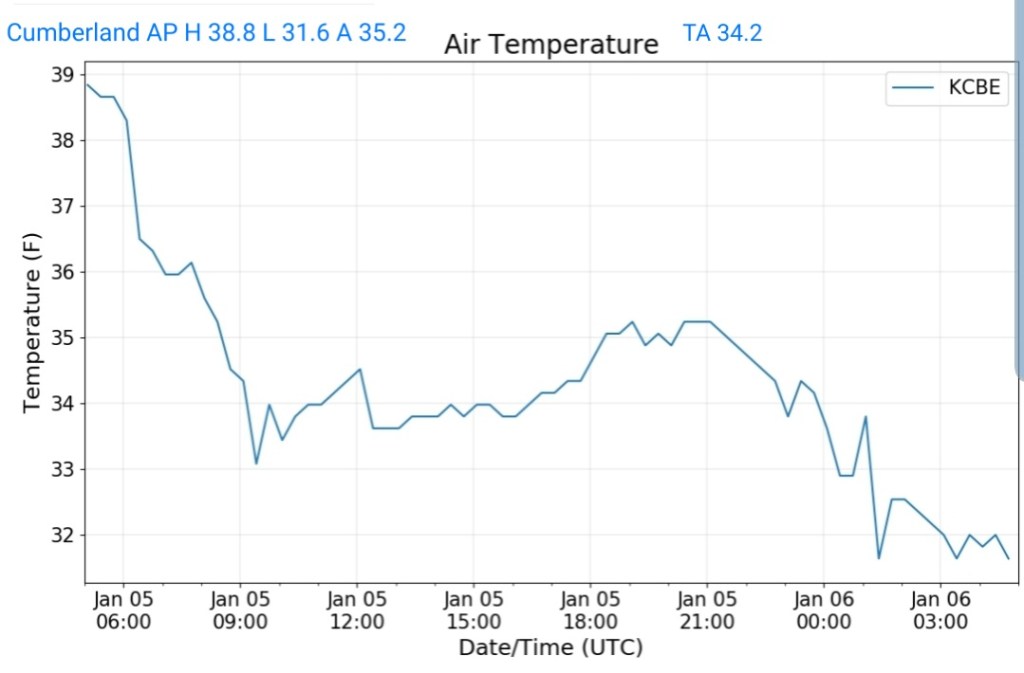
Cumberland Airport
MIN[31.6]—MAX[38.8]—AVERAGE MEAN[35.2]—TRUE AVERAGE(34.2]
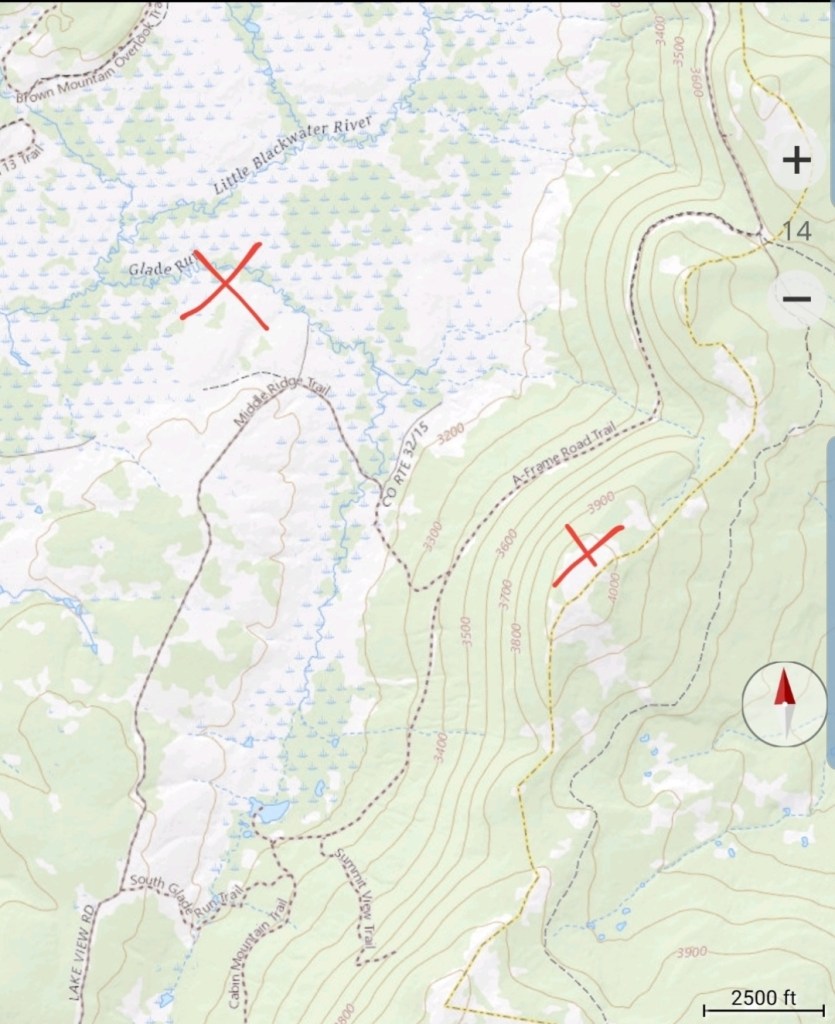
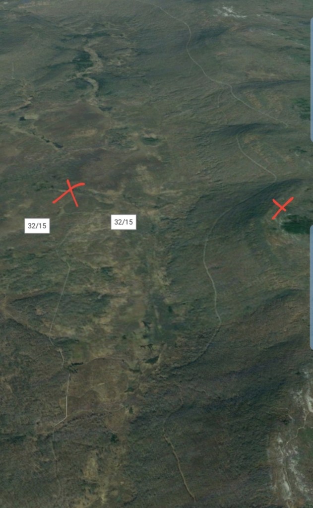
The Valley vs Cabin Mt

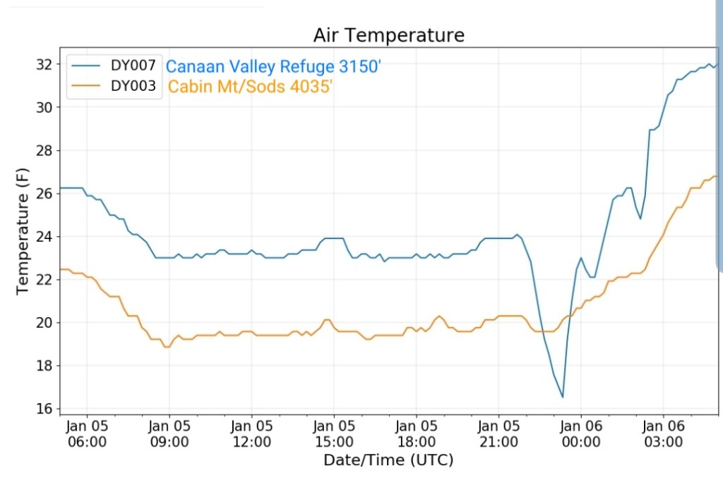
Canaan area temps
Comparison view

RTMA
Radar
Satellite
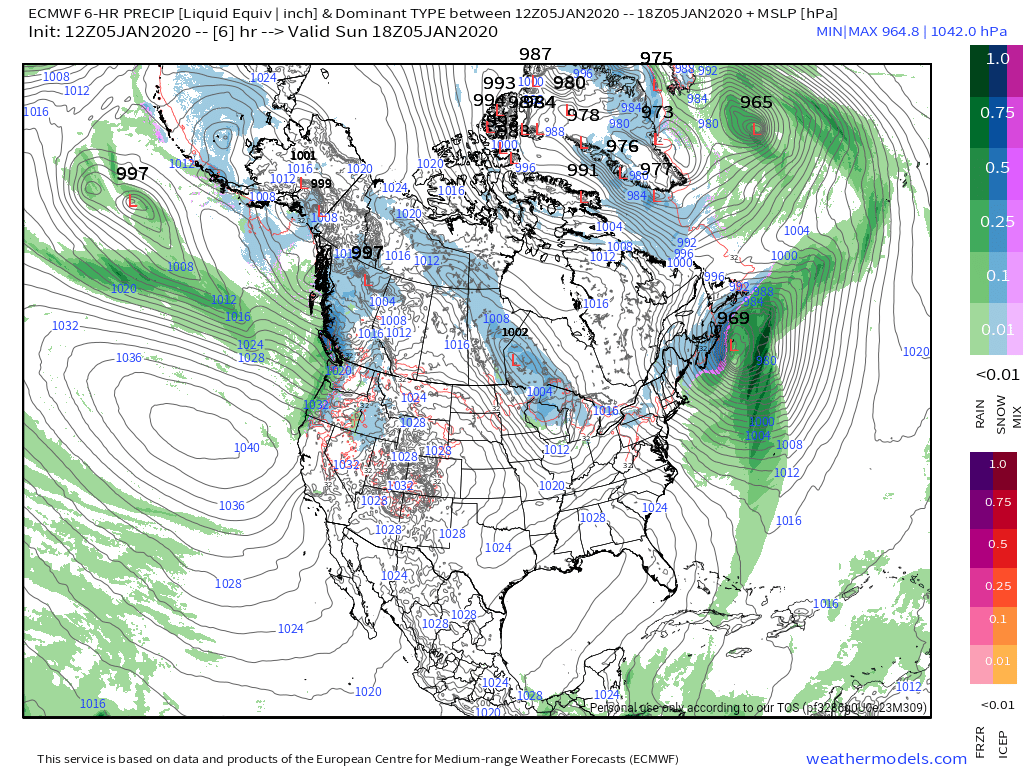
Flow
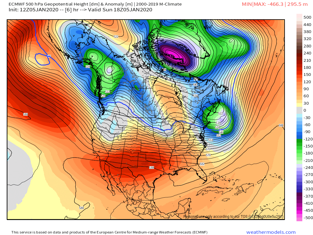
Surface features and 500mb height anomalies and flow
Midday update:
In this small window of winter, for now all is well…..for now…..
Snow totals
Bittinger 2nw Valley 1.9″
McHenry 4.8 SSE 1.5″
Canaan Heights 7.8″
Canaan Valley 4.9″
Mt. Lake Park 2.0″
Terra Alta 4.9NNE 3.1″
Thomas 7.4N 2.6
Snowshoe 4.0″
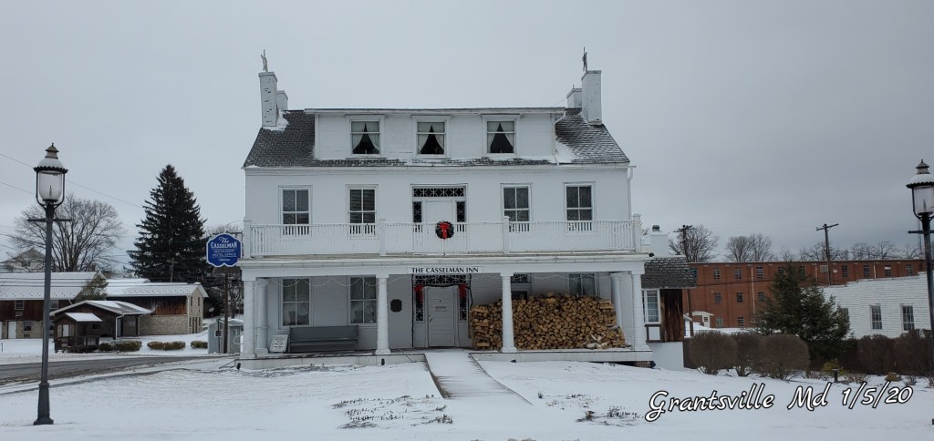
With scenes like this
Near Bittinger, Garrett County 1/5/20

Grantsville 1/5/20
Canaan 1/5/20
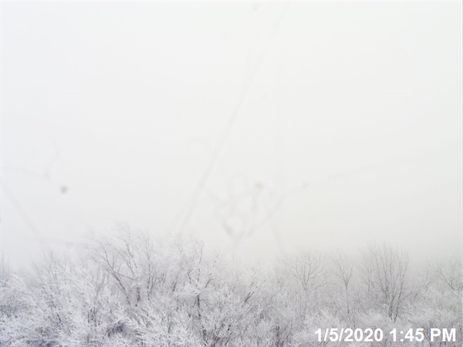
Dolly Sods, WV,Bearden Knob
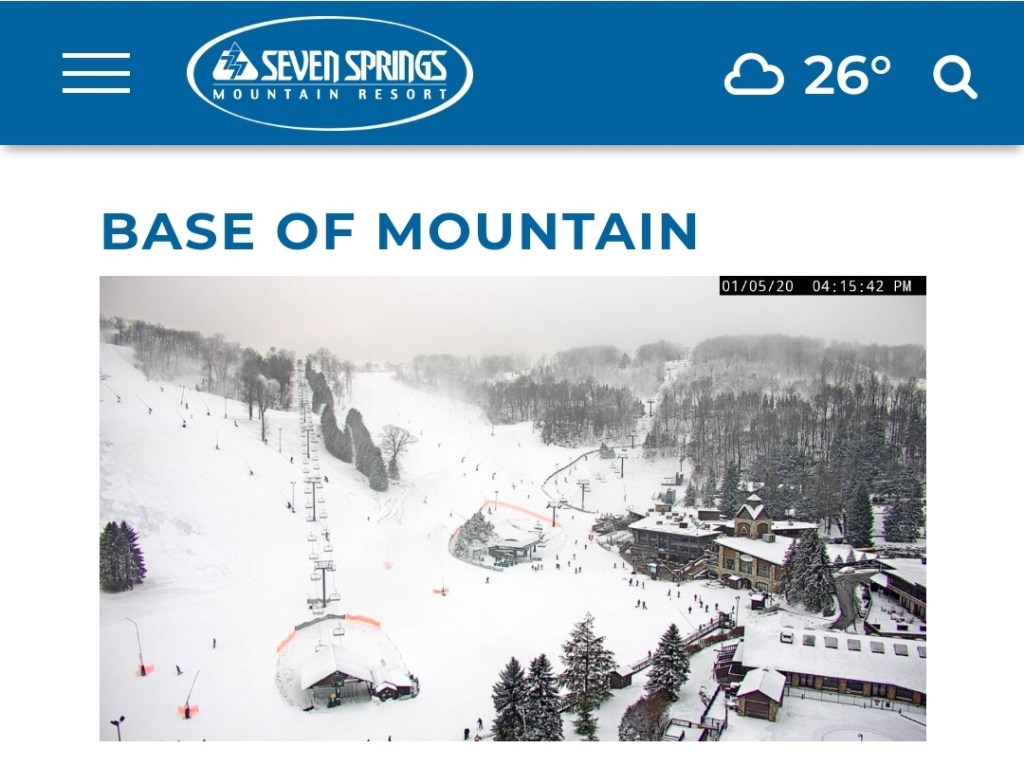
The Resorts
Canaan 4:15pm
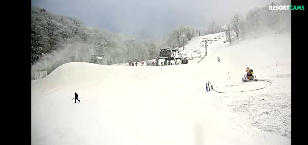
Snowshoe 4:15pm(skies cleared there)
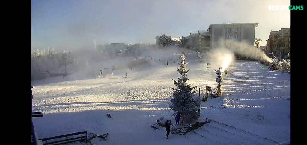
Wisp

7Springs
This 5 day window of winter is beginning great and all looks well…..for now
Over the next few days, it looks even better.
Light snow tonight with the passage of a cold front, additional light accumulations of 1″ of fluff possible in spots.
Then a better organized system looks to come through the area on Tuesday. Tweaks will need to the exact placement of the best axis of snow, but 3-6″ bullseyes look likely with this with 1-3″ outside of that area.
The current ECMWF looks like. This by no means is etched in stone. Expect tweaks.
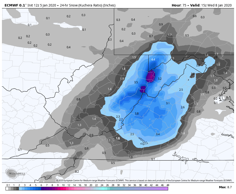
That will carry us to Wednesday night
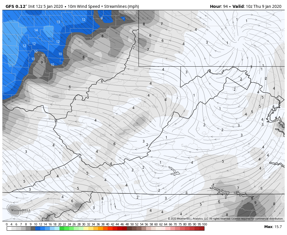
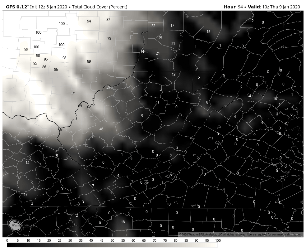
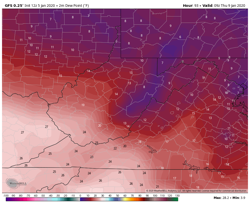
Light winds, clear skies, low dewpoints currently being shown off the models. I prefer the 3km Nam for these details once inside 48 hours. This combo with accompanying snowpack should lead to some possible below 0 readings in the coldest valleys. If any one if these factors are off, that will erase those thoughts.
This comes in ahead of the dreaded SW flow and milder temps late week. A notch up on Thursday and more substantial on Friday into Saturday. That is accompanied by rain.
The dominate pattern beyond Friday looks to be the ridge east, trough west.

NOAAs 8-14 day outlook
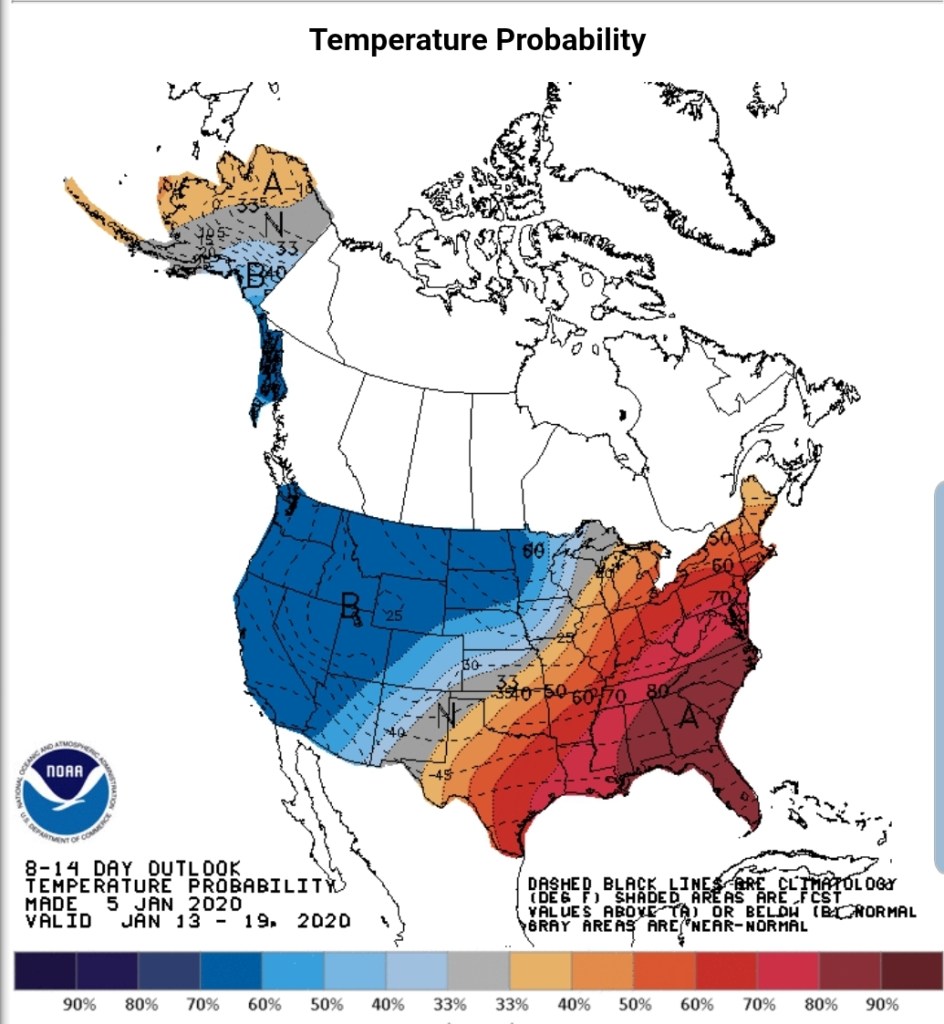
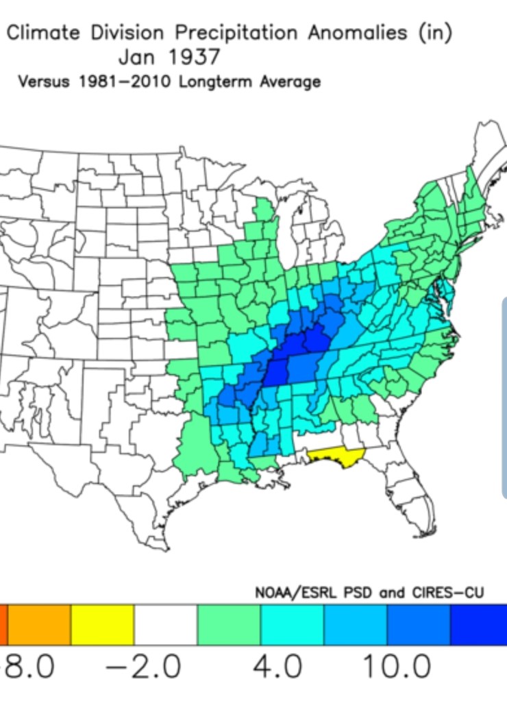
another 37 look??
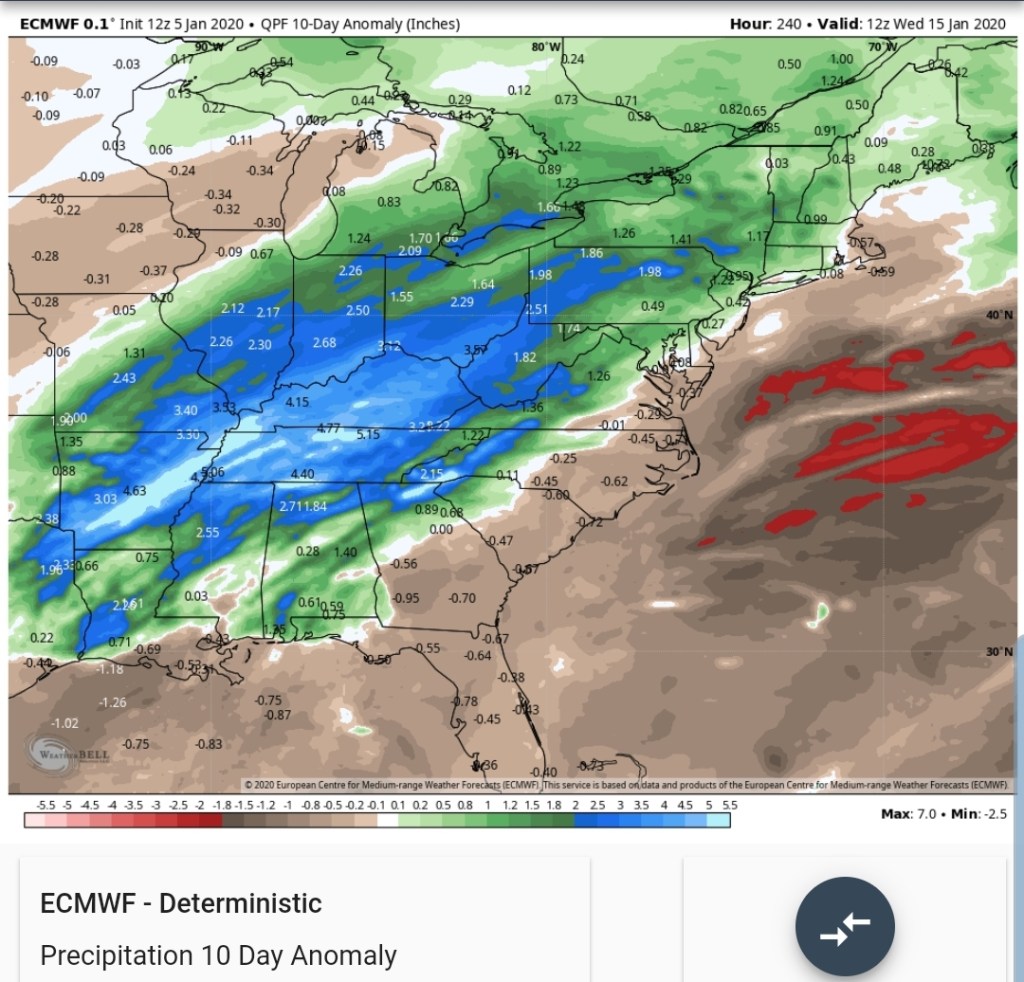
Upcoming 10 day precip anomalies off the ECMWF
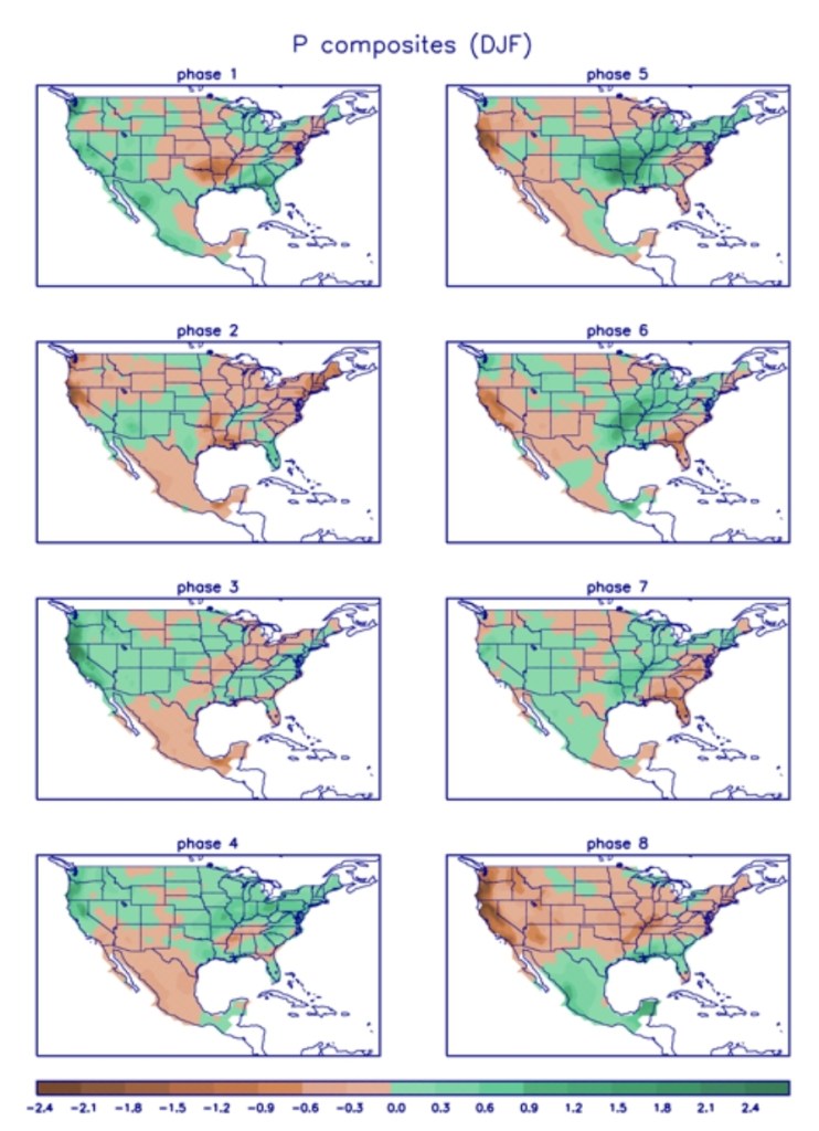
The MJO
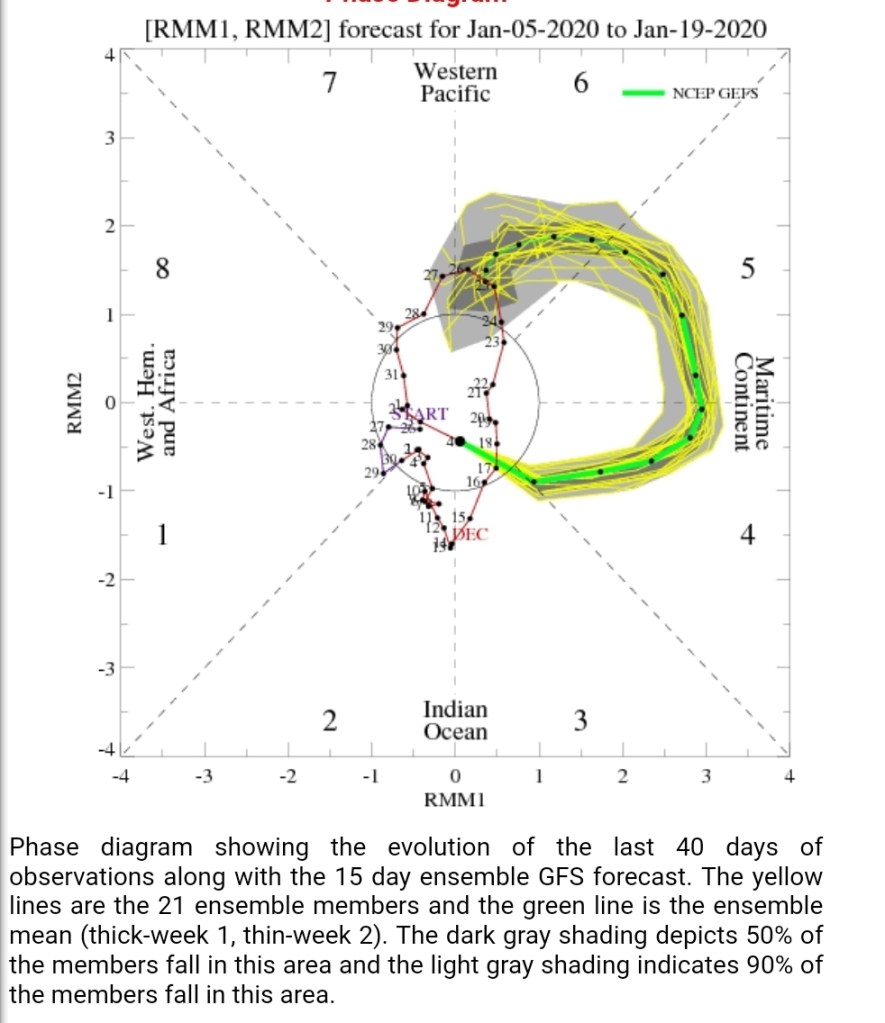
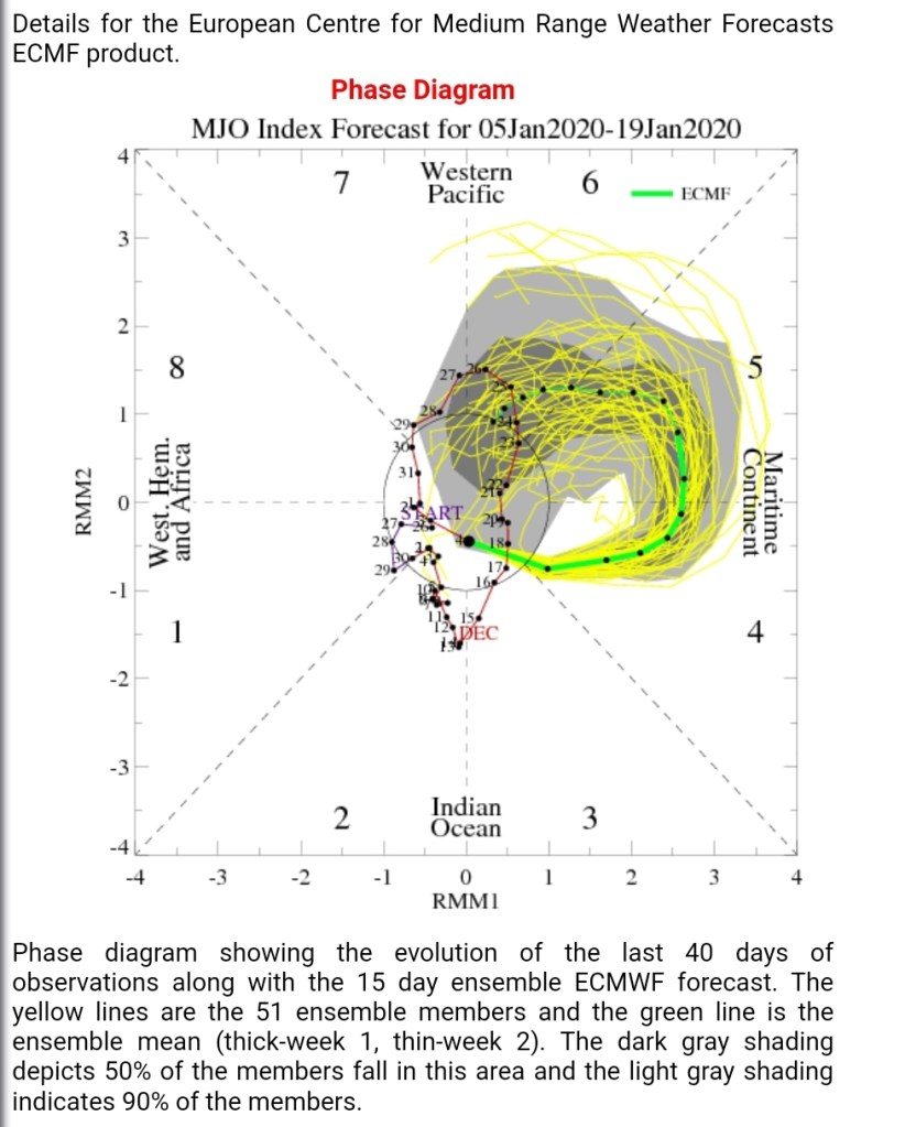
Mjo correlation
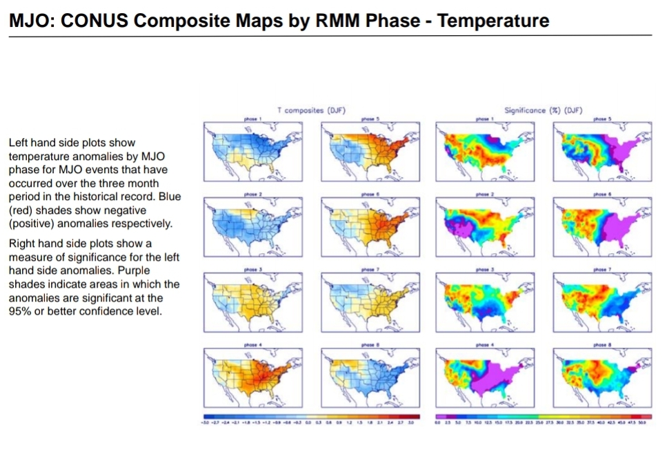
Precip , looks to fit the phase 5-6
Teleconnections off the 12z ECMWF ensemble
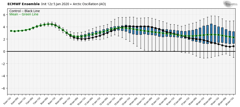
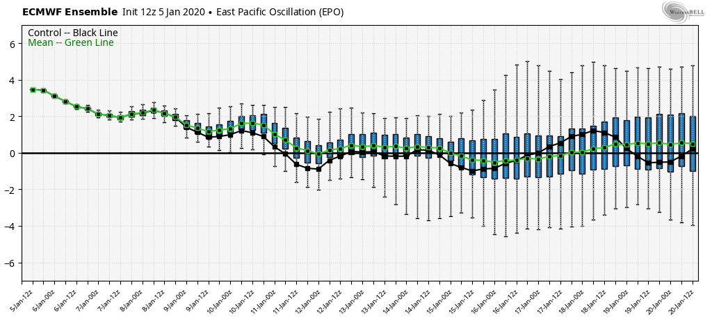
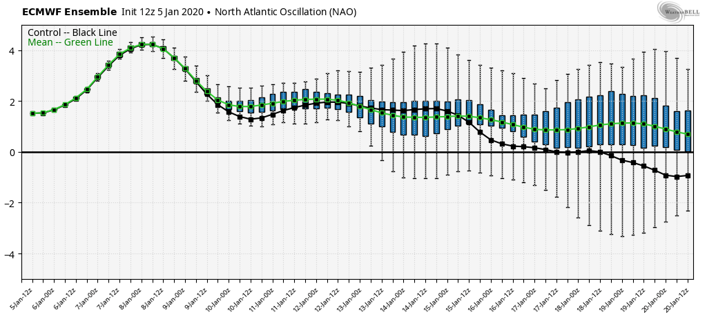
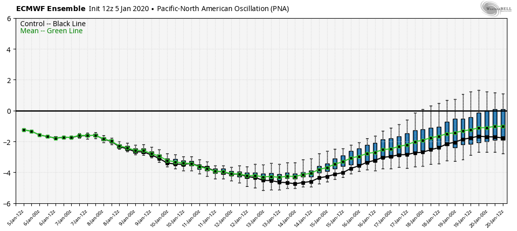
A little hope in the teleconnections..
Overall expect the 10th to 20th period and maybe beyond to be dominated by well above normal temps. Possibly a few 60s in that period.
Performance
Thursday night
Friday night

