January 6, 2019
Jan 6(Mon)
Clouds early, few flurries that quickly dissipated. Leaving behind partly sunny skies and windy conditions
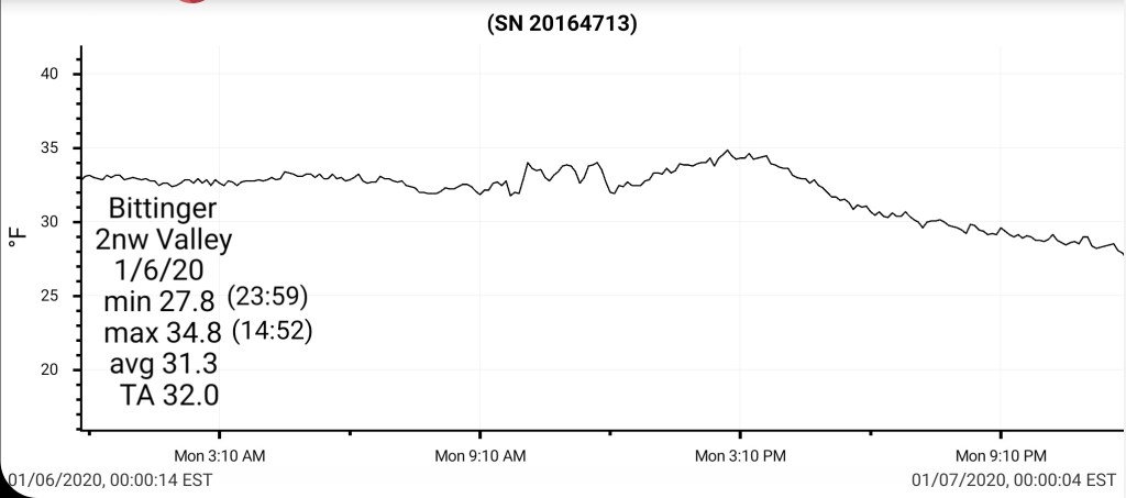
Bittinger 2nw Valley
MIN[27.8]—MAX[34.8]—AVERAGE MEAN[31.3]—TRUE AVERAGE[32.0]—PRECIP[T]
Snowfall season to date 23.2″
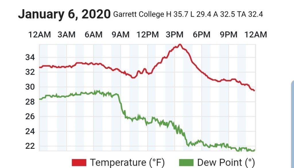
Garrett College
MIN[29.4]—MAX[35.7]—AVERAGE MEAN[32.5]—TRUE AVERAGE[32.4]—PRECIP[0]
Canaan Heights/Davis 3SE
MIN[19.0]—MAX[32.0]—AVERAGE MEAN[25.5]—PRECIP[T]
Snowfall season to date 36.4″
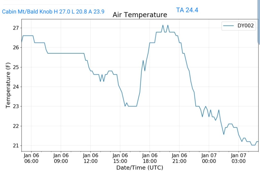
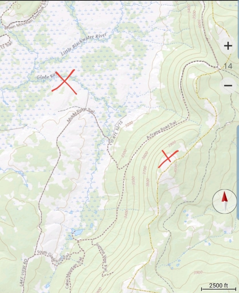
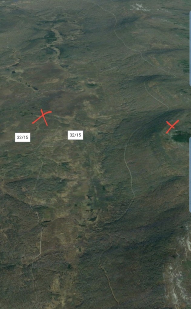
Cabin Mt at Bald Knob
MIN[20.8]—MAX[27.0]—AVERAGE MEAN[23.9]—TRUE AVERAGE[24.4]—PRECIP[0]
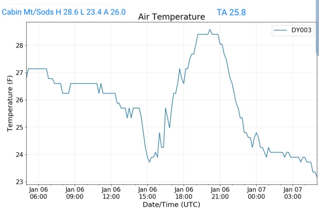
Cabin Mt-Western Sods
MIN[23.4]—MAX[28.6]—AVERAGE MEAN[26.0]—TRUE AVERAGE[25.8]—PRECIP[0]
Spruce Knob
MIN[20.1]—MAX[25.3]AVERAGE MEAN[22.7]—TRUE AVERAGE[22.8]—PRECIP[0]

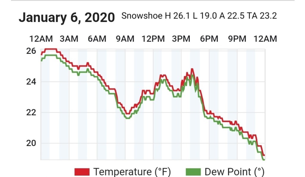
Snowshoe
MIN[19.0]—MAX[26.1]—AVERAGE MEAN[22.6]—TRUE AVERAGE[23.2]
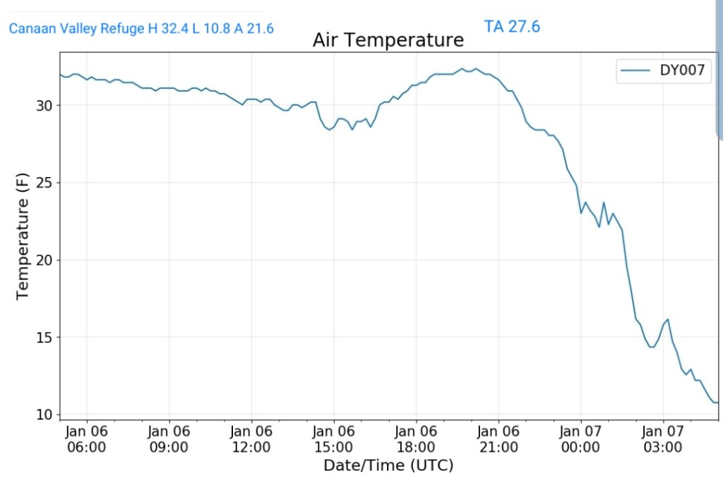
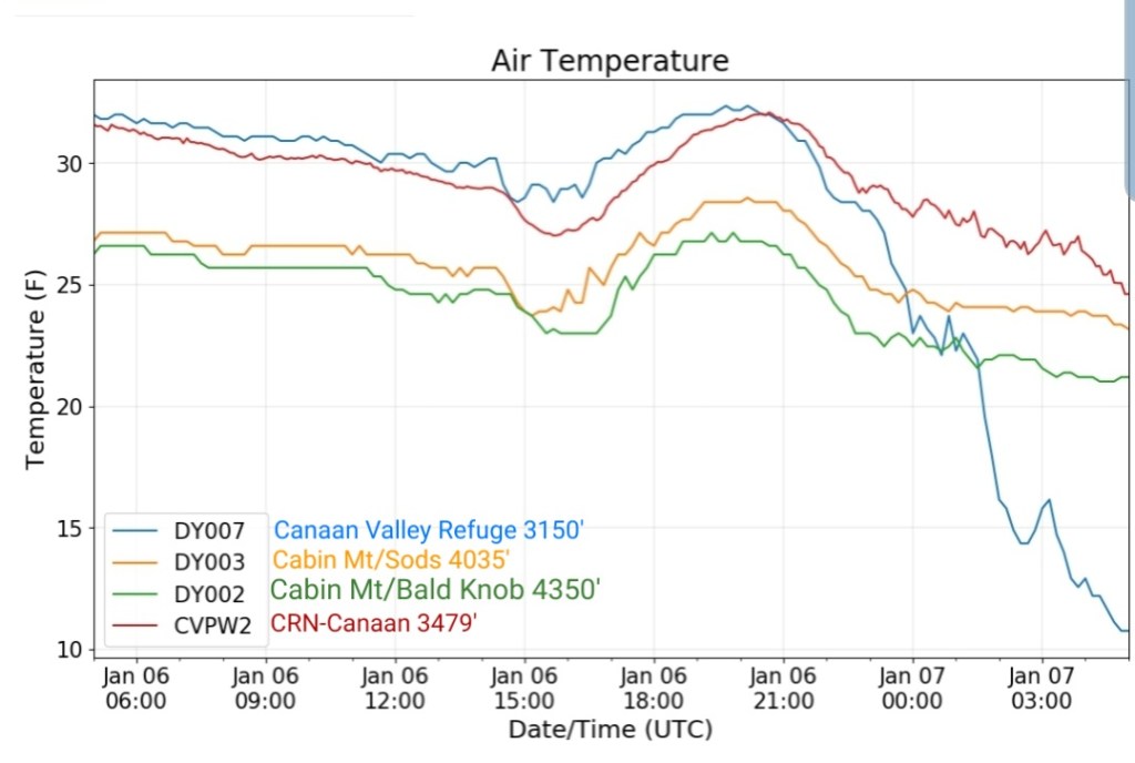
Canaan Valley Refuge
MIN[10.8]—MAX[32.4]—AVERAGE MEAN[21.6]—TRUE AVERAGE[27.6]
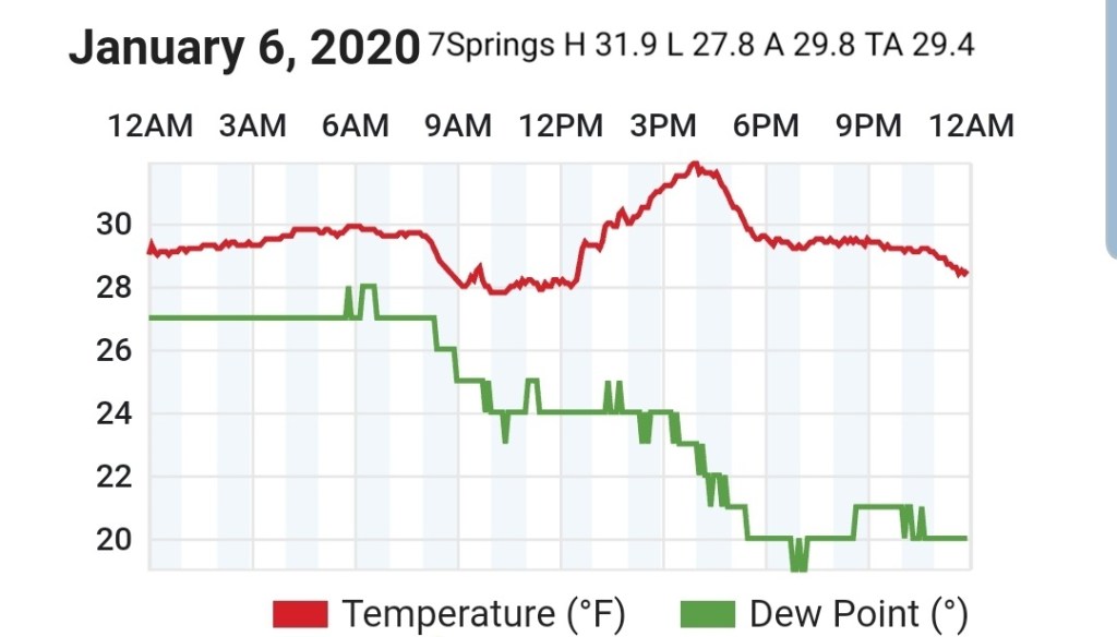
7Springs
MIN[27.8]—MAX[31.9]—AVERAGE MEAN[29.8]—TRUE AVERAGE[29.4]
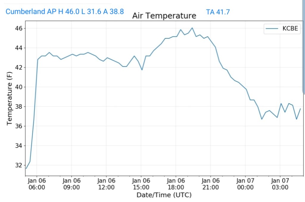
Cumberland Airport
MIN[31.6]—MAX[46.0]—AVERAGE MEAN[38.8]—TRUE AVERAFE[41.7]
The Valley vs Cabin Mt

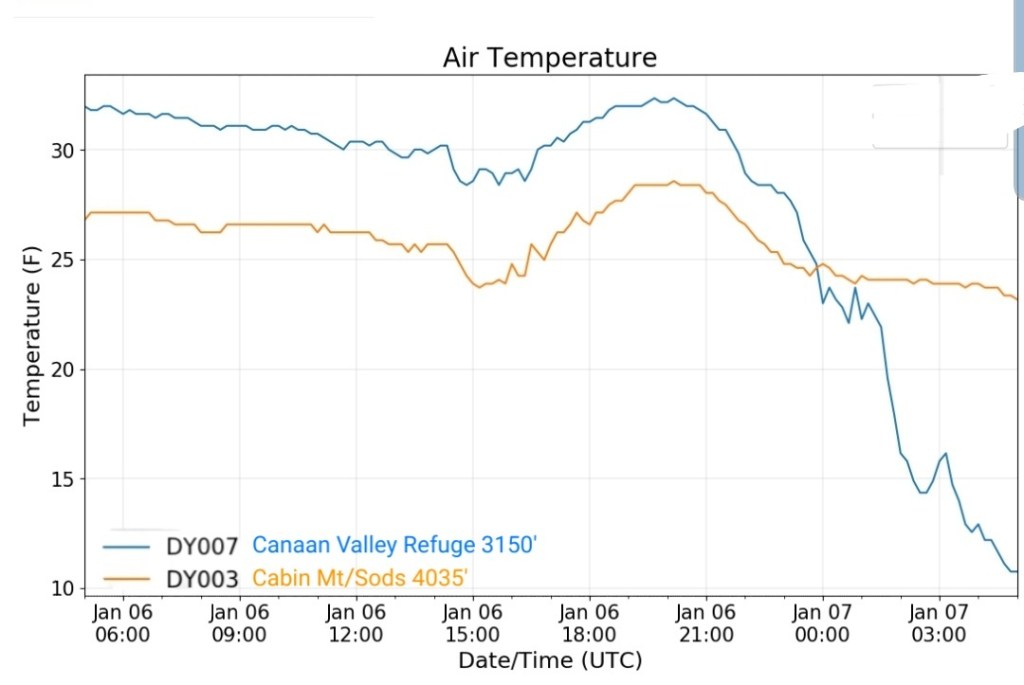
Canaan area temps
Comparison view

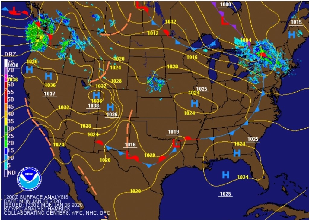
RTMA
Radar
Satellite
Flow
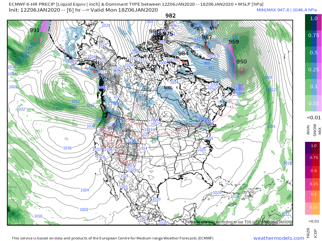
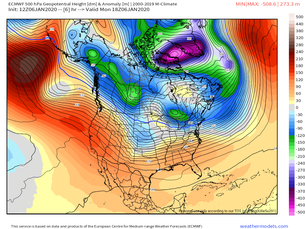
Surface features and 500mb height anomalies and flow
Making the most of the brief opportunity….
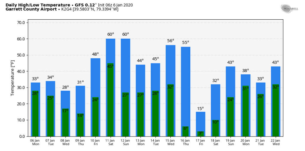
The 4-5 Day winter window
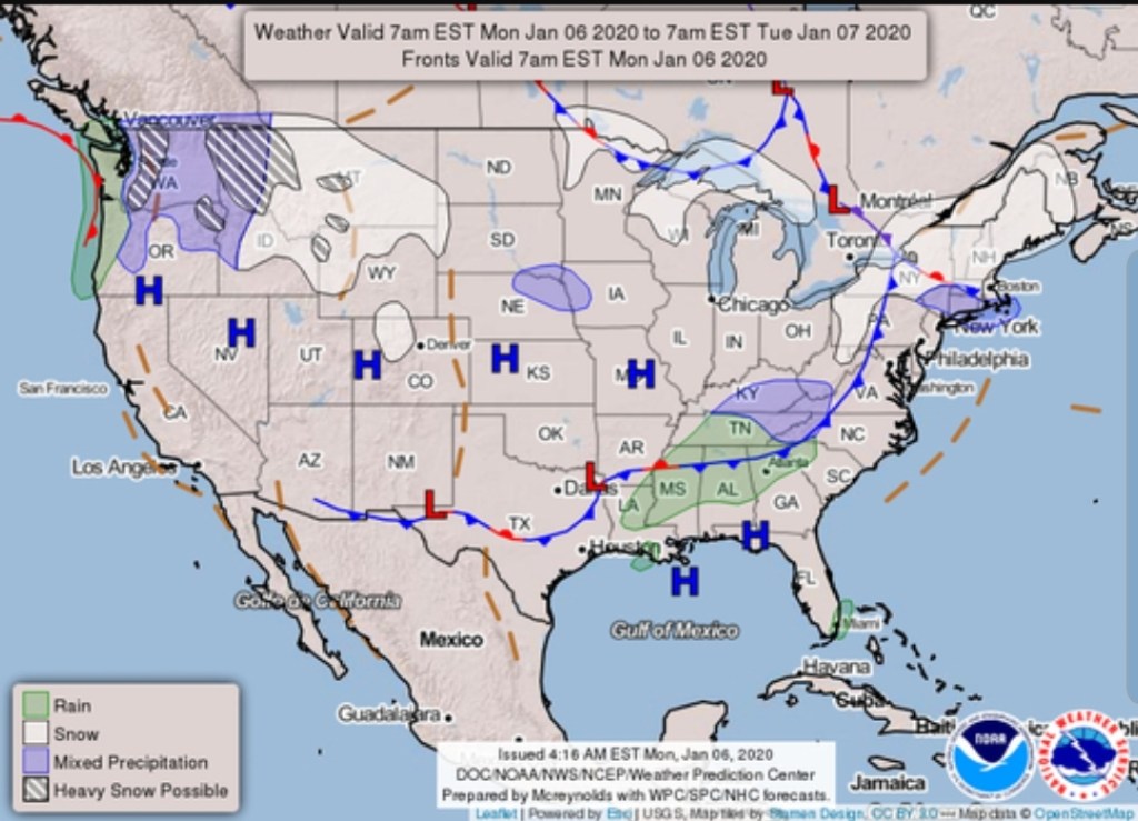
The overnight front last night came through mainly dry, with the exception of the northern Alleghenies seeing the best coverage of some light snow shower activity. Temps also rose some overnight ahead of the front, then leveled off as it passed, and now steady to slowly dropping a few degrees through the day with some gusty winds .
The front that crossed early this morning…with limited moisture.
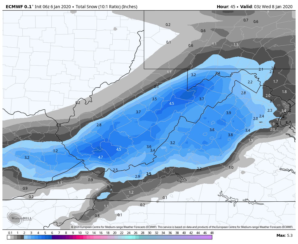
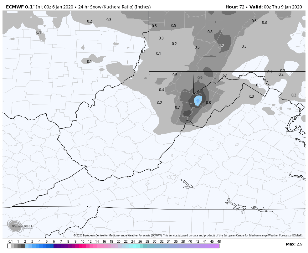
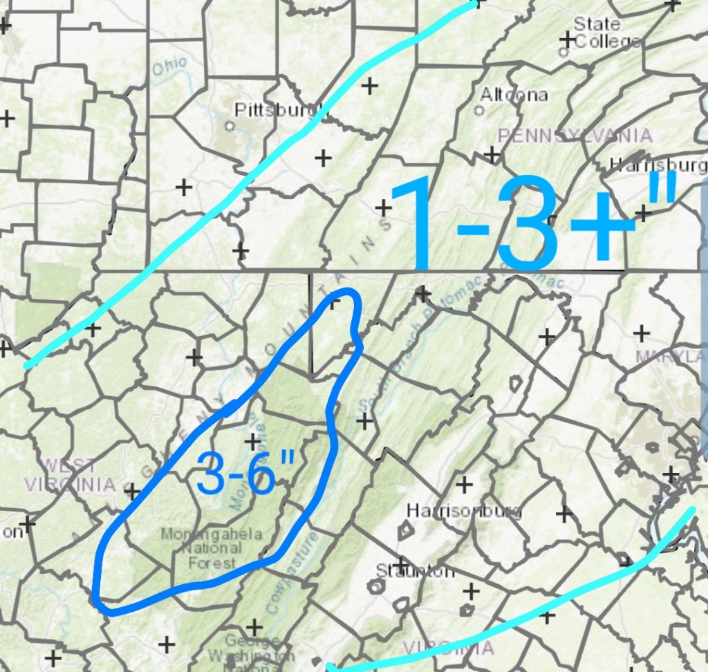
After a lull today, tonight, snow returns to the area tomorrow with a system from the SW, pressing through with a bullseye 3-6″ zone. (As always lean low to mid range, a good performance gives the top range) across the Wv mts, with 1-3″ outside that bullseye zone. There is some variance on the northern edge of the system.
Model output, not a forecast. Only a tool.
Timing kicks this off during the morning hours tomorrow going into the evening.. A relatively fast mover, but likely will cause travel issues during the day tomorrow.
6z ECMWF 10 to 1, through 10pm Tuesday. This is likely a little over 10 to 1 across the high ground. I elected not to use Kuchera parameter as I believe Weatherbell needs to make another adjustment to that parameter.
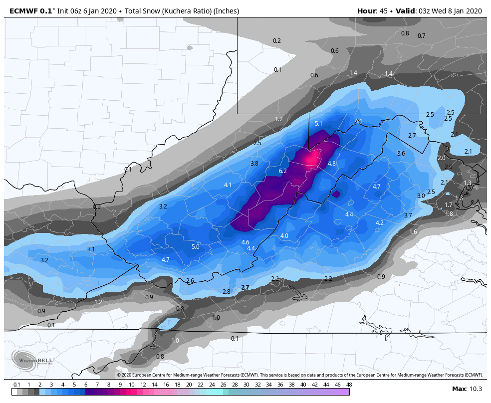
Kuchera ratio off the 6z ECMWF. Again likely overdone as it has been.
6Z GFS Kuchera Ratio off weather.us.

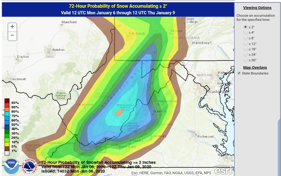
WPC OUTLOOK..this is a product of the WPC, I’ve seen some news outlets slap their own label on it.
Probability of 2″ and 4″
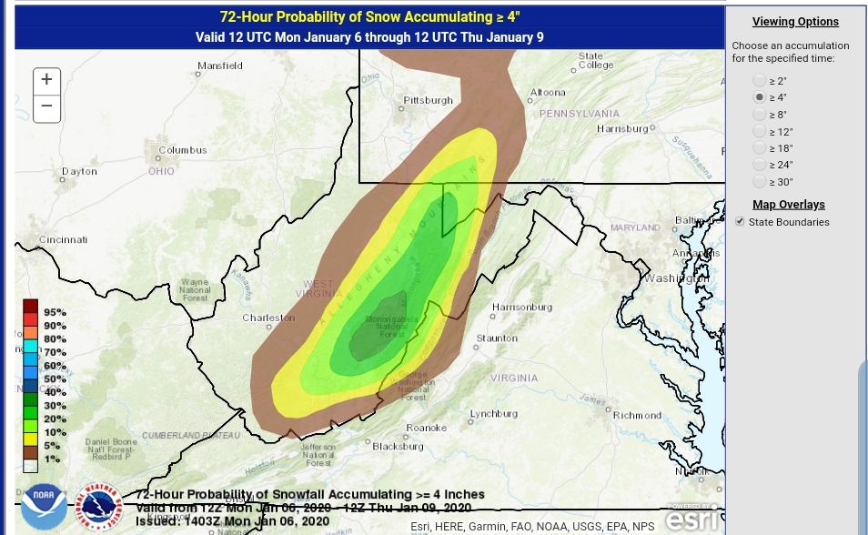
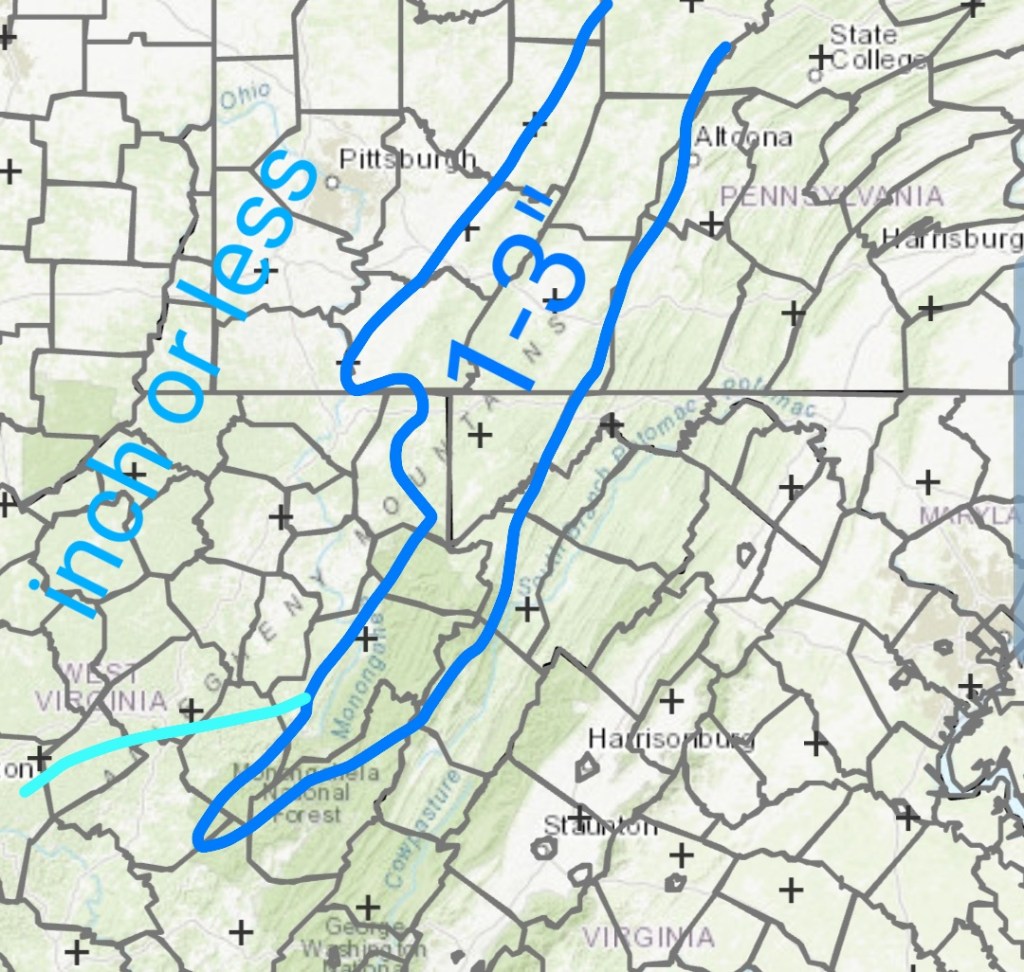
one area of weakness of the WPC, is the backside upslope that comes in Wednesday a.m into the day Wednesday. This is accompanied by very cold air and has 1-3″ of fluff potential. (mainly northern half of the Alleghenies with that backside upslope it appears) out of very limited moisture. High ratio fluff
6z ECMWF on the backside upslope
My thoughts(this is a freehand drawn outline, exact boundaries will vary) again lean low to mid range, good performance gets top end of target zone. East of the Mts tomorrow, spots of 3″ plus possible.
Part 1 ………………………….. Part 2 upslope
That sets up Wednesday night….
Clearing skies
Light to calm winds
Low dew points

That combo shouts that some of the coldest valleys drop below 0 briefly. High ground may hold teens to around 20.
Then………..
0°-60° in 2.2 days…..maybe
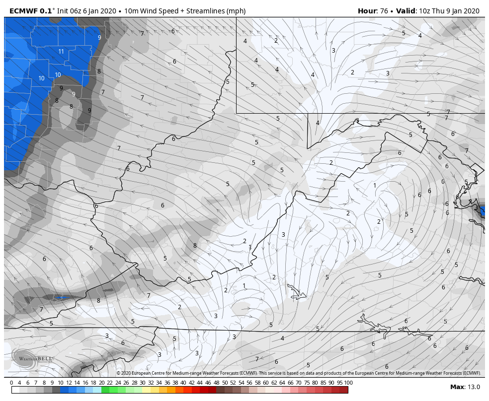
The return flow warmth

Thursday the chill begins to modify, overall its still cold.
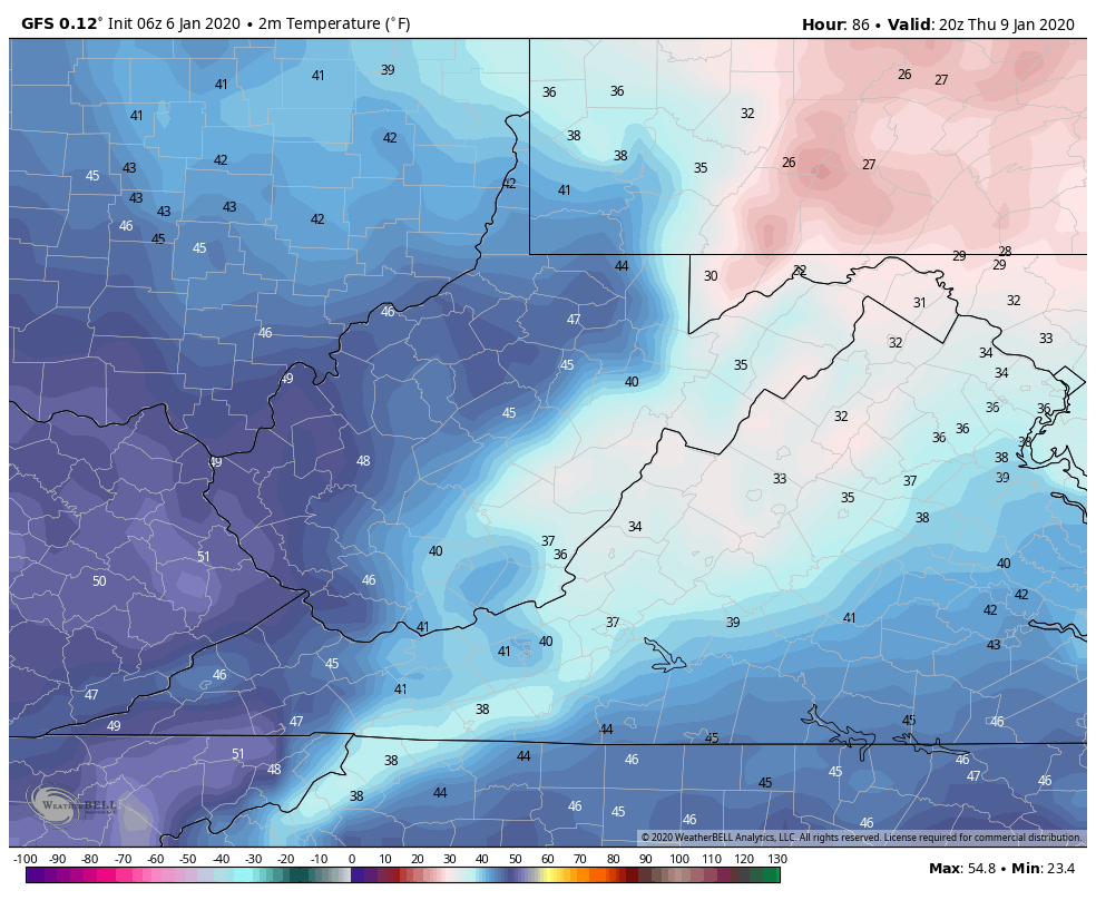
Friday the climb is greater
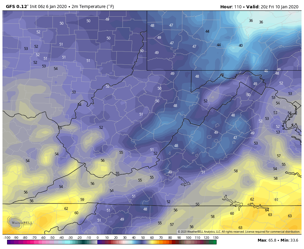
Saturday even greater and I believe this will be underdone
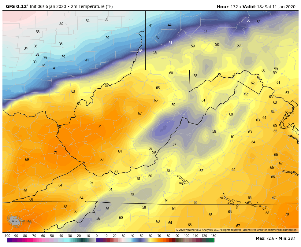
Last nights ECMWF for Saturday
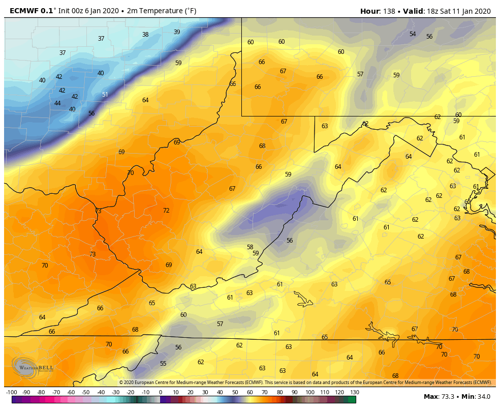
Typically with a southerly surge and if precip holds off, the high end is often met or exceeded 56-65 on Saturday looks like a reality. Outdoor BBQ if the rain holds off??
This is accompanied by
Southerly winds gusting
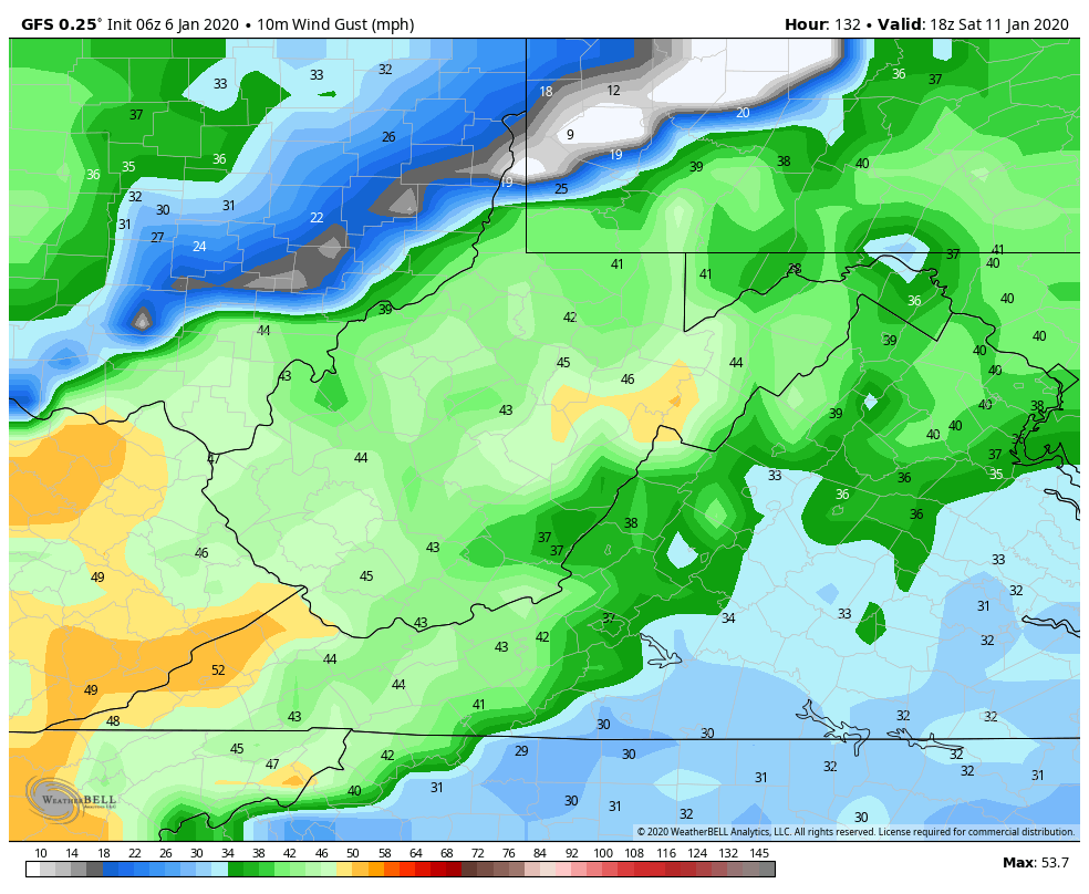
And high dew points

That combo is a rapid snow eater. …ugh
A sharp cutoff from warm to colder exist Saturday, just to our NW, some wintry precip exist up there….But we are on the wrong side of that boundary…
Below the 6z GFS on Saturday. That high north is too slow to get in front and feed any cold air into some of the typical ice zones. Allowing the warm air to over spread the entire area.

that chillier air briefly pushes in on Sunday, after most of the moisture is gone.
Beyond that, the dominance looks to be ridge east, trough west. Maybe some system cuts through with some wintry weather in the heart of the overall mild pattern… that is possible, but sustained winter is not upon us.
Off the 6z GFS and a larger uncertainty in the long range vs near term obviously… that Sunday max would be falling through the day …
MJO , still ugly ..into 4,5,6


Phase correlation to temps
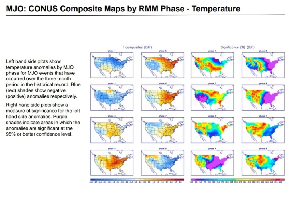
And correlation to precip
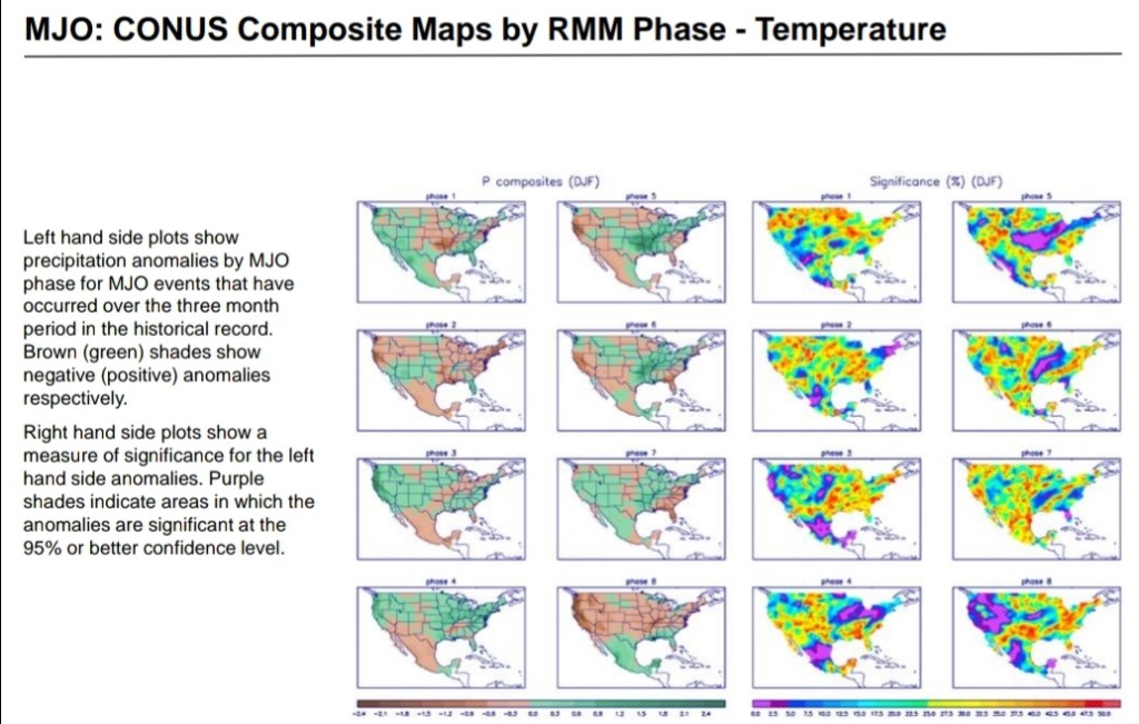
the Teconnections still look poor…All the opposite of a cold eastern U.S
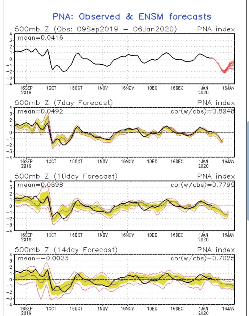
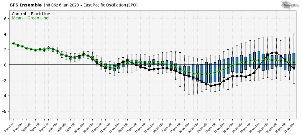
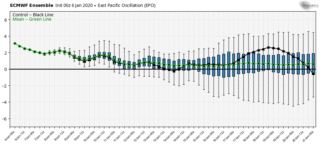
the lone help next week may come from the EPO. The ECMWF holds it neutral to positive, but the GFS takes it negative. That allows cold to push some…lots of resistance though in that SE ridge. Any coming cold over the next few weeks looks very brief and in and out rapidly.
Ski Resorts need to heed the outlooks and go all out on snow making through all the available opportunities this week.
NOAAs 6-10, 8-14 day outlook


While there are variances as we see with this current window of winter that didnt occur in 37, the January 1937 overall setup and look however is very much alive in January 2020.


