January 10, 2020
Jan 10(Fri)
Milder air mass pushing across the area. Some holdouts in the deeper valleys from Savage River, Lonacoaning, Lavale , Cumberland clinging to slightly chillier air from the departing air mass. A few scattered showers in the area this afternoon, mainly western areas.
Bittinger 2nw Valley
MIN[19.9]—MAX[55.9]—AVERAGE MEAN[37.9]—TRUE AVERAGE[34.9]—PRECIP[0]
Snowfall season to date 27.1″

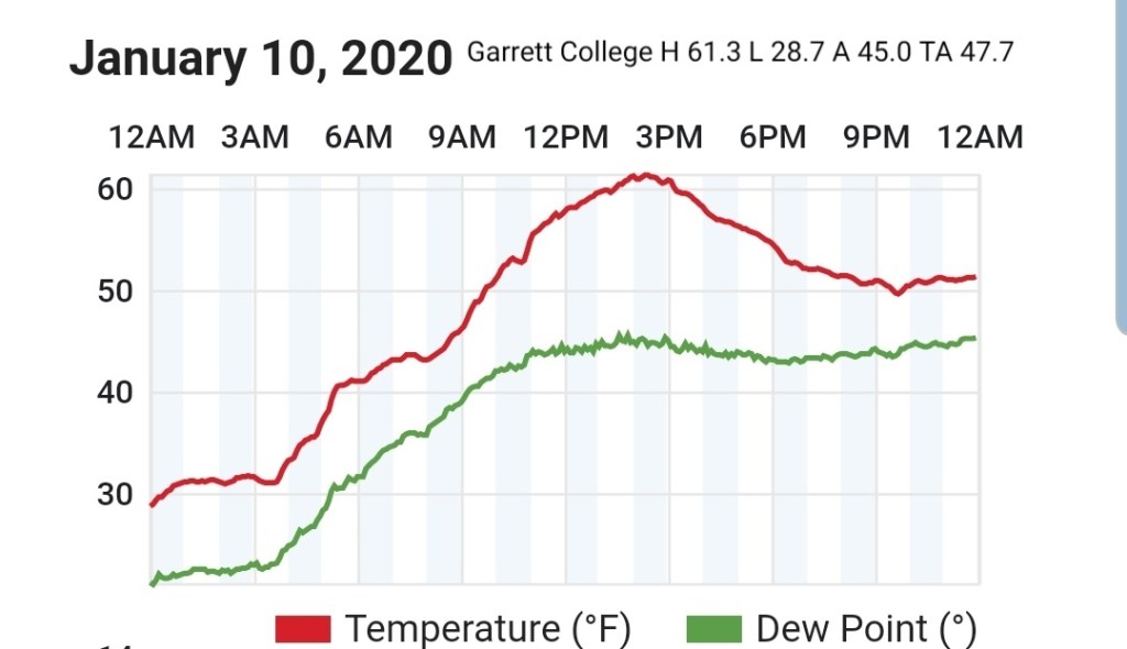
Garrett College
MIN[28.7]—MAX[61.3]—AVERAGE MEAN[45.0]—TRUE AVERAGE[47.7]—PRECIP[0]
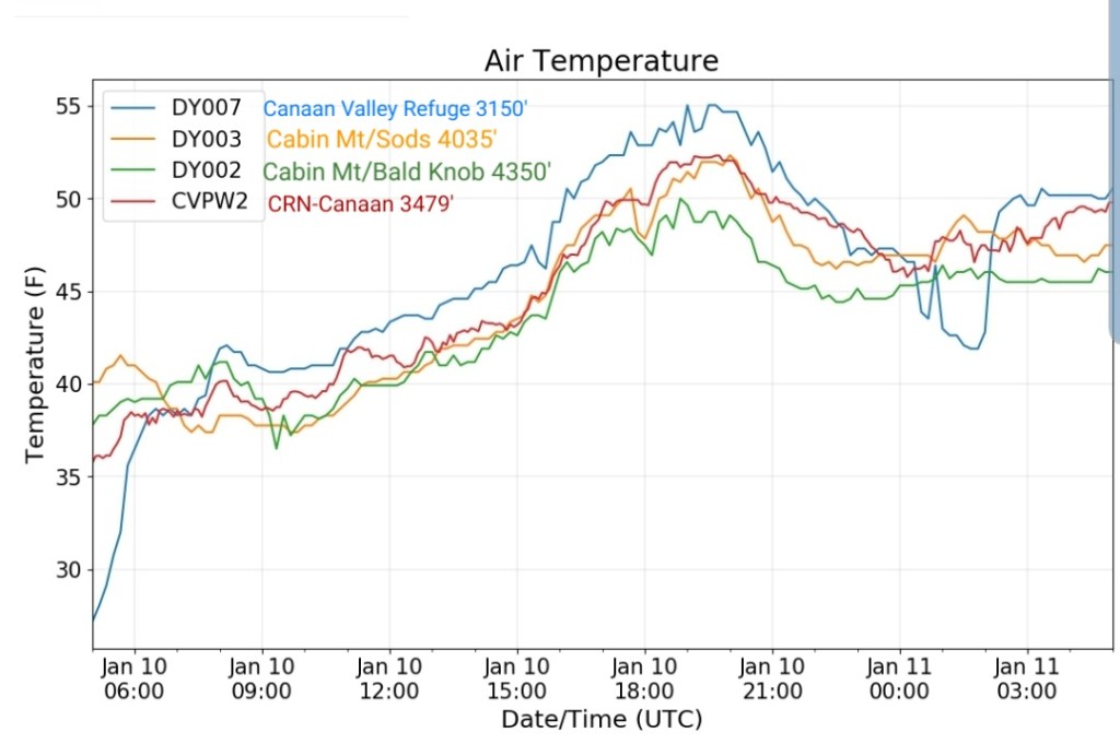
Canaan Heights/Davis 3SE
MIN[42.0]—MAX[54.0]—AVG[48.0]—PRECIP[0]
Snowfall season to date 41.2″
Climate Reference Network Canaan
Cabin Mt at Bald Knob
MIN[36.7]—MAX[50.0]—AVERAGE MEAN[43.3]—TRUE AVERAGE[43.7]

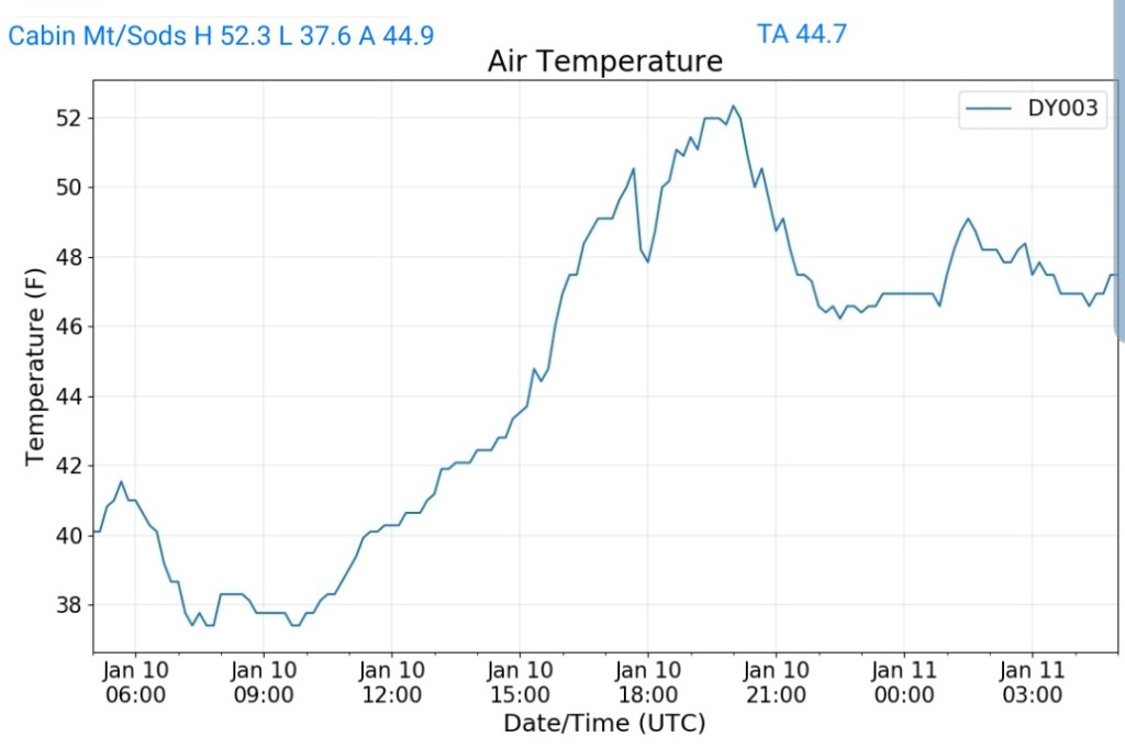
Cabin Mt-Western Sods
MIN[37.6]—MAX[52.3]—AVERAGE MEAN[44.9]—TRUE AVERAGE[44.7]—PRECIP[0]
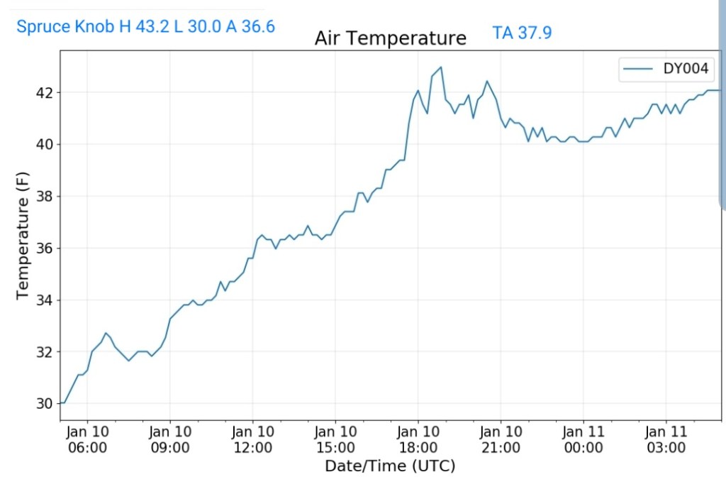
Spruce Knob
MIN[30.0]—MAX[43.2]—AVERAGE MEAN[36.6]—TRUE AVERAGE[37.9]—PRECIP[0]
Snowshoe
MIN[28.8]—MAX[44.2]—AVERAGE MEAN[36.5]—TRUE AVERAGE[38.9]

Canaan Valley Refuge
MIN[27.1]—MAX[55.2]—AVERAGE MEAN[41.1]—TRUE AVERAGE[46.1]

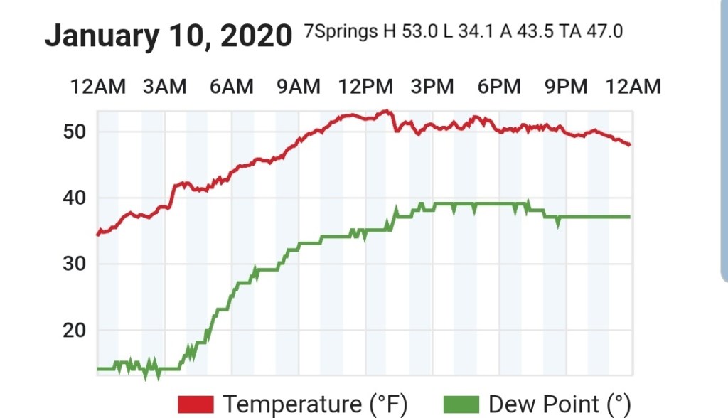
7Springs
MIN[34.1]—MAX[53.0]—AVERAGE MEAN[43.5]—TRUE AVERAGE[47.0]
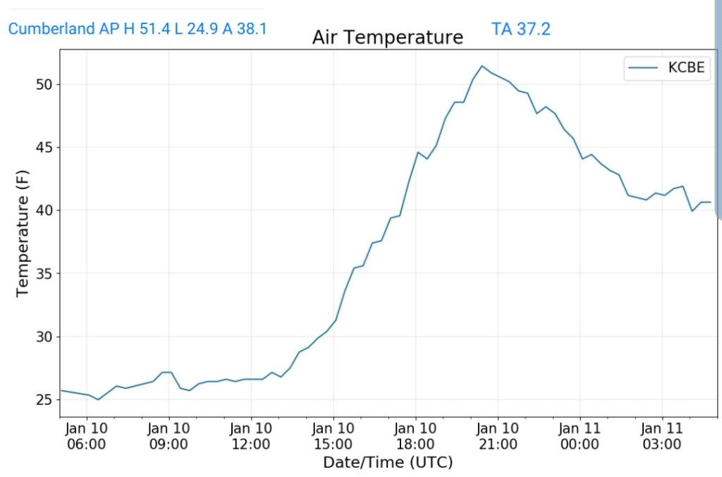
Cumberland Airport
MIN[24.9]—MAX[51.4]—AVERAGE MEAN[38.1]—TRUE AVERAGE[37.2]
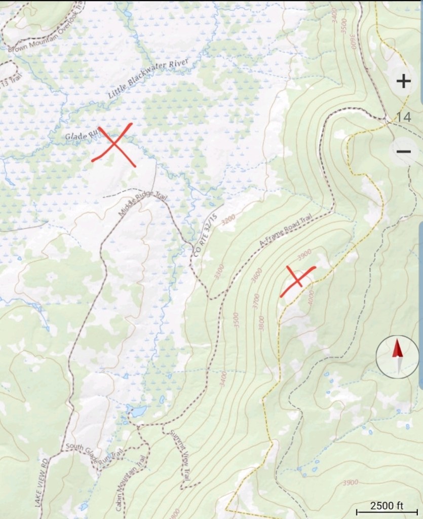
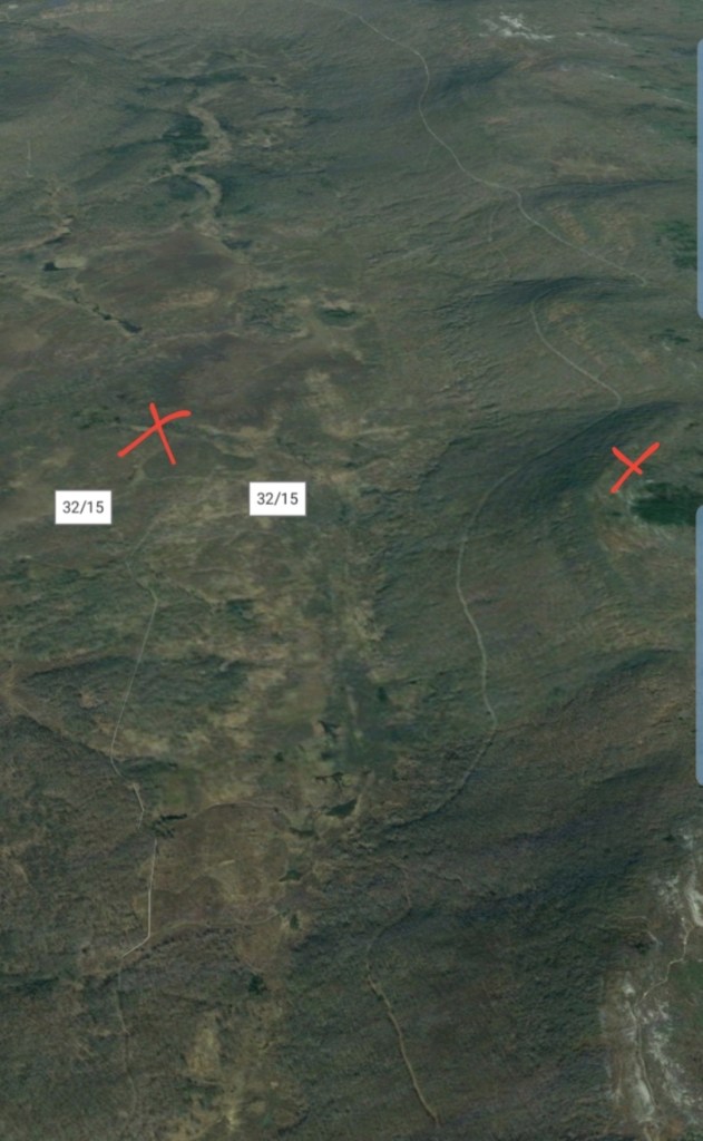
The Valley vs Cabin Mt


Canaan area temps
Comparison view

RTMA
(Not depicting the cooler valleys well at all)
Radar
Satellite
Flow
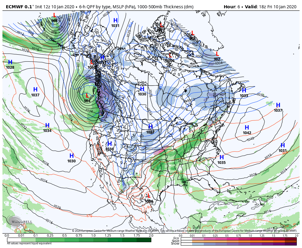
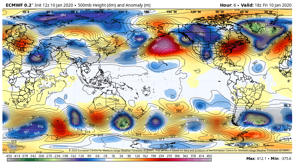
Surface features and 500mb height anomalies and flow
With the 5th through 9th winter window in the books that produced 2 of the better snowfalls on the season in parts of the area, now we go into a lengthy stretch of much above normal temperatures. This looks to run for the next week. Modeling hints at a return to cold weather late next week. To what extent, remains unknown. Initial shot looks brief, and weaker vs what it did appear like on the GFS. The GFS was going crazy with the cold on yesterdays runs and lots of sites were screaming wait until late week, bitter cold! For good reason by going off the one model. This was the GFS yesterday mornings run showing for next Friday morning temp anomalies
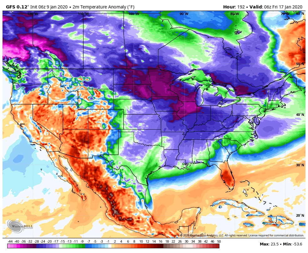
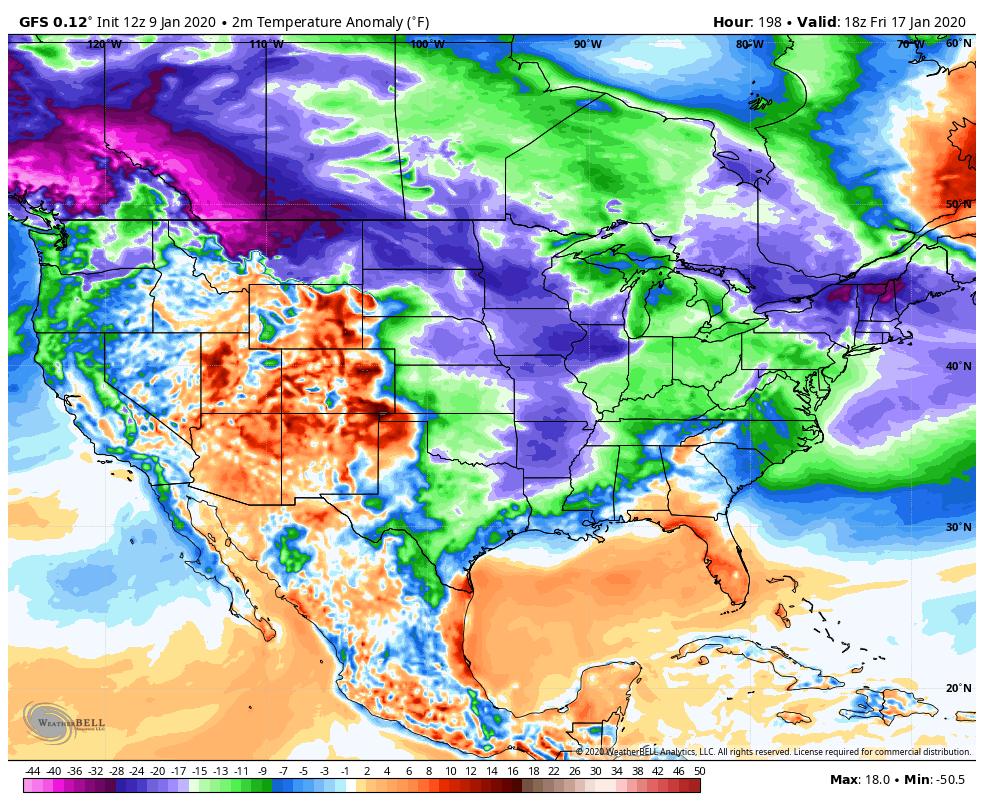
This morning for next Friday morning , backing off some…

Yesterdays 12z continued the cold look. Here was yesterdays 12z run for next Friday afternoon
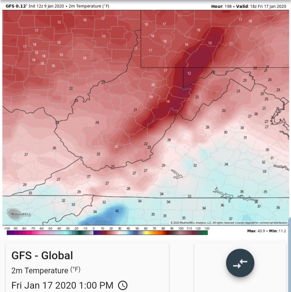
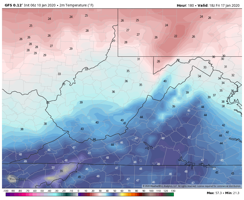
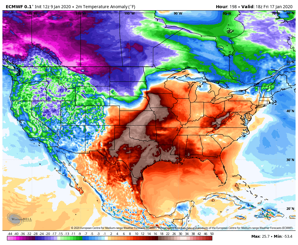
here is this mornings 6z run for the exact same time period 1pm next Friday. Its progressively less cold for late week. Still cold, and much much colder than the next few days, and more in line with seasonal weather, but not what it was shown yesterday.
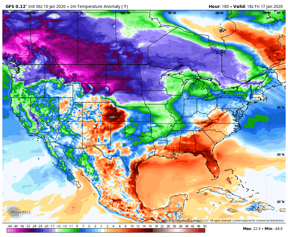
There is still plenty cold on the playing field, but backing off from the extreme, “for now”. This model has a cold bias and a speed bias that shouldn’t be ignored, but often is ignored when its click bait or what one hope’s for. Its been seen all winter. That’s not to say the extreme doesn’t attempt a push at that time and models revert back to it. I’m just saying its backing away and use caution with it.. “More than likely” its a little beyond this period.
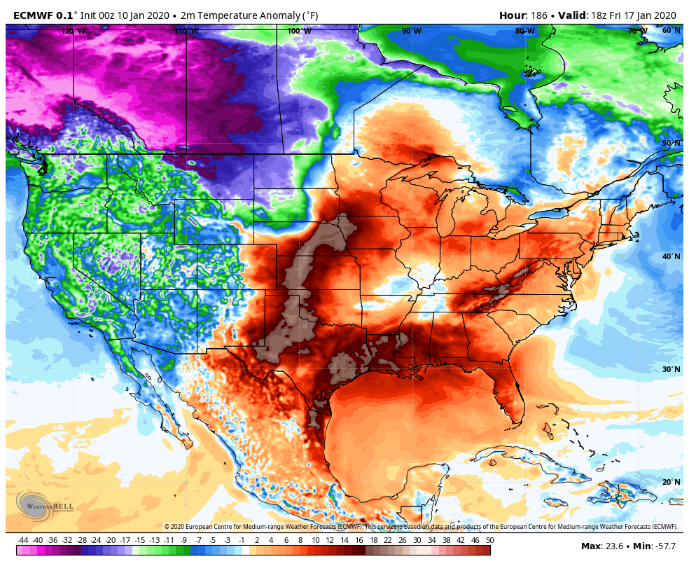
The ECMWF currently looks like this for next Friday afternoon

on yesterdays 12z run looked like

The difference- some areas the GFS was showing teens yesterday and 20s west side of the mts, now 20s, 30s, while the ECMWF was and is 40s, even 50s yet on the west side of the Mts.
What may occur. Late week chills into the 30s on Thursday, with steady to falling temps through the day and rebounds 30s, low 40s into Friday, no temp fall Friday night with a southerly flow, then the weekend sees a temperature rebound of 40s to 50 with the front side of the next system. With the typical cold zones possibly holding cold for onset ice?…Immediately behind that system as it passes, is probably when the cold air really pushes the following week. Only speculation based off the modeling biases and anything in detail beyond 5- 7 days in this pattern is always just speculation. I just don’t like ignoring a milder model that’s performed better(“better” used very loosely) for a colder model just because I want it to get cold. We still live in reality.
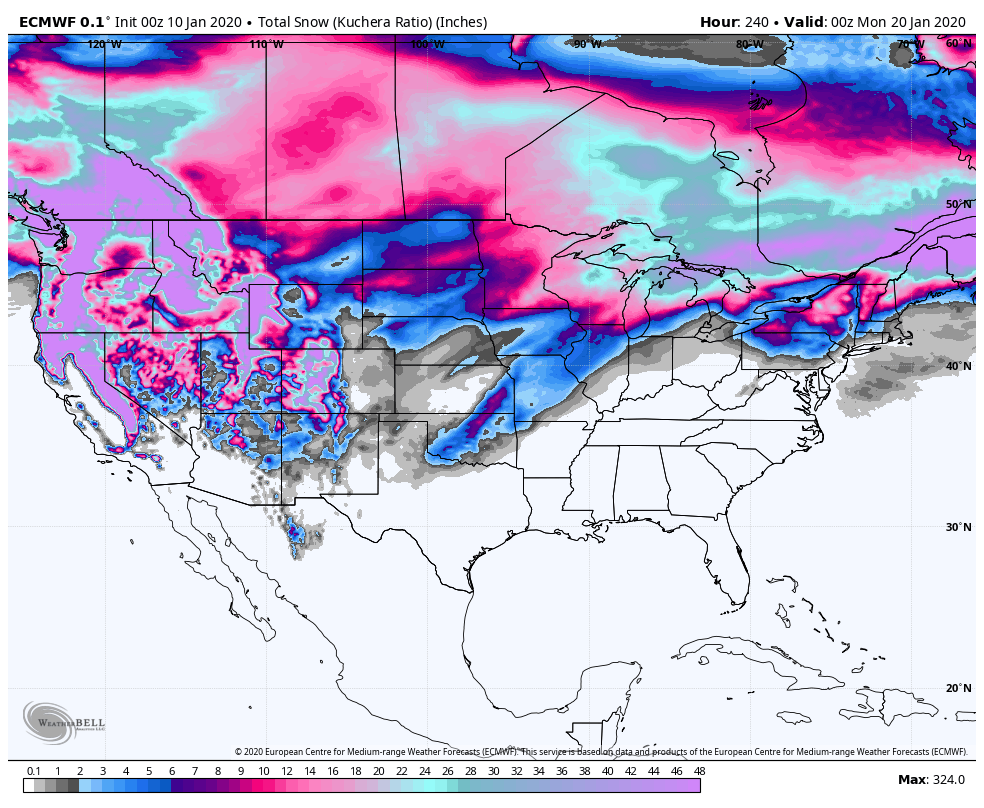
Snowfall off the ECMWF next 10 days
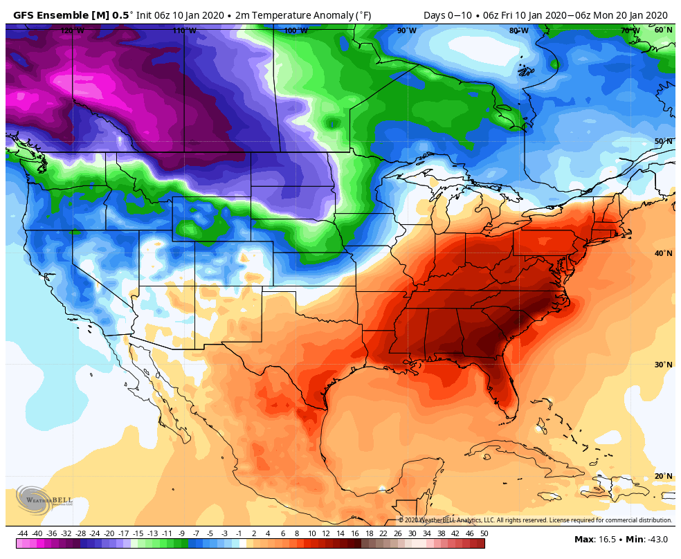
GFS next 10 days
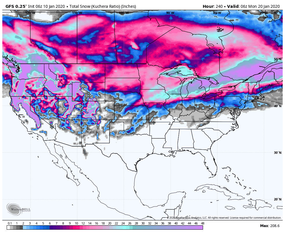
Obviously any threat of snow is occurring towards the end of the 10 day. So expect changes.
Finally though, some positive signs off the models for a colder later January trend.. Snow lovers have some suffering to go through now for at least the next 7-10 days in the heart of January. That sucks.
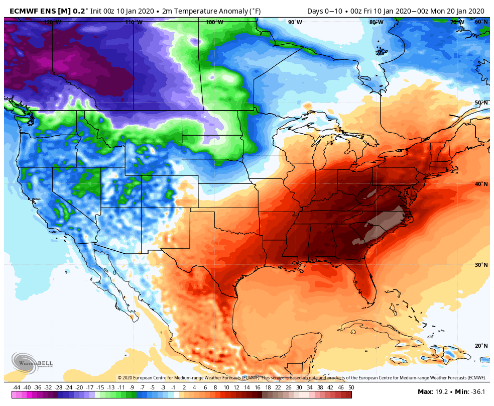
Totality of the next 10 days in the means
ECMWF
GEFS(which has not been upgraded as the GFS operational has been)
Winter is not dead though and January is not dead and the 37 January look gets attacked by the cold push and the snow miser looks to get his grip later January after the heat miser has his way the next week
Even the ECMWF seeing it later January
Ensembles(Ensembles will not show an extreme 10 days out, especially in a pattern with so much warmth vs cold on the table. 51 members averaging themselves out. It can show a trend though)
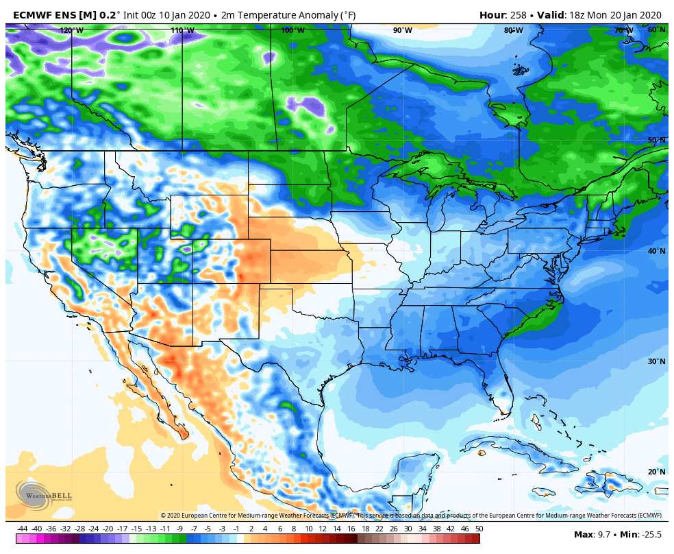
ECMWF control by Jan 20
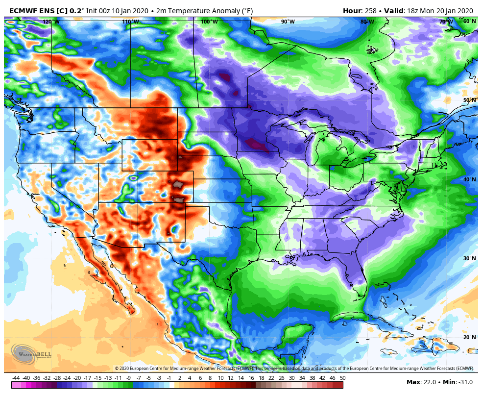
Bring on the Snow miser after the Heat miser has his fun…
Will update with newer runs.
