January 13, 2020
Jan 13(Mon)
Overcast day, with some brightening through the afternoon.
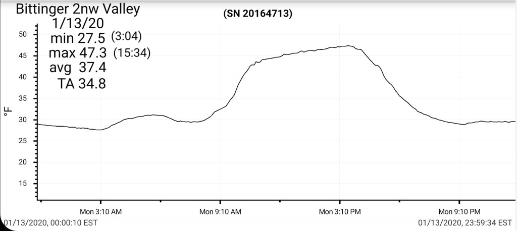
Bittinger 2nw Valley
MIN[27.5]—MAX[47.3]—AVERAGE MEAN[37.4]—TRUE AVERAGE[34.8]—PRECIP[T]7am
Snowfall season to date 27.1″
Garrett College
MIN[30.8]—MAX[47.6]—AVERAGE MEAN[39.2]—TRUE AVERAGE[39.5]—PRECIP[.01]

Canaan Heights/Davis 3SE
MIN[36.0]—MAX[49.0]—AVERAGE MEAN[32.5]—PRECIP[0]7am
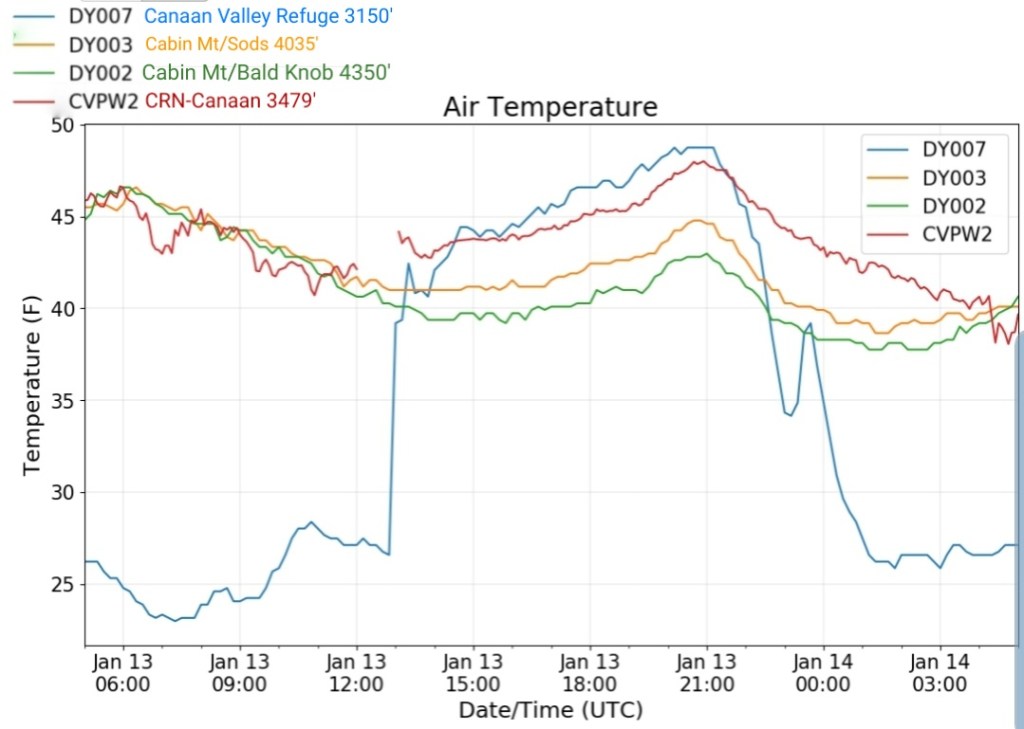
Climate Reference Network Canaan
Cabin Mt at Bald Knob
MIN[37.8]—MAX[46.6]—AVERAGE MEAN[42.2]—TRUE AVERAGE[41.2]—PRECIP[0]

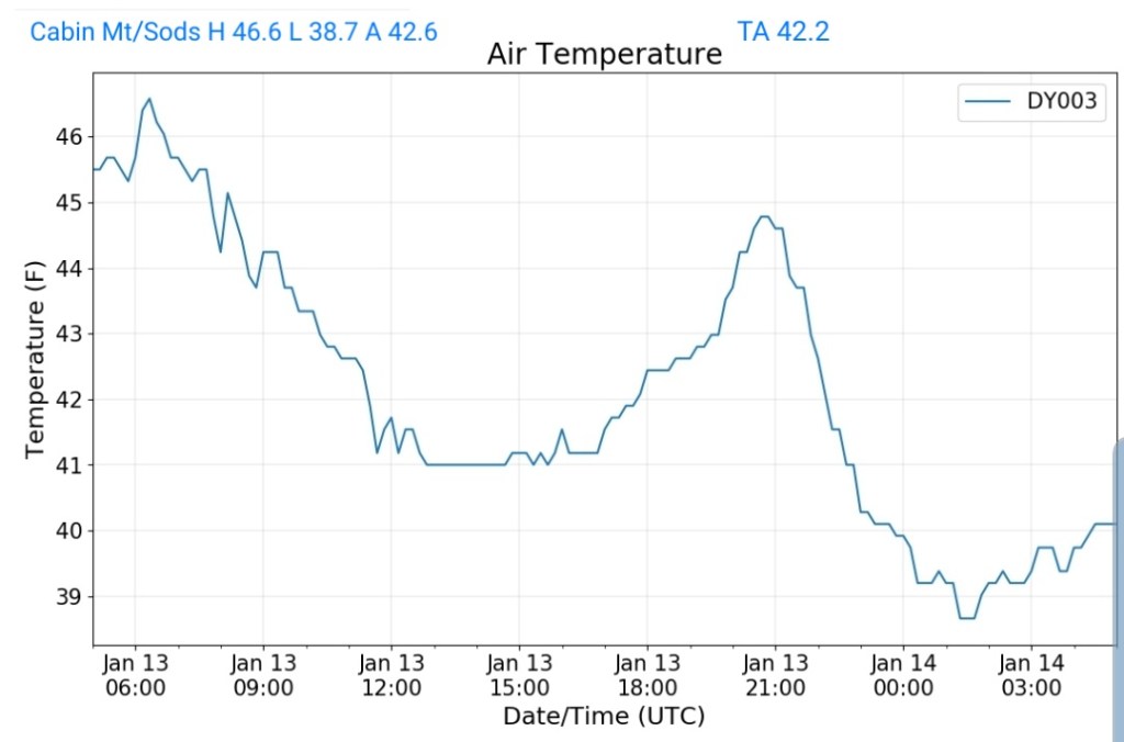
Cabin Mt-Western Sods
MIN[38.7]—MAX[46.6]—AVERAGE MEAN[42.6]—TRUE AVERAGE[42.2]
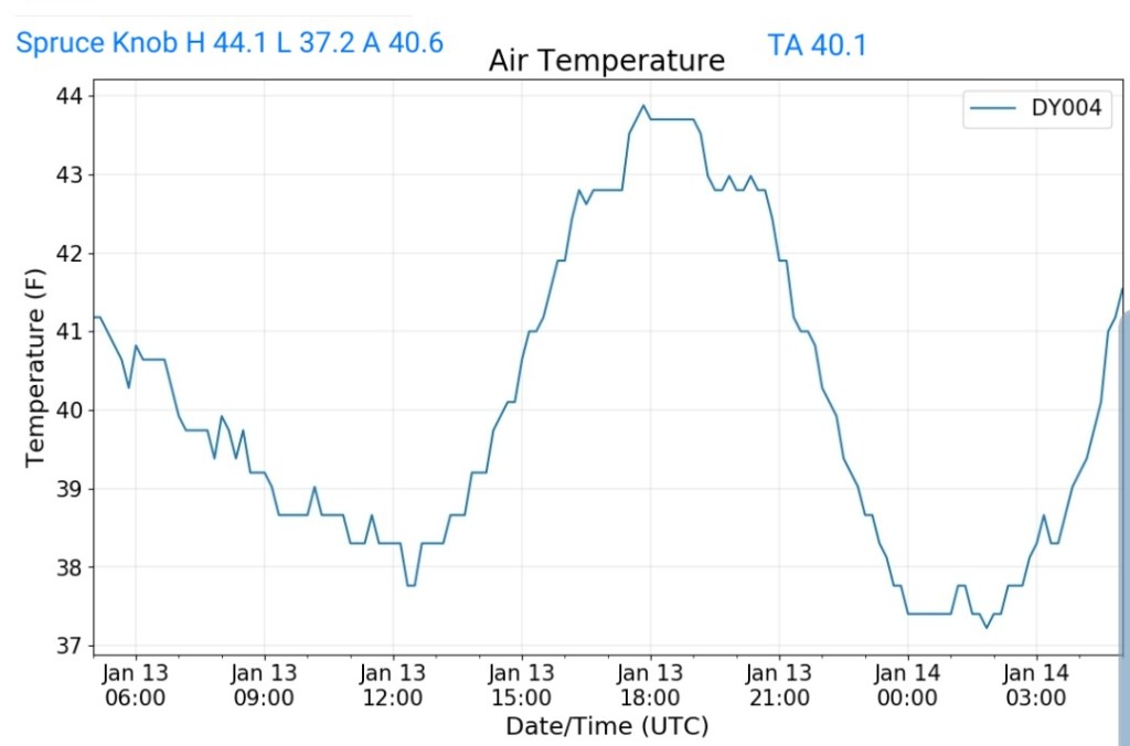
Spruce Knob
MIN[37.2]—MAX[44.1]—AVERAGE MEAN[40.6]—TRUE AVERAGE[40.1]—PRECIP[0]
Snowshoe
MIN[39.4]—MAX[46.4]—AVERAGE MEAN[42.9]—TRUE AVERAGE[42.7]

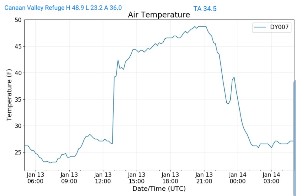
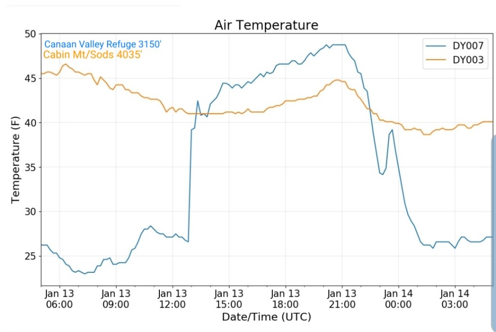
Canaan Valley Refuge
MIN[23.2]—MAX[48.9]—AVERAGE MEAN[36.0]—TRUE AVERAGE[34.5]
7Springs
MIN[33.9]—MAX[43.1]—AVERAGE MEAN[38.5]—TRUE AVERAGE[38.9]

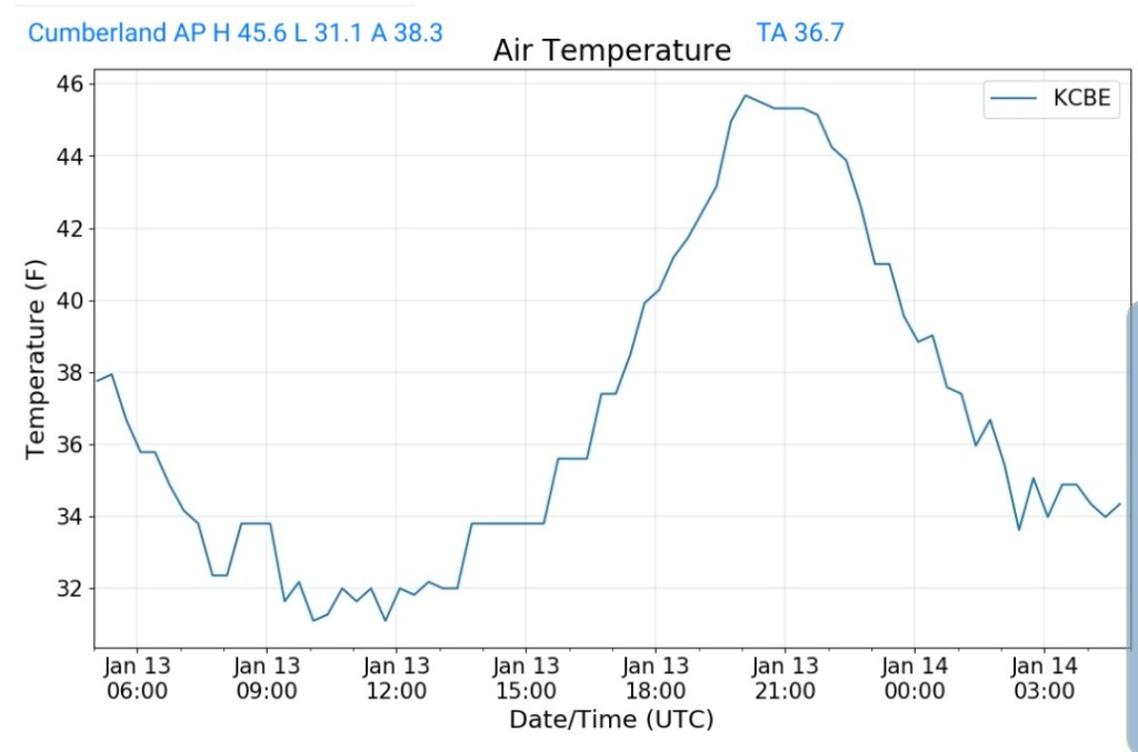
Cumberland Airport
MIN[31.1]—MAX[45.6]—AVERAGE MEAN[38.3]—TRUE AVERAGE[36.7]
The Valley vs Cabin Mt

Canaan area temps
Comparison view

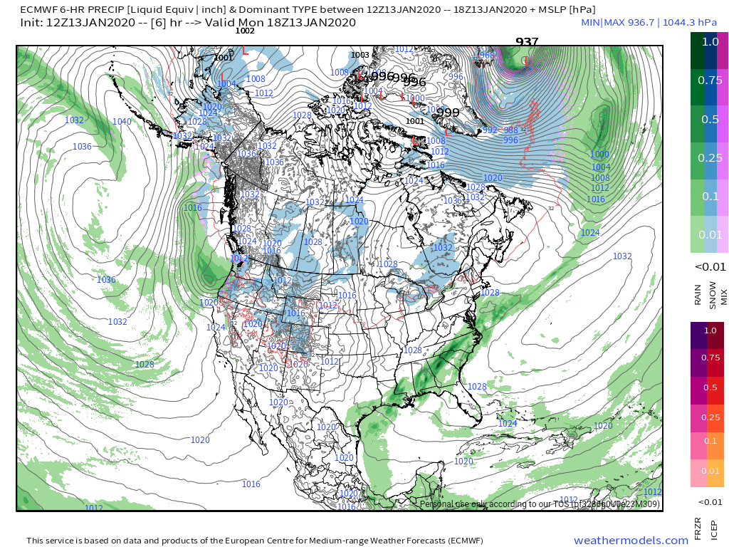
RTMA
Radar
Satellite
Flow
Surface features and 500mb height anomalies and flow
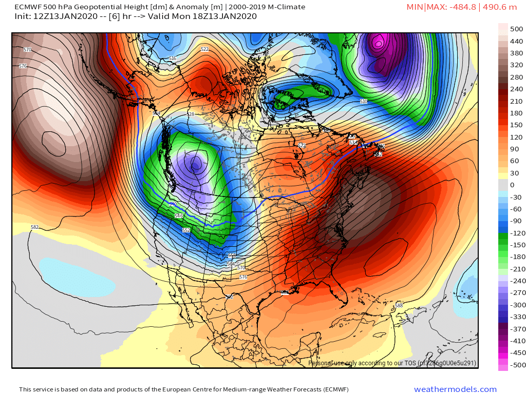
Winters return…..
Past 7 days well above normal , and the next few will be as well….

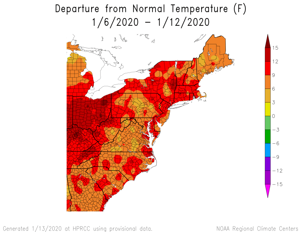
Month to date, even with the 4-5 day window of winter from the 5-9th period.
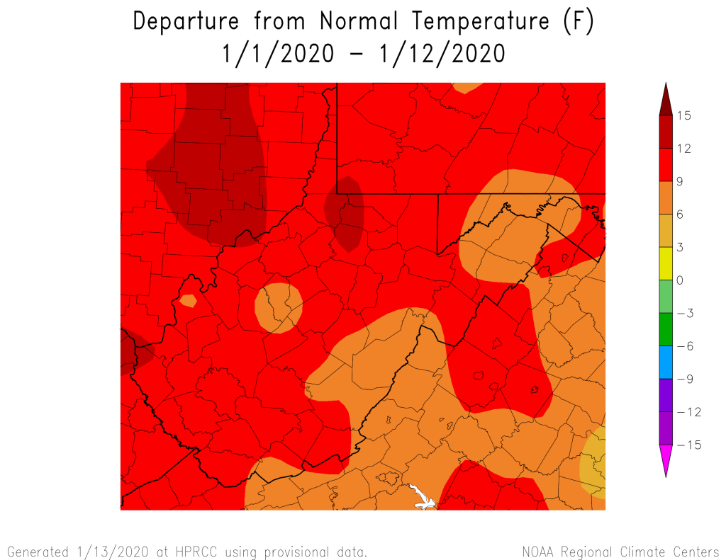
That’s resulted in to this for winter folks

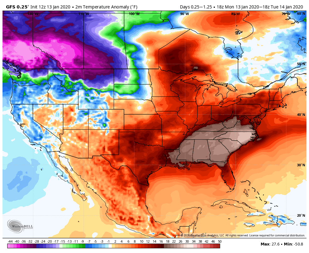
Today’s departures, well above east, with a very cold push into the NW U.S and some of those remaining spots that way that have above anomalies, will be disappearing and turning blue. By Friday the 10-14 day mean will look a lot like some of those mild Januarys used as examples(37 etc)
How-Eva—–
The cold begins its push. By Thursday will see slowly falling temperatures through the day with any lingering precip turning into a few snow showers. Very minor event, Friday holds chilly, thanks to a big high to the north. That slides east, but is a big player in the late Friday night/Saturday system. Overnight Friday, temps hold steady to even rise overnight it appears. How much?? Those details are too far out. Typically the warm tongue plows up west of the Mts and over the Wv high ground in this setup. Model runs have trended a touch colder overall with the brunt of this system. The mild sector of the storm may be short lived in the Wv high ground and not at all across north central Garrett and points NE. Those details are still sketchy.. ..
Today’s 12z Model runs
Precip type boundary from snow, sleet, freezing rain, how much of a surge or push the warm tongue has…do some areas have a lengthy period of plain rain?(best chance Wv high ground and west) those exact details are unknown. As of now, Friday night and Saturday need watched. Way to early to say snow amounts, vs sleet/freezing rain, plain rain…… This event preludes a much stronger cold push of air….
If I had a recent event, of storm and precip type, boundary setup, strength wise as this currently looks like to compare to. Nov 15, 2018 would be a comparison I’d use at present… “Archived” . Actual Low position, 500 pattern are not alike, but results could be similar.
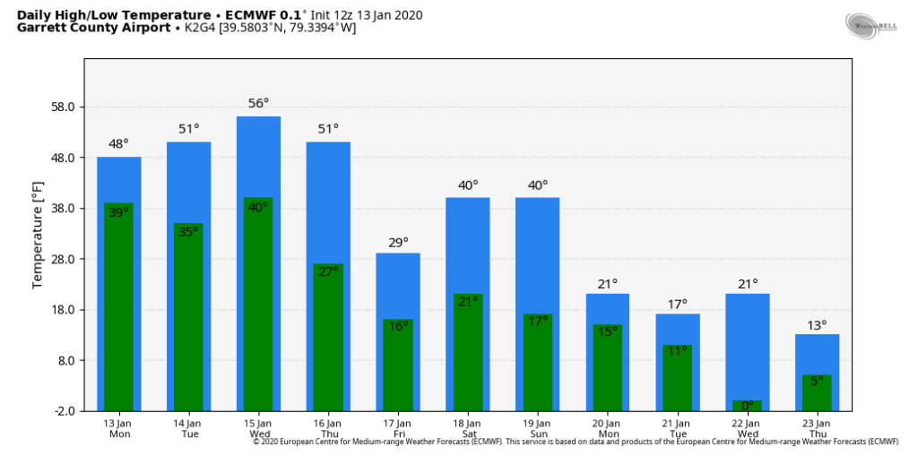
12z ECMWF temps for Garrett Airport
Thursdays highs are predawn, that Saturday-Sunday 40°, if that occurs, that’s a 4-8 hour window and the model sees it occurring near midnight, that’s why you see the double 40° for the weekend in what overall looks like a cold weekend ahead……but check out the temps next week. By then, ski resorts will be needing that in a big way.
The coming cold looks to have “some” holding power. As always, even in cold periods you often have a some bounceback days. Cold looks to outnumber warmth going ahead in the near term once beyond Thursday