January 15, 2020
Jan 15(Wed)
Beautiful day…sunny, mild. Showers late, and some thunderstorms a few hours after dark
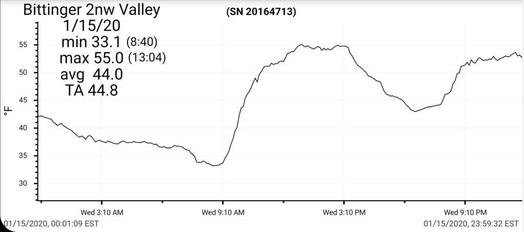
Bittinger 2nw Valley
MIN[33.1]—MAX[55.0]—AVERAGE MEAN[44.0]—TRUE AVERAGE[44.8]—PRECIP[.12]7am
Snowfall season to date 27.1″
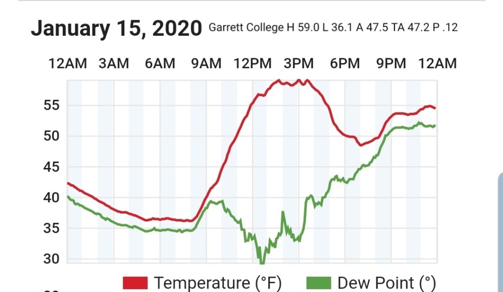
Garrett College
MIN[36.1]—MAX[59.0]—AVERAGE MEAN[47.5]—TRUE AVERAGE[47.2]—PRECIP[.12]
Canaan Heights/Davis 3SE
MIN[34.0]—MAX[55.0]—AVERAGE MEAN[45.0]—PRECIP[.19]
Snowfall season to date 41.2″
Climate Reference Network Canaan
Cabin Mt at Bald Knob
MIN[32.0]—MAX[53.1]—AVERAGE MEAN[42.5]—TRUE AVERAGE[43.2]—PRECIP[.01]

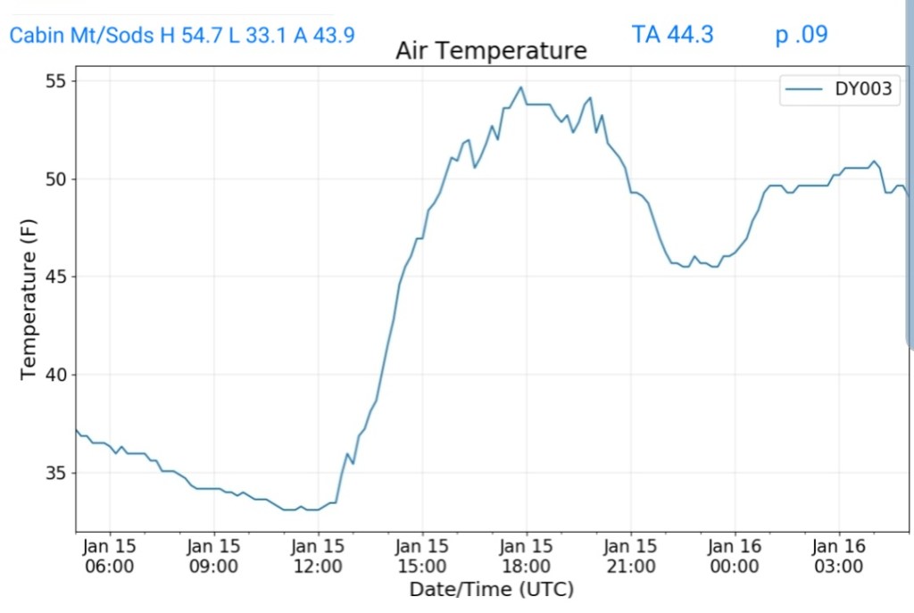
Cabin Mt-Western Sods
MIN[33.1]—MAX[54.7]—AVERAGE MEAN[43.9]—TRUE AVERAGE[44.3]—PRECIP[.09]
Spruce Knob
MIN[29.3]—MAX[49.8]—AVERAGE MEAN[39.5]—TRUE AVERAGE[40.7]—PRECIP[.03]

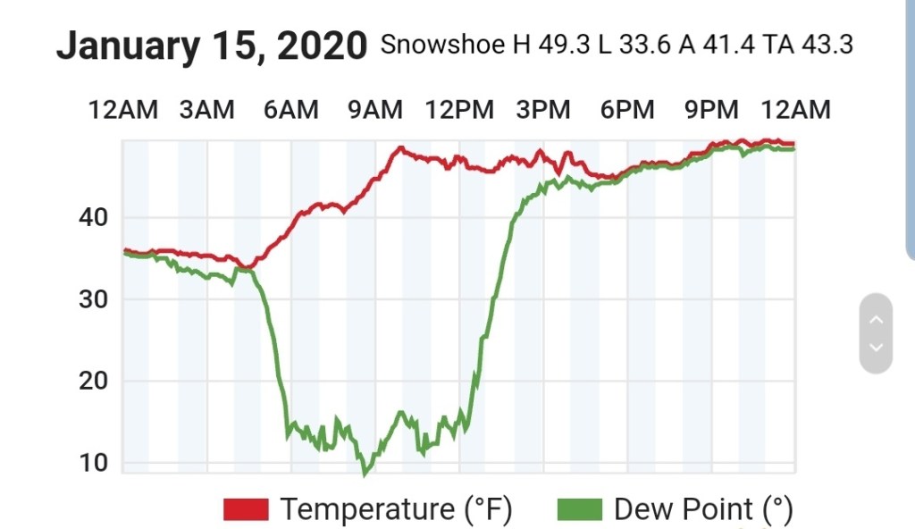
Snowshoe
MIN[33.6]—MAX[49.3]—AVERAGE MEAN[41.4]—TRUE AVERAGE[43.3]
Canaan Valley Refuge
MIN[26.8]—MAX[58.1]—AVERAGE MEAN[42.4]—TRUE AVERAGE[45.6]

7Springs
MIN[31.7]—MAX[53.9]—AVERAGE MEAN[42.8]—TRUE AVERAGE[42.8]

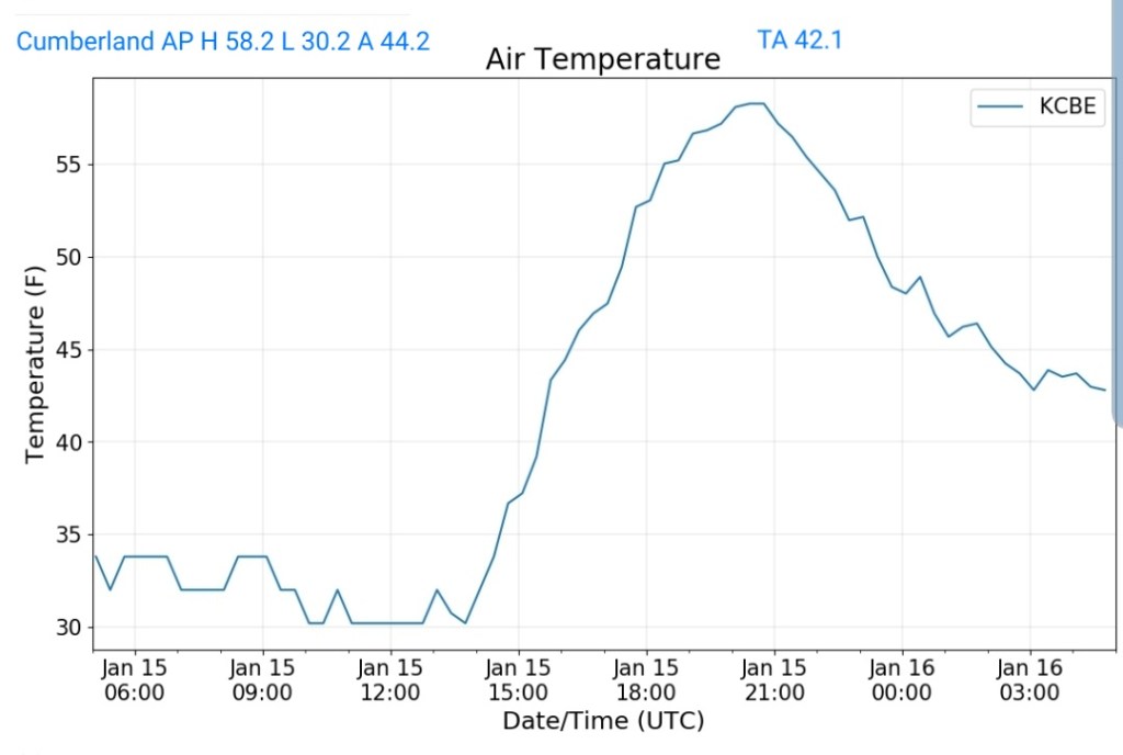
Cumberland Airport
MIN[30.2]—MAX[58.2]—AVERAGE MEAN[44.2]—TRUE AVERAGE[42.1]
The Valley vs Cabin Mt

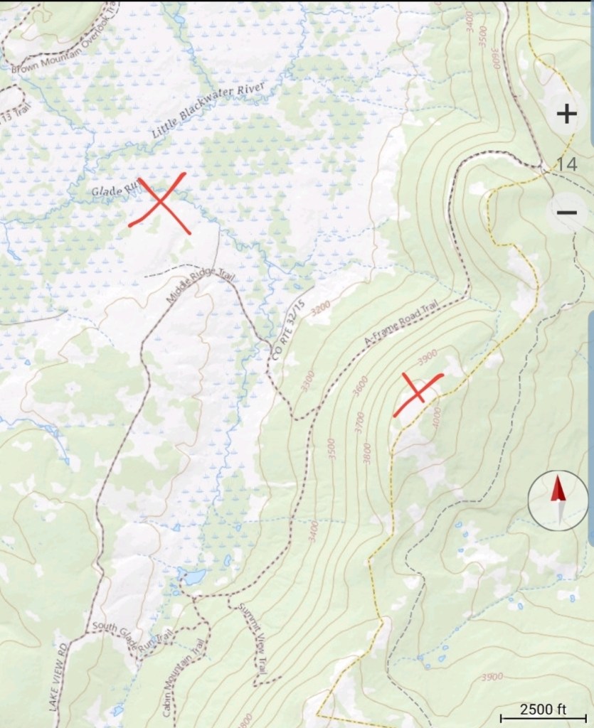
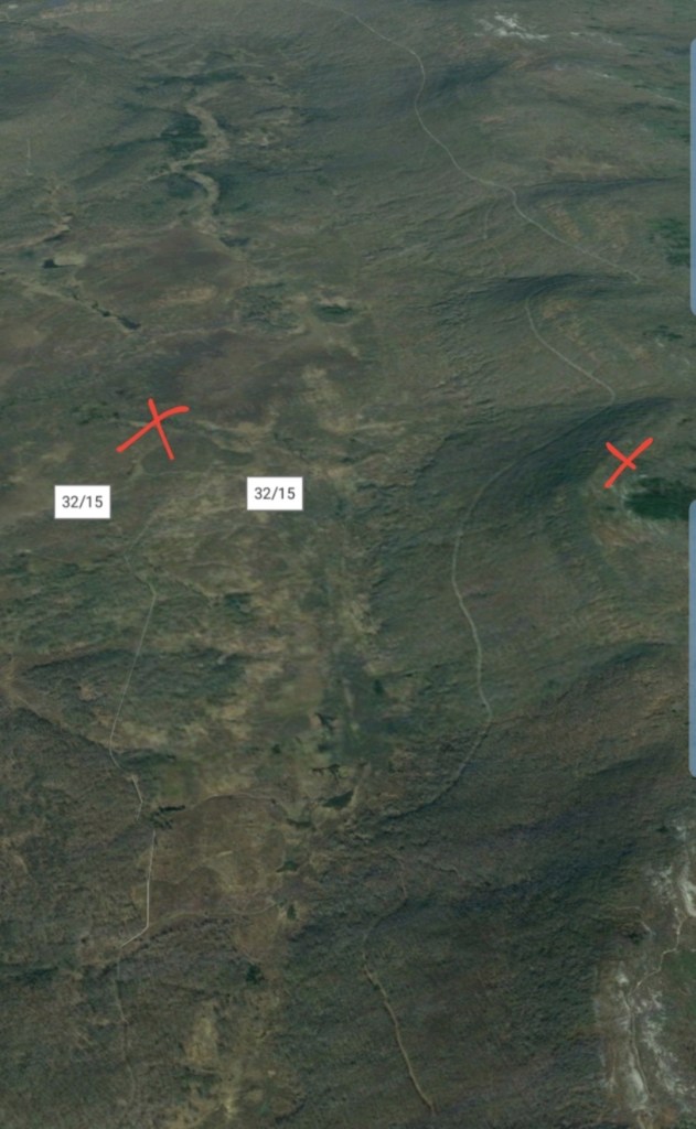
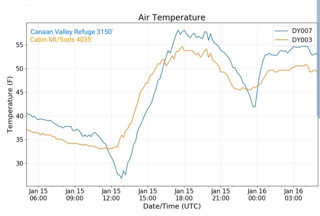
Canaan area temps
Comparison view


RTMA
Radar
Satellite
Flow
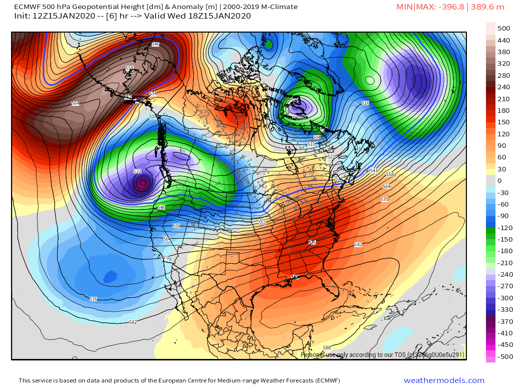
Surface features and 500mb height anomalies and flow
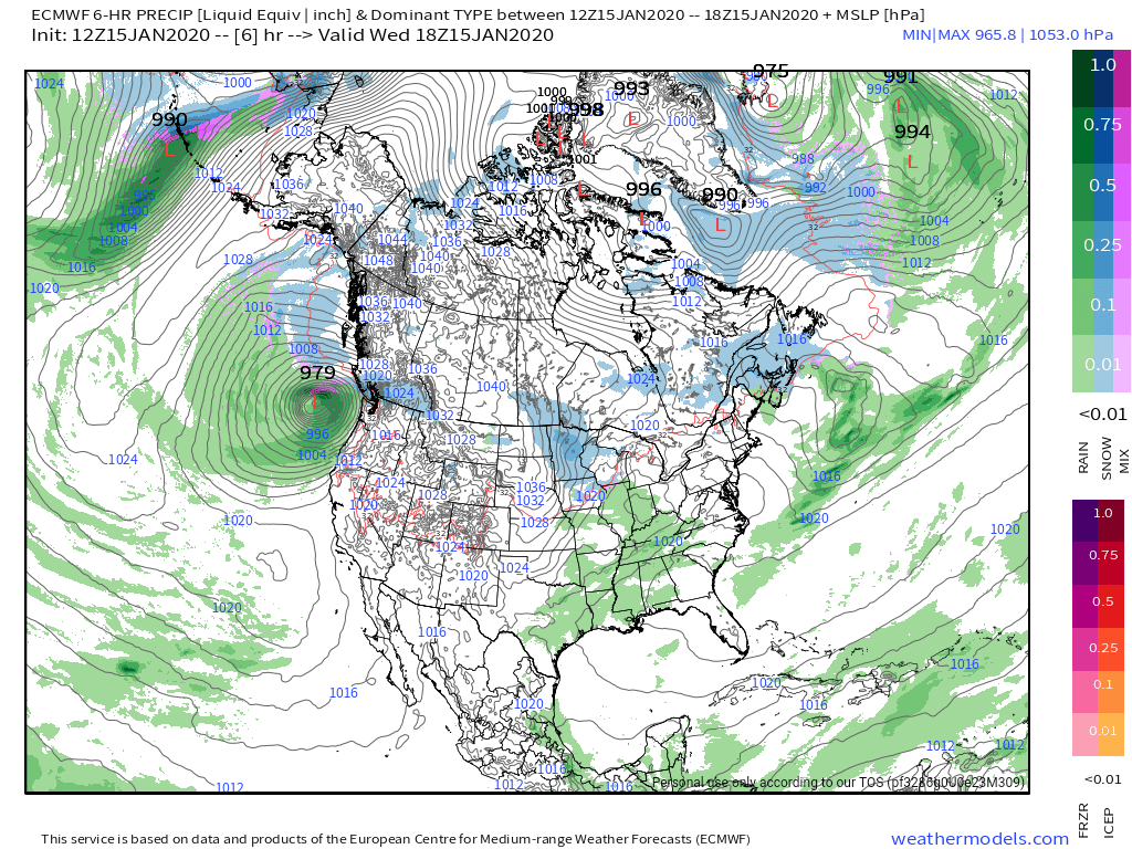
Limited onset snow
I think limited onset snow looks likely at this point. To much warmth screaming in aloft. Thanks to the mega 591 ridge over Florida that is in general a Wv snow killer, especially the high ground.

You may do a little better, on the order of 1-2″ from Eastern Somerset, into Cambria, Bedford , and Allegany County. From Garrett County through the Wv high ground, I just think any onset snow is short lived. Some areas look like they may have a duration of sleet, while others freezing rain before we all go to a period of rain by evening/early overnight. A 4-8 hour window of milder air at the surface. That then changes back to snow overnight Saturday and some upslope accumulations look likely.
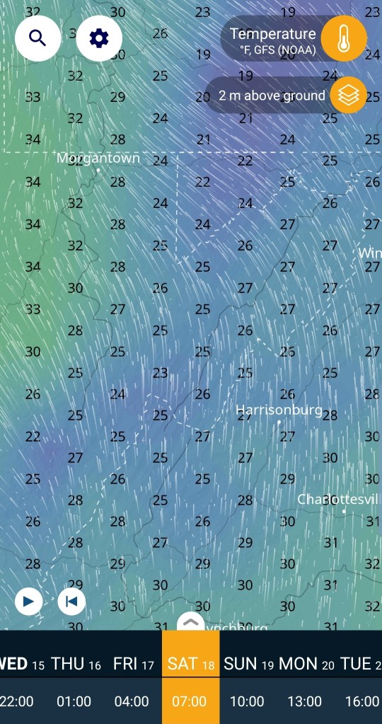
Using the GFS as a guide, not the gospel. I think this may better illustrate the layers better than a sounding for viewers.
What is the video?
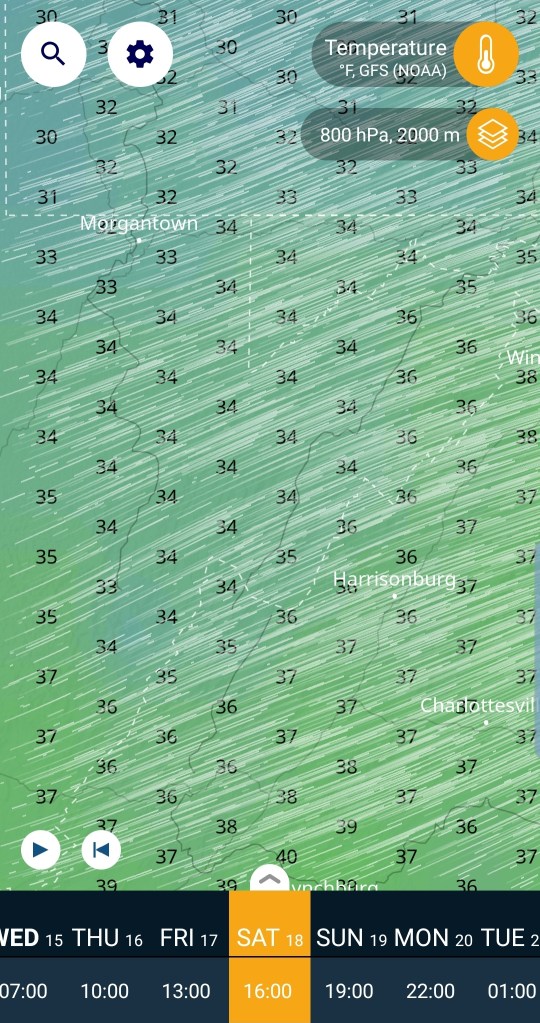
800hpa roughly 6400′
Modeled temps at 7am Saturday morning, around when the precip pushes in. (Keep in mind. This is a 9km model, it will not be perfect with these numbers across the highest and lowest areas)

well above freezing up at that level.
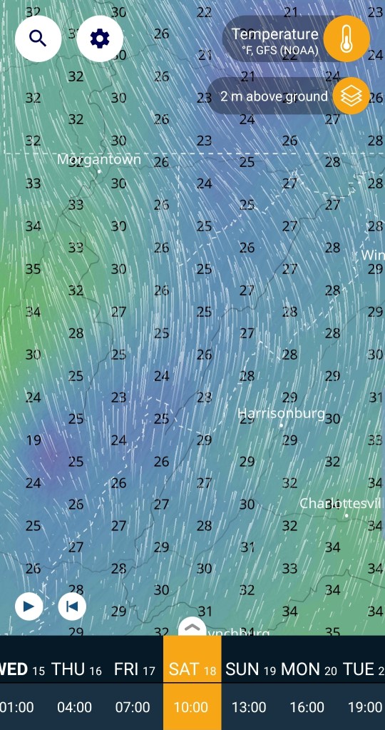
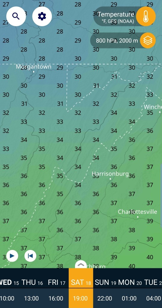
What about the 850 level, roughly the tops of the Wv high ground. See that rapid temp drop in that 1500′ +/-

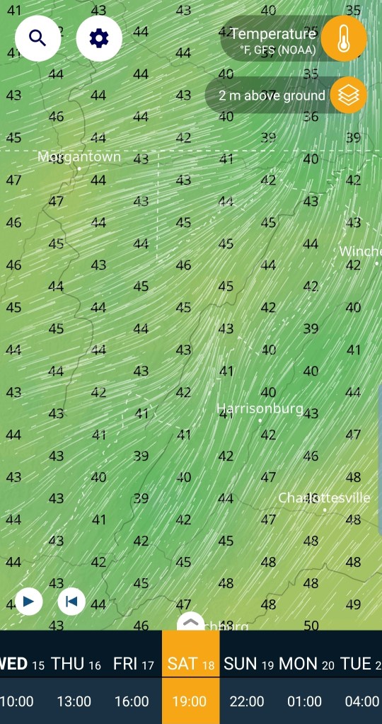
How about 2m above the surface
At 7am, this looks like areas of sleet, and freezing rain. Sleet especially central and eastern areas below 3000′, freezing rain/sleet across the Wv tops above 4000′, freezing rain to rain west side of the Mts and the only profile that looks conducive for snow, eastern Somerset, Cambria, Bedford, Allegany and east at 7am.
How about 10 am
At 800hpa roughly 6400′
Snow threat looks done for all areas at this time. If the model is correct.

what occurs at the layers under 6400, lets drop to the 850 level, again roughly the highest peaks in Wv are the 850 levels.

that 850 layer is much colder, but some areas coming +32…those areas near and under 32 at this level at 10am, that’s showing some depth to your cold air, likely sleet yet at this time, closer to 32, probably freezing rain. Why freezing rain?
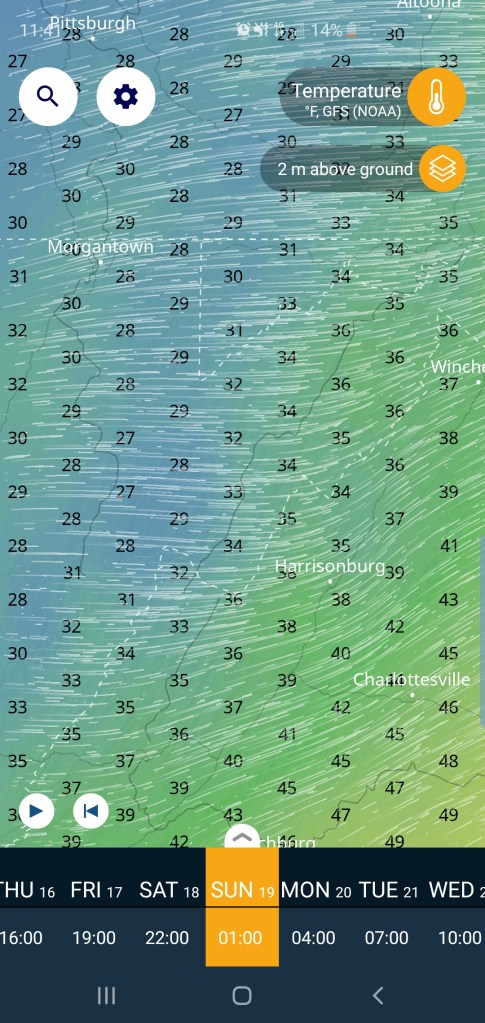
Let’s look at the 2 meters above the surface at 10am. Still cold. Surface is influenced by the big departing high, with the upper air influenced by the low pressure Nw, thanks to the big Southeast ridge
Let’s advance to 1pm
800hpa roughly 6400. This level cooled some in the north, very close to freezing, as well as the levels above it.

what about at 850 level, again, highest Wv elevations around this level. This would indicate some areas could see some snow trying to mix back in..if the model is right.

What about the surface at 1pm…you can see some areas ar 1pm, a cold profile top to bottom occurs for a short spell near the mason dixon. If the model is correct, at this time precip type is primarily maybe some wet snow mixed in north, pockets of freezing rain and plain rain west and that warm tongue with rain in Canaan that is often the case with these setups. Areas of sleet remaining Highland, Bath counties Va with that profile setup. I wouldn’t take it that literal though, it’s a model run.

At 4pm
800hpa 6400′ roughly . This layer is mild south of the mason Dixon, beginning to chill north
850 layer, roughly Wv highest elevations . Warm across the board. Any precip at this time is falling as rain and any areas of freezing rain at 4pm restricted to east valley areas.

Surface temps at 4pm…and I think the model in general is too fast warming surface temps up. I think areas of below 32 will be a bit more expansive yet at 4pm. That said, the deeper valleys on the east side of the Mts holding on to cold the longest and freezing rain lingers the longest. Around this time, likely a little after, west winds should begin howling in.

7pm
800hpa roughly 6400′
Colder air aloft returnin . If we had a Mt. Washington NH, the peak would be back to snow. We dont…
The 850 level, Wv highest areas elevation.
Temps well above freezing yet.

And the surface at 7pm
At this time, most into the 40s, again a 9km model, wont pick it up, but the Wv peaks back into the 30s at this time. Also a few deep valleys still holding 30s that’s slow to be scoured out.
lets jump to 1am Sunday morning
800hpa, no issue with cold here

850 level, no issues here

And the surface,,back below freezing here, except now the lower elevations on the east side are milder, but they too will begin the drop.
From 8pm to midnight the transition back to snow should occur with any remaining precip.
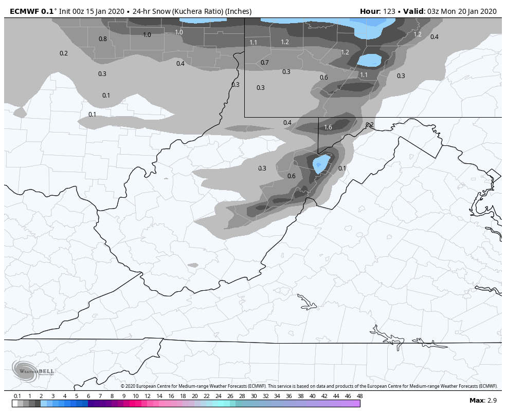
Snowfall on the order of 1-3″ looks likely from the changeover into Sunday night.. with lingering light additional Monday.
beyond this we do go into a predominately cold pattern….will that mean snow?
