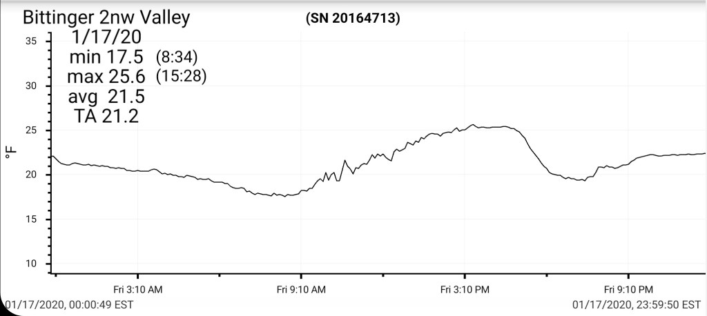
January 17, 2020
Jan 17(Fri)
A touch of light snow this morning, there was more accumulation last evening, overnight towards Grantsville vs Bittinger. The day featured plenty of sun and cold temps.
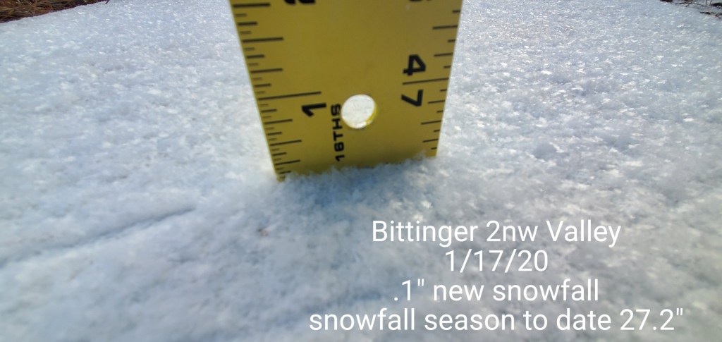
Bittinger 2nw Valley
MIN[17.5]—MAX[25.6]—AVERAGE MEAN[21.5]—TRUE AVERAGE[21.2]—PRECIP[T]
new snowfall. .1″
Snowfall season to date 27.2″
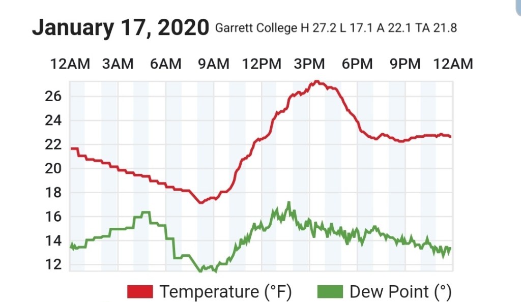
Garrett College
MIN[17.1]—MAX[27.2]—AVERAGE MEAN[22.1]—TRUE AVERAGE[21.8]—PRECIP[F]
Canaan Heights/Davis 3SE
MIN[14.0]—MAX[29.0]—AVERAGE MEAN[21.5]—PRECIP[.01]
New snowfall .3″
Snowfall season to date 41.5″
Comments by Dave Lesher at http://data.canaanmtnsnow.com
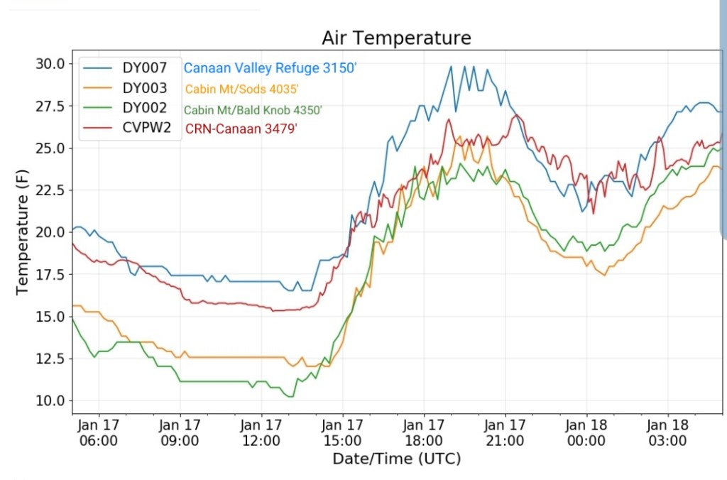
Climate Reference Network Canaan
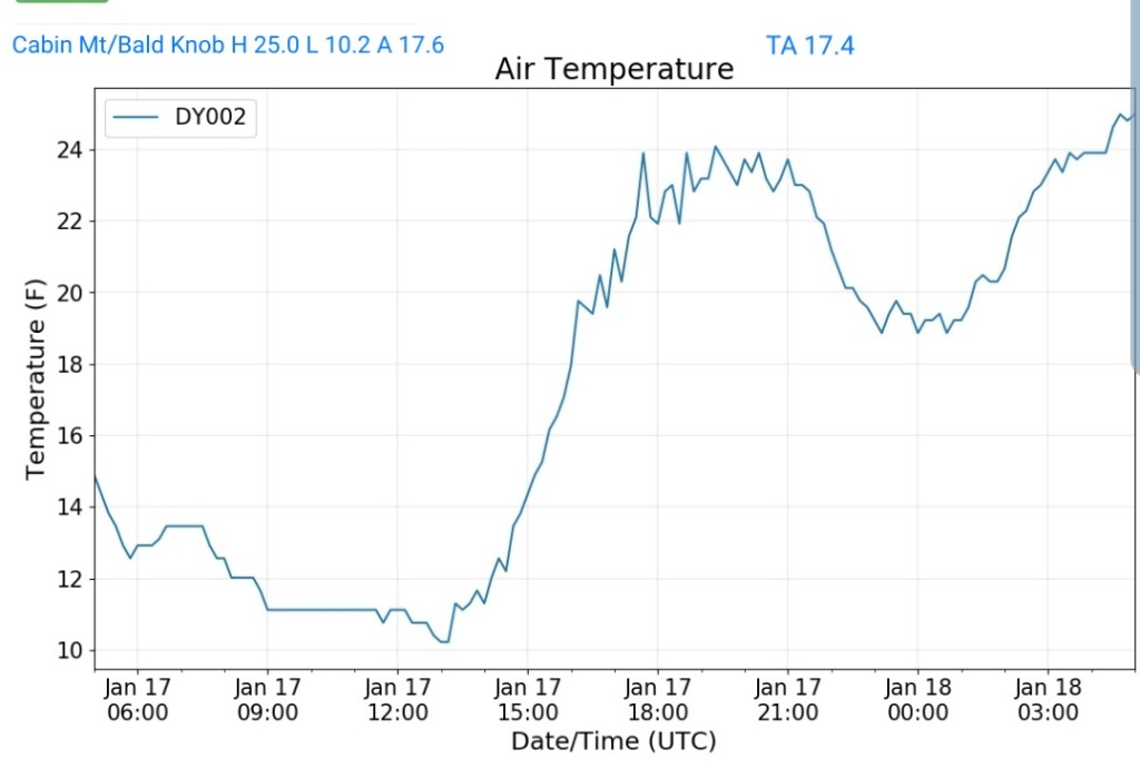
Cabin Mt at Bald Knob
MIN[10.2]—MAZ[25.0]—AVERAGE MEAN[17.6]—TRUE AVERAGE[17.4]—PRECIP[F]
Cabin Mt-Western Sods
MIN[11.8]–MAX[25.7]—AVERAGE MEAN[18.7]—TRUE AVERAGE[17.5]—PRECIP[F]

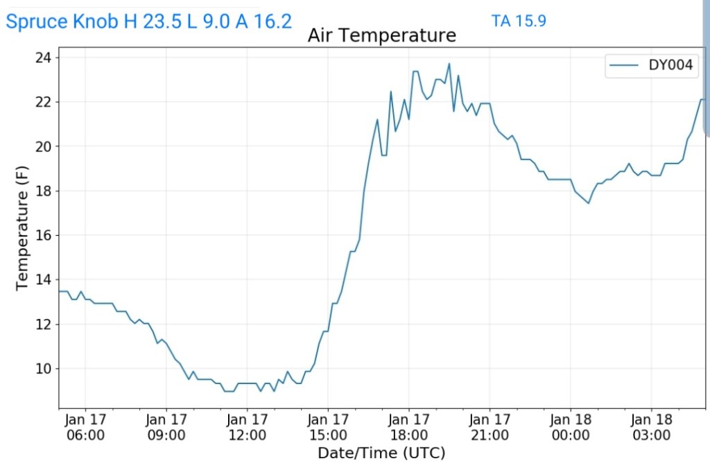
Spruce Knob
MIN[9.0]—MAX[23.5]—AVERAGE MEAN[16.2]—TRUE AVERAGE[15.9]—PRECIP[0]
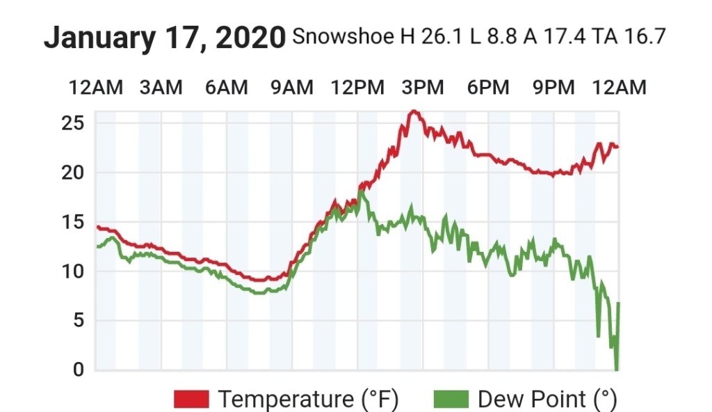
Snowshoe
MIN[8.8]—MAX[26.1]—AVERAGE MEAN[17.4]—TRUE AVERAGE[16.7]
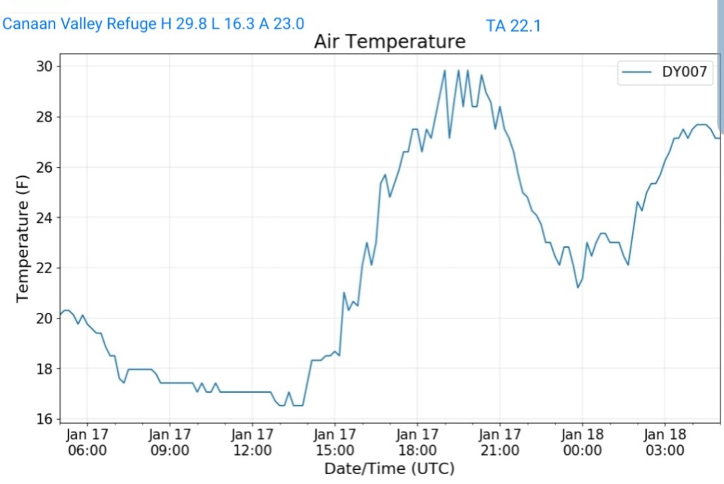
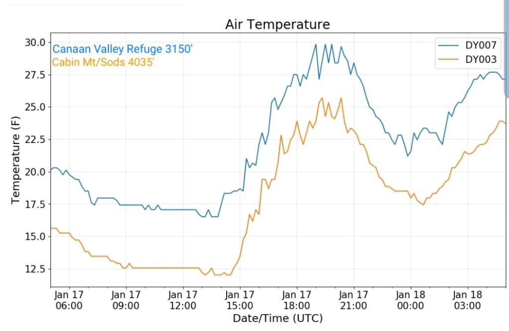
Canaan Valley Refuge
MIN[16.3]—MAX[29.8]—AVERAGE MEAN[23.0]—TRUE AVERAGE[22.1]
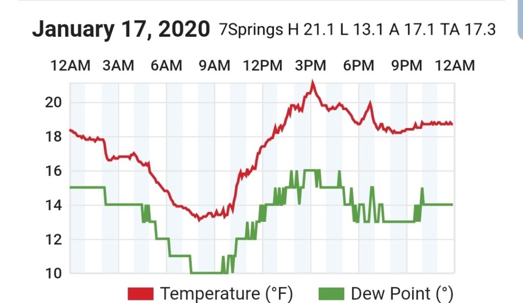
7Springs
MIN[13.1]—MAX[21.1]—AVERAGE MEAN[17.1]—TRUE AVERAGE[17.3]
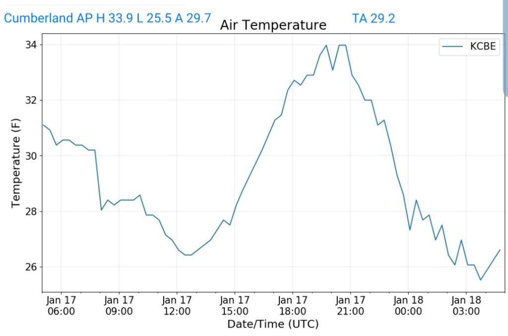
Cumberland Airport
MIN[25.5]—MAX[33.9]—AVERAGE MEAN[29.7]—TRUE AVERAGE[29.2]
The Valley vs Cabin Mt
Canaan area temps
Comparison view
RTMA
Radar
Satellite
Flow
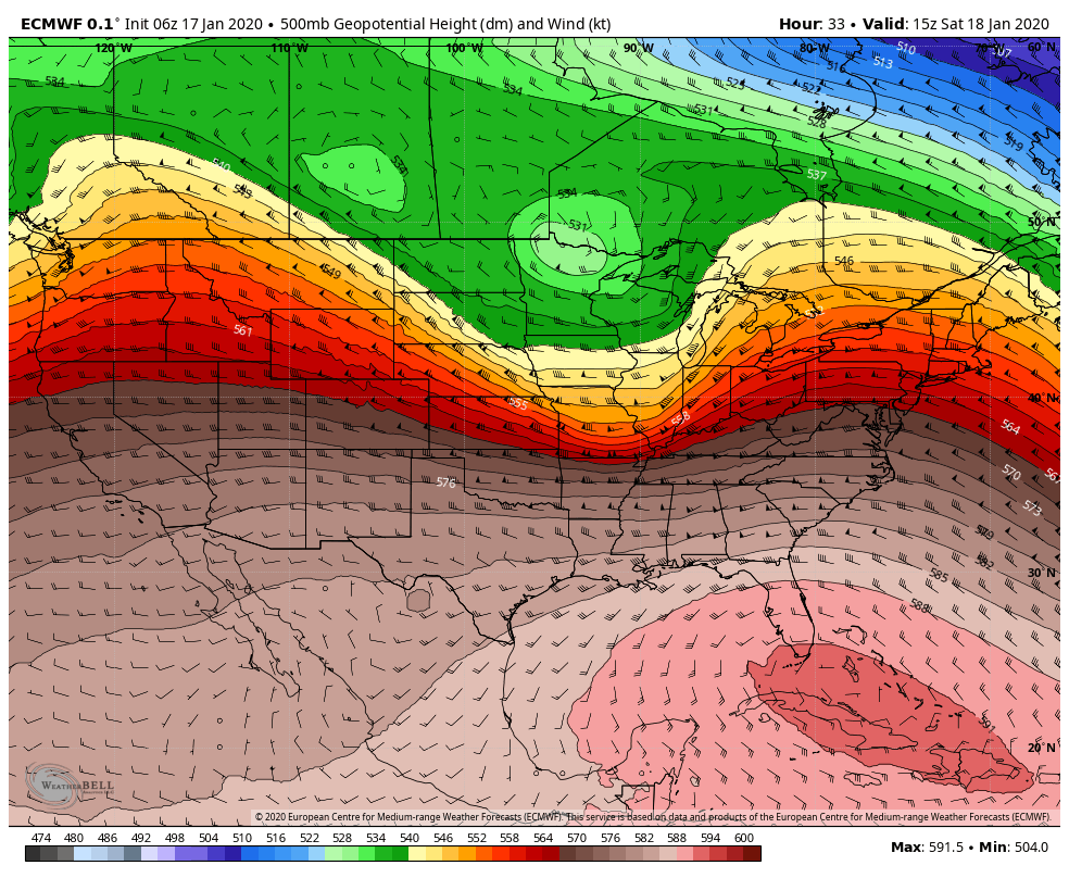
Surface features and 500mb height anomalies and flow

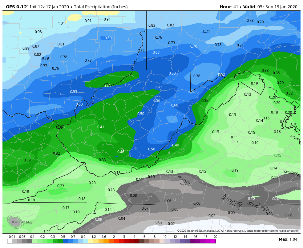
Upcoming winter event….
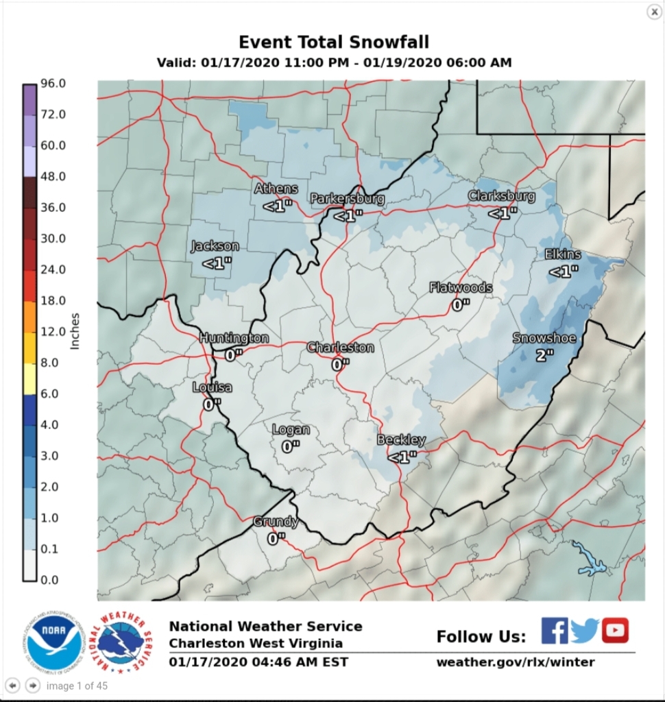
I was going to label this upcoming winter storm, but that probably would make it sound more significant than reality will have it. Having said that, I would expect winter weather advisories to be issued throughout the area late tonight through 1-7pm tomorrow, ending time varied by WFO office and location simply due to the icing risk and the hazards that even a little ice can cause. Charleston out with some already.
Currently we see disagreement within the office forecast.
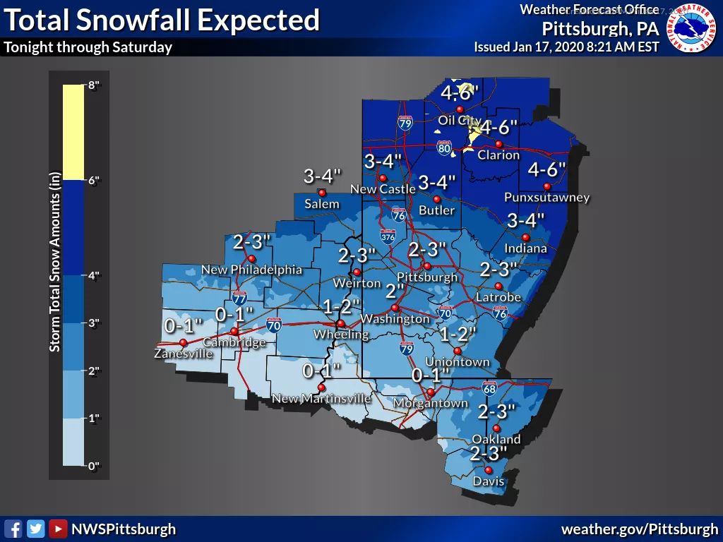
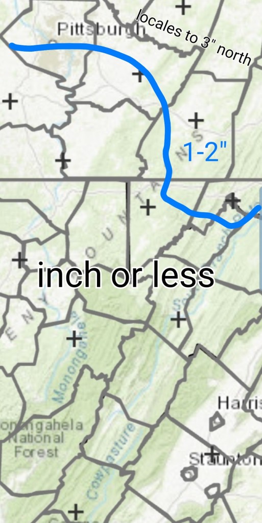
Pitt snowfall(look at the northeast area of Garrett County, 3+”) this through Saturday.
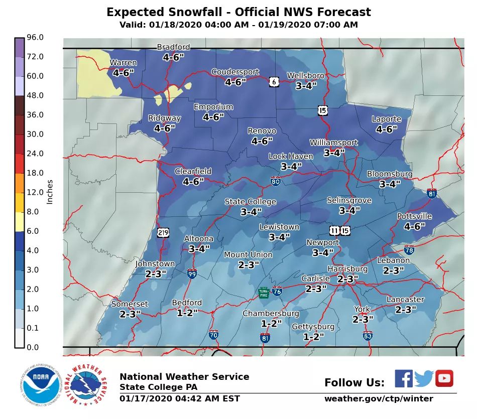
State College
notice 1-2″ at the Somerset/Garrett border where Pitt has 3″+. This includes some into Sunday mornings upslope even and it’s still less.
Sterlings call.. 1-2″ as well. Through tomorrows snow.
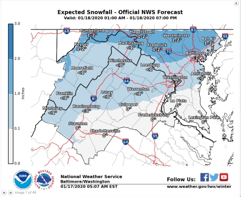
Charleston- includes some Sunday a.m upslope.
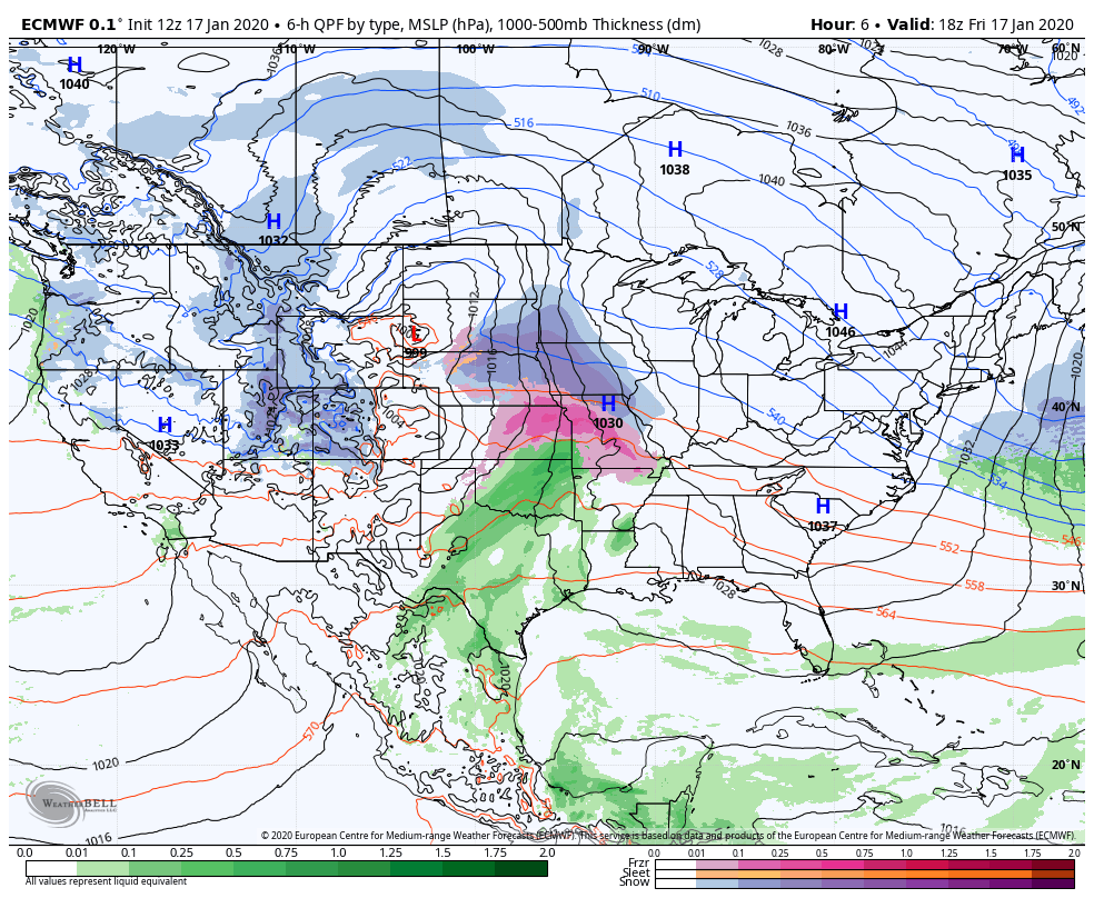
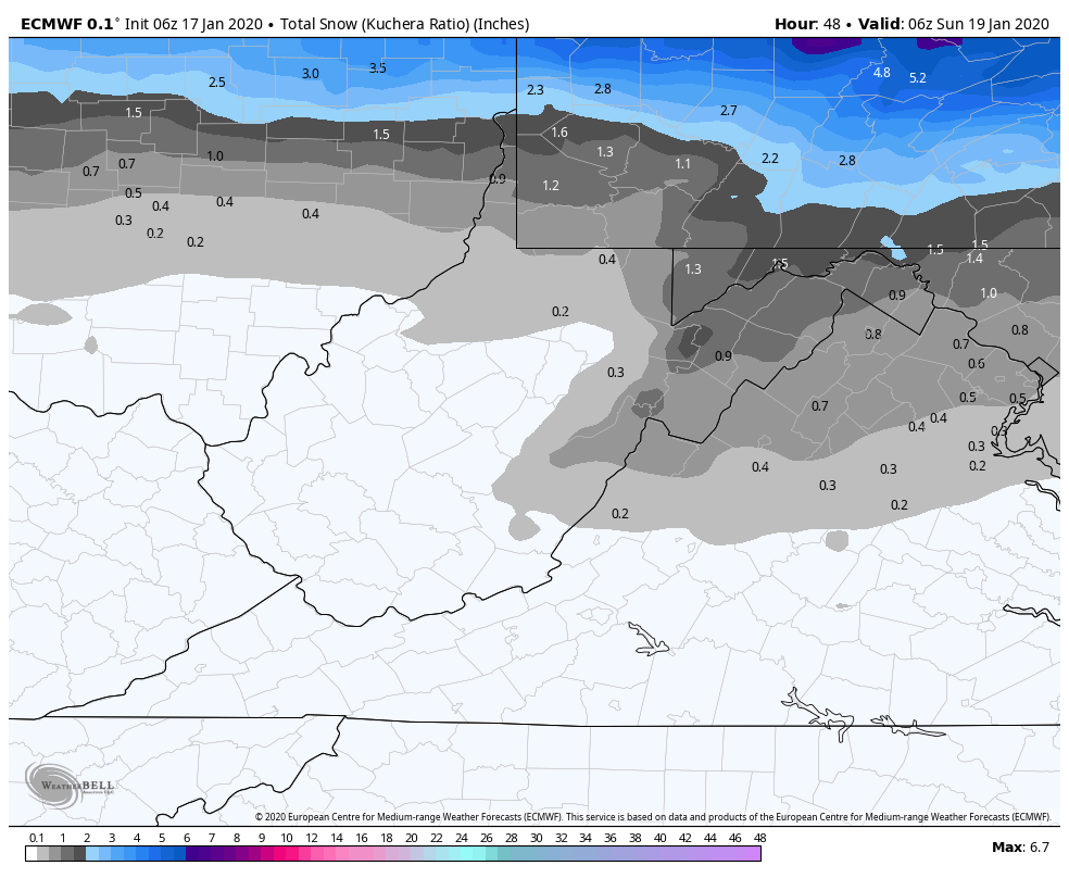
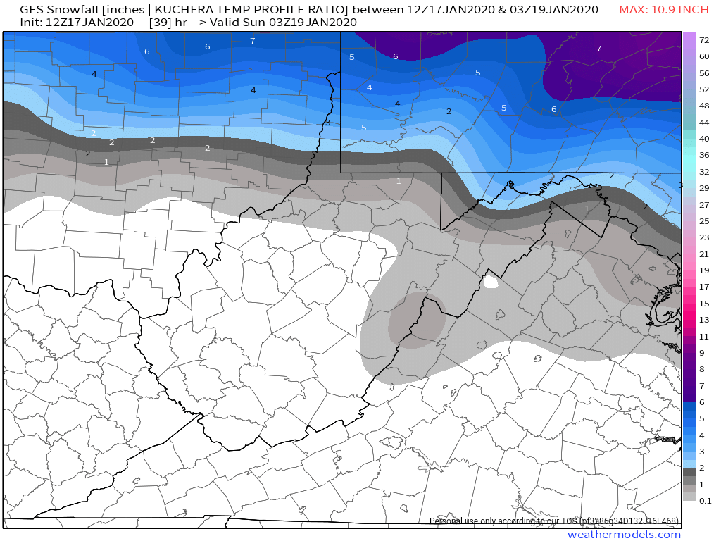
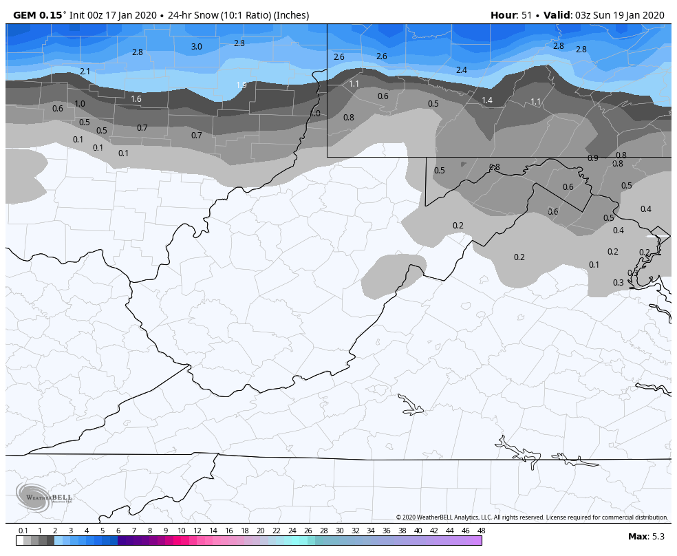
For the last several days models have had LOTS of agreement with only a slight cooling trend on the upper air in recent runs at the onset. Current National model blend holds this for snowfall
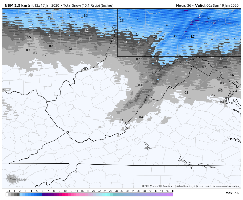
6z ECMWF
12z GFS
00z Canadian
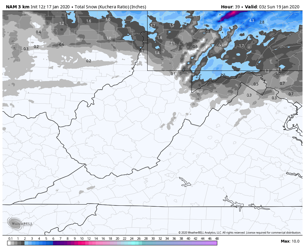
3km Nam. Love its temp profiles which can lead to good boundaries, but in general sucks on QPF
The WPC probability map
2″
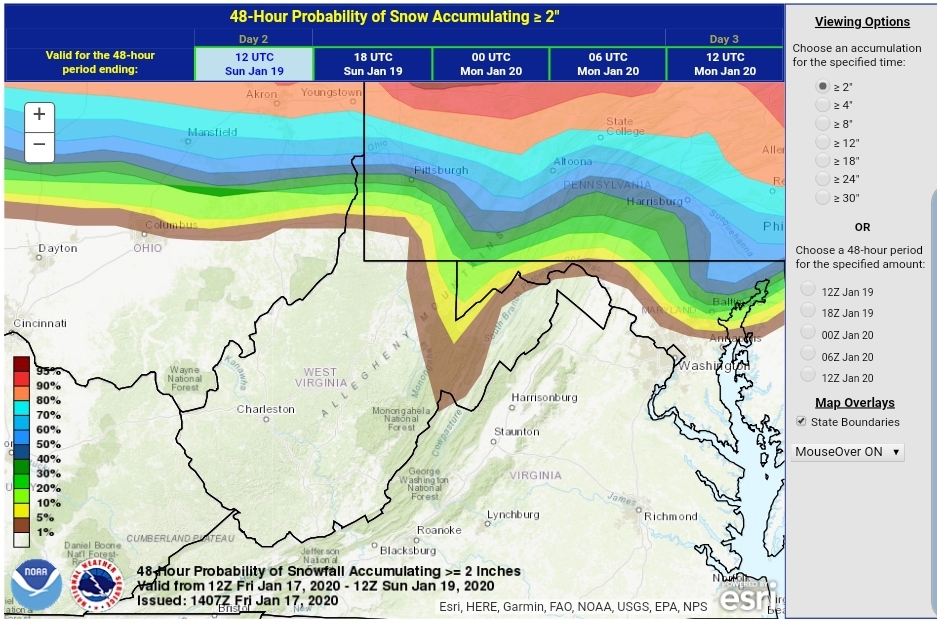
4″

My thoughts, this through Saturday PM, EXCLUDING upslope into Sunday which looks like a 1-3″ deal. If the warmth aloft is faster, this would even be reduced for tomorrows snow.
With this big mega SE Ridge, Wv snowfall with a system into the lakes is often minimal
Lots of warmth pushing in aloft, however as mentioned it is a touch cooler vs the modeling of 2 days ago.
Sleet, there should be a period of sleet mid morning through midday in areas, in some areas on the east side of the Mts until early afternoon. Lots of model variation on this setup and frankly, models are not very good with parameter.
Model listed on each image.


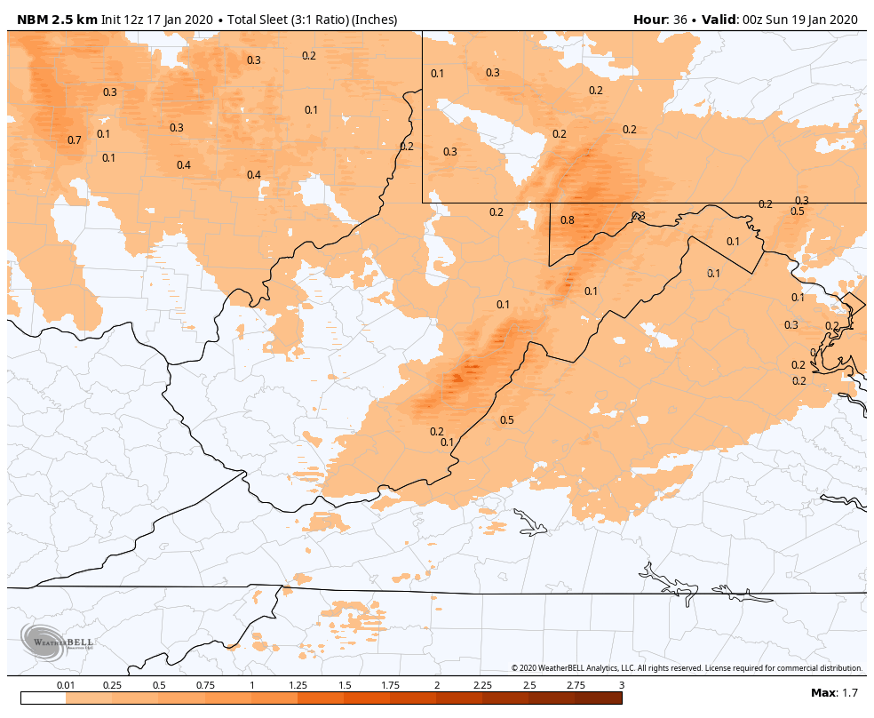

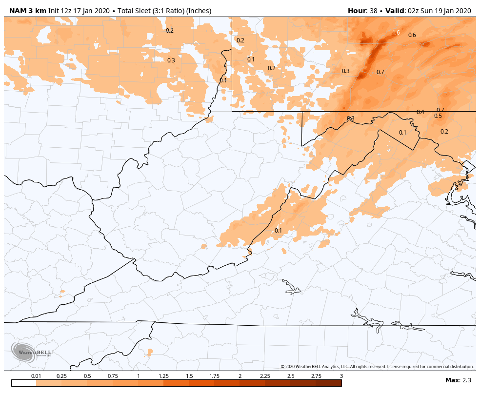
My thoughts… I like what the GFS shows. .3 to .6 sleet in areas with longest duration. Remember sleet does not accrete to objects, its frozen droplets that bounce.
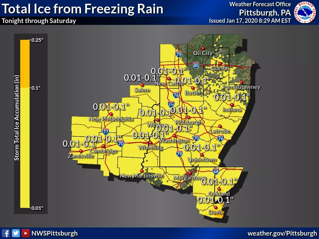
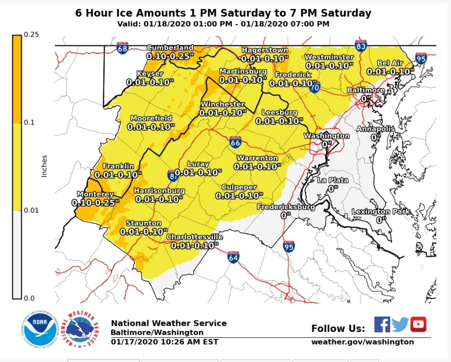
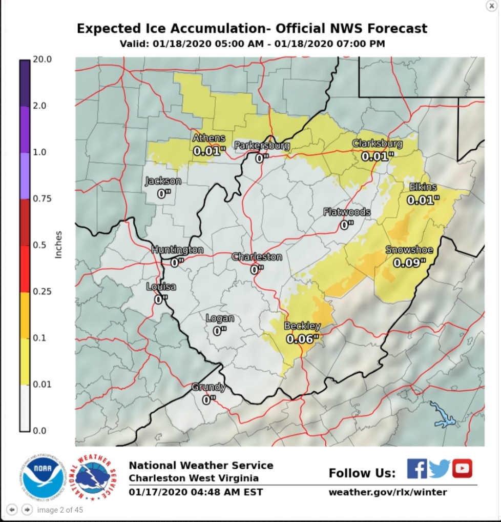
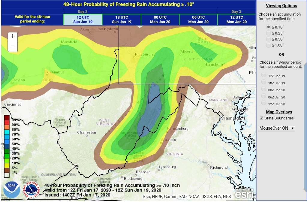
Freezing rain.
Pitt
State College

Sterling
Charleston
WPC probability
Tenth
.25
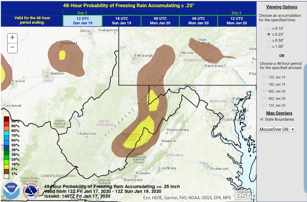
My thoughts

Precip onset
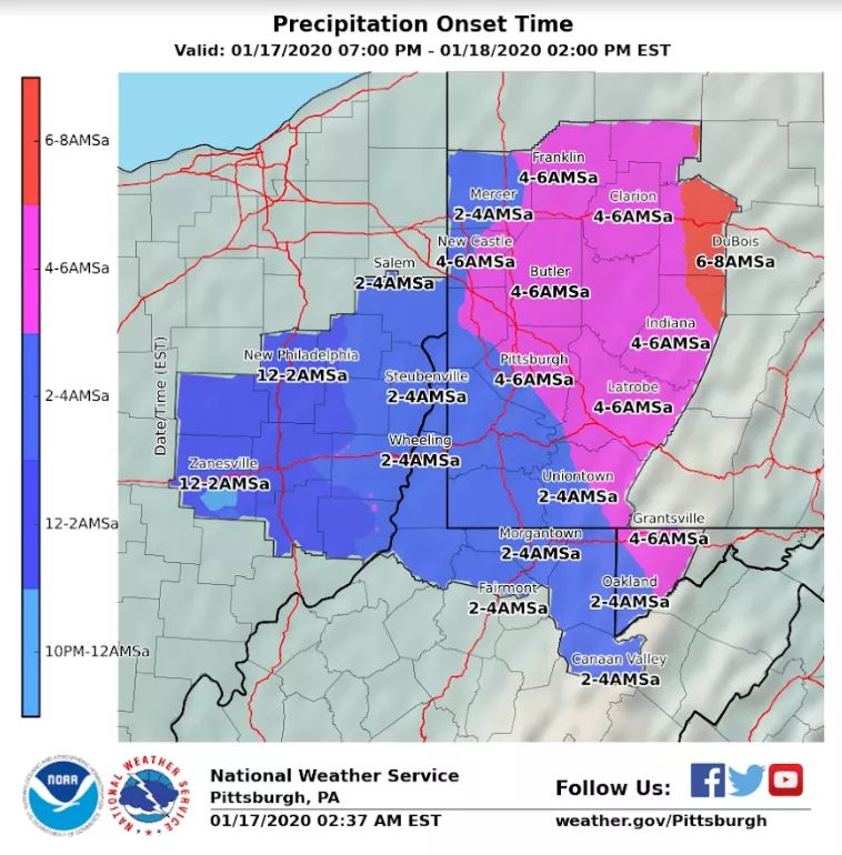
the initial precip should be snow in most areas, I’d expect it to be very brief in the Wv high ground and in some areas maybe not at all.
3km Nam 2m temps. Model of choice in these setup . Gives a good idea when your area will go to plain rain.
3km Nam 850 temps. The SW surge aloft is still evident on modeling, but a touch cooler.
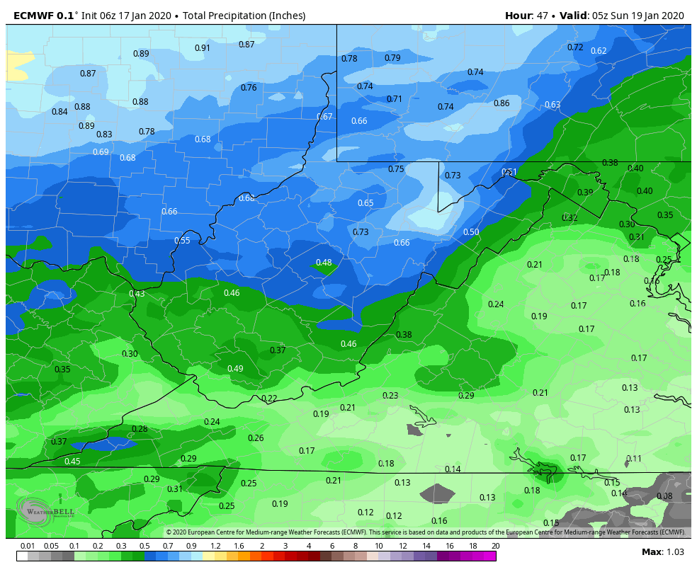
total qpf
6z ECMWF through midnight tomorrow. Around .3 to .6 of this in areas is wintry precip of some sort before plain rain. Beyond this time period we transition to upslope snow.
12z GFS