Jan 23, 2020
High clouds, dimmed sun. A milder flow aloft, capping stagnant air and cooler air the the valleys.
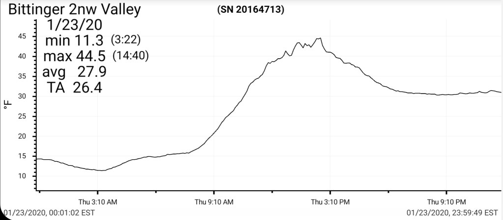
Bittinger 2nw Valley
MIN[11.3]—MAX[44.5]—AVERAGE MEAN[27.9]—TRUE AVERAGE—[26.4]—PRECIP[0]
Snowfall season to date 34.7″
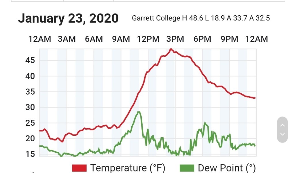
Garrett College
MIN[18.9]—MAX[48.6]—AVERAGE NEAN[33.7]—TRUE AVERAGE[32.5]—PRECIP[0]
Canaan Heights/Davis 3SE
MIN[35.0]—MAX[47.0]—AVERAGE MEAN[41.0]—PRECIP[0]
Snowfall season to date 46.2″
Climate Reference Network Canaan
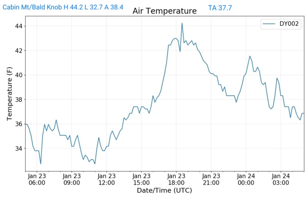
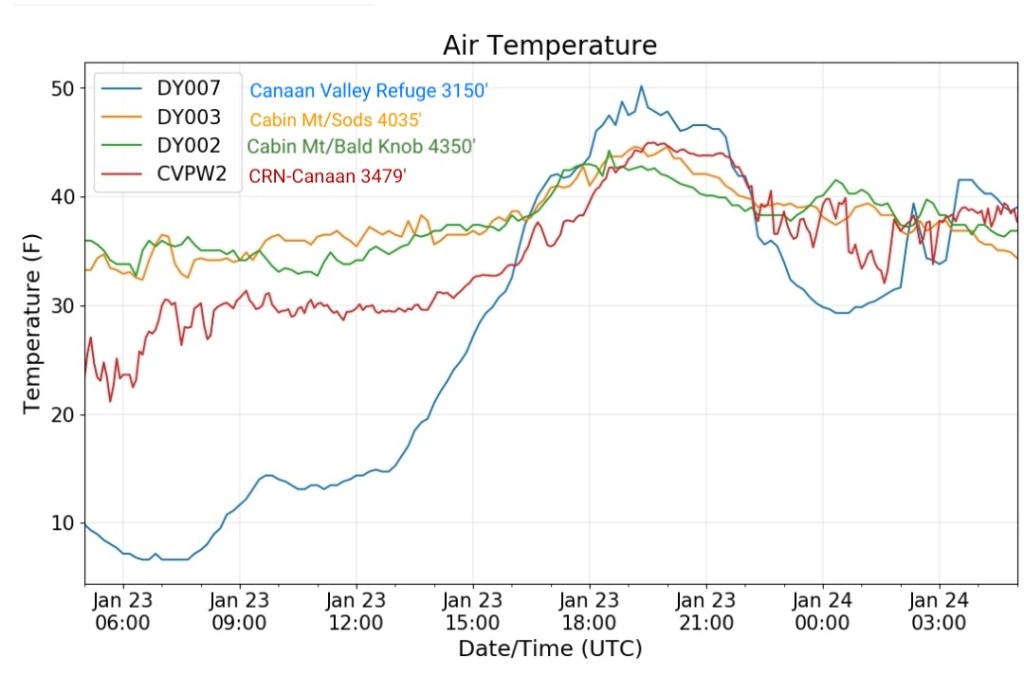
Cabin Mt at Bald Knob
MIN[32.7]—MAX[44.2]—AVERAGE MEAN[38.4]—TRUE AVERAGE[37.7]—PRECIP[0]
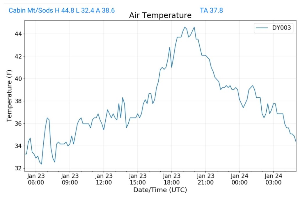
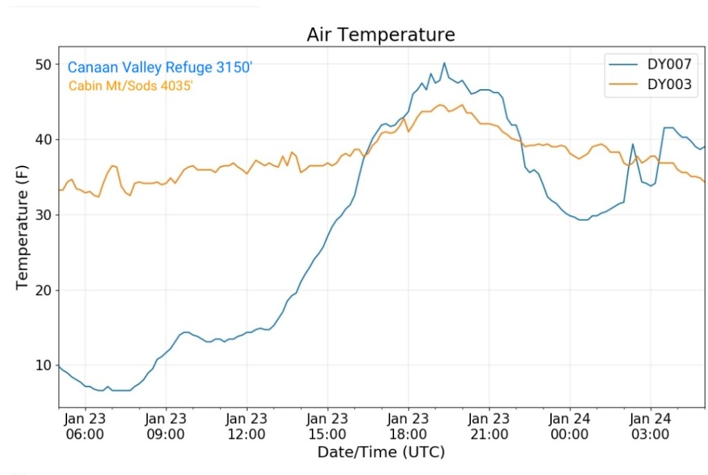
Cabin Mt-Western Sods
MIN[32.4]—MAX[44.8]—AVERAGE MEAN[38.6]—TRUE AVERAGE[37.8]
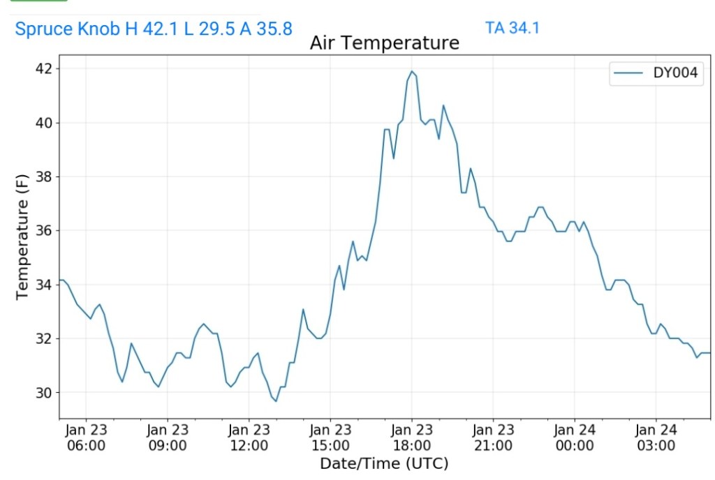
Spruce Knob
MIN[29.5]—MAX[42.1]—AVERAGE MEAN[35.8]—TRUE AVERAGE[34.1]
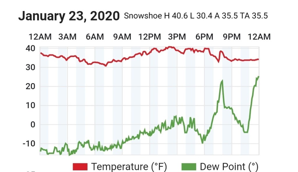
Snowshoe
MIN[30.4]—MAX[40.6]—AVERAGE MEAN[35.5]—TRUE AVERAGE[35.5]
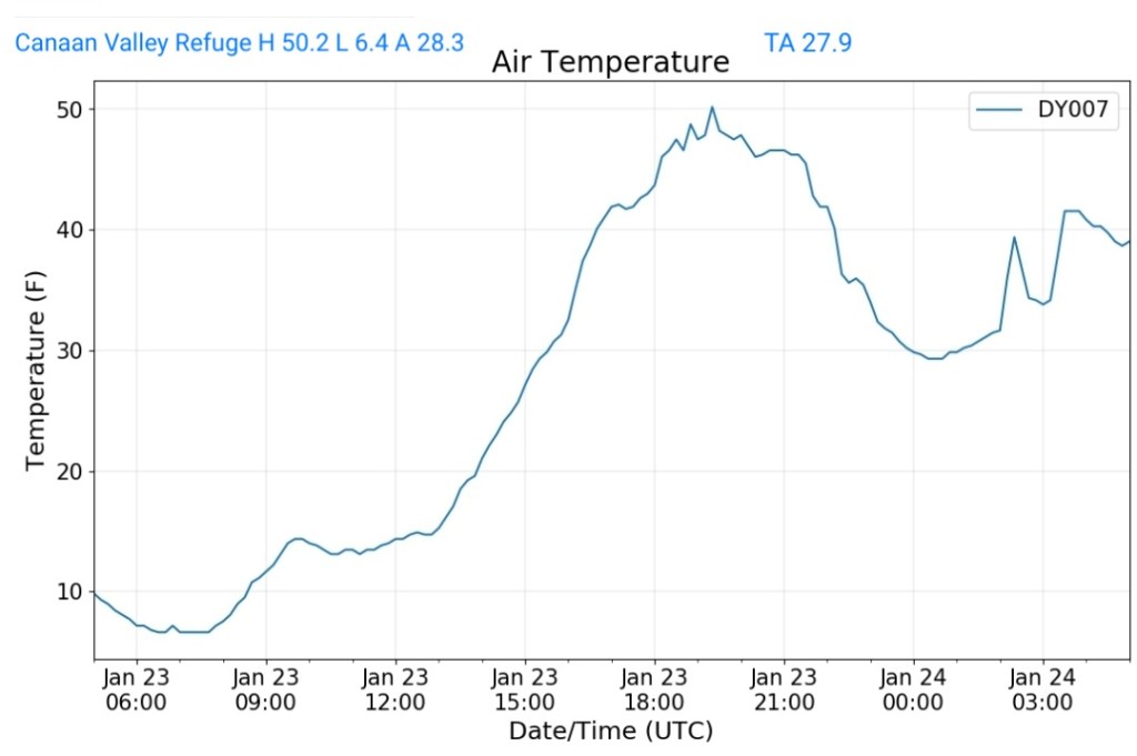
Canaan Valley Refuge
MIN[6.4]—MAX[50.2]—AVERAGE MEAN[28.3]—TRUE AVERAGE[27.9)
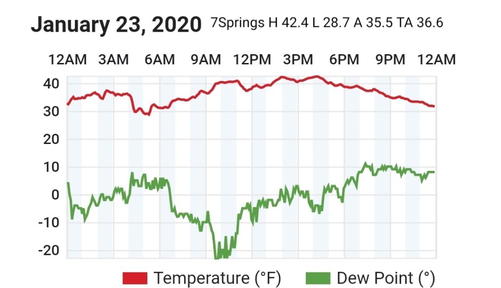
7Springs
MIN[28.7]—MAX[42.4]—AVERAGE MEAN[35.5]—TRUE AVERAGE[36.6]
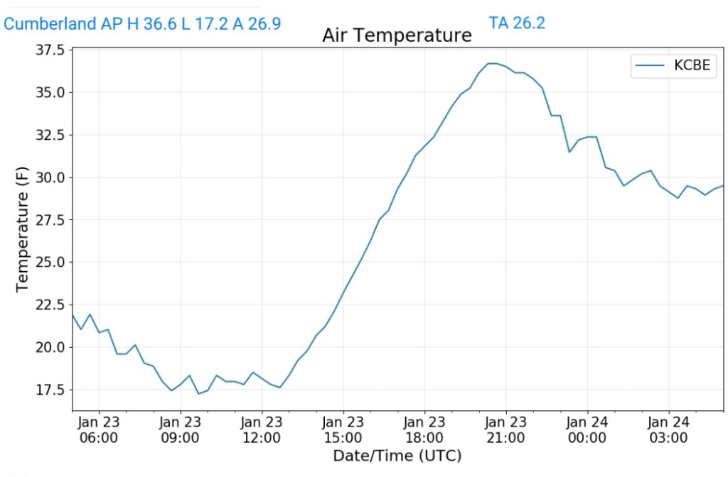
Cumberland Airport
MIN[17.2]—MAX[36.6]—AVERAGE MEAN[26.9]—TRUE AVERAGE[26.2]
The Valley vs Cabin Mt
Canaan area temps
Comparison view
RTMA
Radar
Void of precip
Satellite
Flow
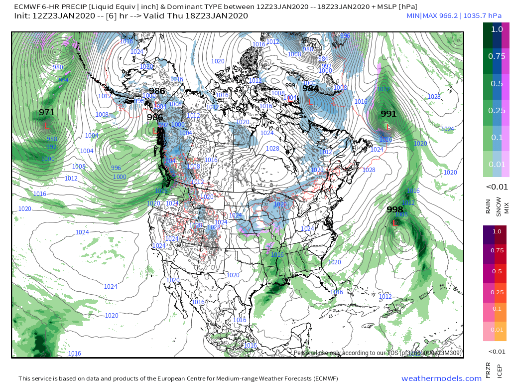
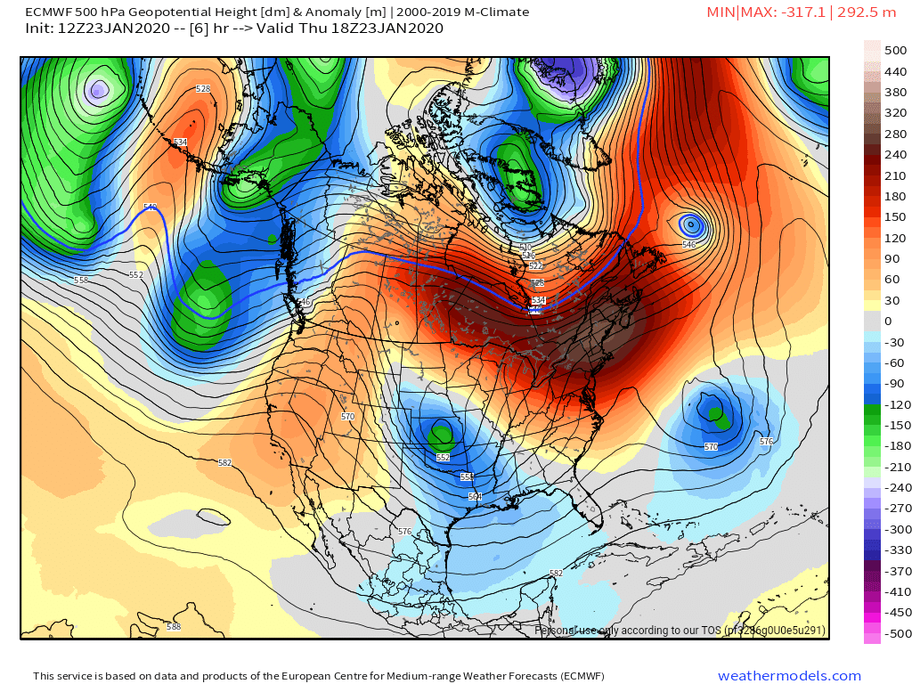
Surface features and 500mb height anomalies and flow
Sooooooo close…..
The upcoming event later Friday through Saturday a.m with backend upslope…
Over the past 2 days models have trended north with the upper low to our west
Case in point, the modeled upper low on today’s ECMWF run vs the 18th. Minor, but significant …

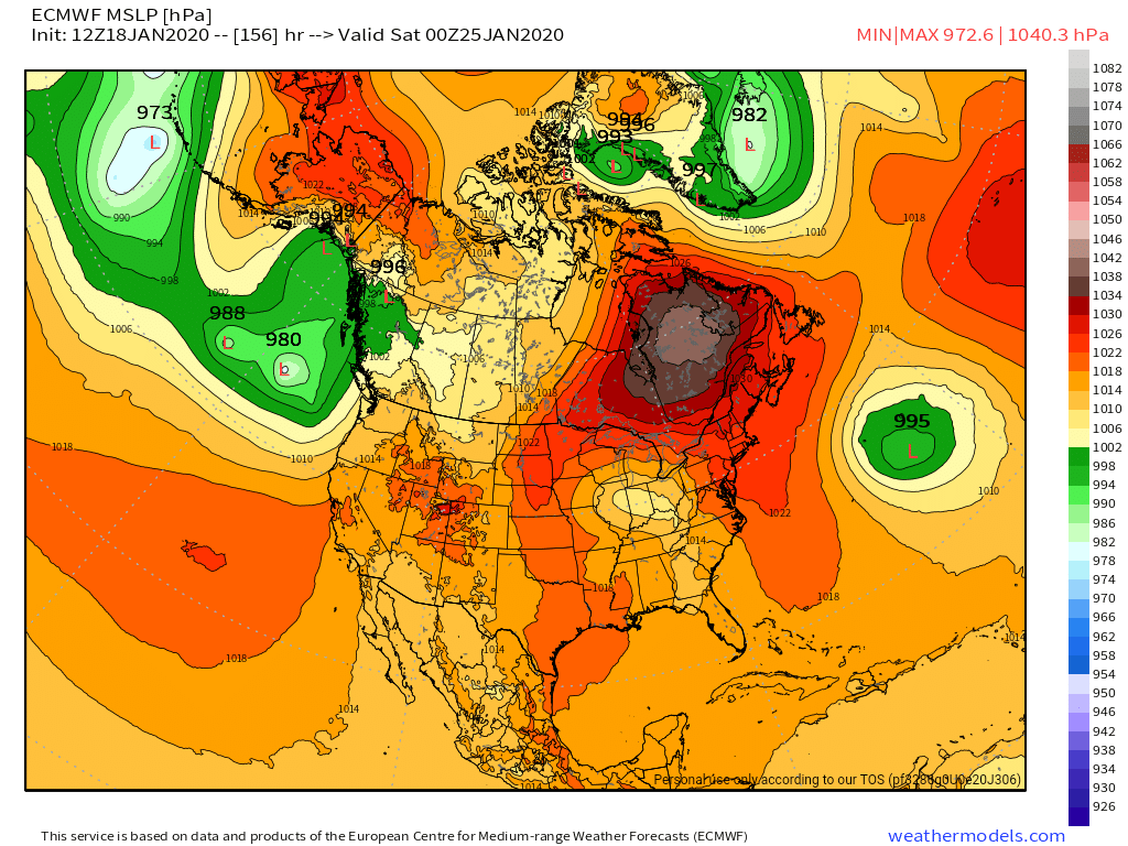
that said, the transfer to the low to our east is slower, we remain jusssst mild enough for for mostly rain Friday/Friday night before we get the wrap around snows on the backside and Saturday afternoon through Monday. 3-6″ of upslope looks like a good bet for the upslope areas.
Areas near and above 4200- 4500′ and above tomorrow afternoon, tomorrow night, across the Wv high ground remain in the snow threat. A very close setup. Charleston has backed off some on the threat for Snowshoe Friday night and at the moment Charleston puts out a very ODD forecast on the point and click.. read

I’ll highlight Friday night. Rain and snowshowers, becoming all snowshowers after 2am. WIDESPREAD blowing snow, mainly before 8pm…but yet on Friday they say precip becomes all rain after 3pm. That makes 0 sense.
Modeled 850s, basically the Wv high ground off the 3km Nam are near +1 to +2 C, freezing levels come down to 5000-5500. That can be just cold enough to get snow at the surface across the high ground. Will try to post latest model trends today…a trend any milder, lowers snow threat across the highest areas, any trend colder and even a minor trend, increases the high ground snow threat.
Friday afternoon- rain for most. Possibly a trace of ice in eastern Garrett with temps briefly reaching the dewpoint and flirting with freezing. The high ground snow risk still in play in W .
Friday night, rain and a cold rain for most, mid 30s, high ground in Wv, the snow risk is still in play and whatever rain there that occurs transitions to snow predawn Saturday.
Saturday- main precip is gone, wrap around upslope begins during the day and that goes through Monday in a varied fashion, with 3-6″ a good bet across the upslope areas over the duration of approximately 48 hours.
Any changes will be posted.
