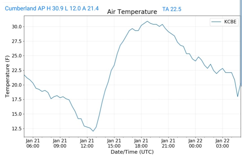
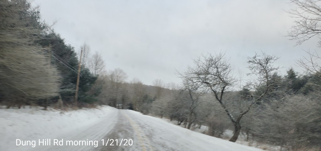
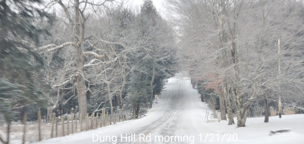
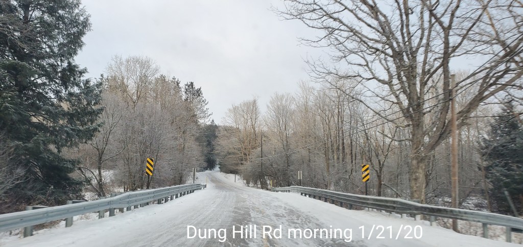
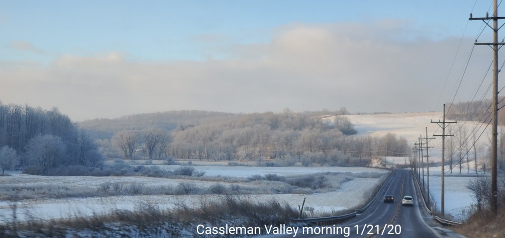
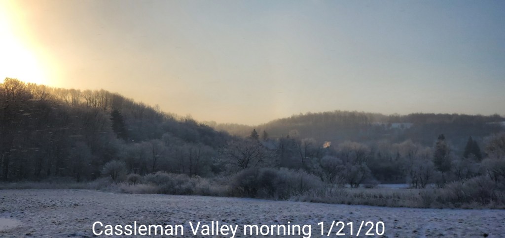
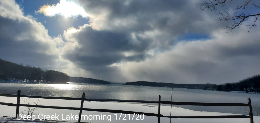
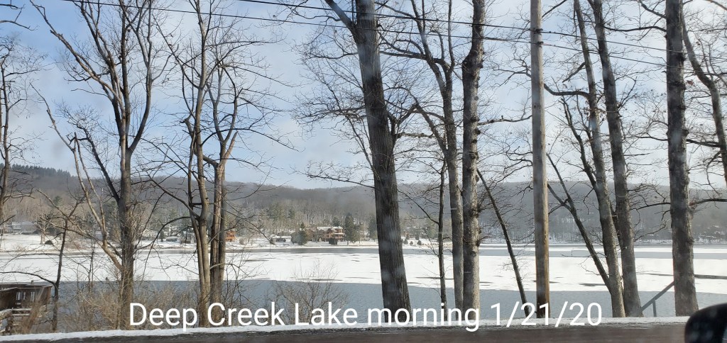
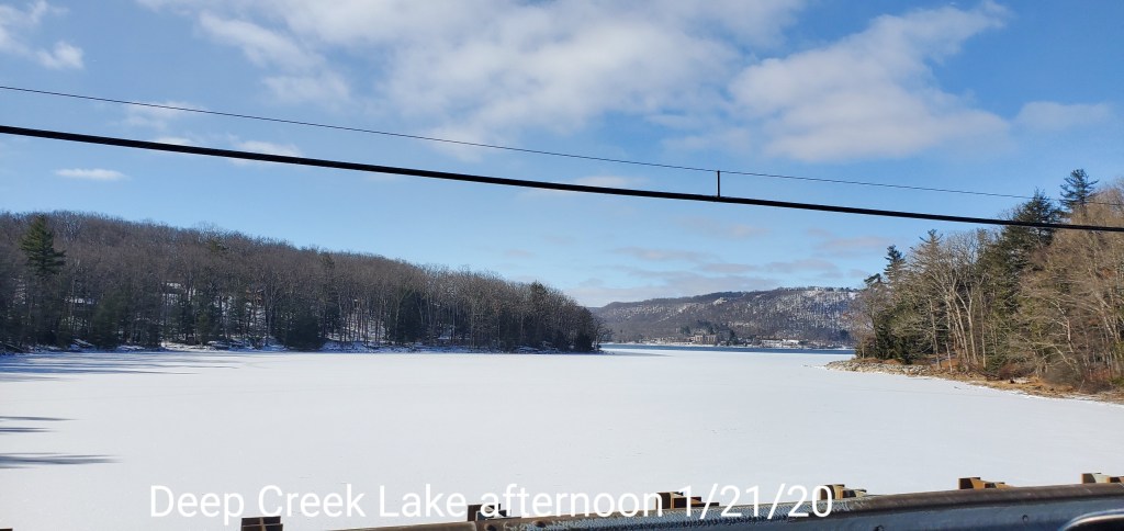
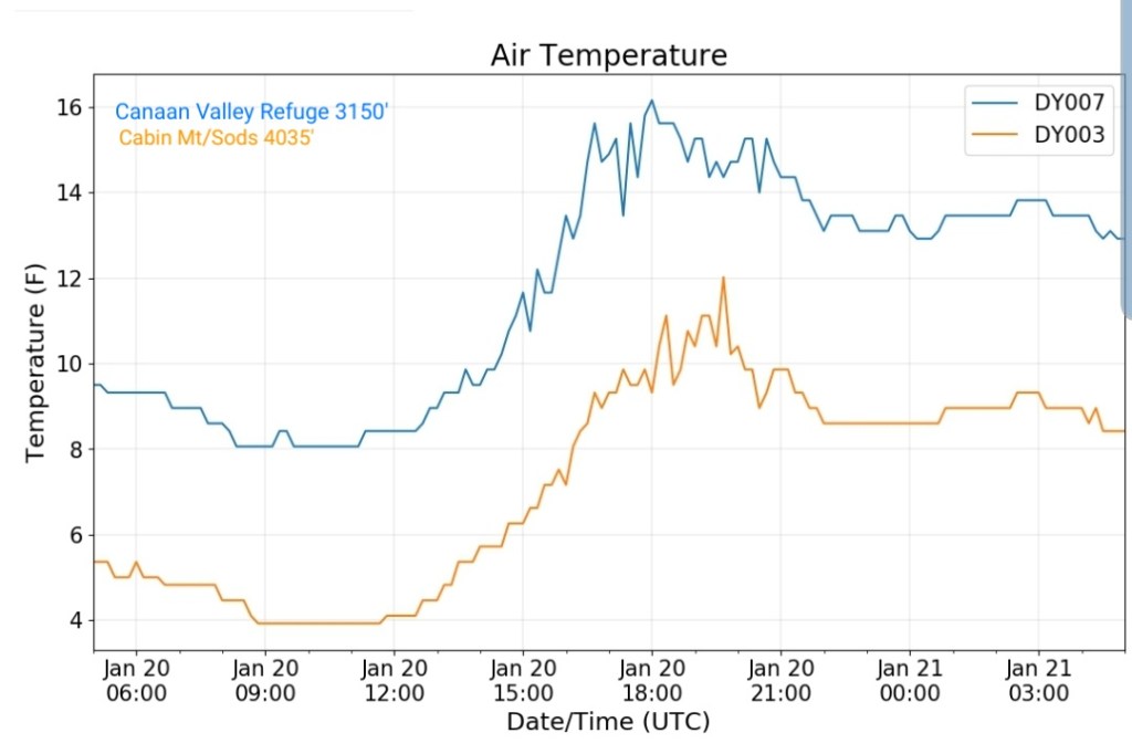
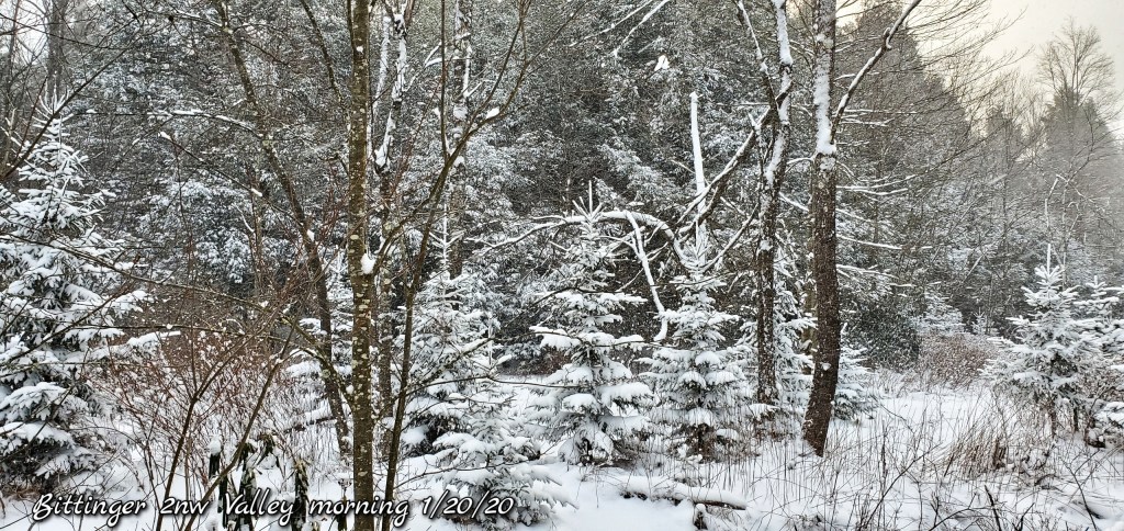
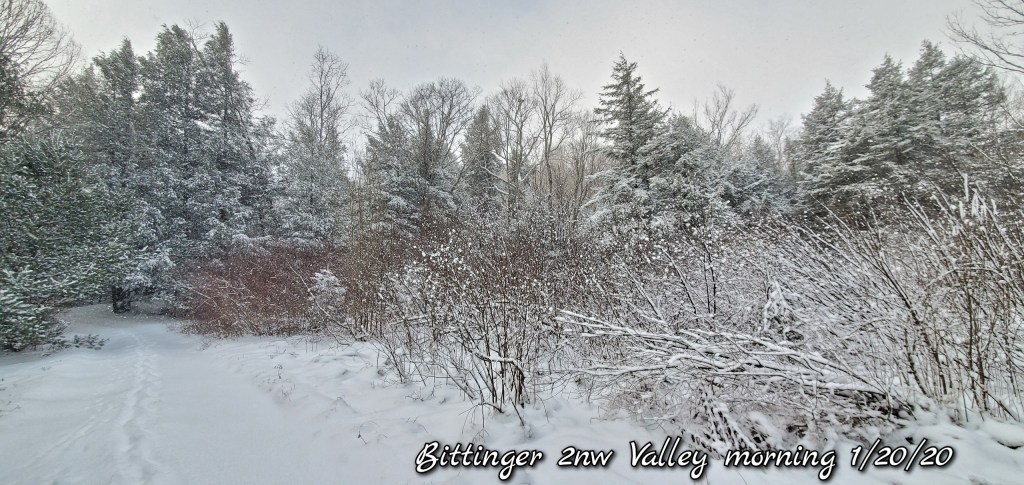
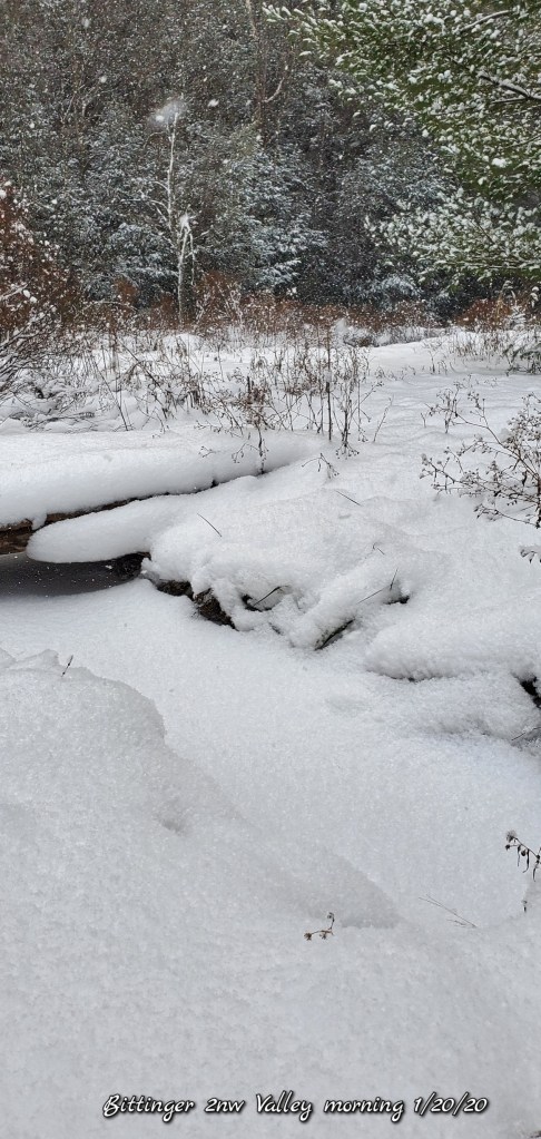
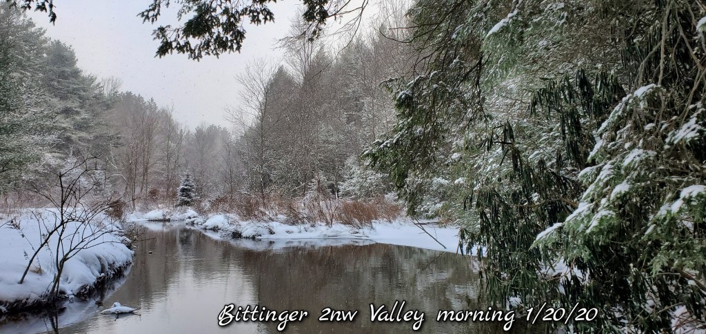
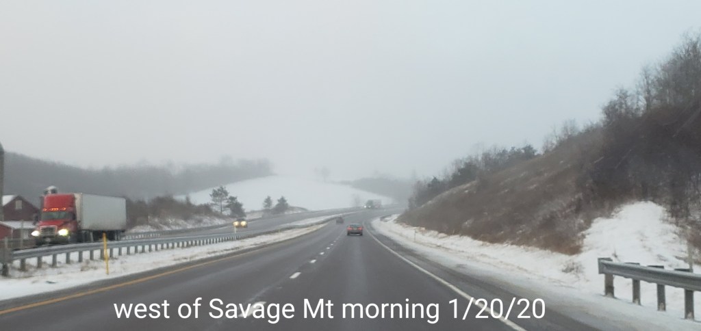
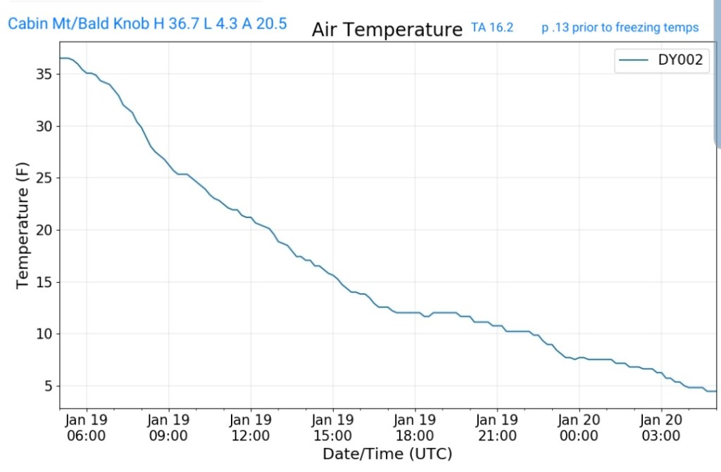
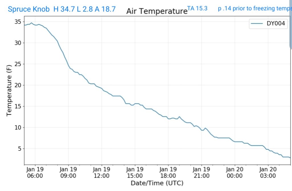
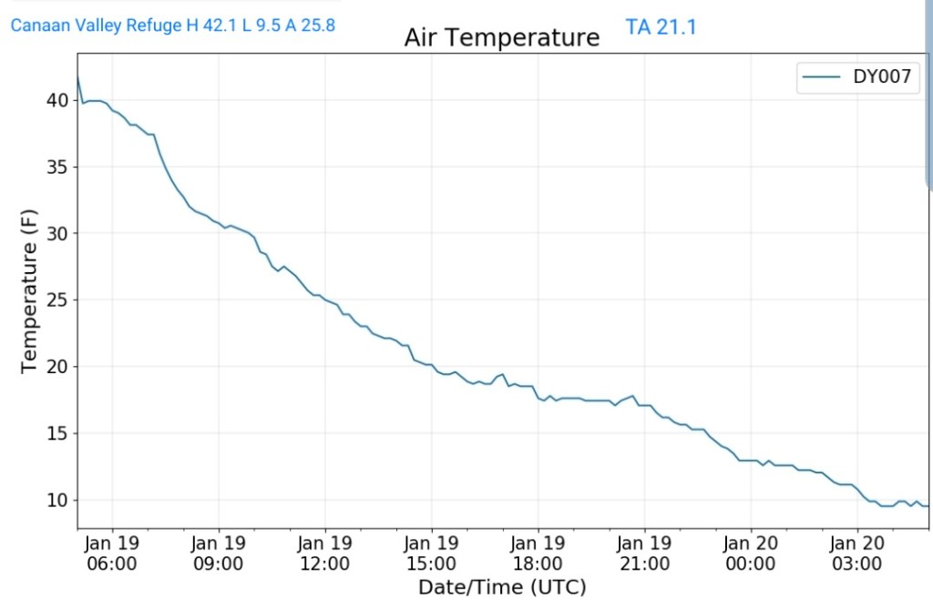
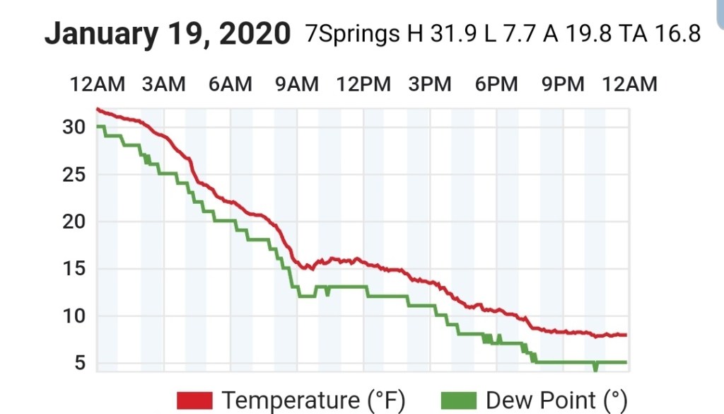
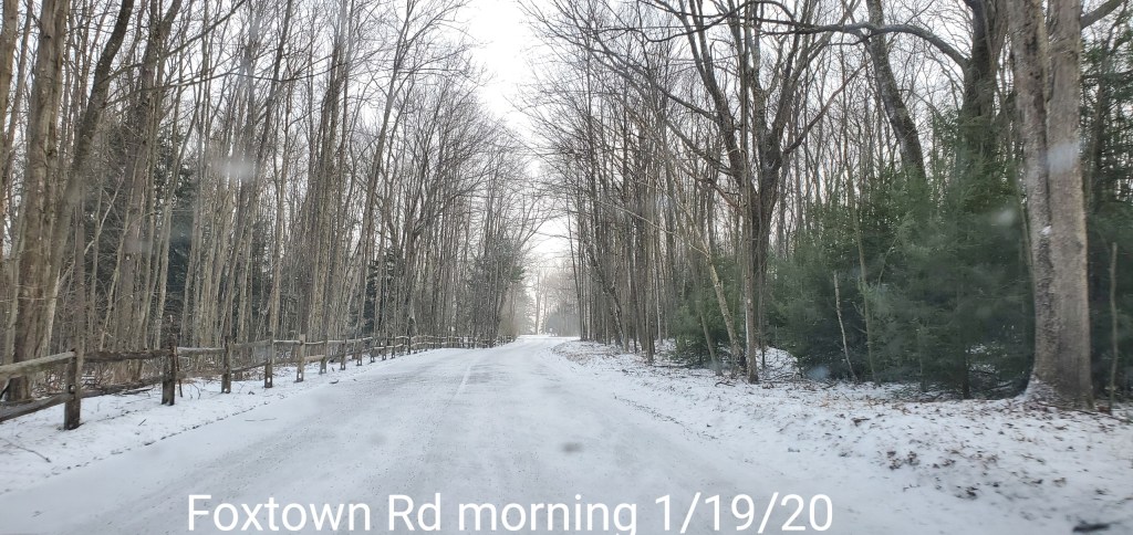
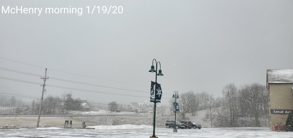
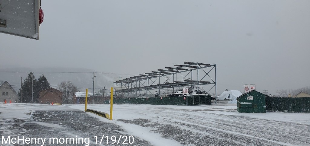
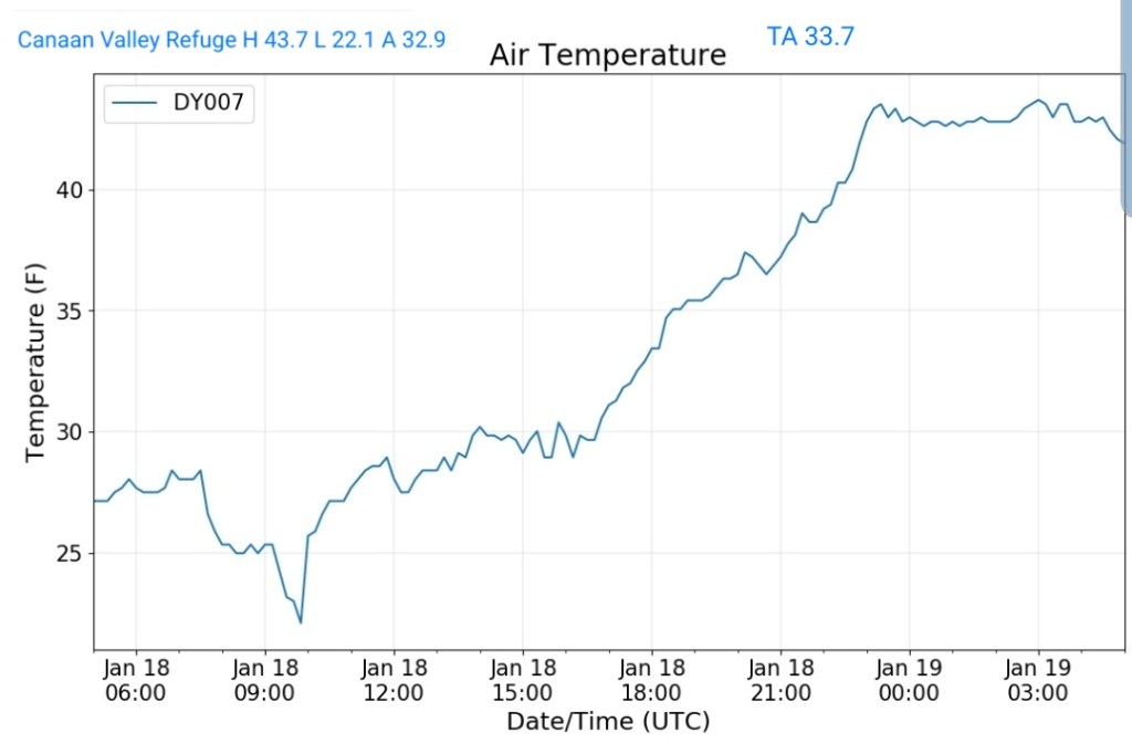
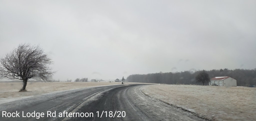
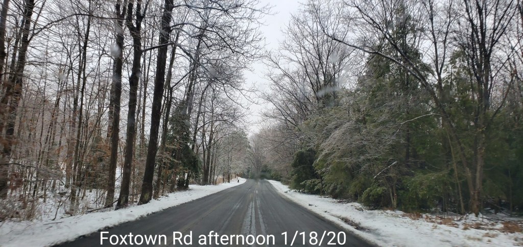
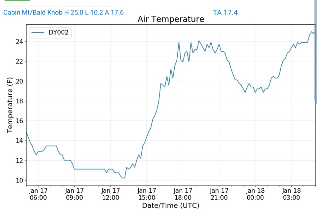
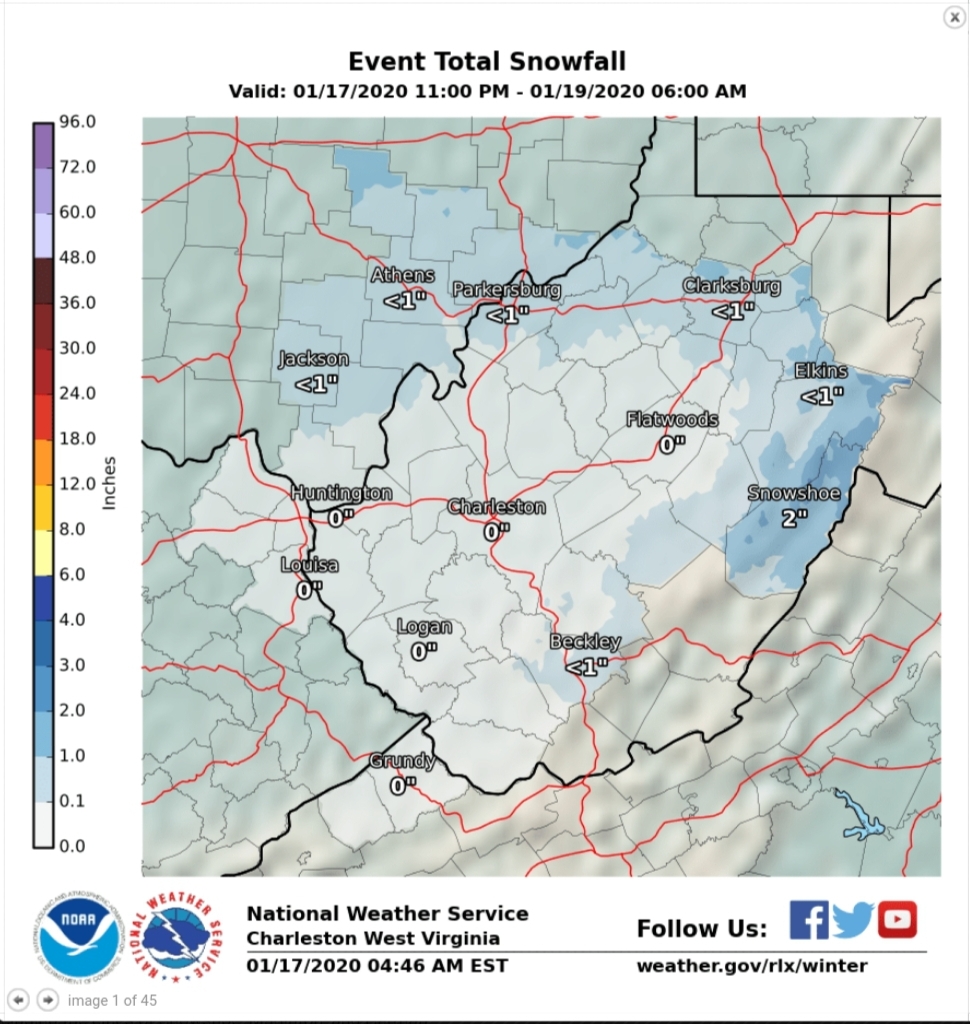
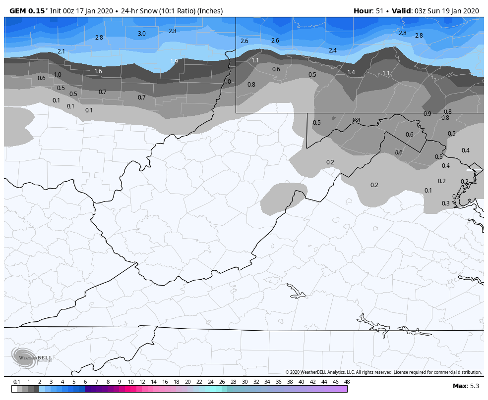
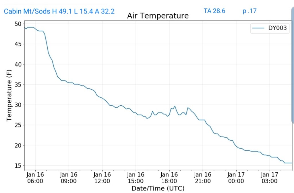
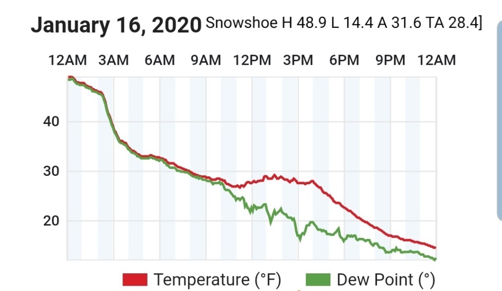
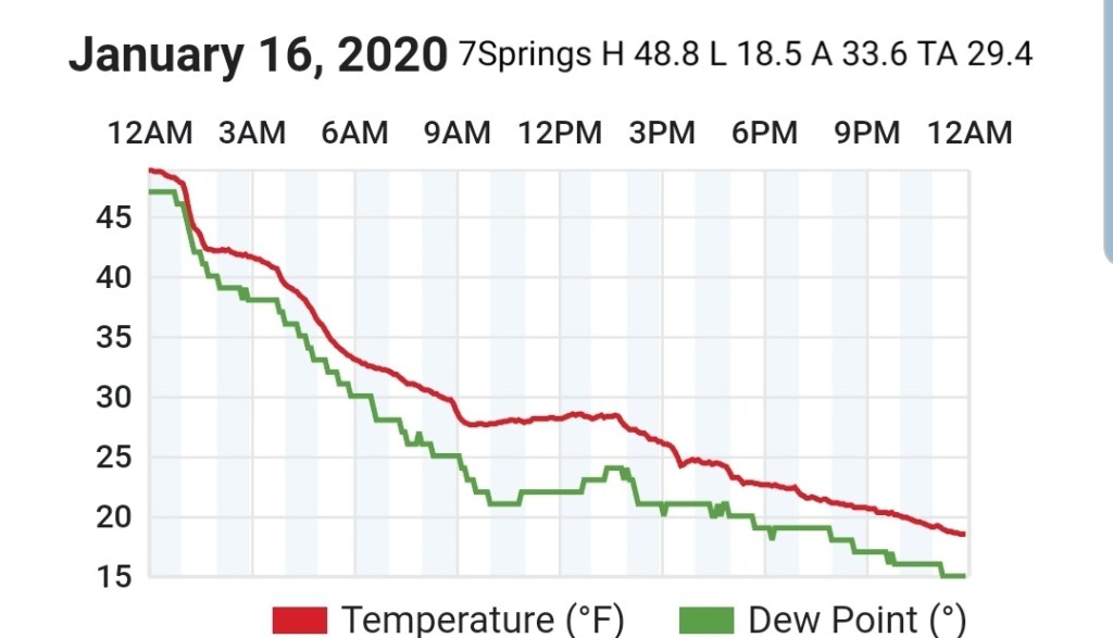
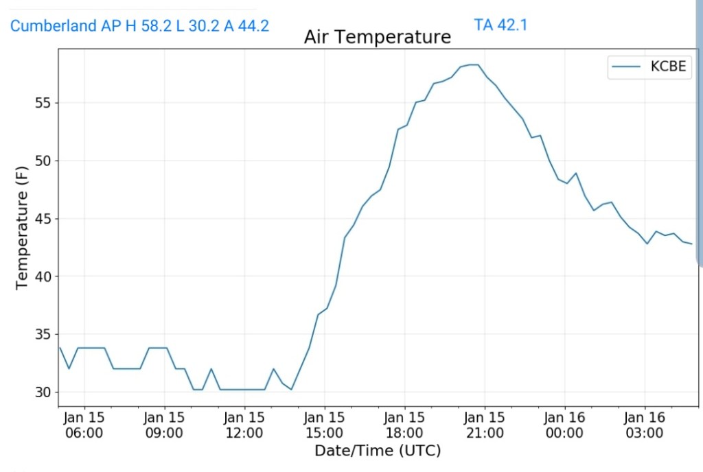
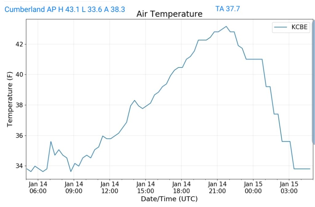
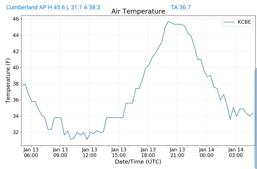
Some steady high ratio fluff from yesterday afternoon, through the overnight into this morning. A lull then again some action returning later. Very cold day.
To note- some areas got into the steady fluff and held it all night, some areas did not. This fluff ran 30 to 40 to 1, depending on your location. Ex- if you record in a calm, non wind impacted area, your ratio will be greater as no settling occurs, the flakes just stack up. On a hill, and throw in the slightest wind, your measurement will be lower as this stuff is very easy to break down. It’s mostly air. So an example and this is one of the imperfections in snow measuring. I had 4.2, neighbor on hill 3.0. We got the same amount of snow, no measurement is wrong. It’s simply the fluff nature where its disturbed vs non disturbed. That’s it.
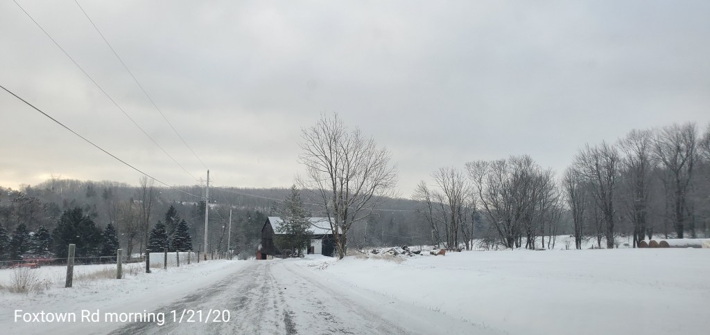
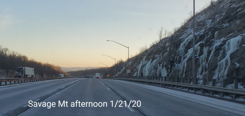
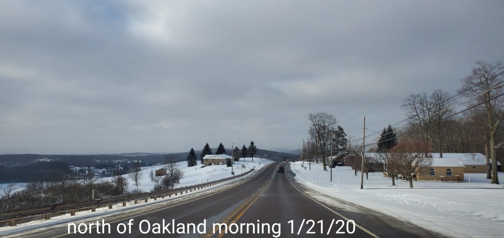
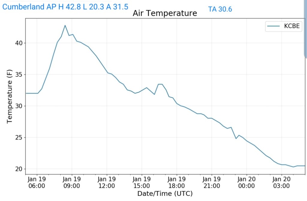
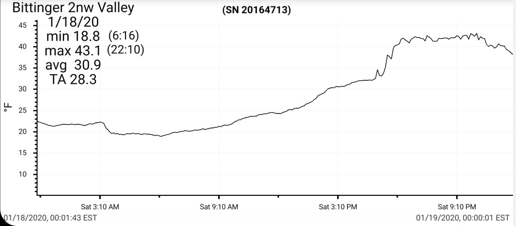
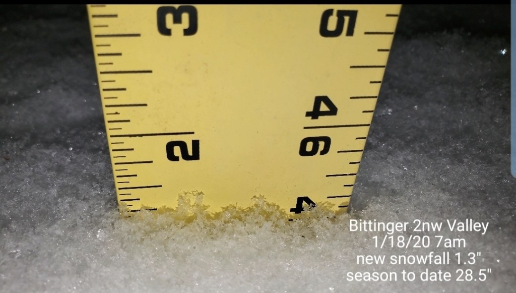
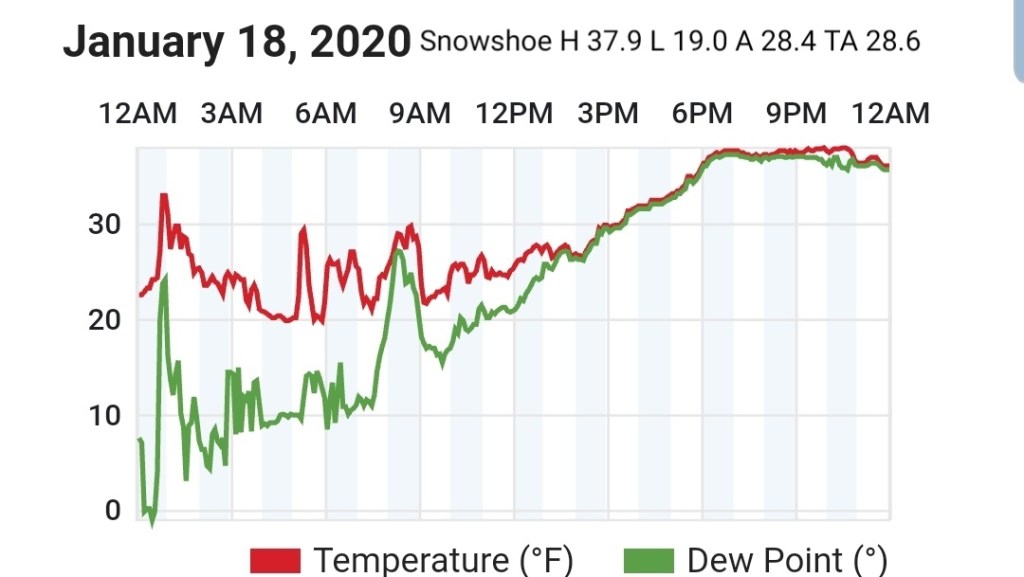
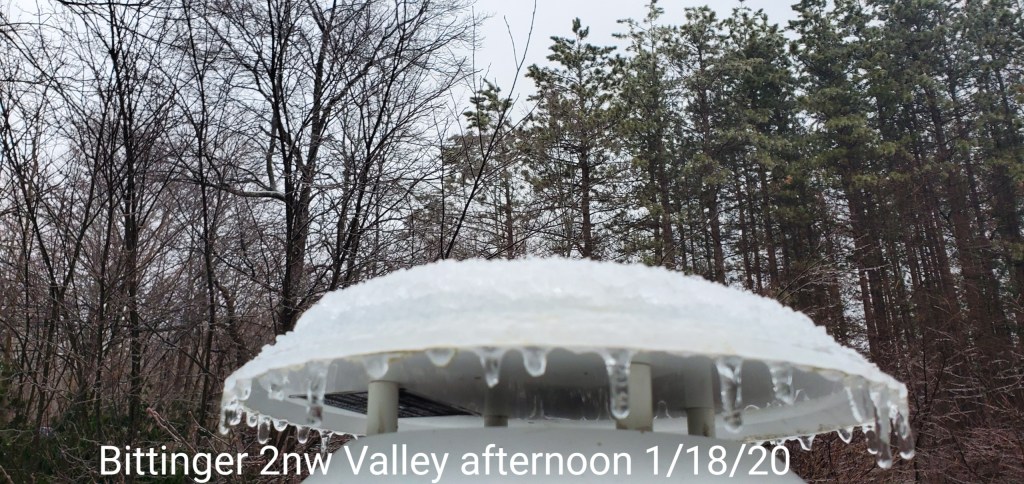
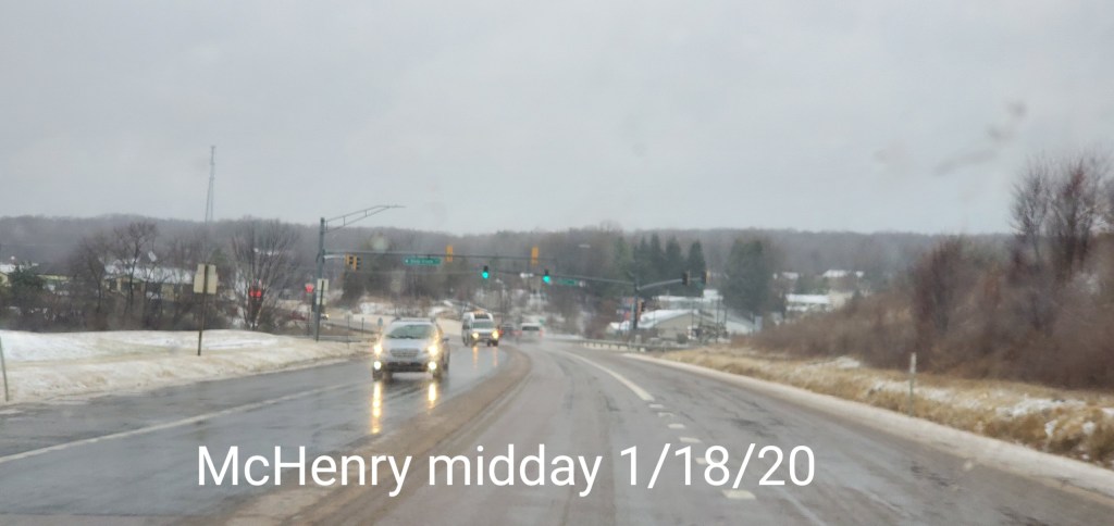
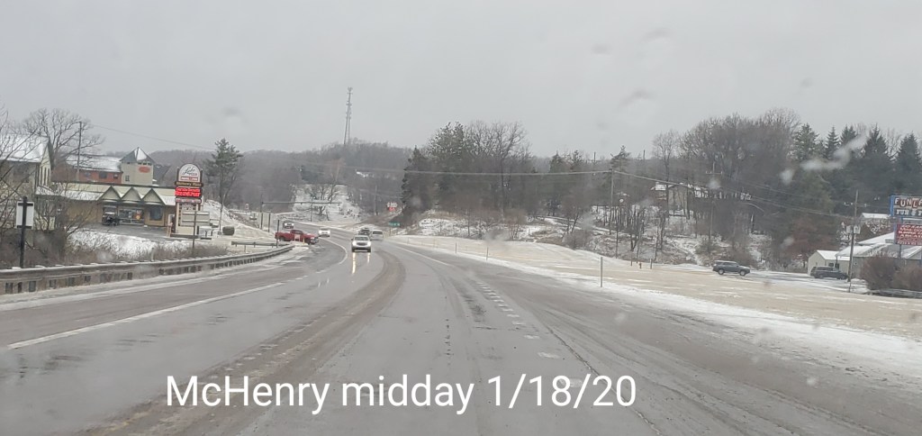
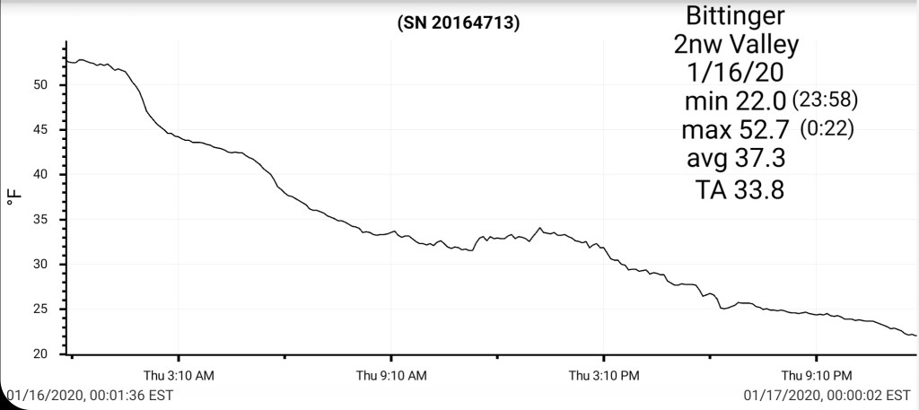
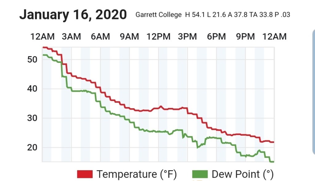
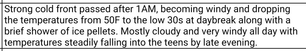
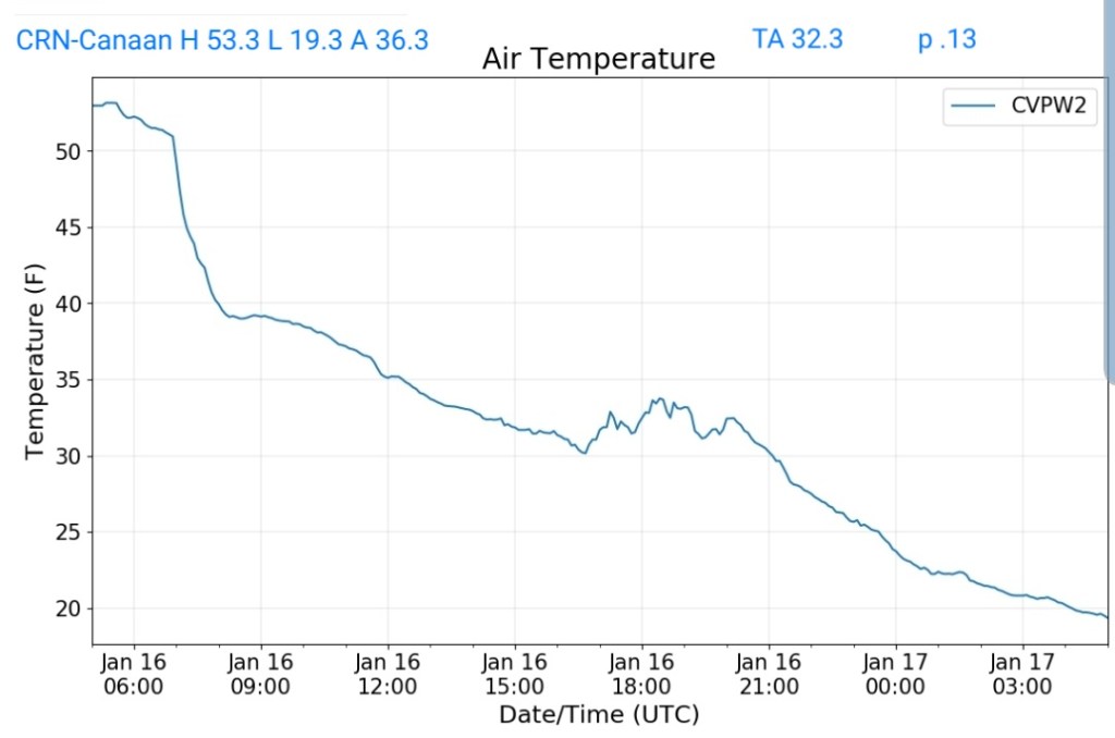
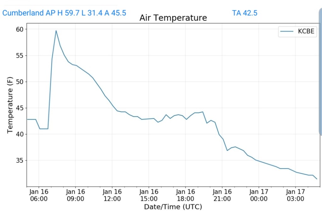
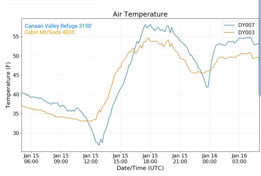
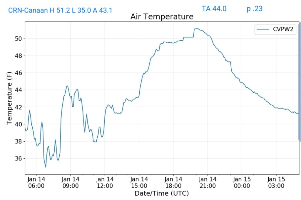
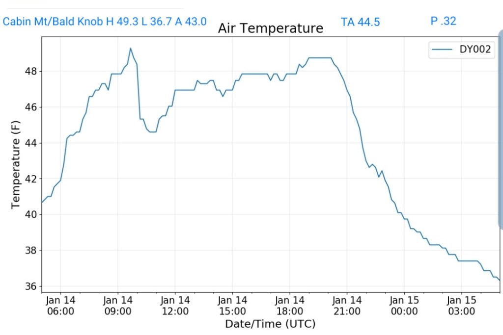
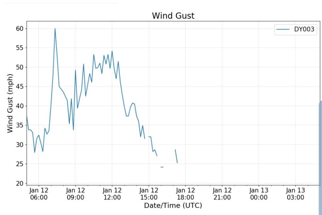
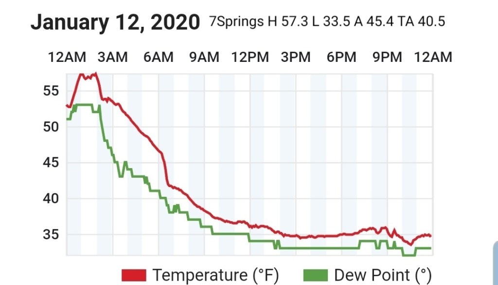
Temps began falling overnight. Strong gusty winds melted yesterdays accumulation in some areas, I retained 1.3″. Which was primarily sleet. A period of snow early morning, a brief break around 10, then that was followed by a continuous fluffy snow through nightfall.
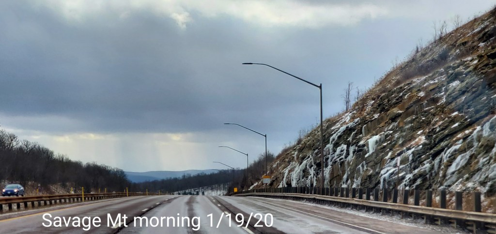
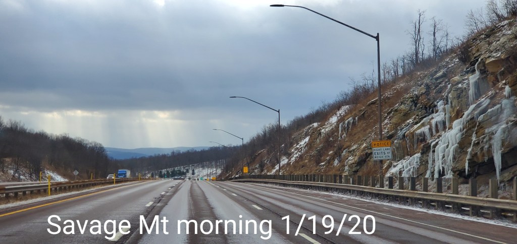
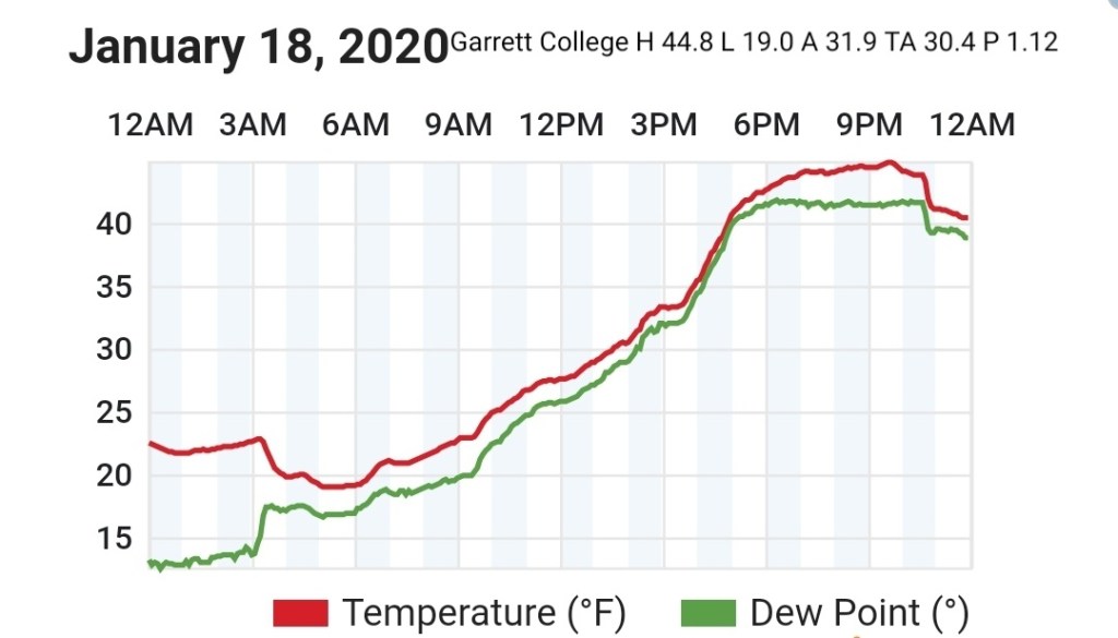
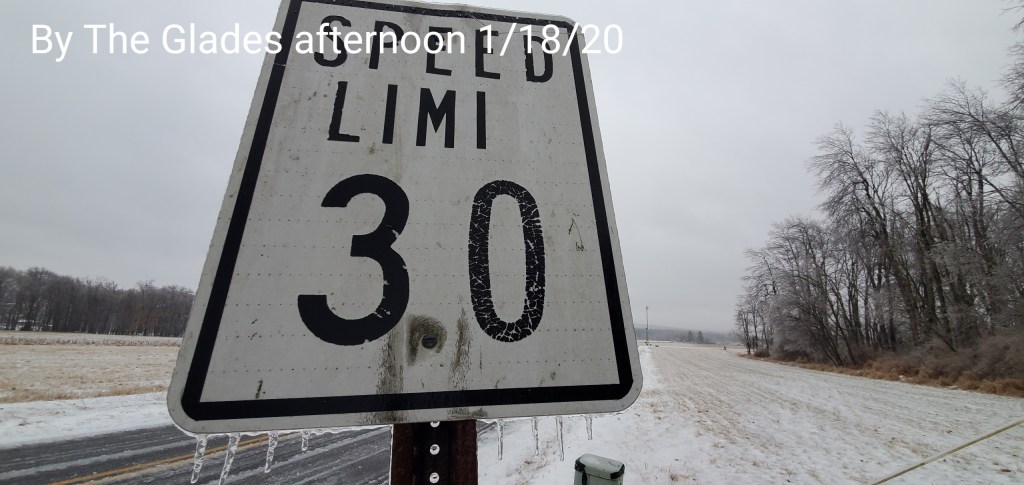
After a brief hit of snow predawn, the day began with a lull. Then after 8, some snow began, that rapidly changed to sleet, then freezing rain and location played a role of when and how much. That went to plain rain late day, with the exception of the deeper valleys east.
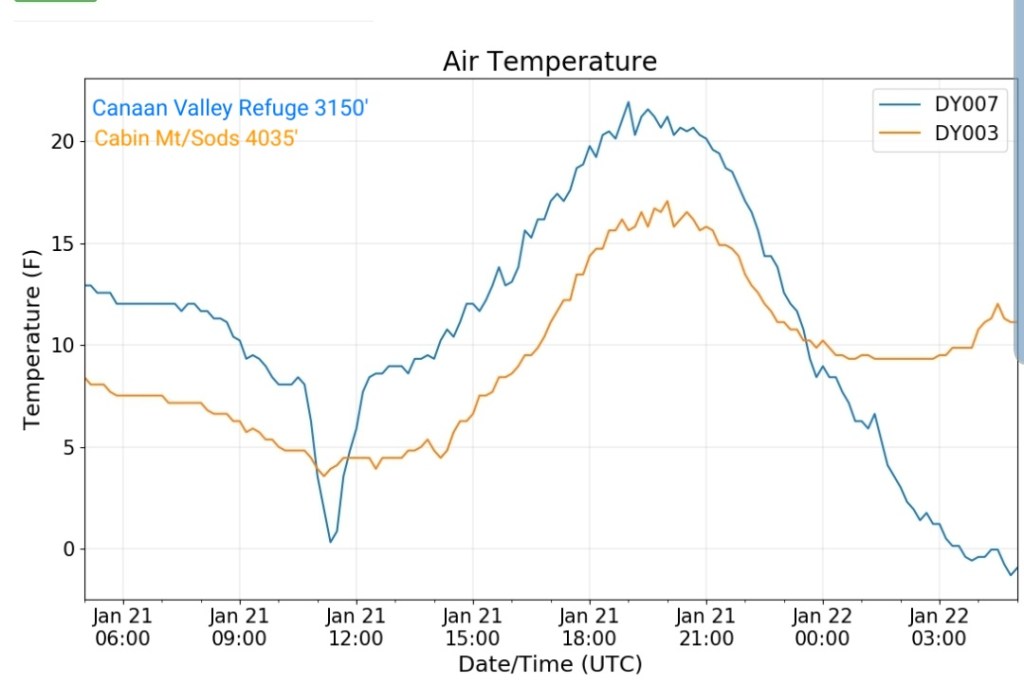
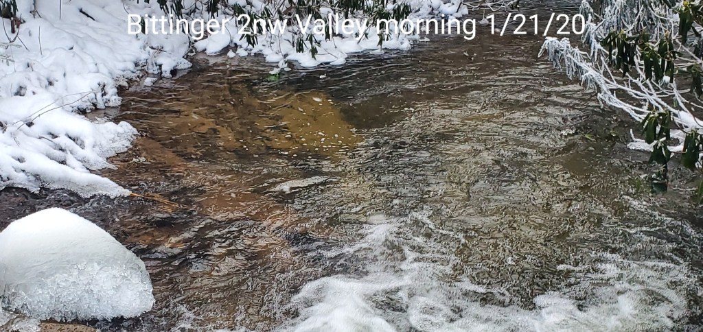
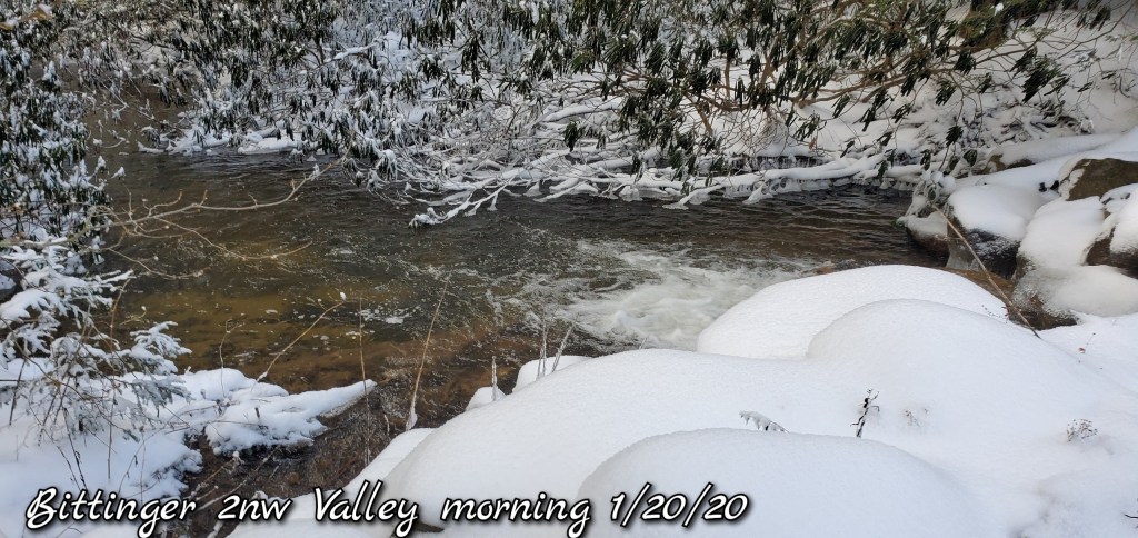
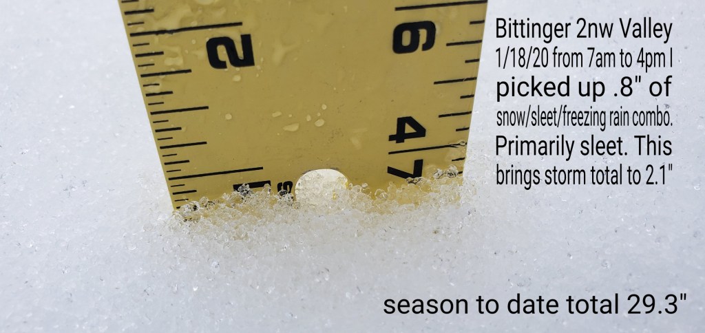
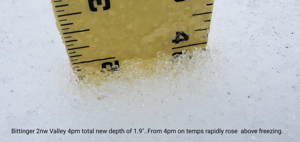
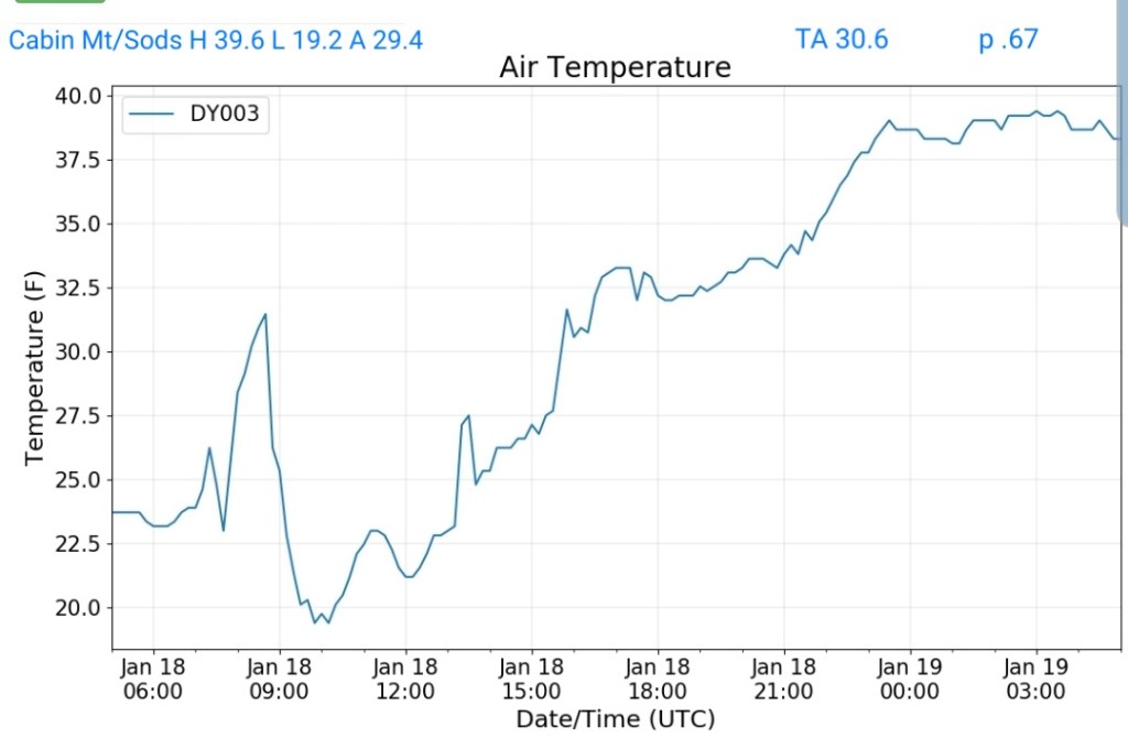
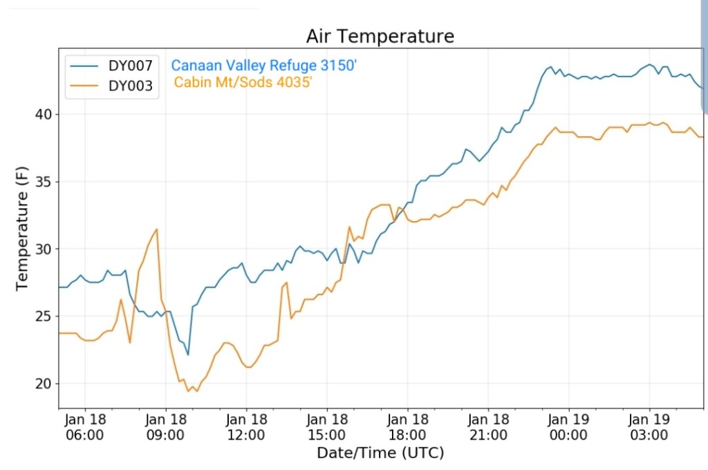
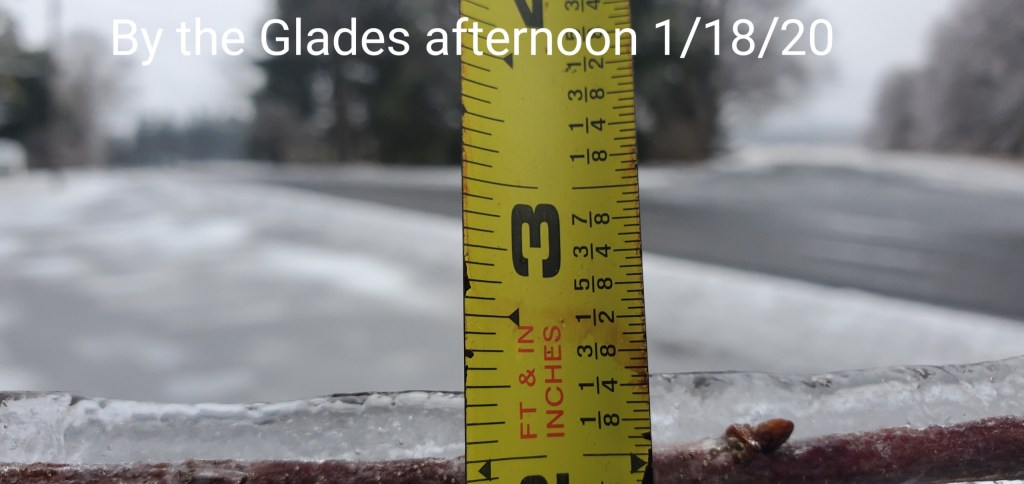
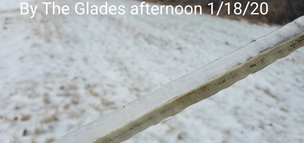
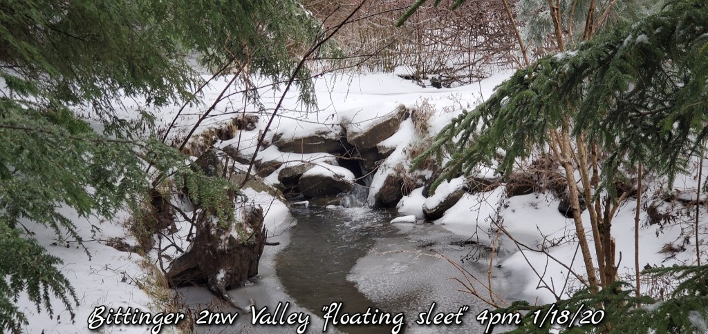
Snowfall total new through 4pm at the time temps rapidly rose. If you didnt record at this time, amounts were lost between 4pm and 1 am with the mild temps and very strong wind. Totals- this INCLUDES sleet, freezing rain combo. 2.1″. The morning consisted of a duration of sleet while nearby areas, ex-McHenry was mainly freezing rain, even the Glades more ice vs this spot and less sleet…. 1.3″ occured with the predawn snow, .8 occured through the day with the snow/sleet/freezing rain combo. To show examples of how much sleet, it floats, and floated along the tops of the small creeks
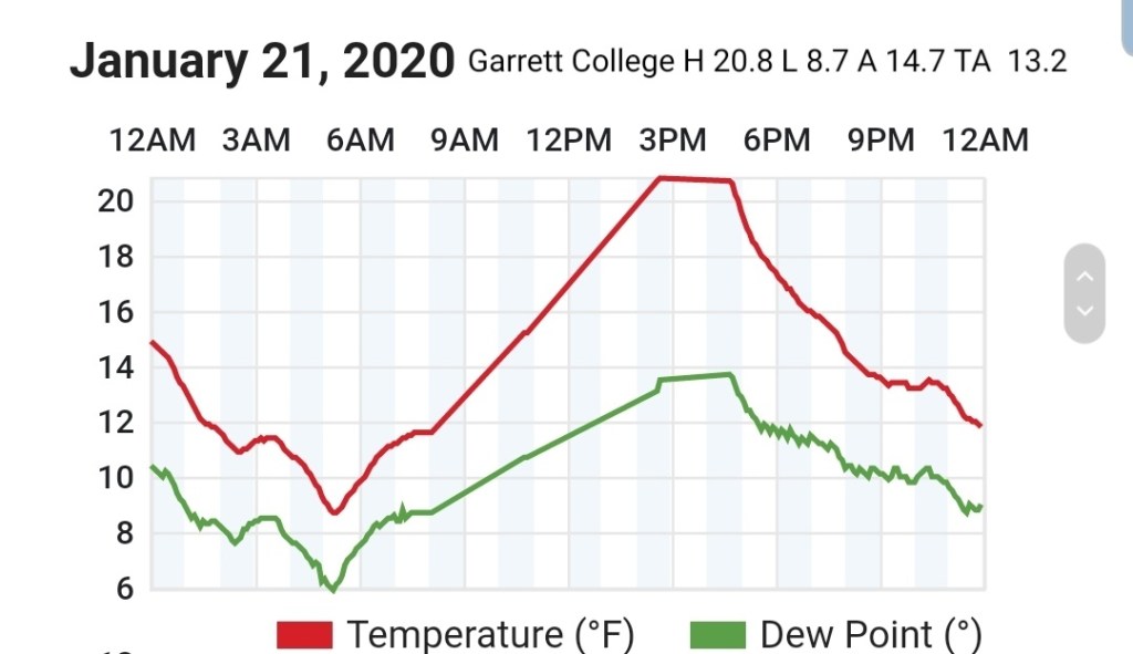
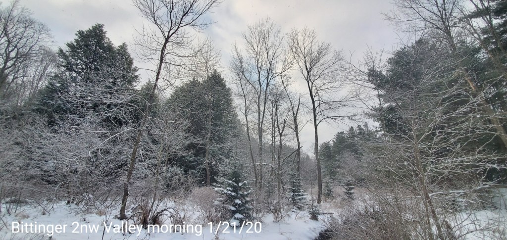
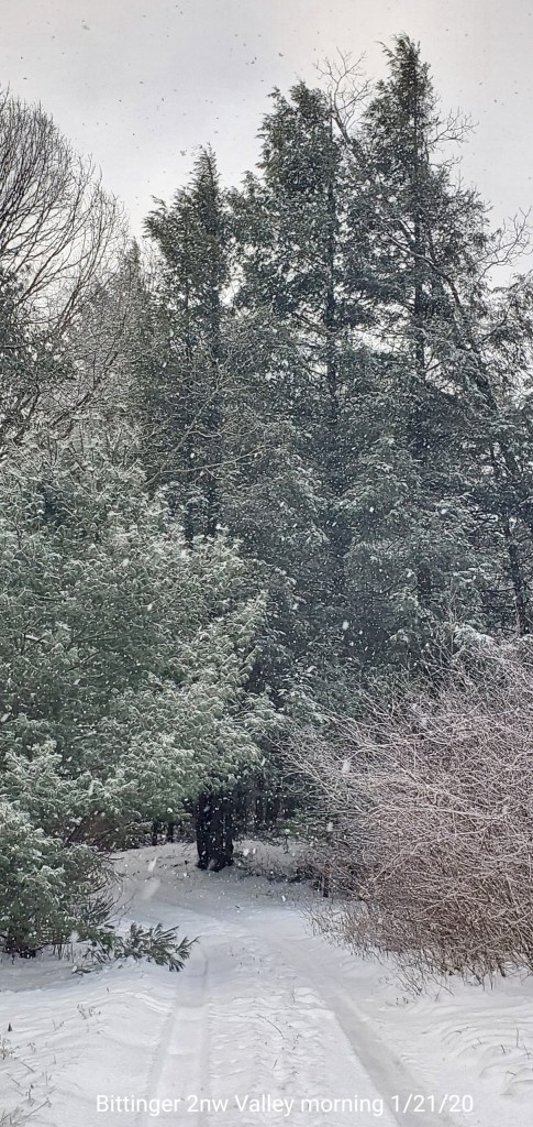
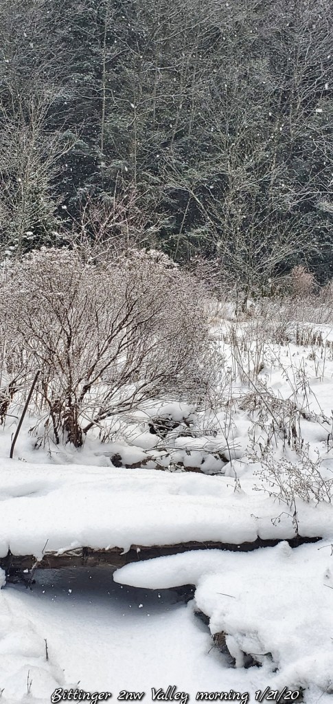
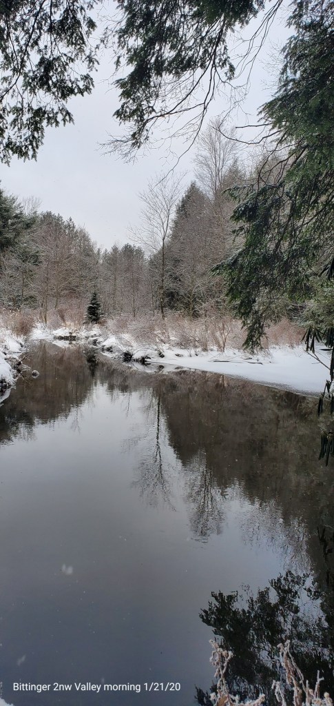
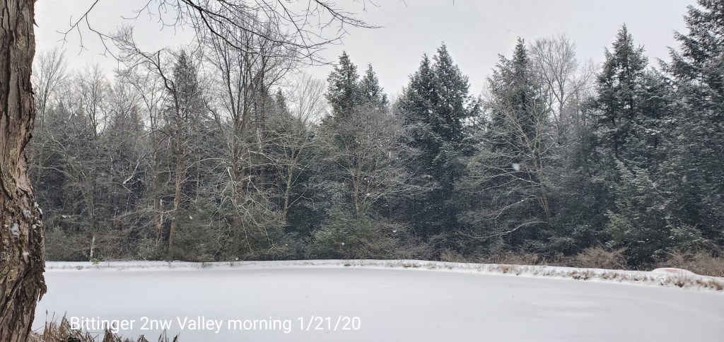
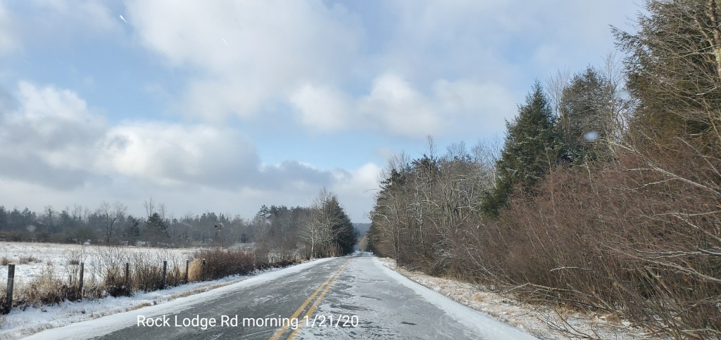
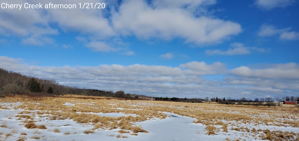
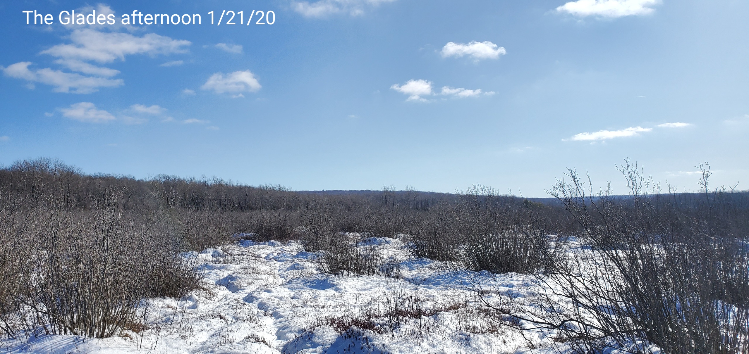
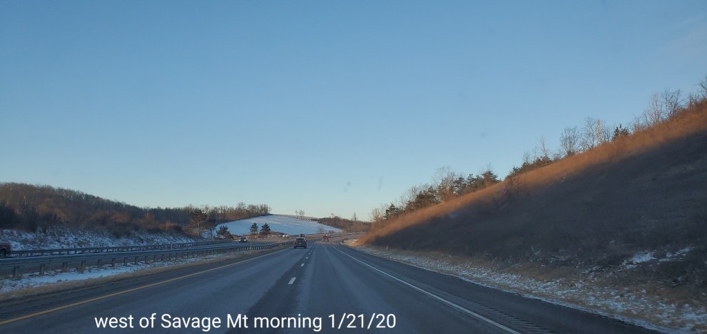
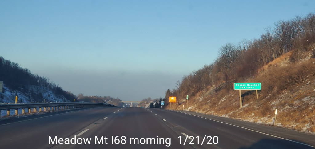
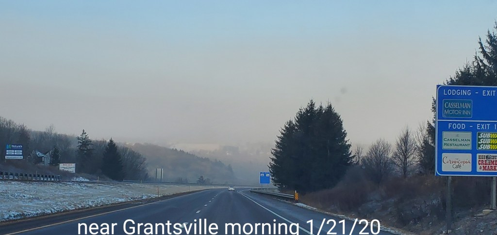
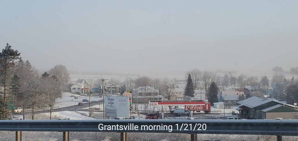
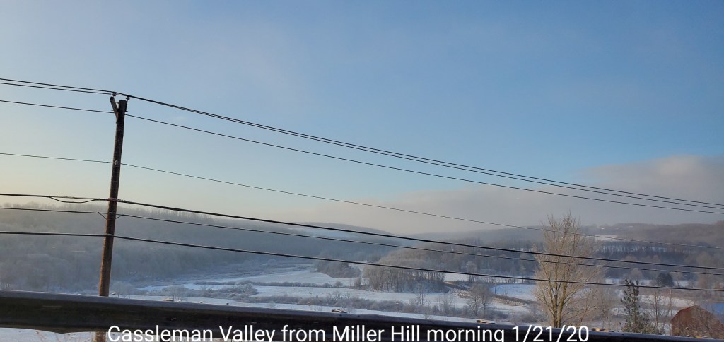
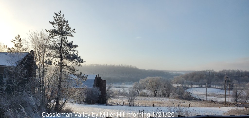
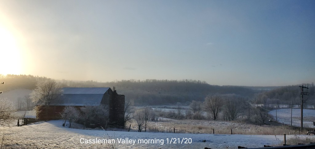
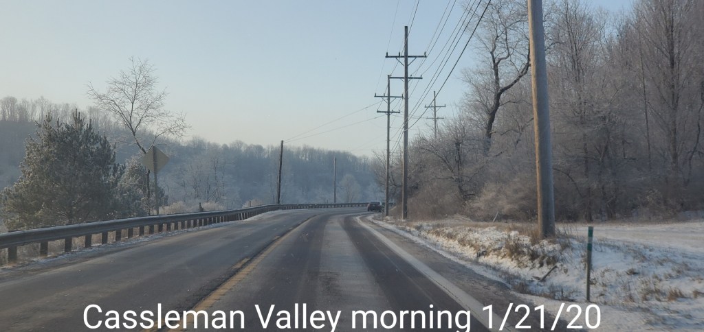
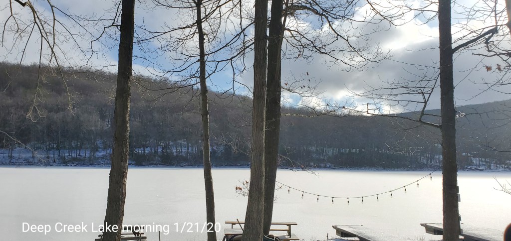
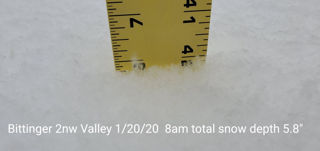
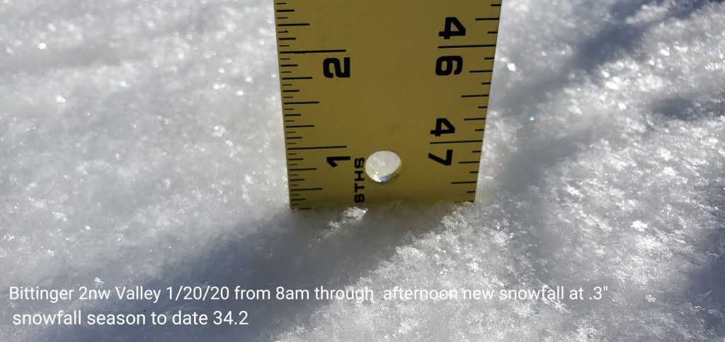
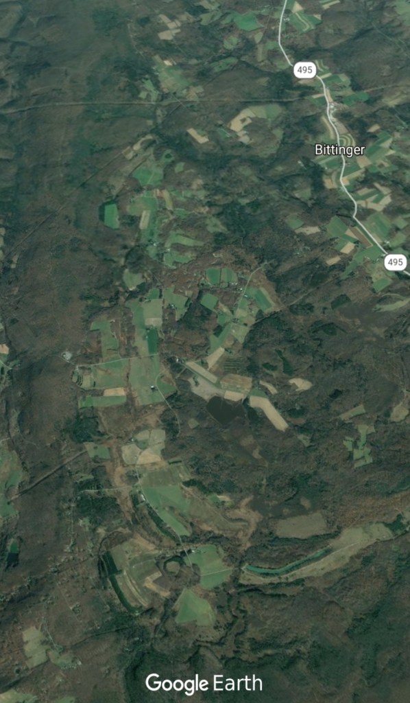
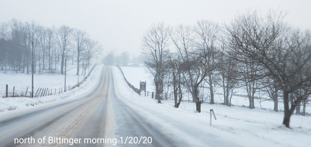
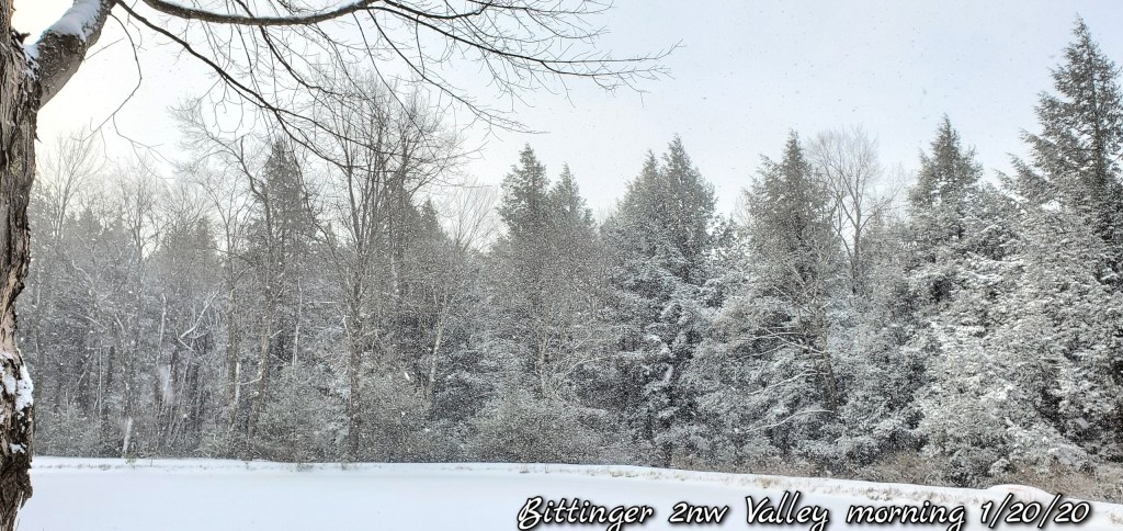
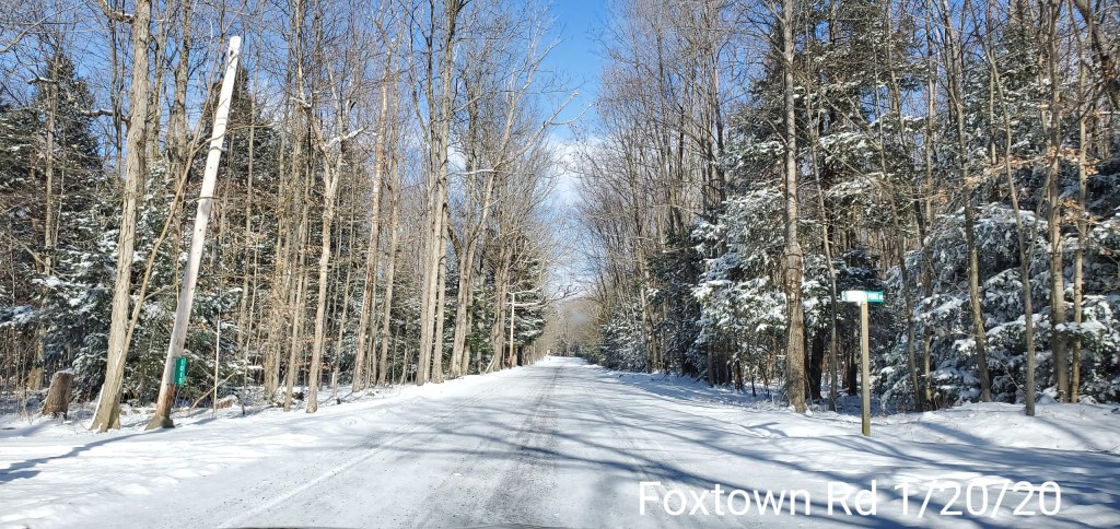
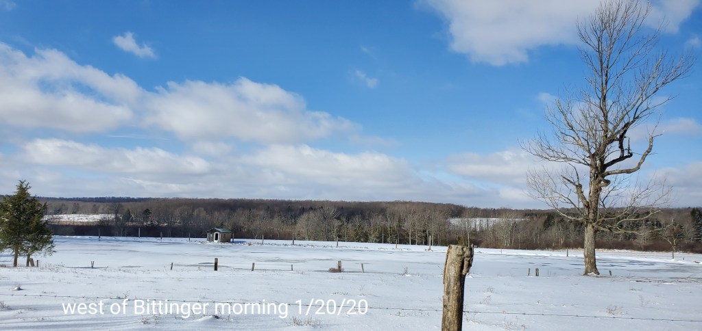
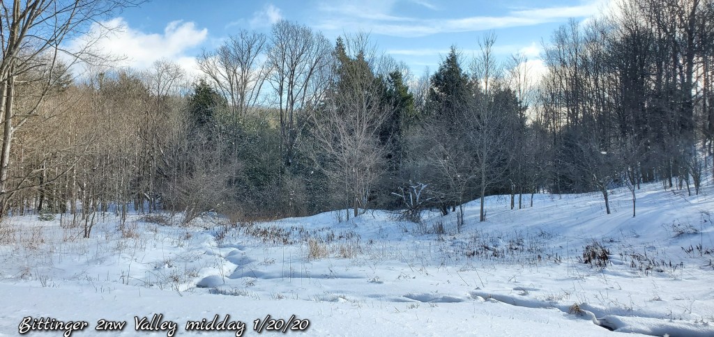
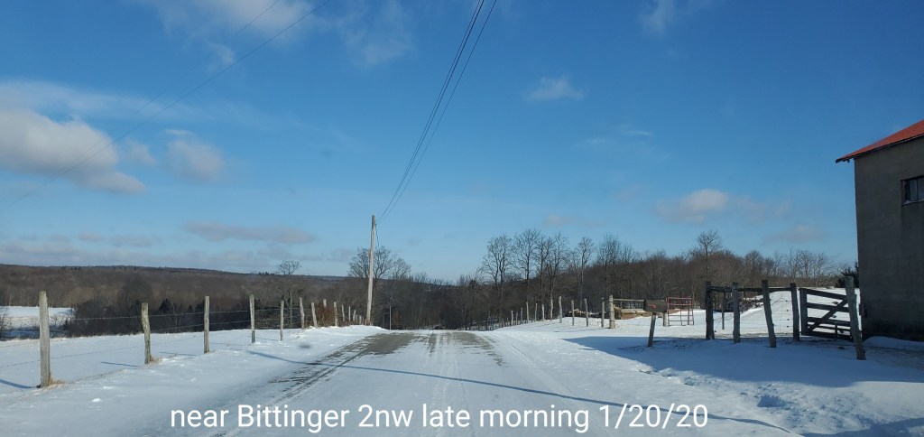
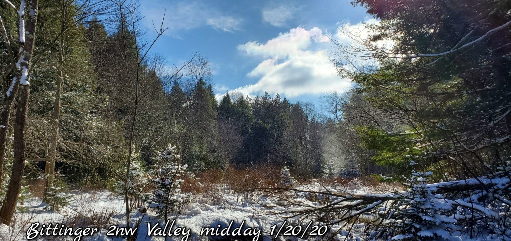
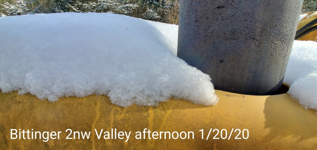
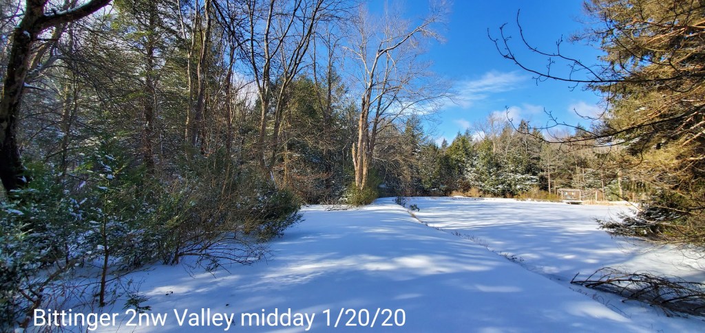
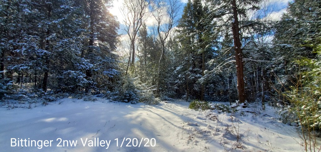
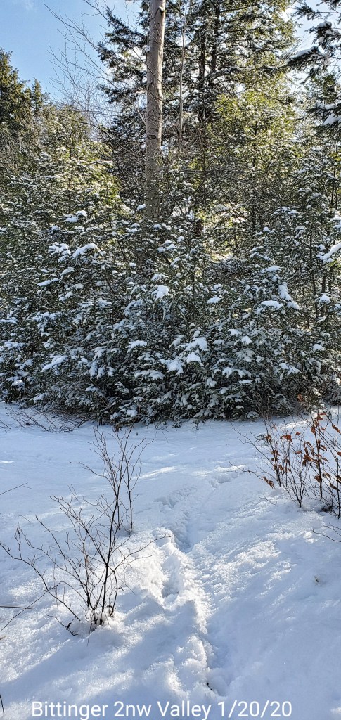
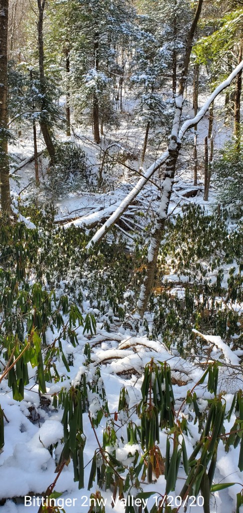
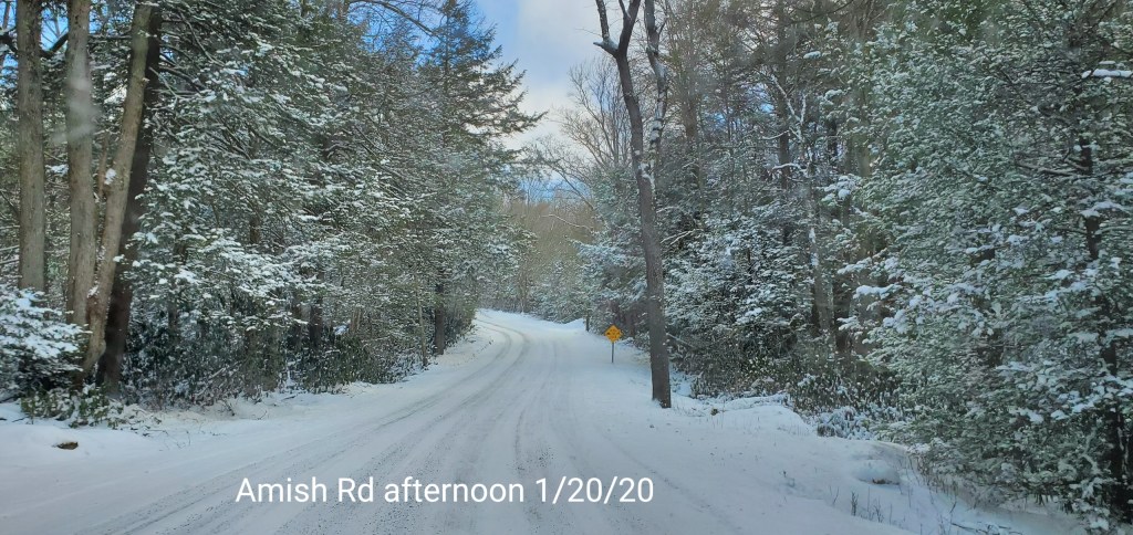
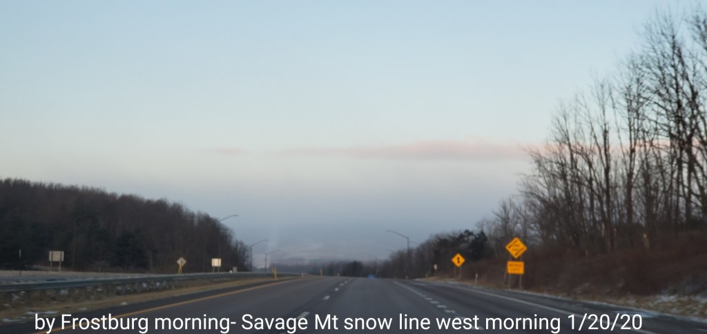
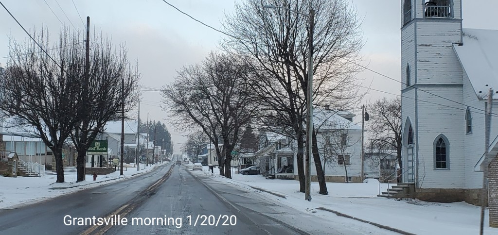
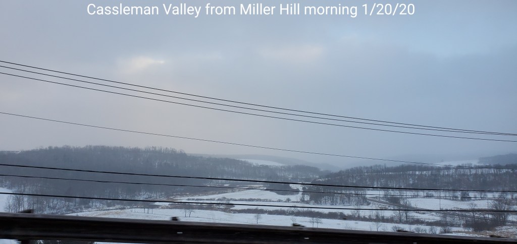
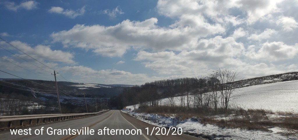
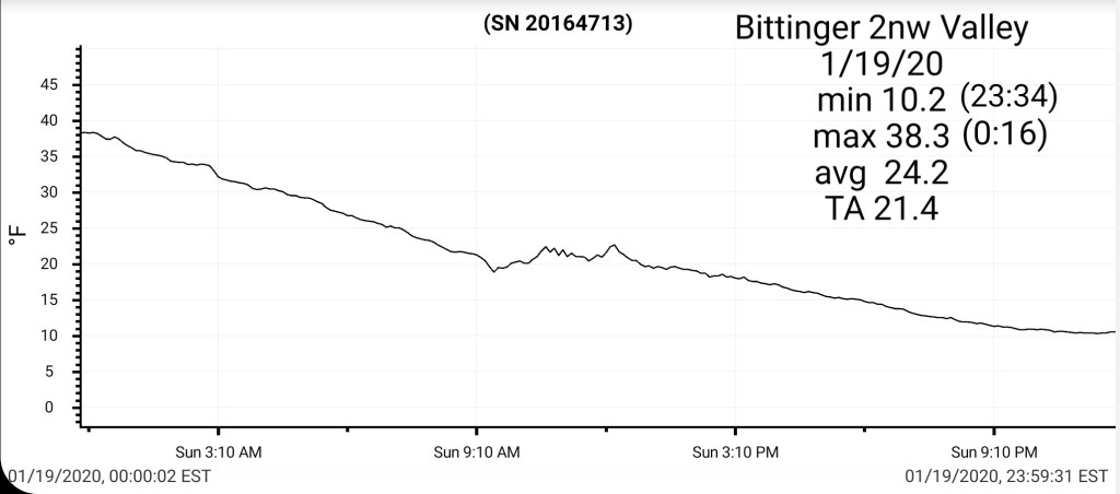
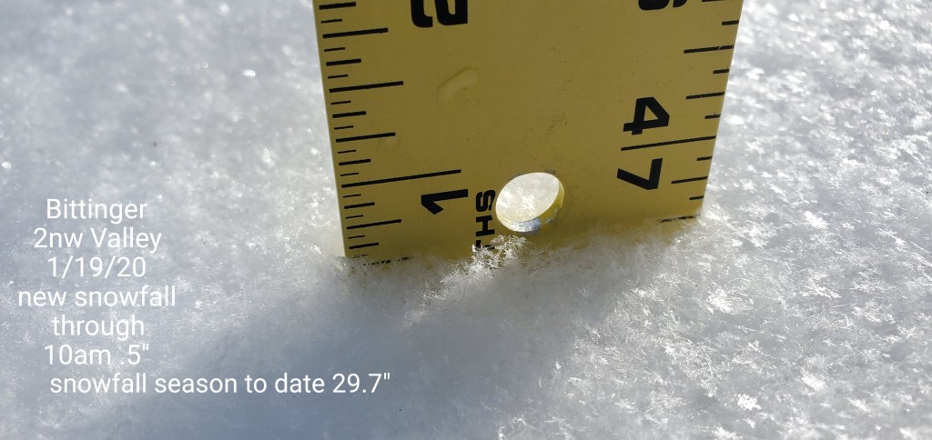
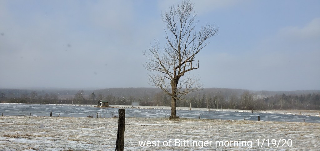
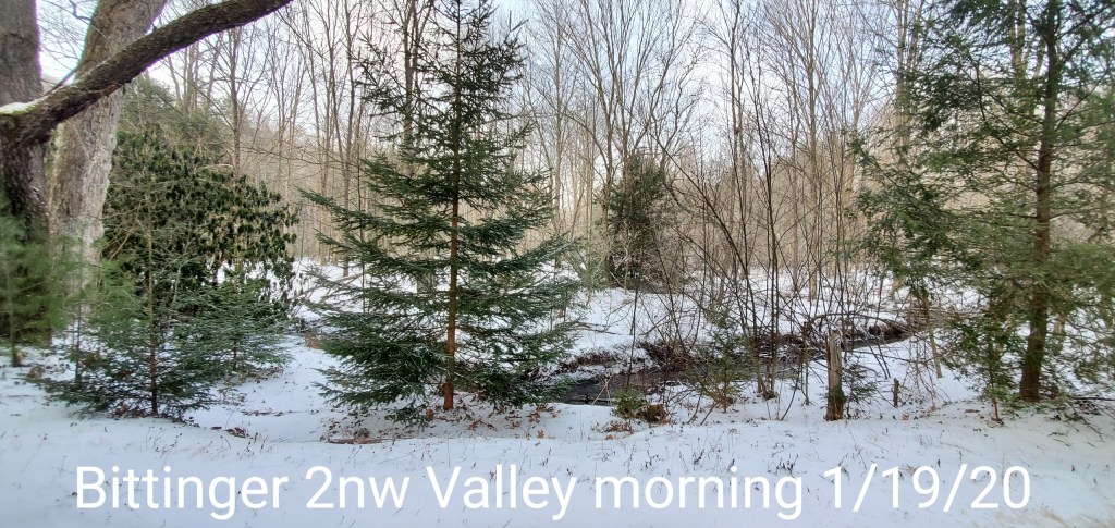
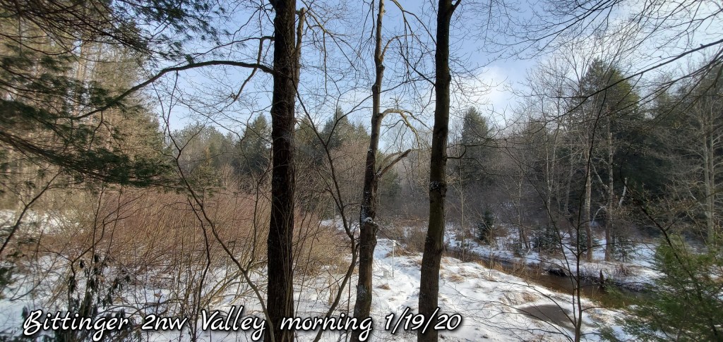
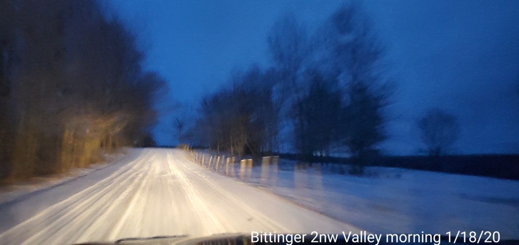
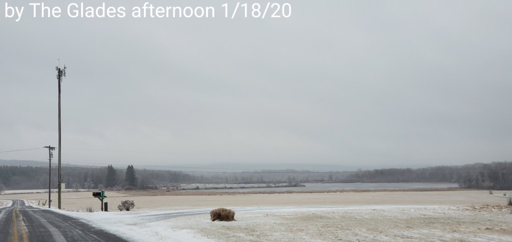
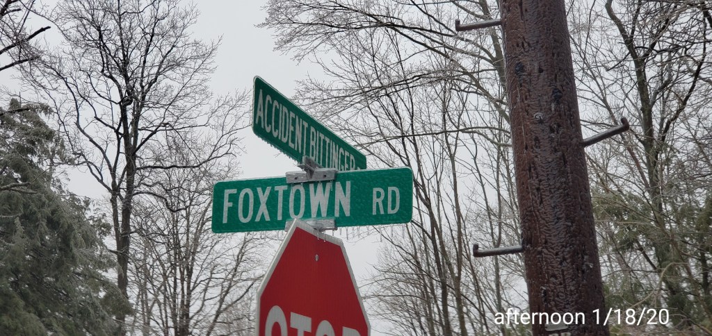
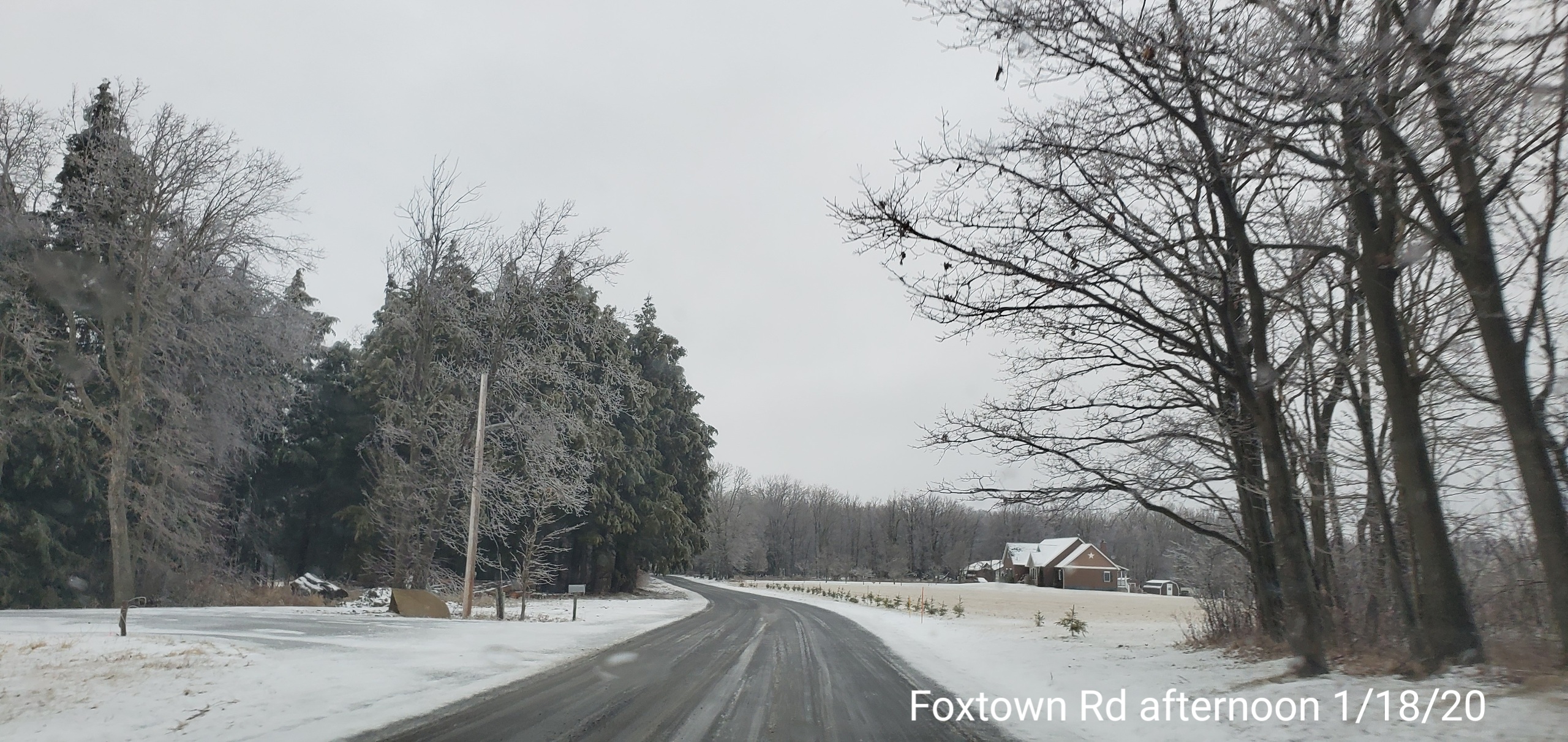
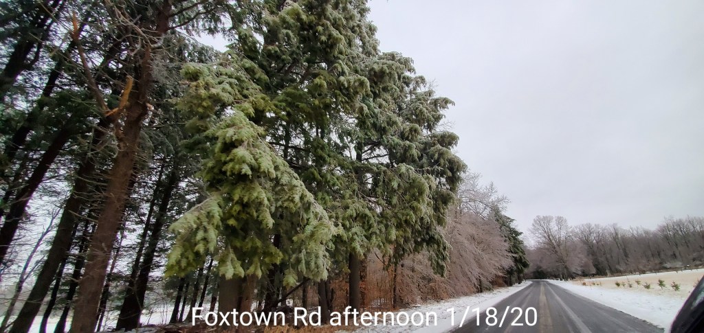
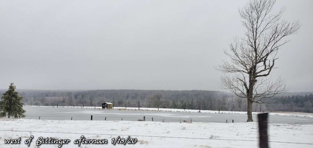
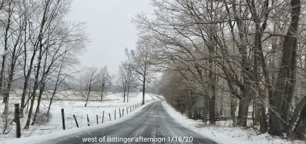
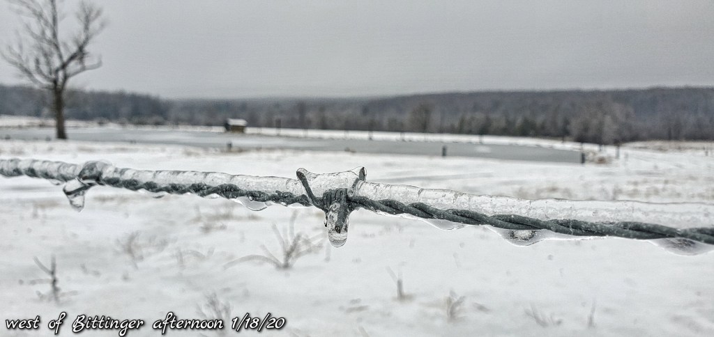
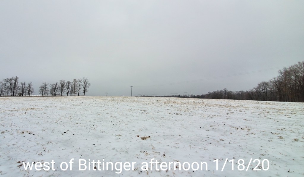
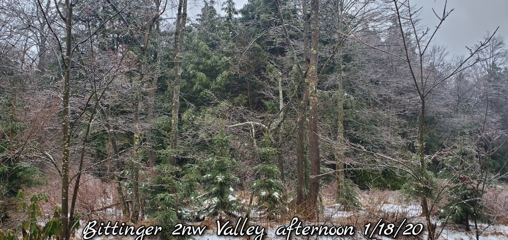
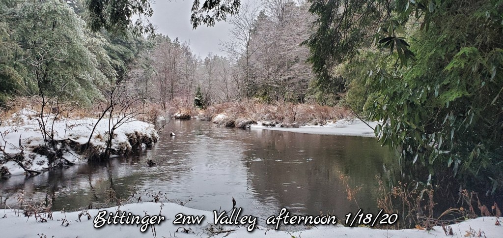
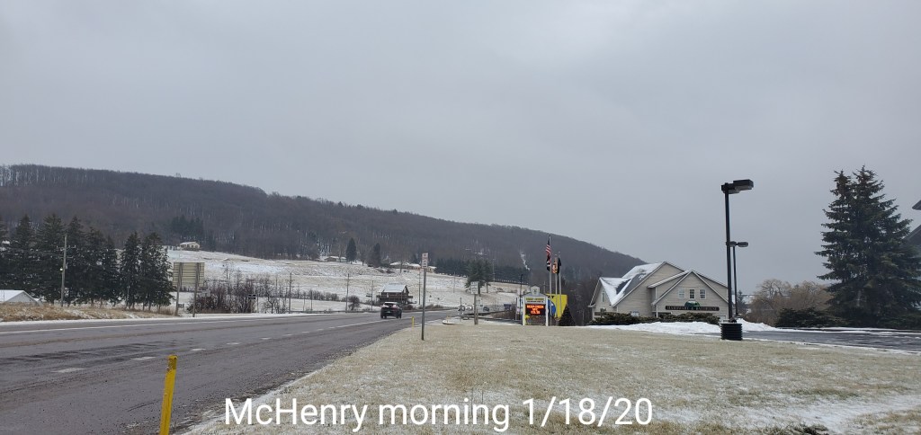
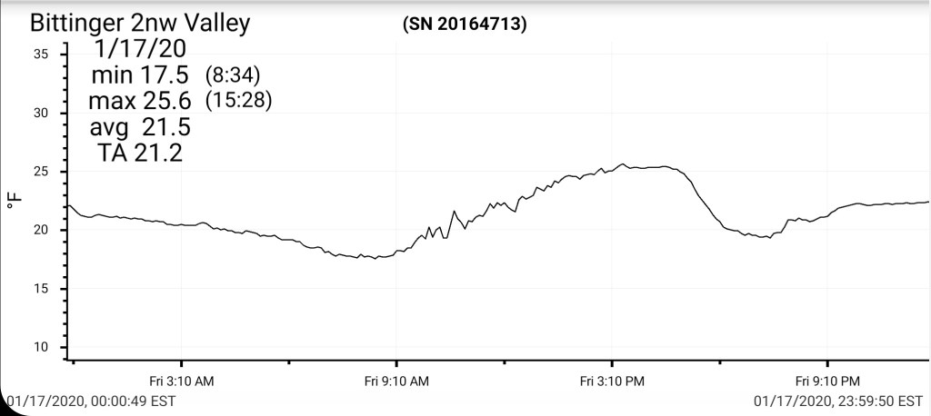
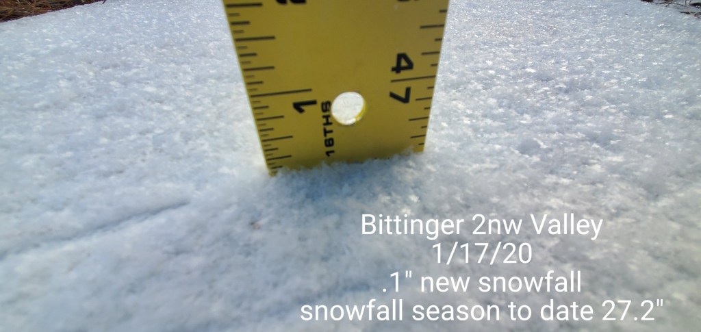
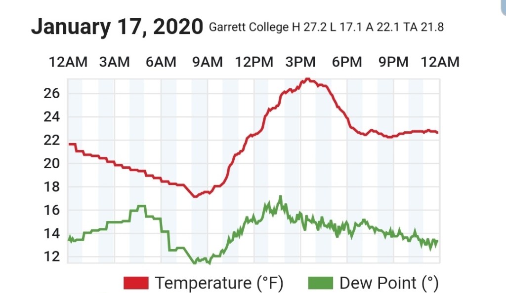
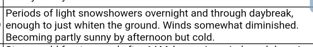
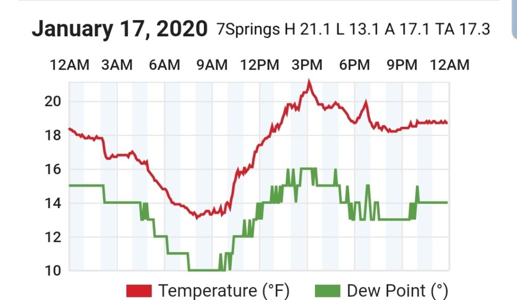
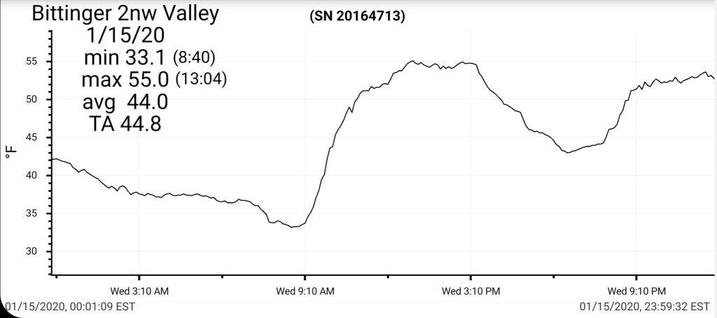
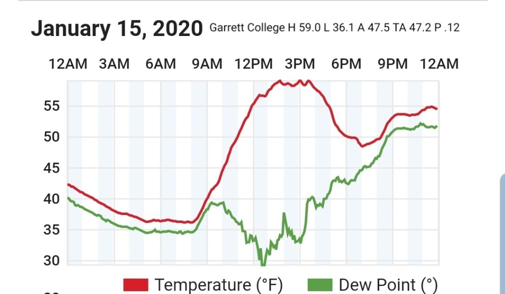
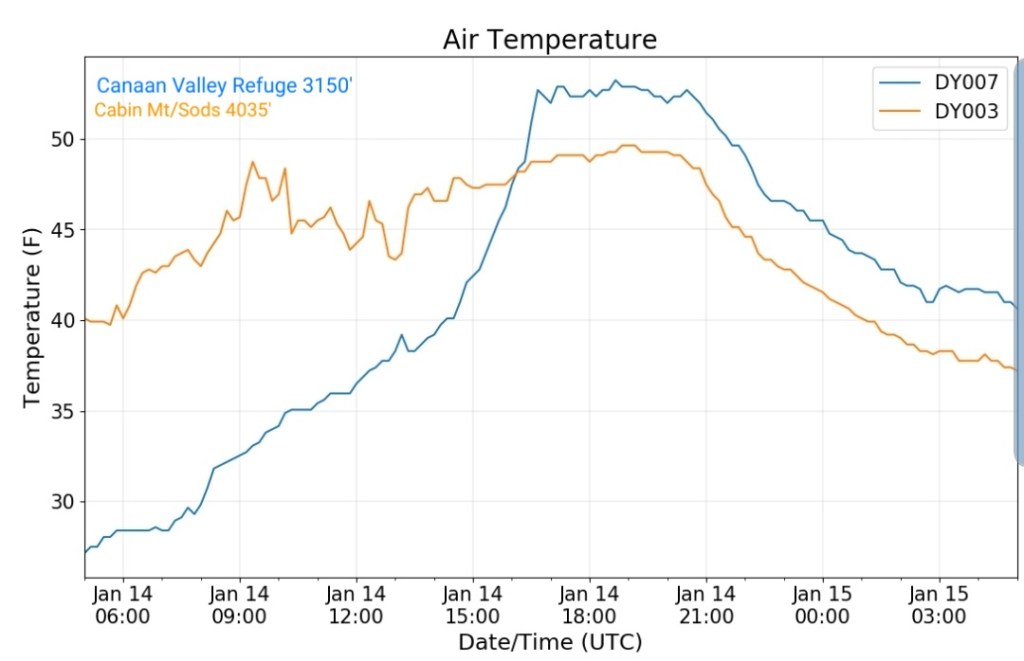
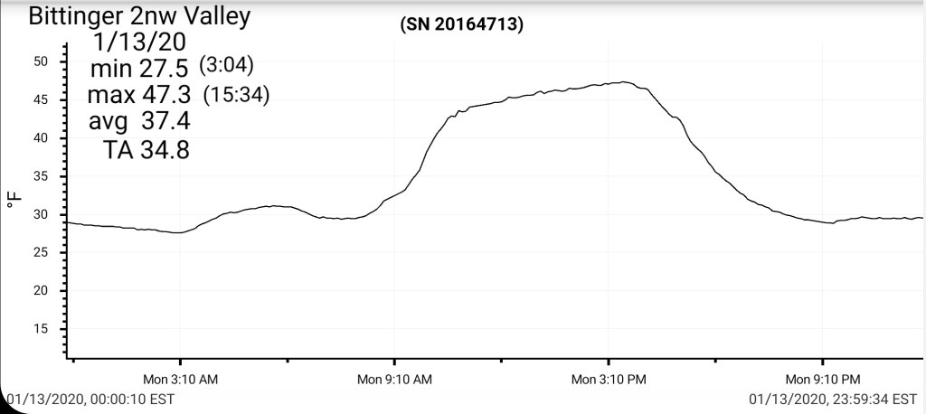
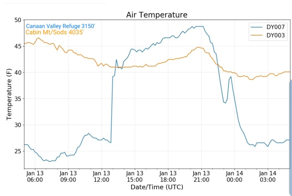
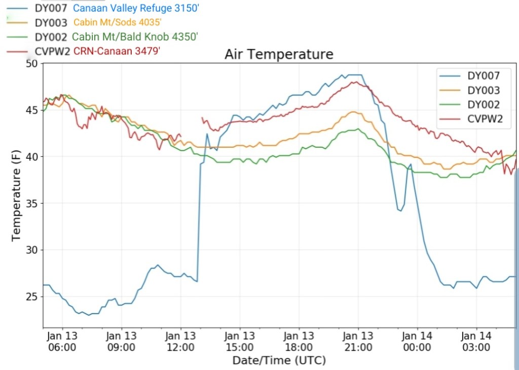
A touch of light snow this morning, there was more accumulation last evening, overnight towards Grantsville vs Bittinger. The day featured plenty of sun and cold temps.
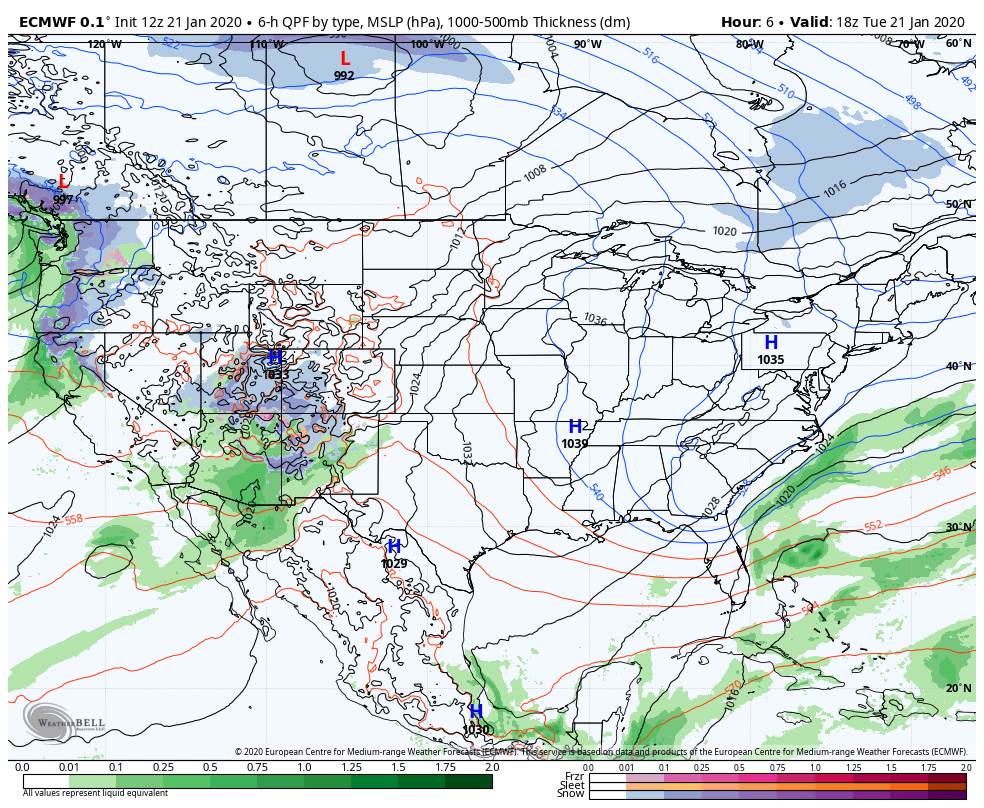
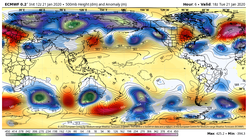
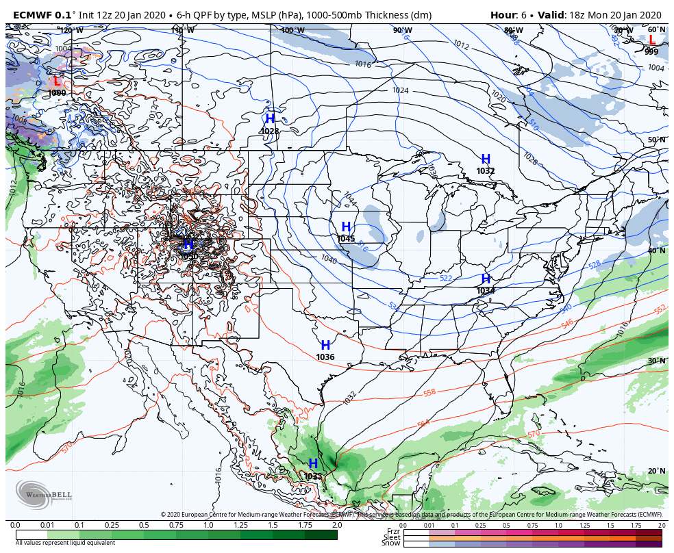
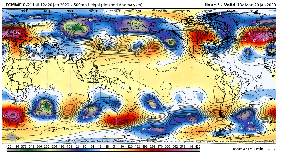
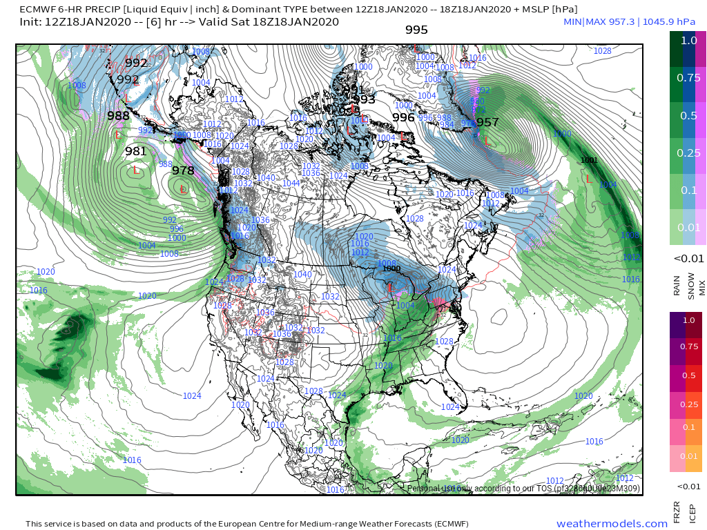
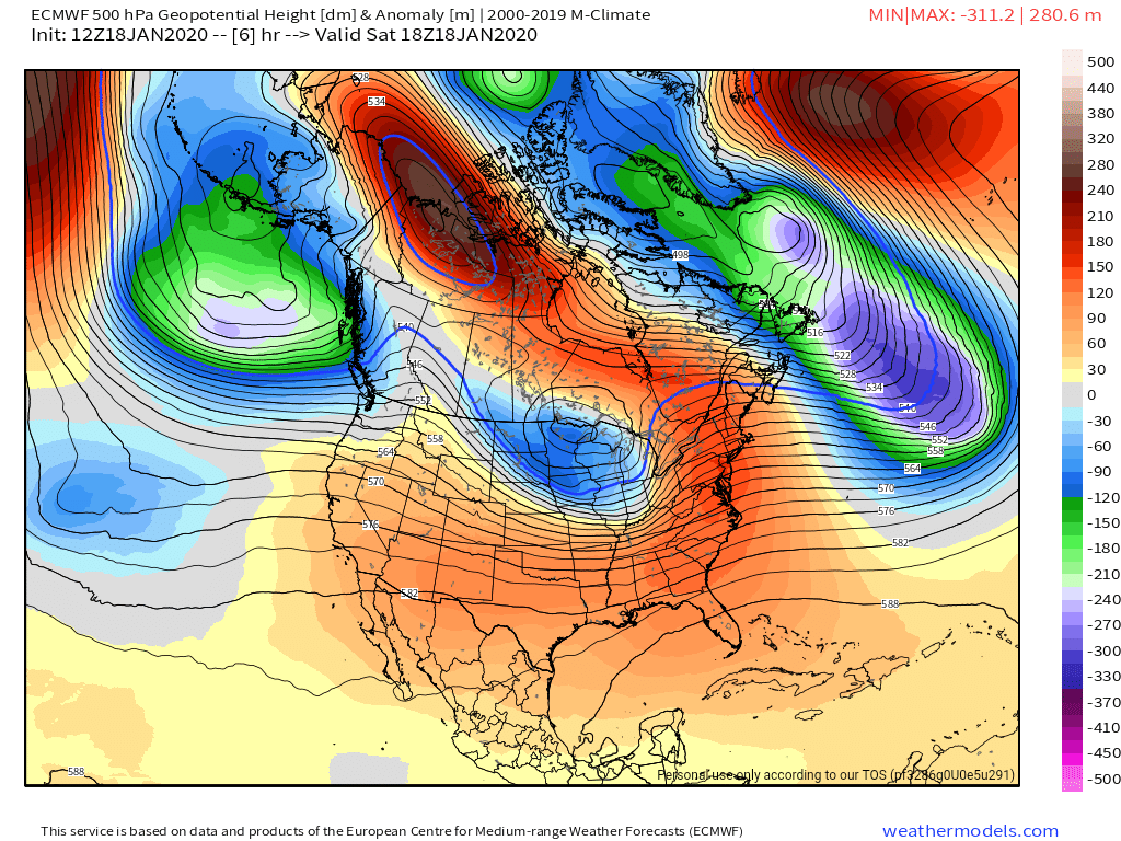
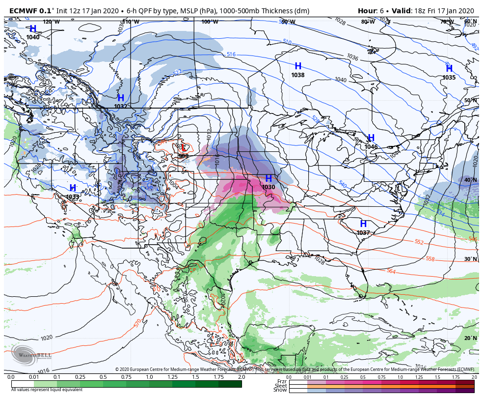
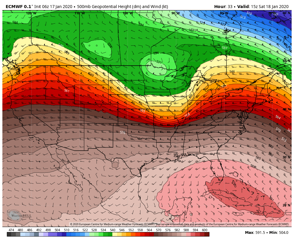
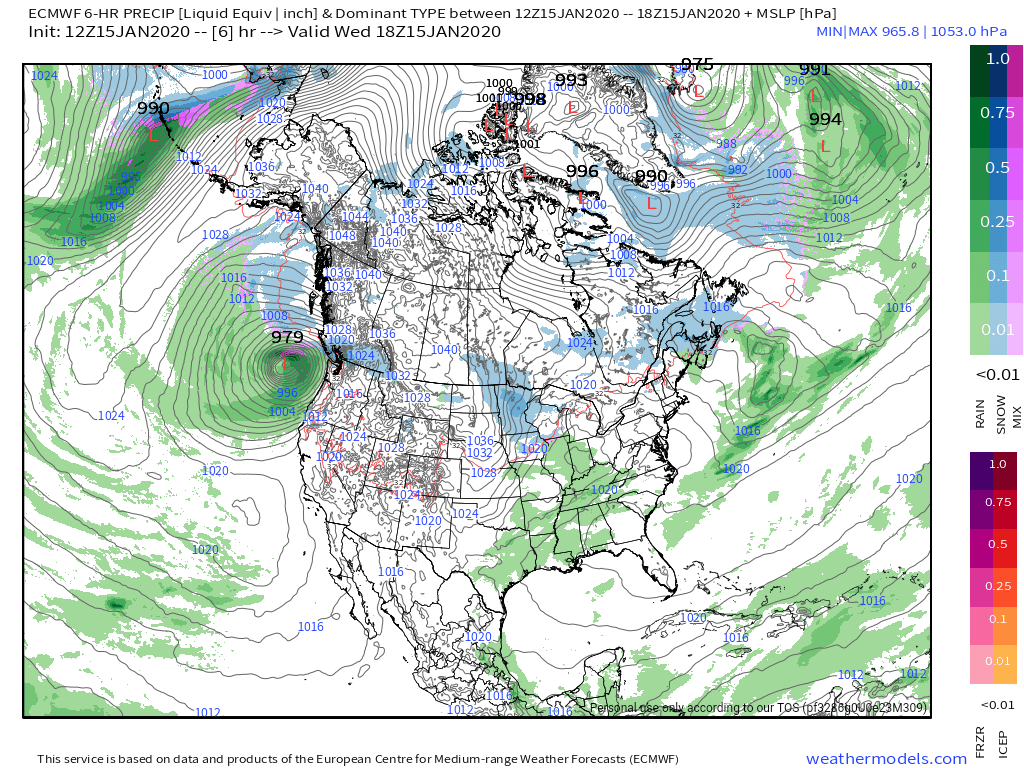
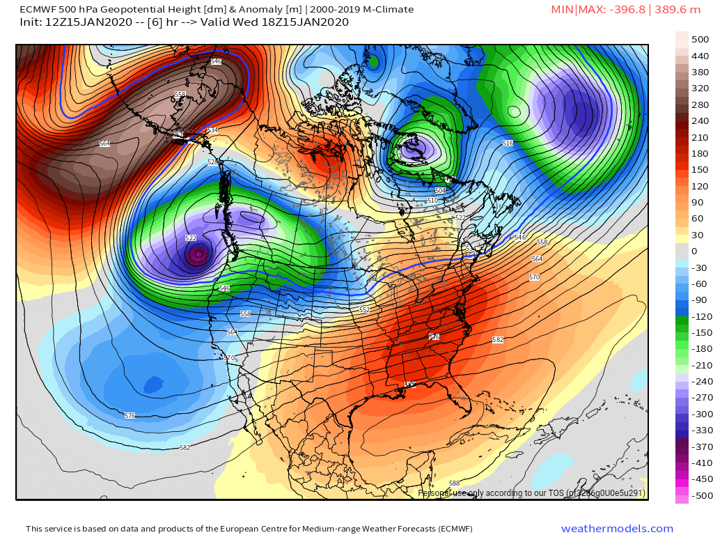
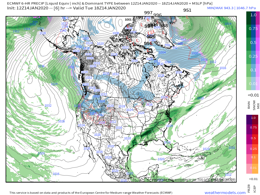
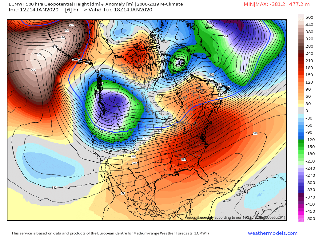
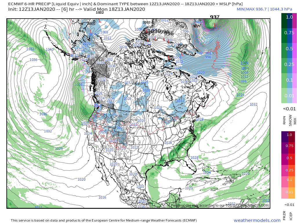
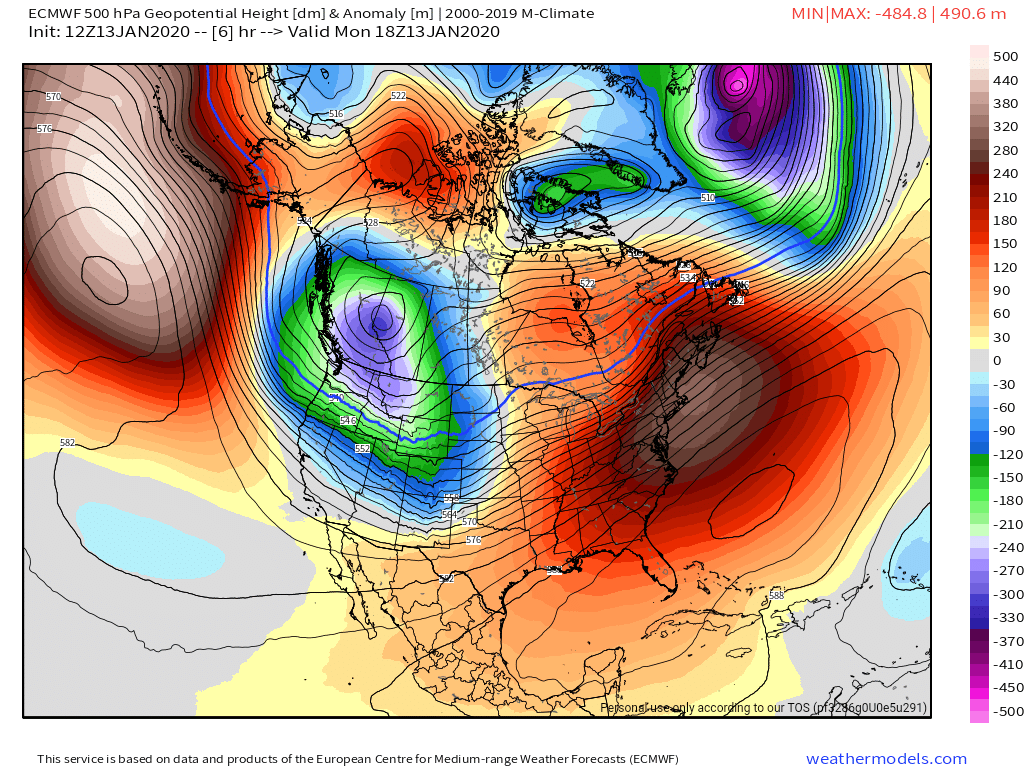
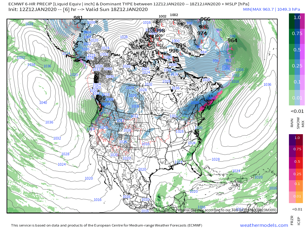
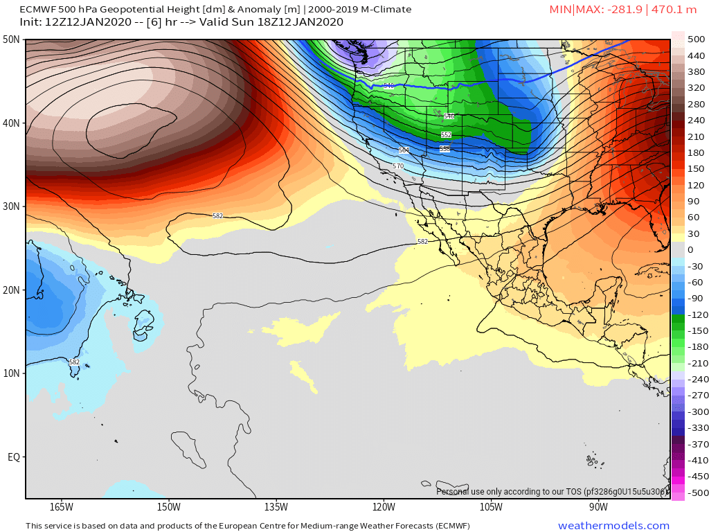
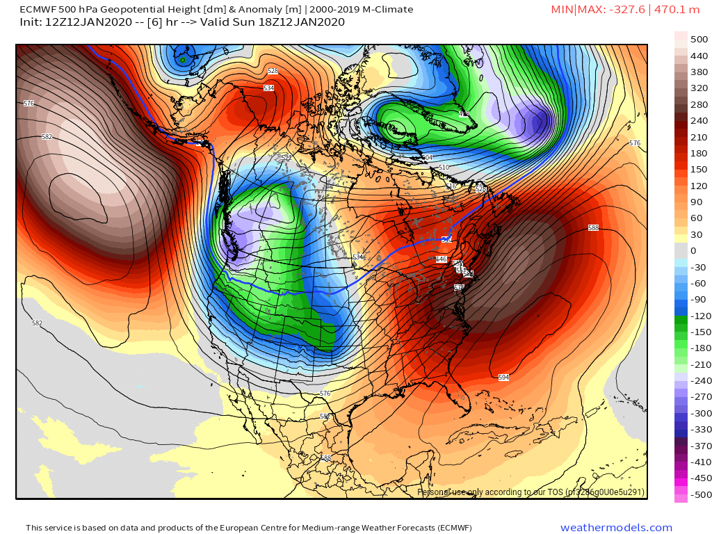
Surface features and 500mb height anomalies and flow
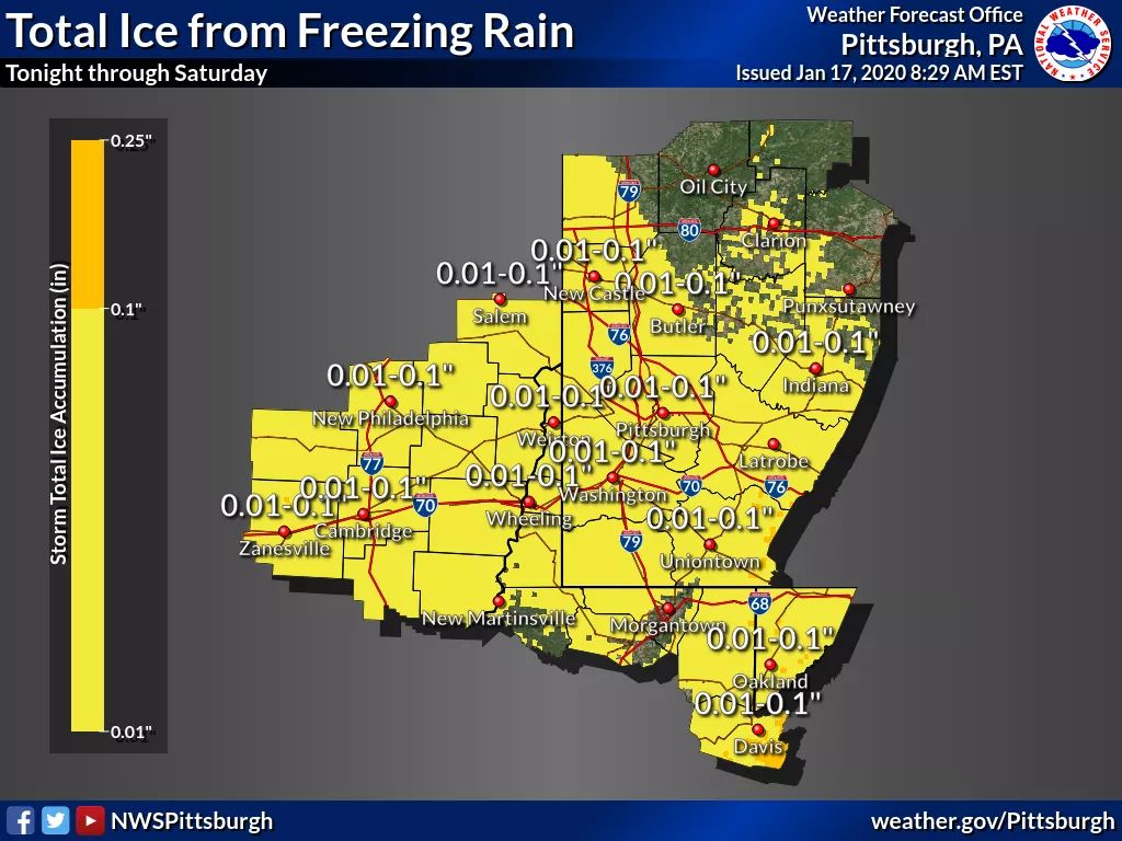
Upcoming winter event….
I was going to label this upcoming winter storm, but that probably would make it sound more significant than reality will have it. Having said that, I would expect winter weather advisories to be issued throughout the area late tonight through 1-7pm tomorrow, ending time varied by WFO office and location simply due to the icing risk and the hazards that even a little ice can cause. Charleston out with some already.
Currently we see disagreement within the office forecast.
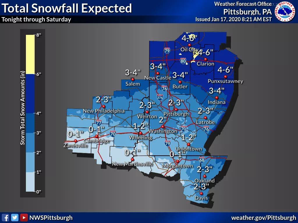
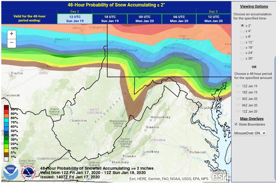
Pitt snowfall(look at the northeast area of Garrett County, 3+”) this through Saturday.
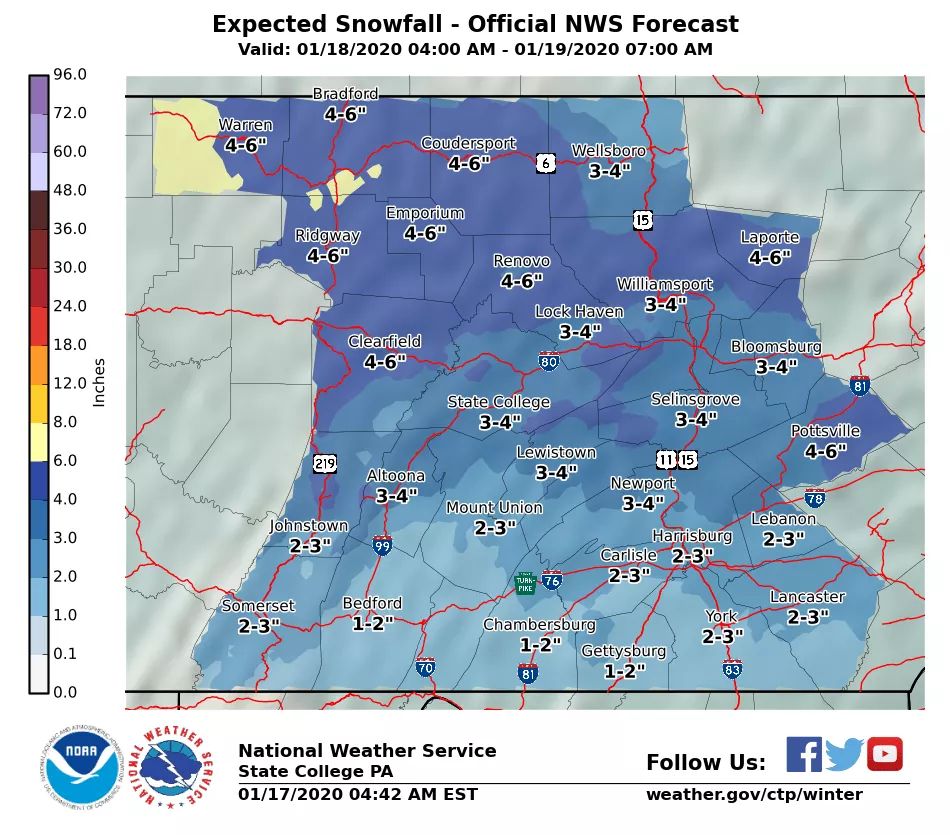
State College
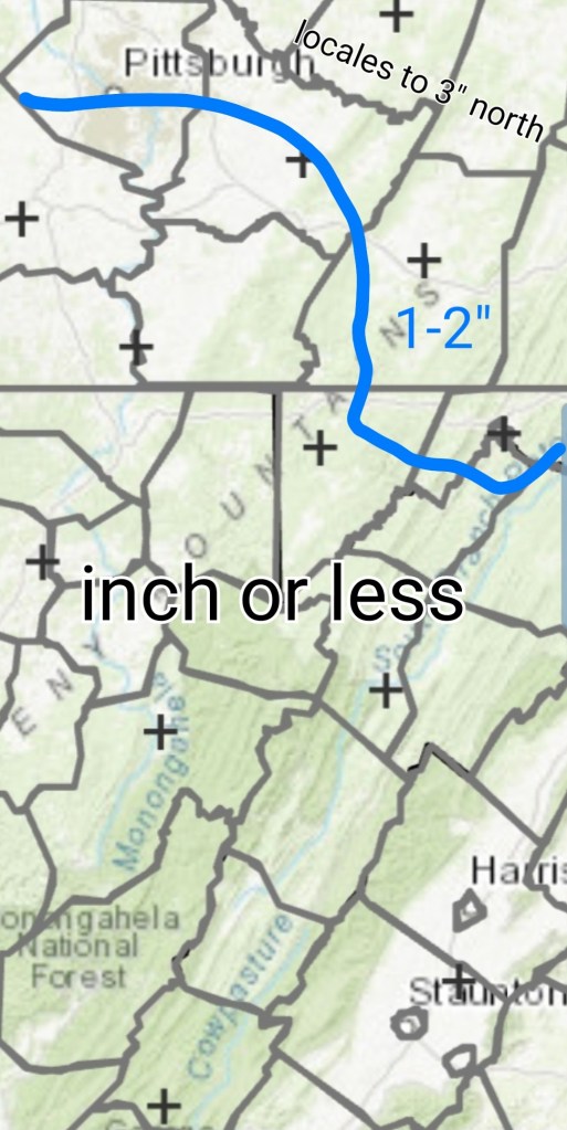
notice 1-2″ at the Somerset/Garrett border where Pitt has 3″+. This includes some into Sunday mornings upslope even and it’s still less.
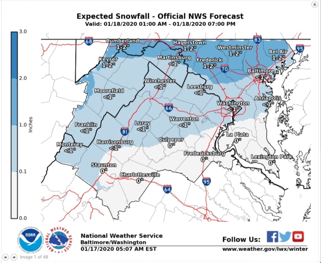
Sterlings call.. 1-2″ as well. Through tomorrows snow.
Charleston- includes some Sunday a.m upslope.
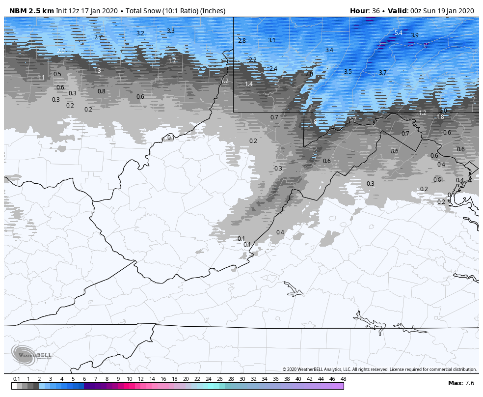
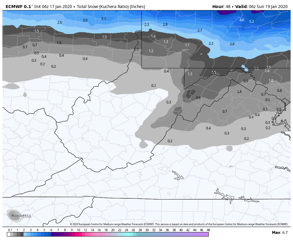
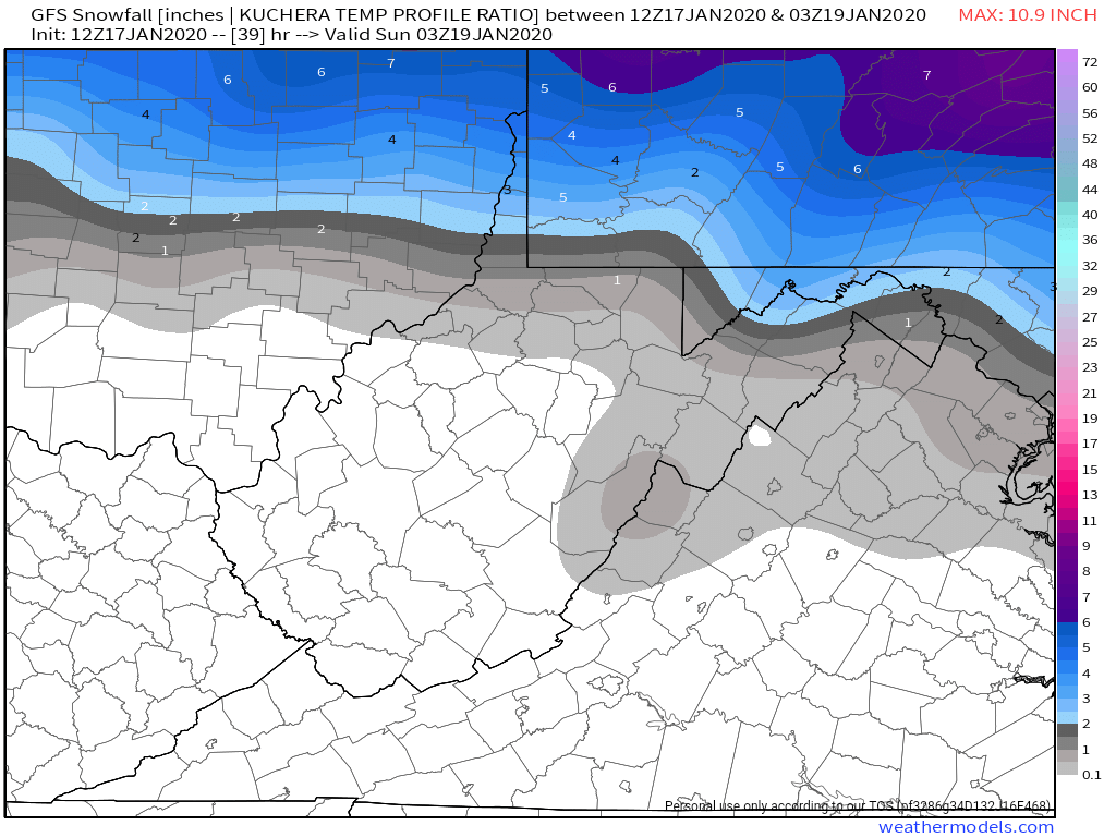
For the last several days models have had LOTS of agreement with only a slight cooling trend on the upper air in recent runs at the onset. Current National model blend holds this for snowfall
6z ECMWF
12z GFS
00z Canadian
3km Nam. Love its temp profiles which can lead to good boundaries, but in general sucks on QPF
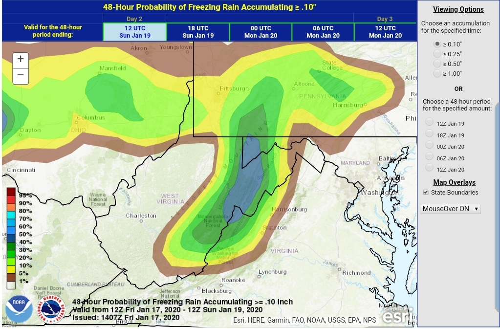
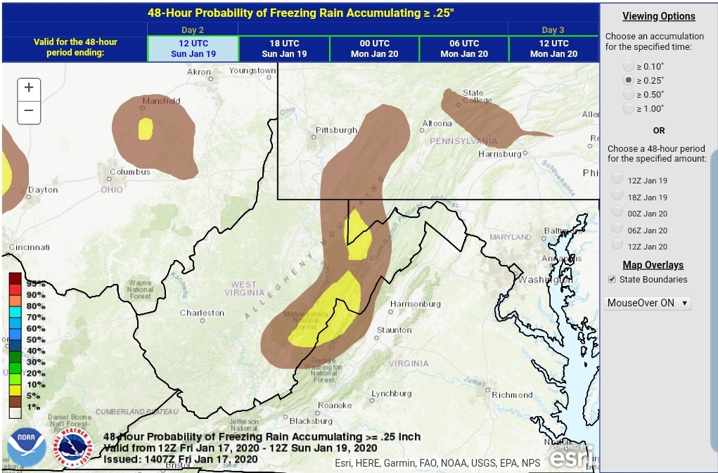
The WPC probability map
2″
4″
My thoughts, this through Saturday PM, EXCLUDING upslope into Sunday which looks like a 1-3″ deal. If the warmth aloft is faster, this would even be reduced for tomorrows snow.
With this big mega SE Ridge, Wv snowfall with a system into the lakes is often minimal
Lots of warmth pushing in aloft, however as mentioned it is a touch cooler vs the modeling of 2 days ago.
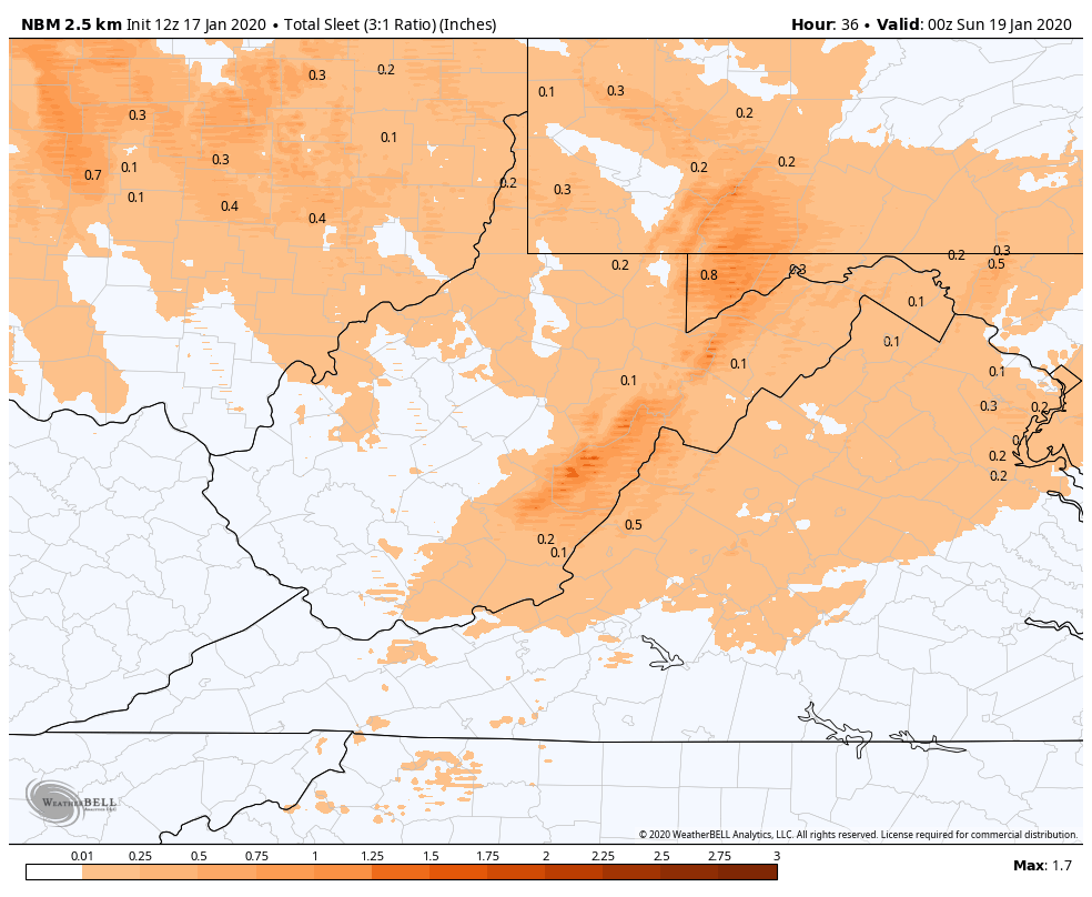
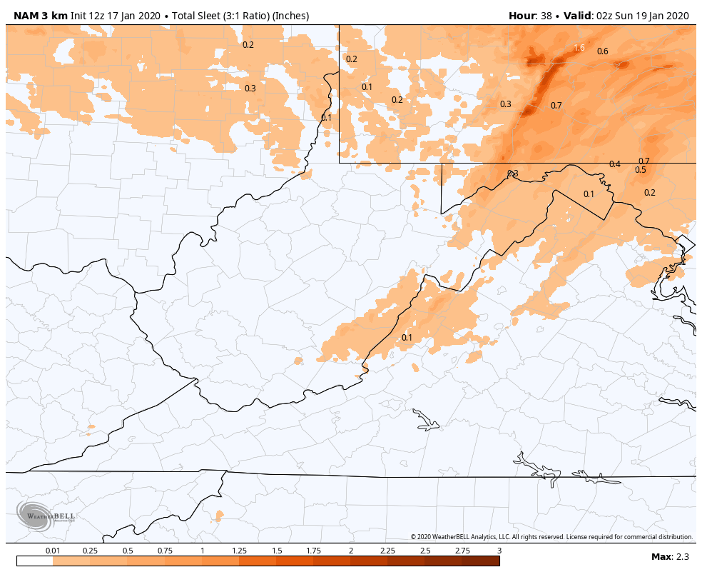
Sleet, there should be a period of sleet mid morning through midday in areas, in some areas on the east side of the Mts until early afternoon. Lots of model variation on this setup and frankly, models are not very good with parameter.
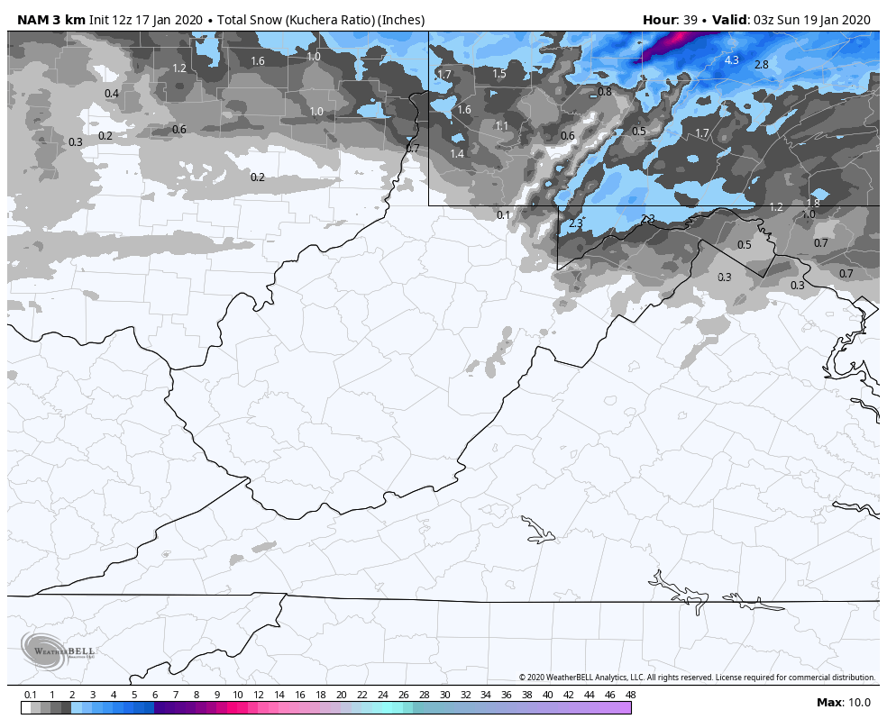
Model listed on each image.
My thoughts… I like what the GFS shows. .3 to .6 sleet in areas with longest duration. Remember sleet does not accrete to objects, its frozen droplets that bounce.
Freezing rain.
Pitt
State College
Sterling
Charleston
WPC probability
Tenth
.25
My thoughts
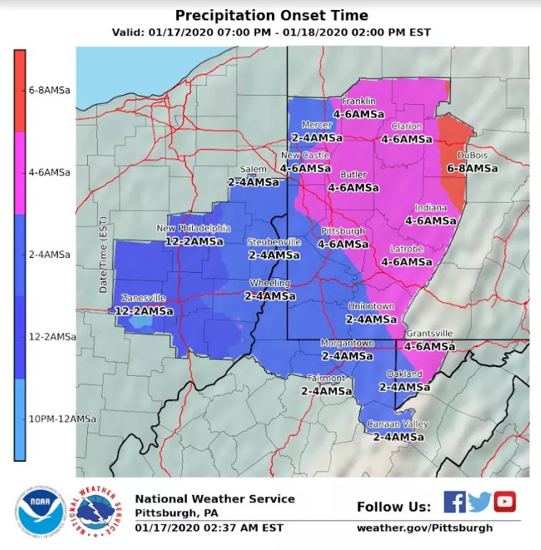
Precip onset
the initial precip should be snow in most areas, I’d expect it to be very brief in the Wv high ground and in some areas maybe not at all.
3km Nam 2m temps. Model of choice in these setup . Gives a good idea when your area will go to plain rain.
3km Nam 850 temps. The SW surge aloft is still evident on modeling, but a touch cooler.
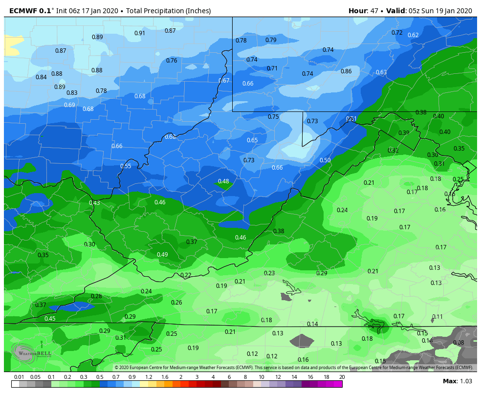
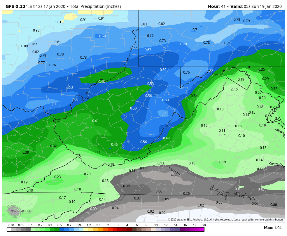
total qpf
6z ECMWF through midnight tomorrow. Around .3 to .6 of this in areas is wintry precip of some sort before plain rain. Beyond this time period we transition to upslope snow.
Surface features and 500mb height anomalies and flow
Limited onset snow
I think limited onset snow looks likely at this point. To much warmth screaming in aloft. Thanks to the mega 591 ridge over Florida that is in general a Wv snow killer, especially the high ground.
You may do a little better, on the order of 1-2″ from Eastern Somerset, into Cambria, Bedford , and Allegany County. From Garrett County through the Wv high ground, I just think any onset snow is short lived. Some areas look like they may have a duration of sleet, while others freezing rain before we all go to a period of rain by evening/early overnight. A 4-8 hour window of milder air at the surface. That then changes back to snow overnight Saturday and some upslope accumulations look likely.
Using the GFS as a guide, not the gospel. I think this may better illustrate the layers better than a sounding for viewers.
What is the video?
800hpa roughly 6400′
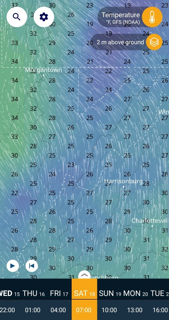
Modeled temps at 7am Saturday morning, around when the precip pushes in. (Keep in mind. This is a 9km model, it will not be perfect with these numbers across the highest and lowest areas)
well above freezing up at that level.
What about the 850 level, roughly the tops of the Wv high ground. See that rapid temp drop in that 1500′ +/-
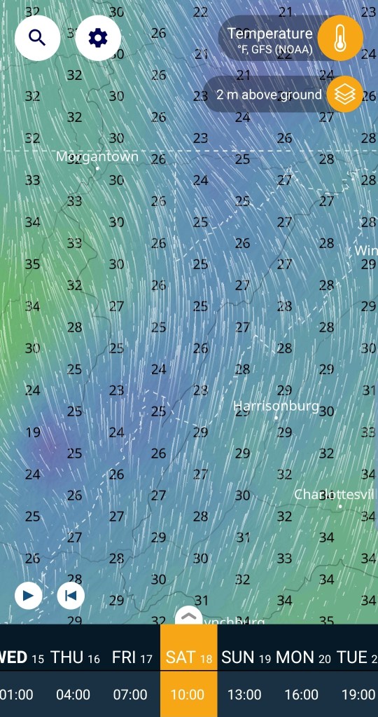
How about 2m above the surface
At 7am, this looks like areas of sleet, and freezing rain. Sleet especially central and eastern areas below 3000′, freezing rain/sleet across the Wv tops above 4000′, freezing rain to rain west side of the Mts and the only profile that looks conducive for snow, eastern Somerset, Cambria, Bedford, Allegany and east at 7am.
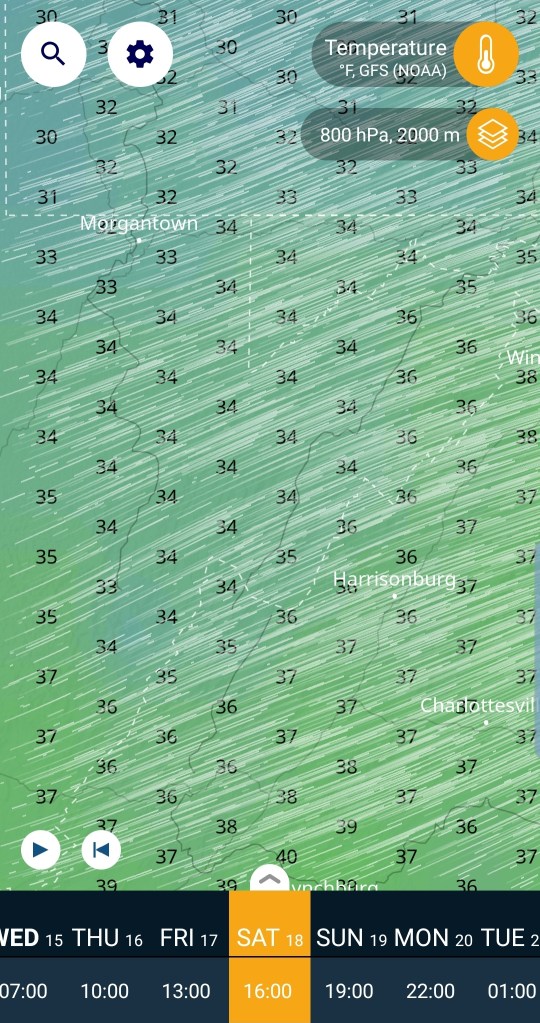
How about 10 am
At 800hpa roughly 6400′
Snow threat looks done for all areas at this time. If the model is correct.
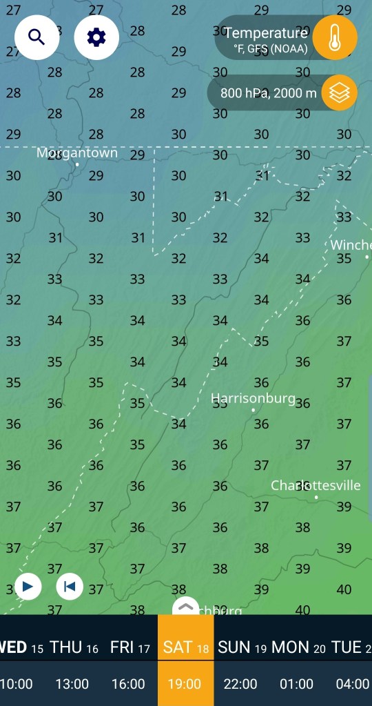
what occurs at the layers under 6400, lets drop to the 850 level, again roughly the highest peaks in Wv are the 850 levels.
that 850 layer is much colder, but some areas coming +32…those areas near and under 32 at this level at 10am, that’s showing some depth to your cold air, likely sleet yet at this time, closer to 32, probably freezing rain. Why freezing rain?
Let’s look at the 2 meters above the surface at 10am. Still cold. Surface is influenced by the big departing high, with the upper air influenced by the low pressure Nw, thanks to the big Southeast ridge
Let’s advance to 1pm
800hpa roughly 6400. This level cooled some in the north, very close to freezing, as well as the levels above it.
what about at 850 level, again, highest Wv elevations around this level. This would indicate some areas could see some snow trying to mix back in..if the model is right.
What about the surface at 1pm…you can see some areas ar 1pm, a cold profile top to bottom occurs for a short spell near the mason dixon. If the model is correct, at this time precip type is primarily maybe some wet snow mixed in north, pockets of freezing rain and plain rain west and that warm tongue with rain in Canaan that is often the case with these setups. Areas of sleet remaining Highland, Bath counties Va with that profile setup. I wouldn’t take it that literal though, it’s a model run.
At 4pm
800hpa 6400′ roughly . This layer is mild south of the mason Dixon, beginning to chill north
850 layer, roughly Wv highest elevations . Warm across the board. Any precip at this time is falling as rain and any areas of freezing rain at 4pm restricted to east valley areas.
Surface temps at 4pm…and I think the model in general is too fast warming surface temps up. I think areas of below 32 will be a bit more expansive yet at 4pm. That said, the deeper valleys on the east side of the Mts holding on to cold the longest and freezing rain lingers the longest. Around this time, likely a little after, west winds should begin howling in.
7pm
800hpa roughly 6400′
Colder air aloft returnin . If we had a Mt. Washington NH, the peak would be back to snow. We dont…
The 850 level, Wv highest areas elevation.
Temps well above freezing yet.
And the surface at 7pm
At this time, most into the 40s, again a 9km model, wont pick it up, but the Wv peaks back into the 30s at this time. Also a few deep valleys still holding 30s that’s slow to be scoured out.
lets jump to 1am Sunday morning
800hpa, no issue with cold here
850 level, no issues here
And the surface,,back below freezing here, except now the lower elevations on the east side are milder, but they too will begin the drop.
From 8pm to midnight the transition back to snow should occur with any remaining precip.
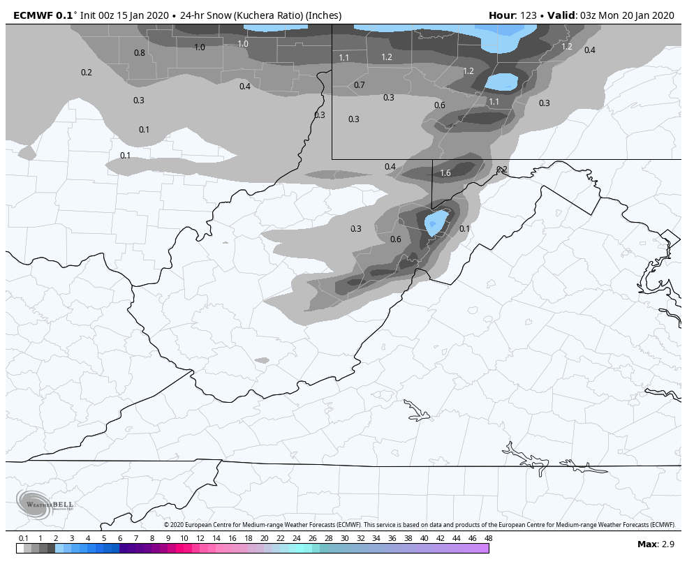
Snowfall on the order of 1-3″ looks likely from the changeover into Sunday night.. with lingering light additional Monday.
beyond this we do go into a predominately cold pattern….will that mean snow?
Surface features and 500mb height anomalies and flow
The trend ain’t no friend of mine. ….
Trends….late Friday night, through Sunday a.m. this too shall adjust. Only thoughts on the model trends. Not etched in stone by any means.
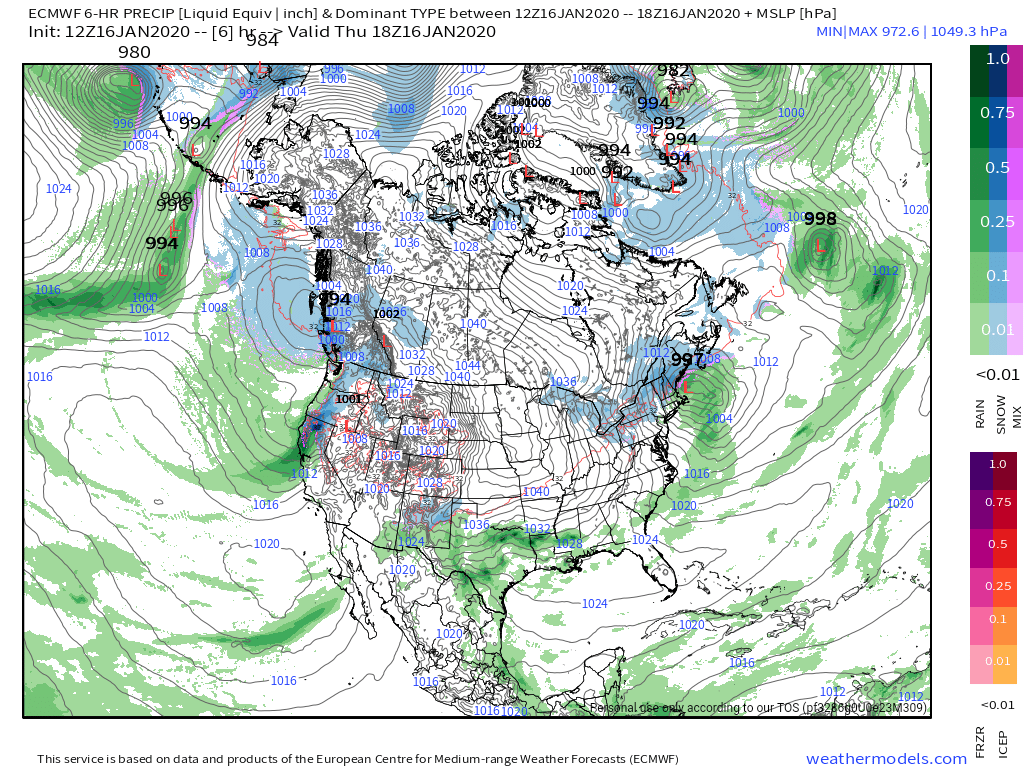
12z ECMWF MSLP/6HR/PRECIP 1/14/20
12z GFS MSLP/6HR/PRECIP 1/14/20
Model agreement yesterday was strong, today is strong as well, but there has been a shift to a bit of warmer air aloft rushing in on both of the major models. If this indeed is the case, that doesn’t bode well for a period of snow lasting long at the onset. Any duration of snow at the onset may be Savage Mt and east, before a changeover to sleet, then freezing rain. Elsewhere it may be very brief snow and rapidly to a mix.
There is a big cold high that is ahead of this system, very cold, dry air mass in place overnight Friday. That’s a big player in low level cold for sleet, freezing rain, even after moving off the coast.
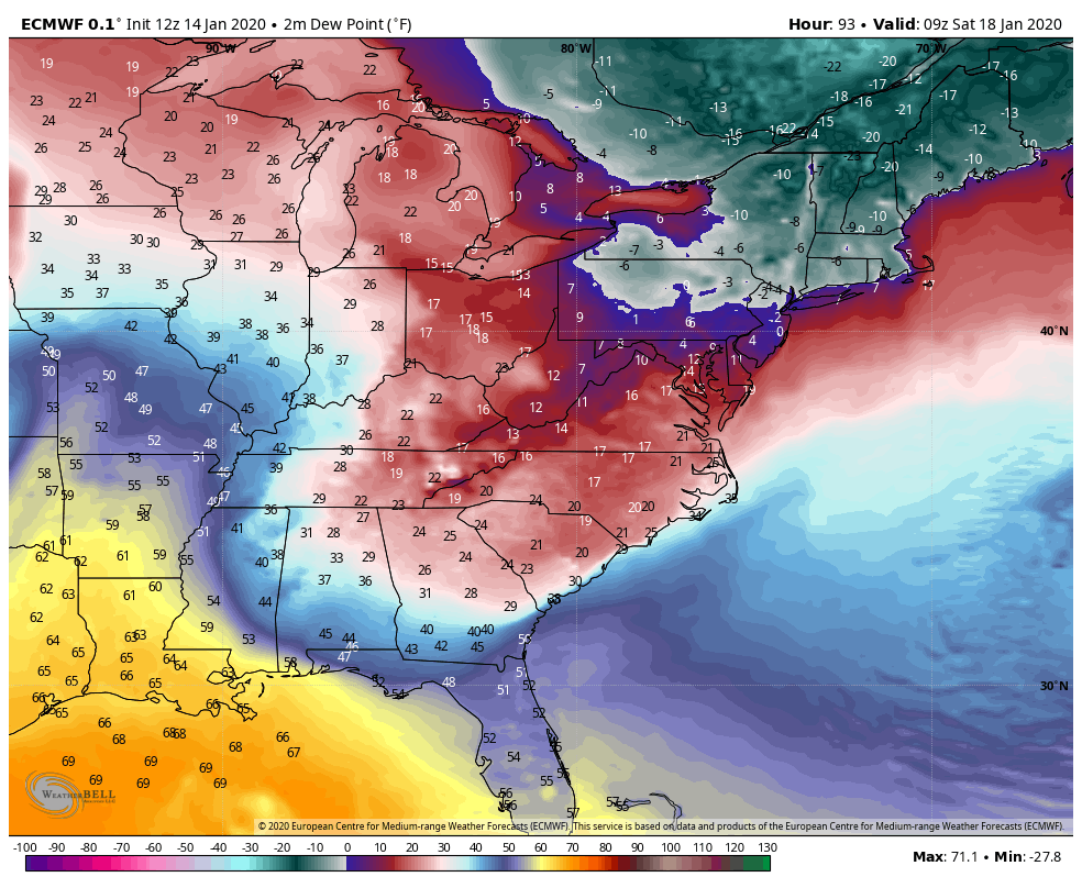
12z ECMWF 2m dewpoints
With the low pressure tracking into the lakes, the low level cold air should hold for a good portion of Saturday, with the high off the east coast. The depth of the cold air may allow for a duration of sleet to occur in the central and eastern portions of the Alleghenies before a change to freezing rain, and a period of rain later Saturday before going back over to some snow Sunday morning.
Yesterday the totality of the event, from a precip type boundary, and amounts perspective looked similar to the Nov 15, 2018 event. Not the low position or the 500mb pattern(those are well different) just the surface results looked like it would produce similar results for what we see when all is said and done. Right now, model trends are leaning a touch less snowy, and more of a sleet, freezing rain to rain trend late Saturday with backend snow and turning much colder through Sunday.
Snow thoughts are looking more 1-3/2-4″ vs 3-6/4-8″ when all is said and done Sunday.
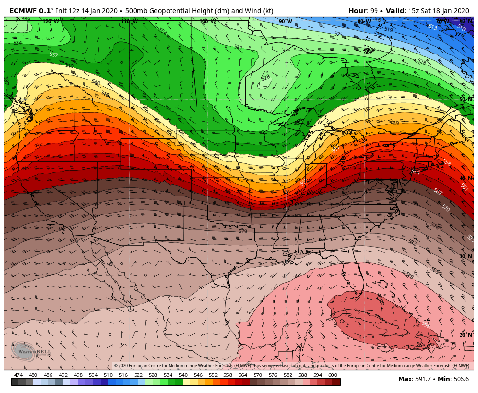
Still fighting the big southeast ridge(image below)with this storm . It will be a fight with the low level cold in place ahead of what’s going on aloft. 591 heights over Florida generally doesn’t bode well for Wv snow. Pa and north, a increase in snow chances increase rapidly in the pattern. So, for now the thoughts are less snowy and more of a mix for the onset and mix to rain in most areas for brunt of the system with some areas holding on to a mix through Saturday and then see what we can catch on the backside as far as snow goes for upslope.
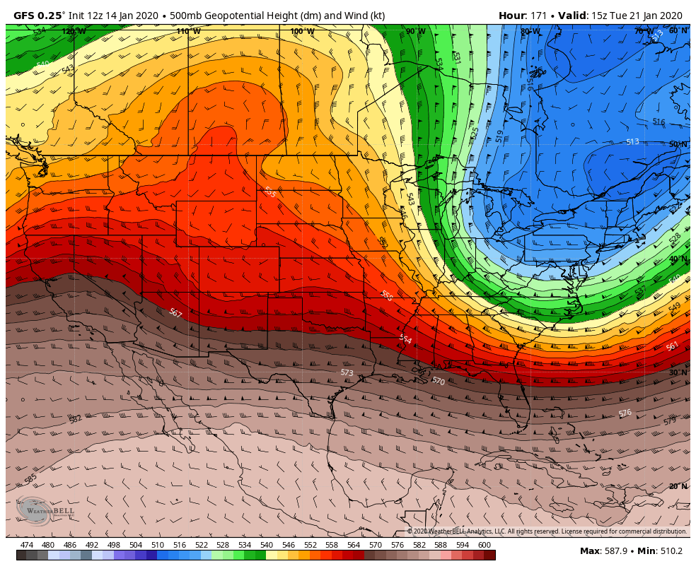
Let’s see if the coming model runs trend colder near term
Long term the SE Ridge breaks down.
Cold is in place by Sunday
12z GFS 2m temp anomalies
Seasonal to below average looks to heavily outweigh above normal temps going forward.
12z GFS 2m temps Garrett County Airport
with the overall colder pattern in place, the question soon will go to can we get a favorable snowy storm track.
Surface features and 500mb height anomalies and flow
Winters return…..
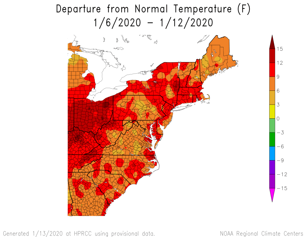
Past 7 days well above normal , and the next few will be as well….
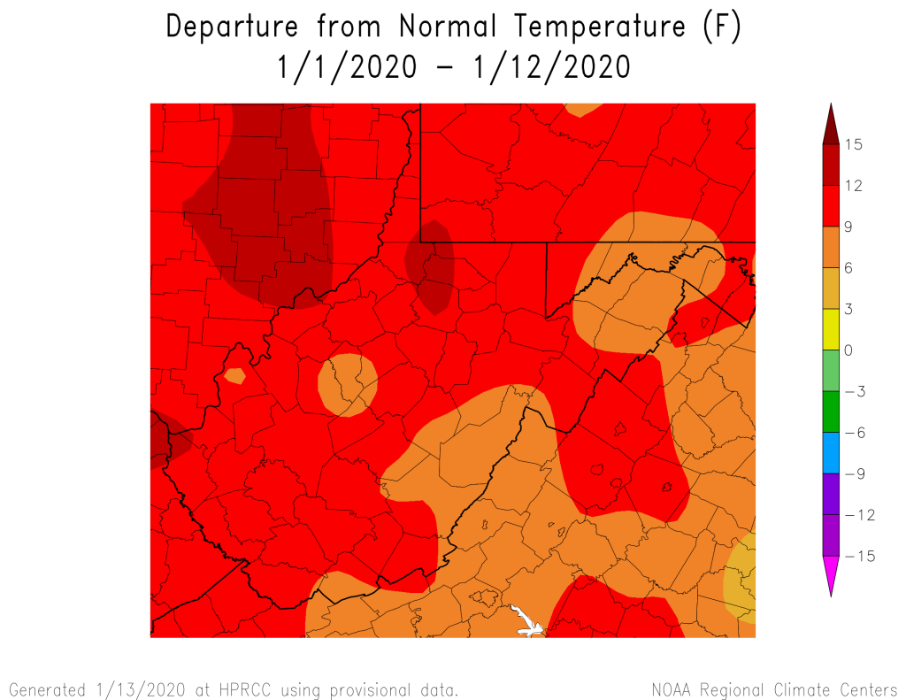
Month to date, even with the 4-5 day window of winter from the 5-9th period.
That’s resulted in to this for winter folks
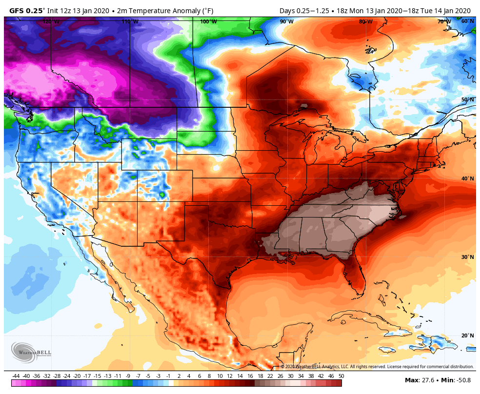
Today’s departures, well above east, with a very cold push into the NW U.S and some of those remaining spots that way that have above anomalies, will be disappearing and turning blue. By Friday the 10-14 day mean will look a lot like some of those mild Januarys used as examples(37 etc)
How-Eva—–
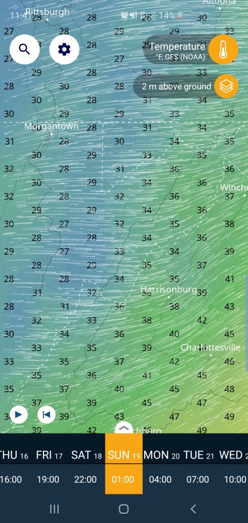
The cold begins its push. By Thursday will see slowly falling temperatures through the day with any lingering precip turning into a few snow showers. Very minor event, Friday holds chilly, thanks to a big high to the north. That slides east, but is a big player in the late Friday night/Saturday system. Overnight Friday, temps hold steady to even rise overnight it appears. How much?? Those details are too far out. Typically the warm tongue plows up west of the Mts and over the Wv high ground in this setup. Model runs have trended a touch colder overall with the brunt of this system. The mild sector of the storm may be short lived in the Wv high ground and not at all across north central Garrett and points NE. Those details are still sketchy.. ..
Today’s 12z Model runs
Precip type boundary from snow, sleet, freezing rain, how much of a surge or push the warm tongue has…do some areas have a lengthy period of plain rain?(best chance Wv high ground and west) those exact details are unknown. As of now, Friday night and Saturday need watched. Way to early to say snow amounts, vs sleet/freezing rain, plain rain…… This event preludes a much stronger cold push of air….
If I had a recent event, of storm and precip type, boundary setup, strength wise as this currently looks like to compare to. Nov 15, 2018 would be a comparison I’d use at present… “Archived” . Actual Low position, 500 pattern are not alike, but results could be similar.
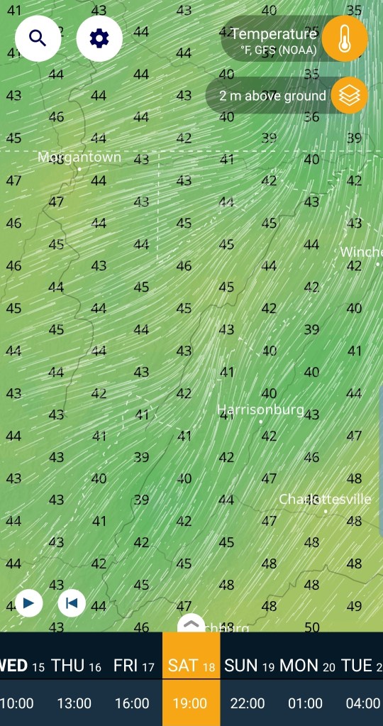
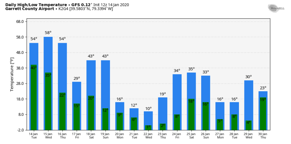
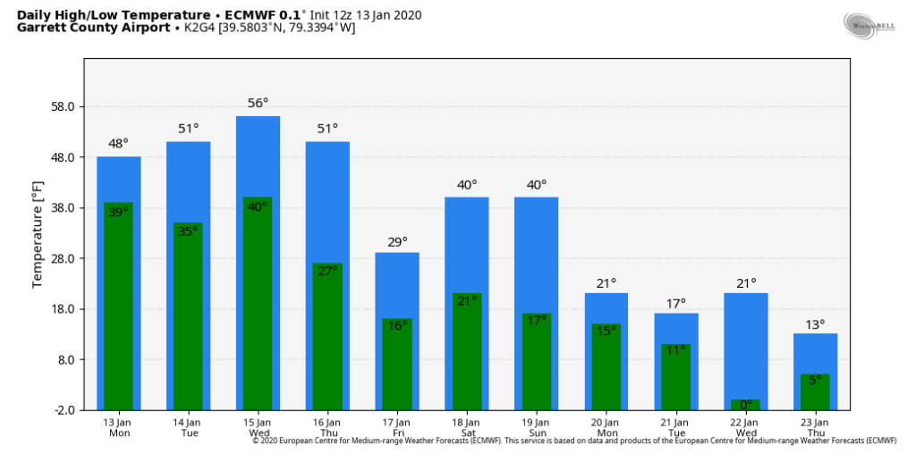
12z ECMWF temps for Garrett Airport
Thursdays highs are predawn, that Saturday-Sunday 40°, if that occurs, that’s a 4-8 hour window and the model sees it occurring near midnight, that’s why you see the double 40° for the weekend in what overall looks like a cold weekend ahead……but check out the temps next week. By then, ski resorts will be needing that in a big way.
The coming cold looks to have “some” holding power. As always, even in cold periods you often have a some bounceback days. Cold looks to outnumber warmth going ahead in the near term once beyond Thursday