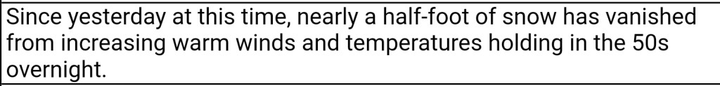
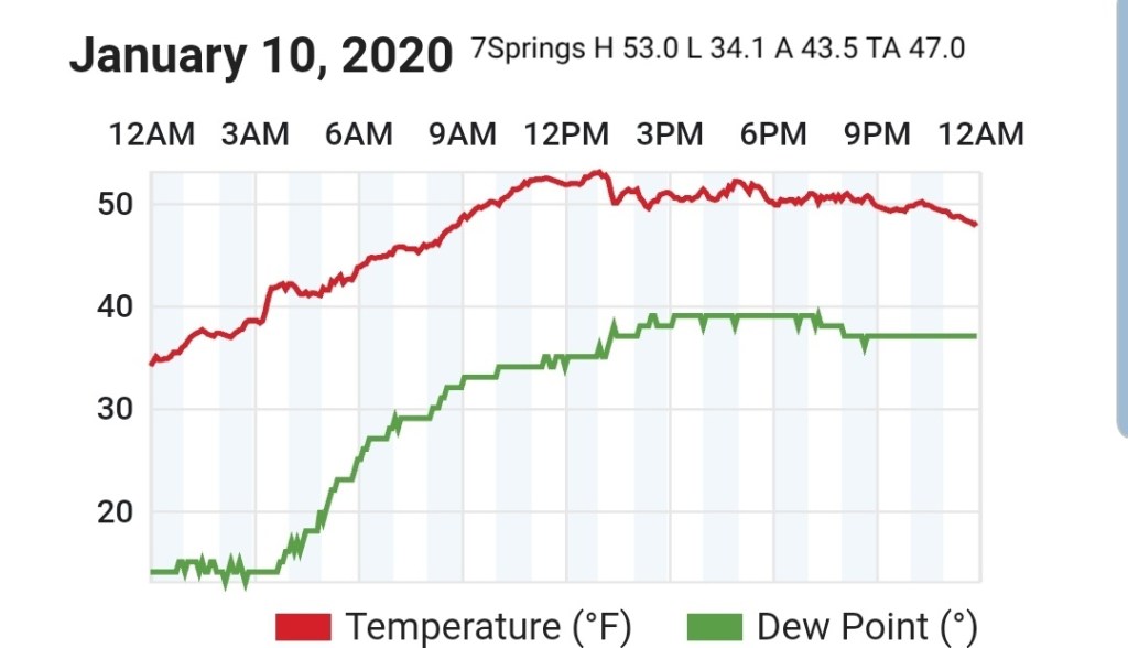
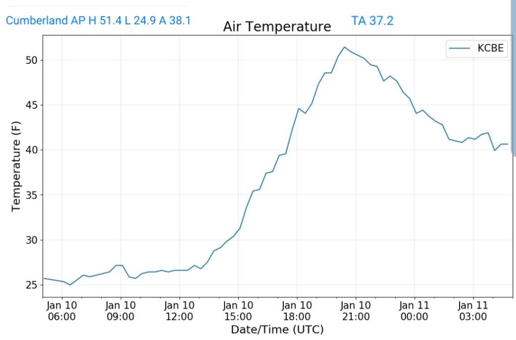
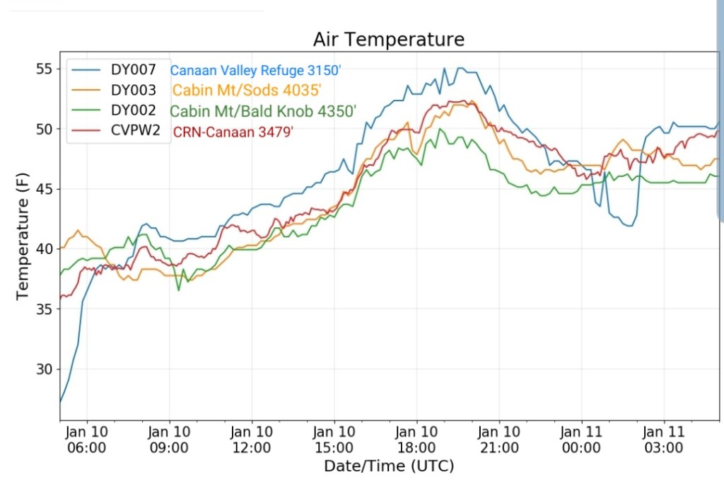
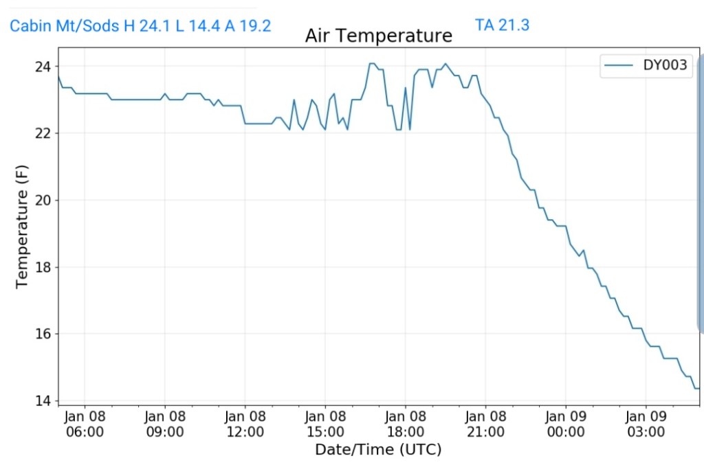
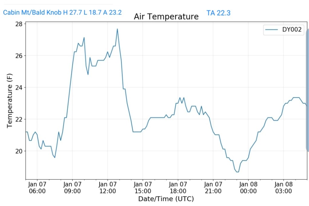
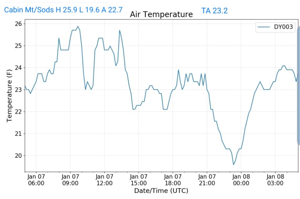
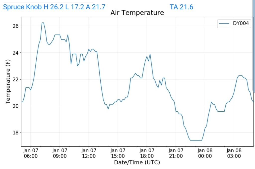
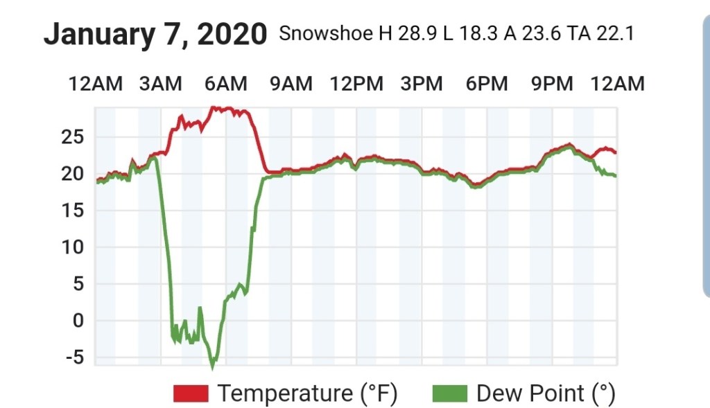
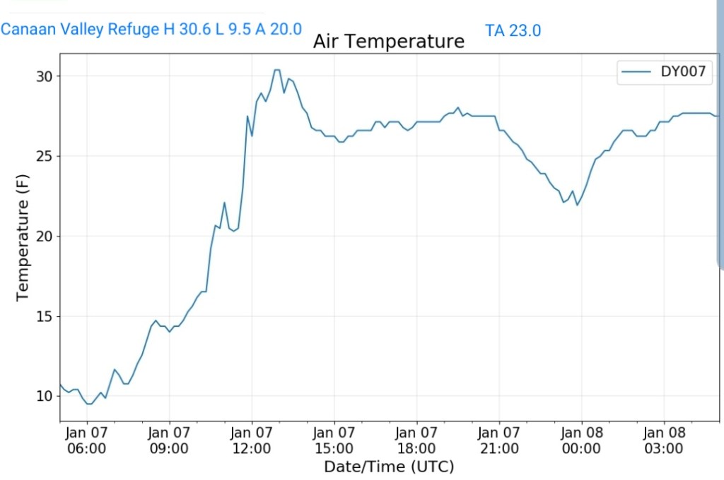
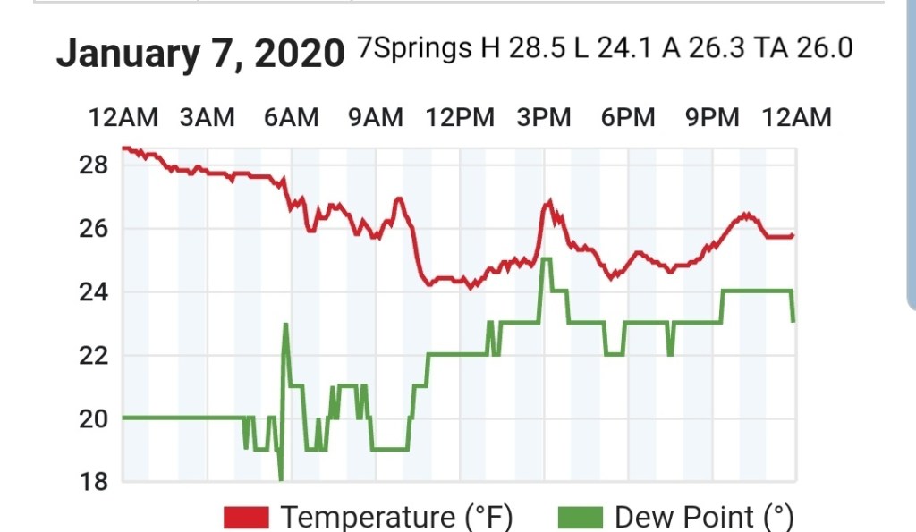
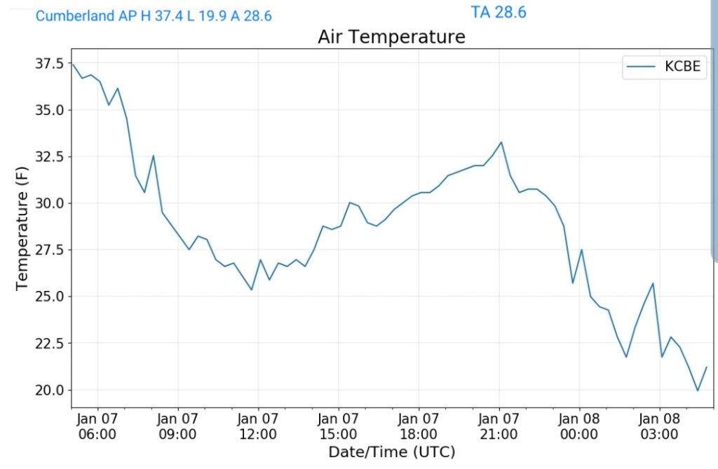
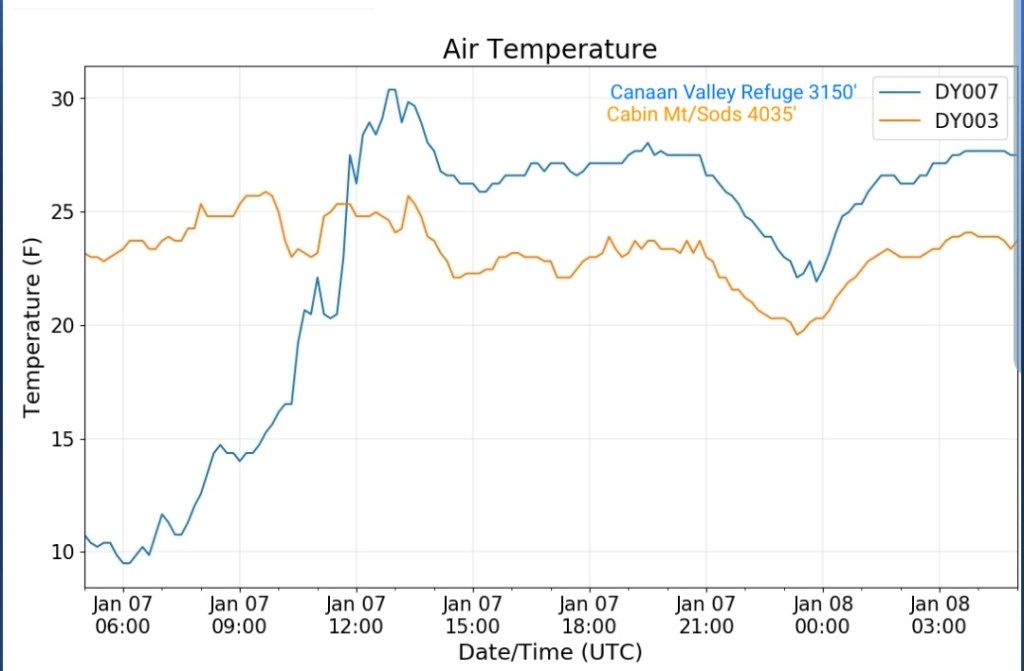
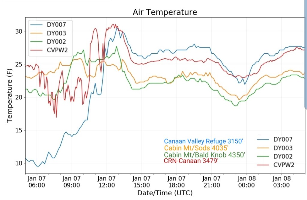
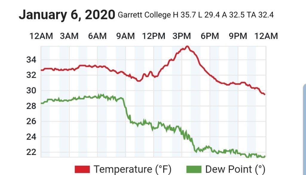
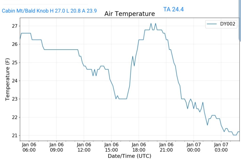
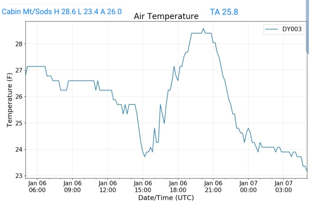
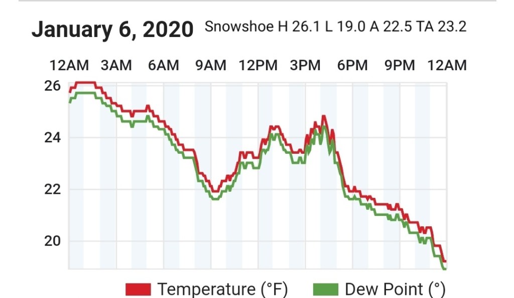
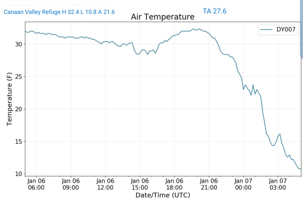
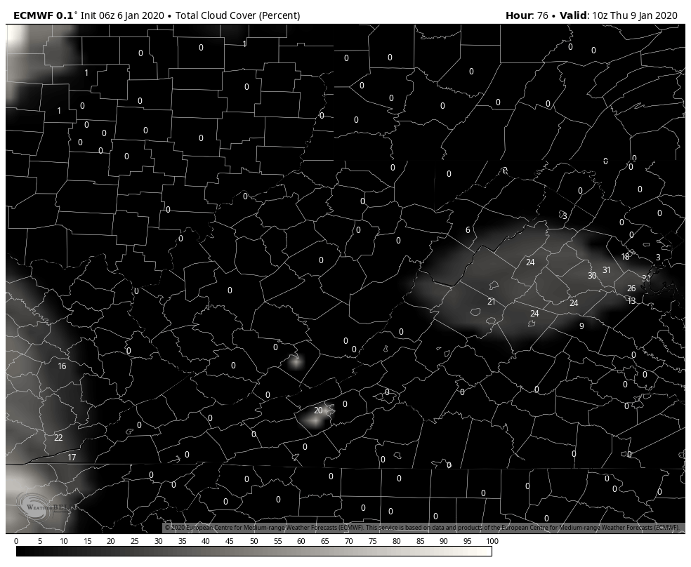
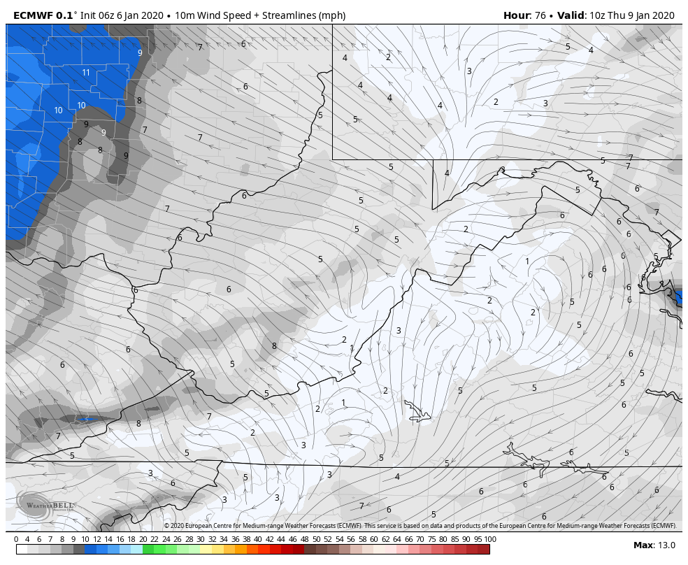
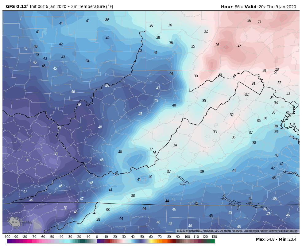
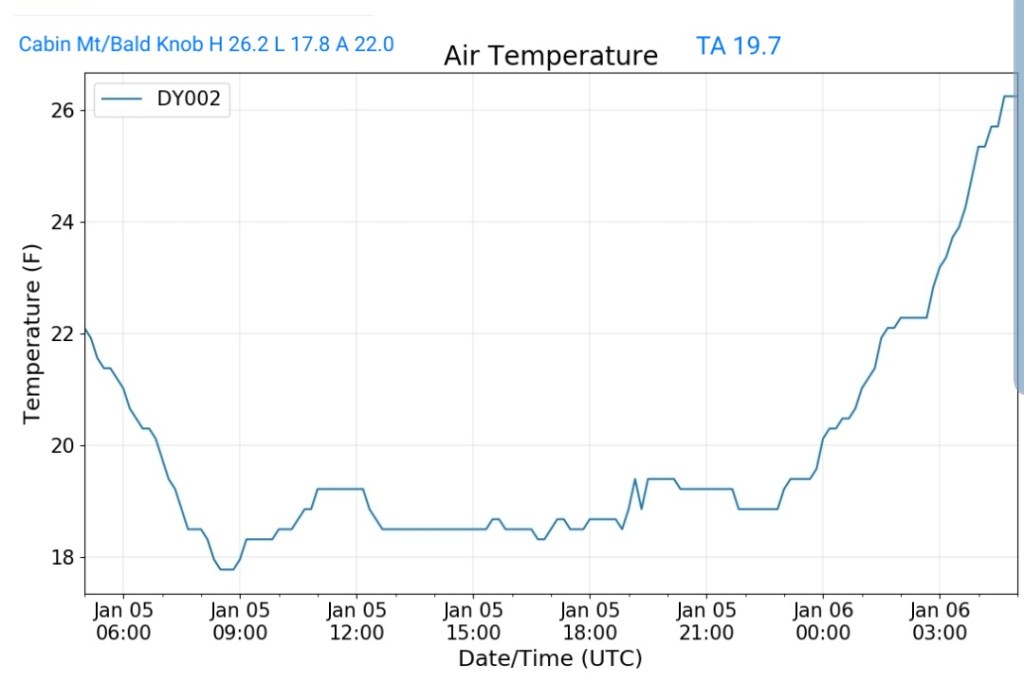
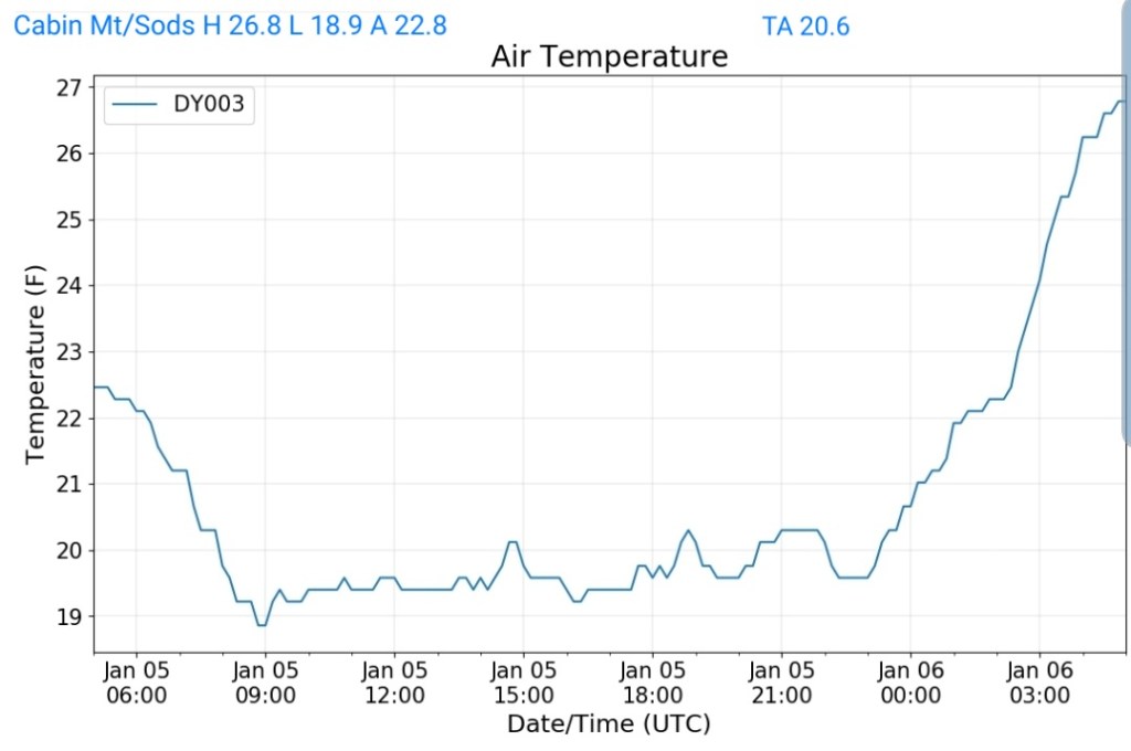
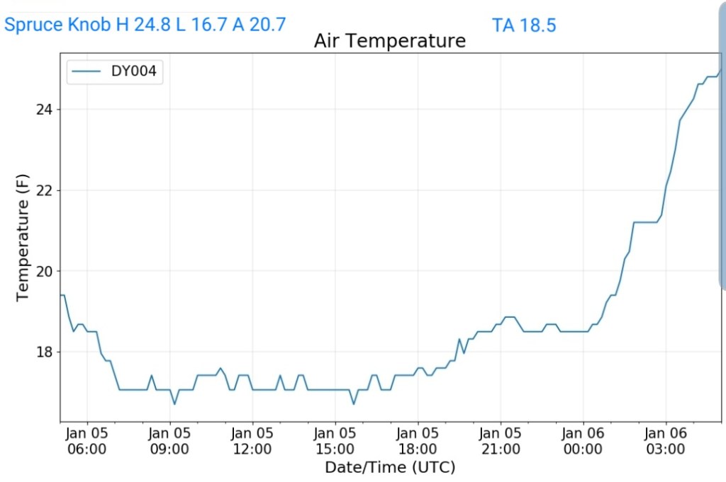
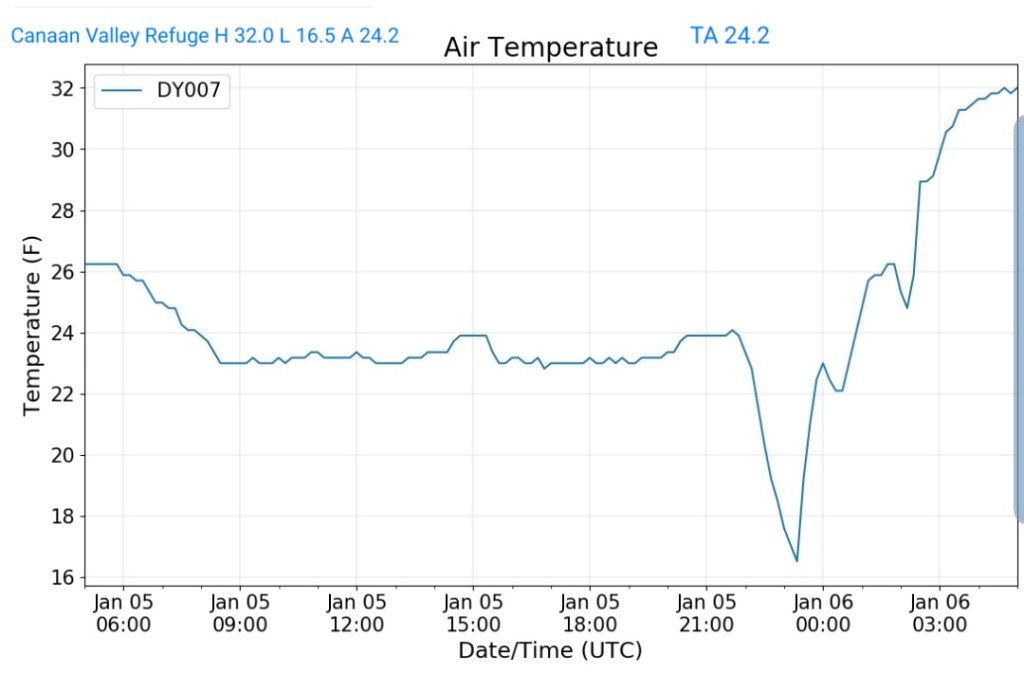
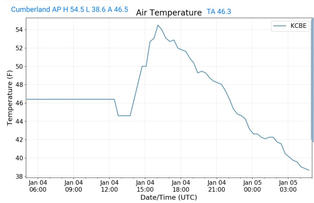
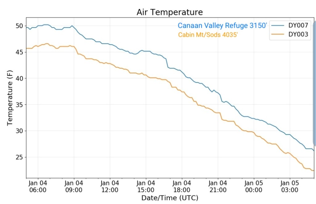
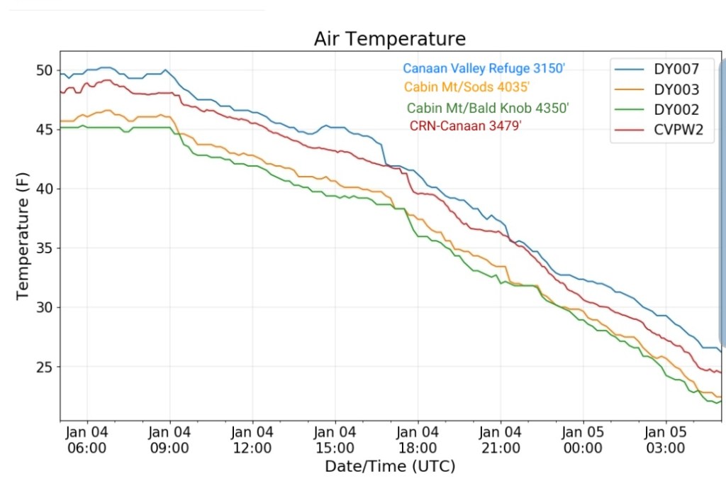
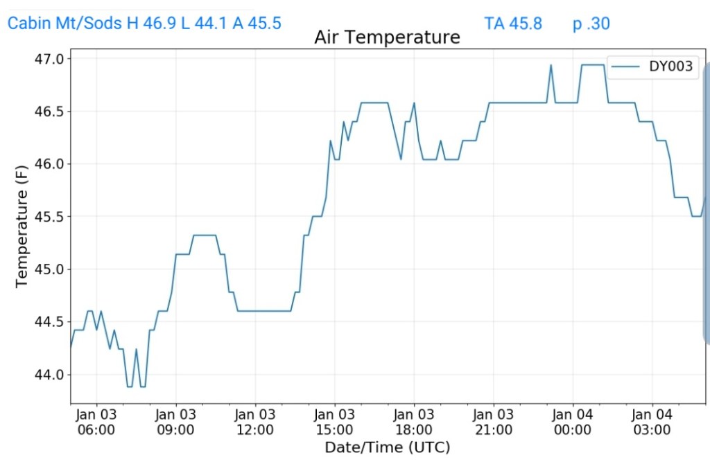
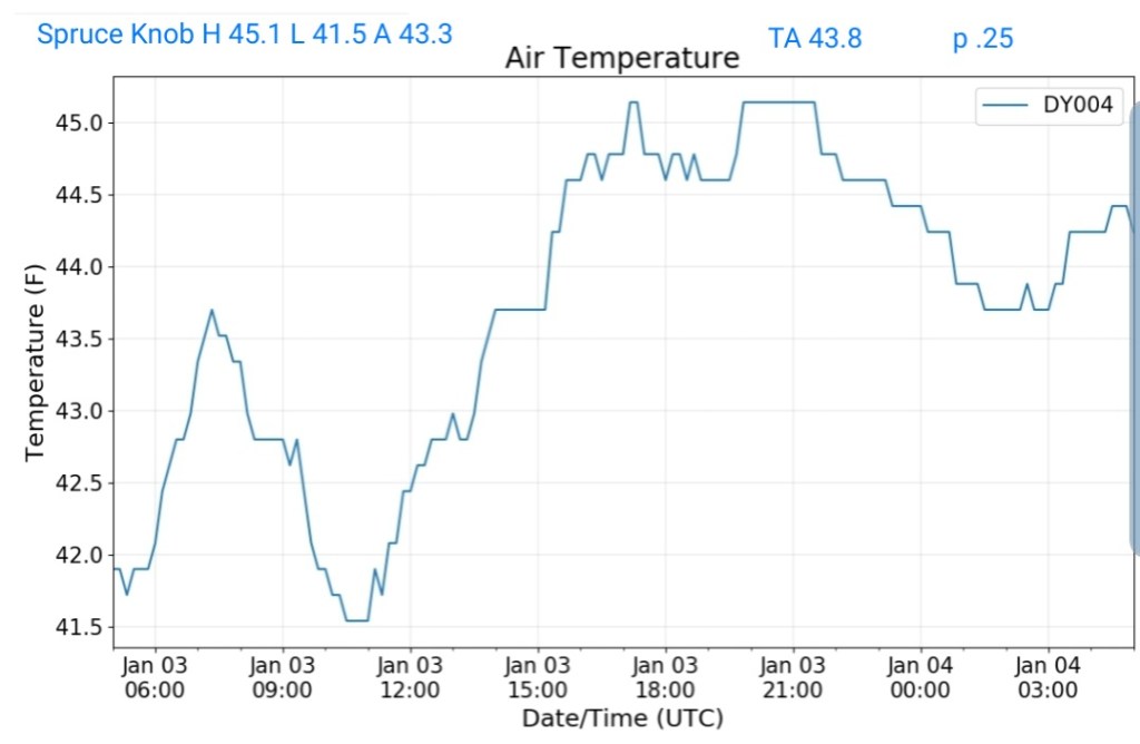
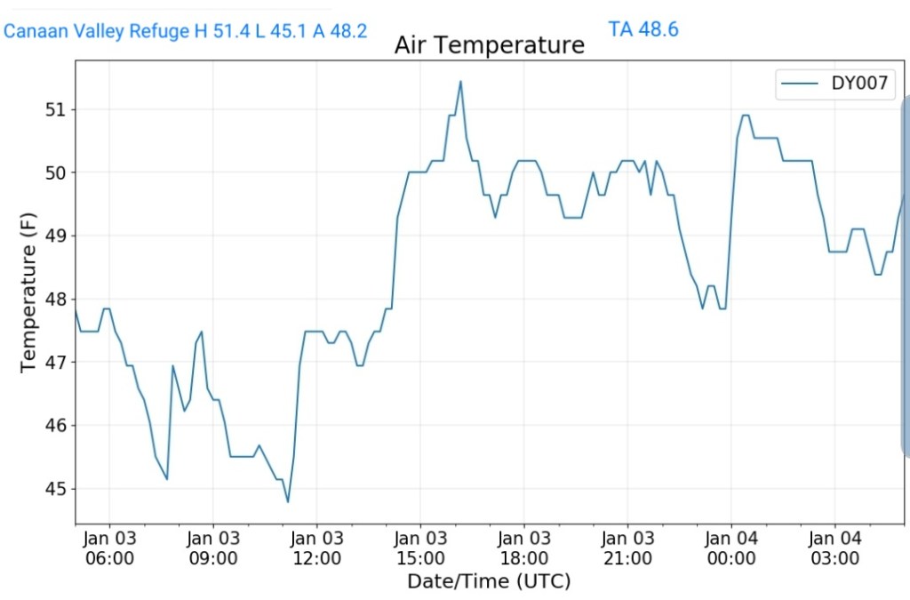
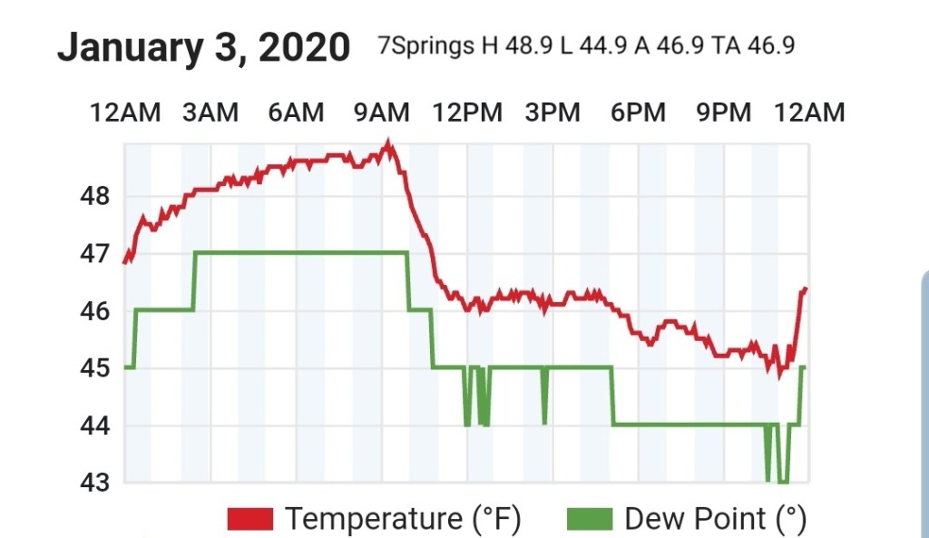
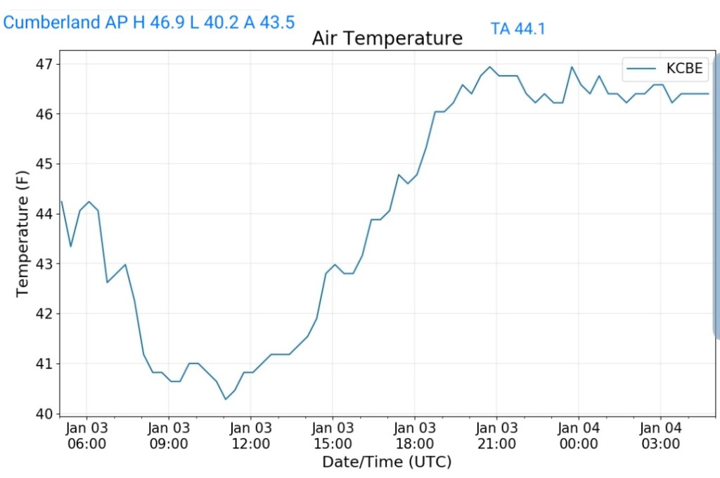
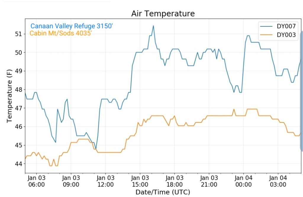
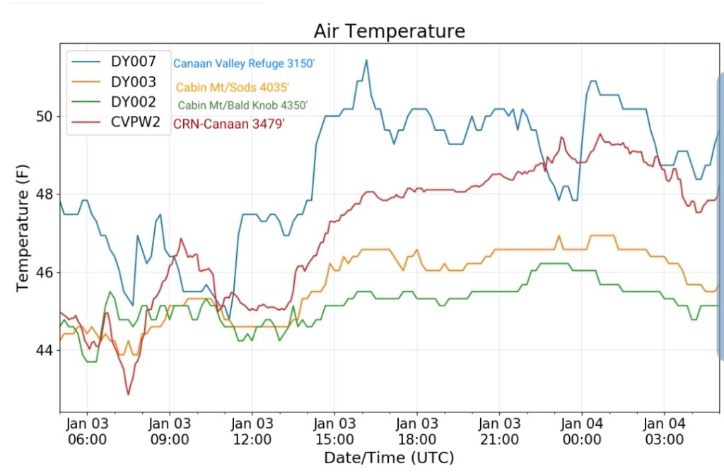
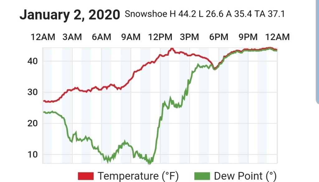
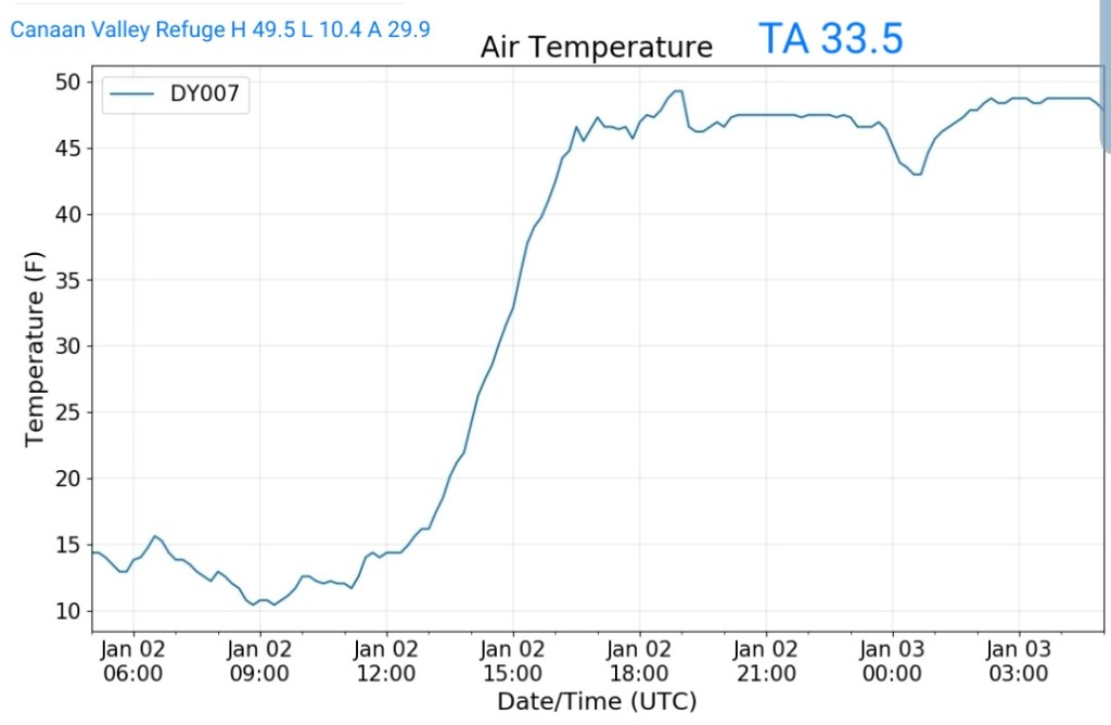
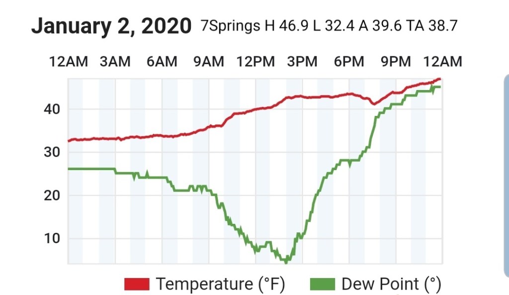
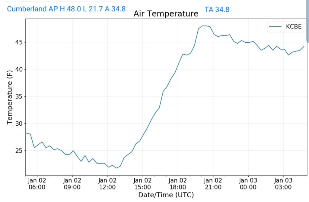
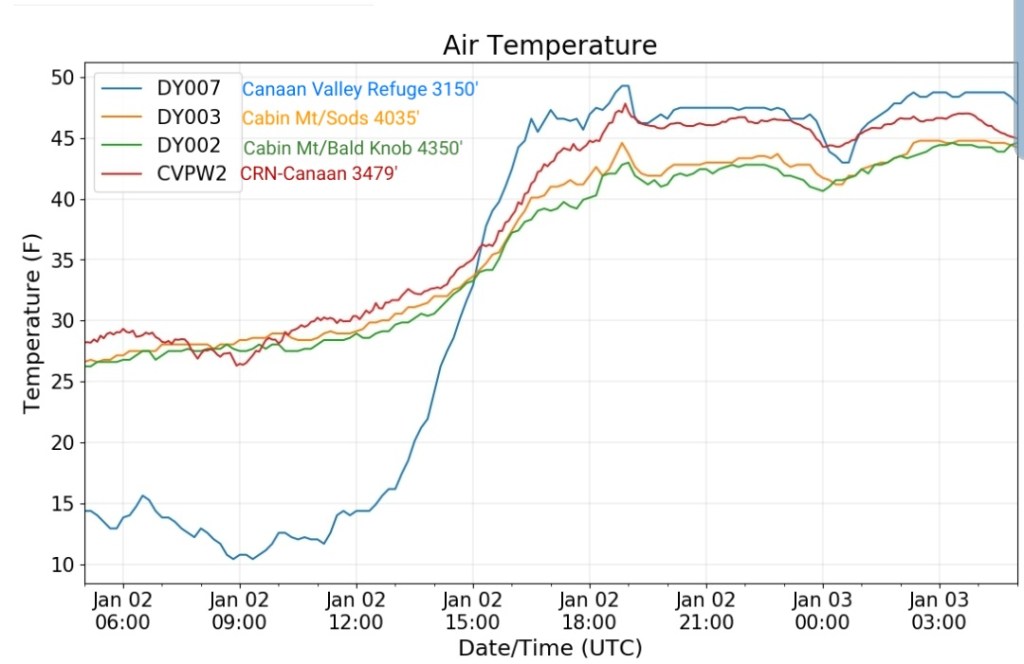
Milder air mass pushing across the area. Some holdouts in the deeper valleys from Savage River, Lonacoaning, Lavale , Cumberland clinging to slightly chillier air from the departing air mass. A few scattered showers in the area this afternoon, mainly western areas.
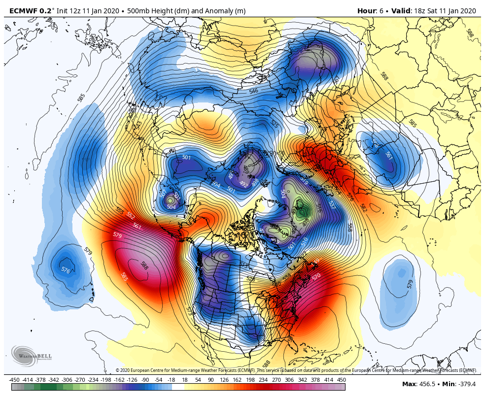
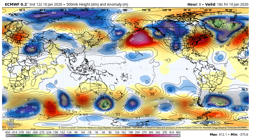
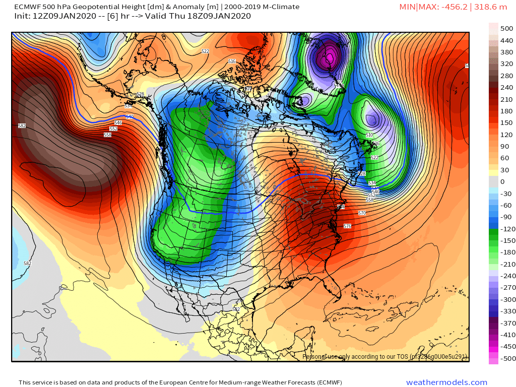
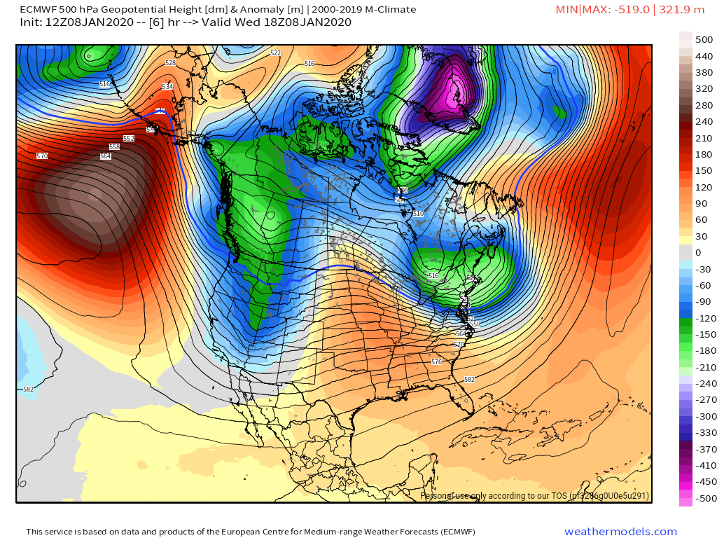
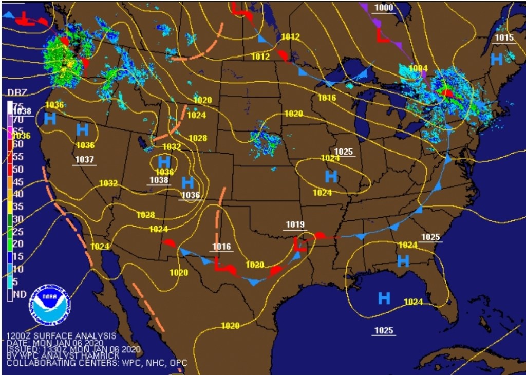
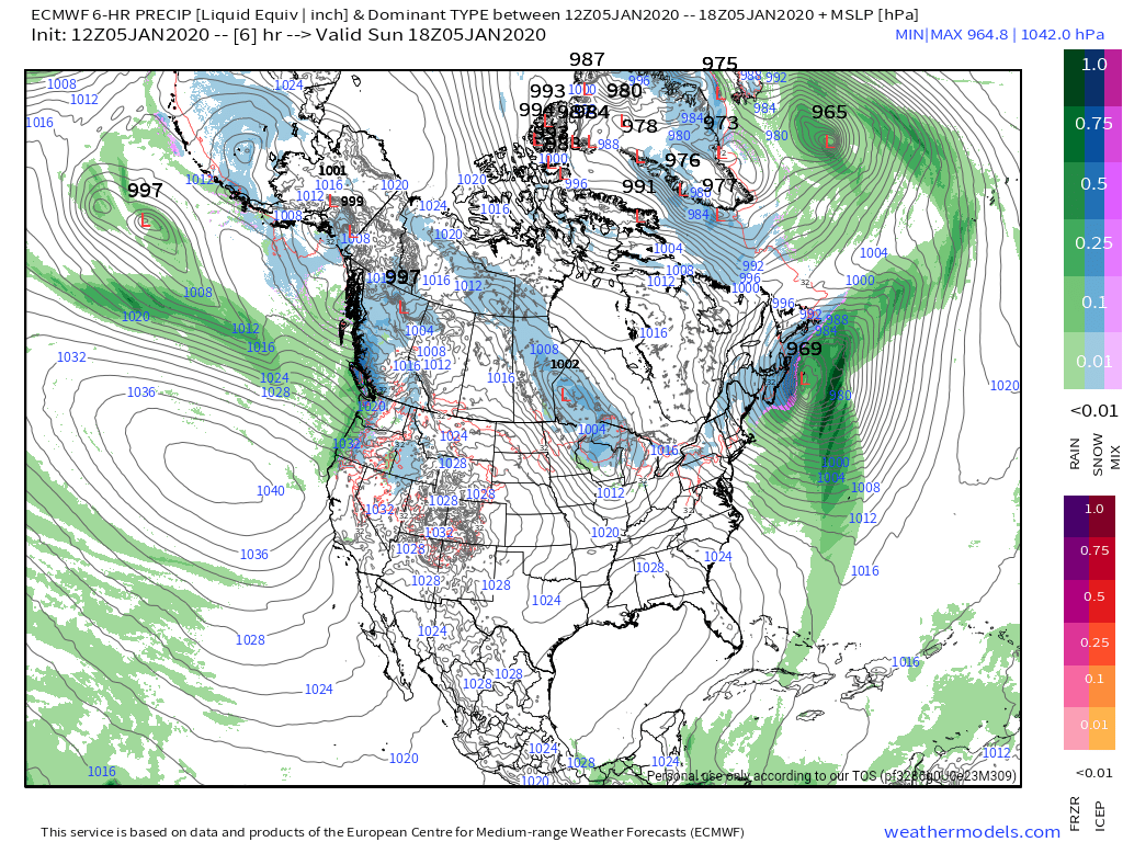
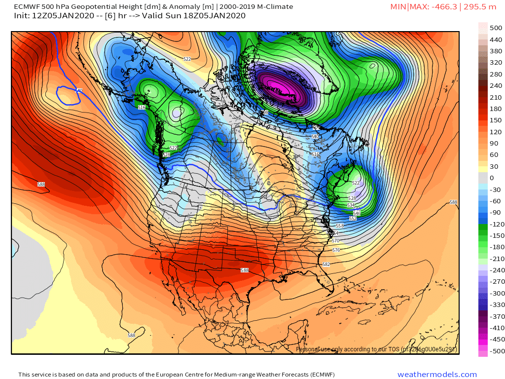
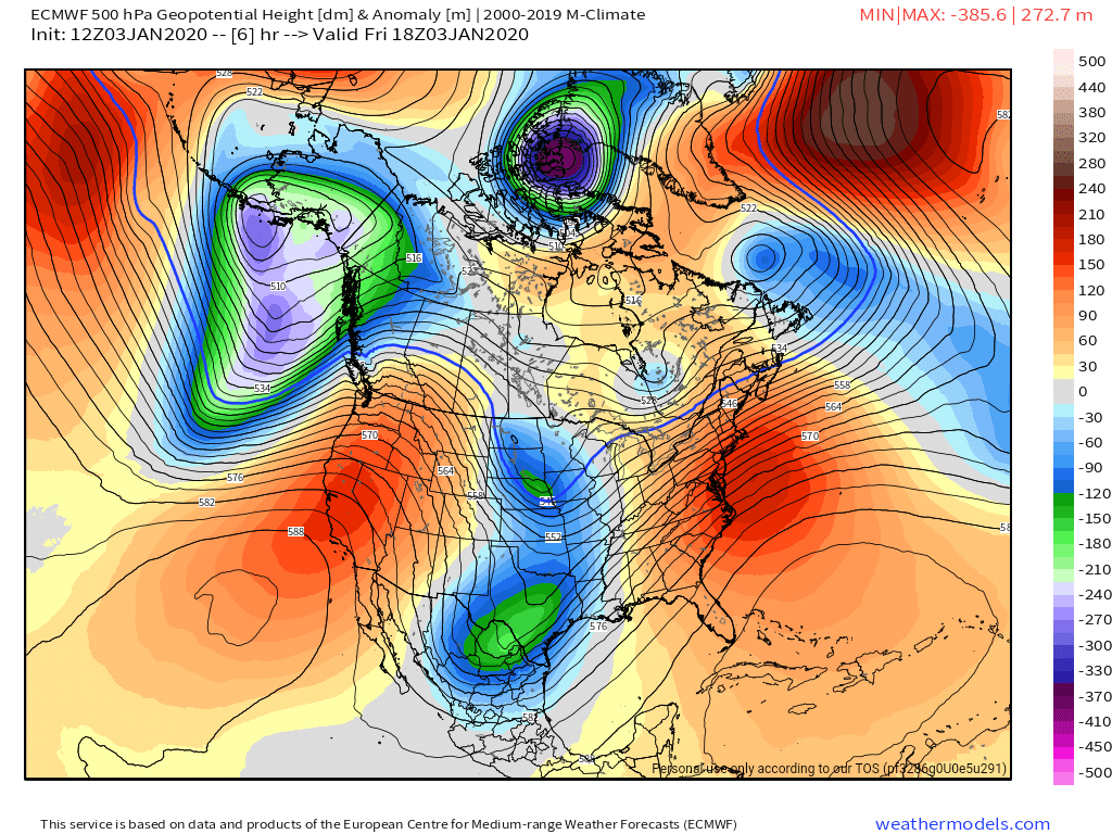
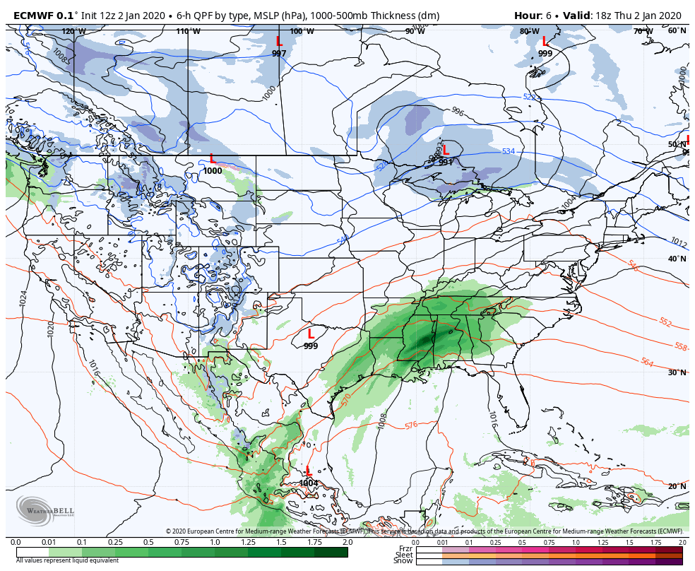
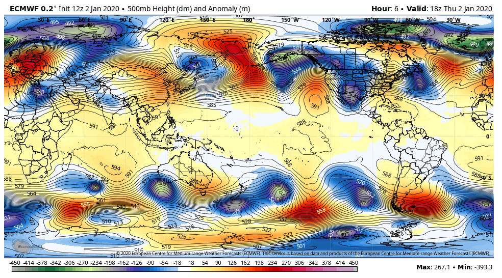
Surface features and 500mb height anomalies and flow
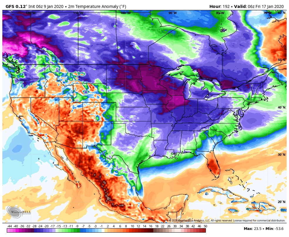
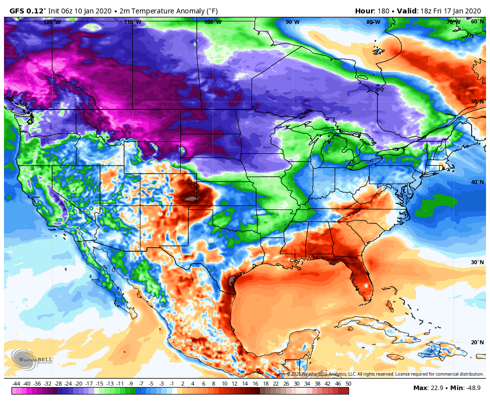
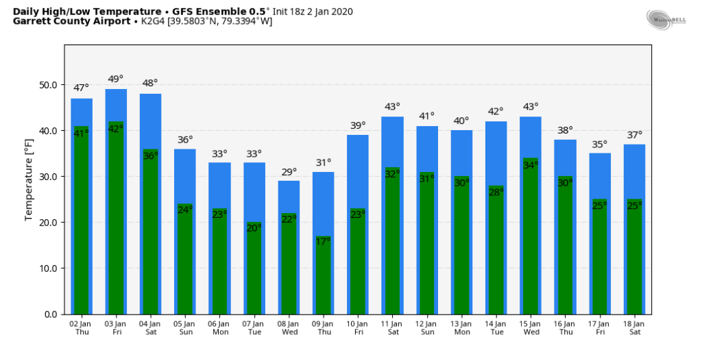
With the 5th through 9th winter window in the books that produced 2 of the better snowfalls on the season in parts of the area, now we go into a lengthy stretch of much above normal temperatures. This looks to run for the next week. Modeling hints at a return to cold weather late next week. To what extent, remains unknown. Initial shot looks brief, and weaker vs what it did appear like on the GFS. The GFS was going crazy with the cold on yesterdays runs and lots of sites were screaming wait until late week, bitter cold! For good reason by going off the one model. This was the GFS yesterday mornings run showing for next Friday morning temp anomalies
This morning for next Friday morning , backing off some…
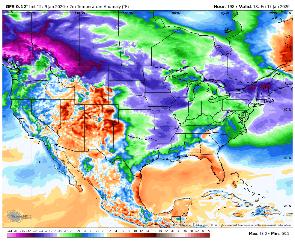
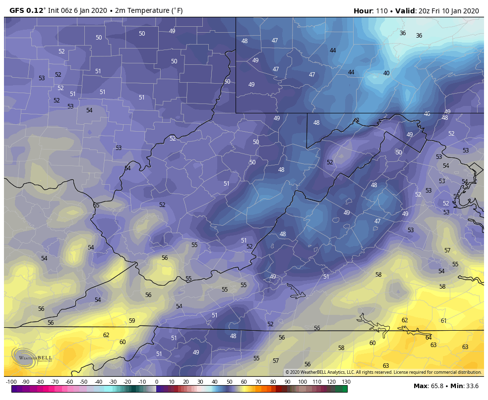
Yesterdays 12z continued the cold look. Here was yesterdays 12z run for next Friday afternoon
here is this mornings 6z run for the exact same time period 1pm next Friday. Its progressively less cold for late week. Still cold, and much much colder than the next few days, and more in line with seasonal weather, but not what it was shown yesterday.
There is still plenty cold on the playing field, but backing off from the extreme, “for now”. This model has a cold bias and a speed bias that shouldn’t be ignored, but often is ignored when its click bait or what one hope’s for. Its been seen all winter. That’s not to say the extreme doesn’t attempt a push at that time and models revert back to it. I’m just saying its backing away and use caution with it.. “More than likely” its a little beyond this period.
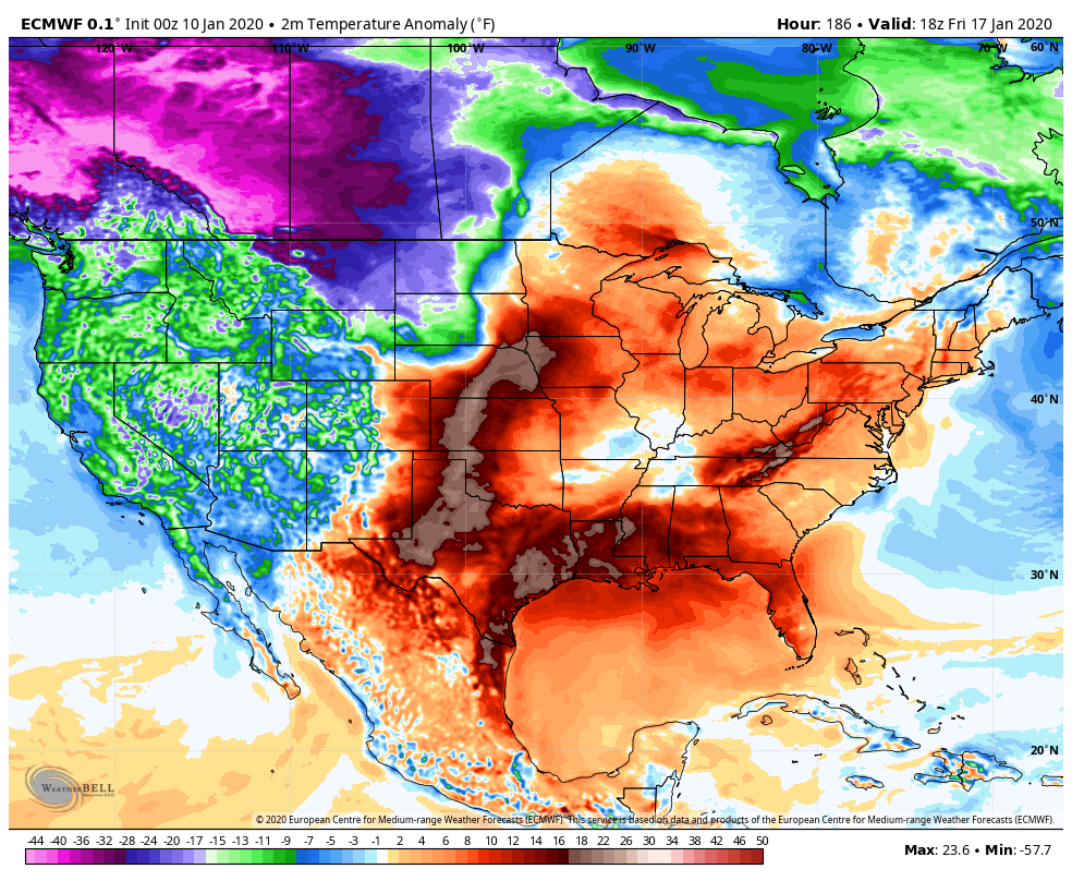
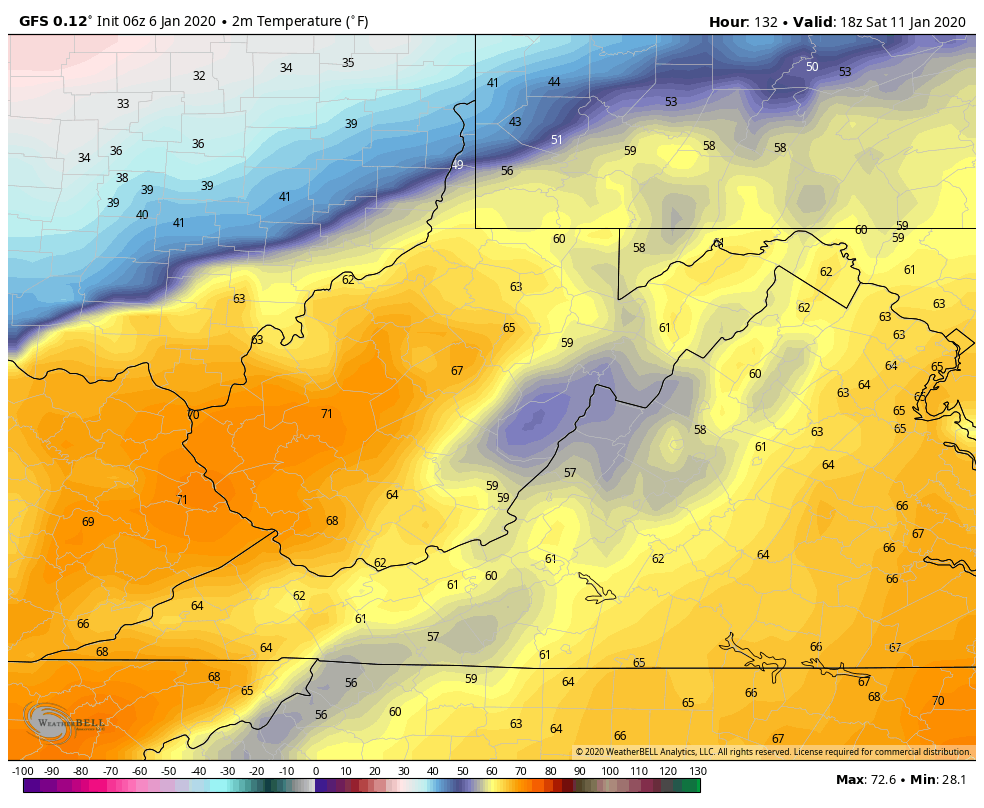
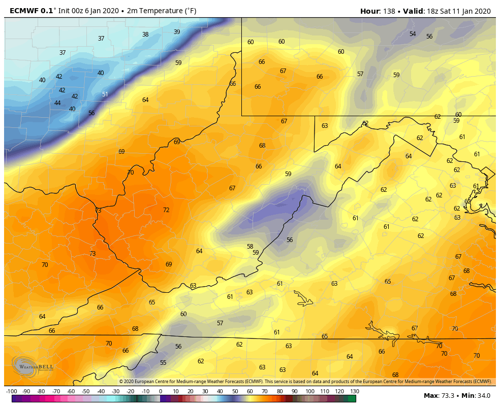
The ECMWF currently looks like this for next Friday afternoon
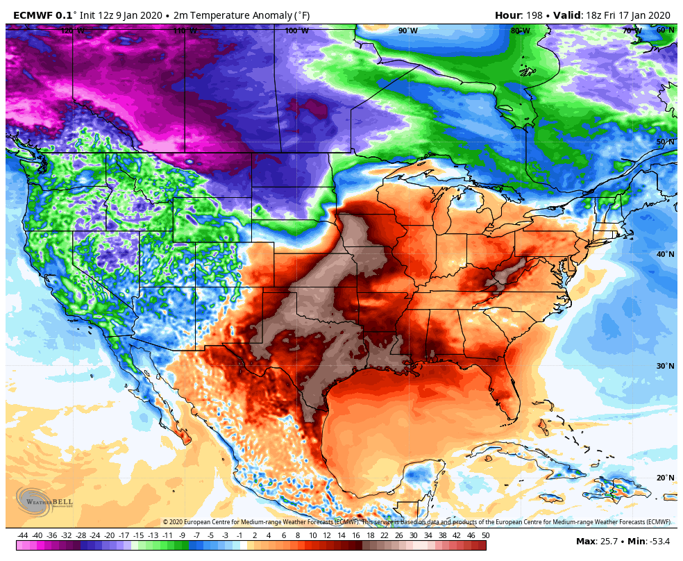
on yesterdays 12z run looked like
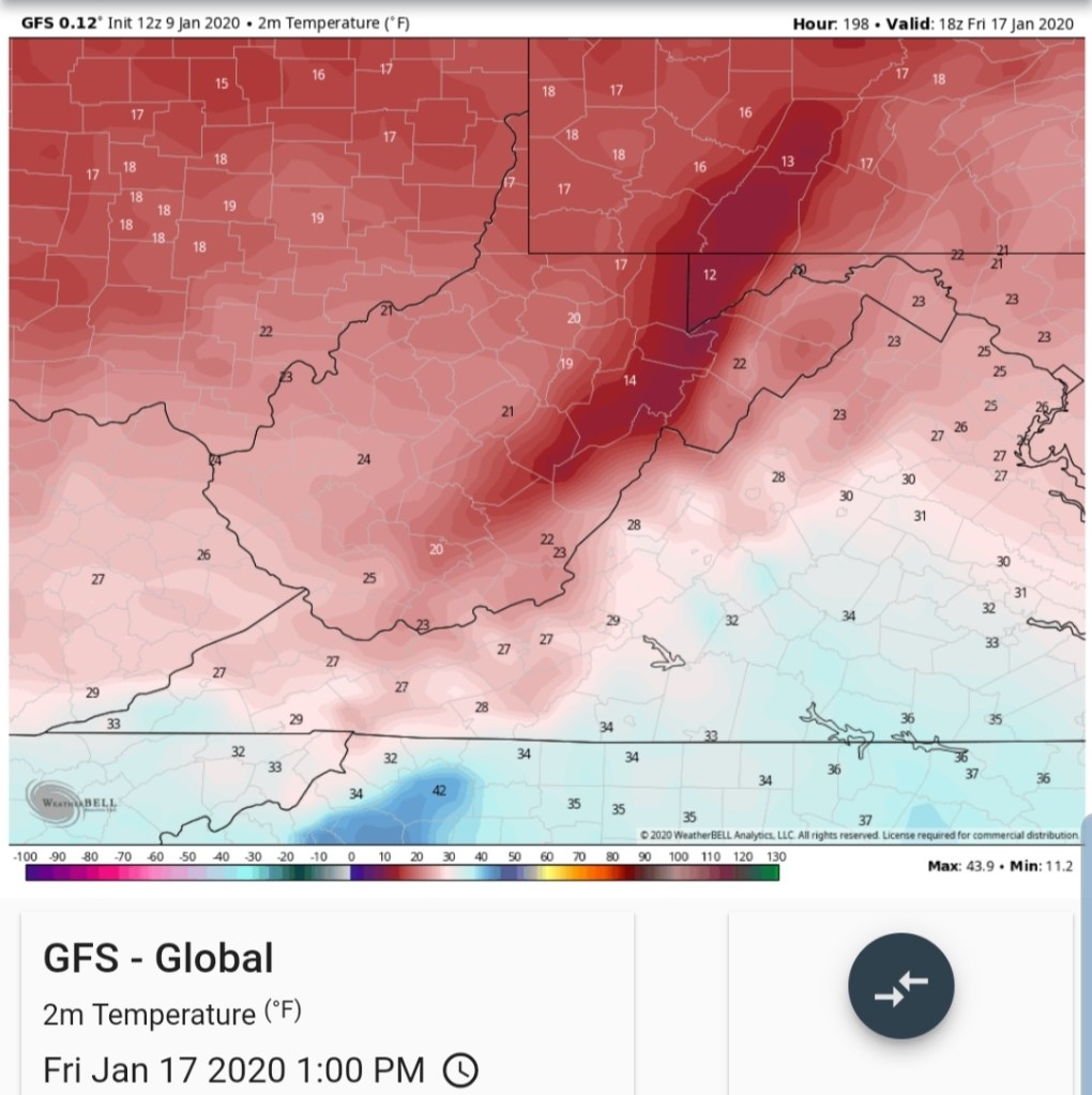
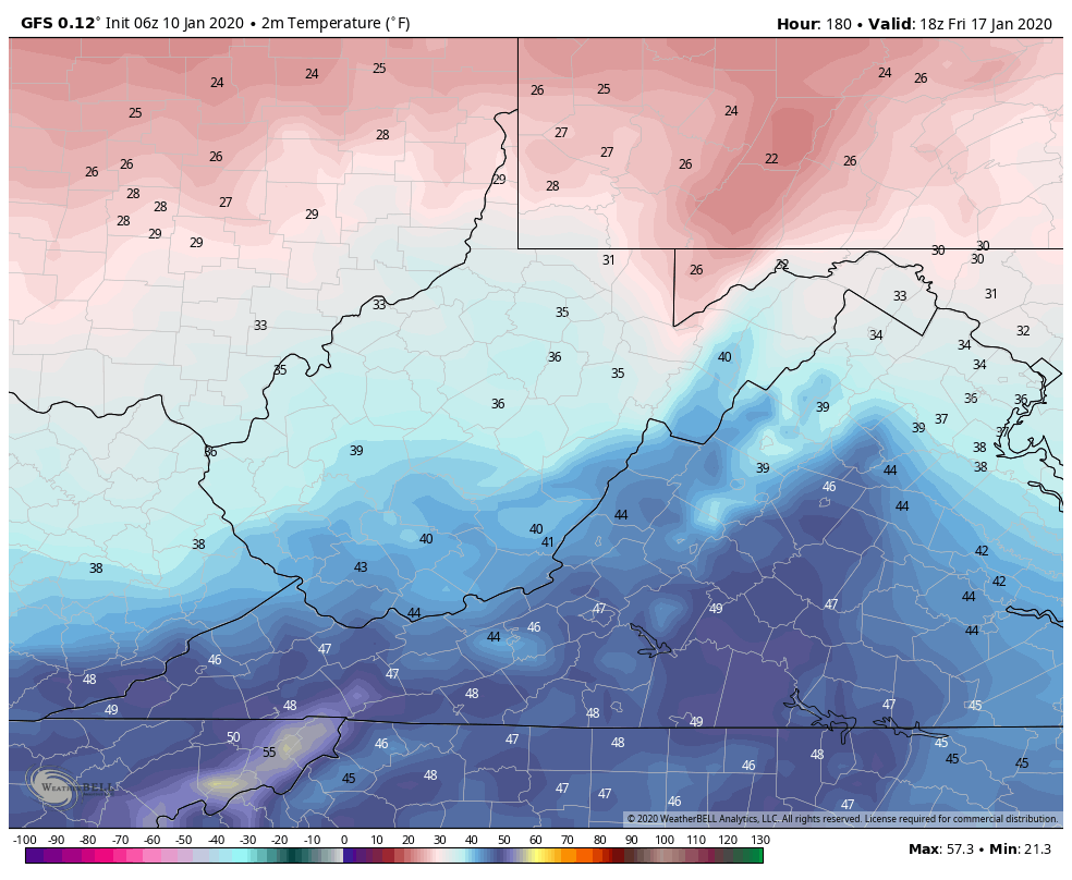
The difference- some areas the GFS was showing teens yesterday and 20s west side of the mts, now 20s, 30s, while the ECMWF was and is 40s, even 50s yet on the west side of the Mts.
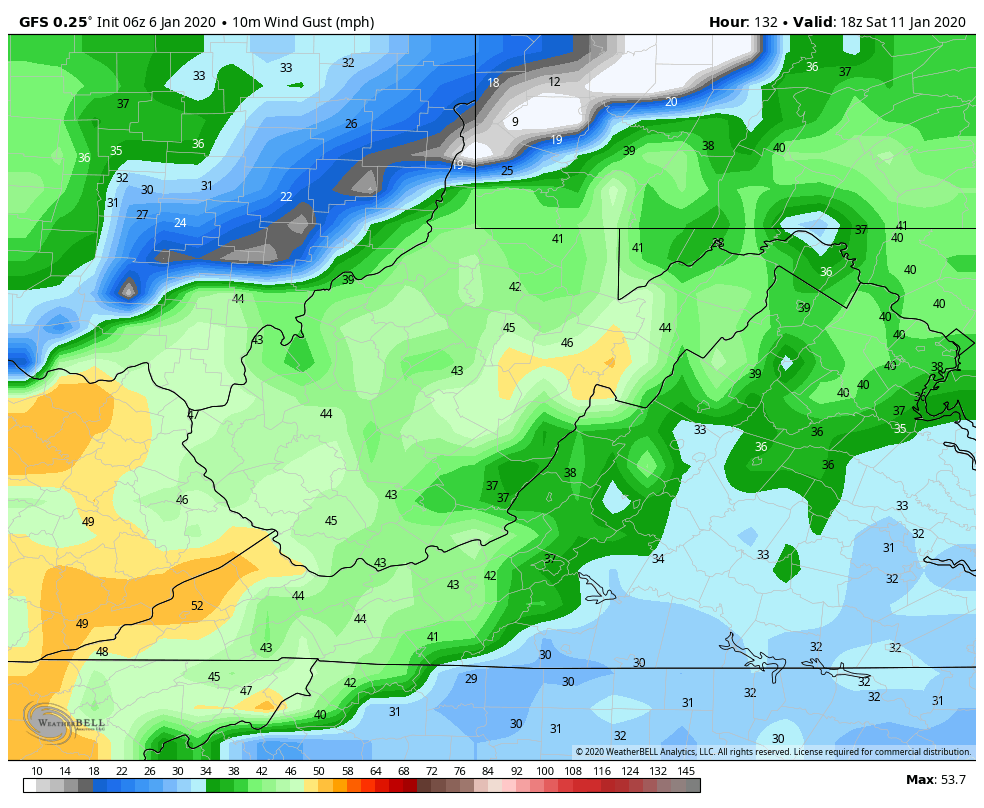
What may occur. Late week chills into the 30s on Thursday, with steady to falling temps through the day and rebounds 30s, low 40s into Friday, no temp fall Friday night with a southerly flow, then the weekend sees a temperature rebound of 40s to 50 with the front side of the next system. With the typical cold zones possibly holding cold for onset ice?…Immediately behind that system as it passes, is probably when the cold air really pushes the following week. Only speculation based off the modeling biases and anything in detail beyond 5- 7 days in this pattern is always just speculation. I just don’t like ignoring a milder model that’s performed better(“better” used very loosely) for a colder model just because I want it to get cold. We still live in reality.
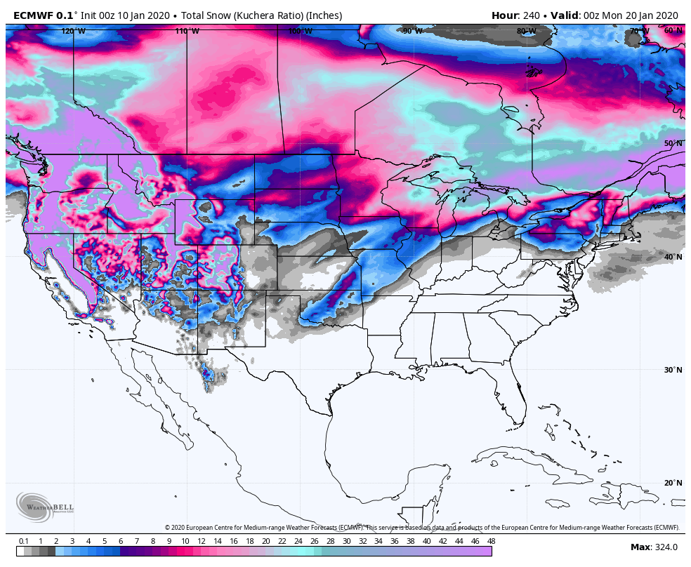
Snowfall off the ECMWF next 10 days
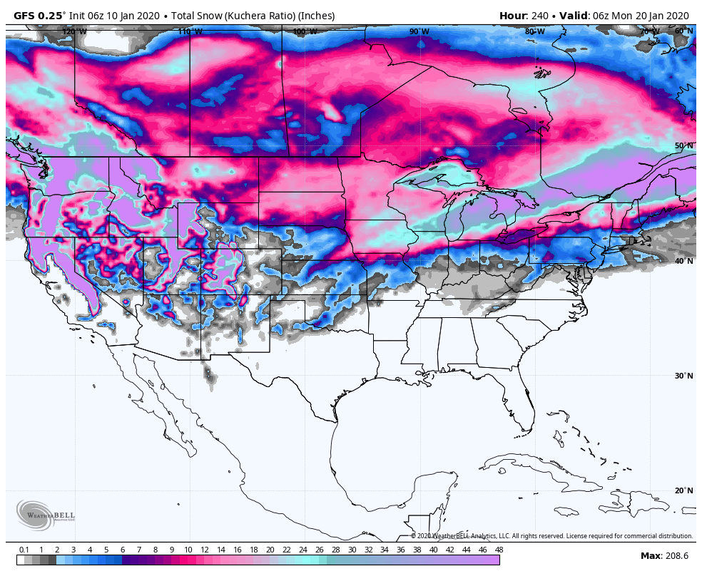
GFS next 10 days
Obviously any threat of snow is occurring towards the end of the 10 day. So expect changes.
Finally though, some positive signs off the models for a colder later January trend.. Snow lovers have some suffering to go through now for at least the next 7-10 days in the heart of January. That sucks.
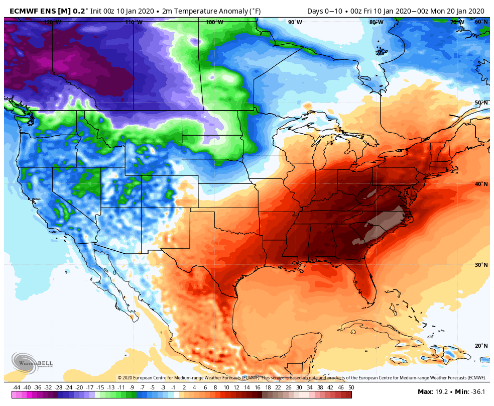
Totality of the next 10 days in the means
ECMWF
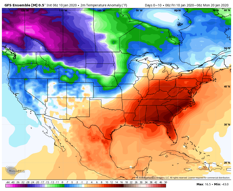
GEFS(which has not been upgraded as the GFS operational has been)
Winter is not dead though and January is not dead and the 37 January look gets attacked by the cold push and the snow miser looks to get his grip later January after the heat miser has his way the next week
Even the ECMWF seeing it later January
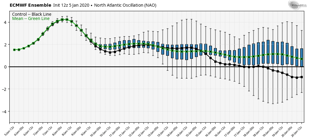
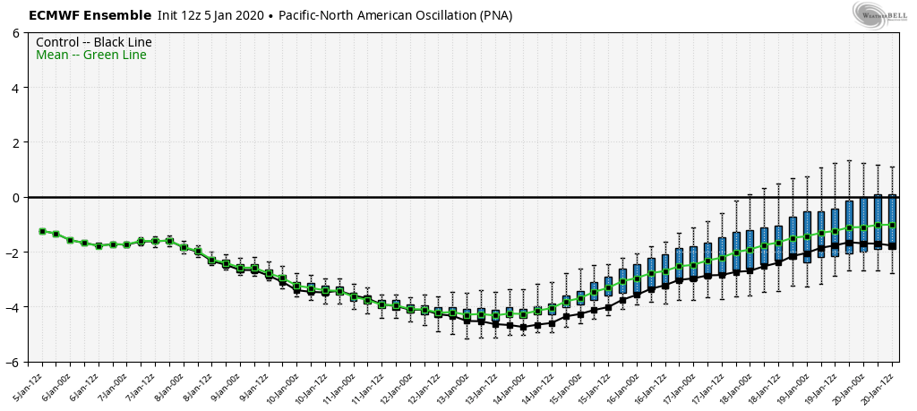
Ensembles(Ensembles will not show an extreme 10 days out, especially in a pattern with so much warmth vs cold on the table. 51 members averaging themselves out. It can show a trend though)
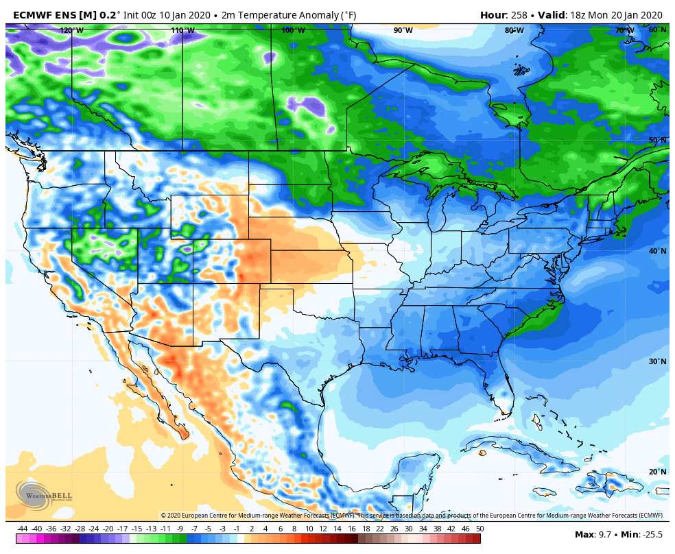
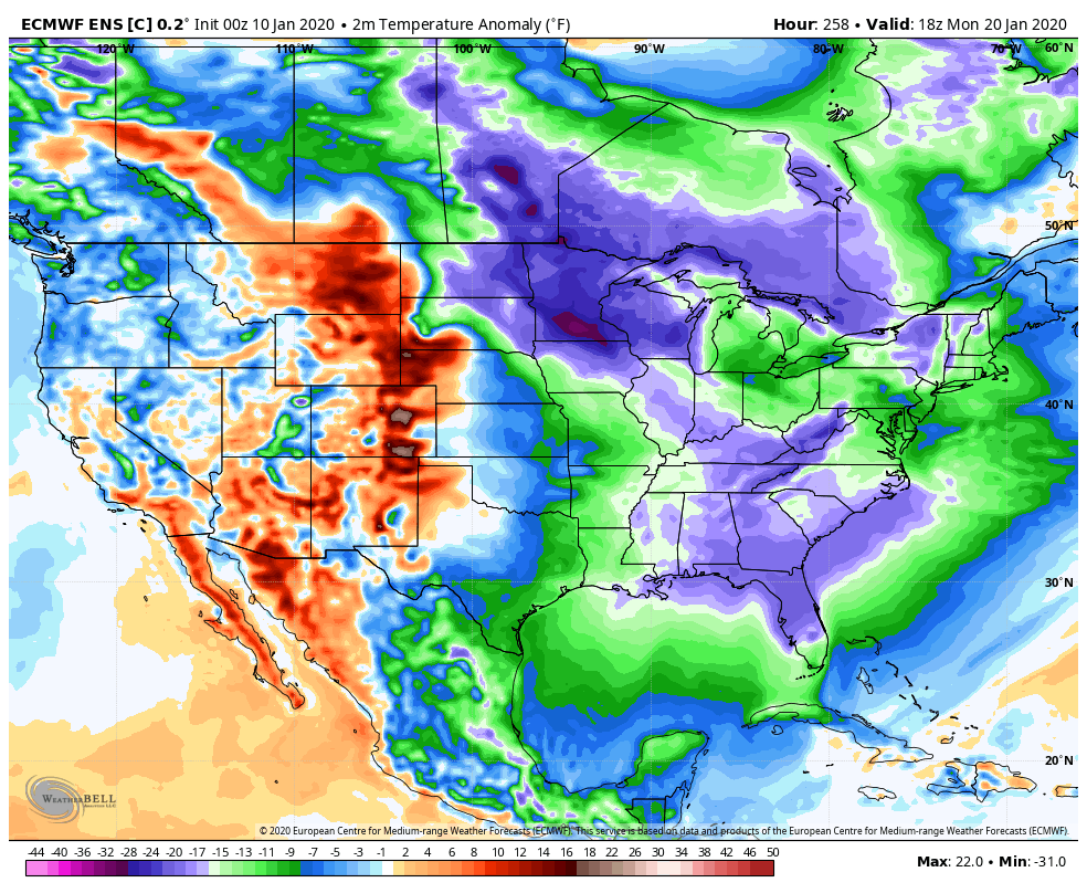
ECMWF control by Jan 20
Bring on the Snow miser after the Heat miser has his fun…
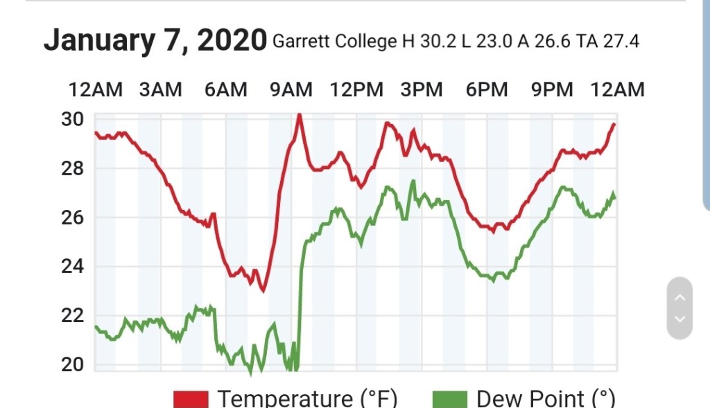
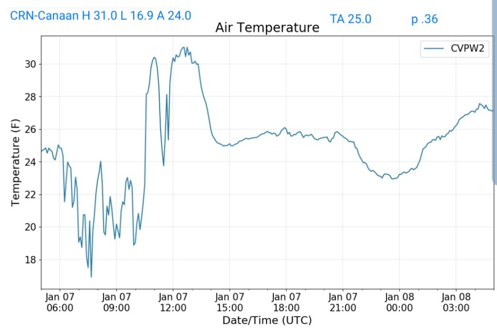
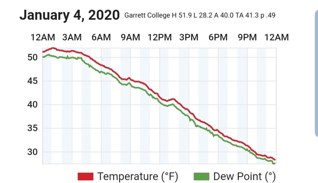
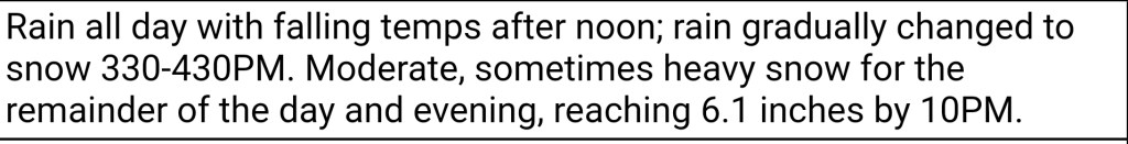
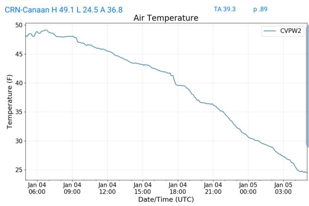
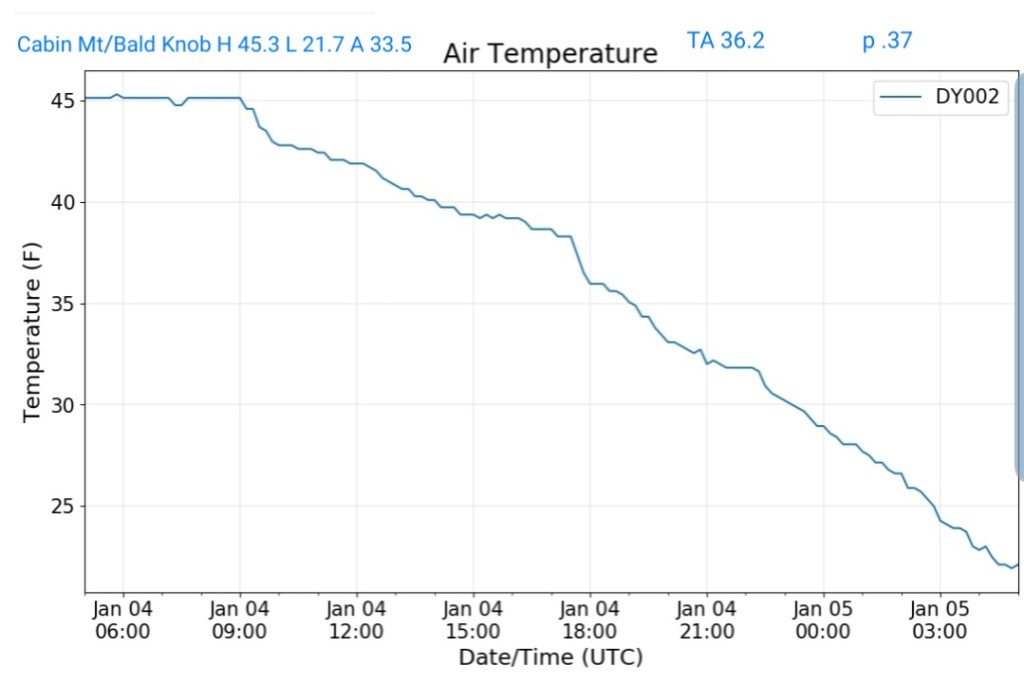
Cloudy start with snow rolling in around 9am rapidly covering things. The main accumulation occured from 9am to 1pm, with some additional through 4pm. Calm during the snow, winds increasing after nightfall.
Surface features and 500mb height anomalies and flow
Making the most of the brief opportunity….
The 4-5 Day winter window
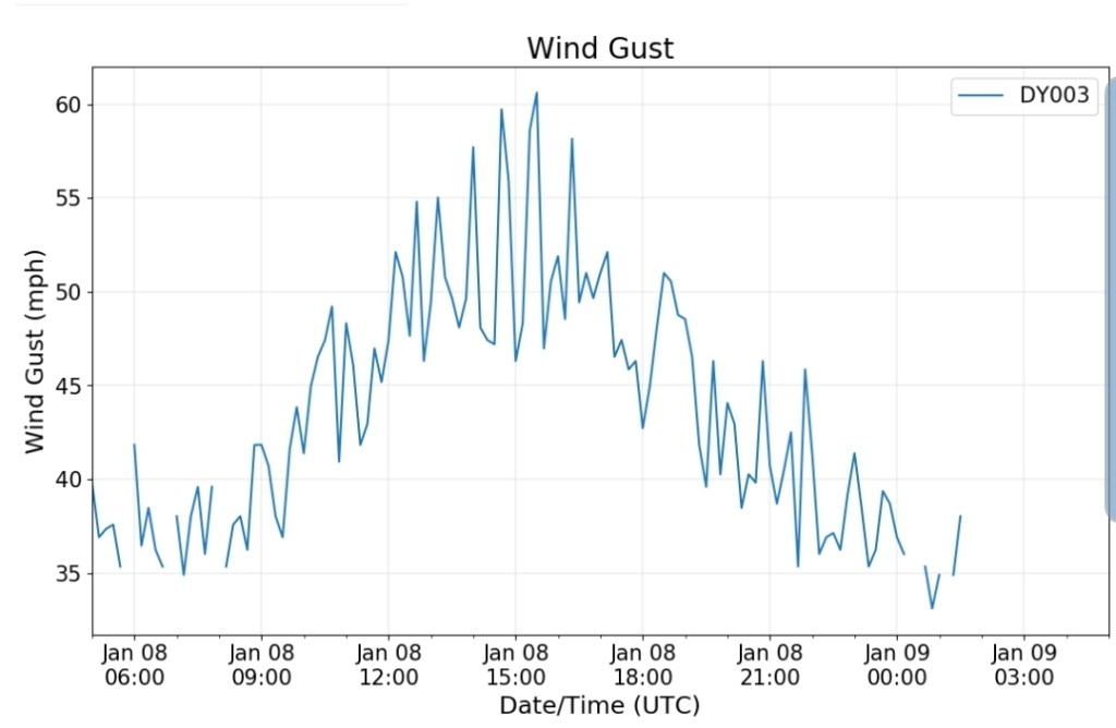
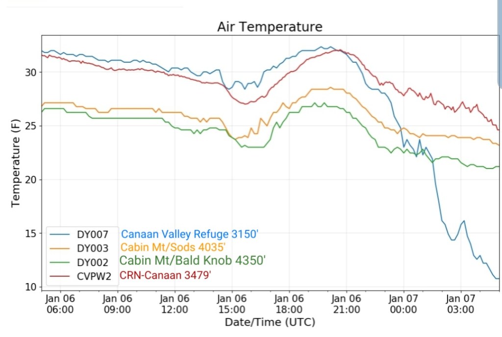
The overnight front last night came through mainly dry, with the exception of the northern Alleghenies seeing the best coverage of some light snow shower activity. Temps also rose some overnight ahead of the front, then leveled off as it passed, and now steady to slowly dropping a few degrees through the day with some gusty winds .
The front that crossed early this morning…with limited moisture.
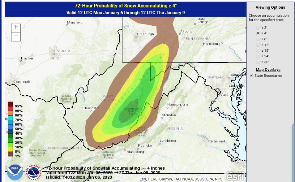
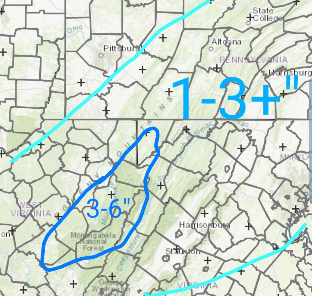
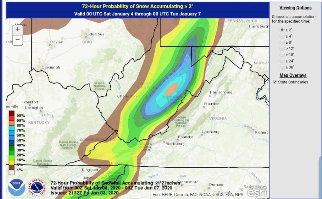
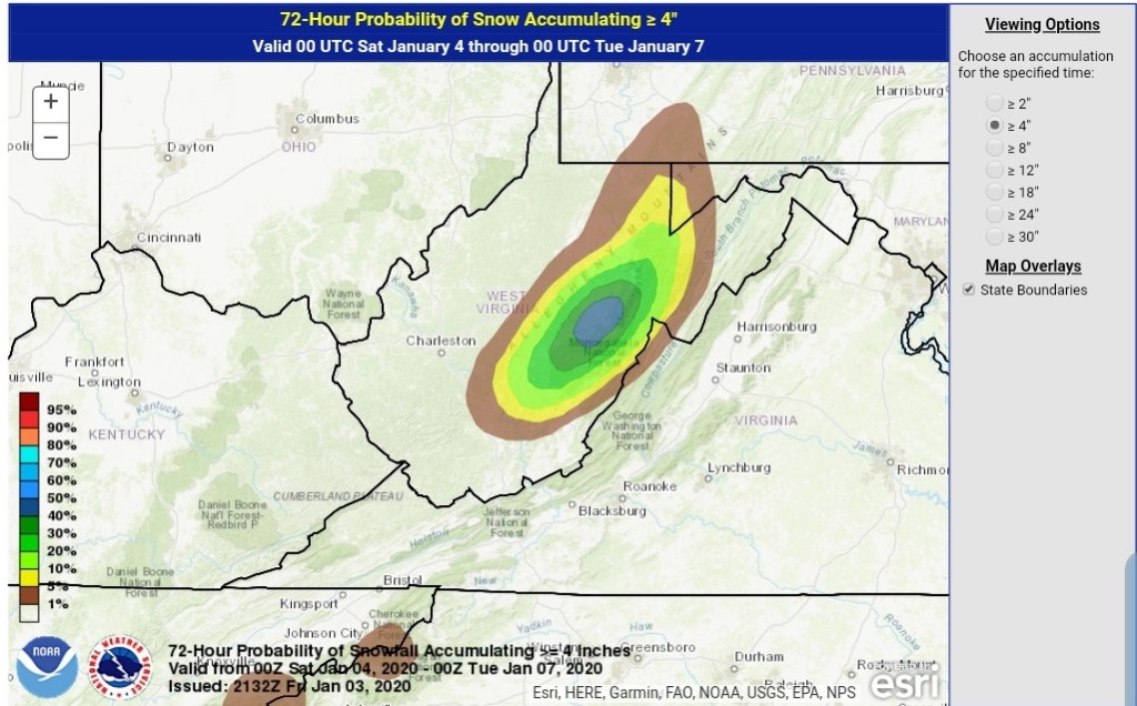
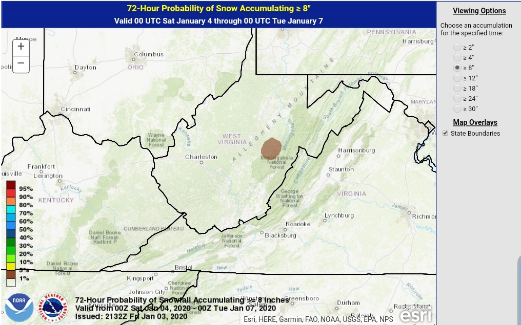
After a lull today, tonight, snow returns to the area tomorrow with a system from the SW, pressing through with a bullseye 3-6″ zone. (As always lean low to mid range, a good performance gives the top range) across the Wv mts, with 1-3″ outside that bullseye zone. There is some variance on the northern edge of the system.
Model output, not a forecast. Only a tool.
Timing kicks this off during the morning hours tomorrow going into the evening.. A relatively fast mover, but likely will cause travel issues during the day tomorrow.
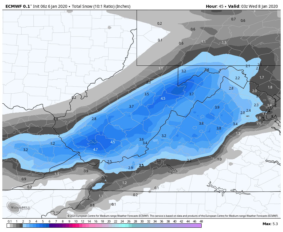
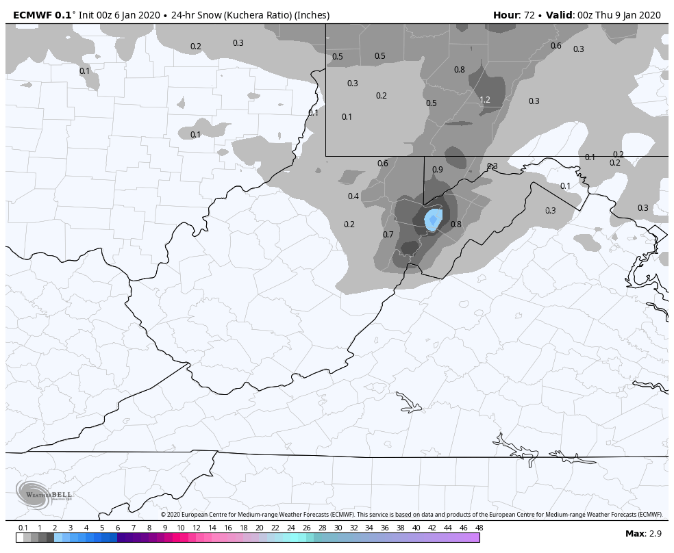
6z ECMWF 10 to 1, through 10pm Tuesday. This is likely a little over 10 to 1 across the high ground. I elected not to use Kuchera parameter as I believe Weatherbell needs to make another adjustment to that parameter.
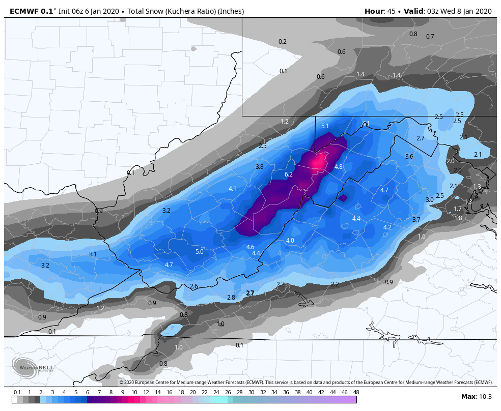
Kuchera ratio off the 6z ECMWF. Again likely overdone as it has been.
6Z GFS Kuchera Ratio off weather.us.
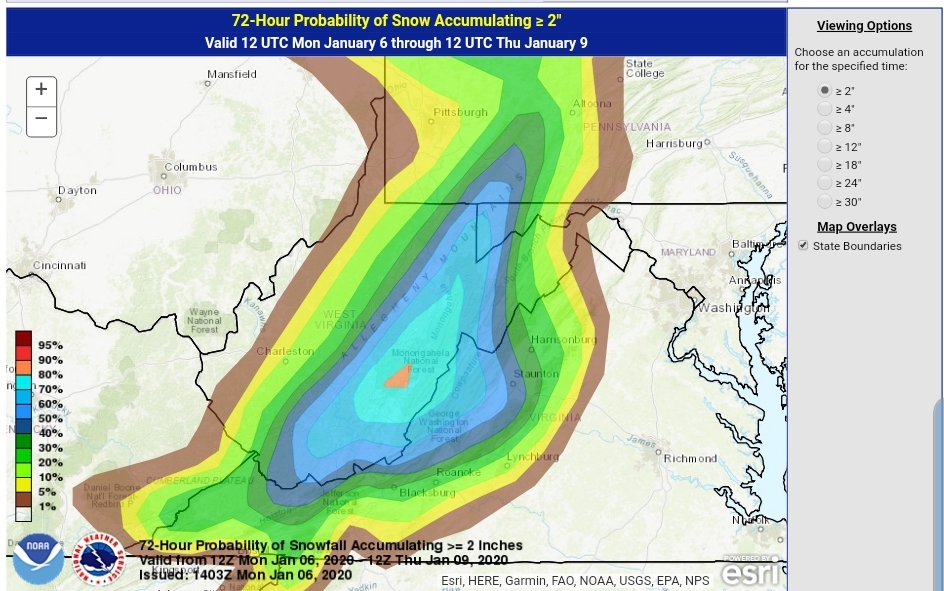
WPC OUTLOOK..this is a product of the WPC, I’ve seen some news outlets slap their own label on it.
Probability of 2″ and 4″
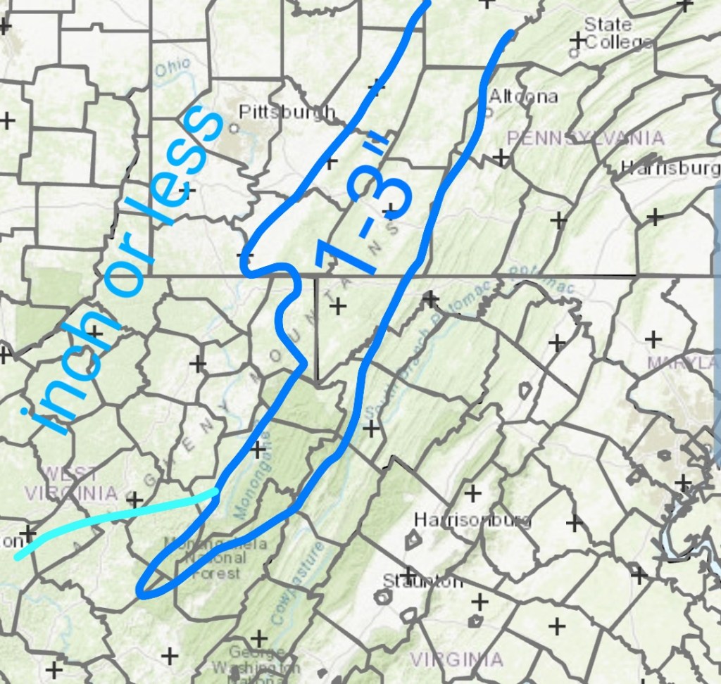
one area of weakness of the WPC, is the backside upslope that comes in Wednesday a.m into the day Wednesday. This is accompanied by very cold air and has 1-3″ of fluff potential. (mainly northern half of the Alleghenies with that backside upslope it appears) out of very limited moisture. High ratio fluff
6z ECMWF on the backside upslope
My thoughts(this is a freehand drawn outline, exact boundaries will vary) again lean low to mid range, good performance gets top end of target zone. East of the Mts tomorrow, spots of 3″ plus possible.
Part 1 ………………………….. Part 2 upslope
That sets up Wednesday night….
Clearing skies
Light to calm winds
Low dew points
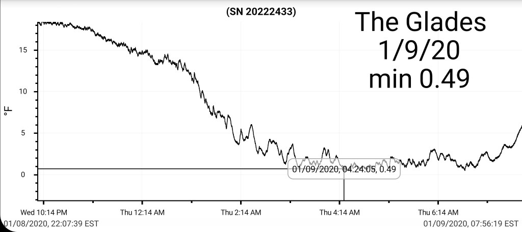
That combo shouts that some of the coldest valleys drop below 0 briefly. High ground may hold teens to around 20.
Then………..
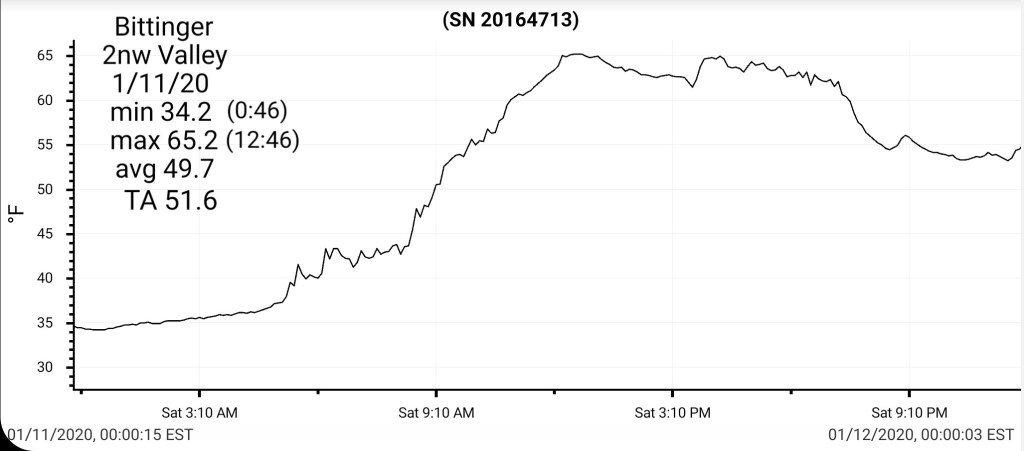
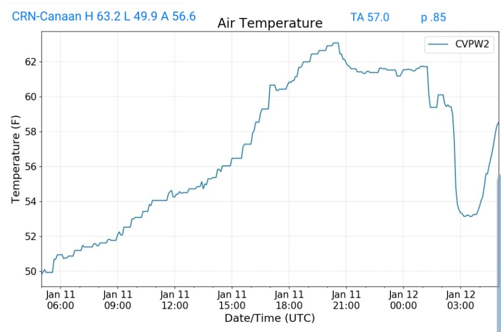
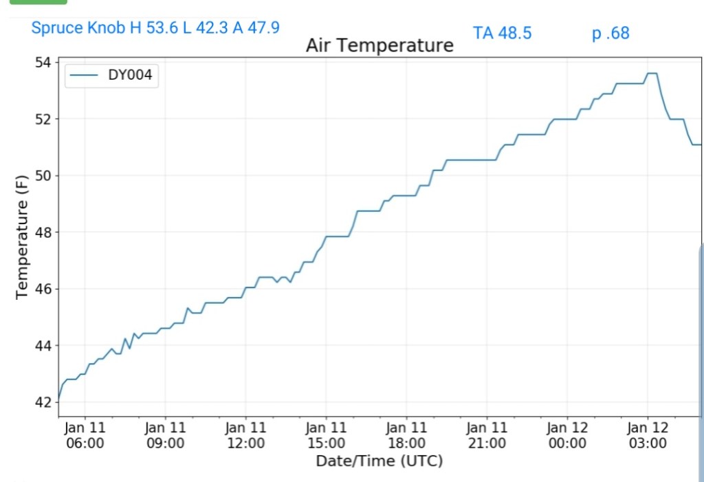
0°-60° in 2.2 days…..maybe
The return flow warmth
Thursday the chill begins to modify, overall its still cold.
Friday the climb is greater
Saturday even greater and I believe this will be underdone
Last nights ECMWF for Saturday
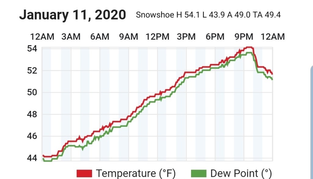
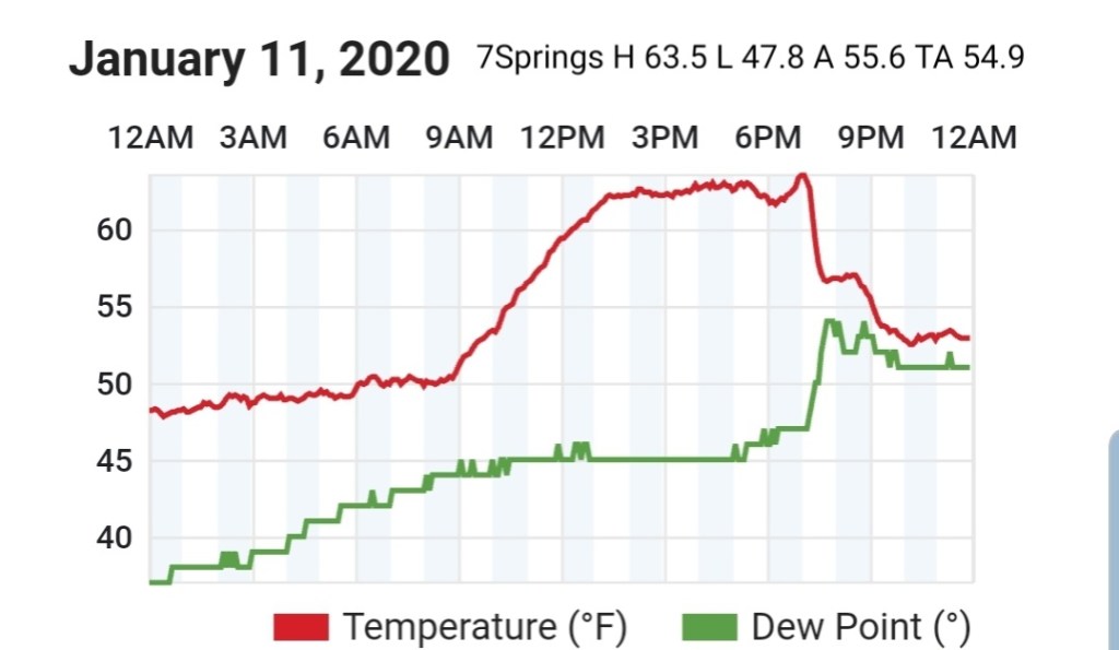
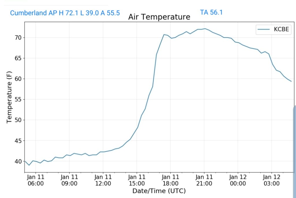
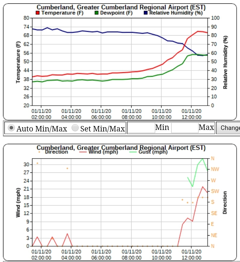
Typically with a southerly surge and if precip holds off, the high end is often met or exceeded 56-65 on Saturday looks like a reality. Outdoor BBQ if the rain holds off??
This is accompanied by
Southerly winds gusting
And high dew points
That combo is a rapid snow eater. …ugh
A sharp cutoff from warm to colder exist Saturday, just to our NW, some wintry precip exist up there….But we are on the wrong side of that boundary…
Below the 6z GFS on Saturday. That high north is too slow to get in front and feed any cold air into some of the typical ice zones. Allowing the warm air to over spread the entire area.
that chillier air briefly pushes in on Sunday, after most of the moisture is gone.
Beyond that, the dominance looks to be ridge east, trough west. Maybe some system cuts through with some wintry weather in the heart of the overall mild pattern… that is possible, but sustained winter is not upon us.
Off the 6z GFS and a larger uncertainty in the long range vs near term obviously… that Sunday max would be falling through the day …
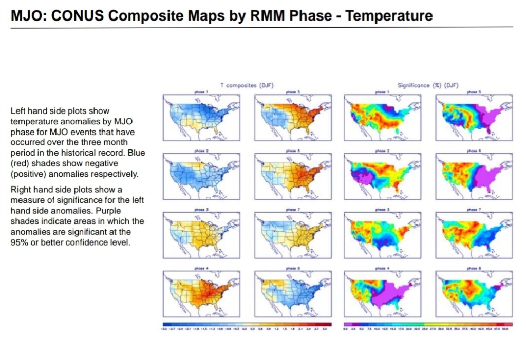
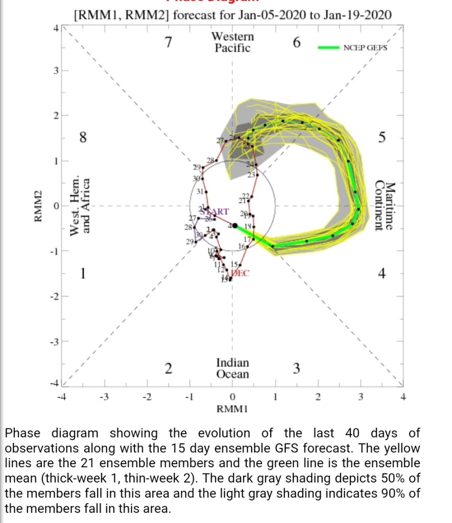
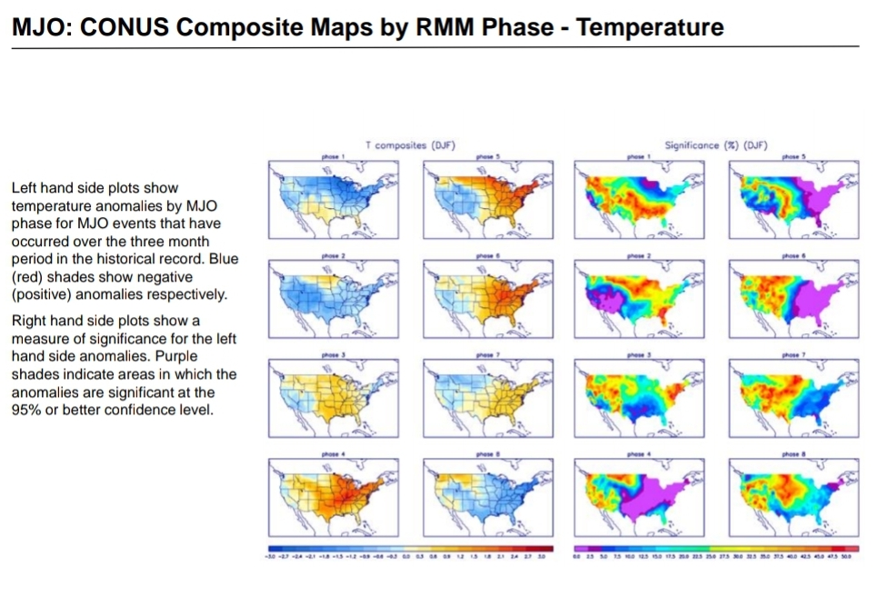
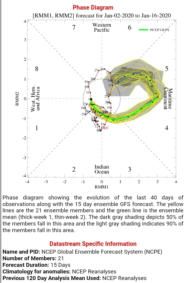
MJO , still ugly ..into 4,5,6
Phase correlation to temps
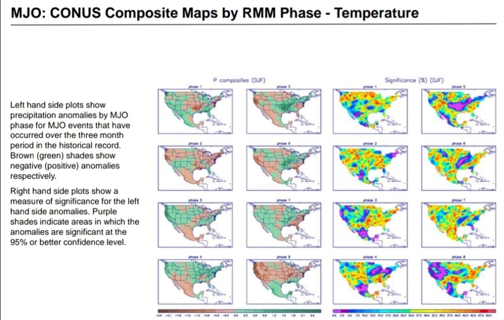
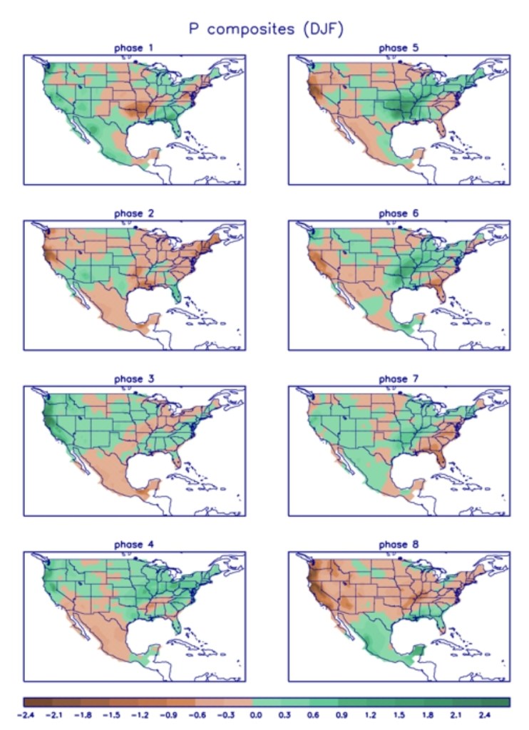
And correlation to precip
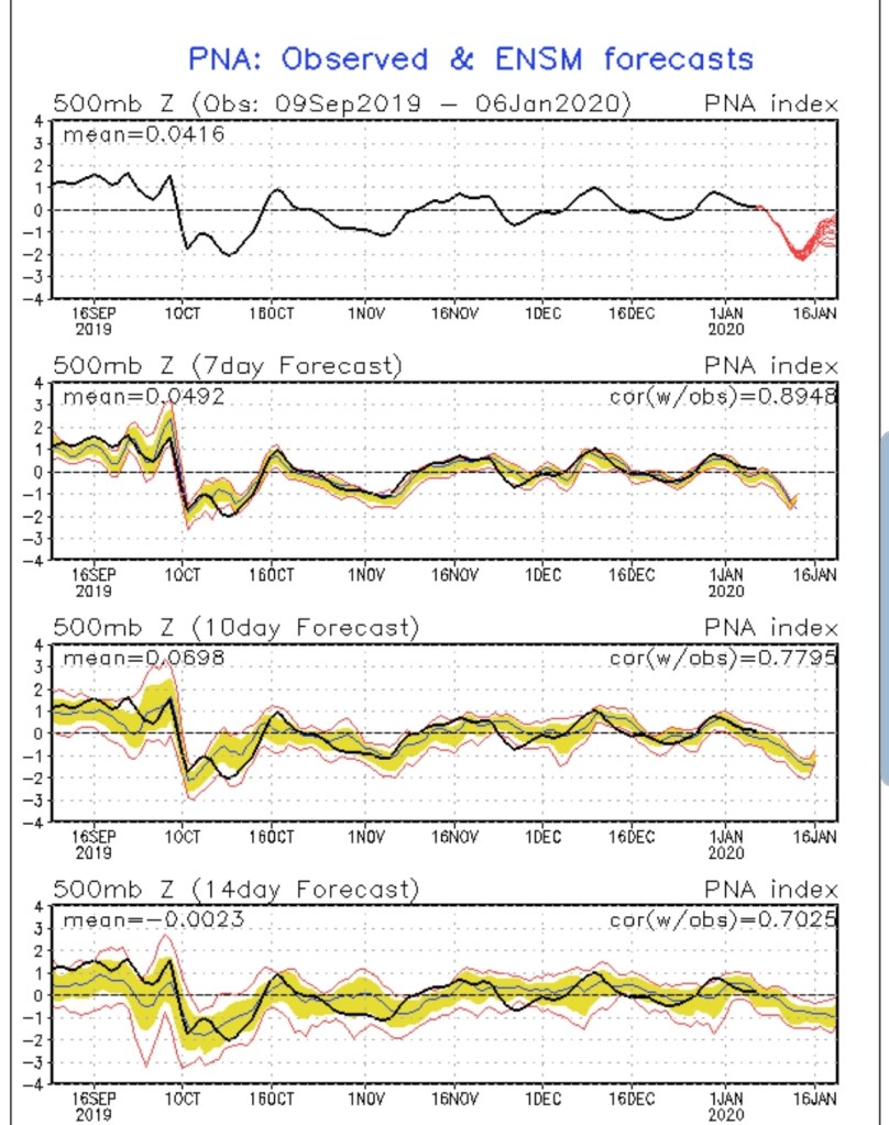
the Teconnections still look poor…All the opposite of a cold eastern U.S
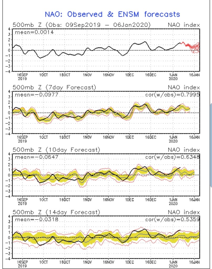
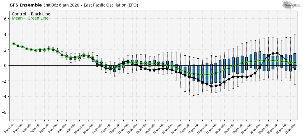
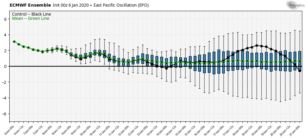
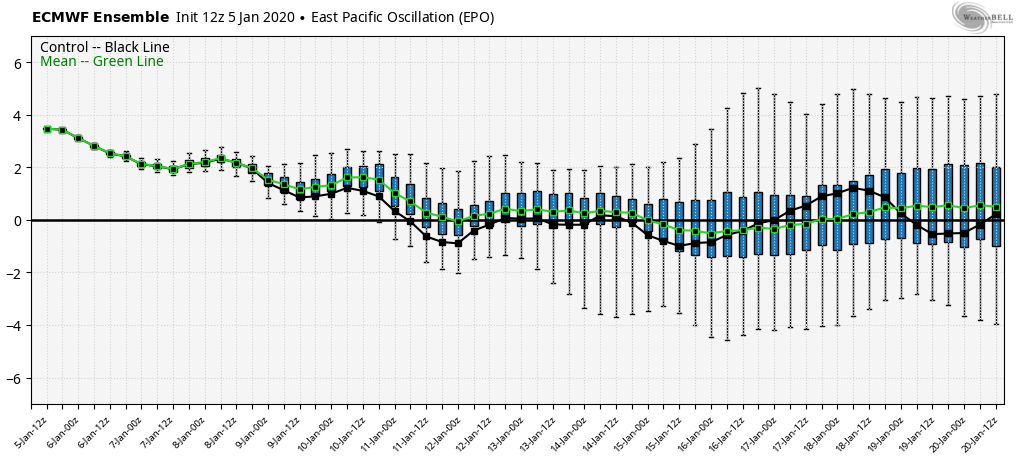
the lone help next week may come from the EPO. The ECMWF holds it neutral to positive, but the GFS takes it negative. That allows cold to push some…lots of resistance though in that SE ridge. Any coming cold over the next few weeks looks very brief and in and out rapidly.
Ski Resorts need to heed the outlooks and go all out on snow making through all the available opportunities this week.
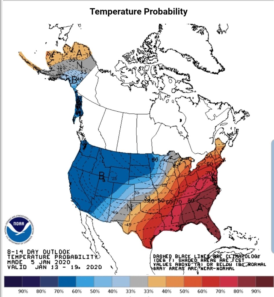
NOAAs 6-10, 8-14 day outlook
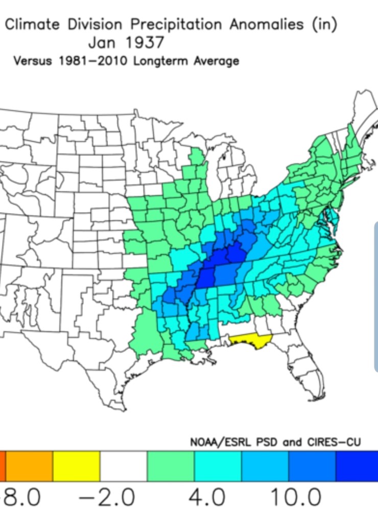
While there are variances as we see with this current window of winter that didnt occur in 37, the January 1937 overall setup and look however is very much alive in January 2020.
Snow overnight, heavier south. Few flurries left this a.m and there was patchy freezing drizzle. Brief but it existed this morning with temps lower to mid 20s. Breezy today as well. Fog and rime after the snow in some of the high Wv ground .
Surface features and 500mb height anomalies and flow
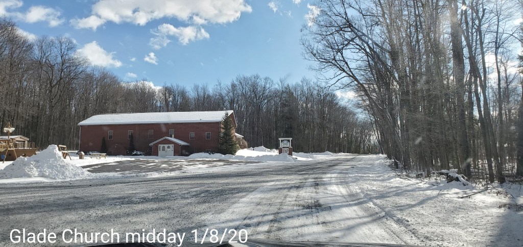
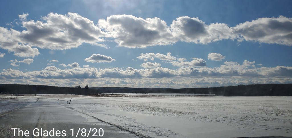
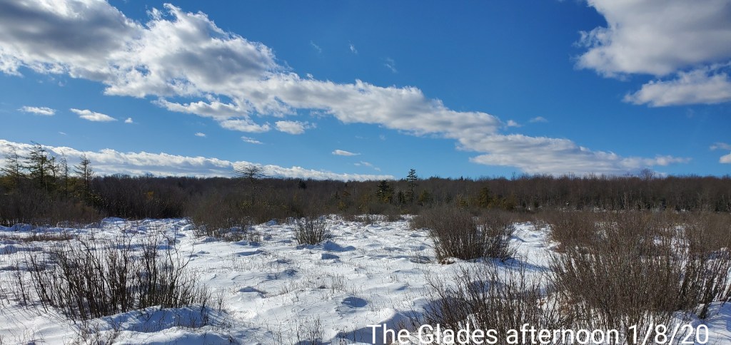
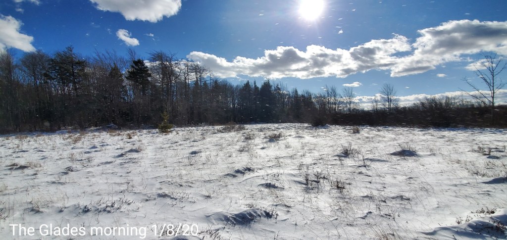
Midday update:
In this small window of winter, for now all is well…..for now…..
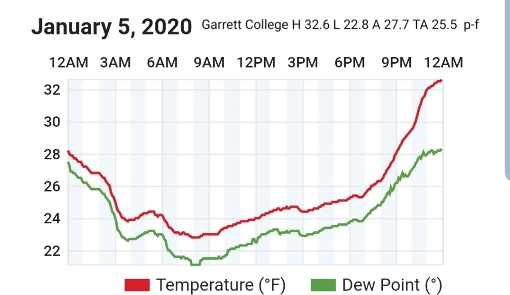
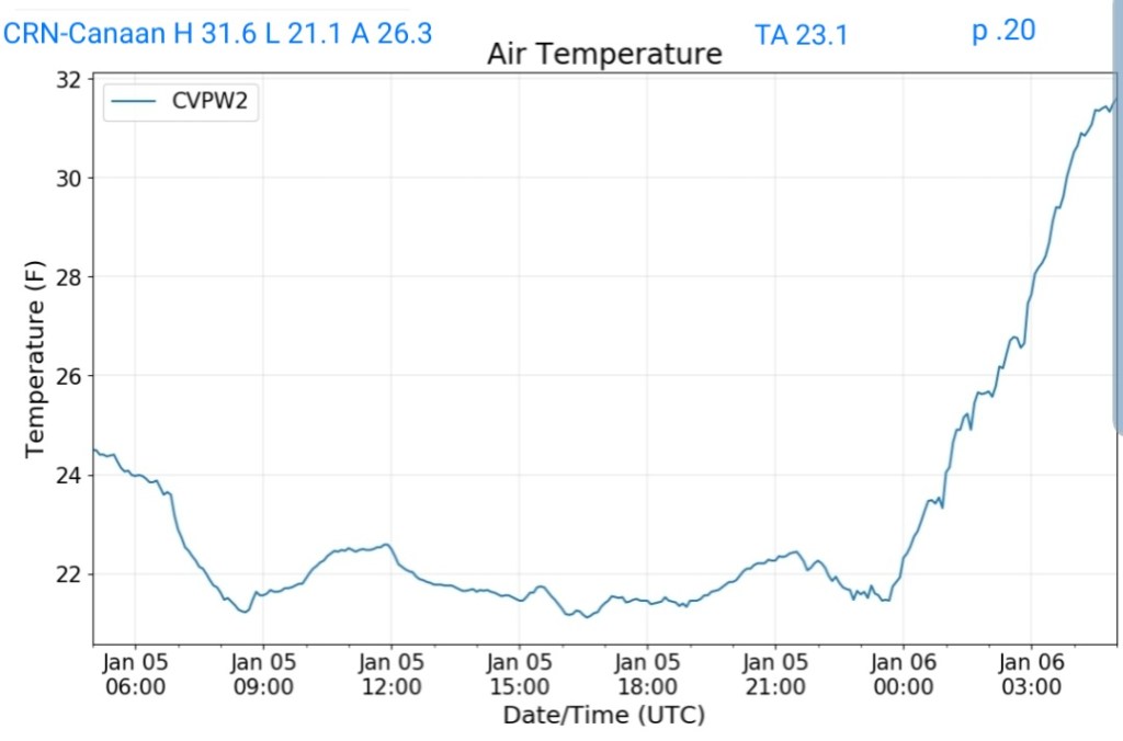
Snow totals
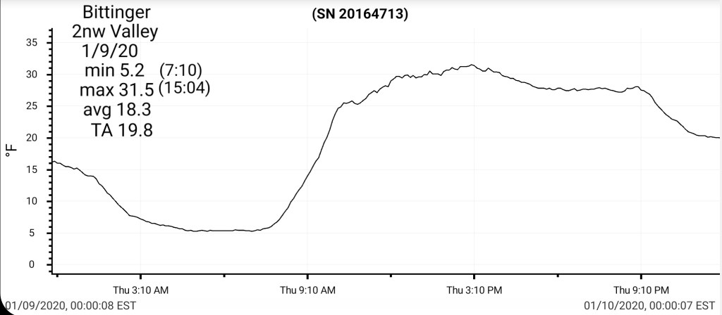
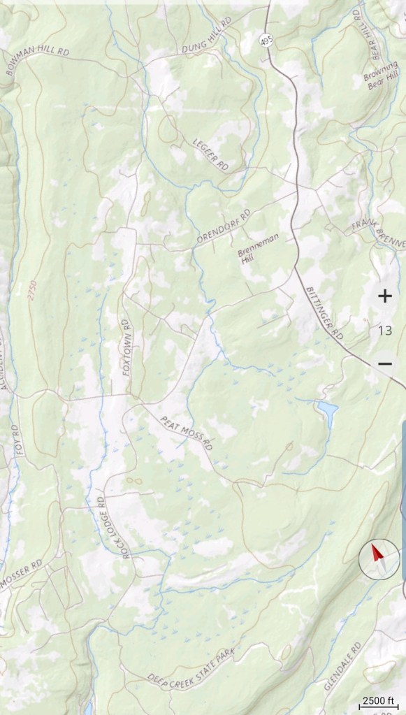
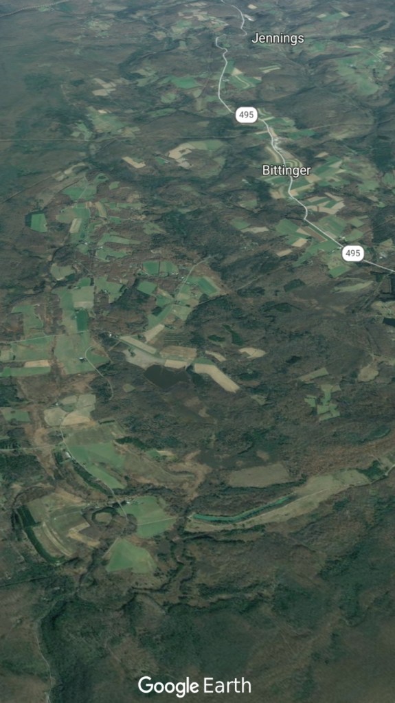
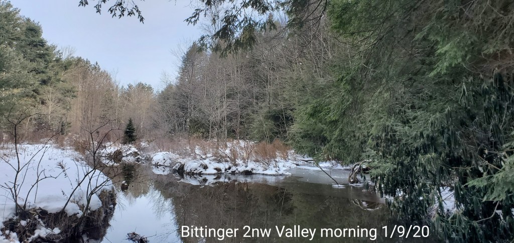
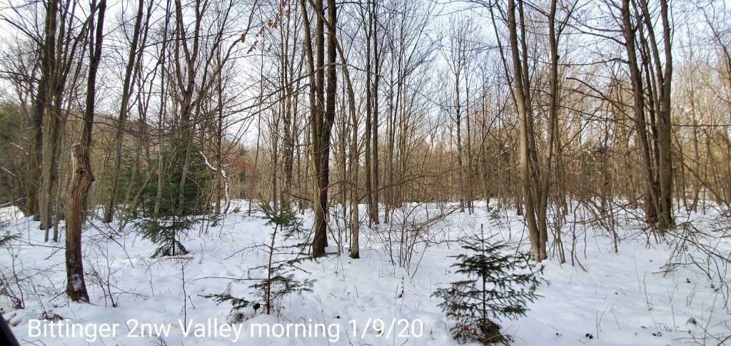
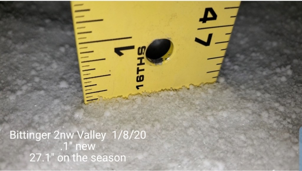
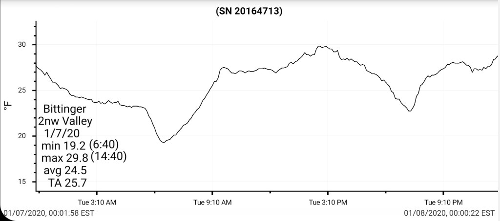
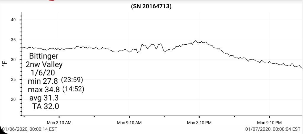
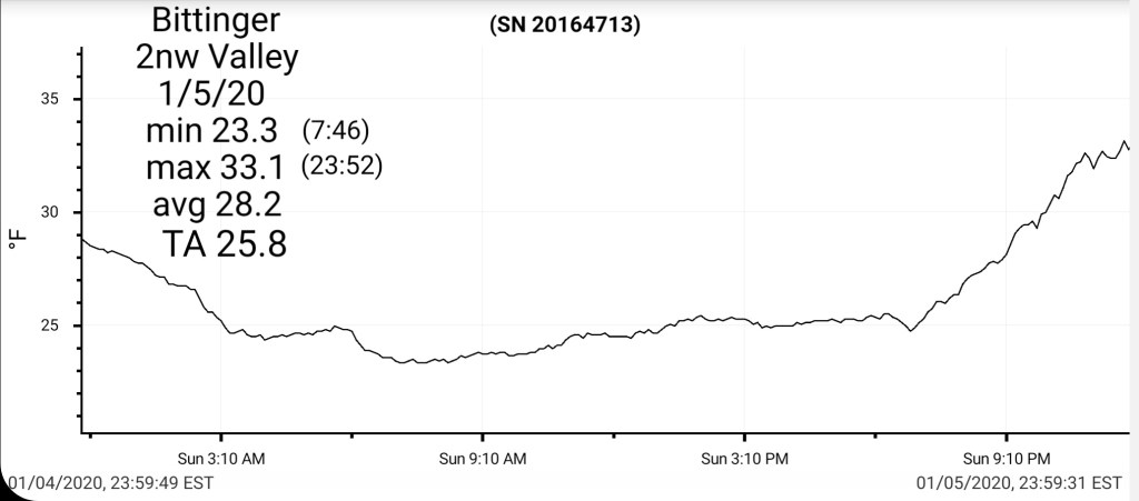
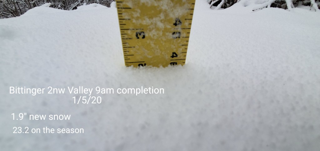
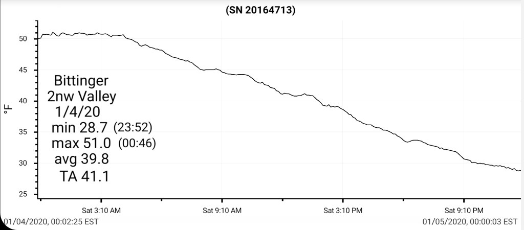
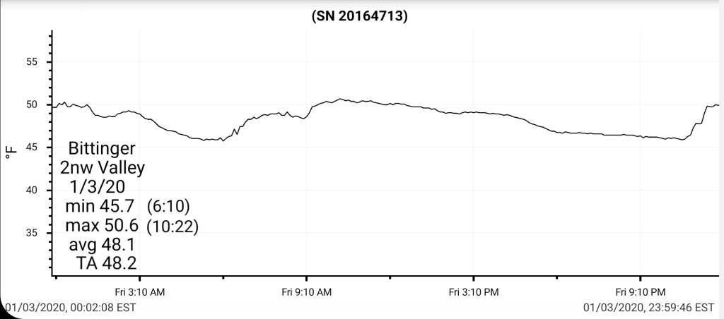
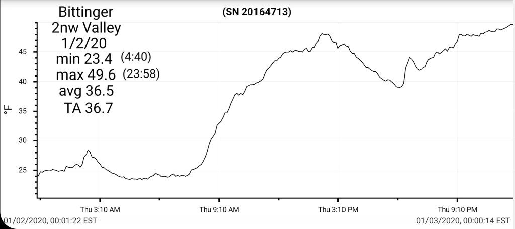
Bittinger 2nw Valley 1.9″
McHenry 4.8 SSE 1.5″
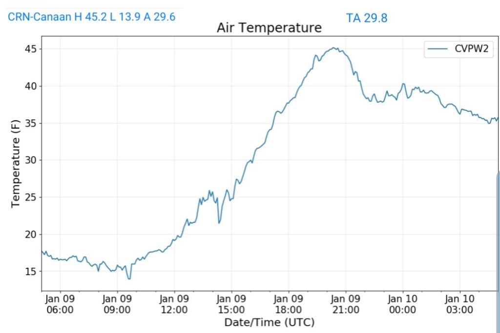
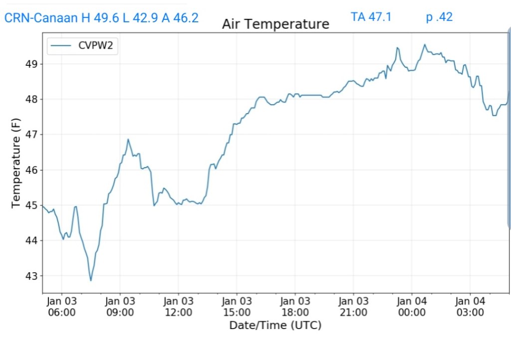
Canaan Heights 7.8″
Canaan Valley 4.9″
Mt. Lake Park 2.0″
Terra Alta 4.9NNE 3.1″
Thomas 7.4N 2.6
Snowshoe 4.0″
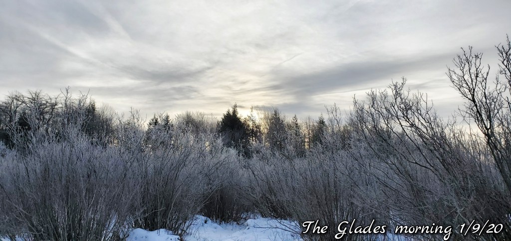
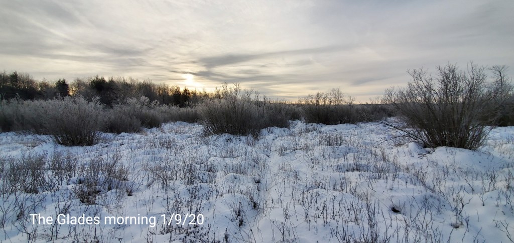
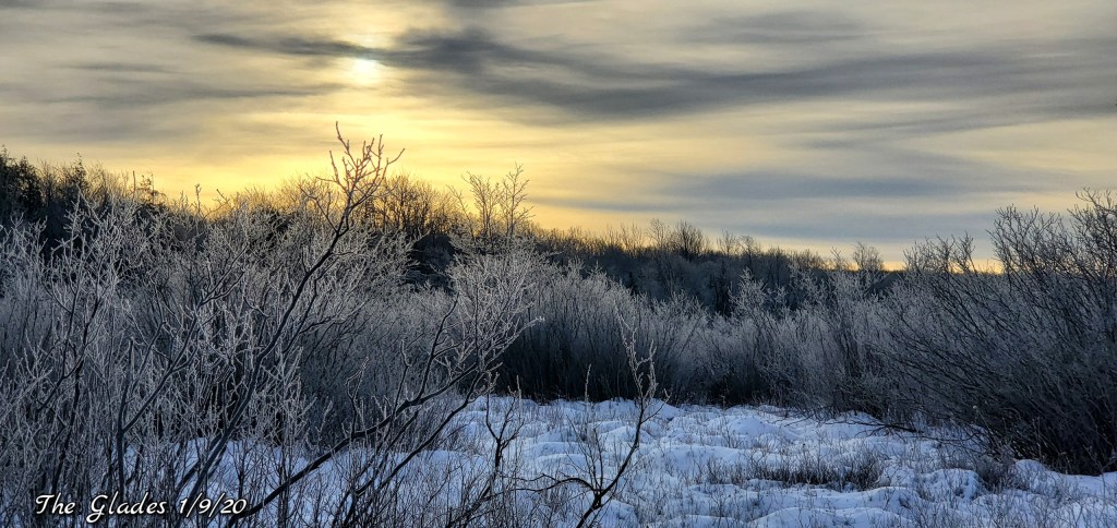
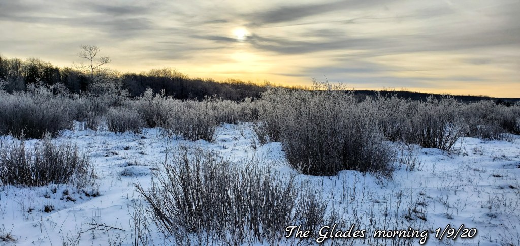
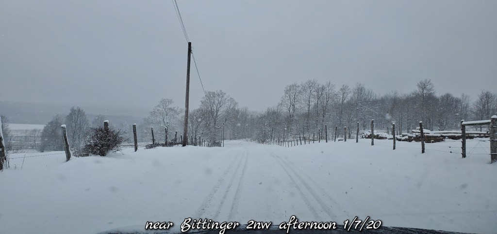
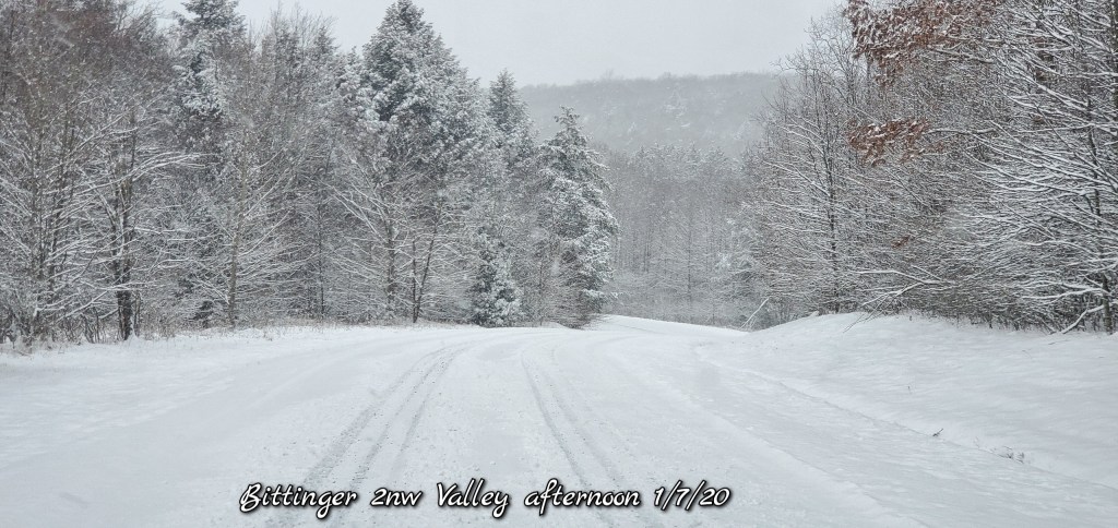
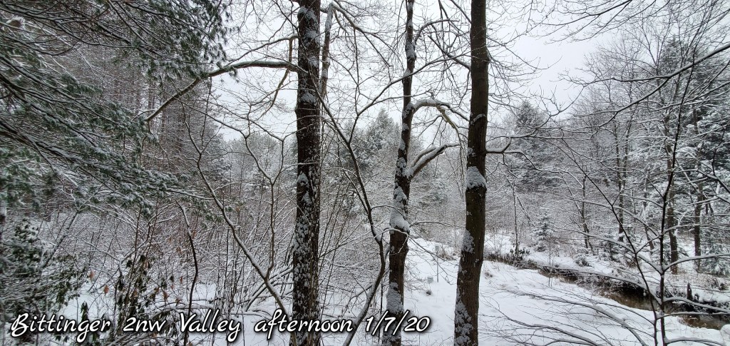
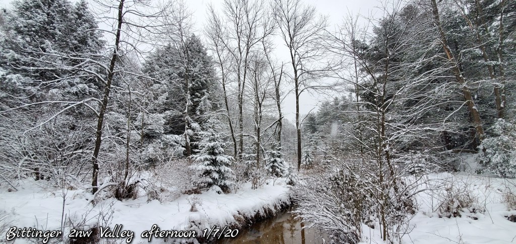
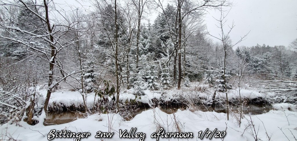
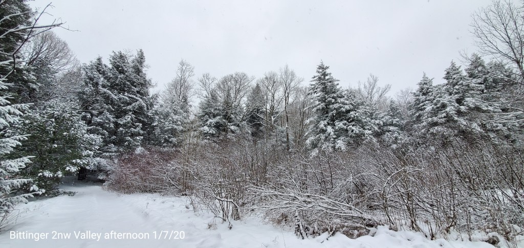
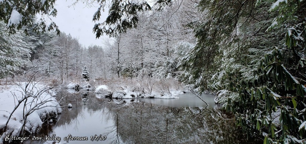
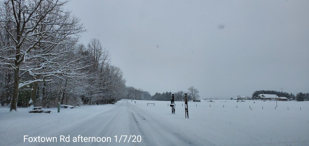
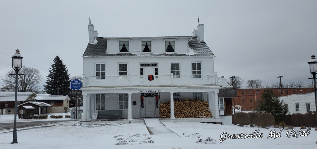
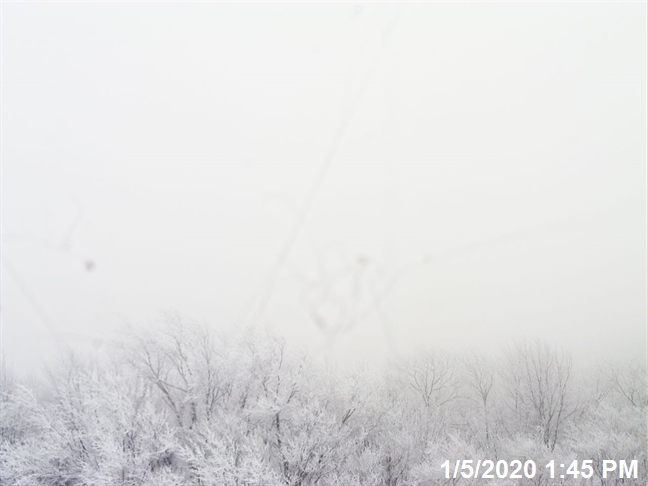
With scenes like this
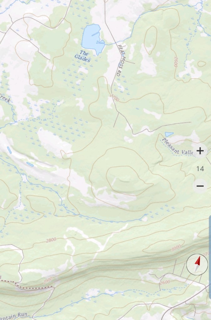
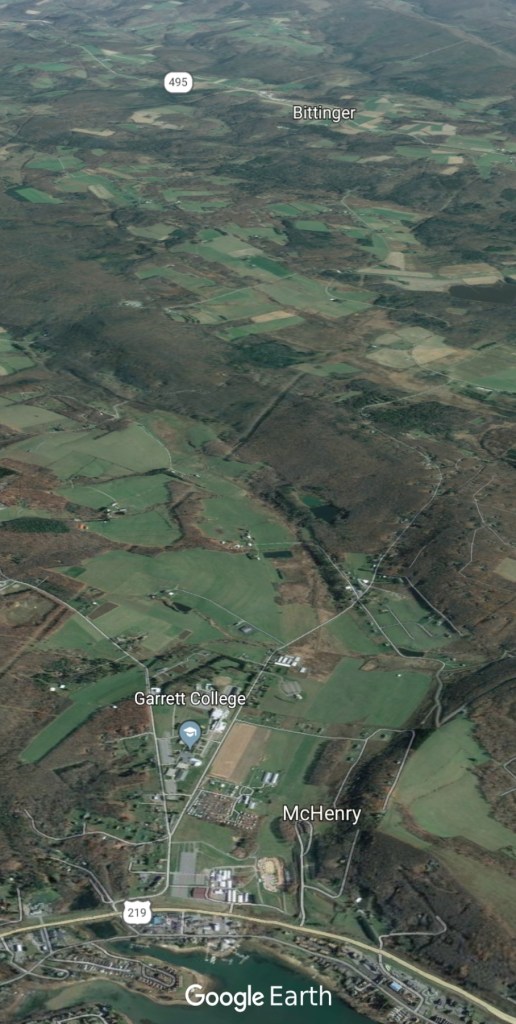
Near Bittinger, Garrett County 1/5/20
Grantsville 1/5/20
Canaan 1/5/20
Dolly Sods, WV,Bearden Knob
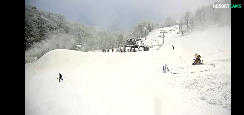
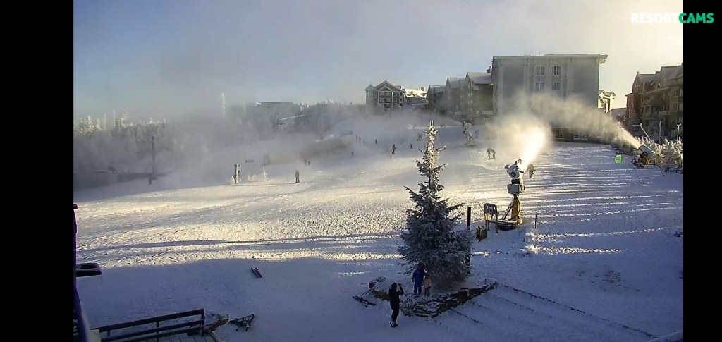
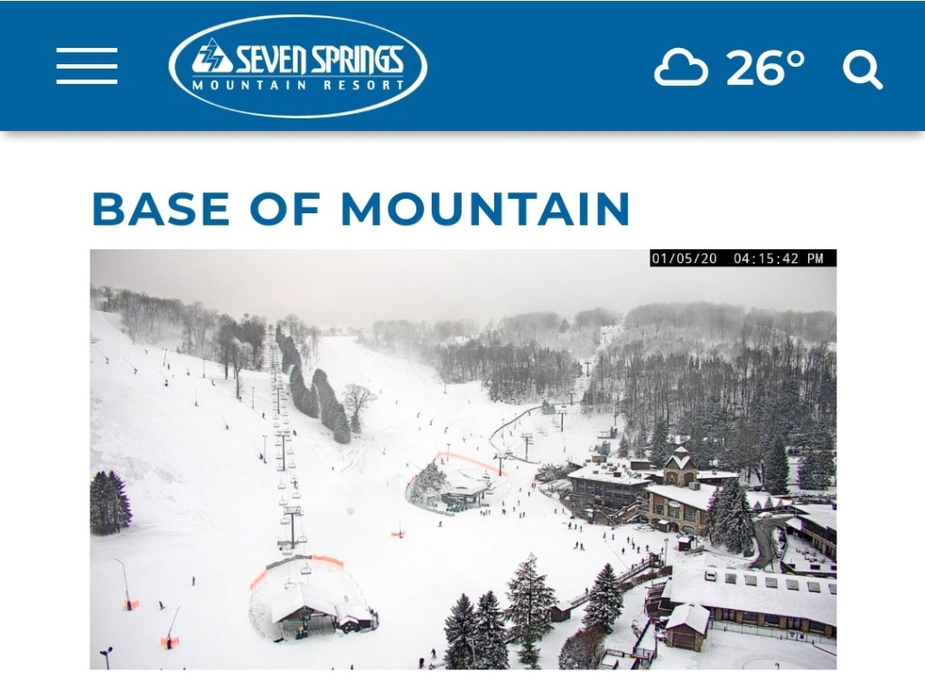
The Resorts
Canaan 4:15pm
Snowshoe 4:15pm(skies cleared there)
Wisp
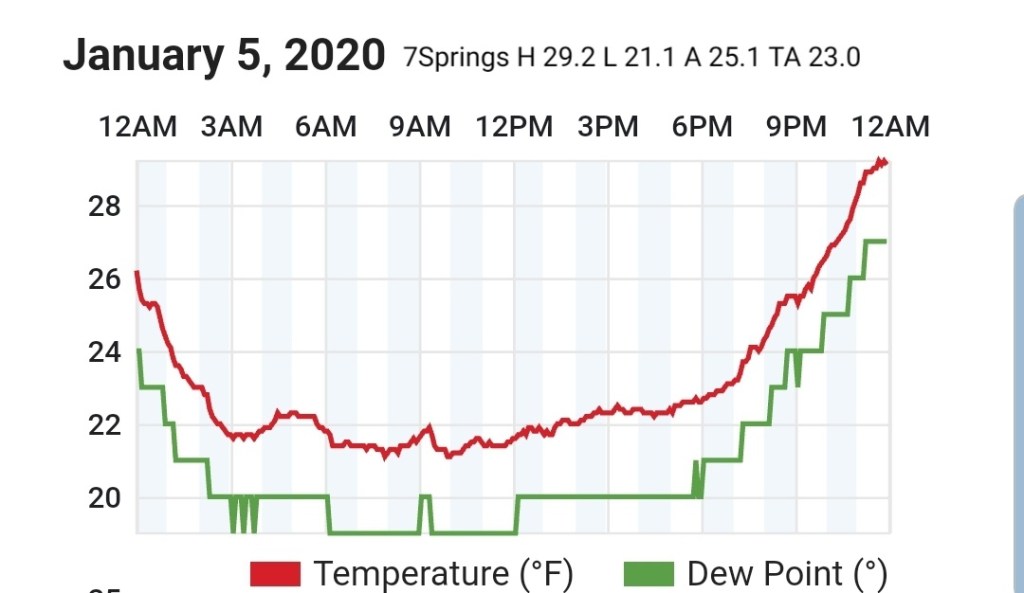
7Springs
This 5 day window of winter is beginning great and all looks well…..for now
Over the next few days, it looks even better.
Light snow tonight with the passage of a cold front, additional light accumulations of 1″ of fluff possible in spots.
Then a better organized system looks to come through the area on Tuesday. Tweaks will need to the exact placement of the best axis of snow, but 3-6″ bullseyes look likely with this with 1-3″ outside of that area.
The current ECMWF looks like. This by no means is etched in stone. Expect tweaks.
That will carry us to Wednesday night
Light winds, clear skies, low dewpoints currently being shown off the models. I prefer the 3km Nam for these details once inside 48 hours. This combo with accompanying snowpack should lead to some possible below 0 readings in the coldest valleys. If any one if these factors are off, that will erase those thoughts.
This comes in ahead of the dreaded SW flow and milder temps late week. A notch up on Thursday and more substantial on Friday into Saturday. That is accompanied by rain.
The dominate pattern beyond Friday looks to be the ridge east, trough west.
NOAAs 8-14 day outlook
another 37 look??
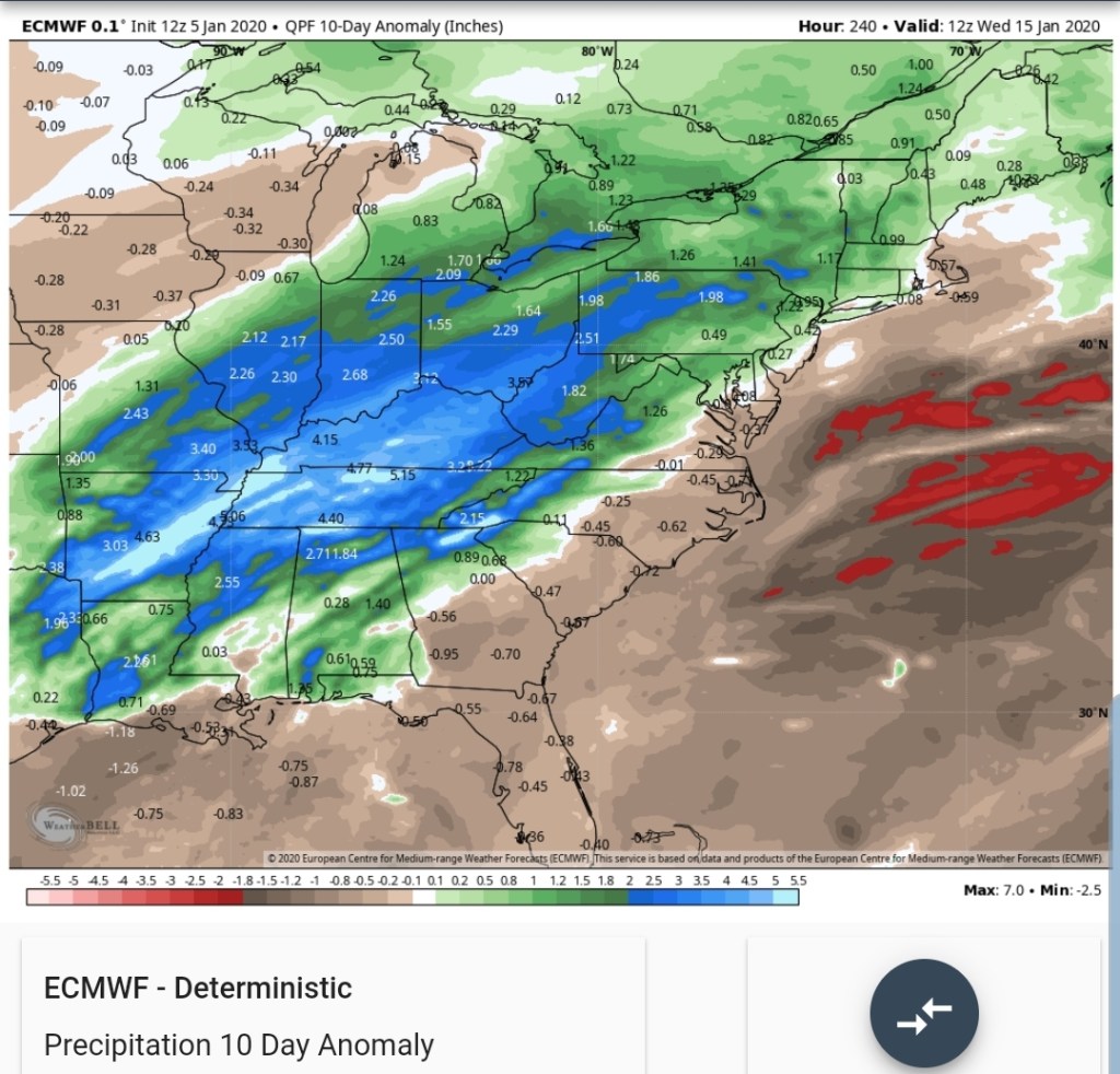
Upcoming 10 day precip anomalies off the ECMWF
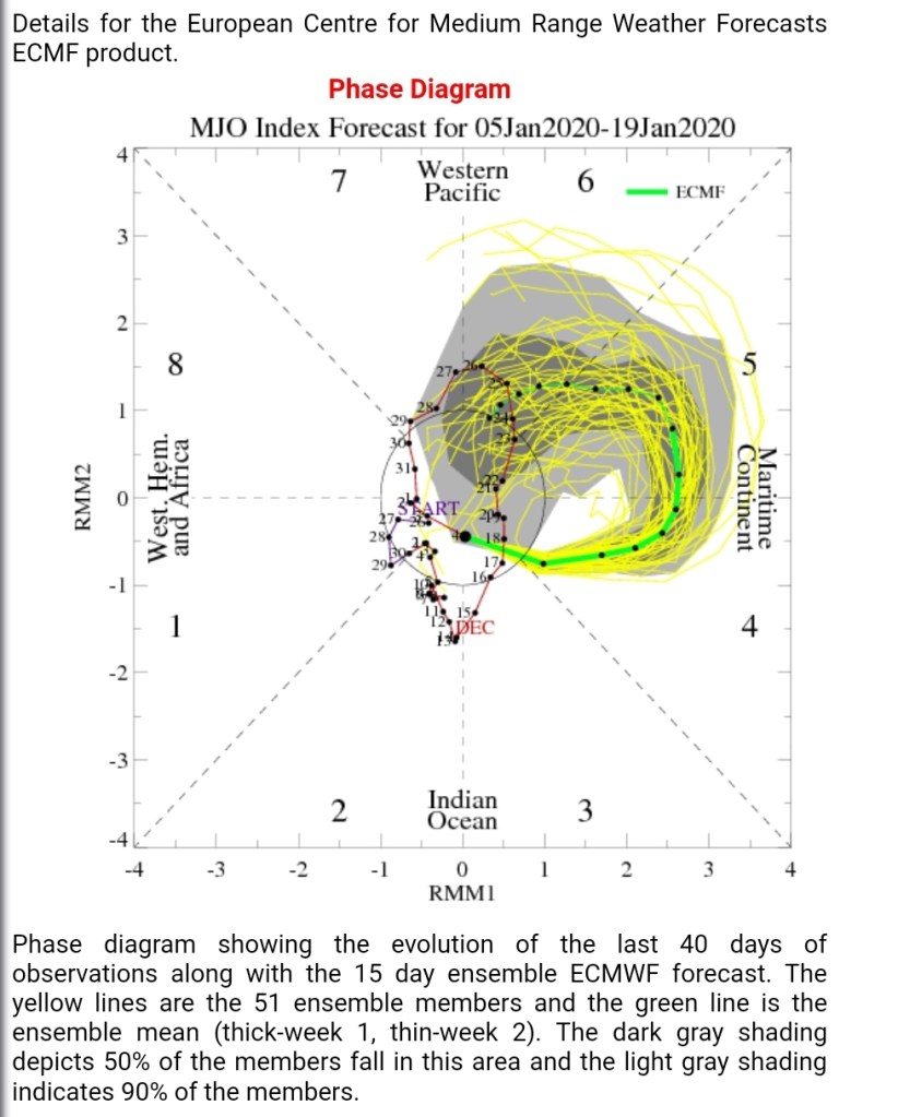
The MJO
Mjo correlation
Precip , looks to fit the phase 5-6
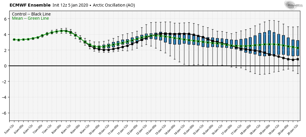
Teleconnections off the 12z ECMWF ensemble
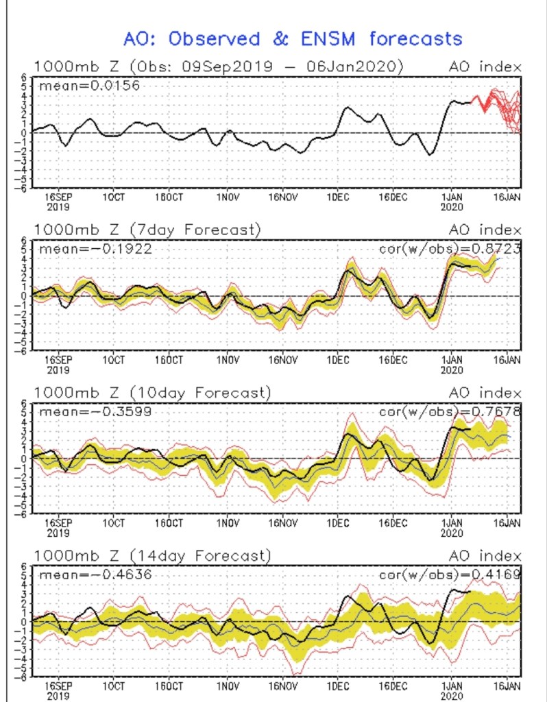
A little hope in the teleconnections..
Overall expect the 10th to 20th period and maybe beyond to be dominated by well above normal temps. Possibly a few 60s in that period.
Surface features and 500mb height anomalies and flow
Webcam at Centennial Park
Canaan Resort
Keysers Ridge
10pm- snow falling, roads in poor condition. Dave Lesher over 6″ through 10pm at Canaan Heights. Will add additional info tomorrow. Be safe, enjoy the snow.
Surface features and 500mb height anomalies and flow
Cold air settles back in late tomorrow, rain goes over to snow in the evening and begins to accumulate, especially after nightfall across the high ground. Snow continues into Sunday a.m before stopping. Temps 26-33 through the event depending on elevation and location. The higher the colder and slightly better ratios. Overnight Sunday with a second surge of colder air, another brief bout of snow may add some light additional accumulation .
Snowfall amounts looks to be
Through midday Sunday-
Lean low to mid range and a good performance can put the high end in target.
3500’+ 3-6″
3000-3500′ 2-4″
2500-3000 1-3″
2000-2500 coating to 2″
Under 2000′ inch or less.
A second round comes through midweek with additional accumulation. Some locations across the high ground may end up with 2 of the better snows of the winter in what has been a poor snow season.
Beyond this, the ridge east, trough west pattern really looks to dominate and snow changes are very low, at best briefly on the tail end of a rain system before rapidly warming as it passes by. Temps and dewpoints both look to be up in the coming pattern beyond the 9th. Area resorts really need to take advantage of the colder snow making periods next week, a few optimal nights look to present themselves before the coming lengthy warm spell.
Surface features and 500mb height anomalies and flow
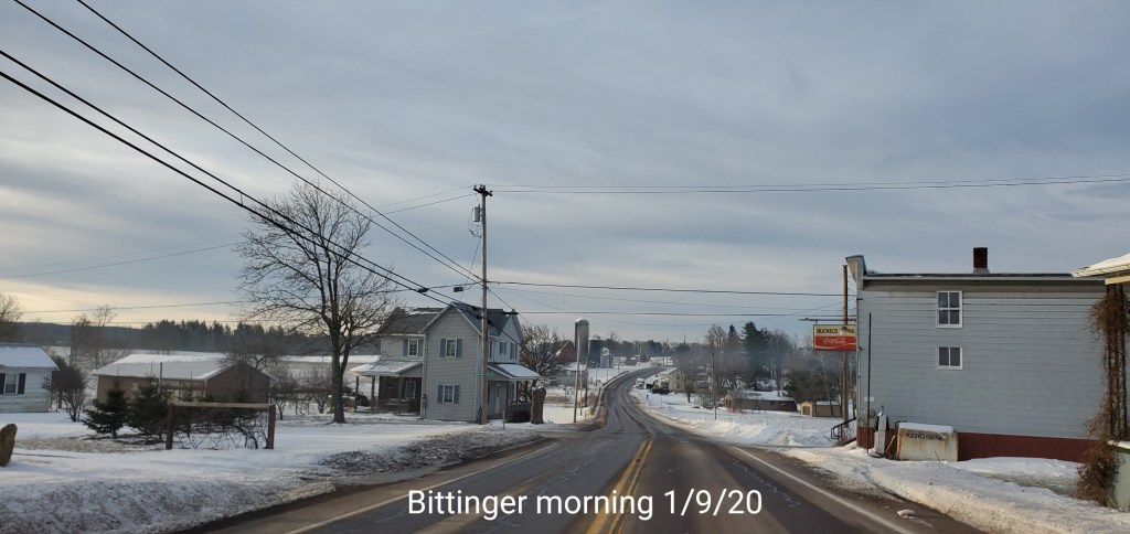
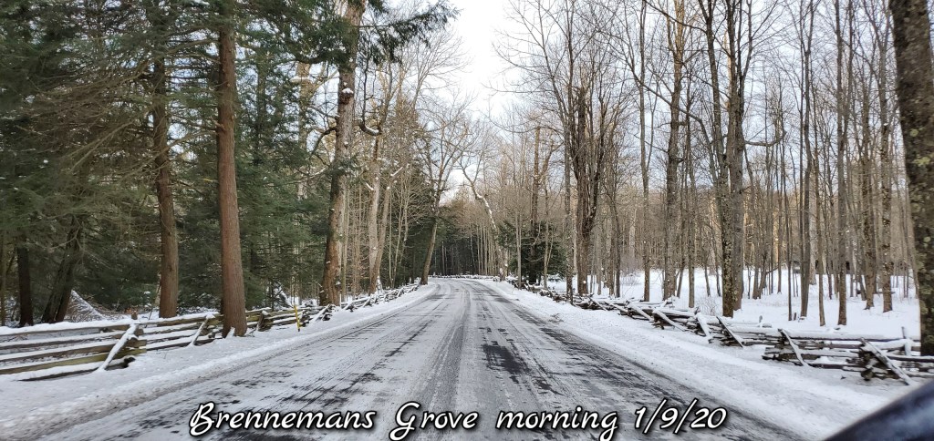
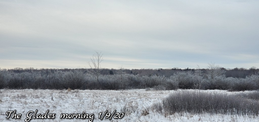
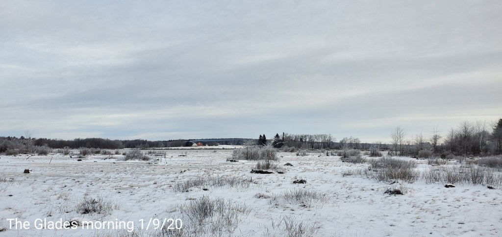
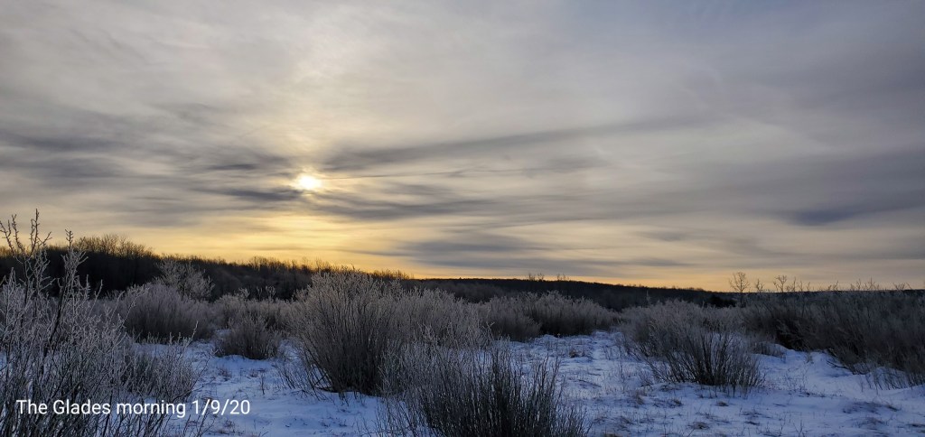
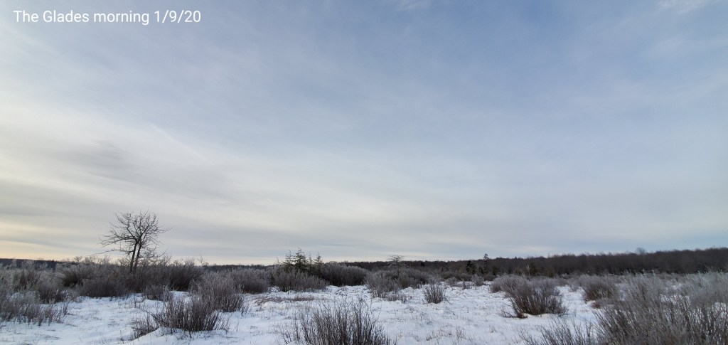
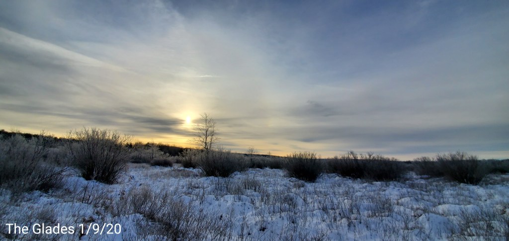
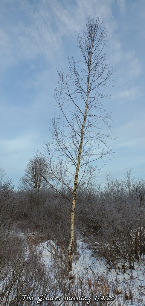
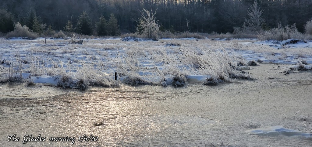
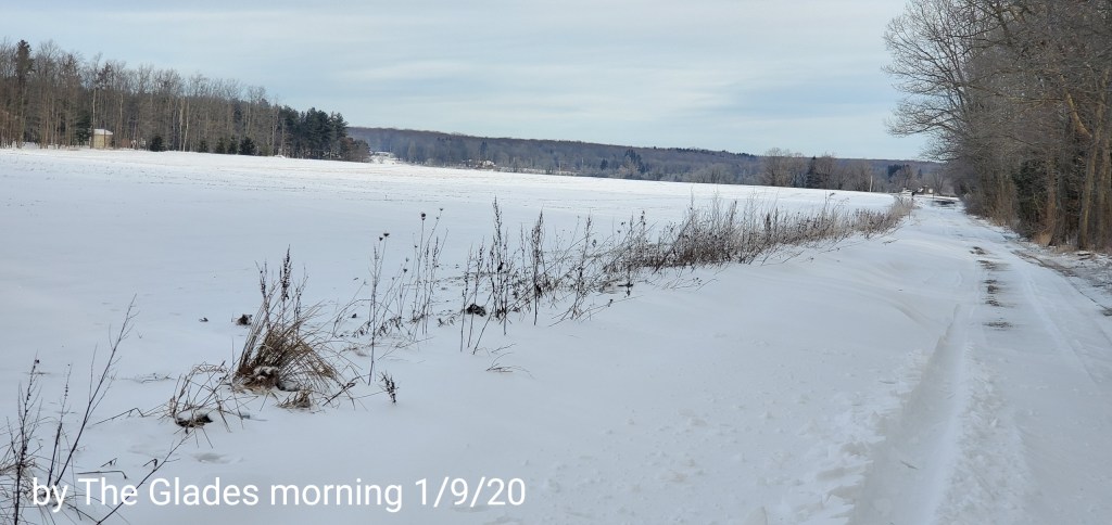
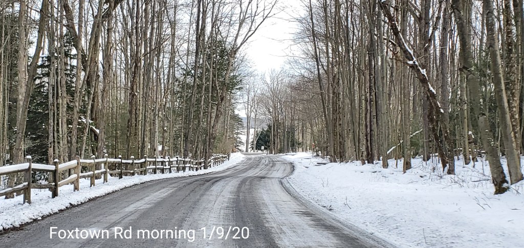
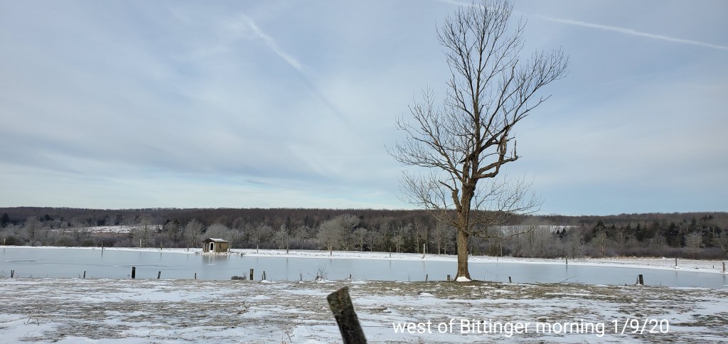
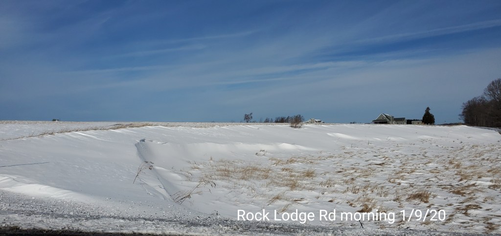
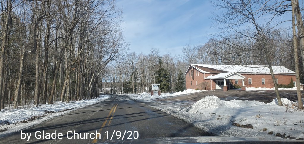
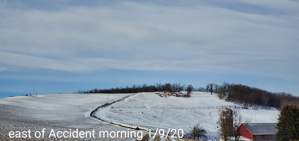
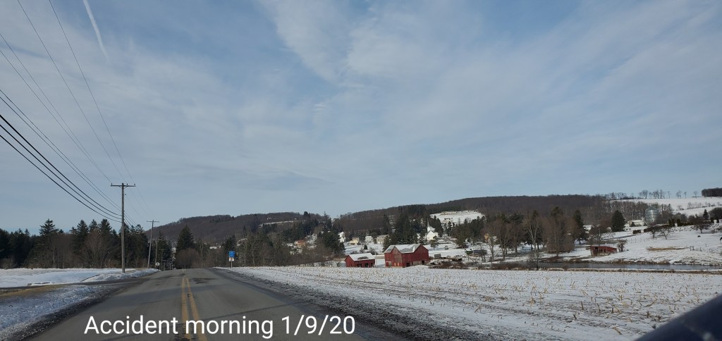
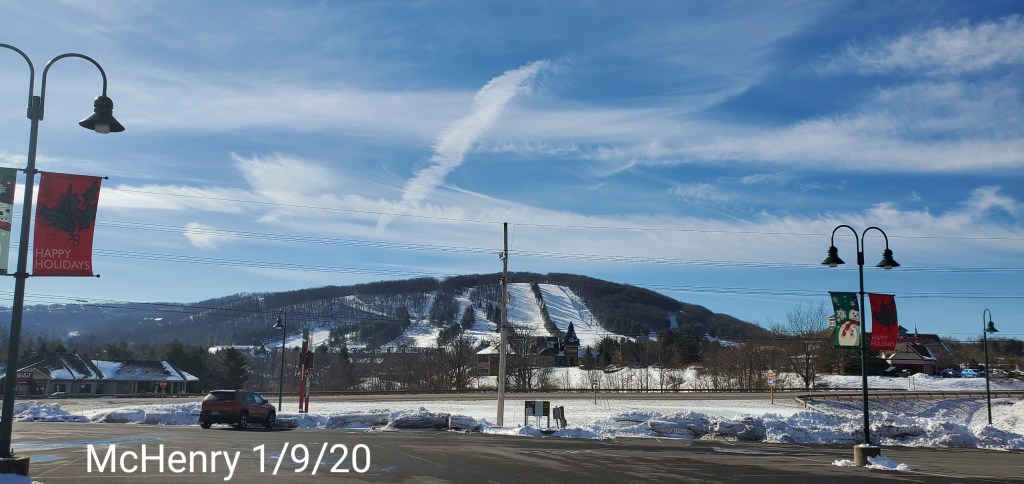
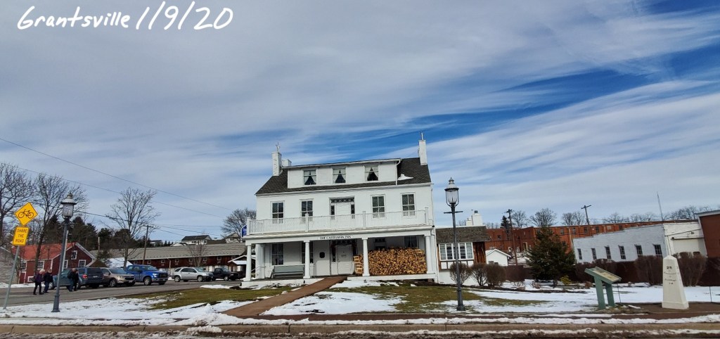
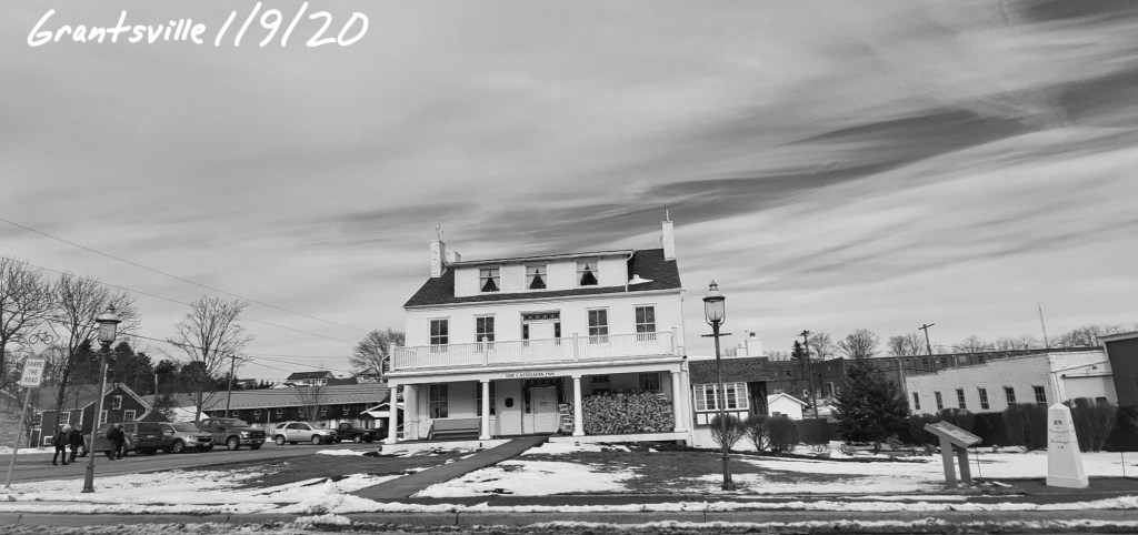
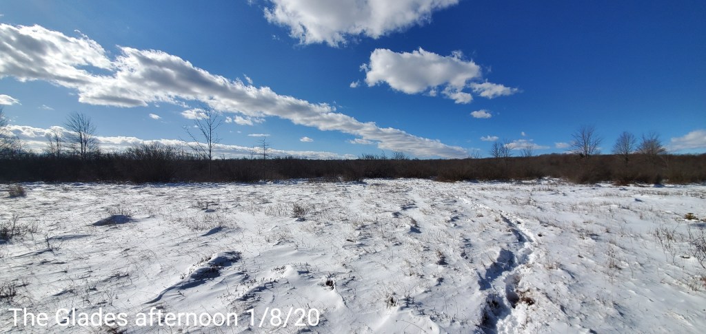
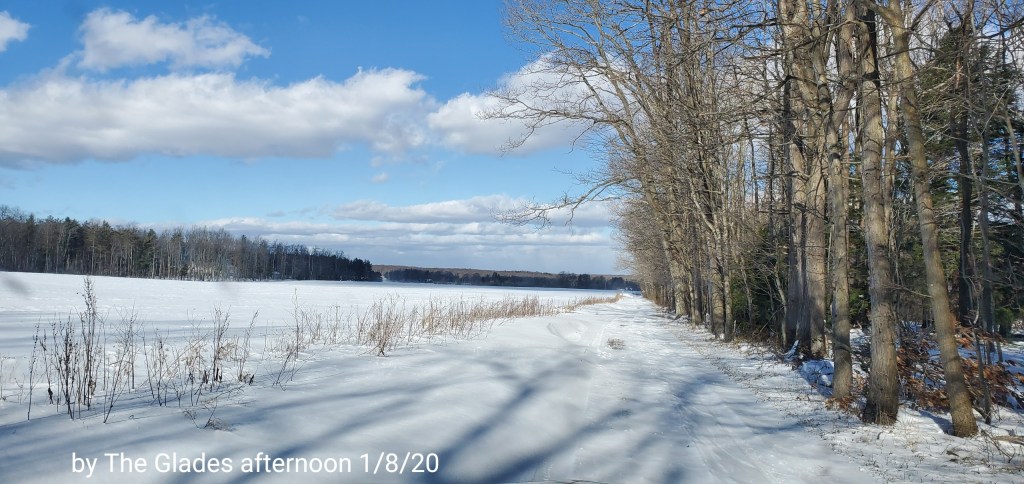
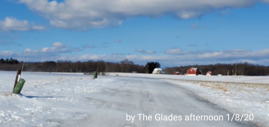
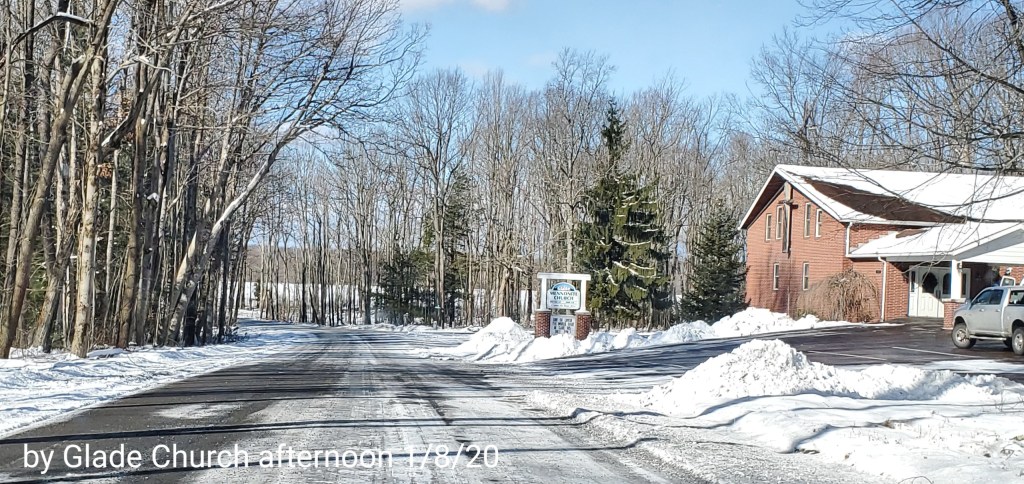
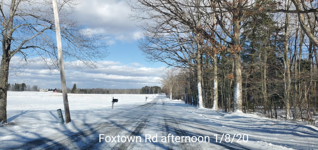
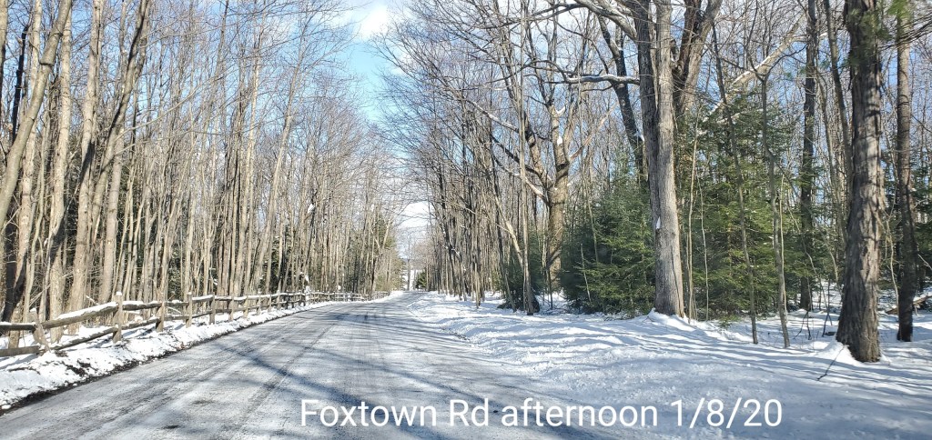
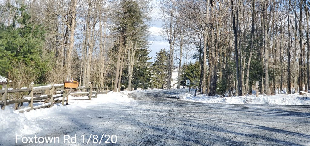
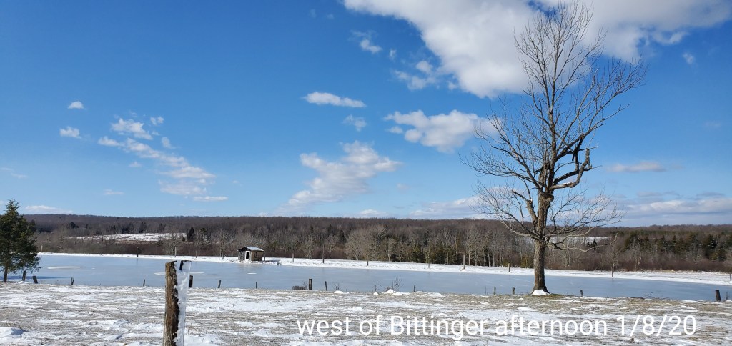
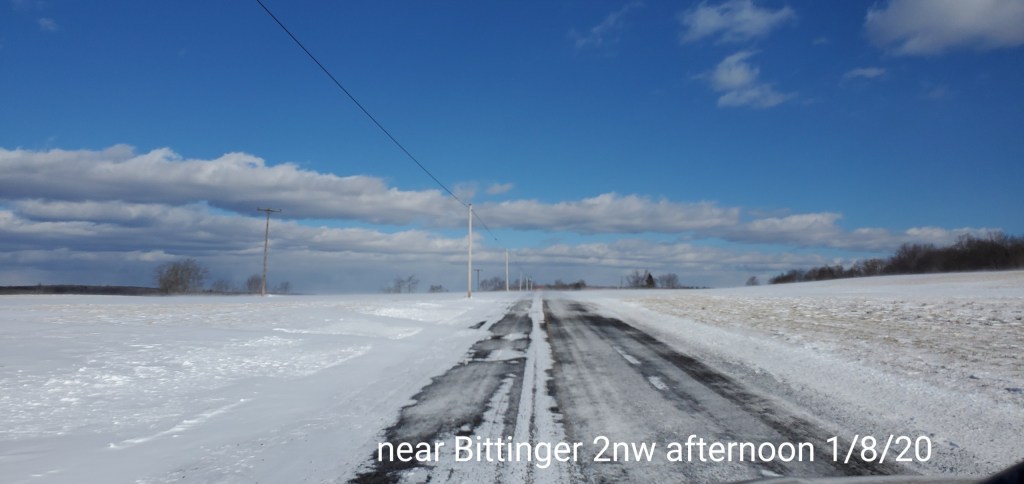
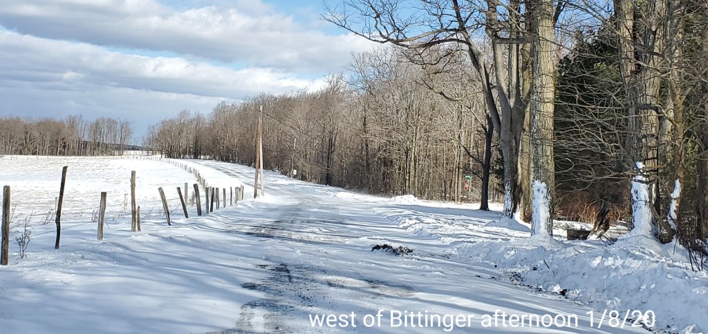
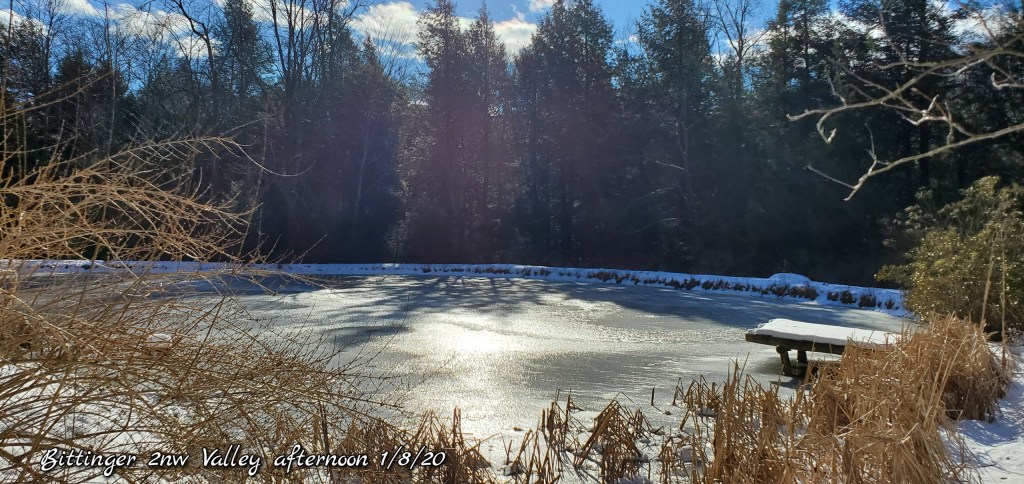
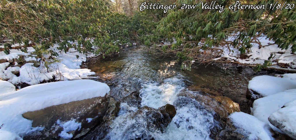
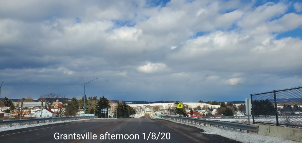
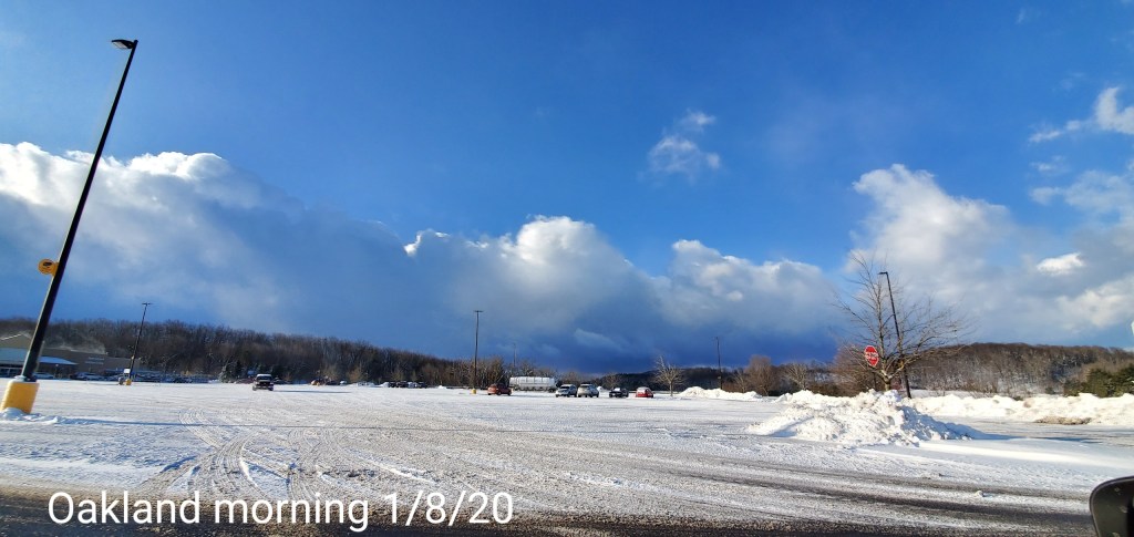
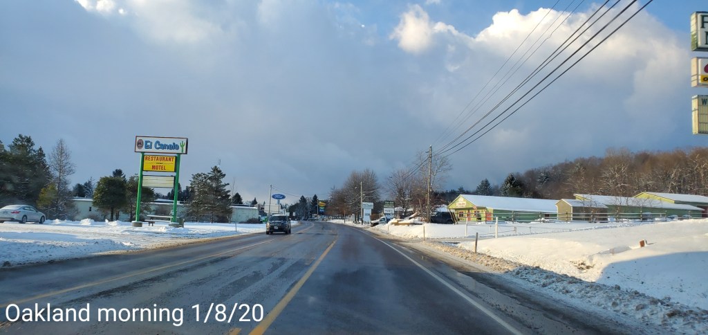
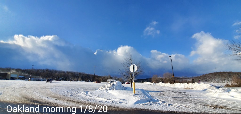
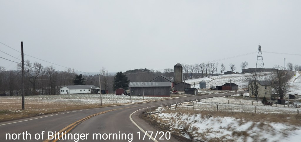
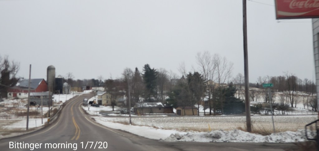
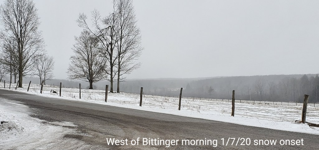
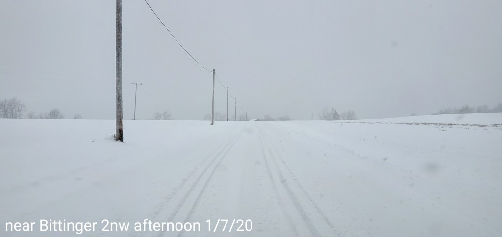
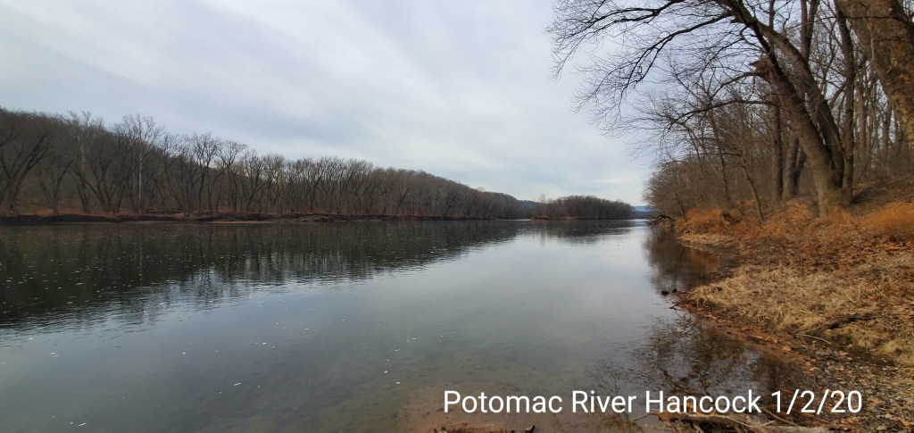
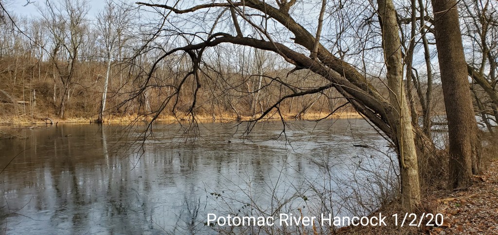
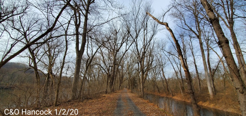
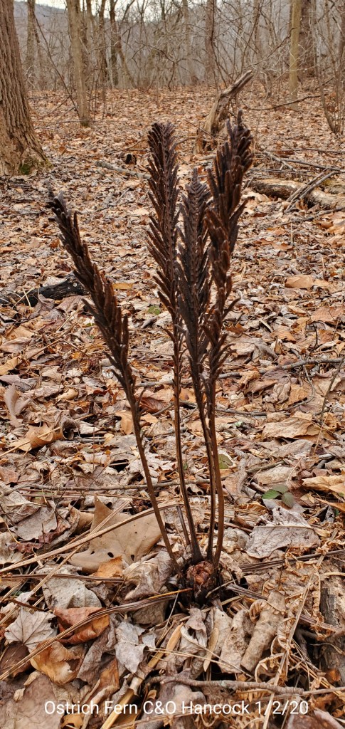
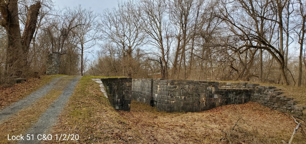
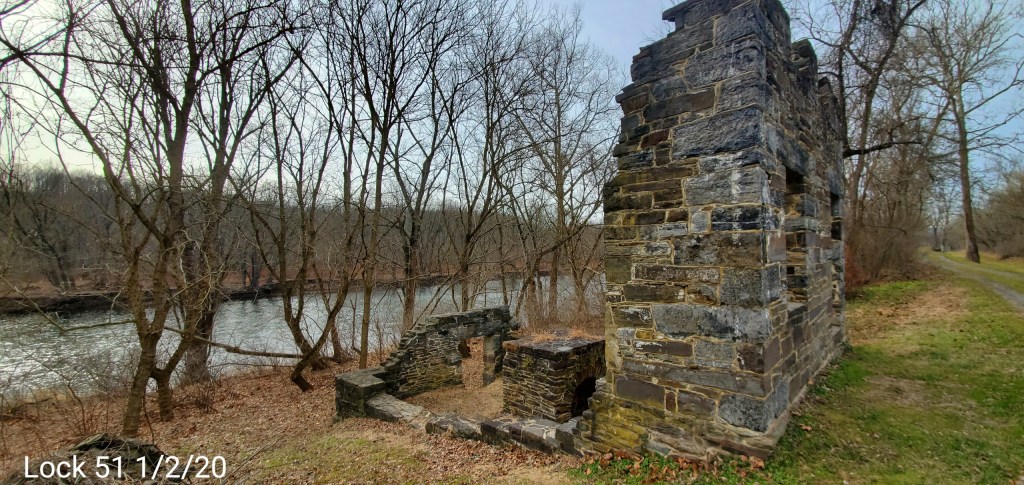
Pics today
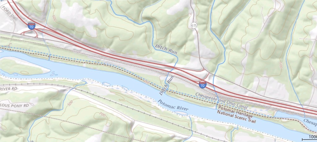
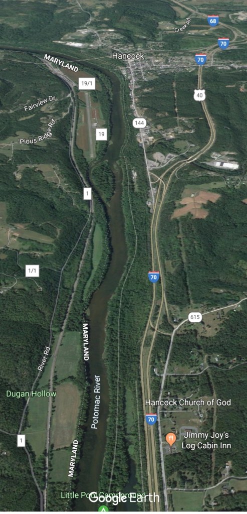
C&O Canal Hancock
The 5th to 9th window remains open. 2 potential snow systems. 1- Saturday night/Sunday morning with an additional piece of energy Sunday night. How fast changeover occurs from rain to snow, available moisture and speed of the system will impact overall amounts. Several inches definently possible, especially above 3000′. Early call 3-6″ above 3000′, 2-4″ above 2500-3000, 1-3″ under 2500′ …expect tweaks.
System 2 comes in mid week- and details are sketchy yet on that. After at system passes, that’s when snow lovers need to bury there heads a little while. The trough west, ridge east theme dominates. This isn’t a shocker, and all signs have strongly pointed this way for awhile.
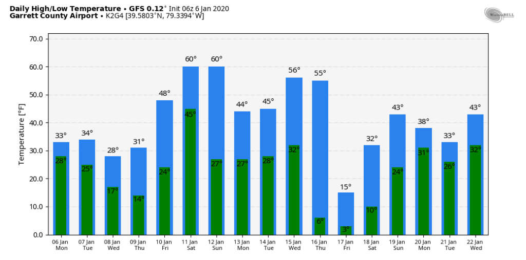
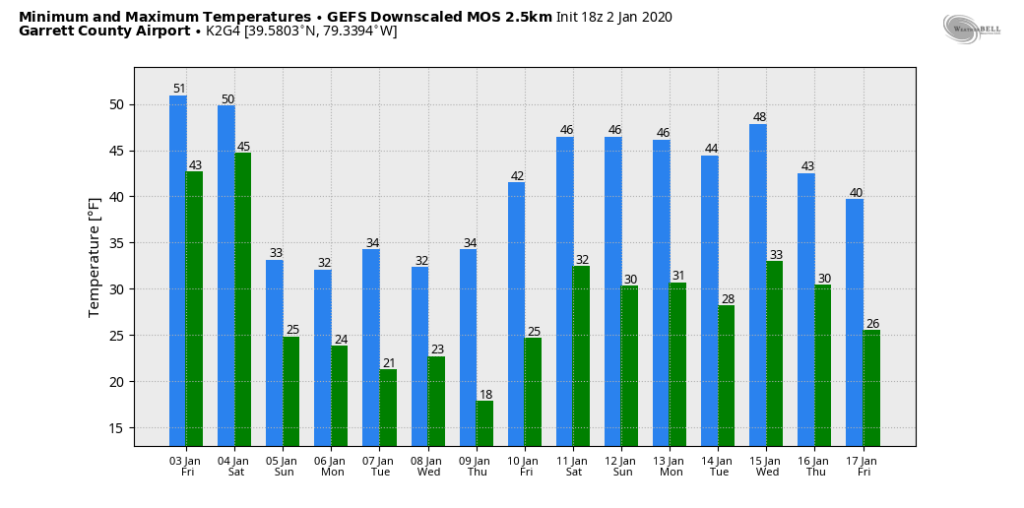
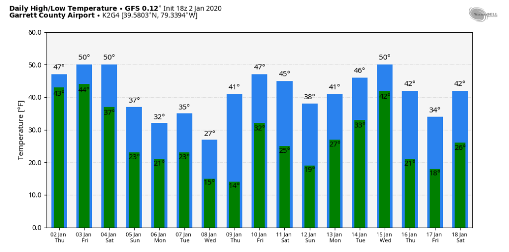
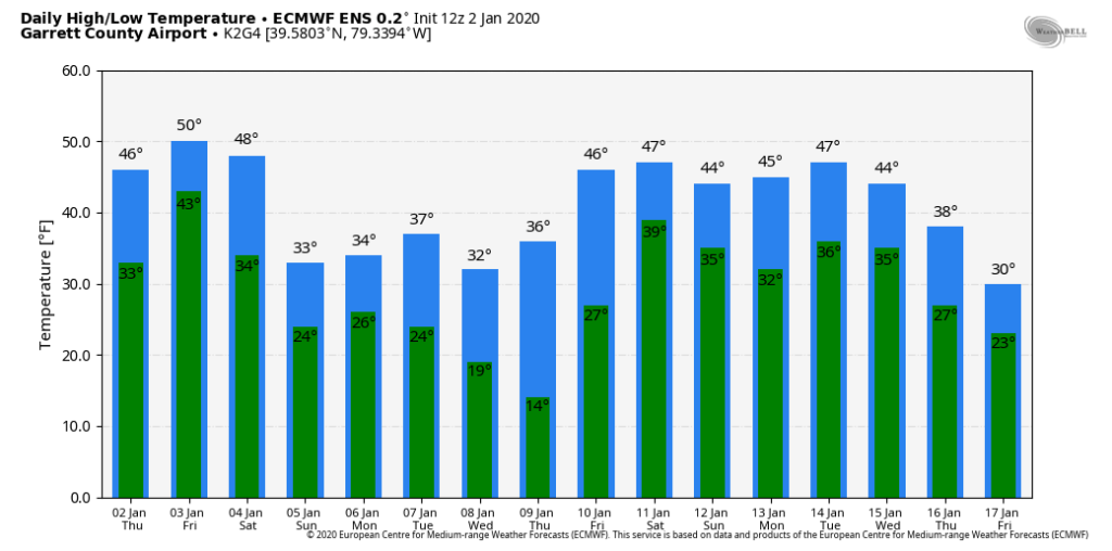
Temps off the 12z ECMWF ensemble mean. 12z GEFS mos, 12z GFS op, 12z GFS ensemble for Garrett. That 4-5 day window is it. Then beyond that, likely these temp numbers will be under done a few days. Likely a few 55°-60° days will show up.
the MJO remain ugly
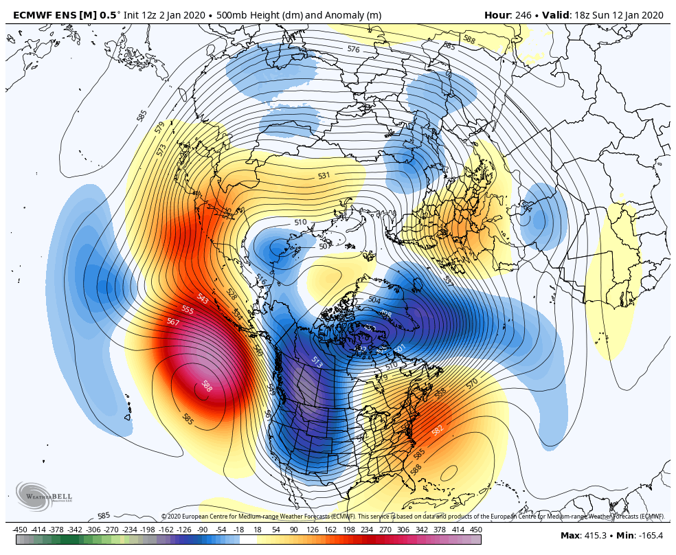
the theme of the 500mb height anomalies through the period hold to this look, that’s ugly
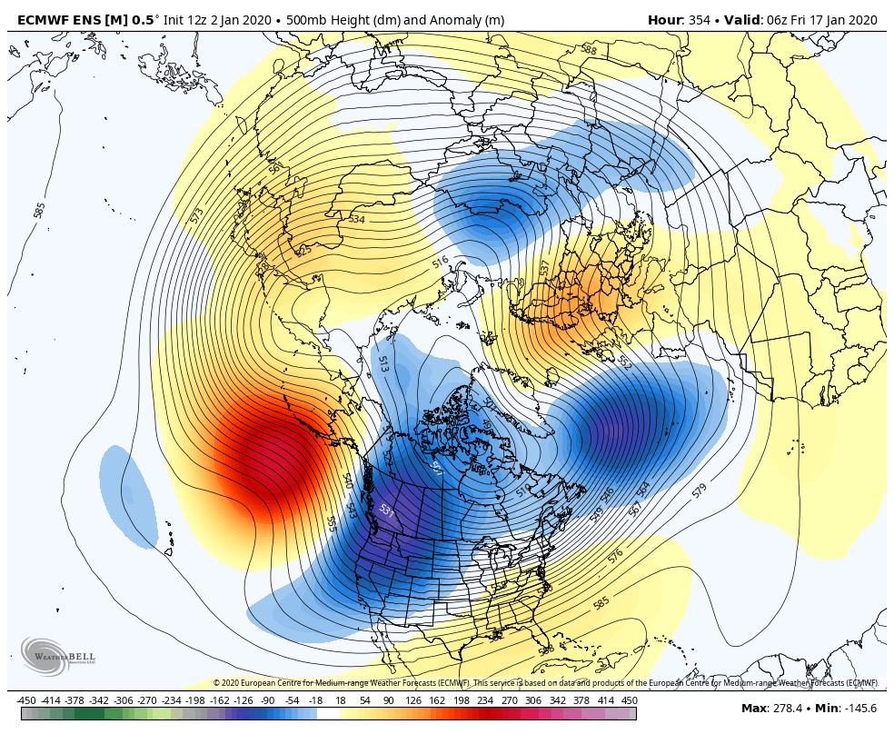
Then at 354, still ugh, but that is some improvement. The trough leans positive and the ridge pokes into Alaska some. That can finally feed some cold back in, in yet a overall mild pattern.