February 28, 2020
Feb 28(Fri)
A moderate at times briefly heavy snow from 7-10 am. I picked up 1.8″ in that time. Late morning from Garrett County and north skies went partly sunny for several hours. This rapidly settled the snow depth. Also in direct sunny areas, with the sun angle higher, some melt occured. If you record snow, it’s highly critical that you took your measurement and from here out take your measurement as soon as possible as the snow ends. Snow and clouds hung on through the day in Wv and some returned north near nightfall.
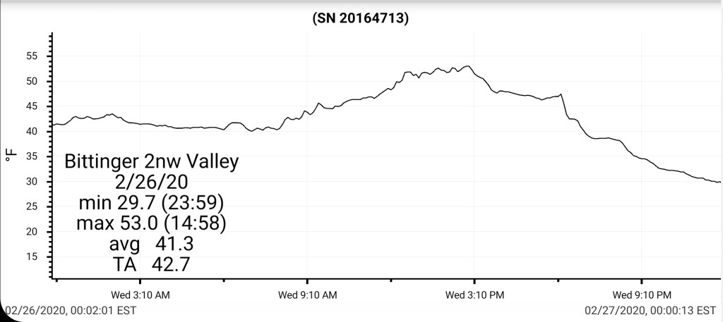
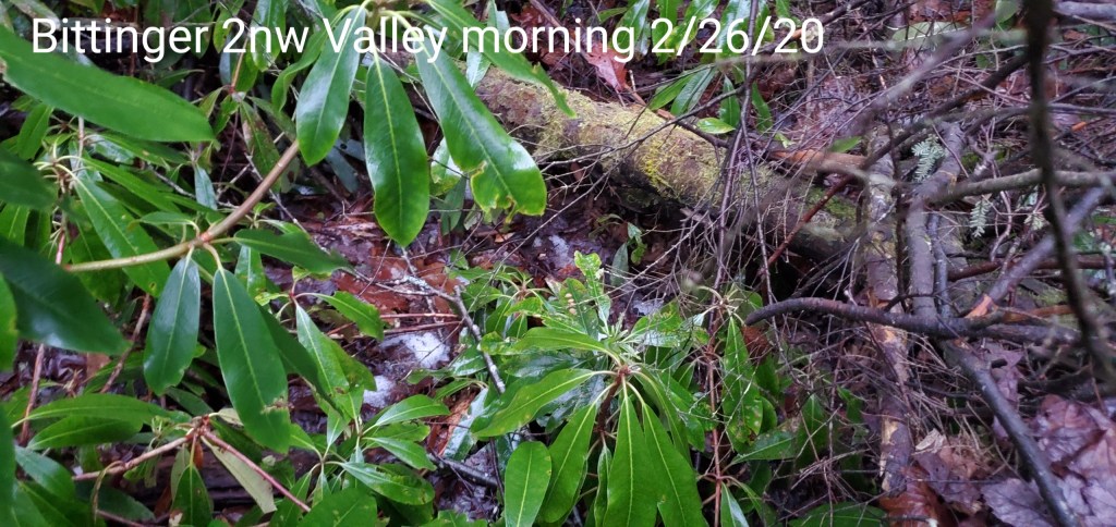
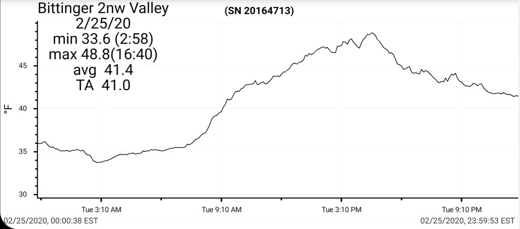
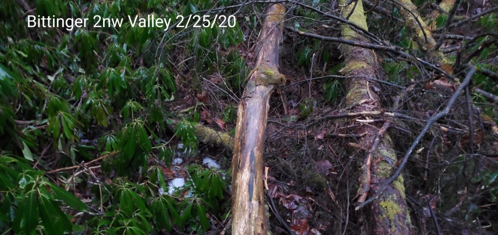
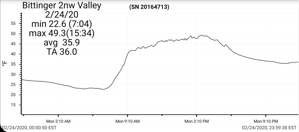
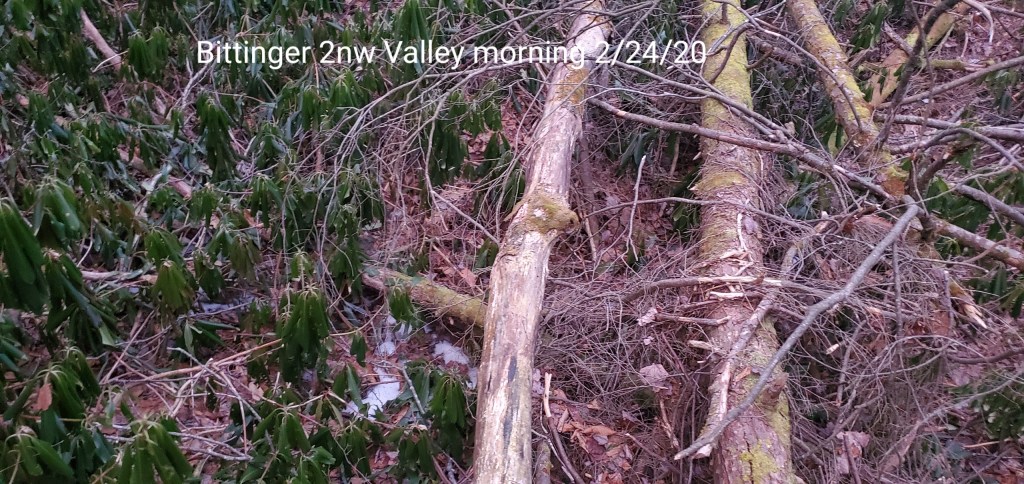
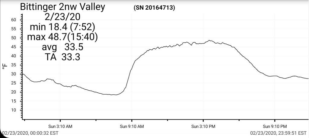
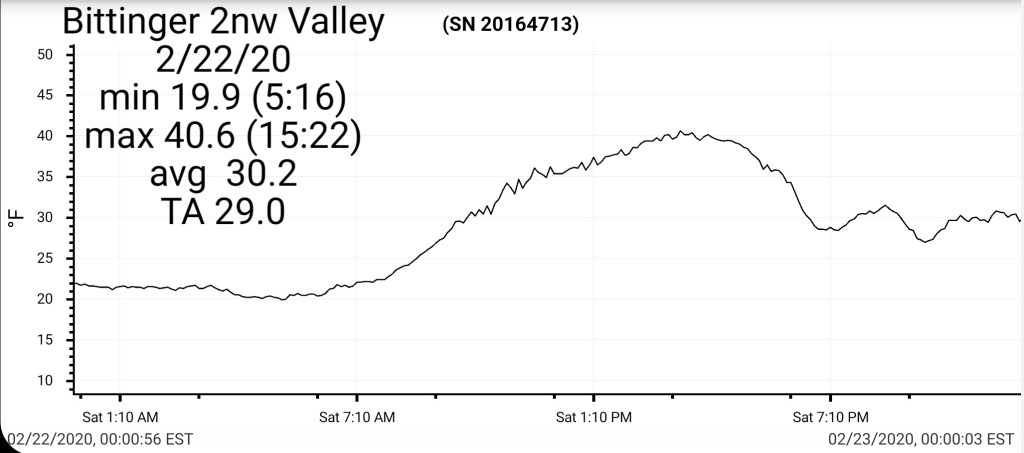
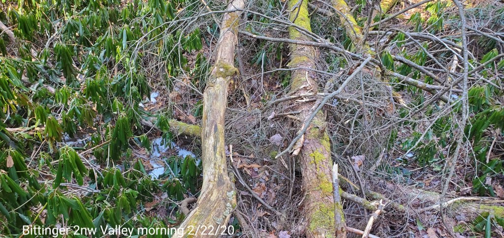
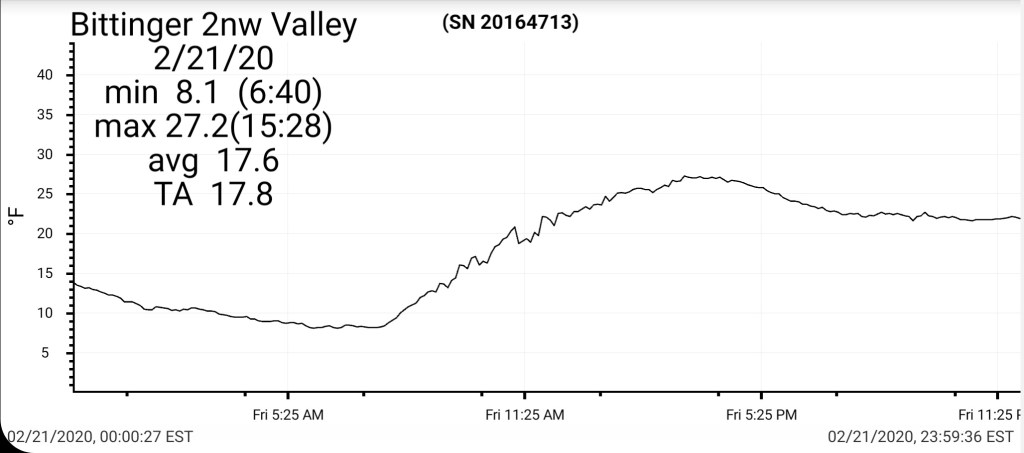
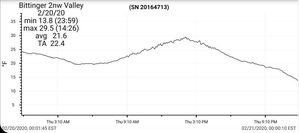
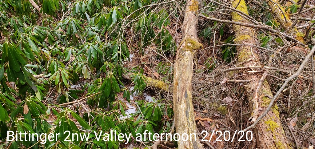
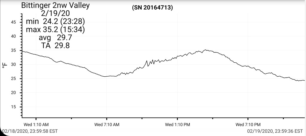
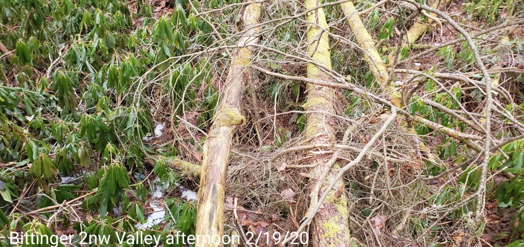
Bittinger 2nw Valley
MIN[18.8]—MAX[27.7]—AVERAGE MEAN[23.2]—TRUE AVERAGE[22.4]
New snowfall 2.7″ through the 6am boardsweep. From 6am through 10:30 1.8″ new fell, with the most from 7-9am.
Snow depth increased to 8″ at 10:30am, then settled back to 5.8″ by late day after several hours of sun and win helping settle the fluff down.
Snowfall season to date 58.5″


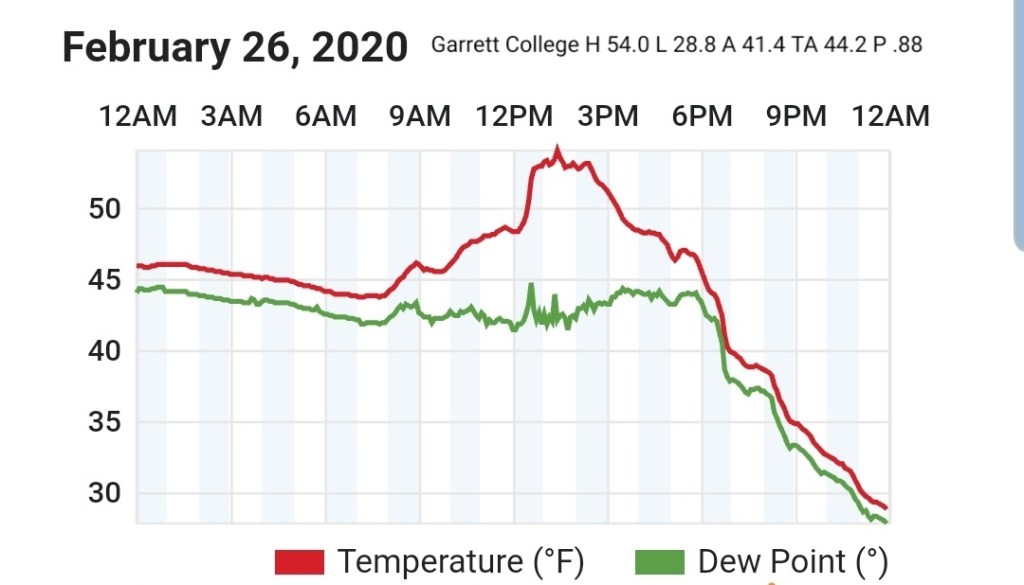
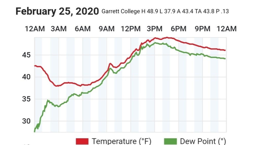
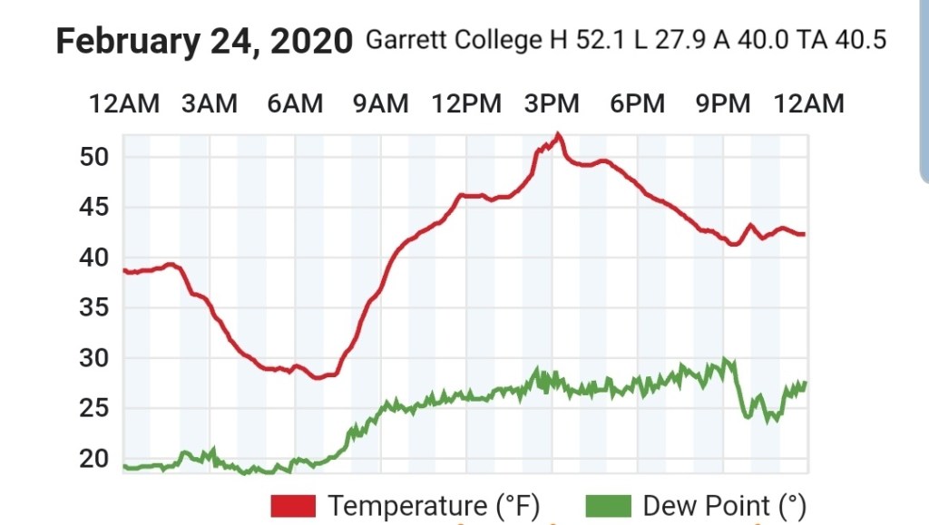
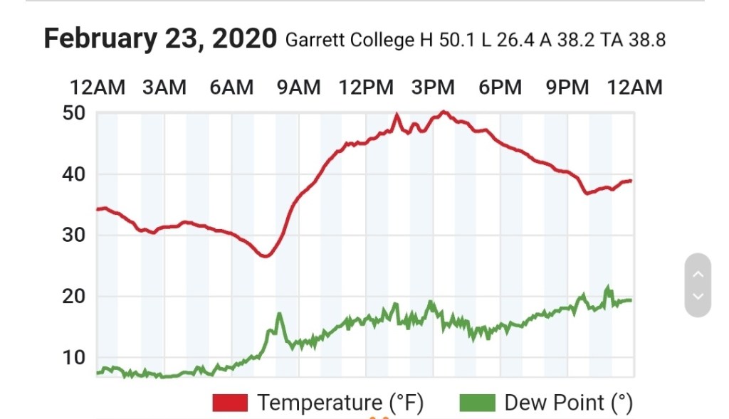
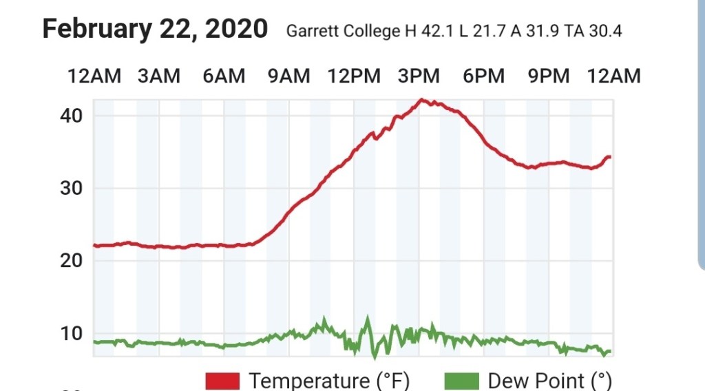
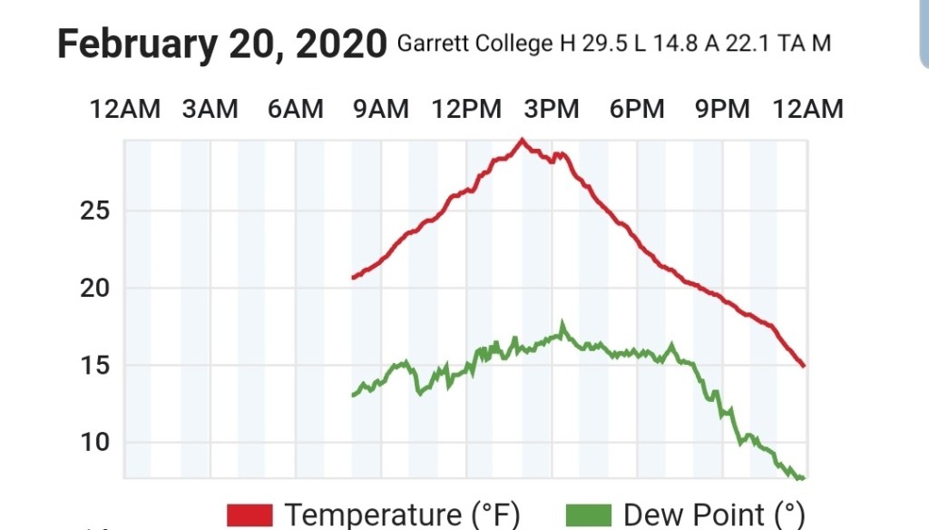
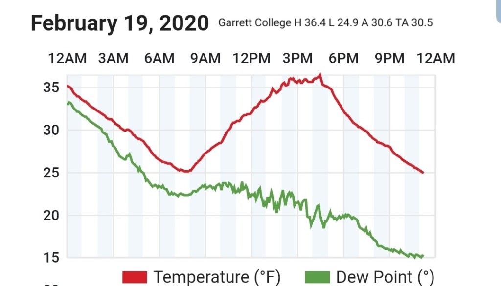
Garrett College
MIN[19.1]—MAX[25.2]—AVERAGE MEAN[22.1]—TRUE AVERAGE[21.6]—PRECIP[F]

Canaan Heights/Davis 3SE
MIN[15.0]—MAX[25.0]—AVERAGE MEAN[20.0]—PRECIP[.15]7am
New snowfall 3.9″ through 7am, snow continuing
Snow depth at 7am 10″
Snowfall season to date 78.0″
Comments by Dave Lesher at:
Temperatures steady in mid teens overnight then creeping up a little toward daybreak; light snow continuing with diminishing winds. Light snow with slowly diminishing winds continued through the day and evening. |
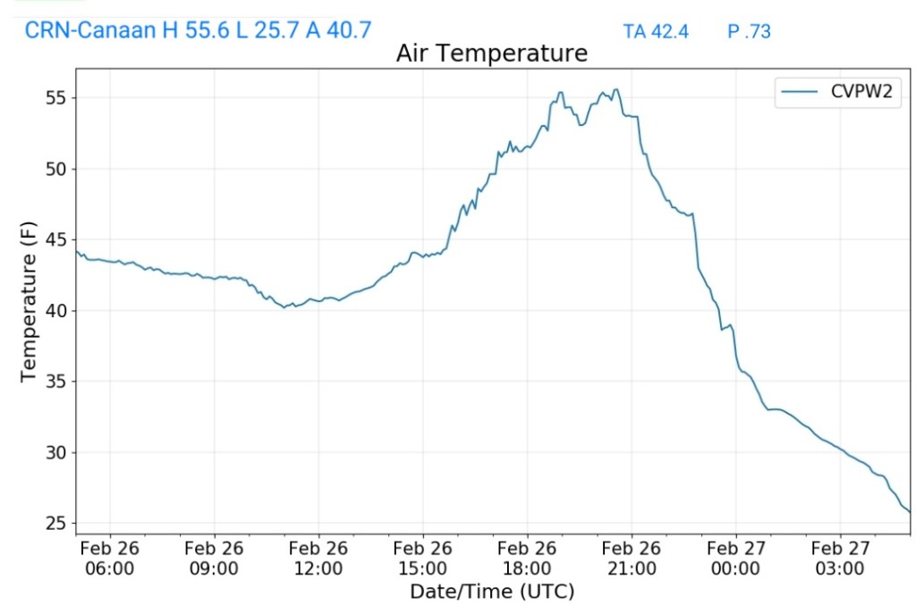
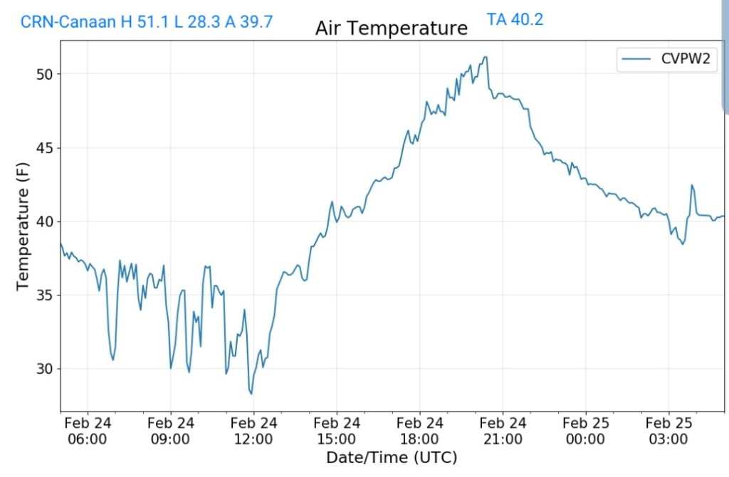
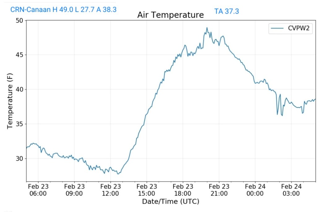
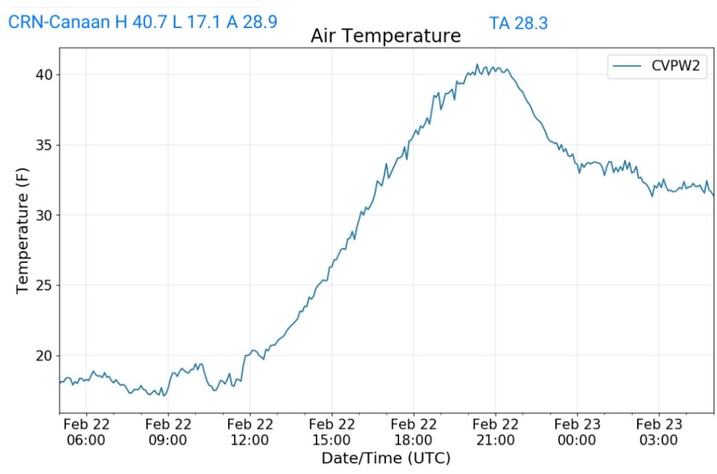
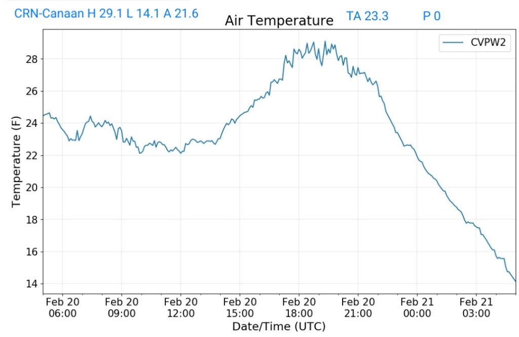
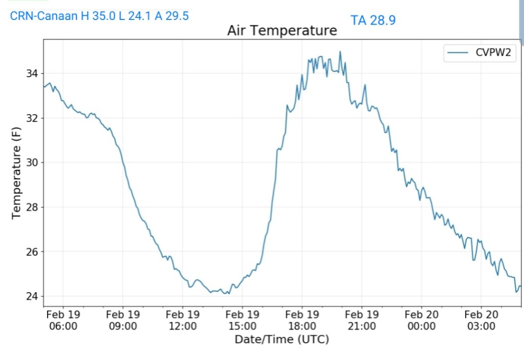
Climate Reference Network Canaan
MIN[17.2]—MAX[23.5]—AVERAGE MEAN[20.3]—TRUE AVERAGE[20.0]—PRECIP[.19]


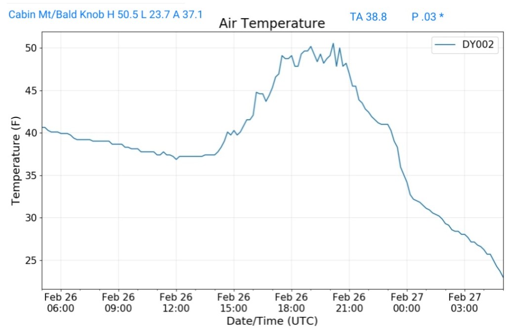
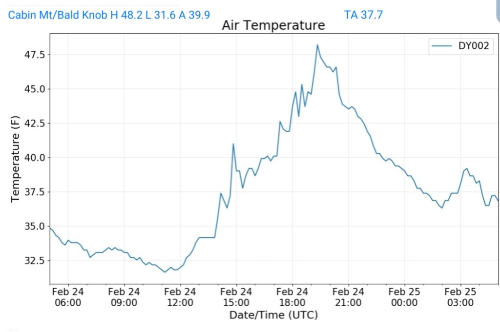
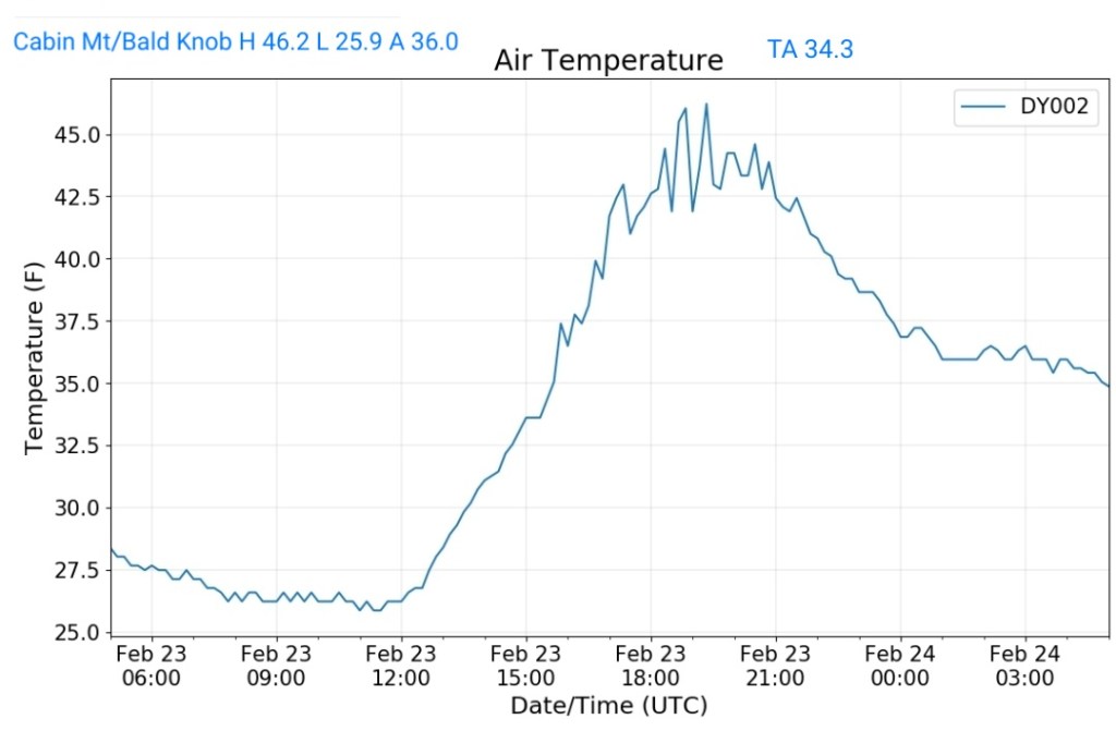
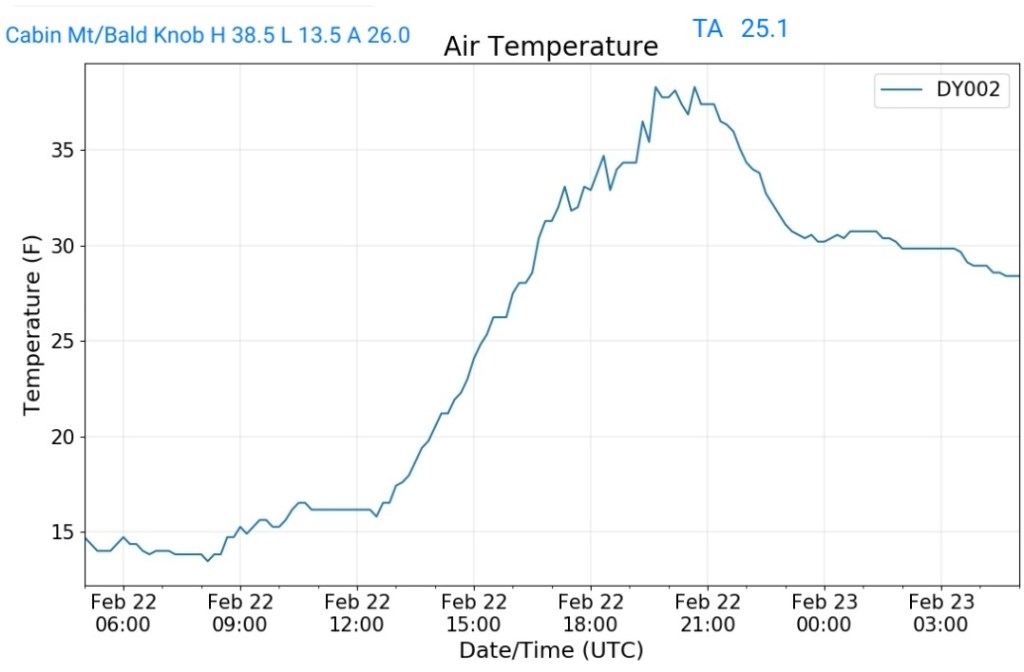
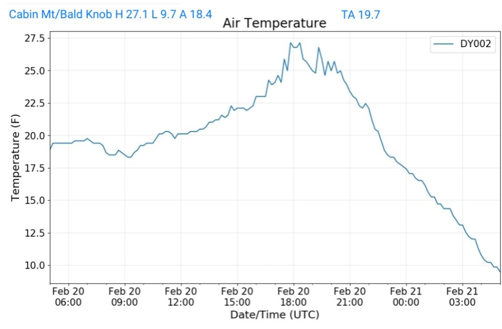
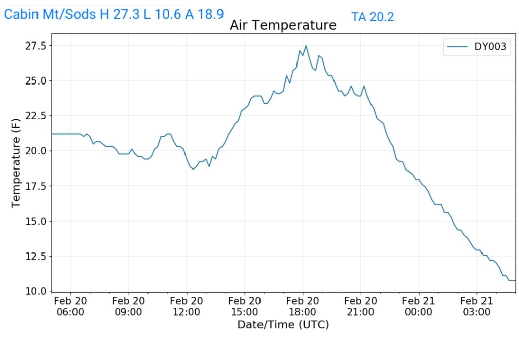
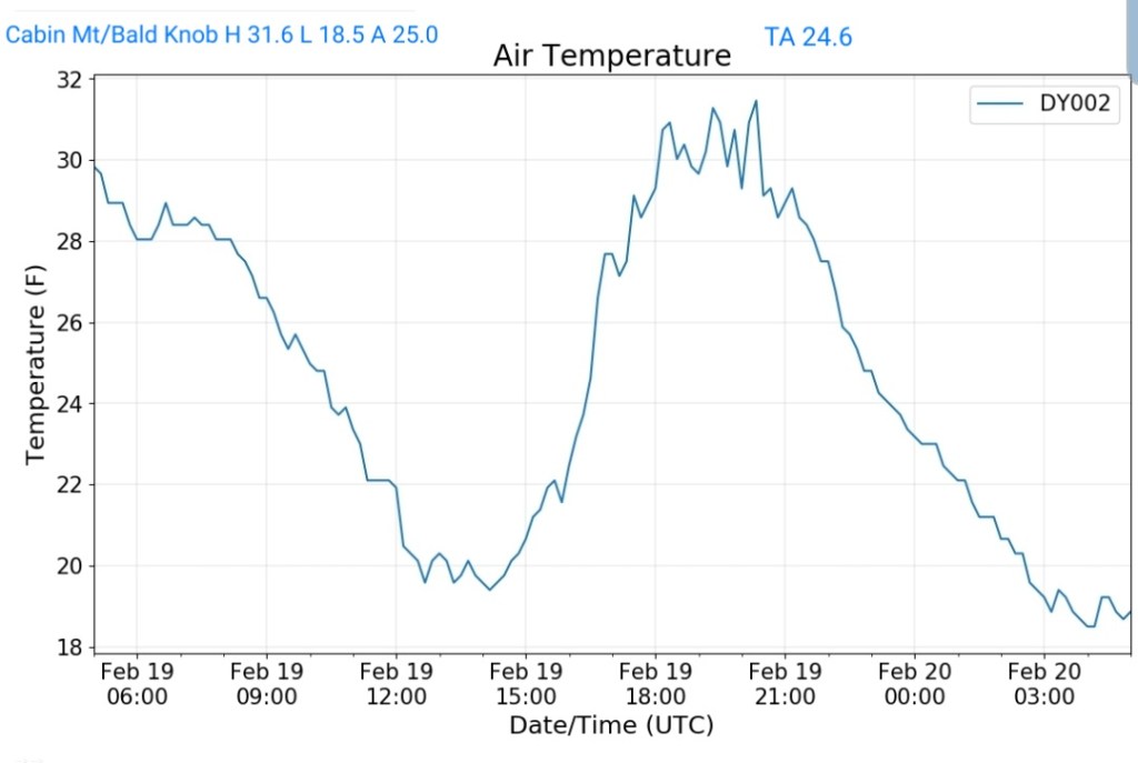
Cabin Mt at Bald Knob
MIN[13.5]—MAX[18.9]—AVERAGE MEAN[16.2]—TRUE AVERAGE[16.2]—PRECIP[F]

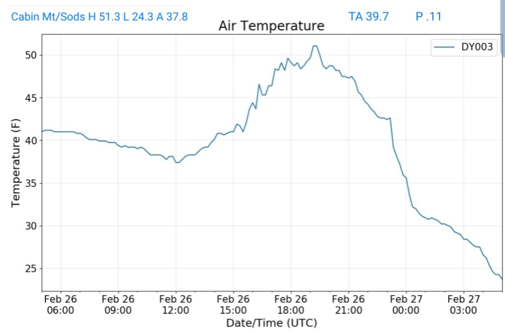
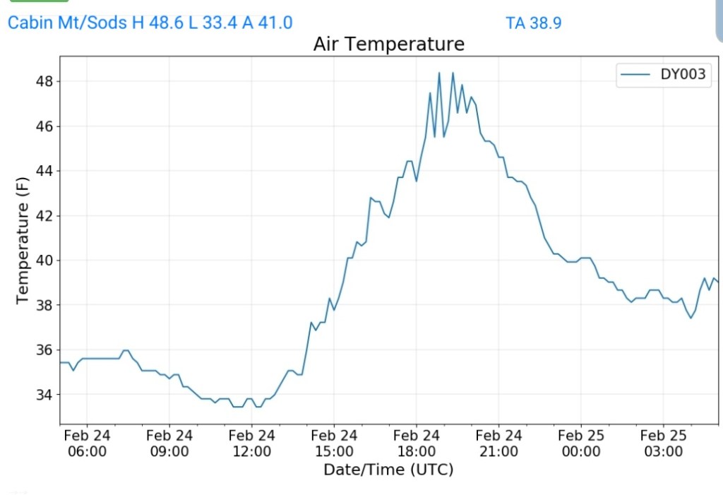
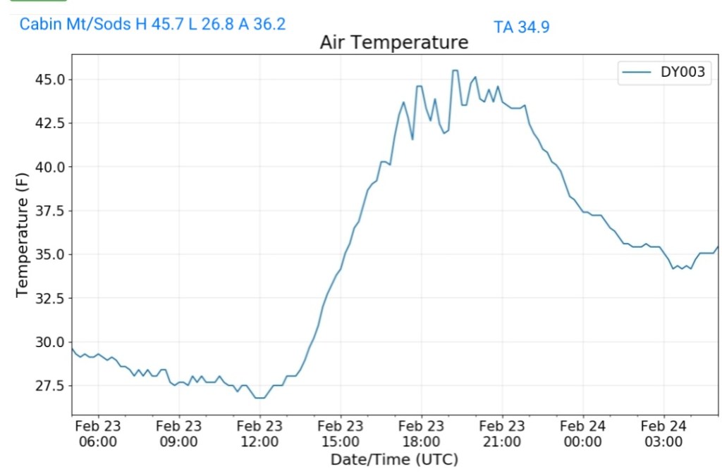
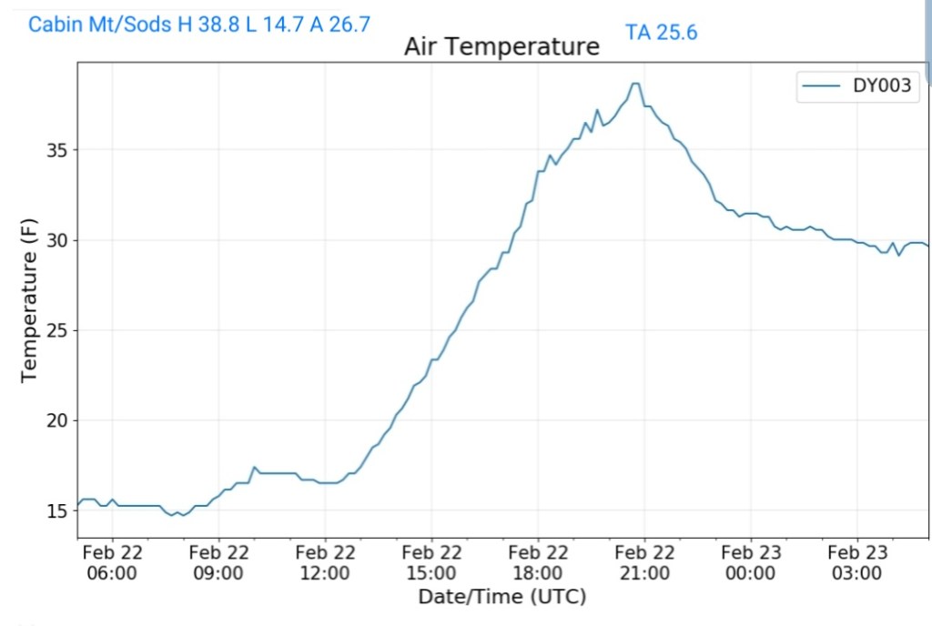
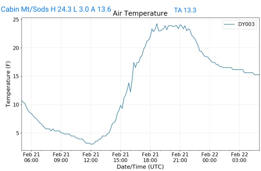
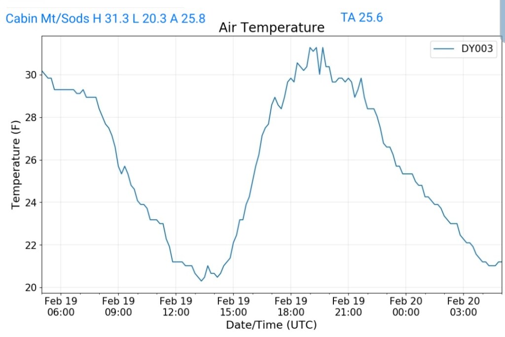
Cabin Mt-Western Sods
MIN[14.0]—MAX[21.6]—AVERAGE MEAN[17.8]—TRUE AVERAGE[17.3]—PRECIP[F]

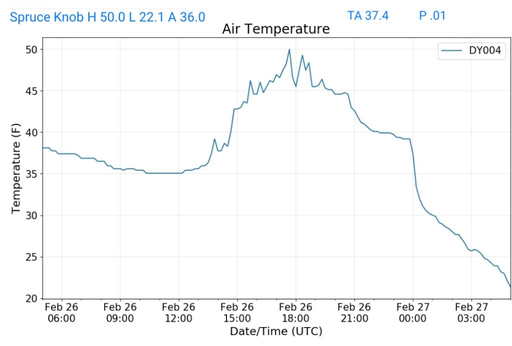
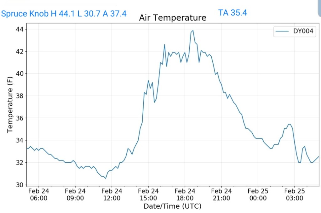
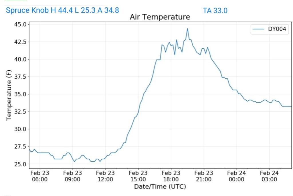
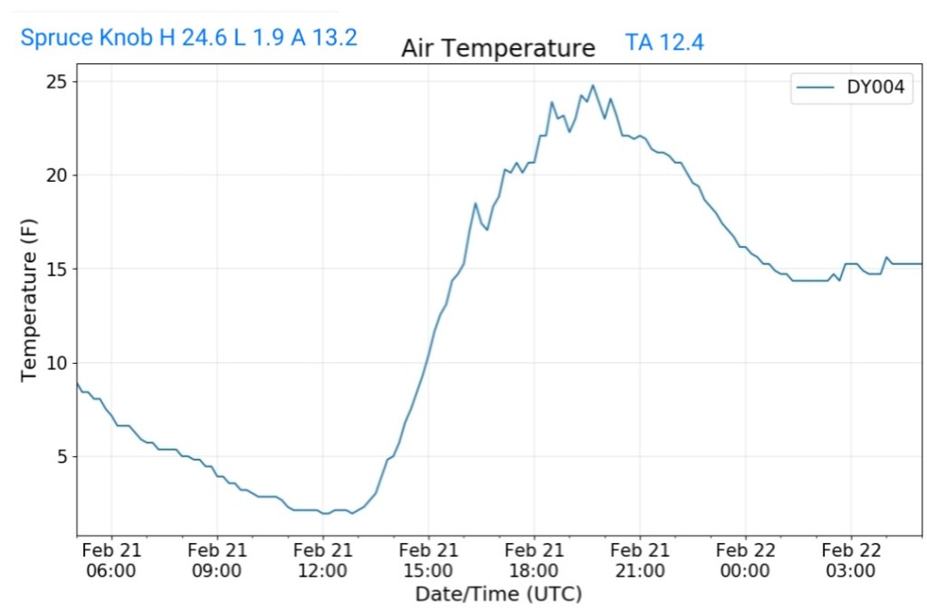
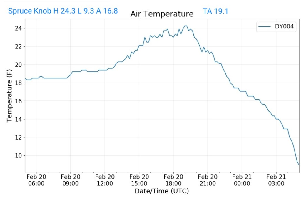
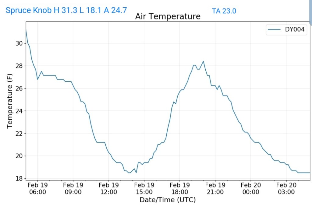
Spruce Knob
MIN[12.0]—MAX[22.6]—AVERAGE MEAN[17.3]—TRUE AVERAGE[16.5]—PRECIP[F]

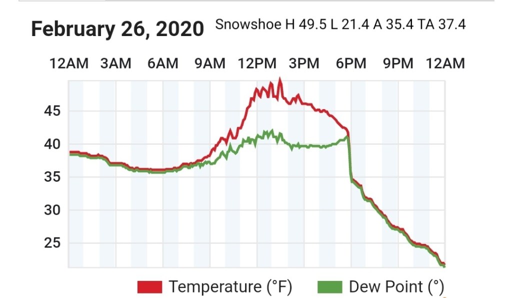
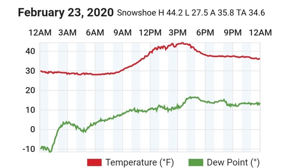
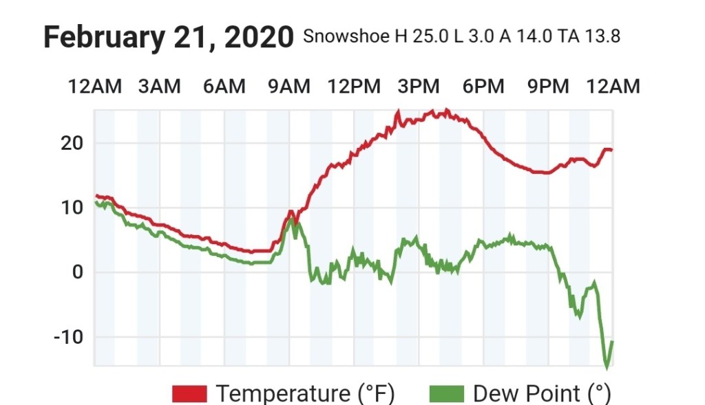
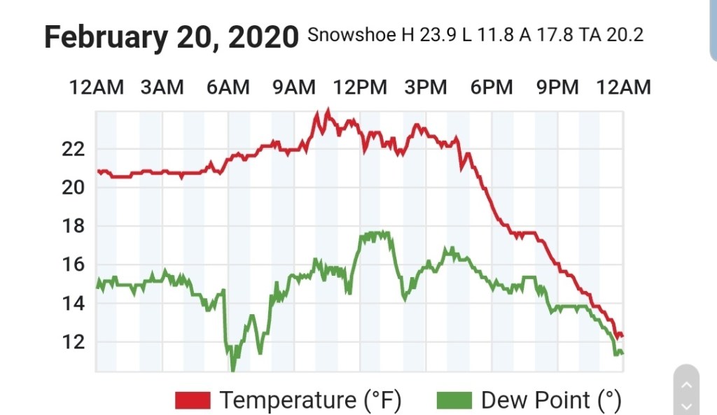
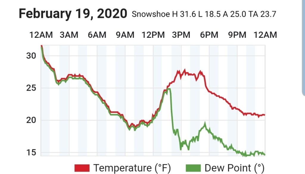
Snowshoe
MIN[13.1]—MAX[21.0]—AVERAGE MEAN[17.0]—TRUE AVERAGE[16.8]

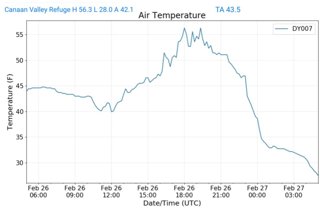
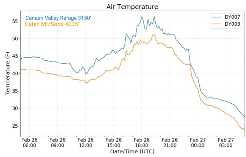
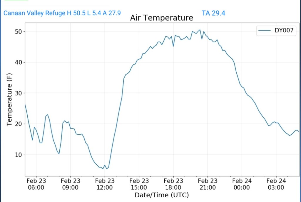
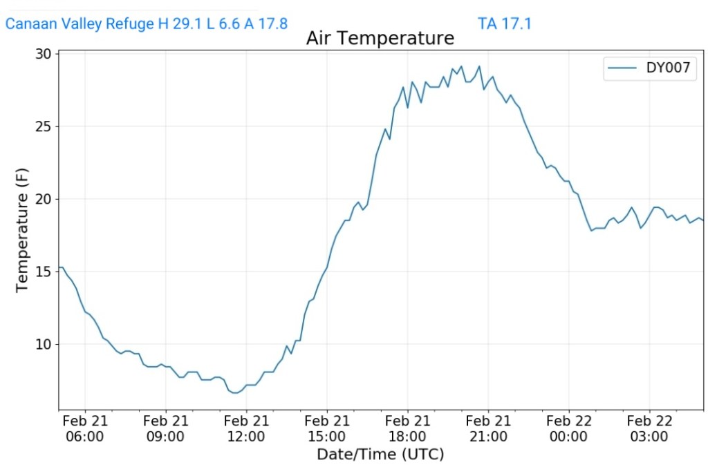
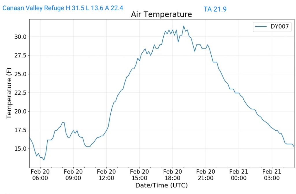
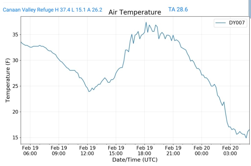
Canaan Valley Refuge
MIN[18.3]—MAX[24.8]—AVERAGE MEAN[21.5]—TRUE AVERAGE[21.3]

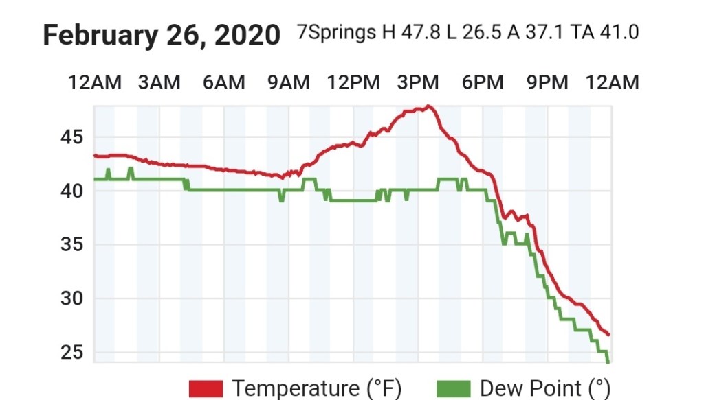
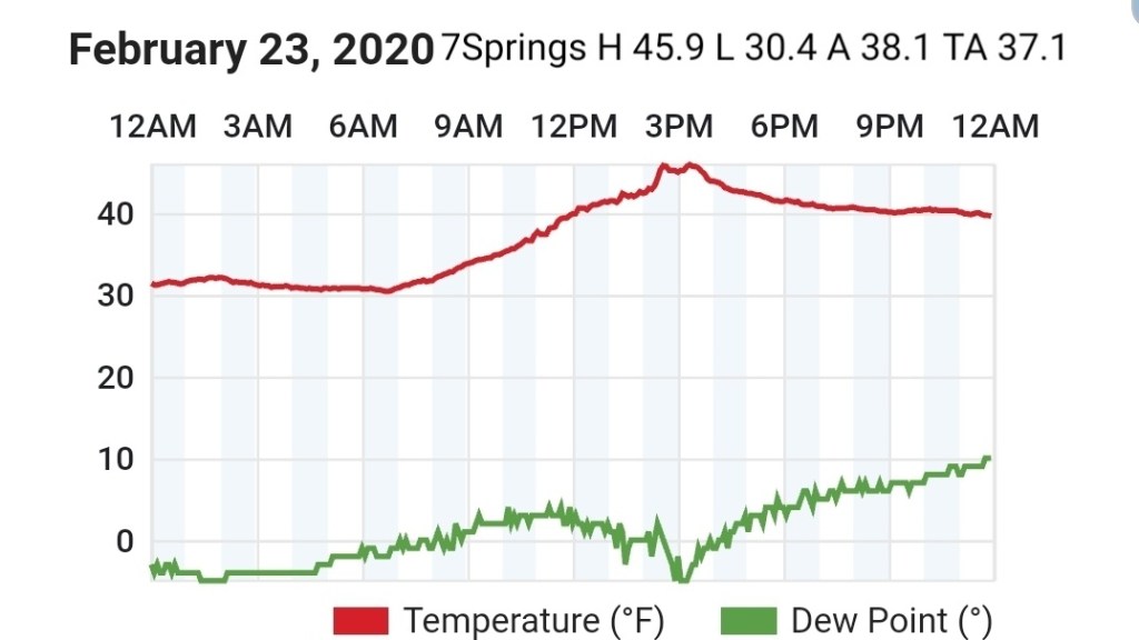
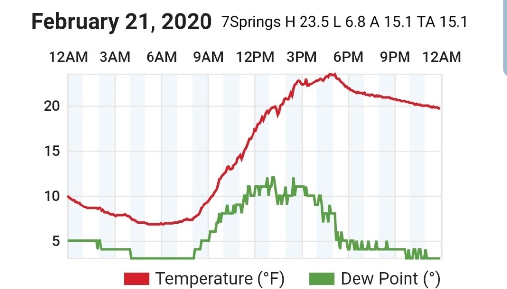
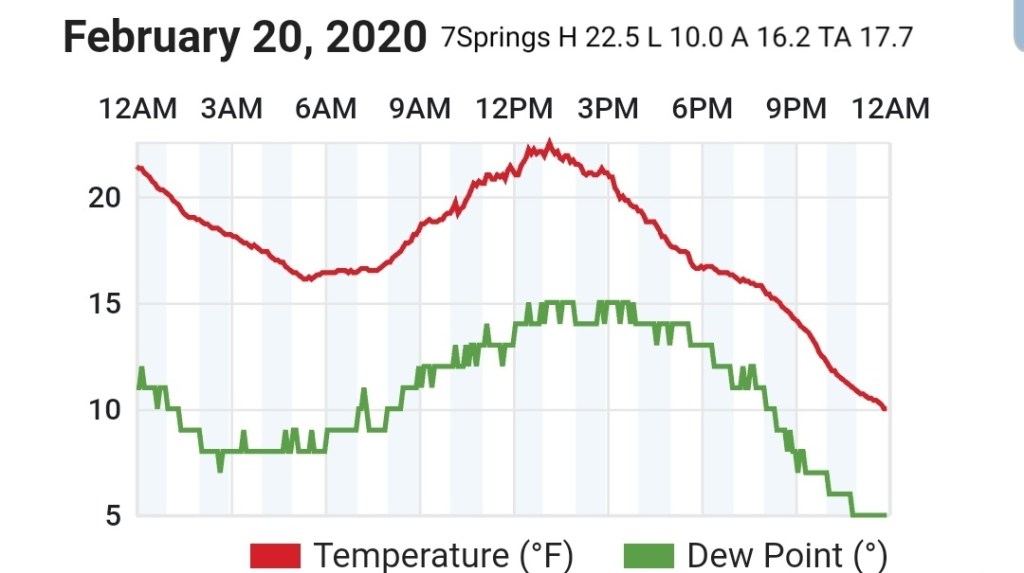
7Springs
MIN[14.7]—MAX[21.6]—AVERAGE MEAN[18.0]—TRUE AVERAGE[17.6]

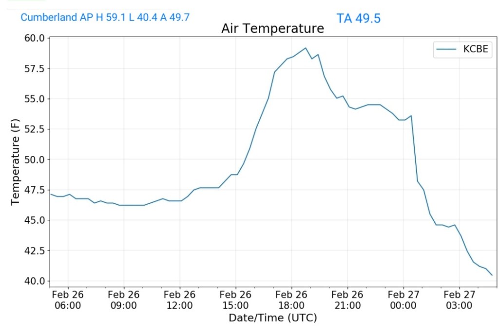
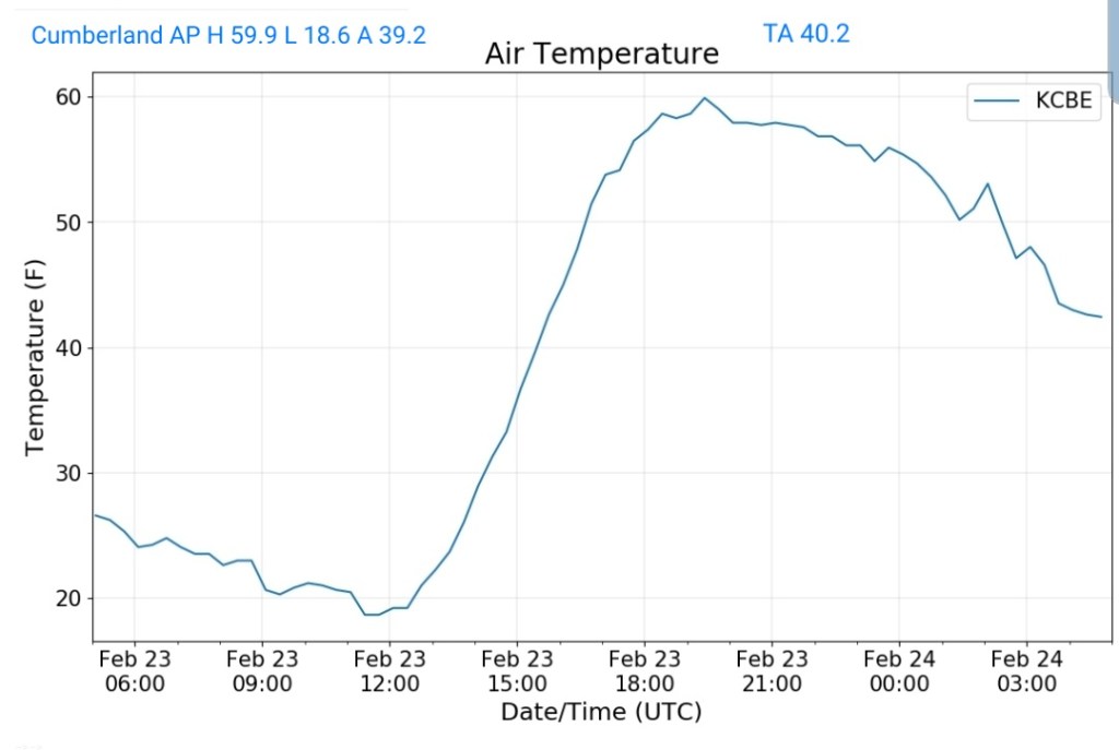
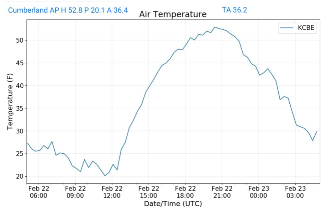
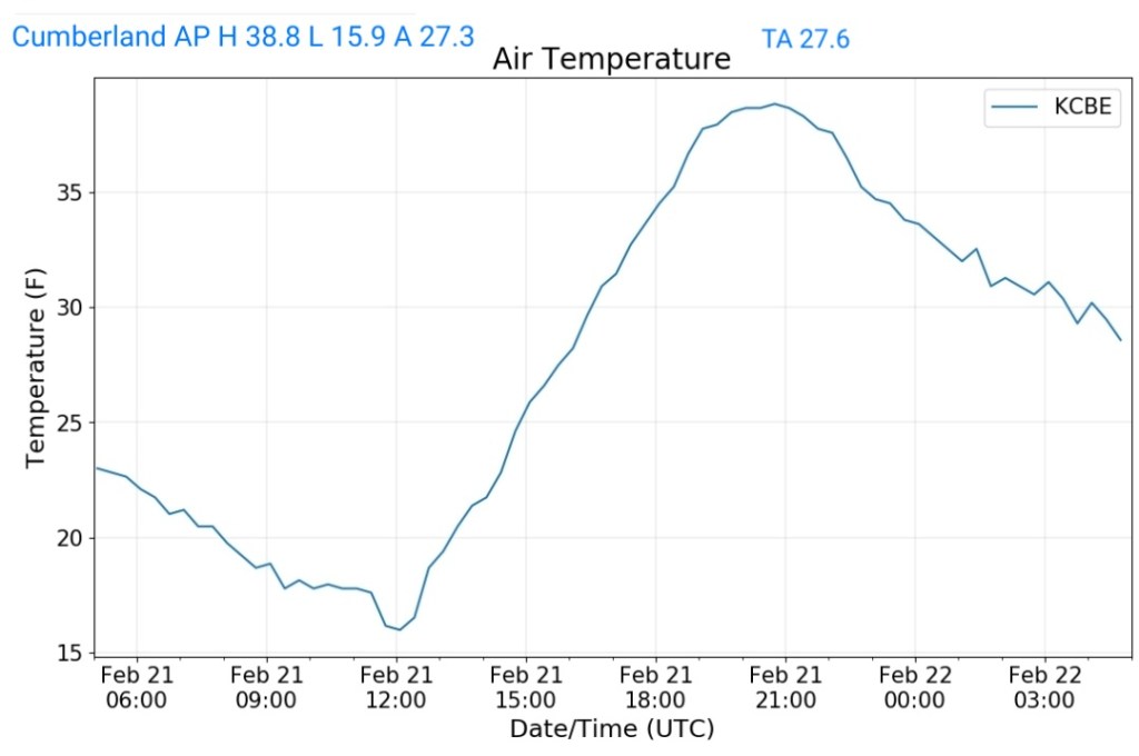
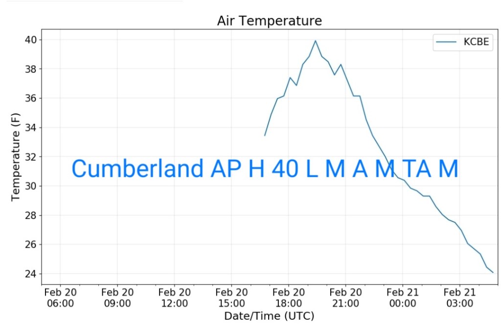
Cumberland Airport

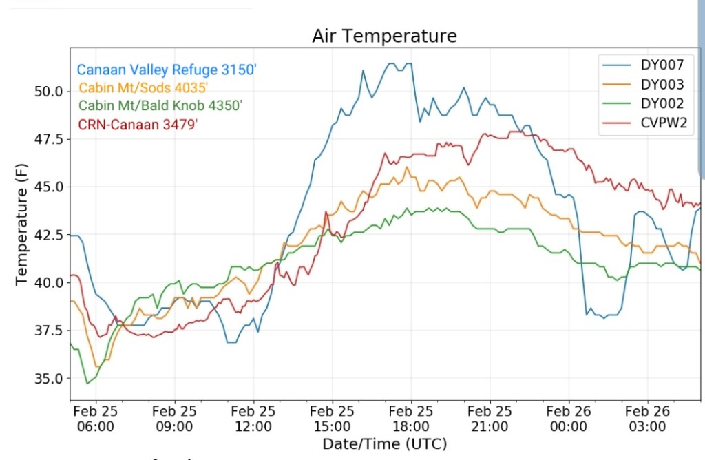
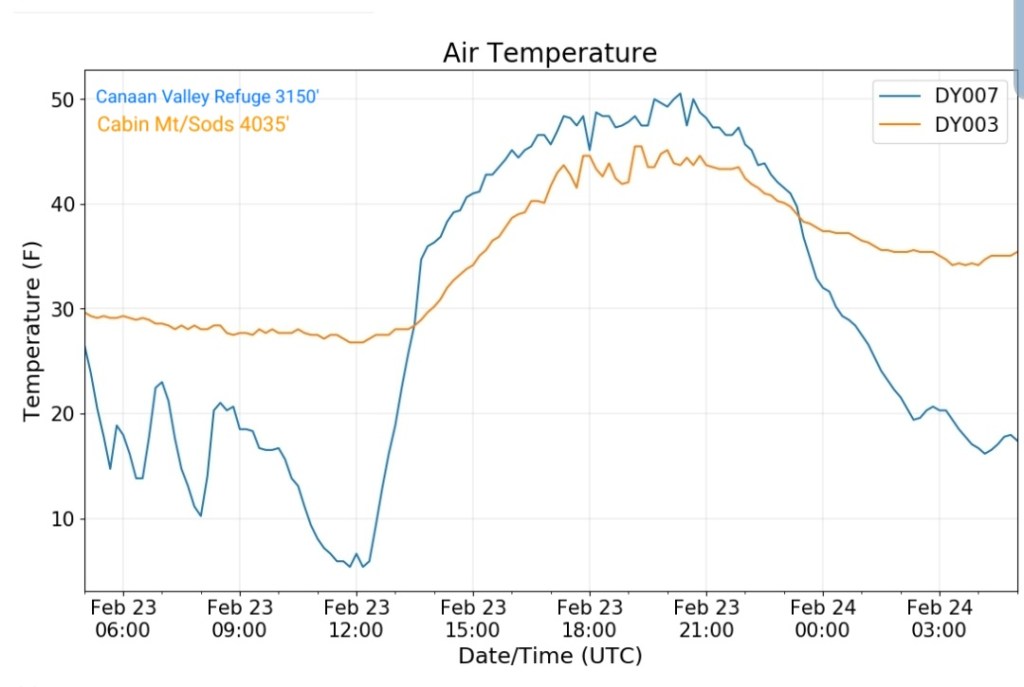
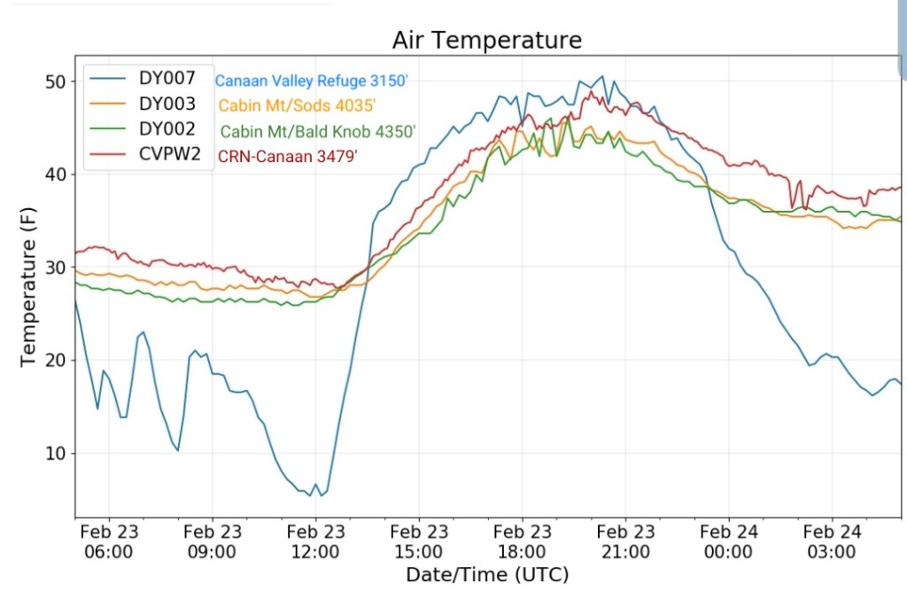
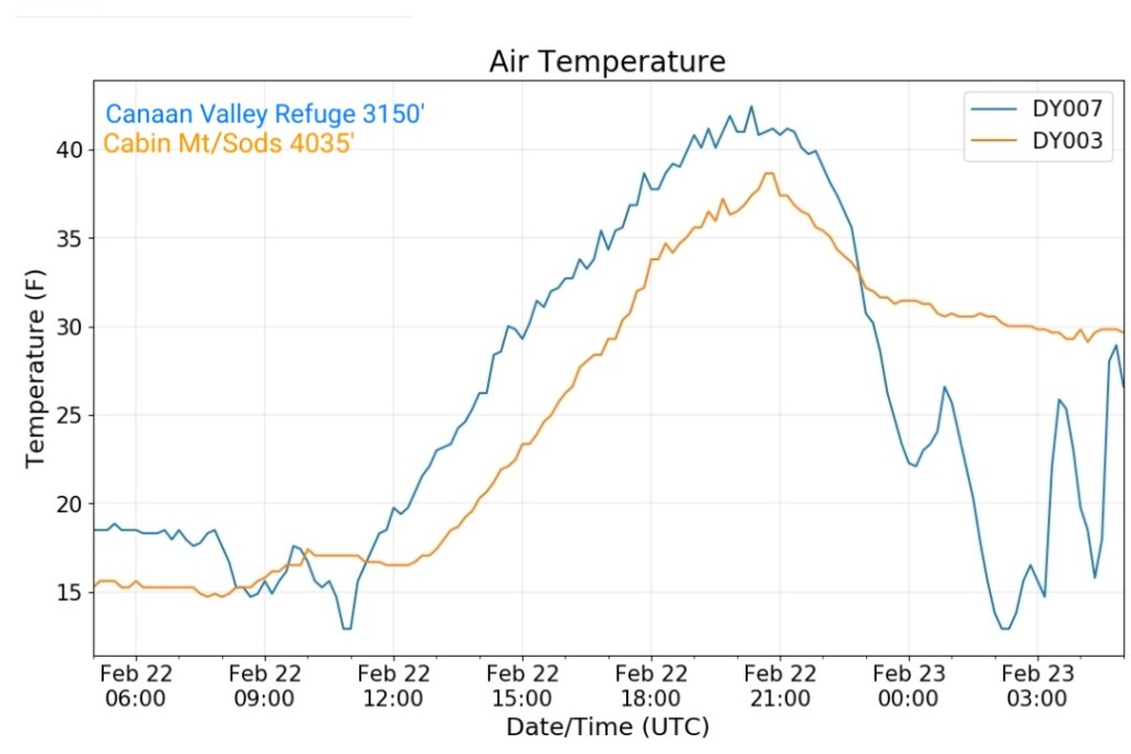
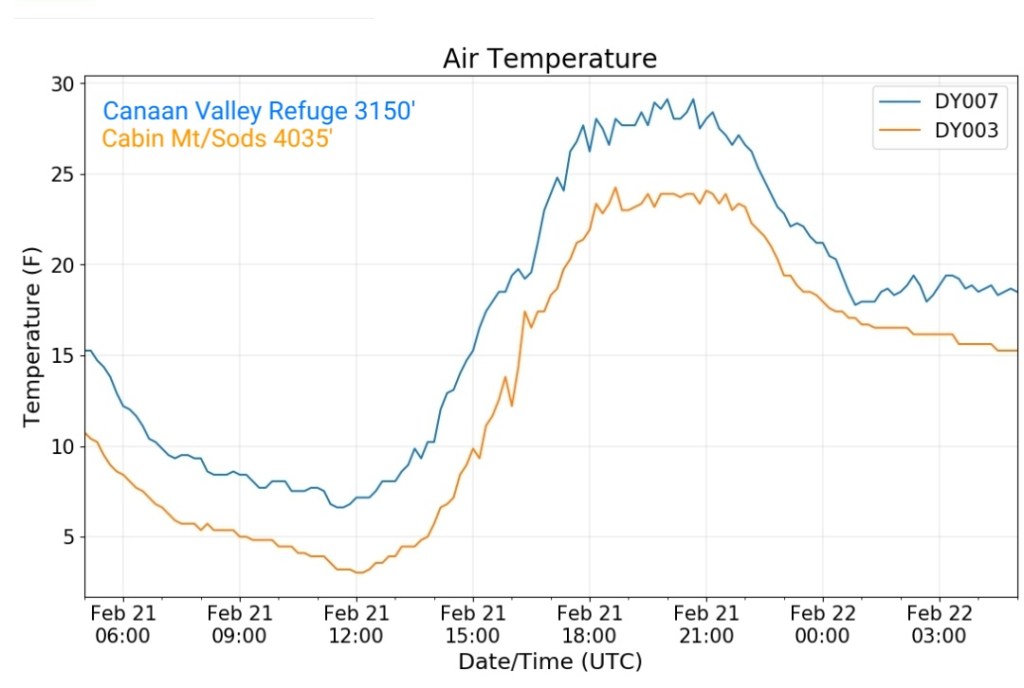
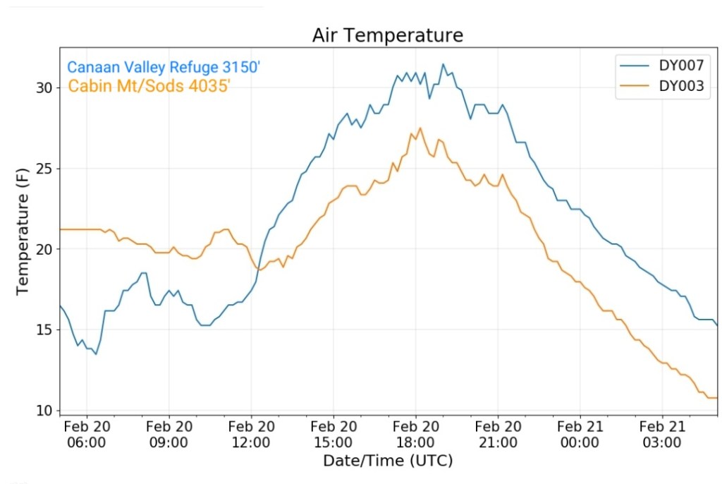
The Valley vs Cabin Mt

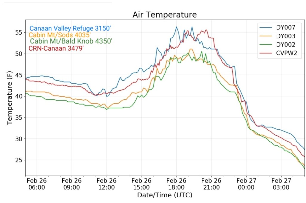
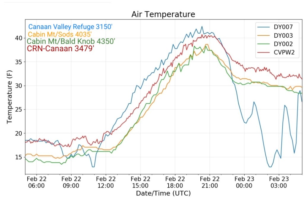
Canaan area temps
Comparison view

RTMA
Radar
Satellite
Flow
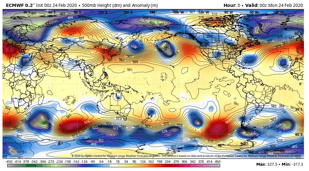
Surface features and 500mb height anomalies and flow


Keysers Ridge at 9:30 in the midst of the morning snowy period that left main roads snow covered