February 1, 2020
Feb 1(Sat)
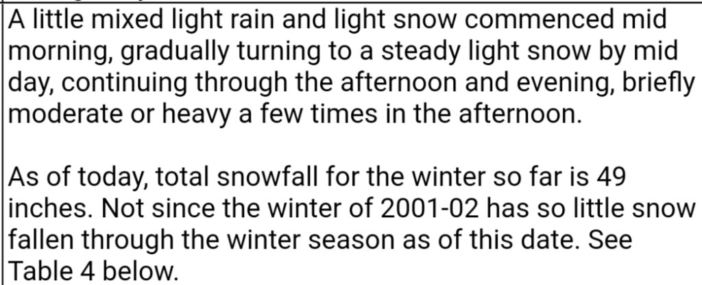
Cloudy, drizzle to some snow in morning. No stickage locally, above 3500′ in Wv today snow did stick. Periods of snow ther . When precip went light here, drizzle mixed in. Snow did get going and accumulating after nightfall area wide.
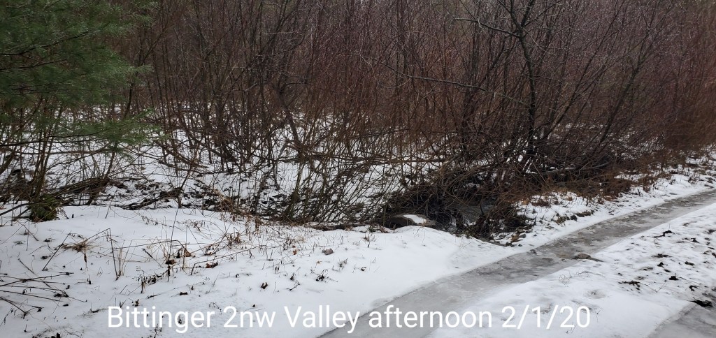
Bittinger 2nw Valley
MIN[30.1]—MAX[36.0]—AVERAGE MEAN[33.0]—TRUE AVERAGE[33.2]
Snowfall- trace
Snowfall season to date 35.8″

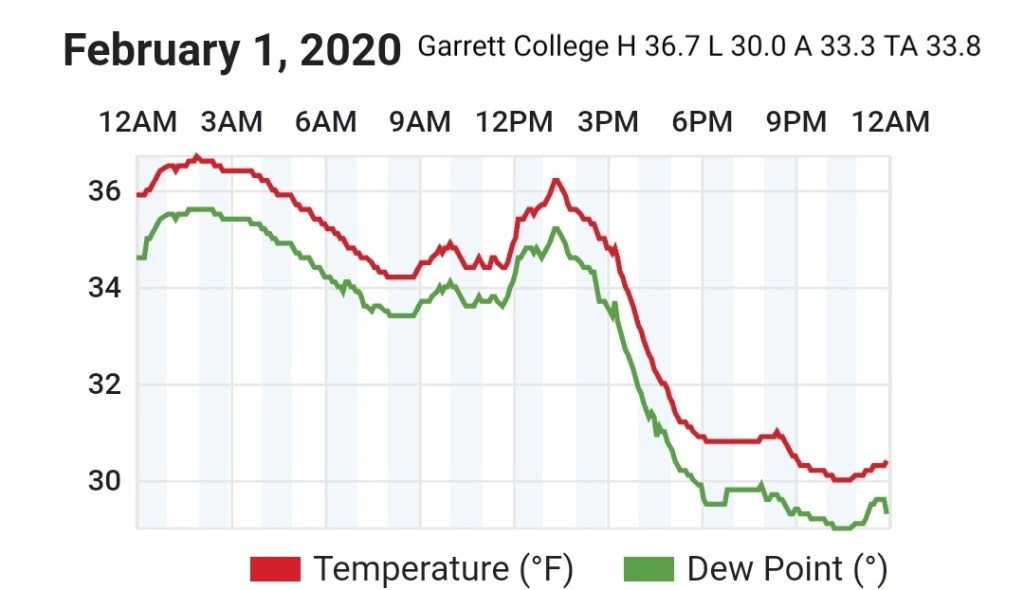
Garrett College
MIN[30.0]—MAX[36.7]—AVERAGE MEAN[33.3]—TRUE AVERAGE[33.8]—PRECIP[.12]+F
Canaan Heights/Davis 3SE
MIN[27.0]—MAX[35.0]—AVERAGE MEAN[31.0]—PRECIP[.02]7am
Today’s accumulation will be added in tomorrow
Snowfall season to date 48.8
Comments by Dave Lesher at
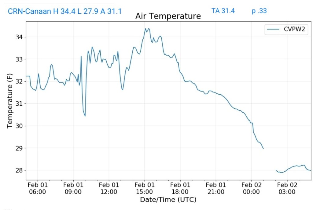
Climate Reference Network Canaan
MIN[27.9]—MAX[34.4]—AVERAGE MEAN[31.1]—TRUE AVERAGE[31.4]—PRECIP[.33]
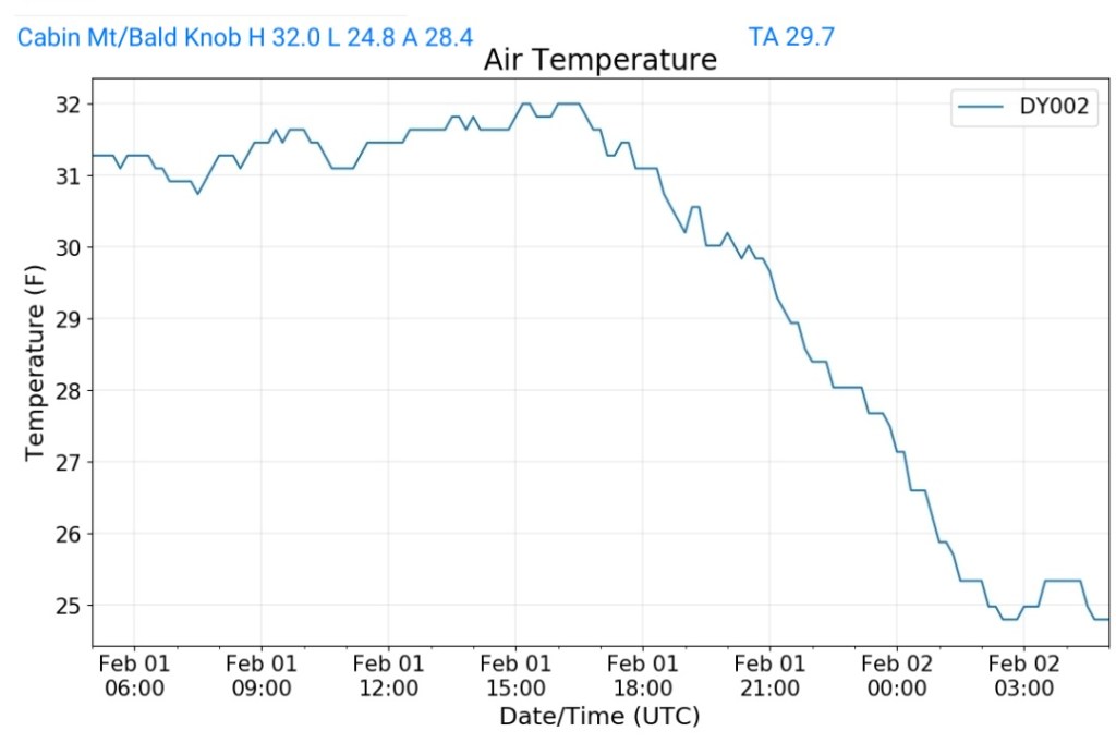
Cabin Mt at Bald Knob
MIN[24.8]—MAX[32.0]—AVERAGE MEAN[28.4]—TRUE AVERAGE[29.7]—PRECIP[F]
Cabin Mt-Western Sods
MIN[25.7]—MAX[32.9]—AVERAGE MEAN[29.3]—TRUE AVERAGE[30.3]—PRECIP[.04-May been melt or light liquid precip before turning to all snow]

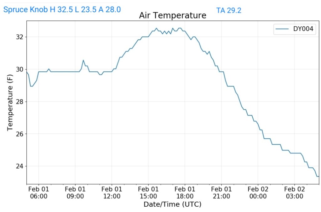
Spruce Knob
MIN[23.5]—MAX[32.5]—AVERAGE MEAN[28.0]—TRUE AVERAGE[29.2]—PRECIP[.02——]
Snowshoe
MIN[24.1]—MAX[31.8]—AVERAGE MEAN[27.9]—TRUE AVERAFE[29.5]

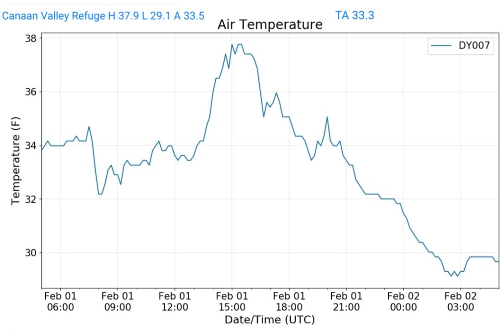
Canaan Valley Refuge
MIN[29.1]—MAX[37.9]—AVERAGE MEAN[33.5]—TRUE AVERAGE[33.3]
7Springs
NO DATA
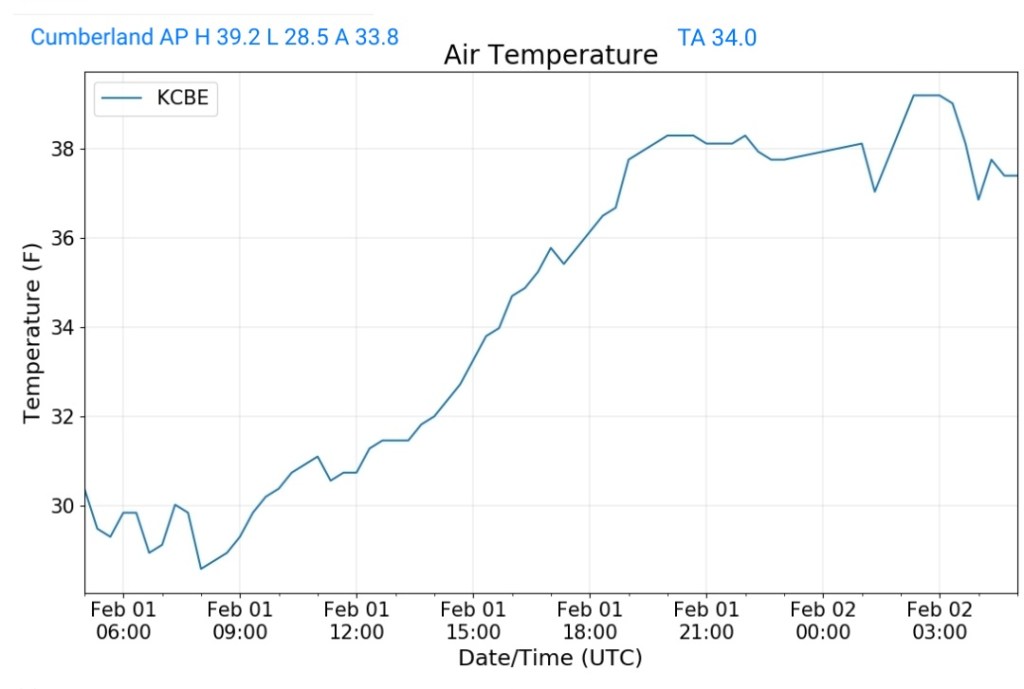
Cumberland Airport
MIN[28.5]—MAX[39.2]—AVERAGE MEAN[33.8]—TRUE AVERAGE[34.0]
RTMA
Radar
Satellite
Flow
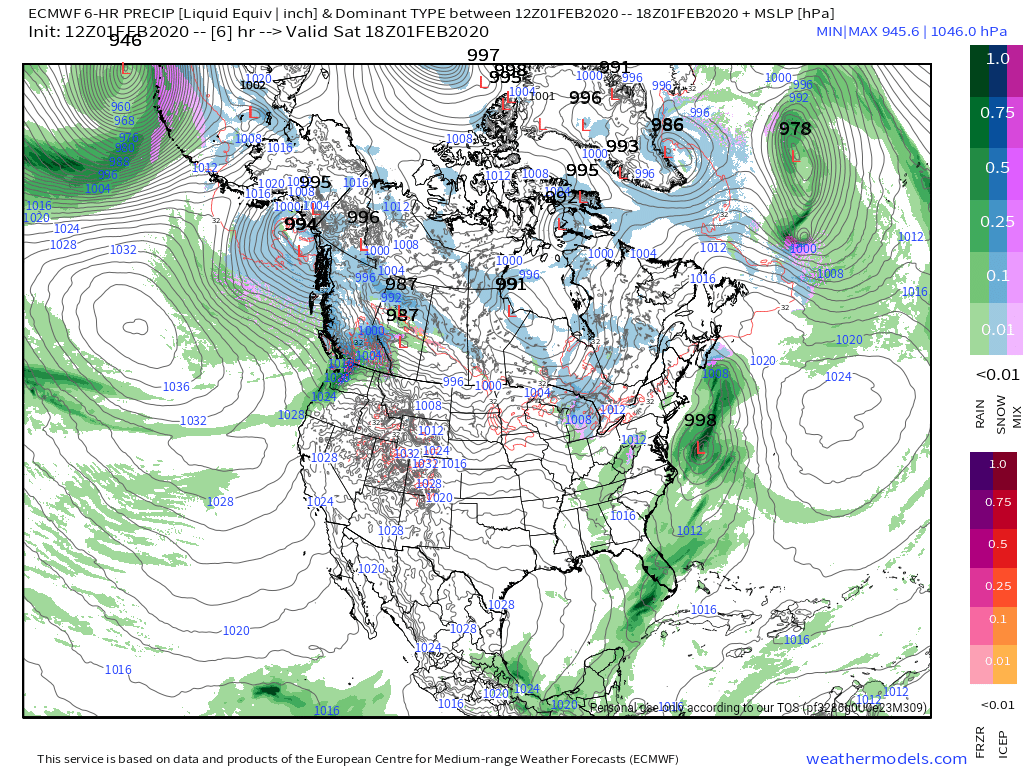
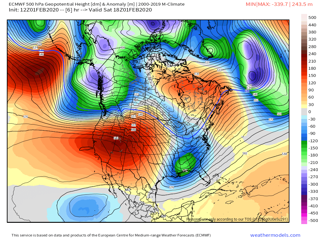
Surface features and 500mb height anomalies and flow
Makes no sense…..
Post generated 8:30am 2/1/20
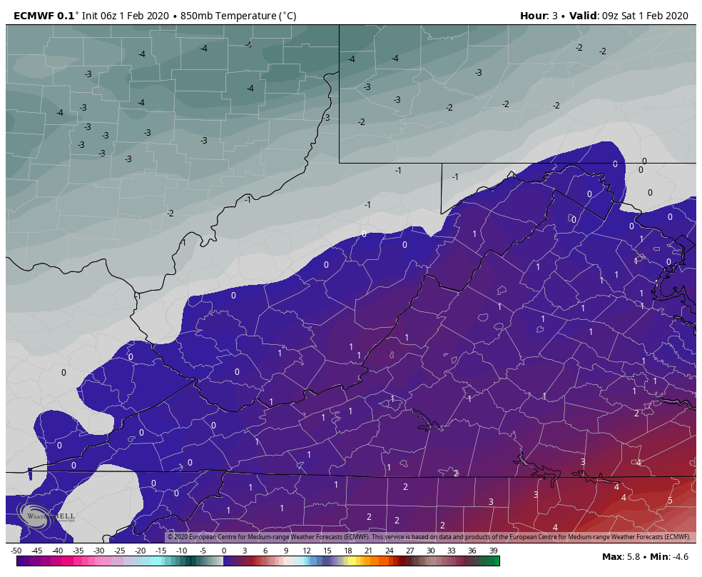
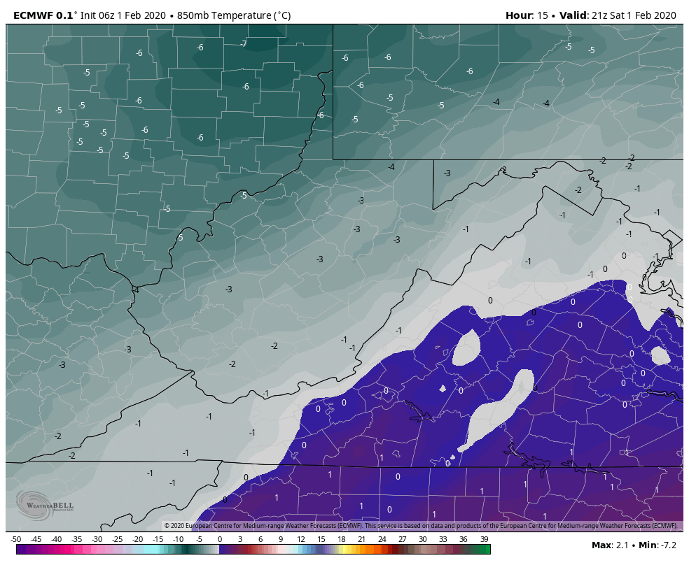
Yesterday I mentioned checking this morning to see of models are initializing ok. They look to be. There has been NO snow overnight, models NEVER had any snow overnight or early morning. Yet, forecast have. The official NWS forecast has had snow early and then I was further confused. The NWS forecast has snow showers likely this morning, changing to snow and rain mixed this afternoon. What? This morning supports liquid, snow mix, this afternoon supports snow, is more in line with reality…heavier precip should be primarily snow across the high ground 2600-3000’+


Under light precip and 850s at and plus 0 this morning it’s going to snow??? But as the precip picks up as we go through the day and 850s go to -2 to -3 it rains??? That’s not how it works.
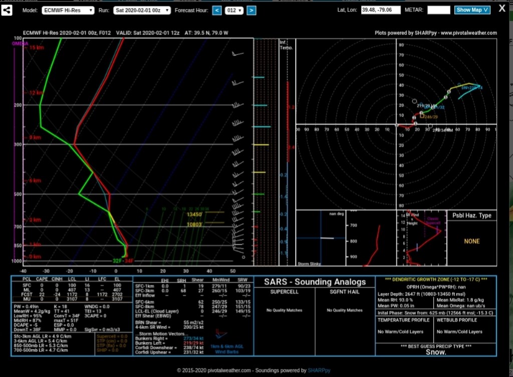
And the soundings
Sounding 1 supports some liquid this morning as we are seeing with the light precip
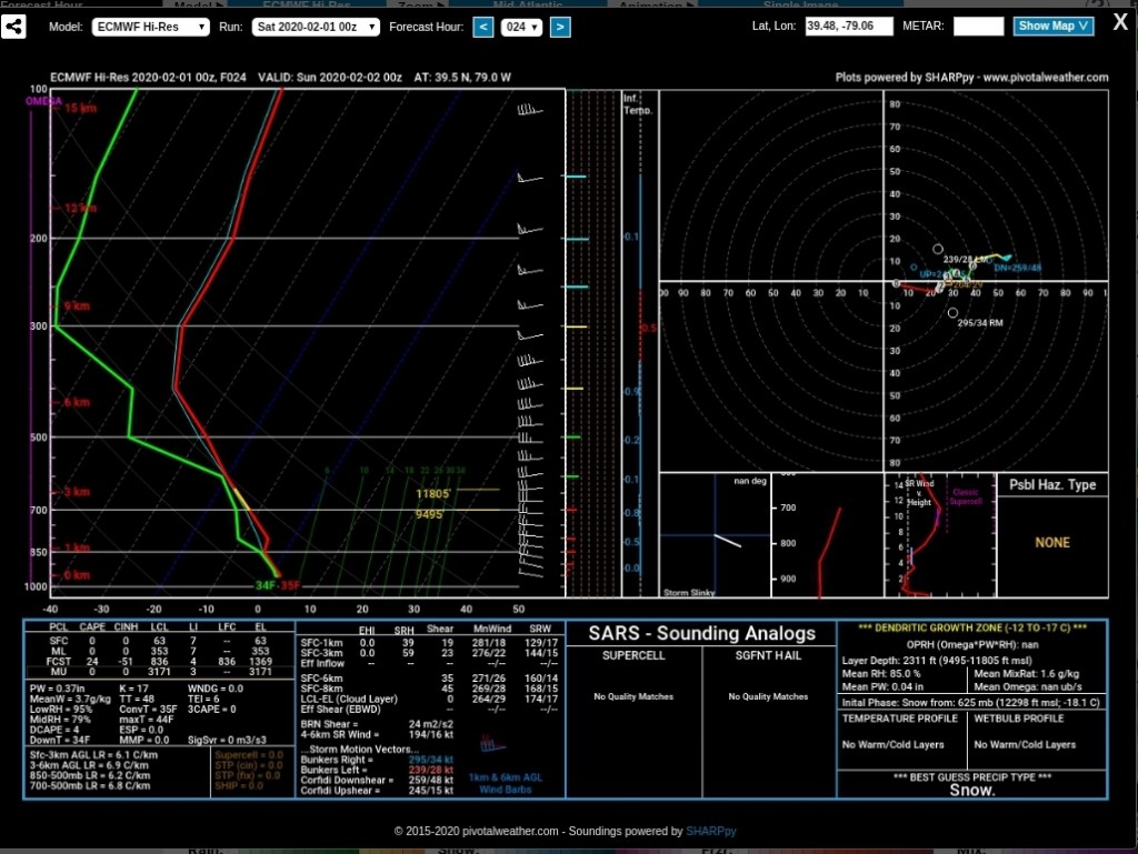
Sounding 2 supports snow this afternoon/evening
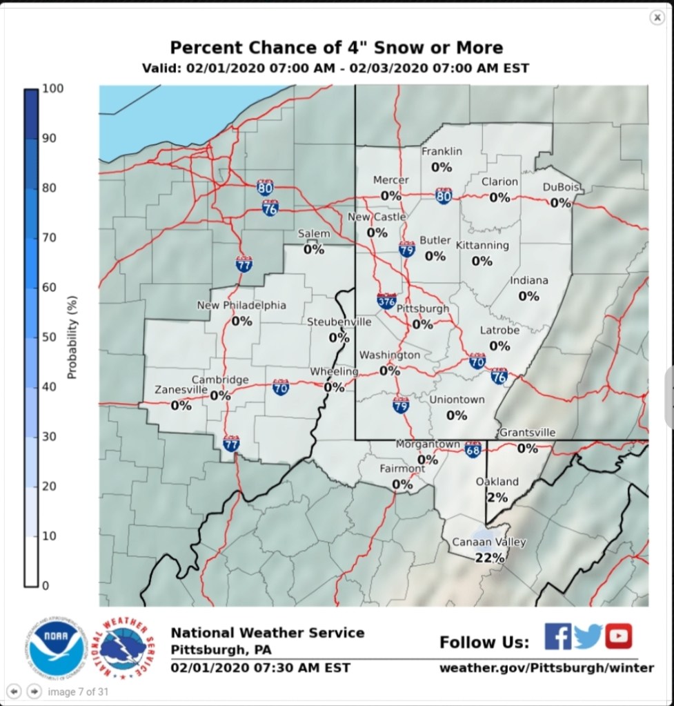
so yesterday the forecast had a 0% chance of 4″ in Canaan. All models supported the possibility of it. Now this morning the forecast has a 22% chance. The models have held steady eddy.
4% chance then

4″ chance now- nothing on models has changed.
Snowfall off the models- comparisons to yesterday can be seen off previous post.
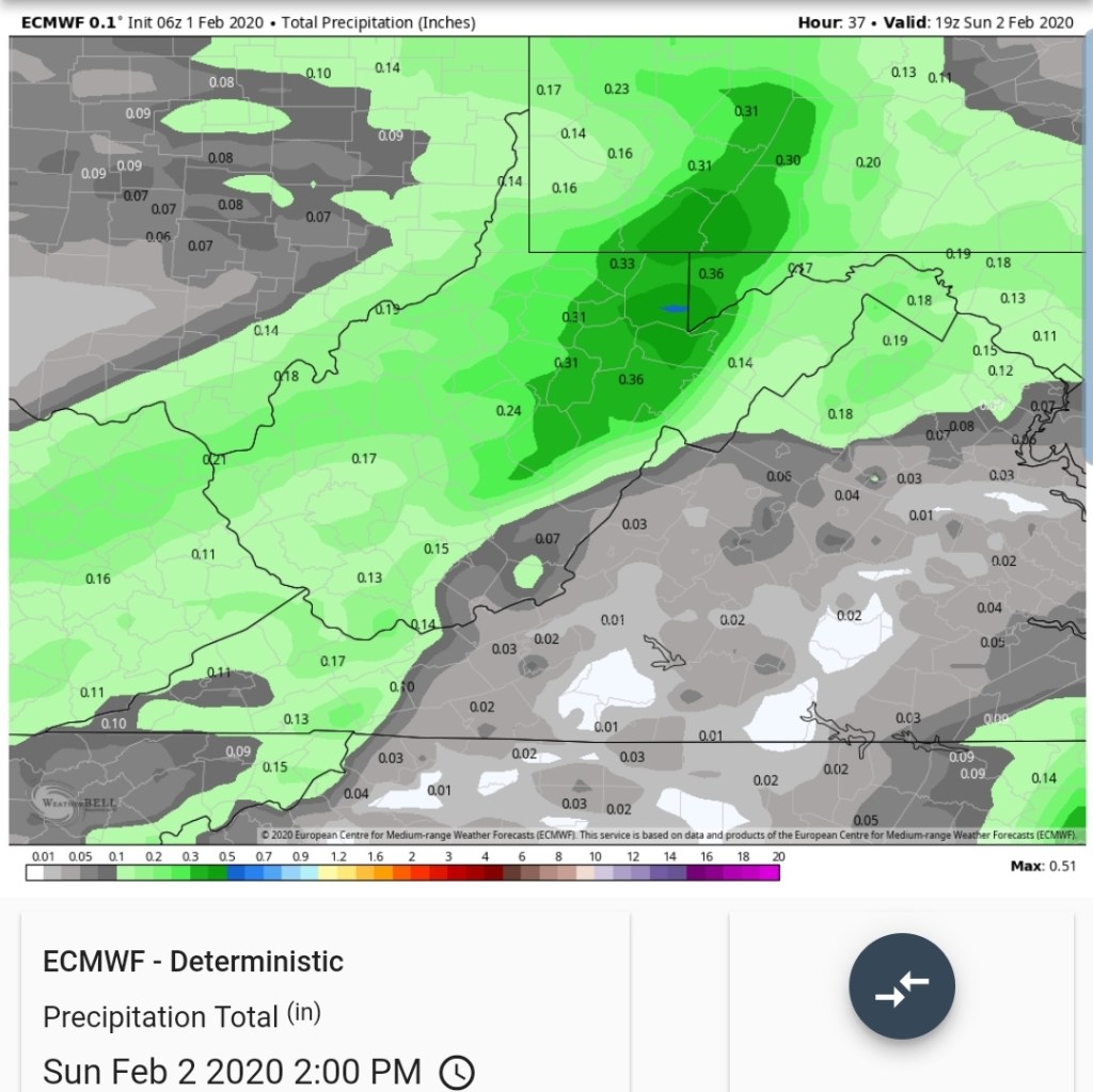
6z ECMWF
KUCHERA

10 to 1
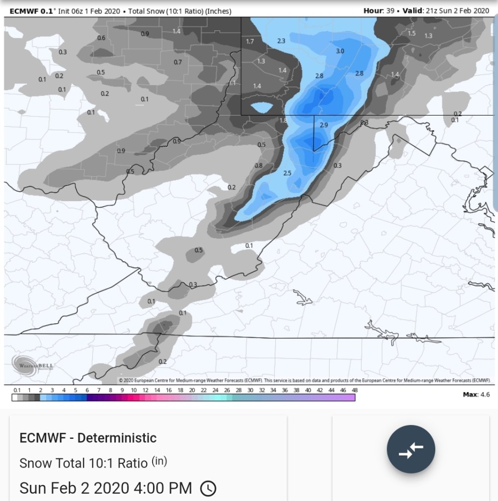
Total qpf, and that first tenth of precip doesn’t even arrive until this afternoon! That will be in snow form across the high ground. 2500-3000’+
6z GFS
KUCHERA

10 TO 1
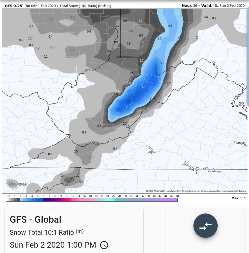
Total qpf, again it supports drizzle this morning as the precip does not increase until this afternoon!

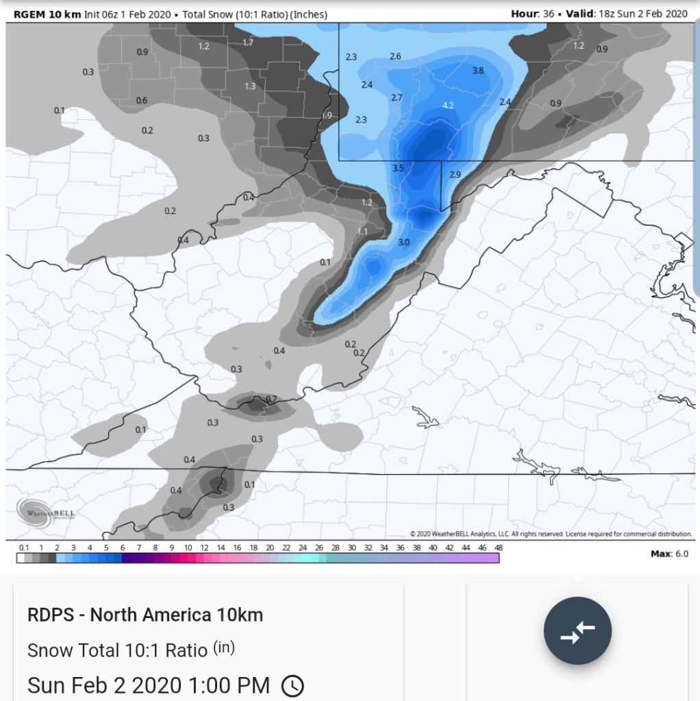
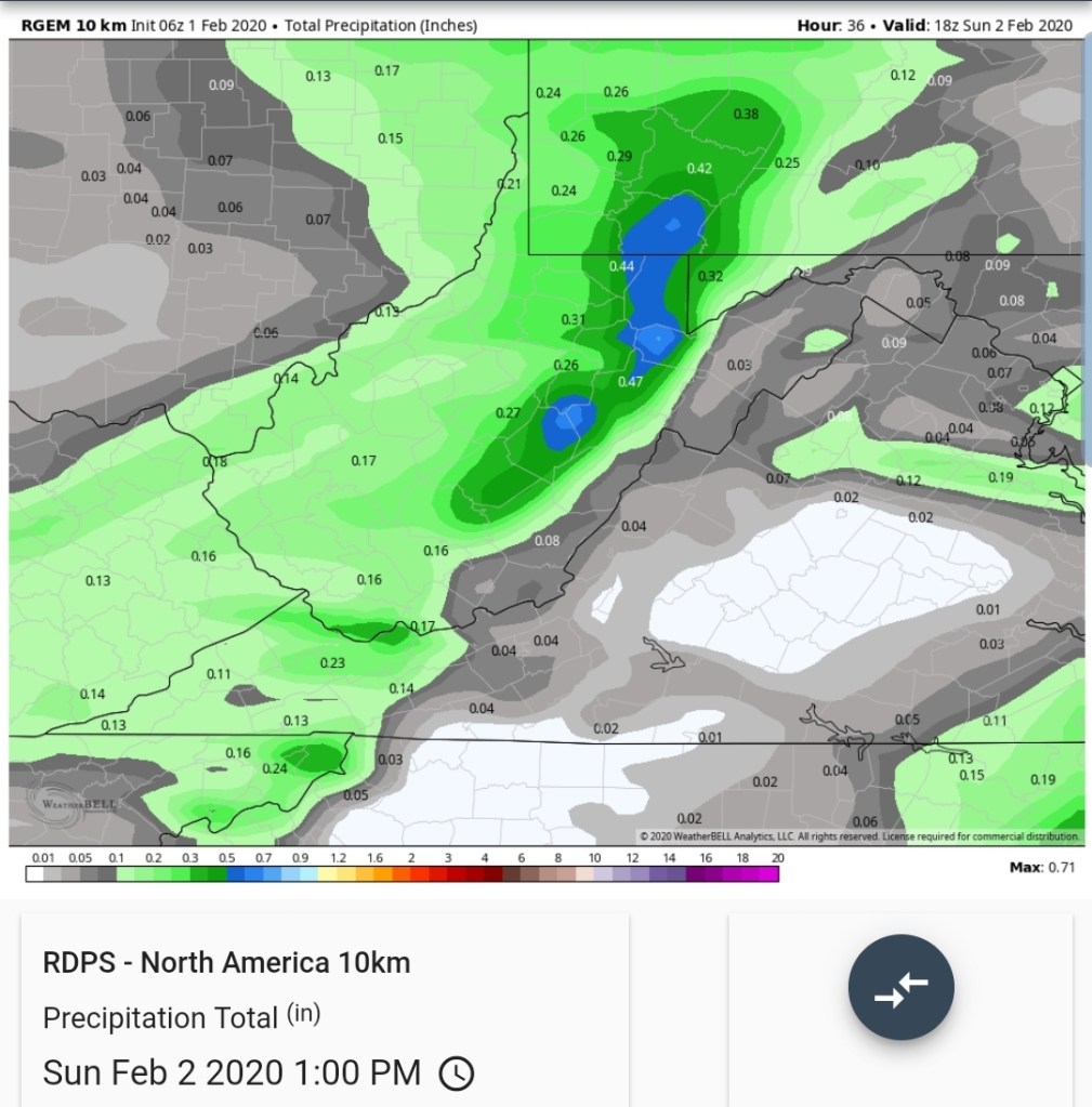
0z Canadian aye…
KUCHERA

10 TO 1
Total qpf
National Model Blend
10 to 1
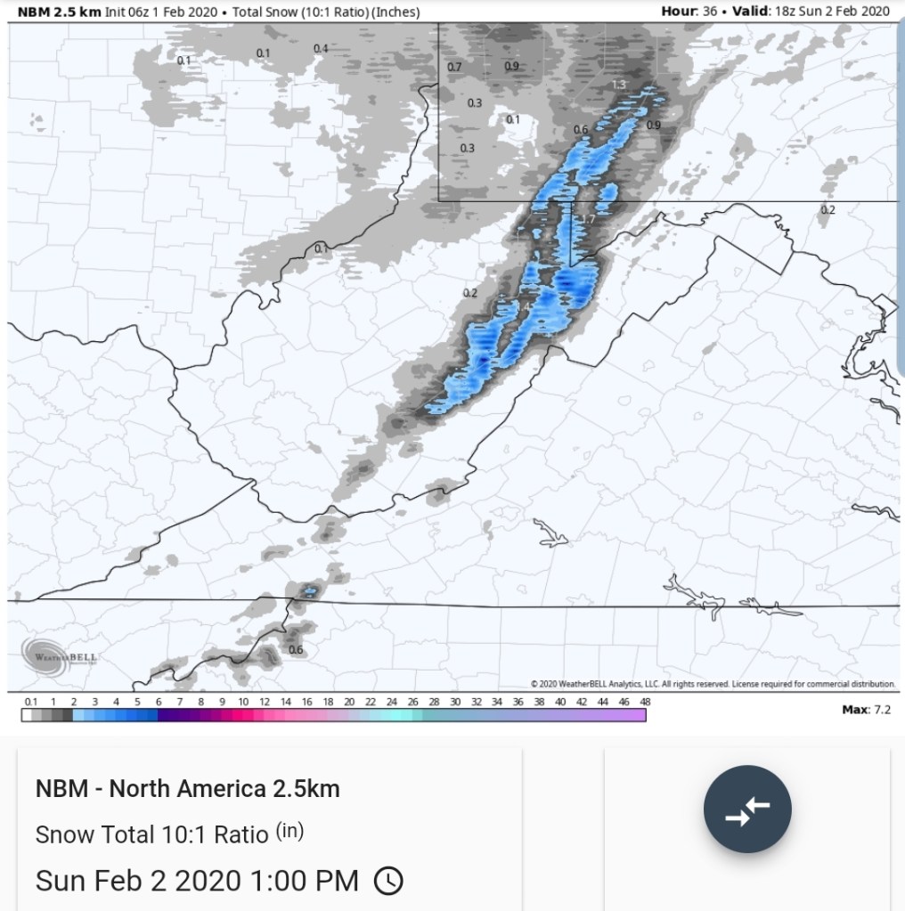
I’d still lean
1800-2500 1-3″, leaning towards low to mid range and the low range with melting at 1800′- 2000
2500-3500 2-4″ leaning low to mid range,,and a good performance gets the high end
3500′ and up- 3-6″ leaning low to mid range, but with temps being critical elsewhere at the onset, this zone is all good.
This is accompanied by some gusty winds overnight and snow activity runs into the morning on Sunday and things gradually mild up through the afternoon ahead of very mild air early to mid next week. With a fight of cold air pushing towards the mason dixon at times. If it pushes, forecasted number will be too high.
This was never a overnight or early morning snow on the models. So, as of now, models are doing ok.
