February 6, 2020
Feb 6(Thurs)
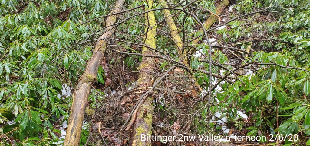
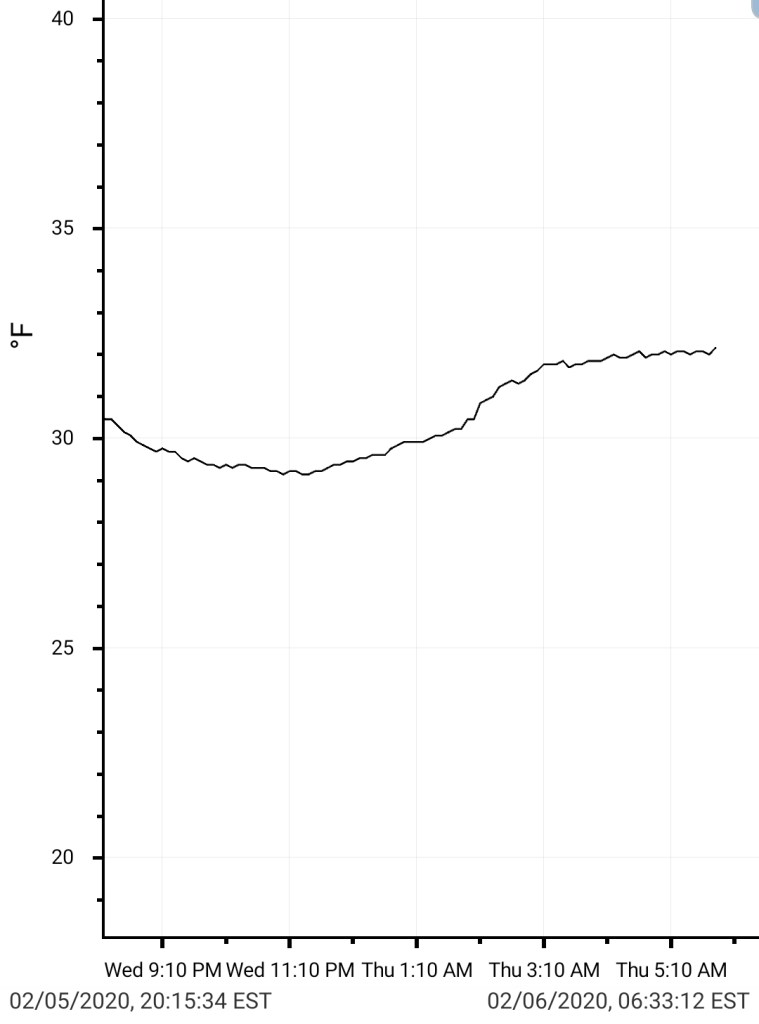
A trace of ice pre dawn before temps rose. Few showers, heavier rain south.
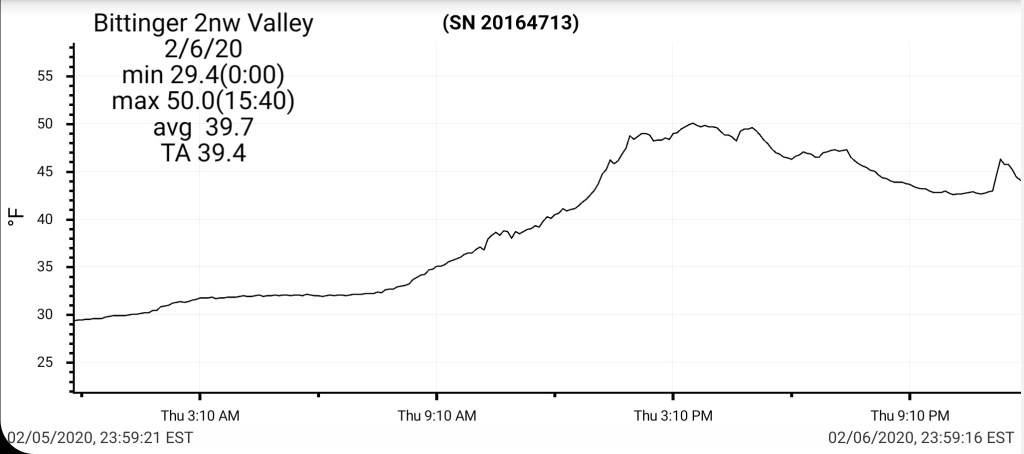
Bittinger 2nw Valley
MIN[29.4]—MAX[50.0]—AVERAGE MEAN[39.7]—TRUE AVERAGE[39.4]
Still a few patches of snow remain in the woods.
Snowfall season to date 39.4″
Garrett College
MIN[29.7]—MAX[52.1]—AVERAGE MEAN[40.9]—TRUE AVERAGE[42.6]—PRECIP[.13]

Canaan Heights/Davis 3SE
Will fill in shortly
Climate Reference Network Canaan
MIN[42.8]—MAX[54.7]—AVERAGE MEAN[48.8]—TRUE AVERAGE[49.1]—PRECIP[.24]

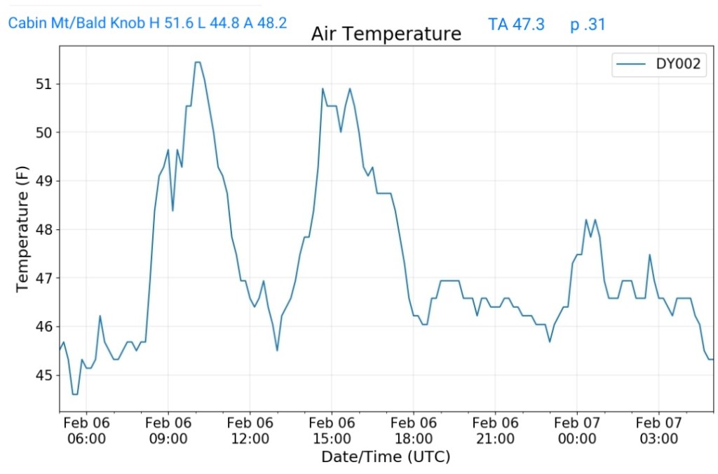
Cabin Mt at Bald Knob
MIN[44.8]—MAX[51.6]—AVERAGE MEAN[48.2]—TRUE AVERAGE[47.3]—PRECIP[.31]
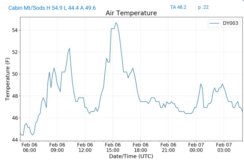
Cabin Mt-Western Sods
MIN[44.4]—MAX[54.9]—AVERAGE MEAN[49.6]—TRUE AVERAGE[48.2]—PRECIP[.22]
Spruce Knob
MIN[40.1]—MAX[46.2]—AVERAGE MEAN[43.1]—TRUE AVERAGE[43.8]—PRECIP[.47]

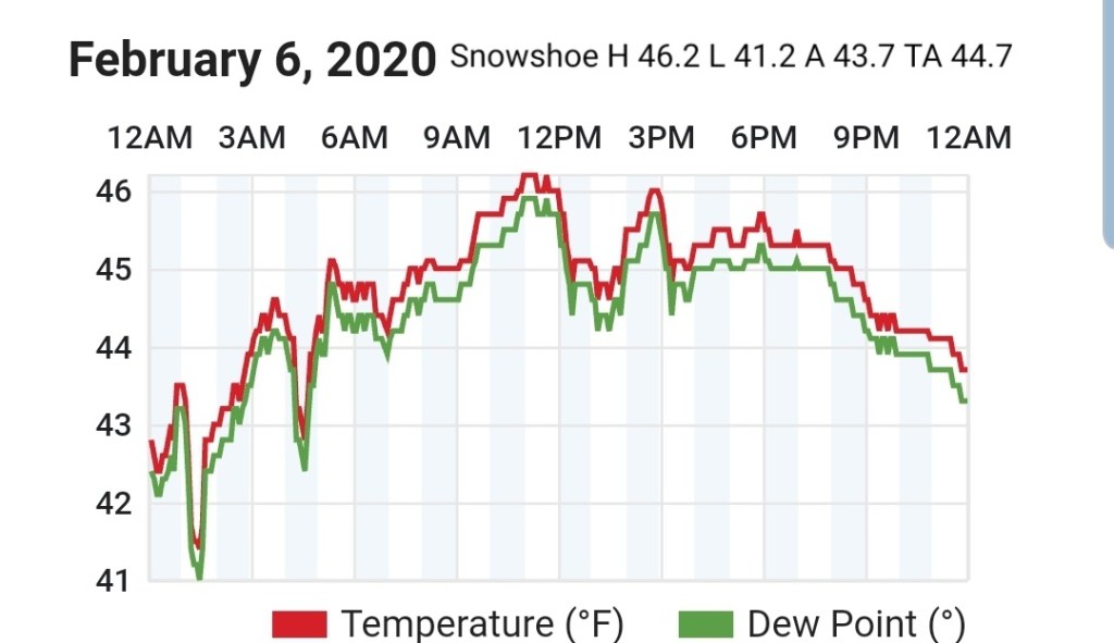
Snowshoe
MIN[41.2]—MAX[46.2]—AVERAGE MEAN[43.7]—TRUE AVERAGE[44.7]
Canaan Valley Refuge
MIN[44.1]—MAX[57.6]—AVERAGE MEAN[50.8]—TRUE AVERAGE[50.3]

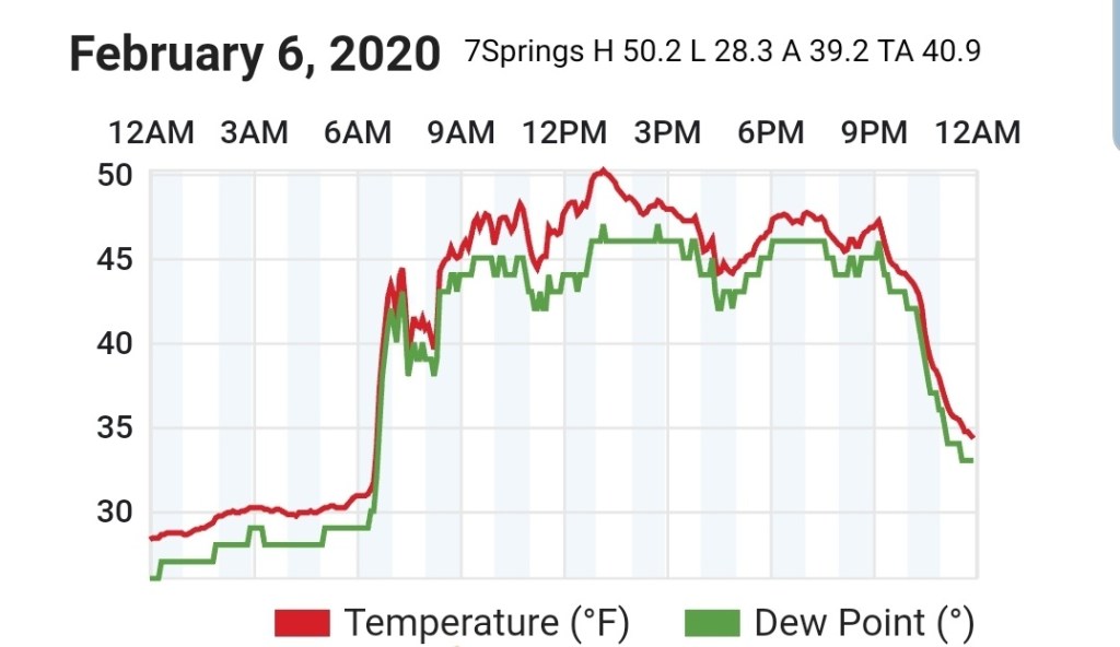
7Springs
MIN[28.3]—MAX[50.2]—AVERAGE MEAN[39.2]—TRUE AVERAGE[40.9]
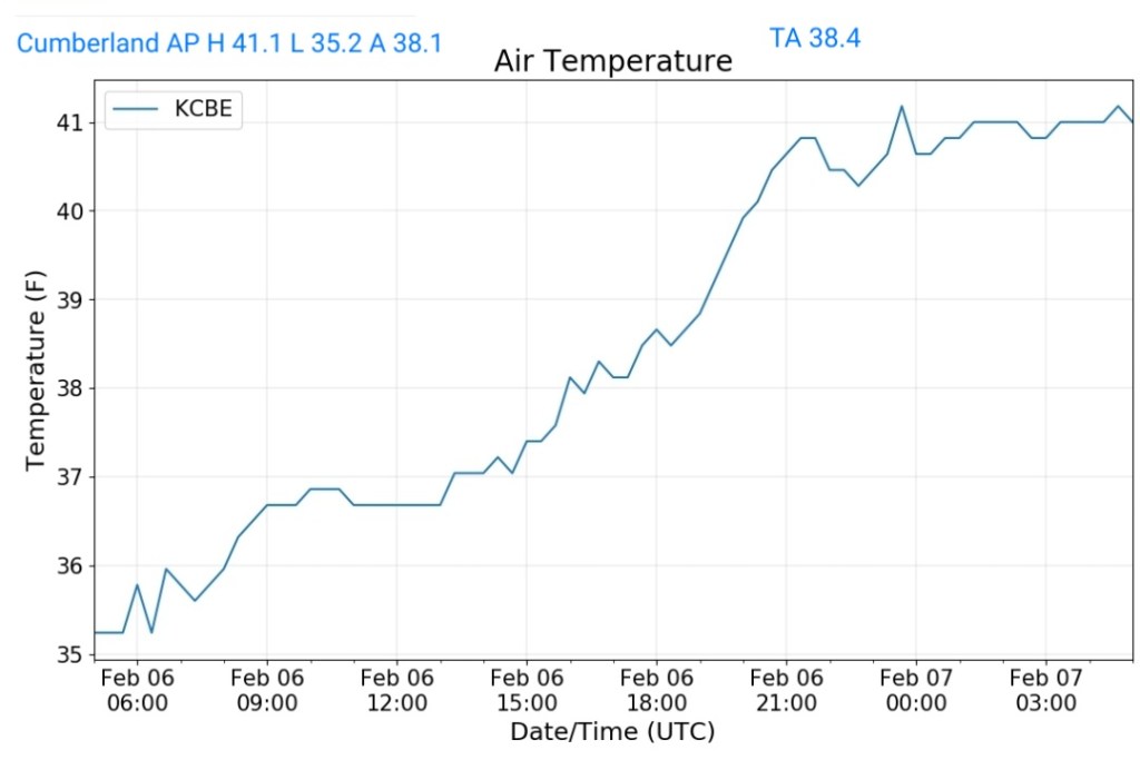
Cumberland Airport
MIN[35.2]—MAX[41.1]—AVERAGE MEAN[38.1]—TRUE AVERAGE[38.4]
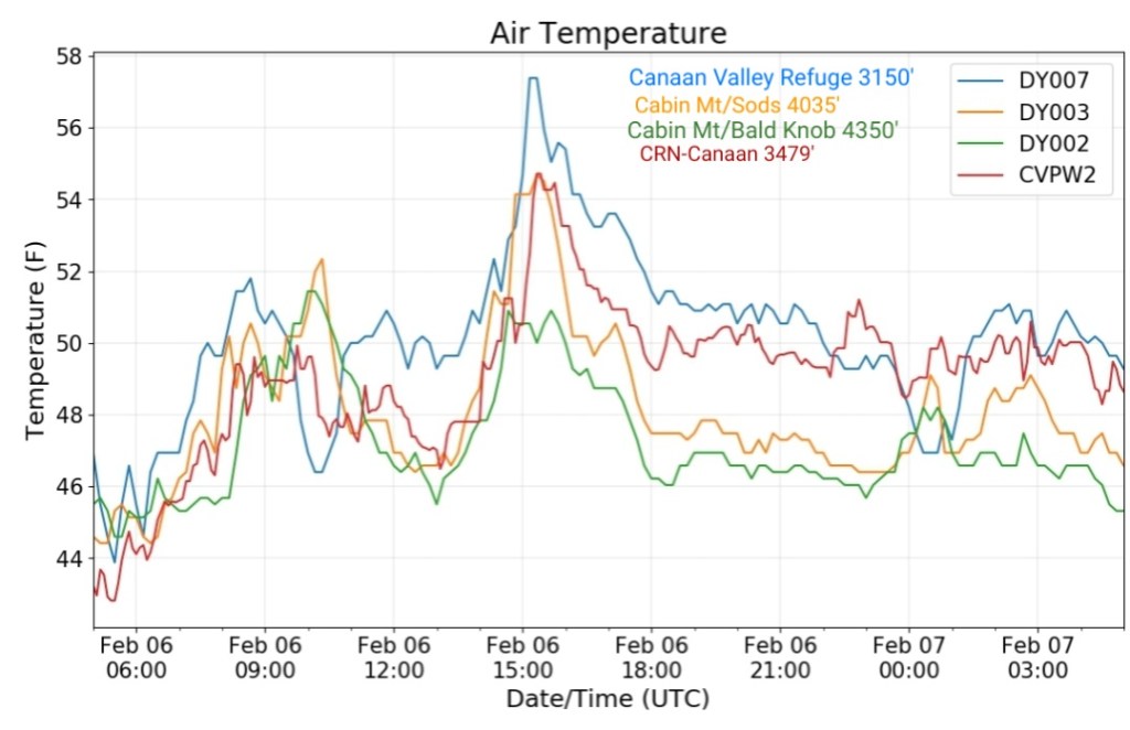
The Valley vs Cabin Mt

Canaan area temps
Comparison view
RTMA
Radar
Satellite
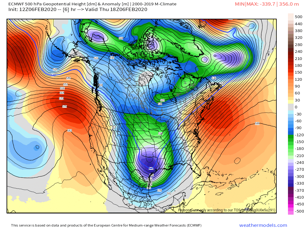
Flow
Surface features and 500mb height anomalies and flow
The roller coaster ride of temps continues ….
After a chill down yesterday for parts, not all of the area, we rebound today and fall again tomorrow.
The ice event overnight underperformed mainly due to a lack of moisture. Temps did come into the expected range overnight. My temps near Bittinger were in range and there was trace ice , but not enough to cause any issues…
Temps rising today, holding steady the first part of the night and falling late
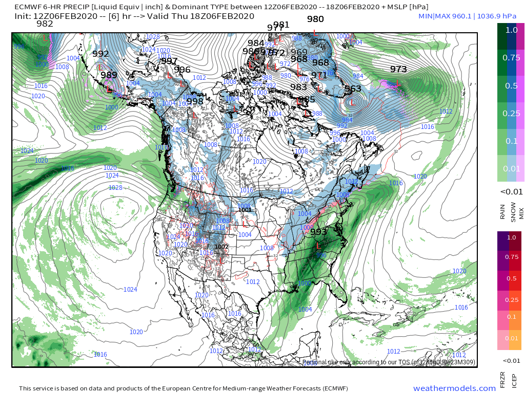
Rainfall this afternoon and overnight off the models
6z ECMWF and 6z GFS

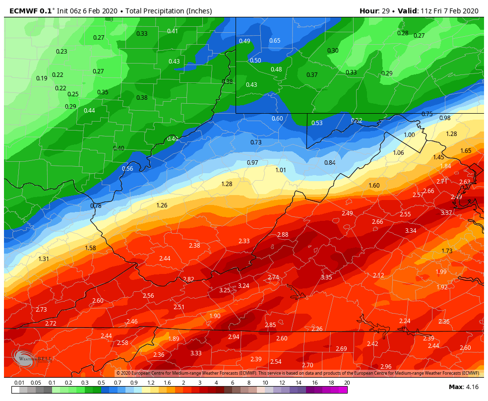
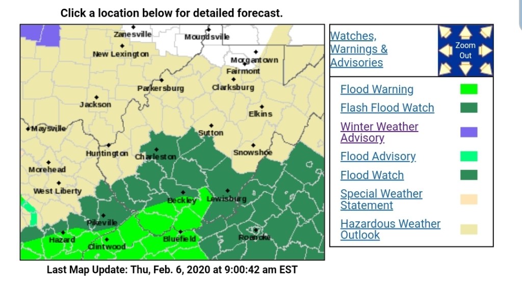
Not surprisingly the NWS has a Flood Watch in the expected heavy rain areas
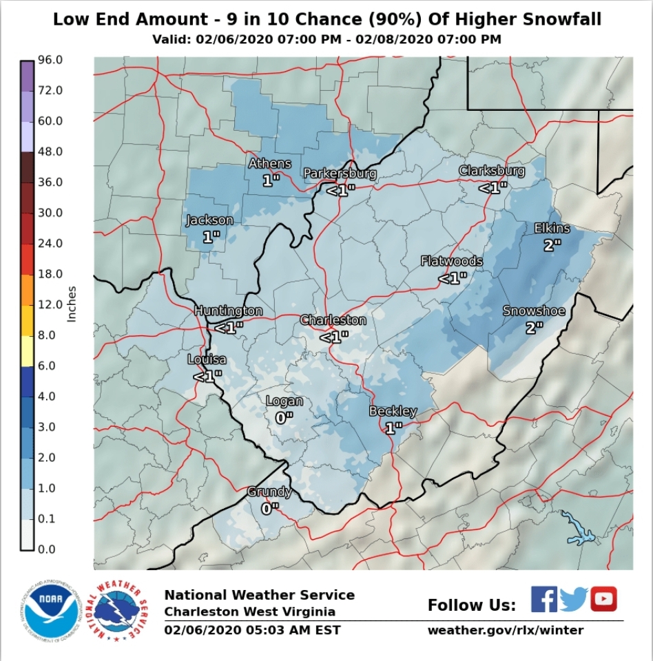
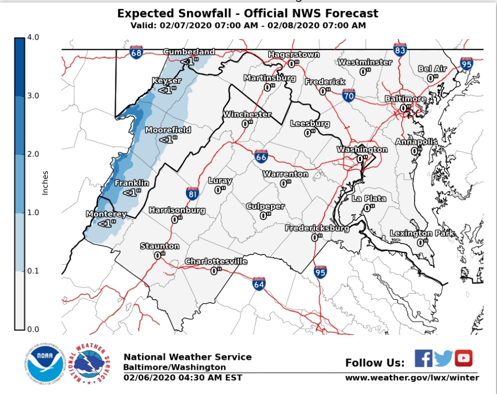
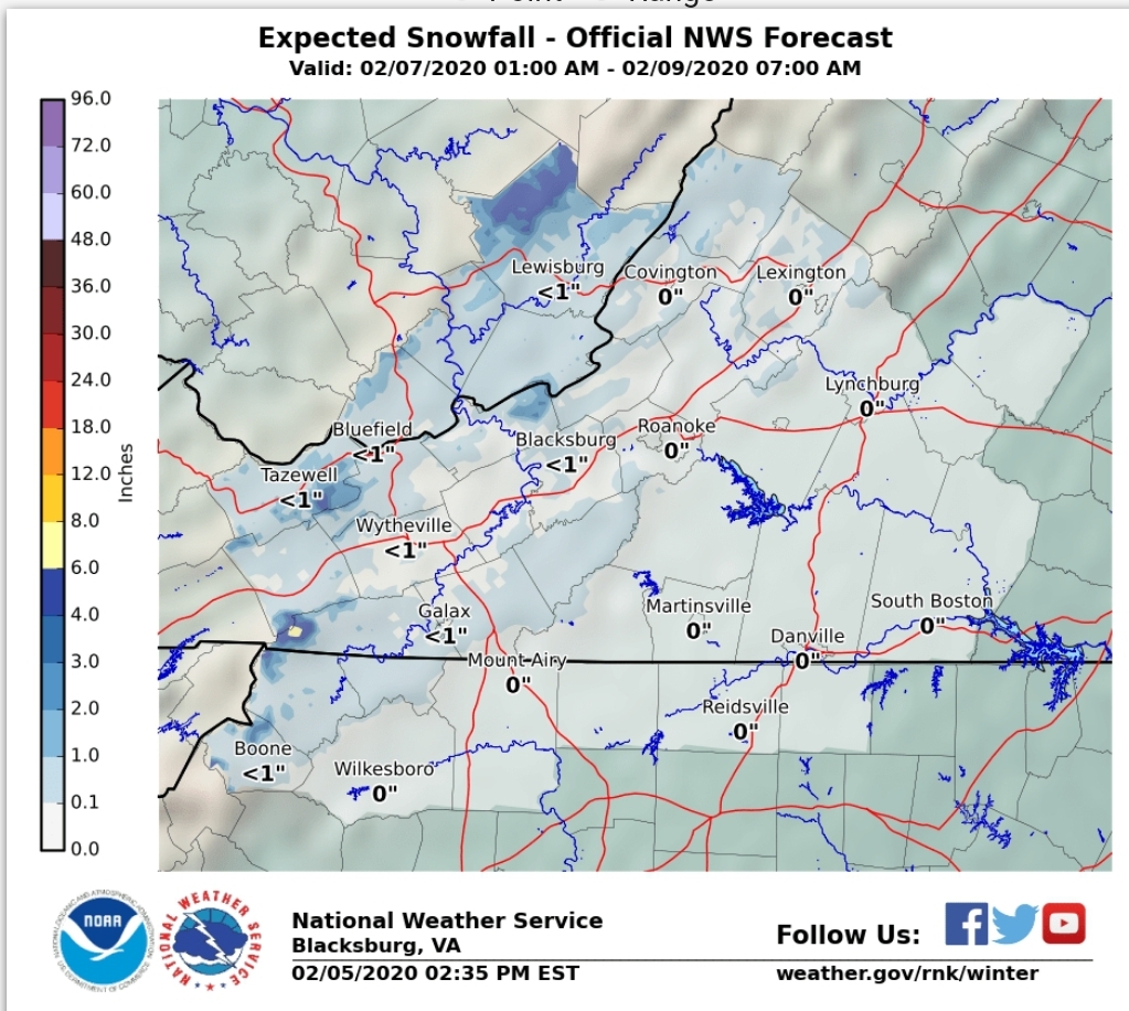
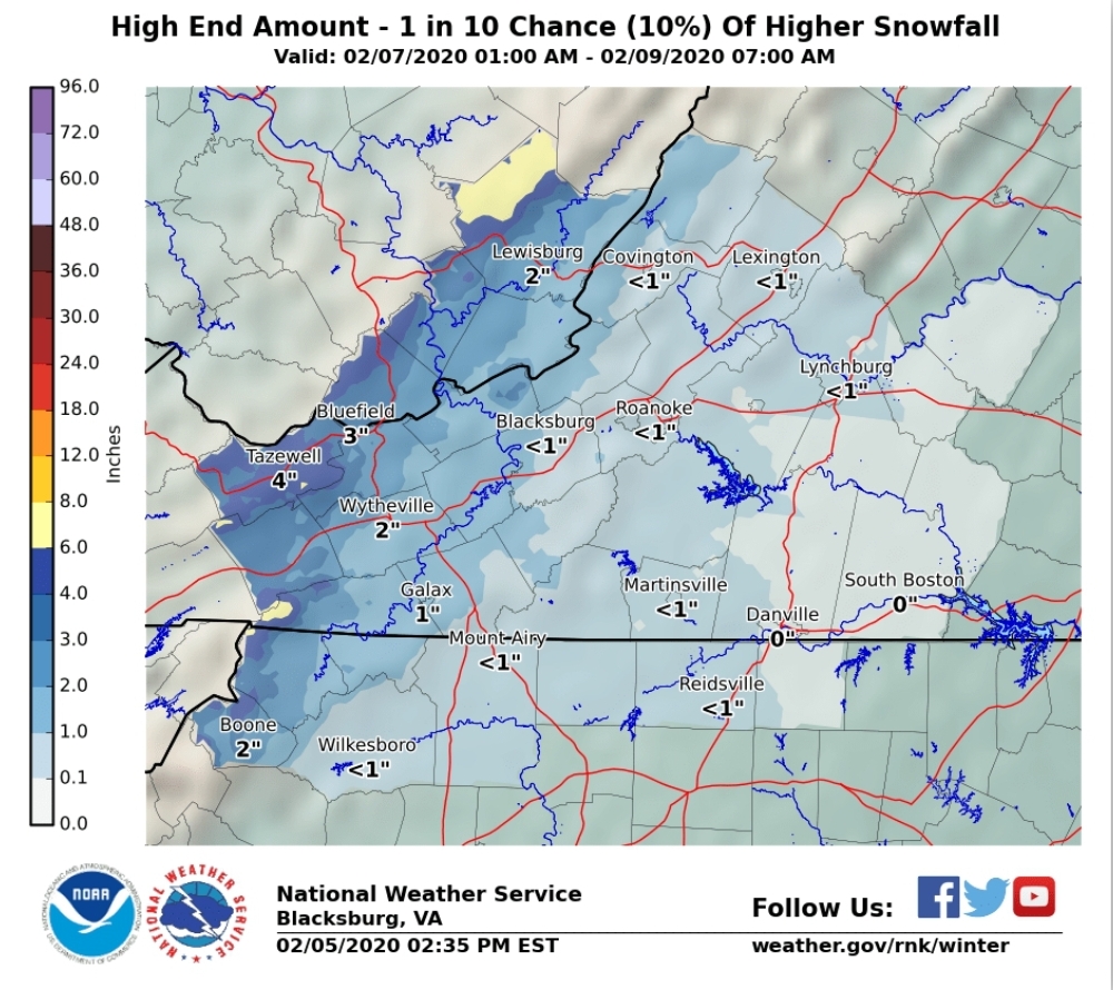
Towards tomorrow morning the wet turns to white. I think this has the potential to be a bit dramatic from 1 hour to the next early tomorrow morning as rain goes to snow and a quick thump of snow after changeover. By quick thump a rapid 1-3 inches over a couple hour period. That’s something that will need monitored today and again early tomorrow morning, but something to be aware of. Overall the snow activity runs into Friday night with even spotty activity until Saturday morning. The brunt of this round should be done prior to midnight.
Now I’ll run through models and NOAA products as well as my thoughts on part 1
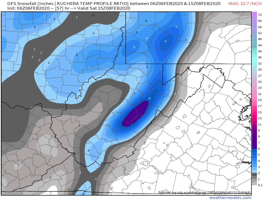
6z GFS
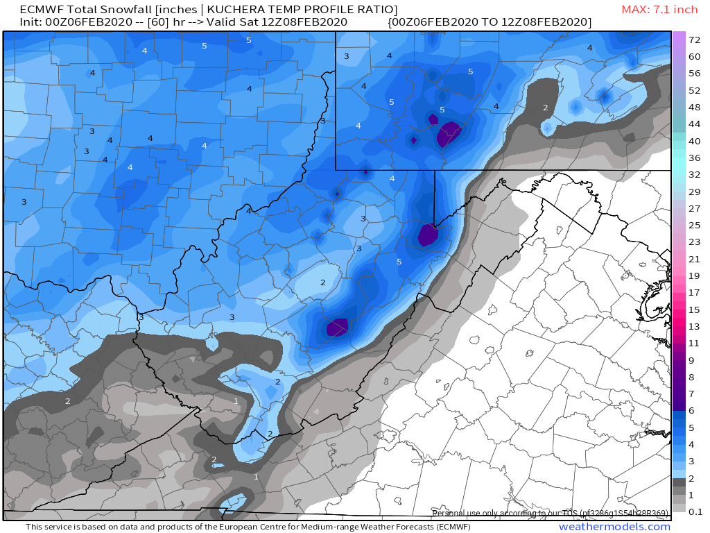
6z ECMWF
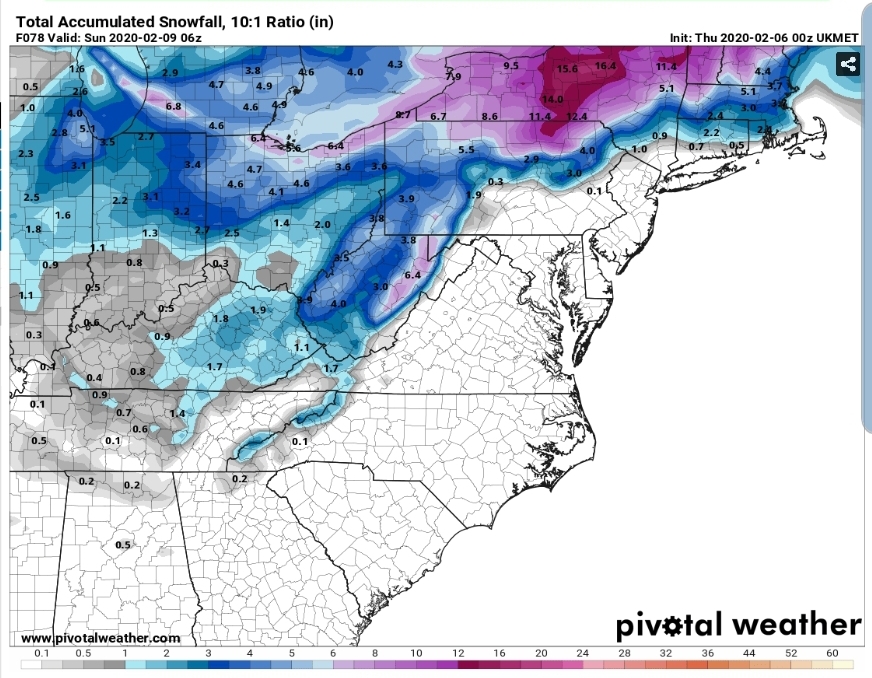
UKMET (10 to 1)
WPC- typically they do better with this and actually show the max over the high ground. This is like what a model physics error does and places the max west of the Mts like this is the Rockies here. It is not. Again a tool, not a high res look.

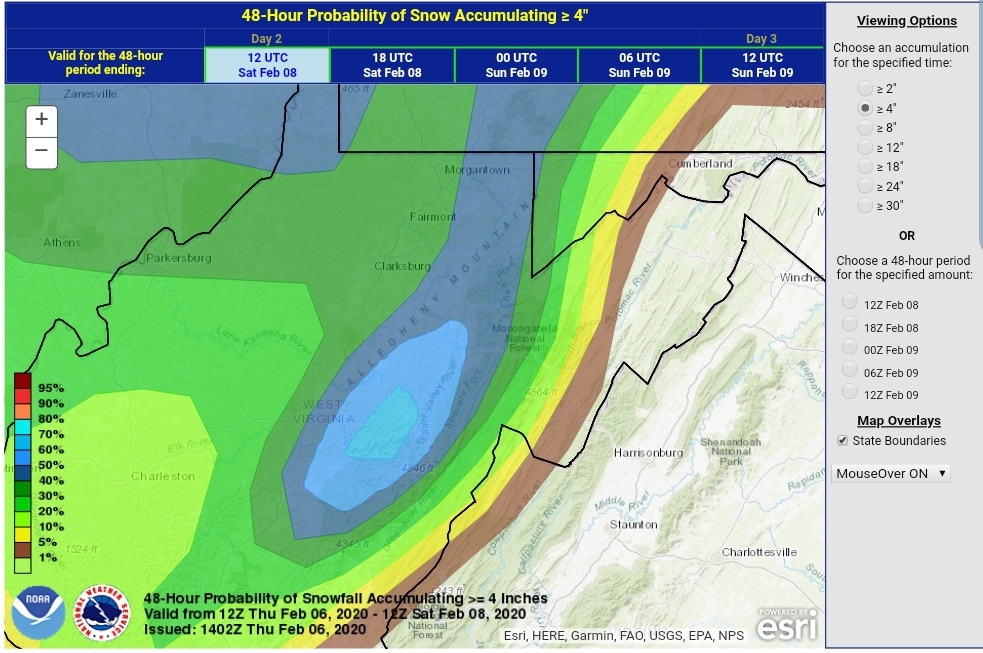
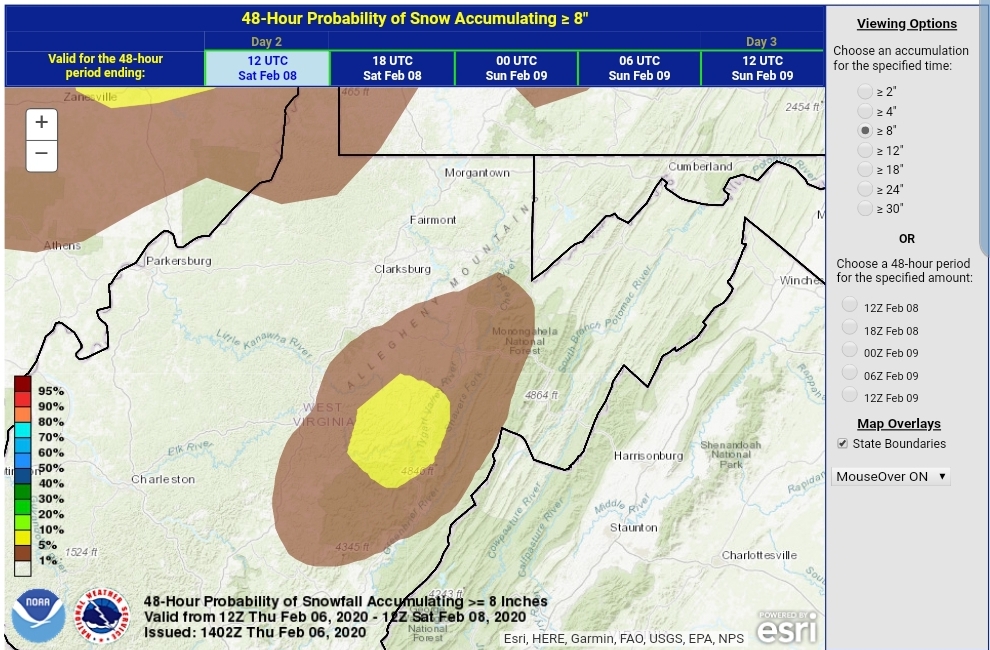
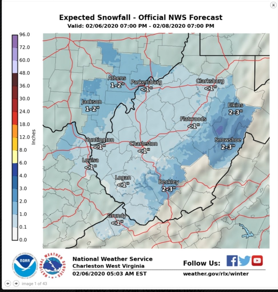
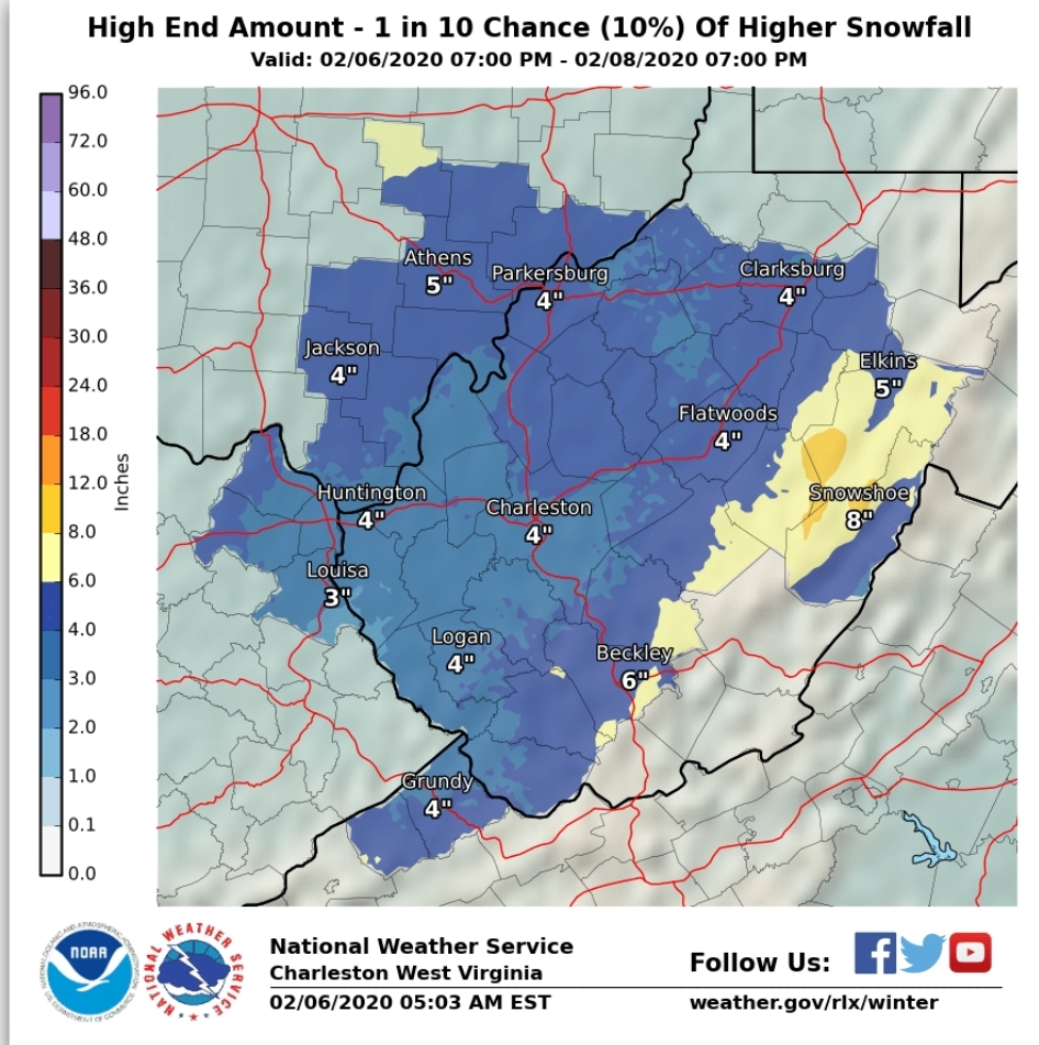
The NWS for part 1 through Saturday a.m … I see some odd things from Charleston on max potential. It looks like the elevation factor was less of an influence in their forecast than should be.
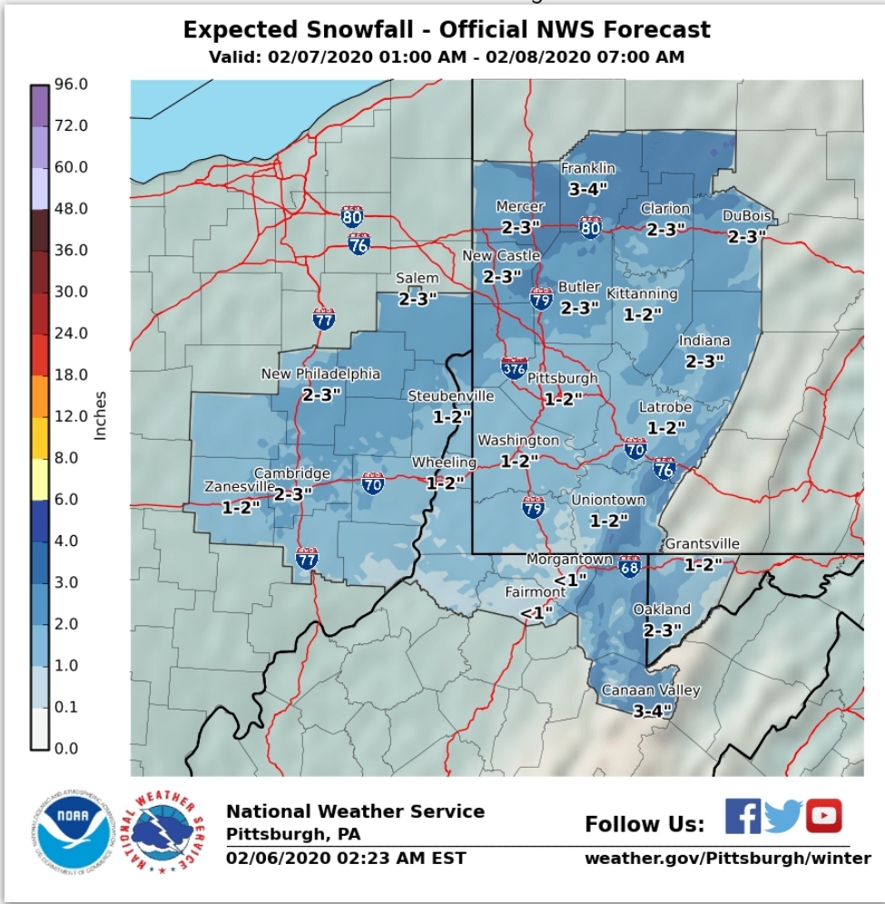


I’m not going to bother with the State College products as they are only going out until tomorrow 1pm with the graphics above.
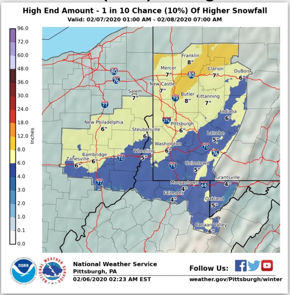
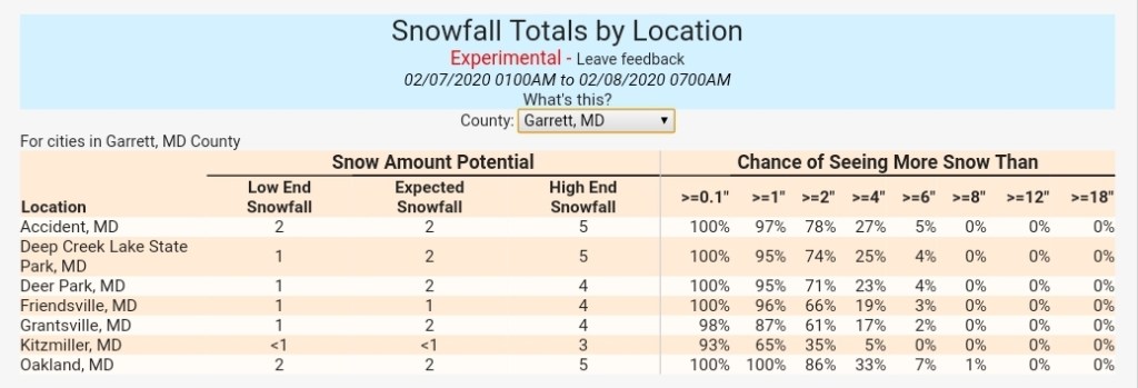
My thoughts on some select areas for part 1…
7Springs 3-6″
Somerset 1-3″
Mt.Davis 3-6″
Grantsville 1-3″
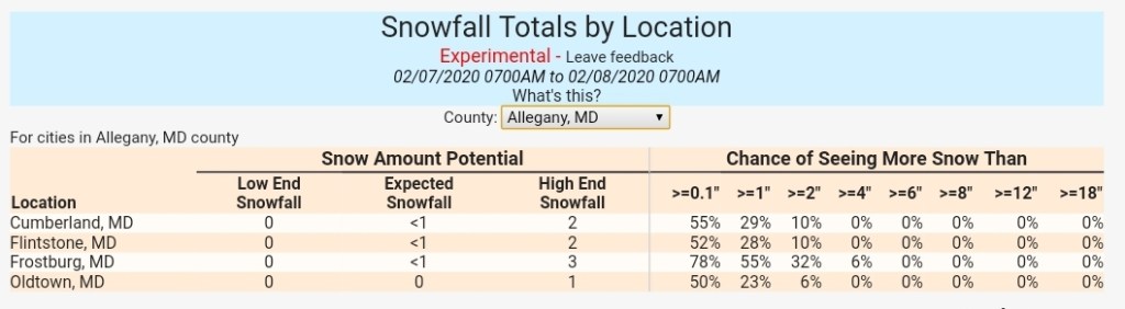
Bittinger 2-5″
Oakland 2-4″
Cranesville 3-6″
Terra Alta 3-6″ (Any interested weather gurus here? A snow observer needed in this area)
Coopers Rock 2-4″
Davis 4-7″
Canaan Heights 4-7″
Canaan Valley 3-6″
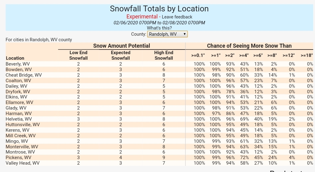
Parson 1-3″
Whitmer 2-4″
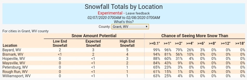
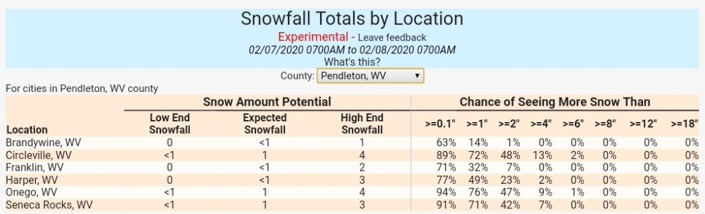
Onego 1-2″
Elkins 2-4″
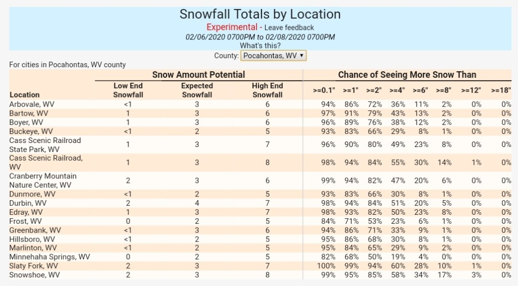
Snowshoe 4-7″
Highland Scenic Highway 4-7″
Marlinton 1-3″
Again watch for changeover early tomorrow morning. A quick thump could disrupt schools in the morning.
Now Saturday night with another disturbance. That overall looks like a widespread 1-3″ type event. Tweaks may be needed.
