February 26, 2020
Feb 26(Wed)
A bit of a dreary start, but turning into a nice late morning, early afternoon, before clouds and rain pushed in, in the evening. Accompanied by some thunder/lightning, some pockets of hail, some heavy downpours, that went over to snow, first in the Wv high ground and then north.
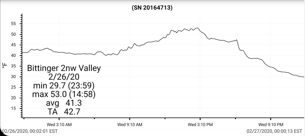
Bittinger 2nw Valley
MIN[29.7]—MAX[53.0]—AVERAGE MEAN[41.3]—TRUE AVERAGE[42.7]
New snowfall occurring late, after 8pm will be tallied at the morning measurement tomorrow.
Snowfall season to date 48.0″

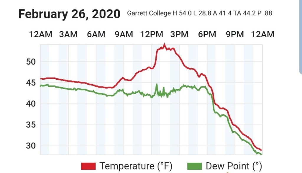
Garrett College
MIN[28.8]—MAX[54.0]—AVERAGE MEAN[41.4]—TRUE AVERAGE[44.2]—PRECIP[.88]
Canaan Heights/Davis 3SE
MIN[28.0]—MAX[54.0]—AVERAGE MEAN[41.0]—PRECIP[.02]7am
New snowfall- snow accumulated rapidly after the nightfall changeover. That will be tallied in the morning.
Snowfall season to date 65.8″
Comments by Dave Lesher at:
Mostly cloudy and mild, warming to 53F by mid afternoon, then clouds rolling in with rain commencing shortly before nightfall along with several thunderclaps and a brief fall of pea hail. Rapidly falling temperatures changed the rain to snow by 7PM, continuing through the evening. Heavy snow lays down 4 inches by 10PM.
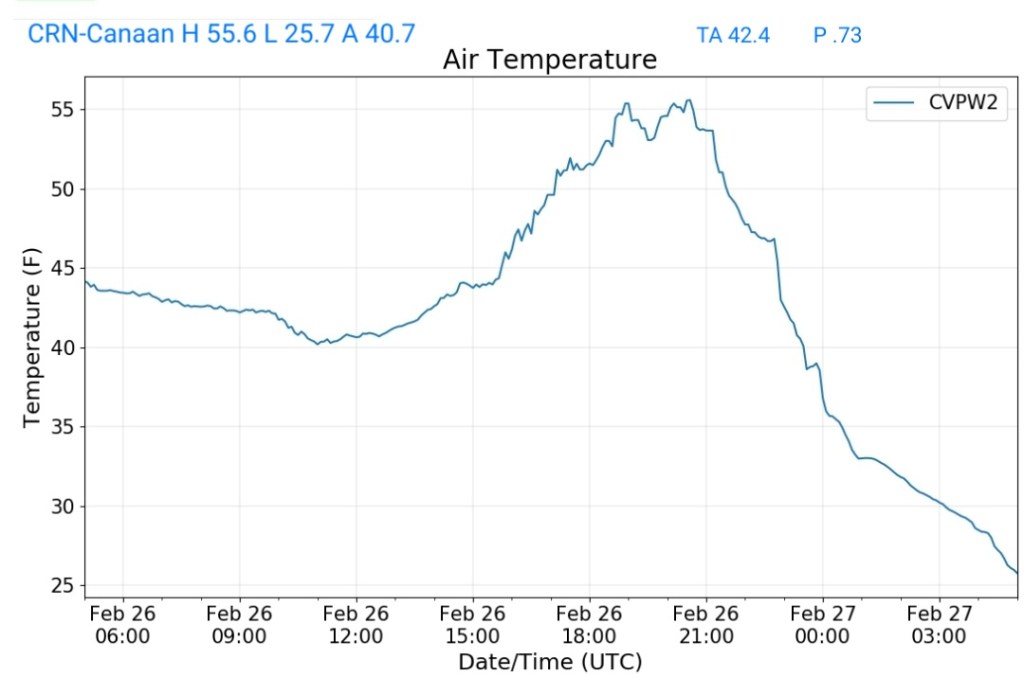
Climate Reference Network Canaan
MIN[25.7]—MAX[55.6]—AVERAGE MEAN[40.7]—TRUE AVERAGE[42.4]—PRECIP[.73]
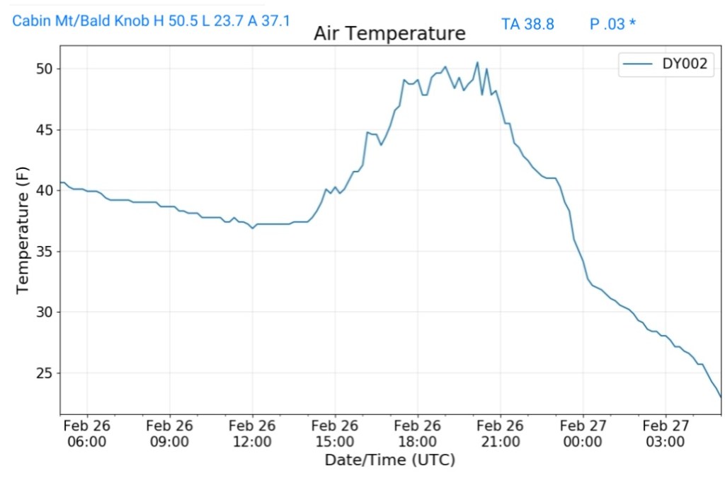
Cabin Mt at Bald Knob
MIN[23.7]—MAX[50.5]—AVERAGE MEAN[37.1]—TRUE AVERAGE[38.8]—PRECIP[.03]*before frozen
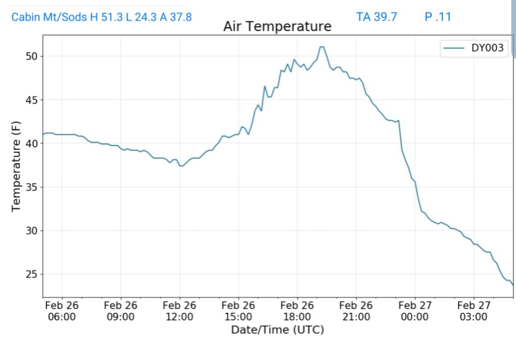
Cabin Mt-Western Sods
MIN[24.3]—MAX[51.3]—AVERAGE MEAN[37.8]—TRUE AVERAGE[39.7]—PRECIP[.11]*
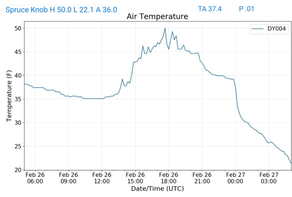
Spruce Knob
MIN[22.1]—MAX[50.0]—AVERAGE MEAN[36.0]—TRUE AVERAGE[37.4]—PRECIP[.01]*
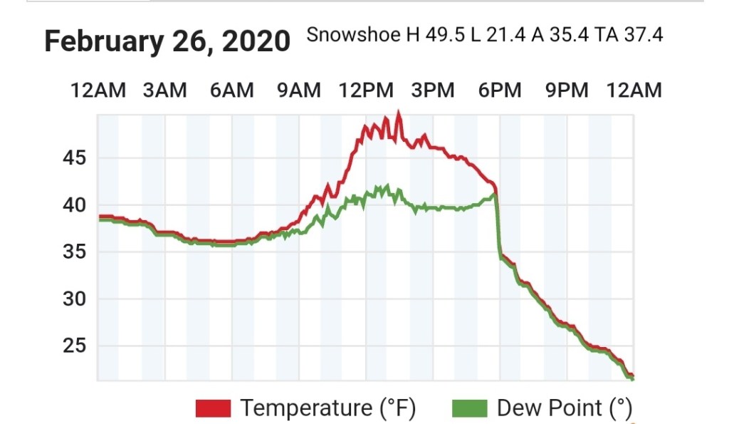
Snowshoe
MIN[21.4]—MAX[49.5]—AVERAGE MEAN[35.4]—TRUE AVERAGE[37.4]
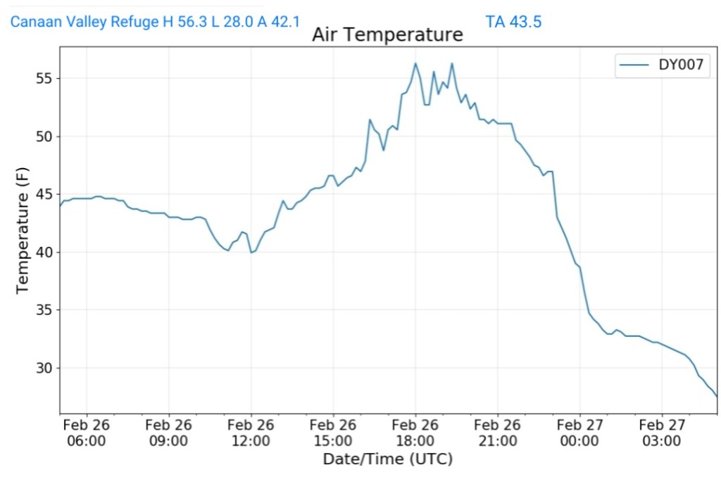
Canaan Valley Refuge
MIN[28.0]—MAX[56.3]—AVERAGE MEAN[42.1]—TRUE AVERAGE[43.0]
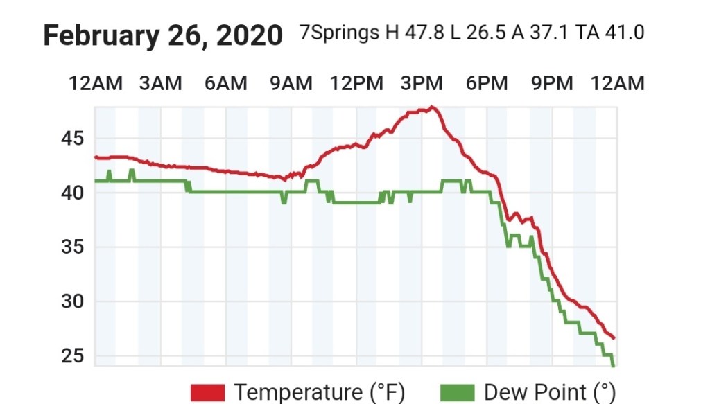
7Springs
MIN[26.5]—MAX[47.8]—AVERAGE MEAN[37.1]—TRUE AVERAGE[41.0]
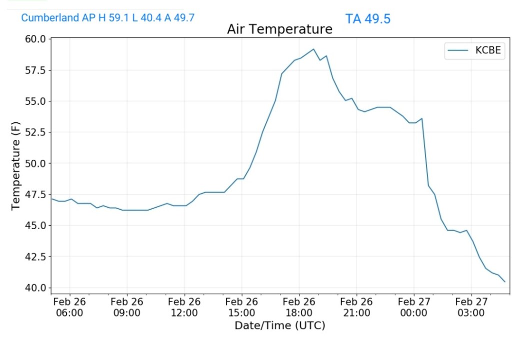
Cumberland Airport
MIN[40.4]—MAX[59.1]—AVERAGE MEAN[49.7]—TRUE AVERAGE[49.5]
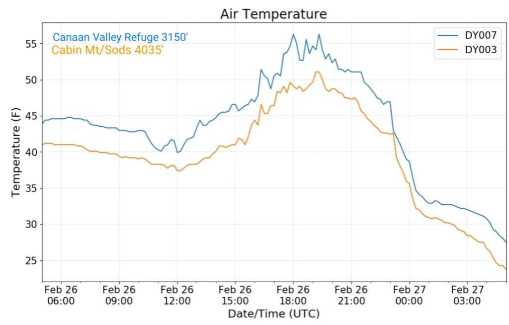
The Valley vs Cabin Mt
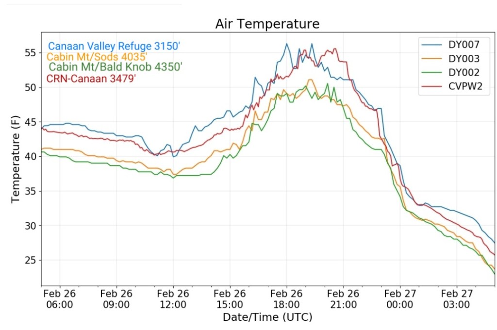
Canaan area temps
Comparison view
RTMA
Radar
Satellite
Flow
Surface features and 500mb height anomalies and flow
NOAAs March outlook

