March 14, 2020
Mar 14(Sat)
Chilly, dry start, temps coming up by midday into the 40s, very dry air in place. Snow across northern Garrett, southern Somerset by mid afternoon with a rapid .5 to 1.5 in areas. Smow continuing Garrett and north, minimal action south of Garrett.
Bittinger 2nw Valley
New snowfall of .6″ through 6pm boardsweep. The temp was just above 32° and I wanted to grab a measurement for daily max before it compressed any.
Snow depth at that time was .6″, daily max recorded but increased through midnight after a brief lull in snow action in the evening
Snowfall season to date 64.1″
Garrett College
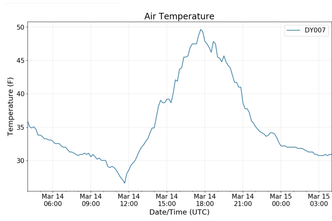
Canaan Heights/Davis 3SE
Precip .02 7am
New snow 0 7am
Snow depth 0
Snowfall season to date 88.7″
Comments by Dave Lesher at
Sunshine early in the day quickly pushing high temperature to 48F, then slowly falling temperatures through the afternoon with thickening and lowering clouds, then first snowflakes seen at 510PM with temperature of 36F. 810PM: 32F with mixed light freezing rain and a few snowflakes now and then. No accumulation. Next update around 11PM. 11PM: 30F with mixed light snow and snow pellets. New snow 0.3 inch. |
Climate Reference Network Canaan
Cabin Mt at Bald Knob
Cabin Mt-Western Sods
Spruce Knob
Snowshoe
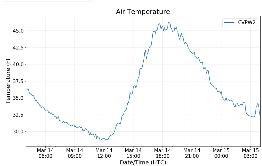
Canaan Valley Refuge
7Springs
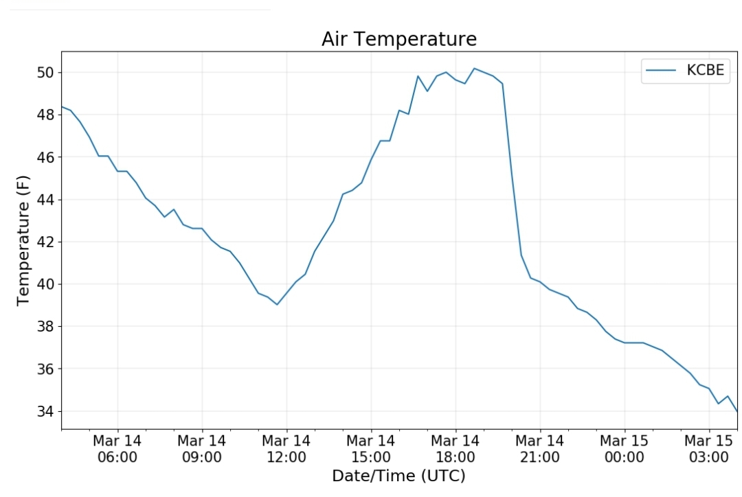
Cumberland Airport
The Valley vs Cabin Mt
Canaan area temps
Comparison view
RTMA
Radar
Satellite
Flow
Surface features and 500mb height anomalies and flow
The snow beginning
At 3:10pm snow began to break out across northern Garrett
In 15 minutes the ground was white
A half hour later
little over and hour after it began
However, this was not widespread and was mainly along this corridor
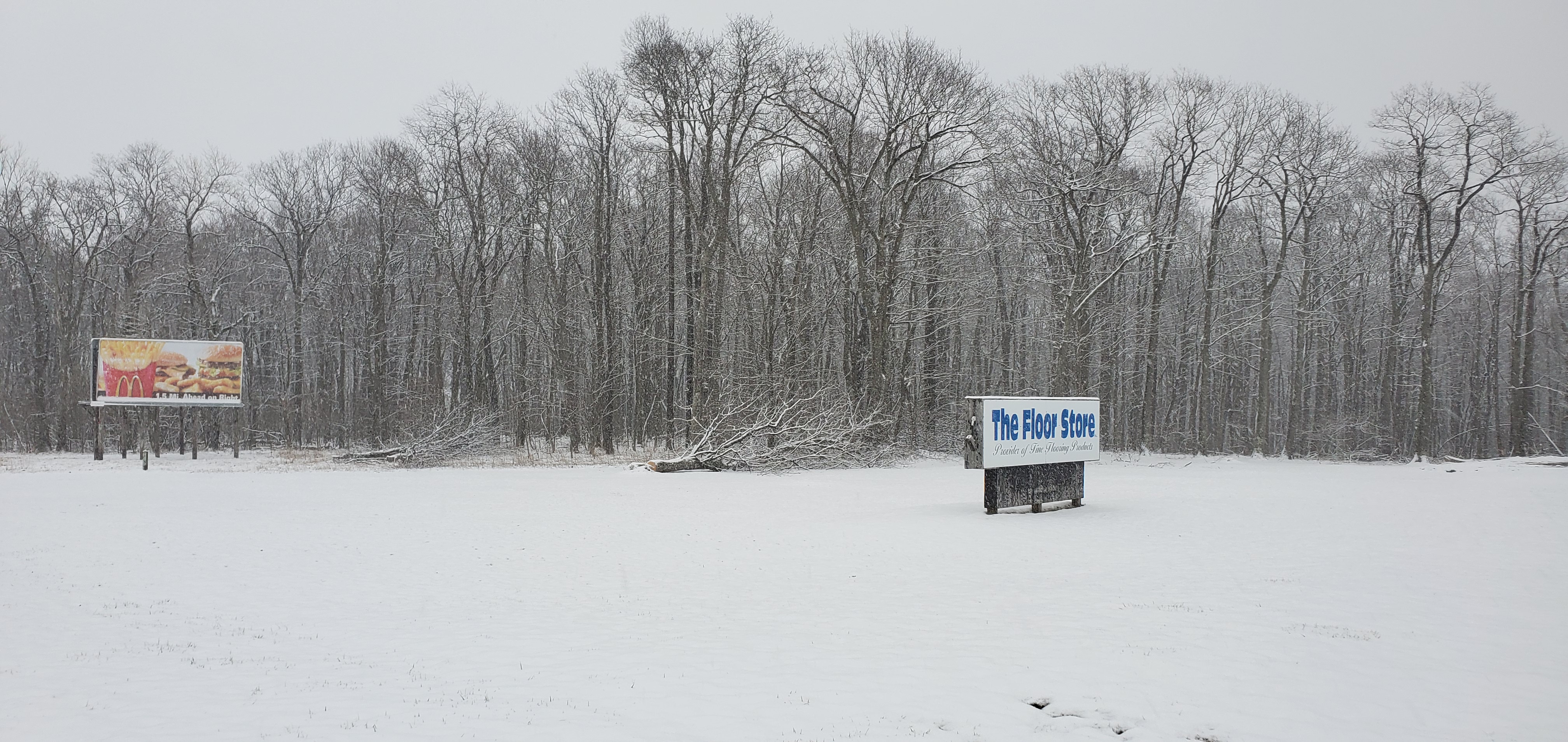
This left northern Garrett in the snow, while Accident had a light coating and bare from McHenry south. My drive from 6pm to 6:20 PM saw snow coverage like this:
1- Mchenry
2-Accident
3-Northern Garrett High School
4-Keysers Ridge, at 6:30pm before McHenry has any stickage, Keysers Ridge had a 1.7″ depth I measured by Little Sandy’s


