May 9, 2020
May 9(Sat)
Very cold start, skies cleared for a time overnight, then clouded up early to mid morning with more snowshowers with a few heavier pockets.
Bittinger 2nw Valley
Snowfall 1.5″ total…. ( .8 has fell through 8pm last night, .3 more before ending 10pm. Another .4″ today midday with 2 separate moderate to briefly heavy burst. I made it back right at the tail end of the second burst to capture the daily max snowfall as a May sun does not give much opportunity to do so. Within a 15-20 minutes the snow board will be bare, even in indirect sun and cold temps. So, its key to capture it quick.
Snowfall season to date 73.0″
Garrett College
Station remains offline
Canaan Heights/Davis 3SE
Precip 1.08 7am
Snowfall 2.8″
Snowfall season to date 100.8″
Comments by Dave Lesher at:
Much colder overnight with some clearing by daybreak and a few lingering snowflakes.
Two new May records for the 19 years of record-keeping here: Low temp of 19F bests the previous May record low of 24 on 9 May 2017. The 2.8 inches of snow exceeds the previous record of 2.3 inches on 7 May 2017
Climate Reference Network Canaan
Cabin Mt at Bald Knob
Cabin Mt-Western Sods
Spruce Knob
lots of pics to fill in/also on the 7th as well ..check back
https://www.washingtonpost.com/weather/2020/05/09/polar-vortex-record-may-cold-snow/
Snowshoe
Canaan Valley Refuge
7Springs
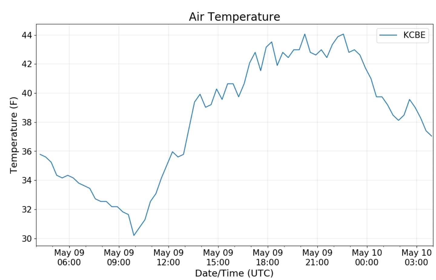
Cumberland Airport
The Valley vs Cabin Mt
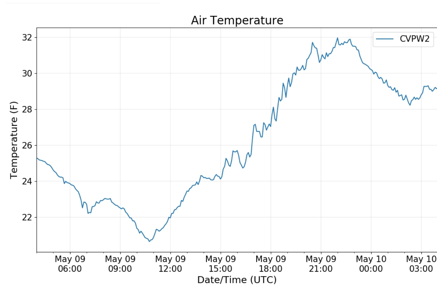
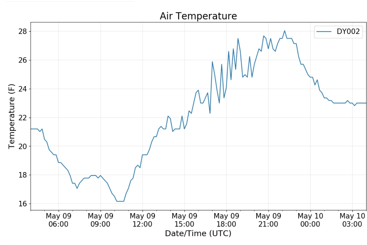
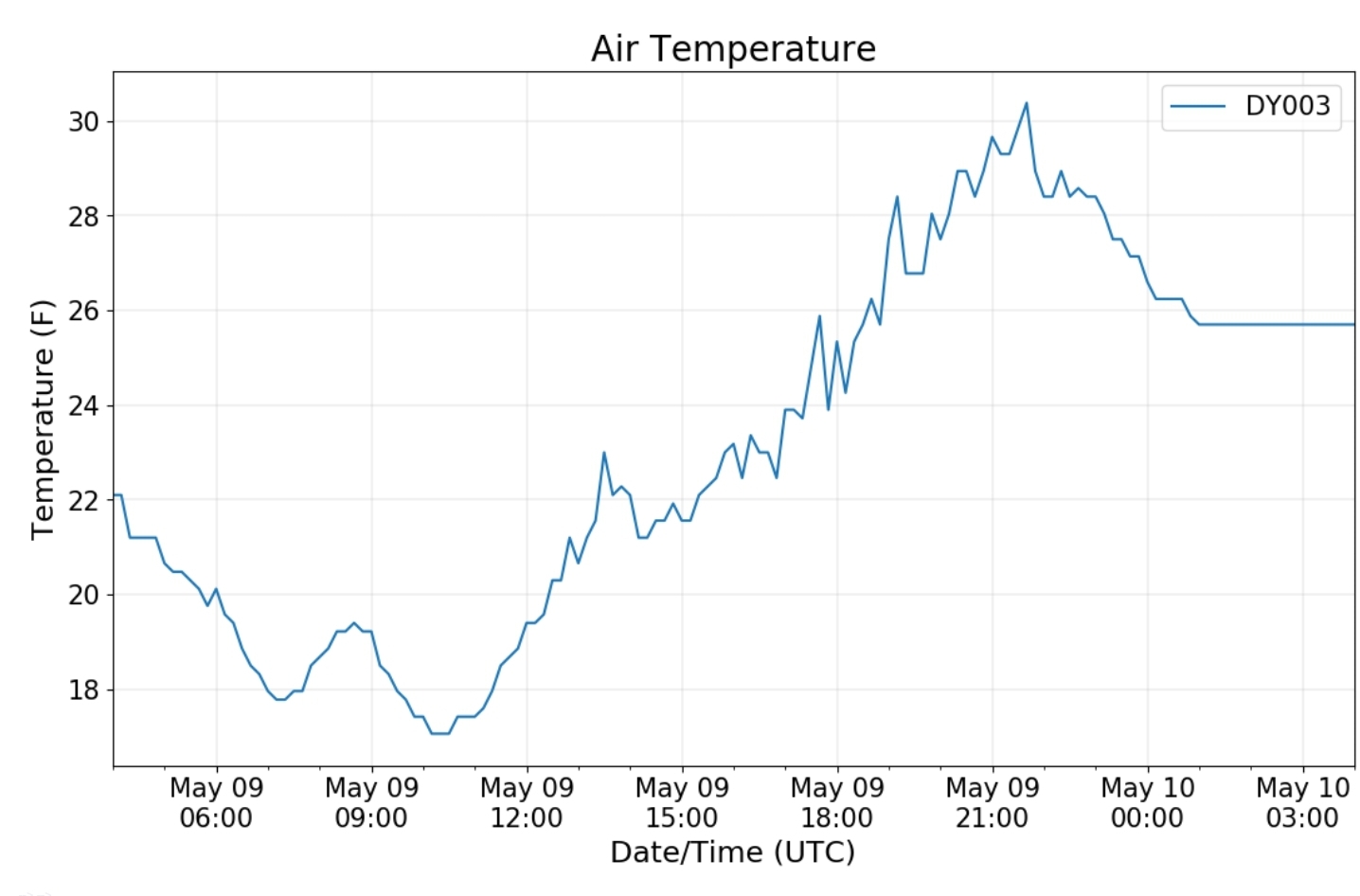
Canaan area temps
Comparison view


