May 18, 2020
May 18(Mon)
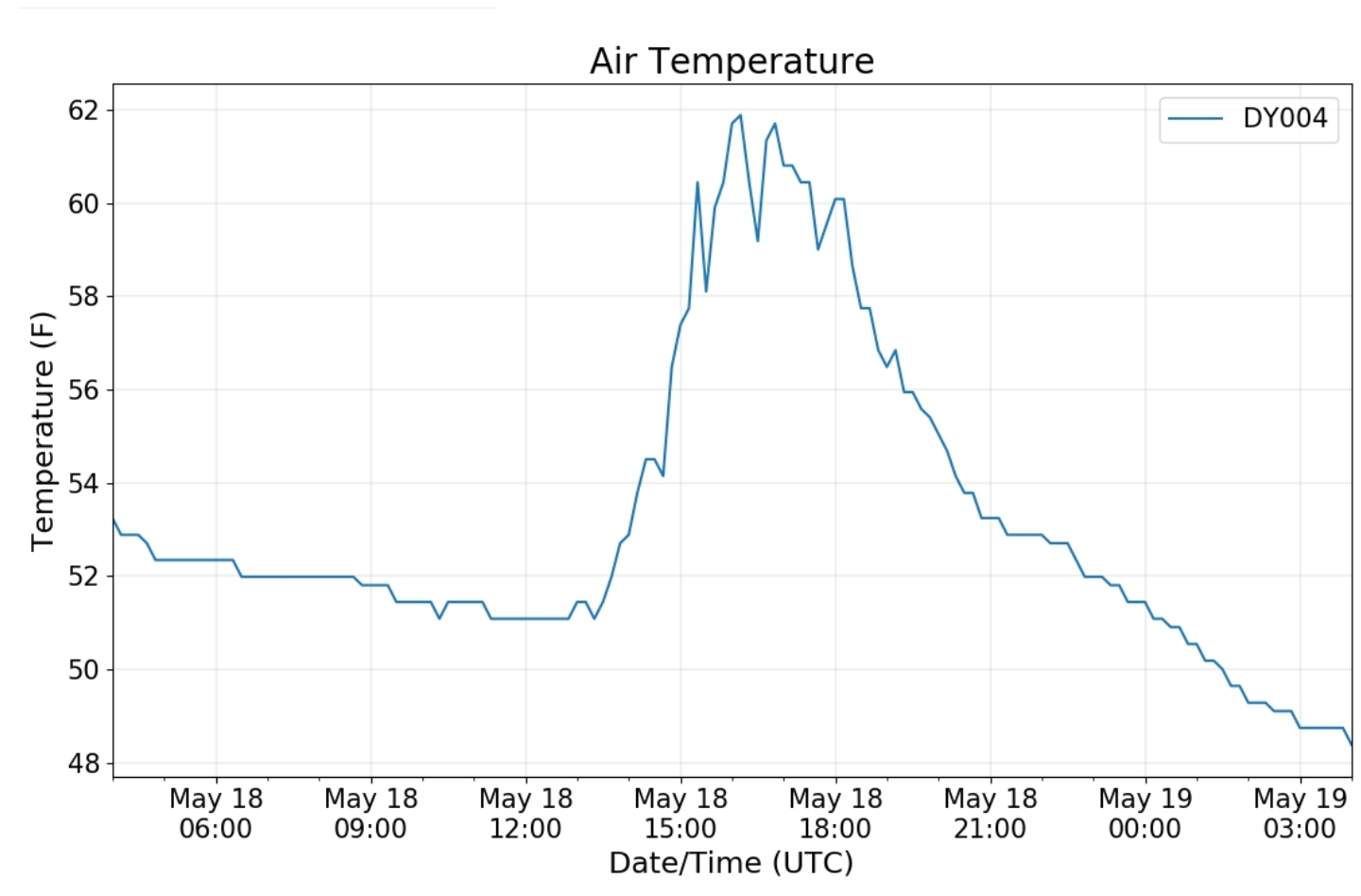
Cloudy ,foggy start, fog lingered along eastern Alleghenies north. Things briefly broke for a few hours in the afternoon with some sun mixed in. Areas south turned drearier after a ok start. I had a little most towards dark returning pushing back over Meadow Mt.
Bittinger 2nw Valley
Snowfall season to date 73.1″
Garrett College
Canaan Heights/Davis 3SE
Precip 0 7am
Snowfall season to date 101.9″
Comments by Dave Lesher at:
Climate Reference Network Canaan
Cabin Mt at Bald Knob
Cabin Mt-Western Sods
Spruce Knob
Snowshoe
Station having issues and incomplete data today…
Canaan Valley Refuge
7Springs
Cumberland Airport
Station remains down. Inquiry sent on issue.
Cumberland Coop reached a max of 67°
The Valley vs Cabin Mt
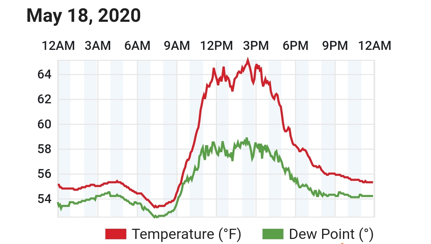
Canaan area temps
High Ground Comparison
RTMA
Radar
Satellite
Flow
Surface features and 500mb height anomalies and flow
The old most east flow…
Savage Mt
fog lifted for a time in the afternoon before returning
Keysers Ridge
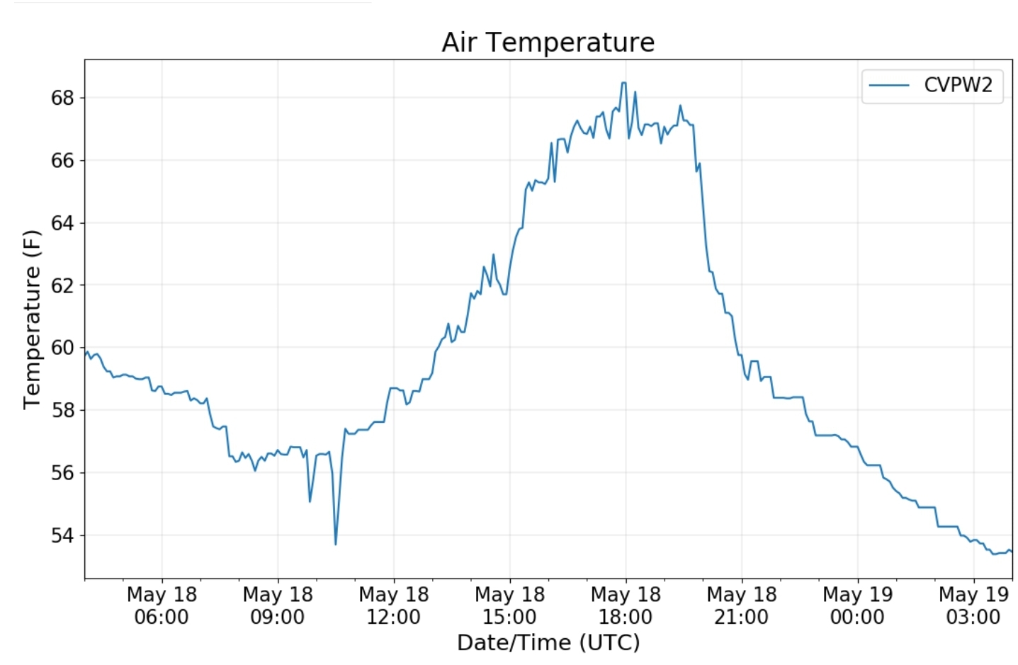
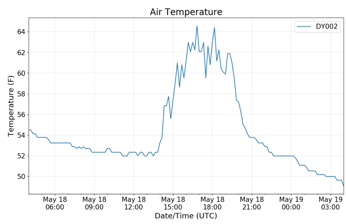
That led to temps like this between the 2 locations
a temp setup like


