May 10, 2020

May 10, 2020

May 10(Sun)

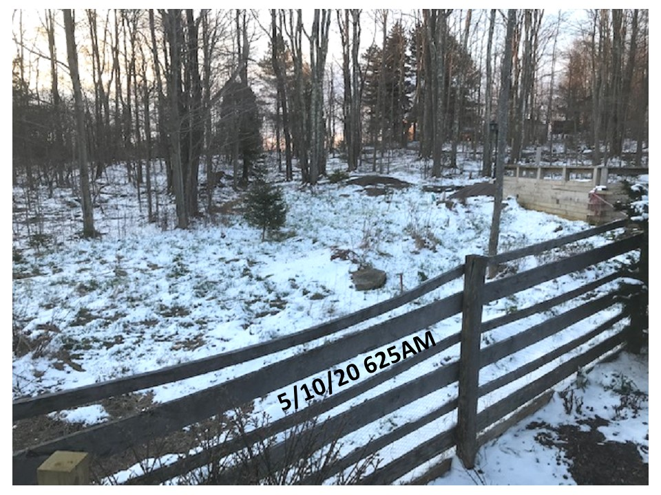
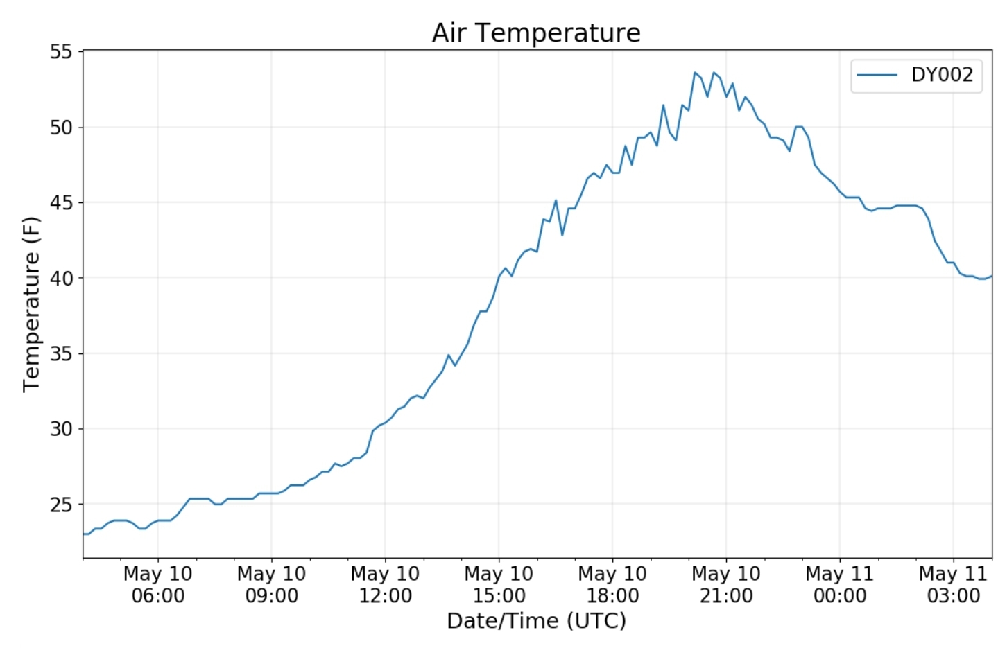
Breezy, mainly clear start. Still a touch cold. Snow remained in the shady woods early a.m, already melted in any sunny areas yesterday and all left today.

Bittinger 2nw Valley

Snowfall season to date 73.0

Garrett College

Unfortunately technical issues have not been corrected and station remains down

Canaan Heights/Davis 3SE

Precip -T 7am

24 hour 7am snowfall – T

Snow depth at 7am 1″, melted during the day

Snowfall season to date 100.8″

Comments by Dave Lesher at :

http://data.canaanmtnsnow.com

Mostly sunny and much warmer. Snowcover totally gone by afternoon.

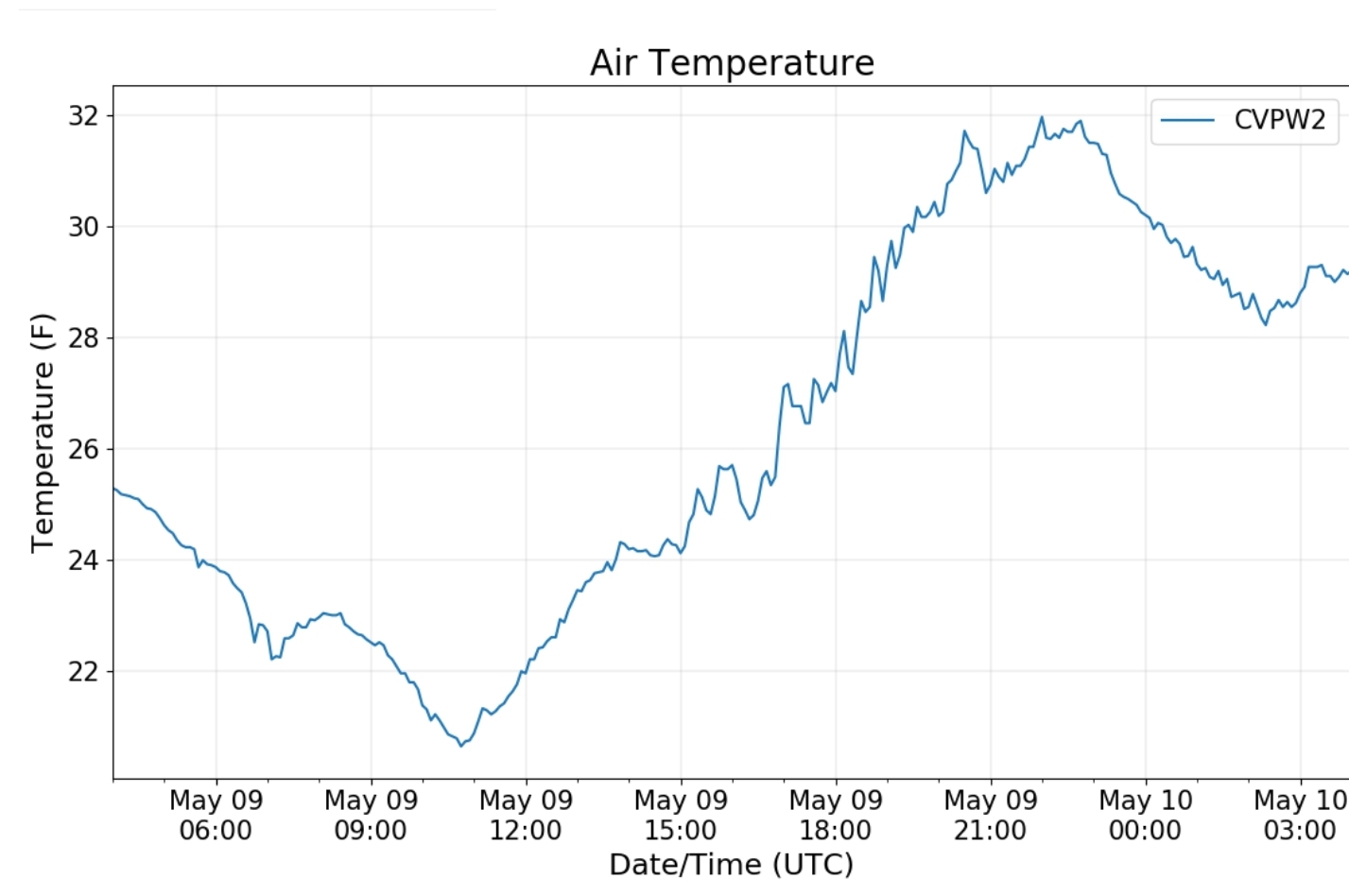
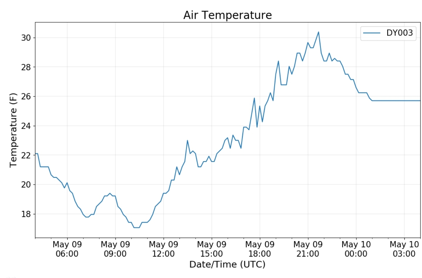
Yesterday’s daily maximum temperature of 32F (31.9) is the lowest daily max recorded in May since temperature record-keeping commenced here in October 1998. The previous record low max in May was 36F on May 19, 2002.

photo by Dave Lesher

Climate Reference Network Canaan

Cabin Mt at Bald Knob

photo from base of the ski resort adjacent to Bald Knob

Cabin Mt-Western Sods

Spruce Knob

Snowshoe

Canaan Valley Refuge

7Springs

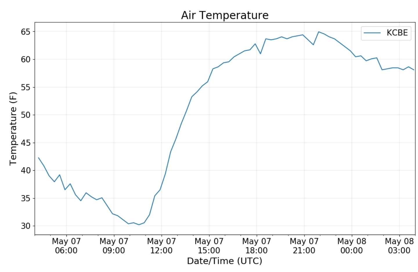
Cumberland Airport

The Valley vs Cabin Mt

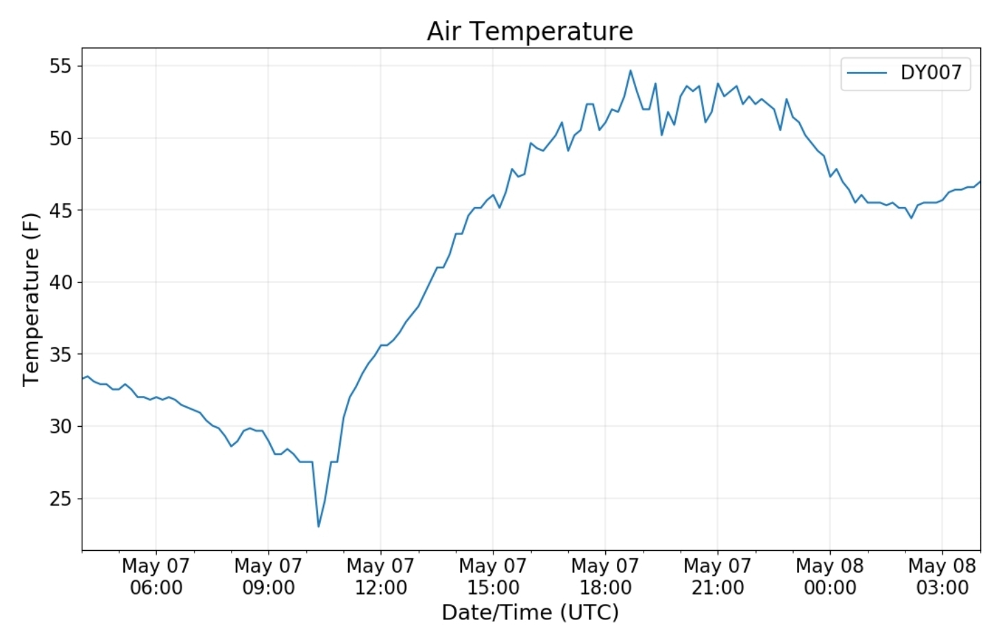
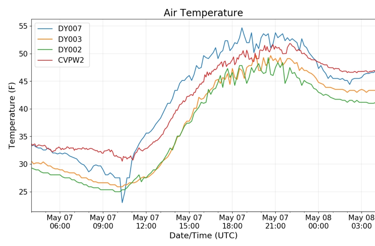
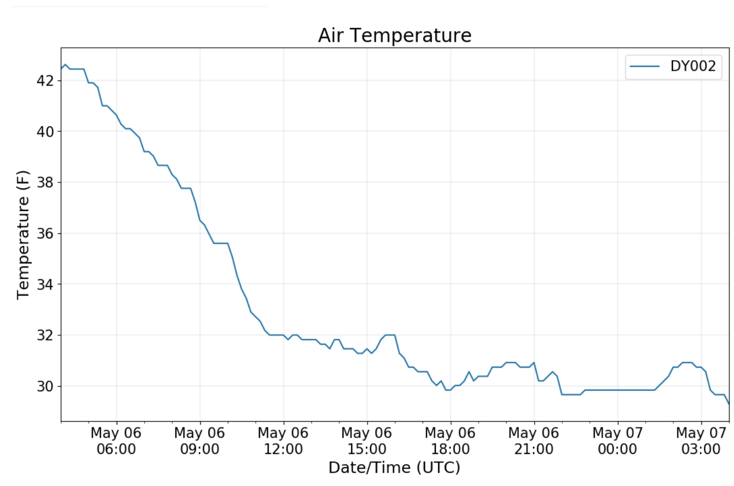
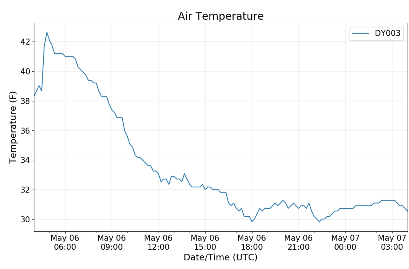
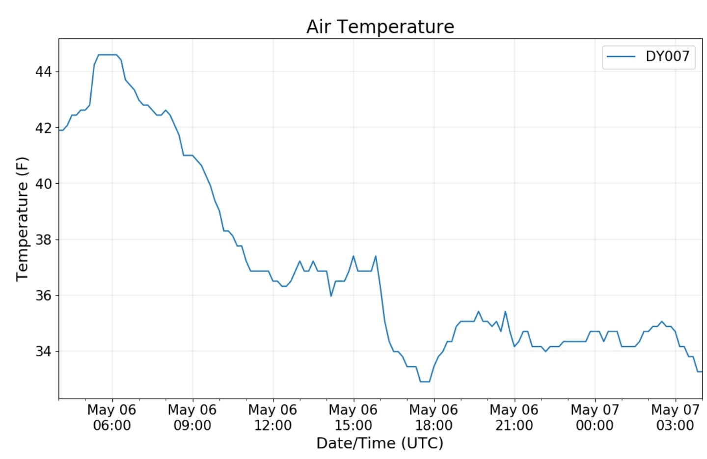
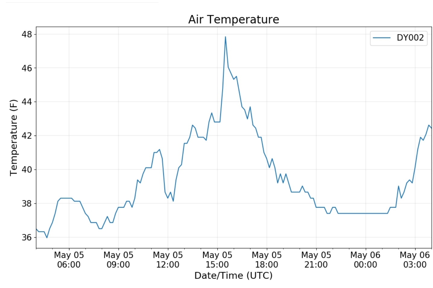
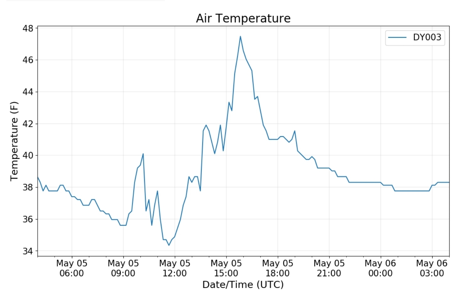
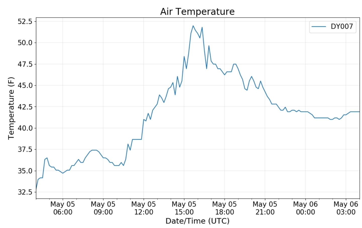
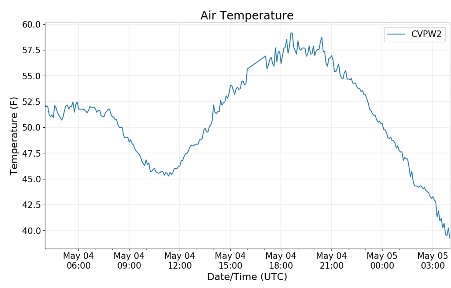
Canaan area temps

Comparison view

High Ground Comparison

RTMA

Radar

Void of precip locally

Satellite

Flow

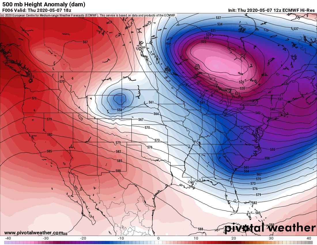
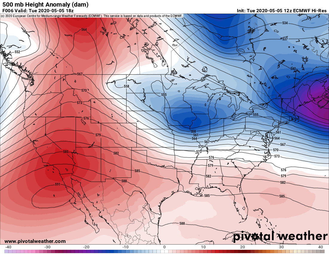
Surface features and 500mb height anomalies and flow

May 9, 2020

May 9, 2020

May 9(Sat)

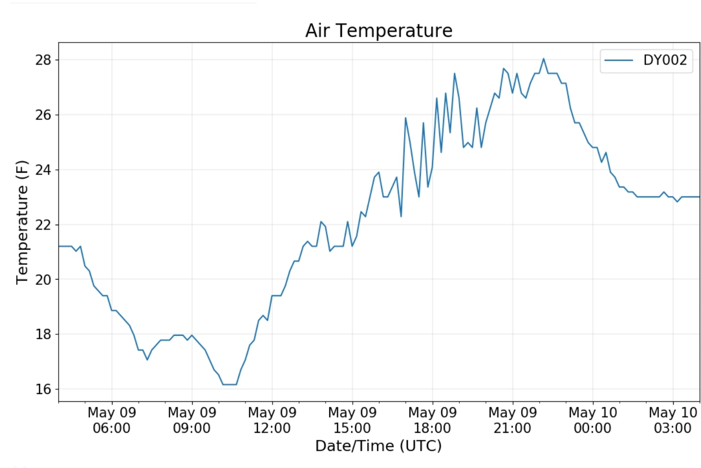
Very cold start, skies cleared for a time overnight, then clouded up early to mid morning with more snowshowers with a few heavier pockets.

Bittinger 2nw Valley

Snowfall 1.5″ total…. ( .8 has fell through 8pm last night, .3 more before ending 10pm. Another .4″ today midday with 2 separate moderate to briefly heavy burst. I made it back right at the tail end of the second burst to capture the daily max snowfall as a May sun does not give much opportunity to do so. Within a 15-20 minutes the snow board will be bare, even in indirect sun and cold temps. So, its key to capture it quick.

Snowfall season to date 73.0″

Garrett College

Station remains offline

Cherry Creek along Mosser Rd

Canaan Heights/Davis 3SE

Precip 1.08 7am

Snowfall 2.8″

Snowfall season to date 100.8″

Comments by Dave Lesher at:

http://data.canaanmtnsnow.com

Much colder overnight with some clearing by daybreak and a few lingering snowflakes.
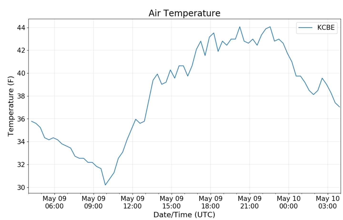
Two new May records for the 19 years of record-keeping here: Low temp of 19F bests the previous May record low of 24 on 9 May 2017. The 2.8 inches of snow exceeds the previous record of 2.3 inches on 7 May 2017

Climate Reference Network Canaan

Cabin Mt at Bald Knob

Cabin Mt-Western Sods

Spruce Knob

lots of pics to fill in/also on the 7th as well ..check back

https://www.washingtonpost.com/weather/2020/05/09/polar-vortex-record-may-cold-snow/

Snowshoe

Canaan Valley Refuge

7Springs

Cumberland Airport

The Valley vs Cabin Mt

Canaan area temps

Comparison view

High Ground Comparison

RTMA

Radar

Satellite

Flow

Surface features and 500mb height anomalies and flow

May 8, 2020

May 8, 2020

May 8(Fri)

Wet start, to a white finish. Rain in the morning, few ice pellets as it started, then rain to snow in the evening hours. Rapidly whitening things and accumulating and covering roadways in areas.

Bittinger 2nw Valley

Snowfall late today will be tallied tomorrow(to note .8 fell through 7pm)

Snowfall season to date 71.5″ -again what fell today will be tallied tomorrow

Garrett College

Station remains down

Cherry Creek along Mosser Rd
live from top of Wisp

Canaan Heights/Davis 3SE

Precip 0 7am

Snowfall began evening, will be tallied tomorrow. This amount did top 100″ for the site

Snowfall season to date prior to this snow 98.0″

Comments by Dave Lesher at:

http://data.canaanmtnsnow.com

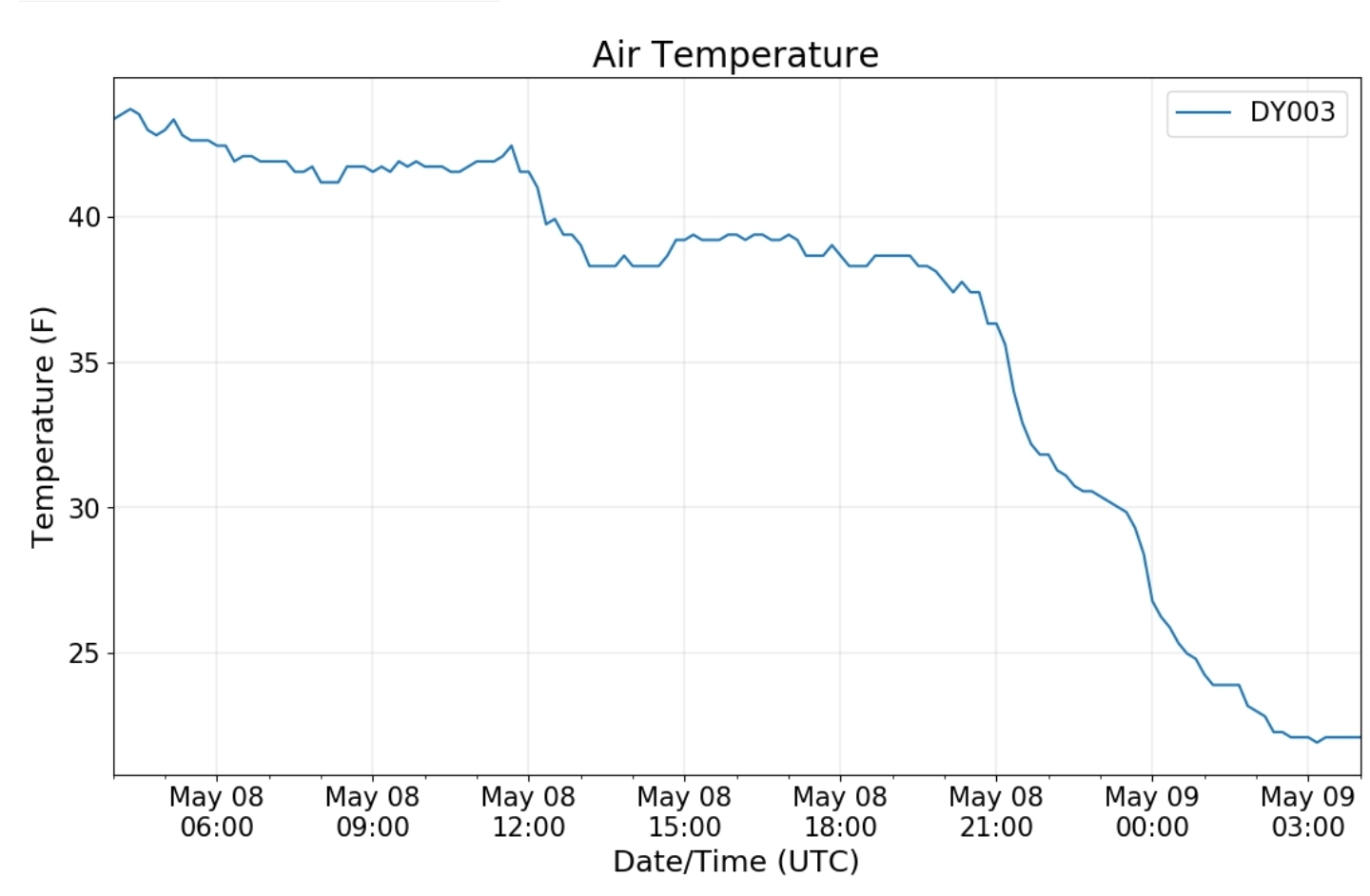
Steady rain all day with slowly falling temperatures. Rain changed to snow at 530PM, quickly becoming moderate or heavy, then tapering off and ending by late evening. Turning sharply colder

photo by Dave Lesher

Climate Reference Network Canaan

Cabin Mt at Bald Knob

Cabin Mt-Western Sods

Spruce Knob

Snowshoe

Canaan Valley Refuge

7Springs

Cumberland Airport

The Valley vs Cabin Mt

Canaan area temps

Comparison view

RTMA

Radar

Satellite

Flow

Surface features and 500mb height anomalies and flow

May 7, 2020

May 7, 2020

I have lots to fill in for this date. However the snow event on the 8th consumed my typical time…will fill in asap

May 7, 2020

A cold start, milder finish. Winter early up high.

Bittinger 2nw Valley

Snowfall season to date 71.5″

Garrett College

station remains offline

Cherry Creek along Mosser Rd

Canaan Heights/Davis 3SE

Precip .16 7am

Snowfall season to date 98.0″

Trace past 24 hours

Comments by Dave Lesher at:

http://data.canaanmtnsnow.com

Clearing and colder overnight. 
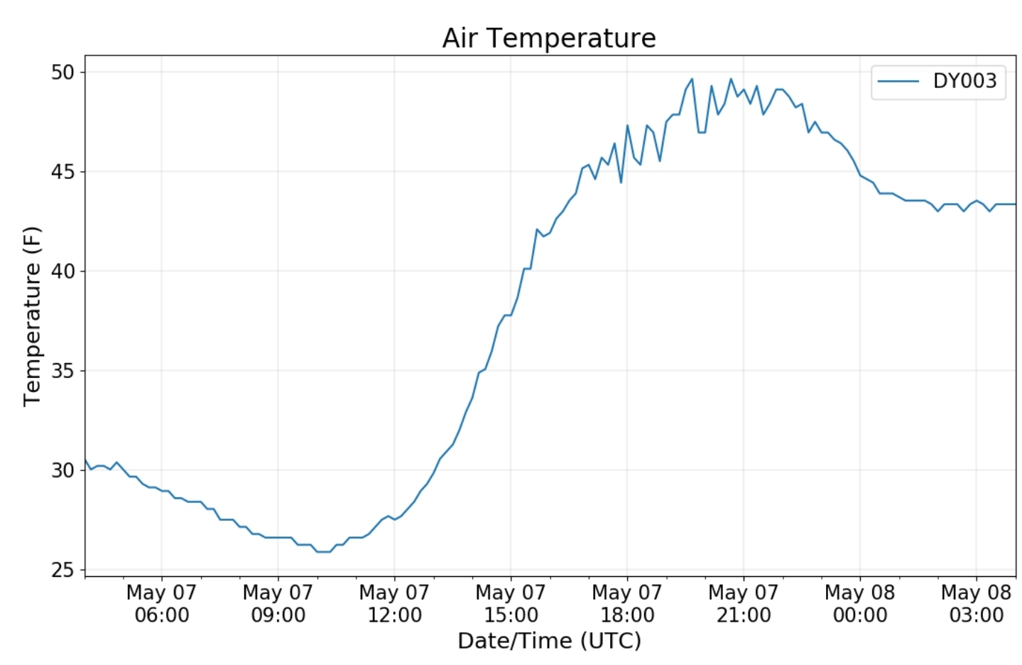
Yesterday’s max temp of 36 equals the lowest daily max ever recorded here in May (May 19, 2002) since daily temperature recordkeeping commenced in Oct 1998

Climate Reference Network Canaan

Cabin Mt at Bald Knob

Cabin Mt-Western Sods

Spruce Knob

Snowshoe

Canaan Valley Refuge

7Springs

Cumberland Airport

The Valley vs Cabin Mt

Canaan area temps

Comparison view

RTMA

Radar

Satellite

Flow

Surface features and 500mb height anomalies and flow

May 6, 2020

May 6, 2020

May 6(Wed)

Cloudy, wet, flakes beginning early morning across Wv high ground. Whitening up by evening there up high. I has snow showers in the evening.

Bittinger 2nw Valley

Snowfall season to date 71.5″

Garrett College

Station remains offline

Cherry Creek along Mosser Rd

Canaan Heights/Davis 3SE

Precip .34 7am

Snowfall season to date 98.0″

Comments by Dave Lesher at:

http://data.canaanmtnsnow.com

First snowflakes seen 725AM. 35F.
10AM: Cloudy and 35F. Periods of light snow past two hours briefly dropped temp to 33F. No accumulation.
7PM: Cloudy and 32F. Off and on light or very light snow all afternoon produced no accumulation.
10PM: Cloudy and 33F. No snow past three hours

Climate Reference Network Canaan

Cabin Mt at Bald Knob

Cabin Mt-Western Sods

Spruce Knob

Snowshoe

another graph error. .all data was collected though

Canaan Valley Refuge

7Springs

Cumberland Airport

The Valley vs Cabin Mt

Canaan area temps

Comparison view

RTMA

Radar

Satellite

Flow

Surface features and 500mb height anomalies and flow

Keysers Ridge

Gaudineer Knob

By Eric Furr

May 5, 2020

May 5, 2020

May 5(Tues)

Cloudy, overcast, chilly. Some rain, fog late.

Bittinger 2nw Valley

Snowfall season to date 71.5″

early morning near Bittinger 2nw

Garrett College

Unfortunately the station is offline again.

Cherry Creek along Mosser Rd early morning-north view.

Canaan Heights/Davis 3SE

Precip 0 7am

Snowfall season to date 98.0″

Comments by Dave Lesher at :

http://data.canaanmtnsnow.com

Climate Reference Network Canaan

Website issue, error page. However no data is lost here

Cabin Mt at Bald Knob

Cabin Mt-Western Sods

Spruce Knob

Snowshoe

Canaan Valley Refuge

7Springs

Cumberland Airport

The Valley vs Cabin Mt

Canaan area temps

Comparison view

RTMA

Radar

Satellite

Flow

Surface features and 500mb height anomalies and flow

Southeast view-Rock Lodge Rd morning

May 4, 2020

May 4, 2020

May 4(Mon)

Overall a chilly,breezy, but really beautiful day after the rains last night

Bittinger 2nw Valley

Snowfall season to date 71.5″

Accident 3 9E cocorahs picking up .81 rainfall last night

Garrett College

Unfortunately this station just cant shake the connectivity issue.

Cherry Creek along Mosser Rd

Canaan Heights/Davis 3SE

Precip 1.10 7am

Snowfall season to date 98.0″

Comments by Dave Lesher at:

http://data.canaanmtnsnow.com

Climate Reference Network Canaan

Cabin Mt at Bald Knob

Cabin Mt-Western Sods

Spruce Knob

Snowshoe

Canaan Valley Refuge

7Springs

Cumberland Airport

The Valley vs Cabin Mt

Canaan area temps

Comparison view

RTMA

Radar

Void after last night’s rain that ended near midnight

Satellite

Flow

Surface features and 500mb height anomalies and flow

May 3, 2020

May 3, 2020

May 3(Sun)

Rain early, more so in Wv, dry semi warm midday, with some heavier rain late.

Bittinger 2nw Valley

Garrett College

Station offline again due to technical issues

Flashback to 2014 on May 3

Canaan Heights/Davis 3SE

Precip .22 7am

Snowfall season to date 98.0″

Comments by Dave Lesher at:

http://data.canaanmtnsnow.com

Canaan Mountain:

Climate Reference Network Canaan

This site is horrible to get loaded. Todays chart may not be posted.

Cabin Mt at Bald Knob

morning

Cabin Mt-Western Sods

Spruce Knob

view towards Spruce Mt from North Fork Mt

Snowshoe

Canaan Valley Refuge

7Springs

Cumberland Airport

The Valley vs Cabin Mt

Canaan area temps

RTMA

Radar

Satellite

Flow

Surface features and 500mb height anomalies and flow

May 2, 2020

May 2, 2020

May 2(Sat)

Cloudy start, some areas some some early clearly helping temps drop off a bit more. A fair amount of sun and a very mild day.

Bittinger 2nw Valley

Snowfall season to date 71.5″

Garrett College

Cherry Creek along Mosser Rd

Canaan Heights/Davis 3SE

Precip .13 7am

Snowfall season to date 98.0″

Comments by Dave Lesher at:

http://data.canaanmtnsnow.com

Climate Reference Network Canaan

Cabin Mt at Bald Knob

Cabin Mt-Western Sods

Spruce Knob

view towards Spruce Mt from North Fork Mt

Snowshoe

Canaan Valley Refuge

Cloud cover, wind, getting the Valley off to a slow start for cold nights

7Springs

Cumberland Airport

The Valley vs Cabin Mt

Canaan area temps

Comparison view

RTMA

Radar

Void of precip for once locally

Satellite

Flow

Surface features and 500mb height anomalies and flow

May 1, 2020

May 1, 2020

May 1(Fri)

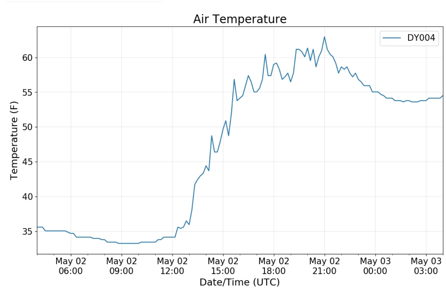
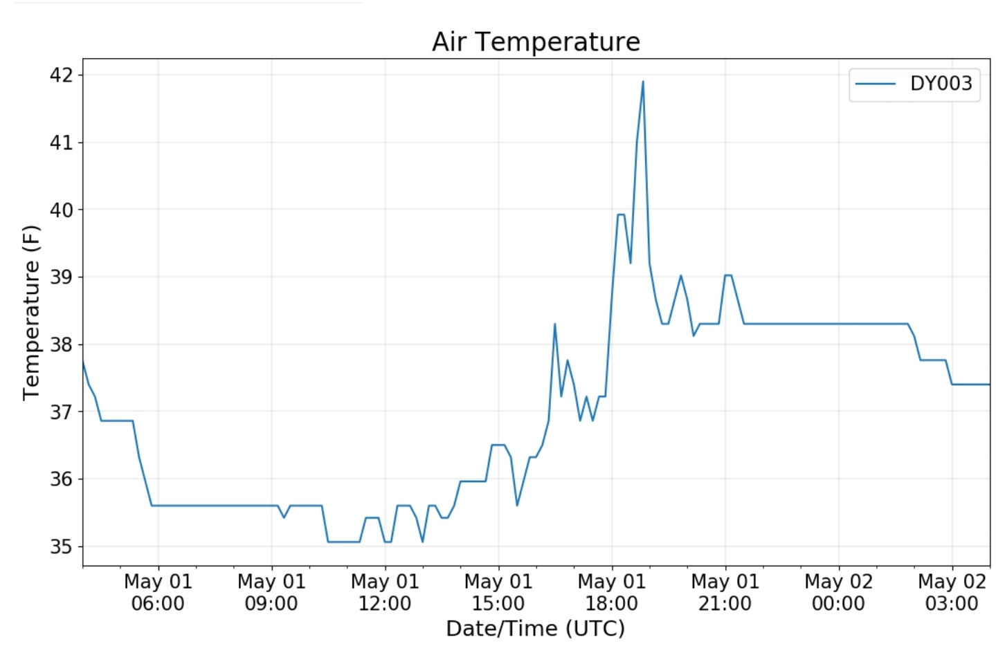
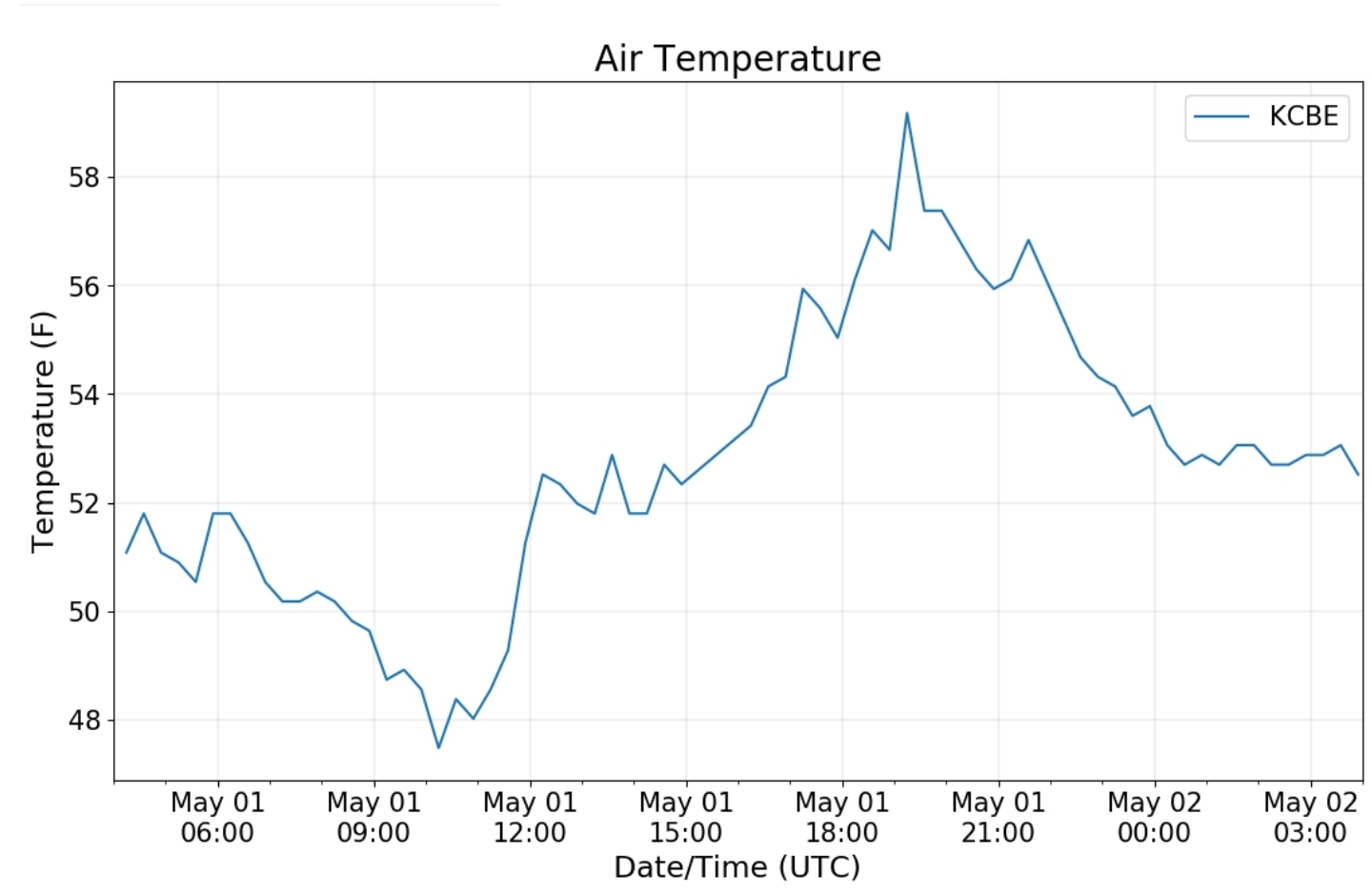
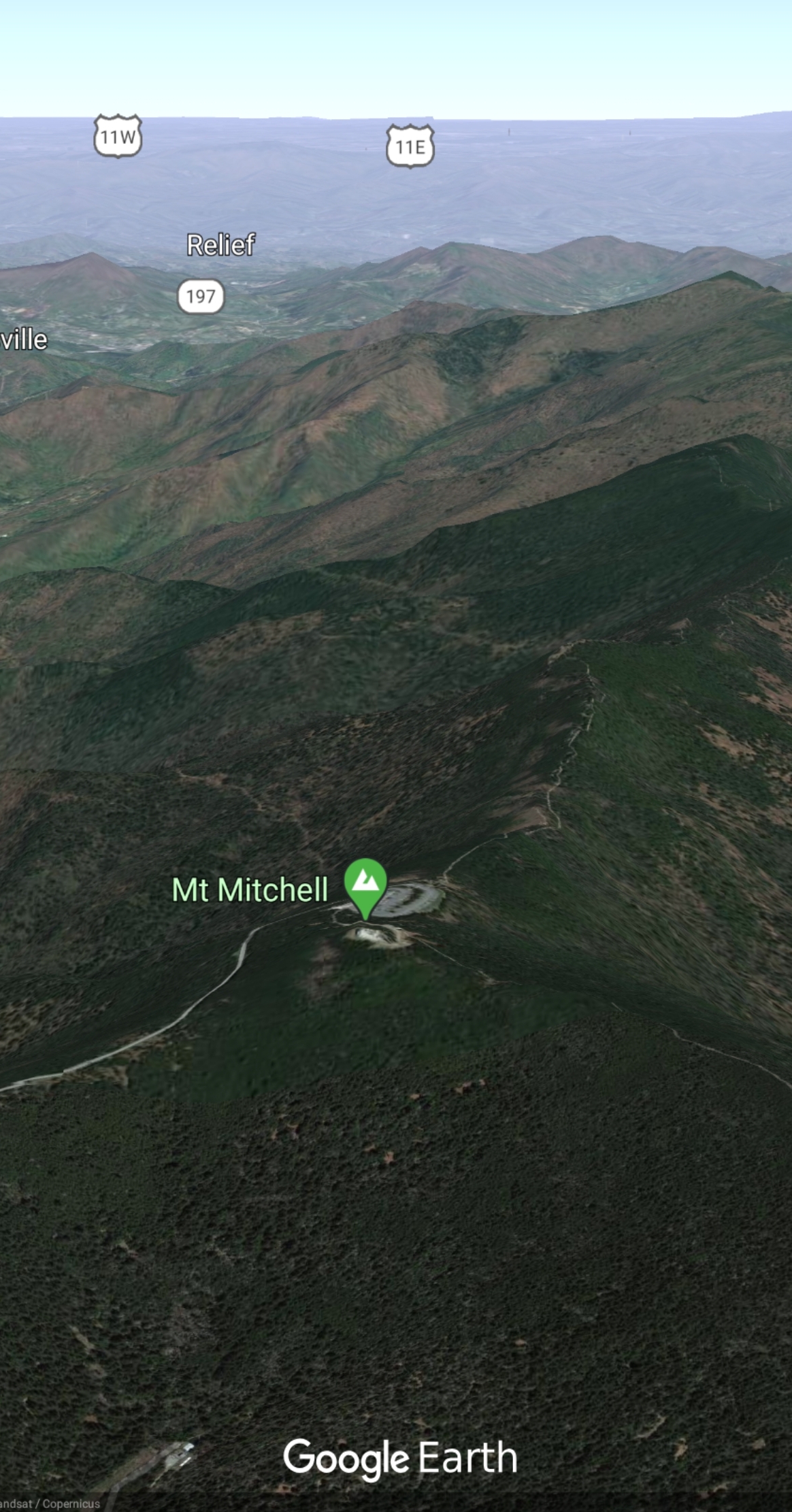
Chilly, dreary start, fog, some light rain on n off, especially late day. Possibly a few flakes at times in the Wv high ground. High N.C mts got coated white.

Bittinger 2nw Valley

Garrett College

Cherry Creek along Mosser Rd

Canaan Heights/Davis 3SE

Precip .14 7am

Snowfall season to date 98.0″

Comments by Dave Lesher at:

http://data.canaanmtnsnow.com

Climate Reference Network Canaan

Cabin Mt at Bald Knob

Cabin Mt-Western Sods

Spruce Knob

Snowshoe

Canaan Valley Refuge

7Springs

Cumberland Airport

The Valley vs Cabin Mt

Canaan area temps

Comparison view

RTMA

Radar

Satellite

Flow

Surface features and 500mb height anomalies and flow

Seneca Rocks

Backbone Mt

Mt.Mitchell in North Carolina today

Rimed Fir

Beech Mt in N.C