July 22, 2020
July 22(Wed)
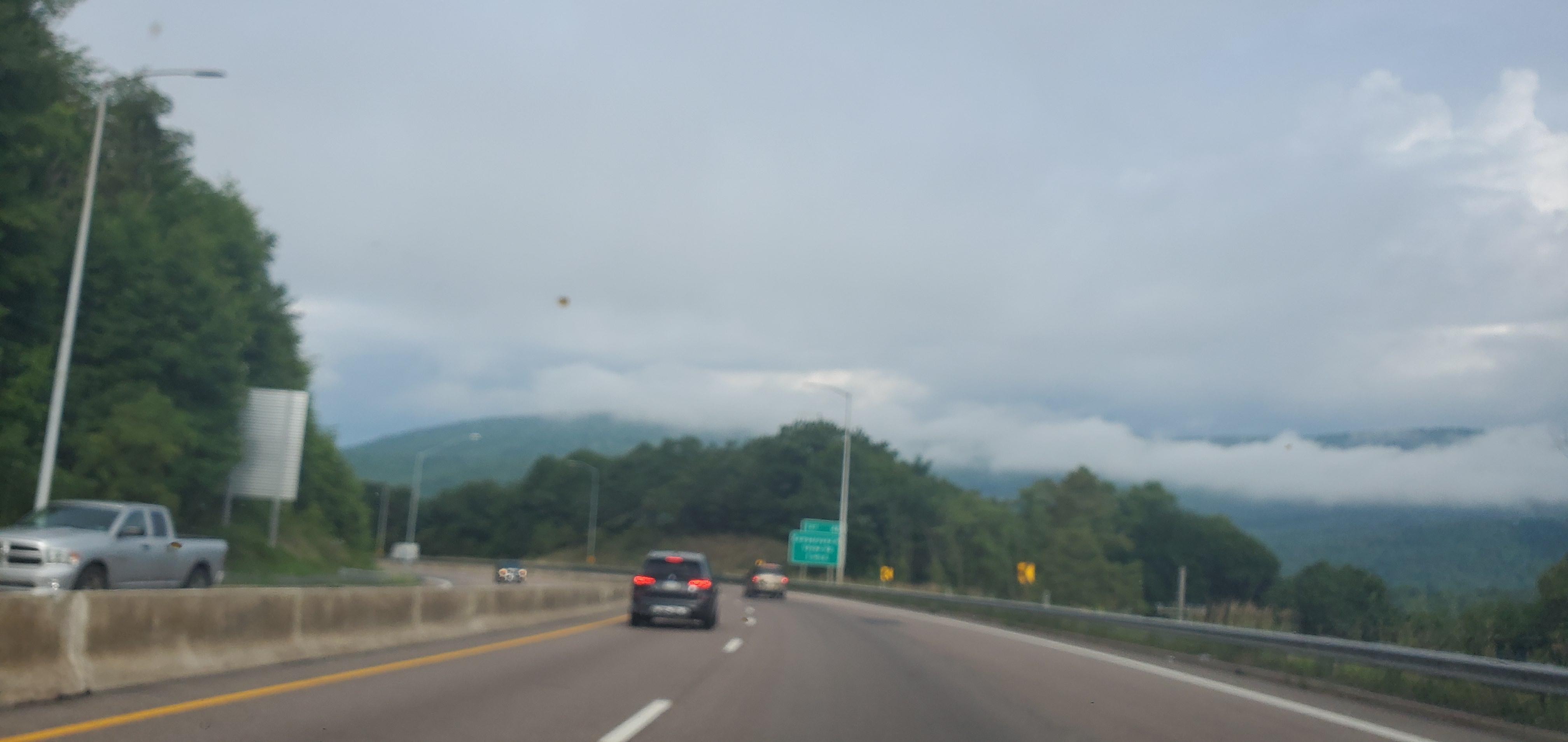
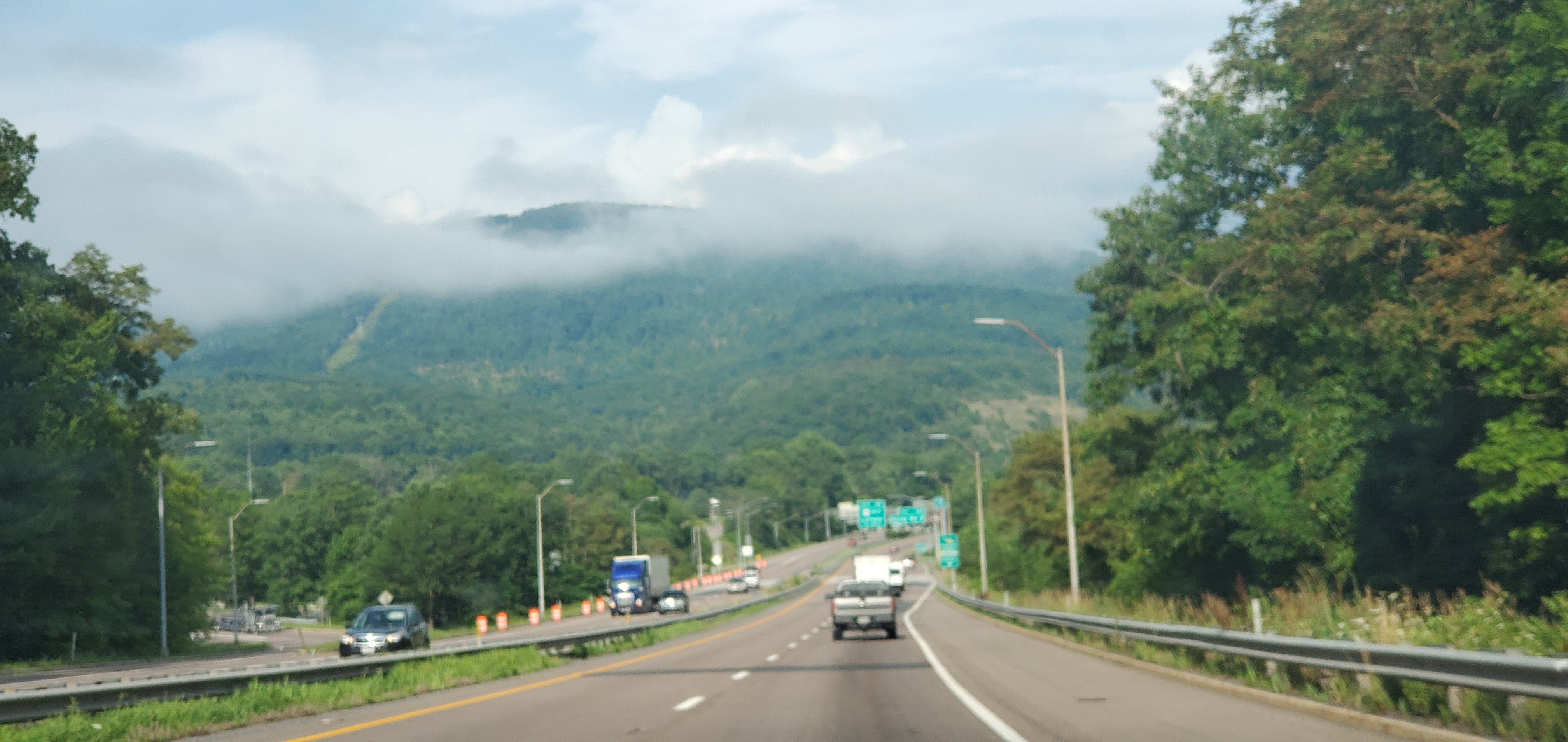
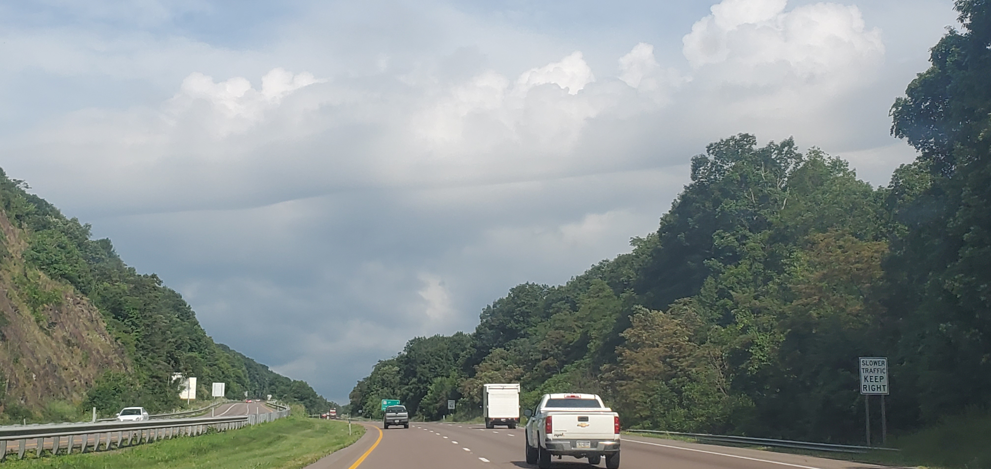
Cloudy, showers, some pockets of heavy ones.. sunny break mid afternoon
Bittinger 2nw Valley
Garrett College
Canaan Heights/Davis 3SE
Precip T 7am
Year to date total precip 39.53
Comments and data by Dave Lesher at:
Climate Reference Network Canaan
Cabin Mt at Bald Knob
Cabin Mt-Western Sods
Spruce Knob
Snowshoe
Canaan Valley Refuge
7Springs
Petersburg Grant County Airport
will fill in asap
The Valley vs Cabin Mt
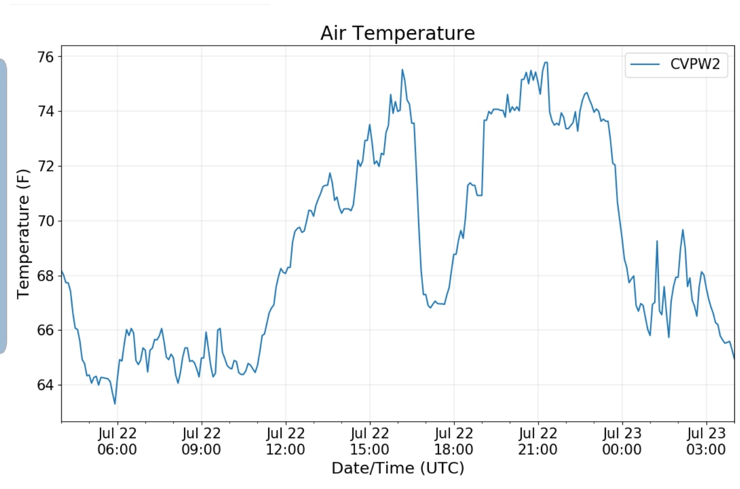
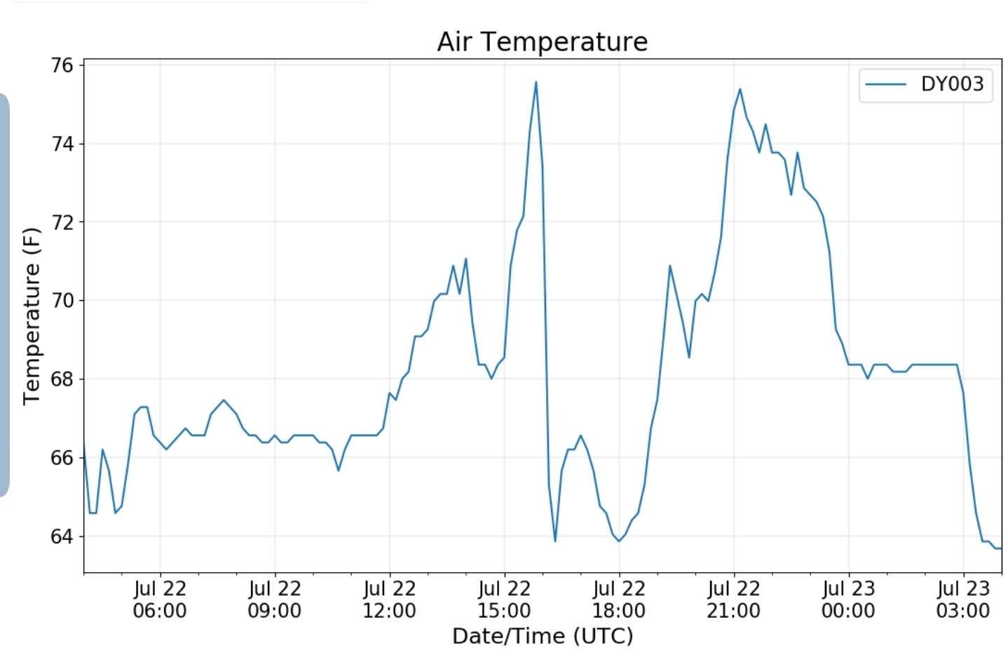
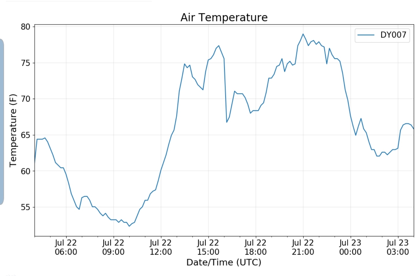
Canaan area temps
Comparison view
High Ground Comparison
Up High and Down Low
Up High, High Valley, Low Valley
RTMA
Radar
Satellite
Flow
Surface features and 500mb height anomalies and flow
Cumberland to Frostburg
Savage Mt
Cassleman Valley from Miller Hill
33 east of Harman at the divide
Rare unusual warmth? Not seen in many years??
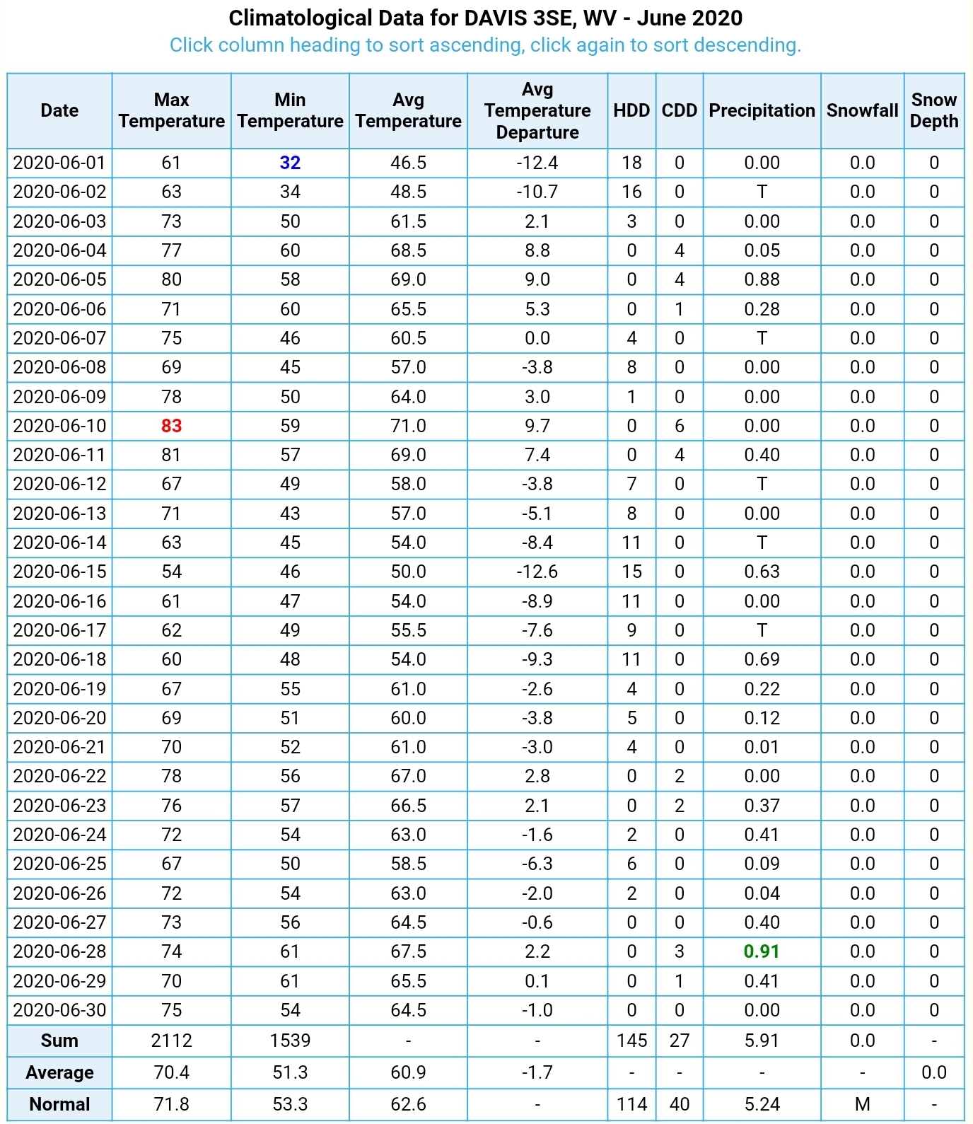
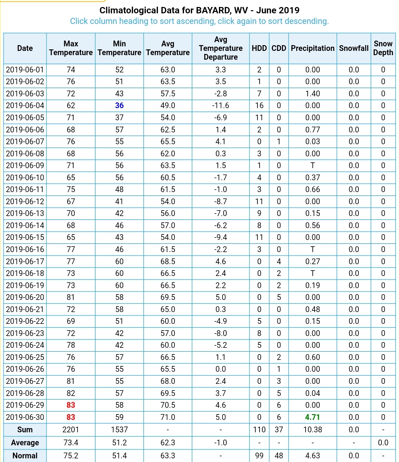
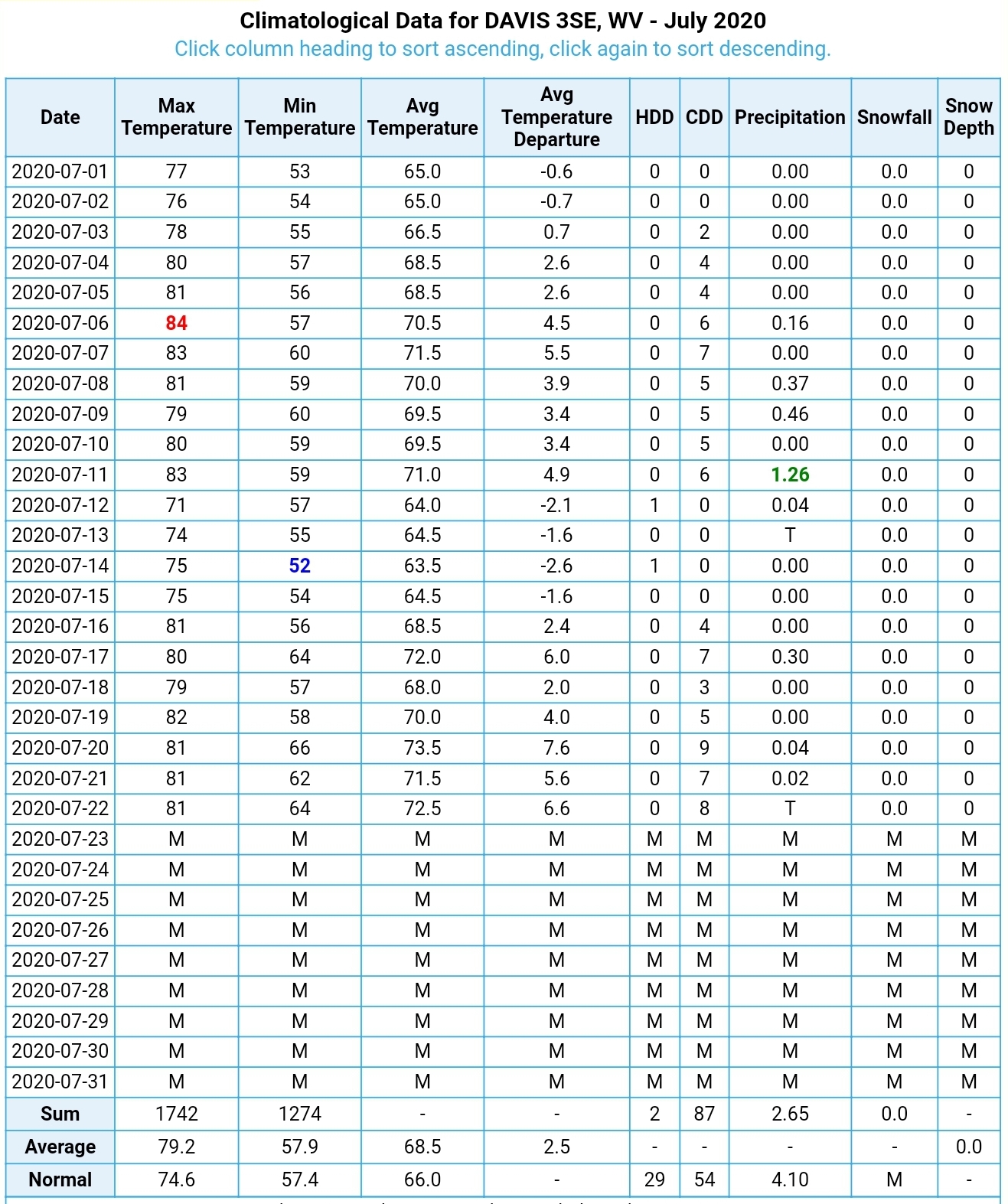
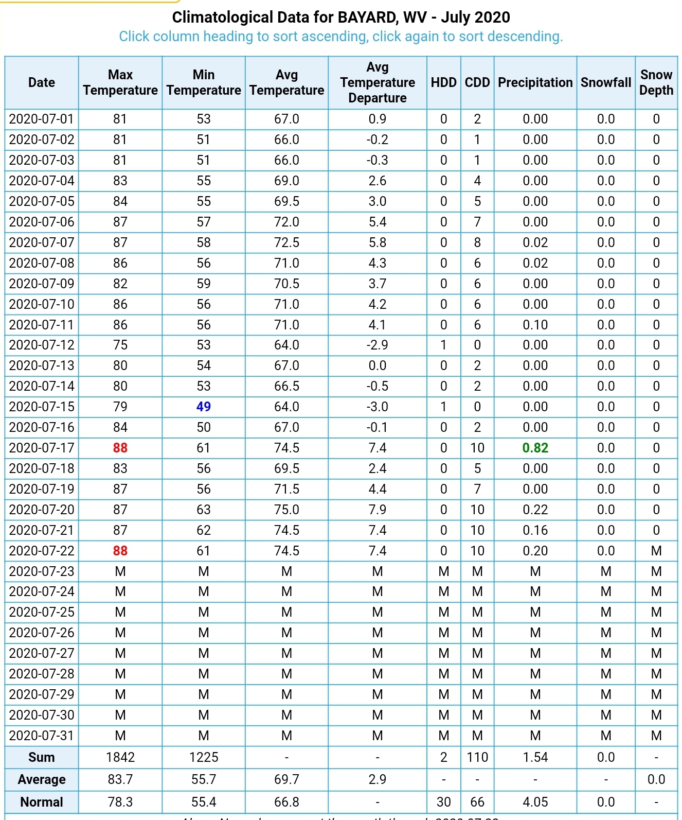
While we have seen an above normal month, temps in general are running around +2 to +3 above the average mean, which is max/min ÷2 at area coops. This on the heels of the month of June that came in very close to average. Most sites were in the -1.5 to +1 range. No great shakes there.
There has been a bit of ramble on the unusual warmth. However, the numbers say, its been warm, but nothing not seen before. In fact, its been seen many times and just last year July 1 through the 21st averaged a bit warmer than this year through the 21st.
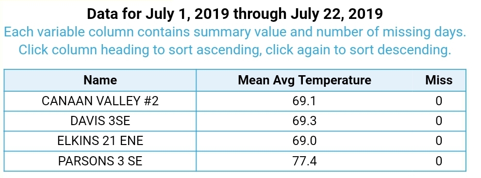
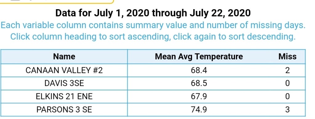
I would include some Garrett County coop data, but unfortunately it is skewed. The only consistent high ground coop reporting site is at the Oakland hospital. This site has thrown all comparisons out the window. At over 2400′, this site now averages higher monthly maxes than the 1400′ Savage River Dam site. All due to the site location 9 feet off the hospital wall. A site 1000′ higher, should NOT average higher monthly maxes. Min temps it absolutely can and common. On occasion max temps will be higher, but over the course of a month, that should not occur and this began occuring as the station site moved…unfortunate. The other local coop at Terra Alta has also fell off the earth and is currently not in operation. Oakland and TA needs some hood observers! The other official coop in Garrett, Sines Deep Creek, averages 10-14 missed days per month. Rendering data comparison useless.
What do we got. I record daily in an official NWS MMTS shelter with a data logger. Lets use it to compare last year to this year. With this, I compare every temp reading from July 1 through July 21st to get an average.
Bittinger 2nw Valley
Last year 2019 July 1 through 21- Avg temp 68.1
This year 2020 July 1 through 21- Avg temp 67.3
A -.8 average this year to last.
My max July temp last year through the 21st was 85.2 and lowest min 45.2. This year my month max is 85.3 and lowest min 47.6.
One main reason as the early part of the heat spell early in the month occured with dry air. Dewpoints in the 50s. While it was hot, the dewpoints were low and relatively comfortable. This setup allows nighttime temps to fall more readily in which they did. Recently the air mass has been stickier, dew points up, and nightime lows haven’t fell as much or as quick at night.
What about a higher area, an area where nightime temps do not fall off like they do in a high valley area
Garrett County Airport
Last year 2019 July 1 through 21- avg temp 68.7
This year 2020 July 1 through 21 – avg temp 69.9
These sites record dewpoints
Last year July 1 through 21 average DP 64.1
This year July 1 through 21 average DP 59.9
Overall a drier airmass in place vs last year. That increases the nighttime temp variance valley to hilltop. We have +1.2 temp at this site. A lack of rainfall has occured in this area, and that allows for warmer days. Dry air mess equals : 1- a daytime max increase as drier air heats easier and thats accompanied by the high ground holds higher temps on the overnights vs the valleys under these relatively stagnant patterns.
Lets look at another valley site- the cold one
The northern Canaan site which is running neck n neck with Mt. Washington for lowest average min temps for July in the east so far this year. 48.8 at Mt.Washington to 49.1 at the Refuge site and up until the past few days the refuge site was a notch in the lead.
Canaan Valley Refuge
Last year 2019 July 1 through 21- avg temp 67.0
This year 2020 July 1 through 21- avg temp 65.4
This year is -1.6 vs last year
Lets climb back up high
Spruce Knob
Last year 2019 July 1 through 21- avg temp 64.4
This year 2020 July 1 through 21- avg temp 64.5
A + .1, so nearly identical.
Back to the coop-
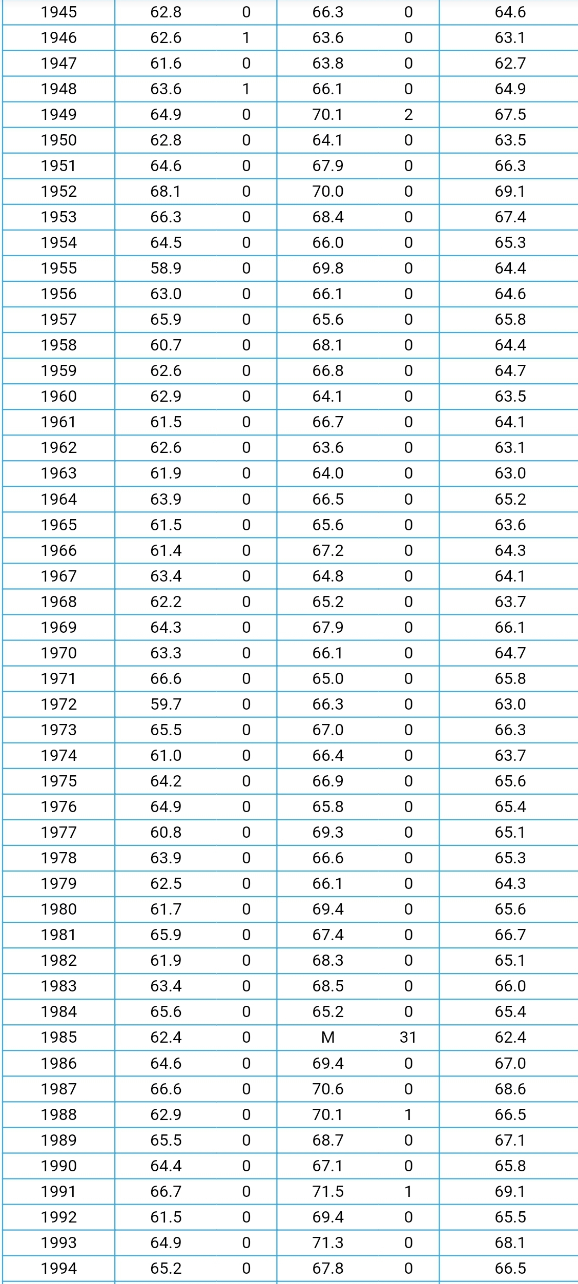
Average July temps through the years:
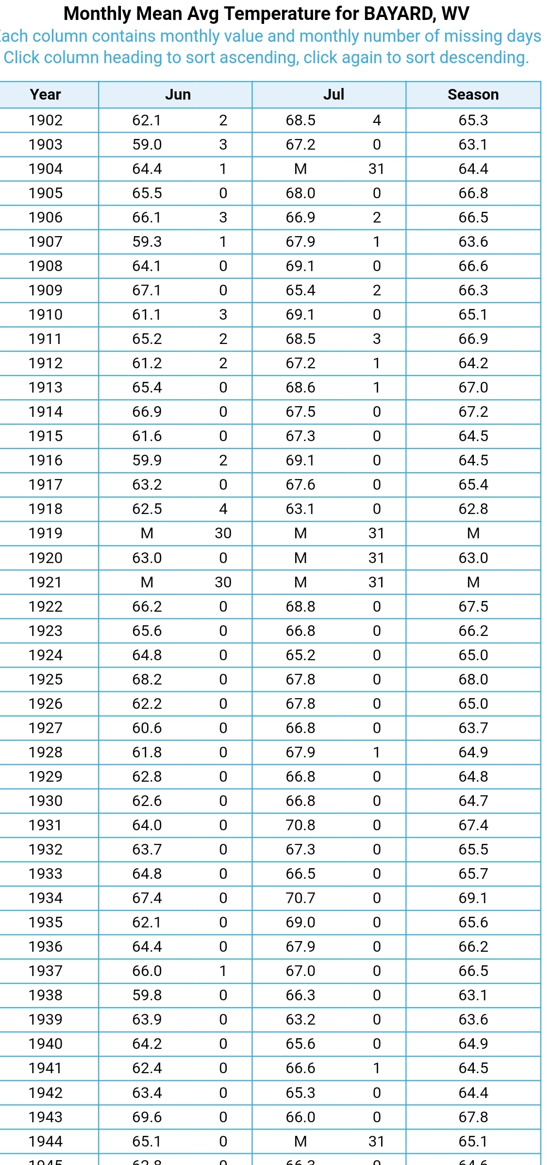
A long running consistent coop for temps-
Bayard
nothing earth shattering to see here
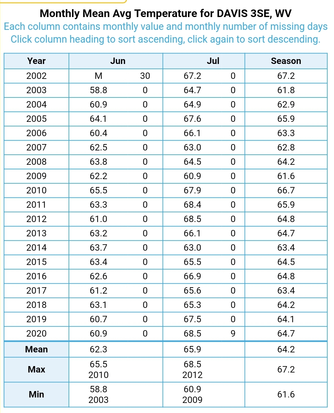
Canaan Heights/Davis 3SE
In a shorter time span, this year matches the max years
Look at June at Davis 3SE
last year
This year
Bayard
Last year
This year
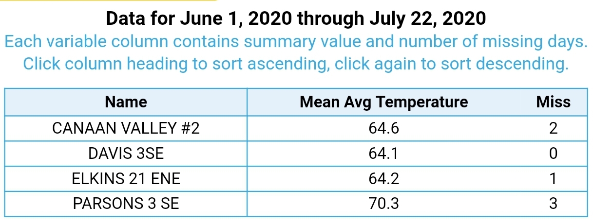
June 1 through July 22
Last year
This year
Doesn’t get much closer than that…
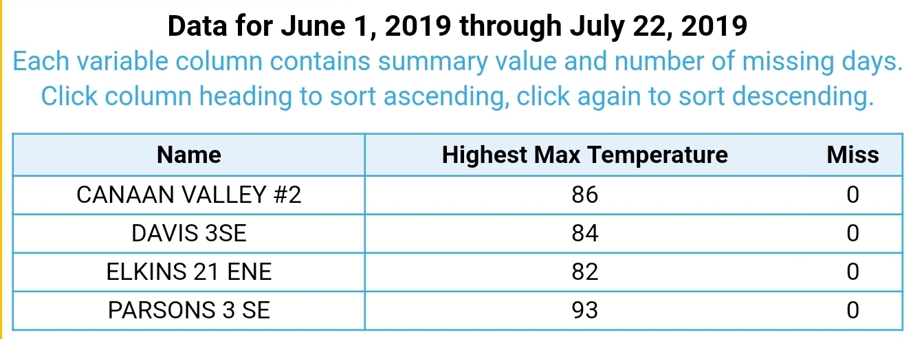
Hottest temp for the period
2019
2020
The 2 month period through the years
Davis 3SE
Bayard
Overview- while we have had our dose of very warm maxes this month
Davis 3SE
A +4.6 on the max temps , a + .5 on min temps
Bayard
A +5.3 on max temps, a + .3 on min temps. The overall totality, thanks to the drier air mass allowing mins to fall off more and the mostly cool June, this summer so far would go down as a stretch of very warm days, normal mins and nothing out of the extreme unordinary when based againt what is average.
In a wetter pattern, we see maxes held down to near the long term averages and nighttime mins held up due to consistent cloud cover thats usually accompanied by high dewpoints. This warm stretch has been pretty well the opposite of that. Until the past few days. This overall has featured well above normal maxes for July. That would really be about the only summer highlight to date.
Looking ahead, the next few days with a little more moisture present, we may see daytime maxes lowered a bit and nighttime maxes bumped up….thats the great balancing act…


