August 30, 2020

August 30, 2020

Aug 30(Sun)

Mix of clouds and sun, breezy, pleasant day.

Bittinger 2nw Valley

Will fill in asap

Garrett College

Canaan Heights/Davis 3SE

Precip .36 7am

Year to date total precip 46.57

Comments and data by Dave Lesher at:

http://data.canaanmtnsnow.com/

Climate Reference Network Canaan

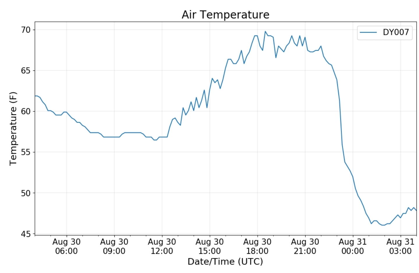
Cabin Mt at Bald Knob

Cabin Mt-Western Sods

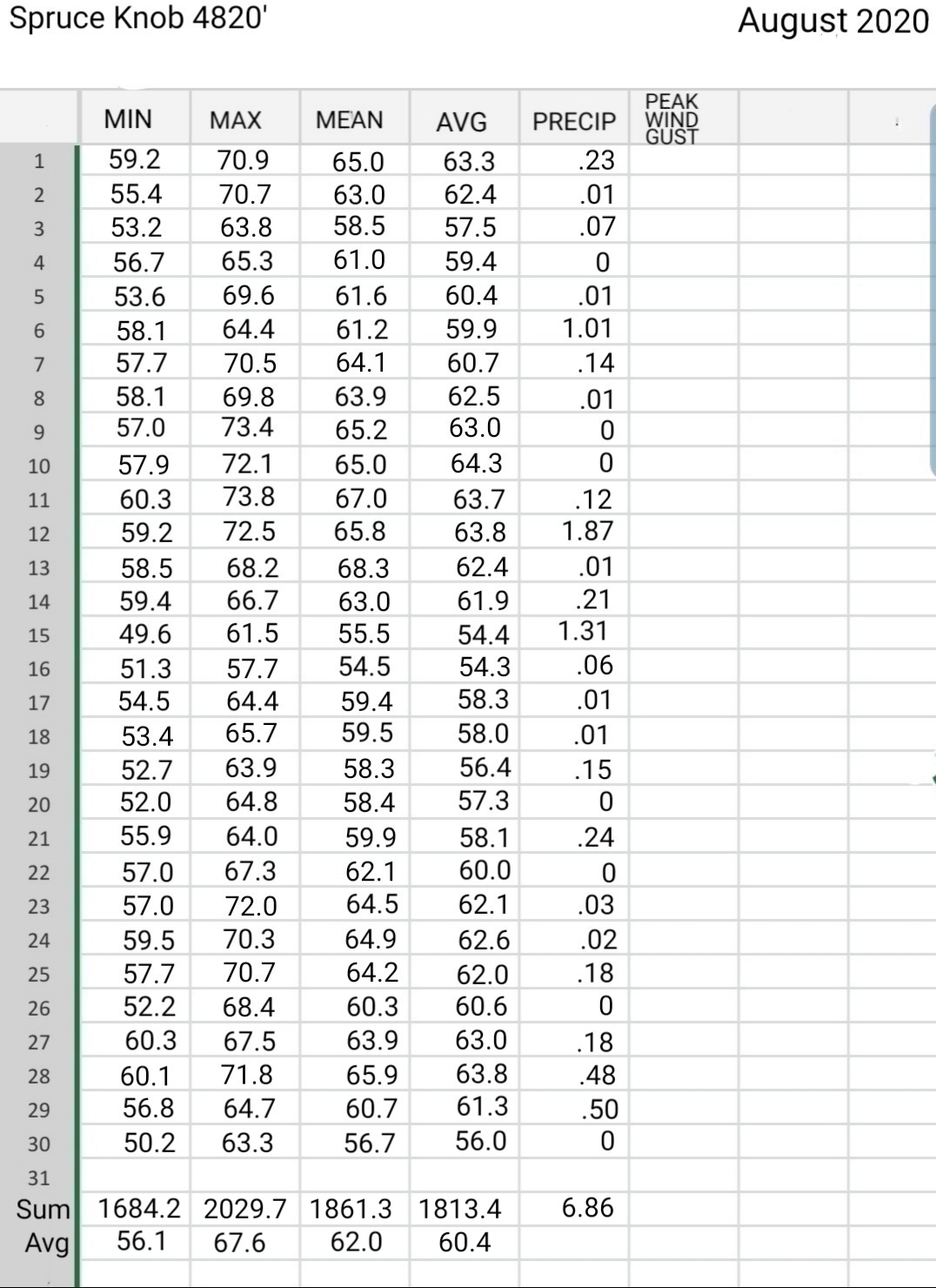
Spruce Knob

Snowshoe

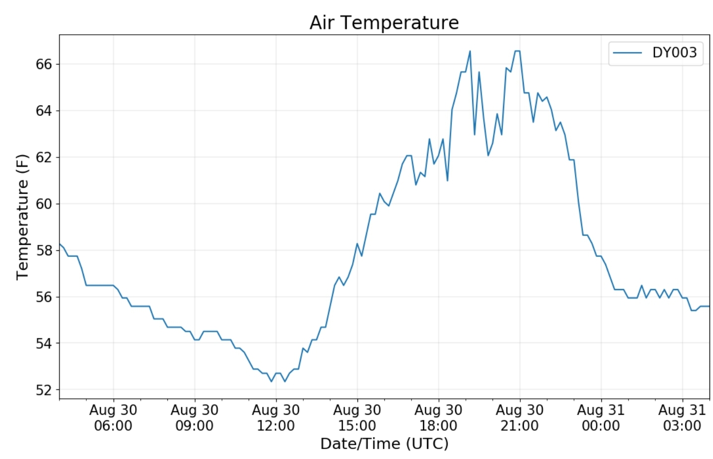
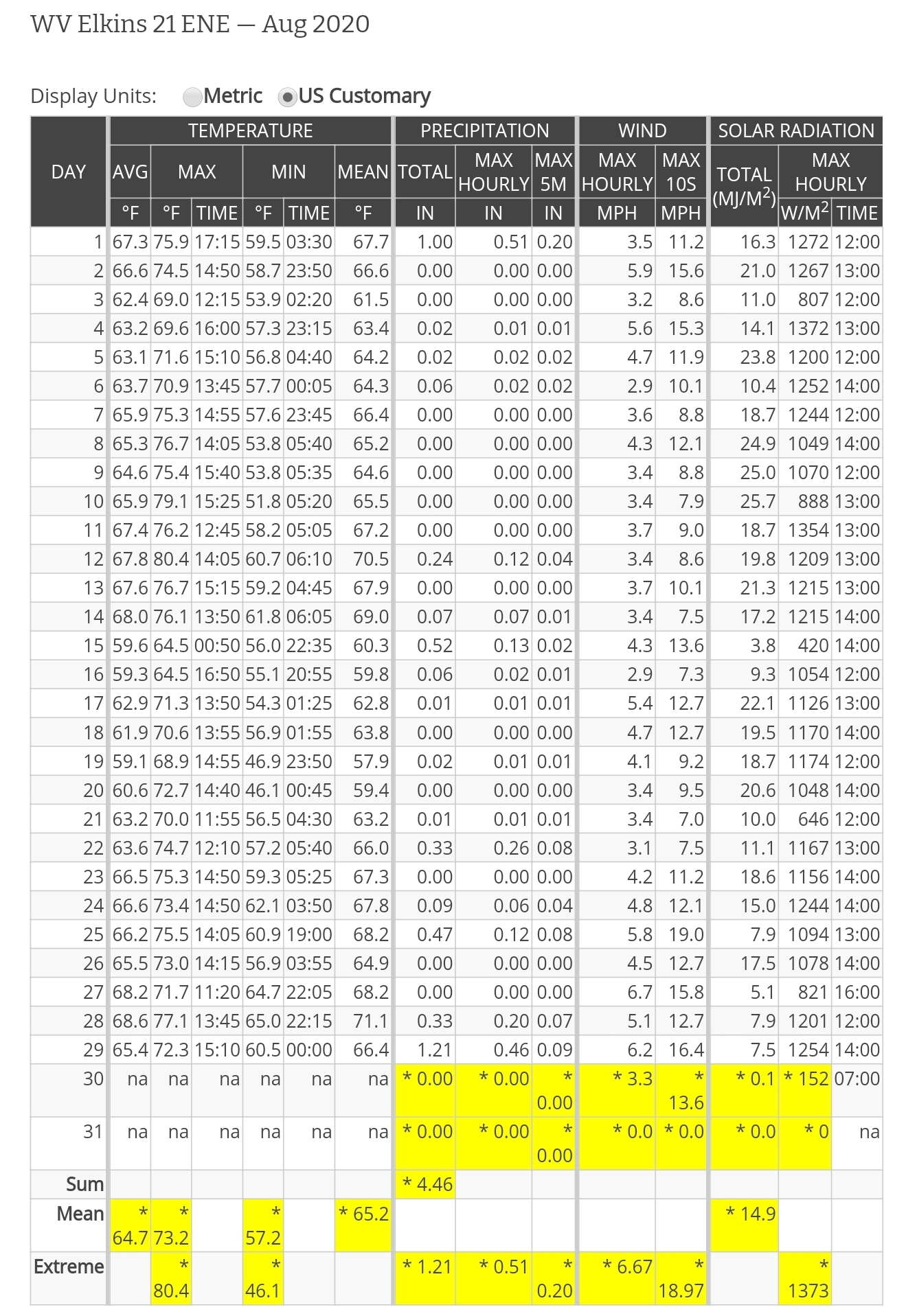
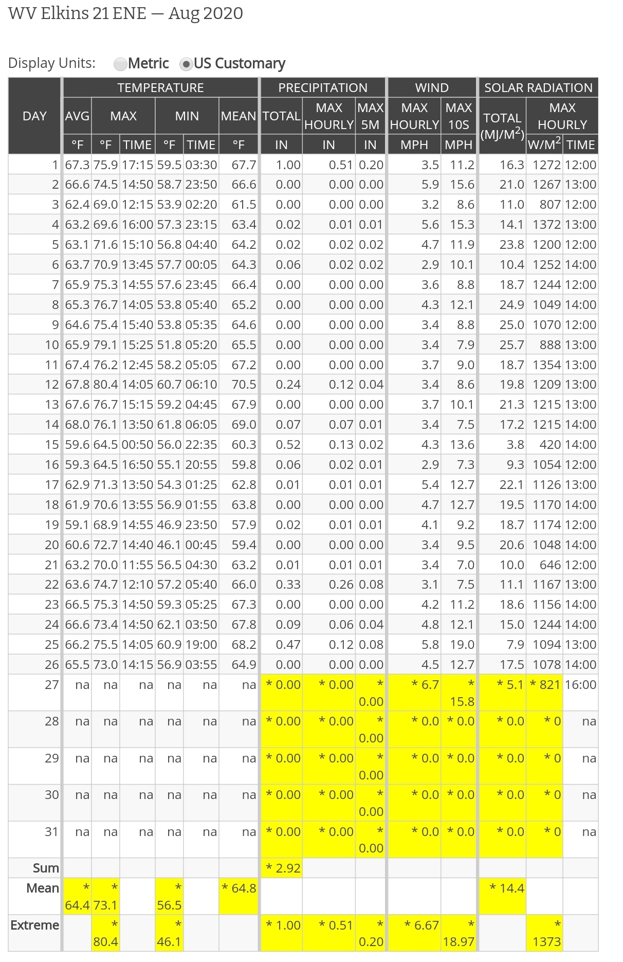
this station runs into daily technical issues that go unresolve . After the date of 8/31/20 this station will be replaced or dropped completely. Too much questionable data.

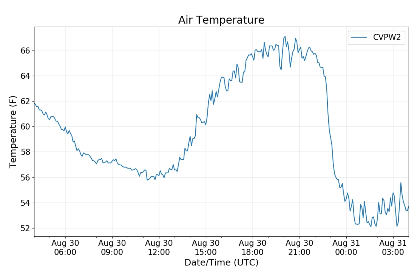
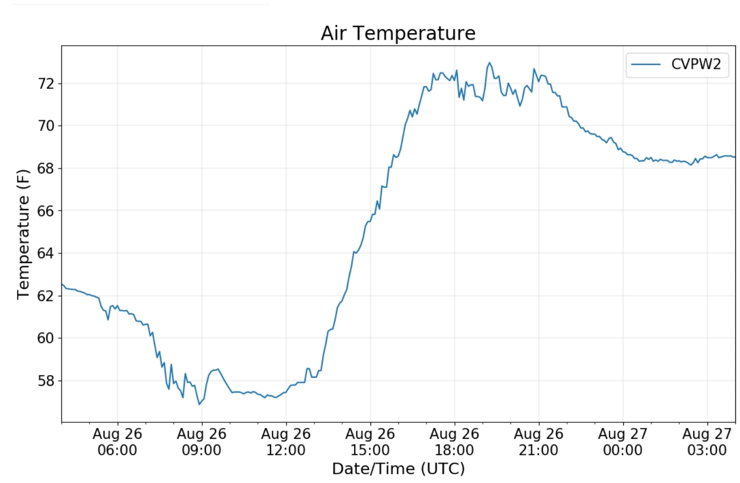
Canaan Valley Refuge

7Springs

Petersburg Grant County Airport

The Valley vs Cabin Mt

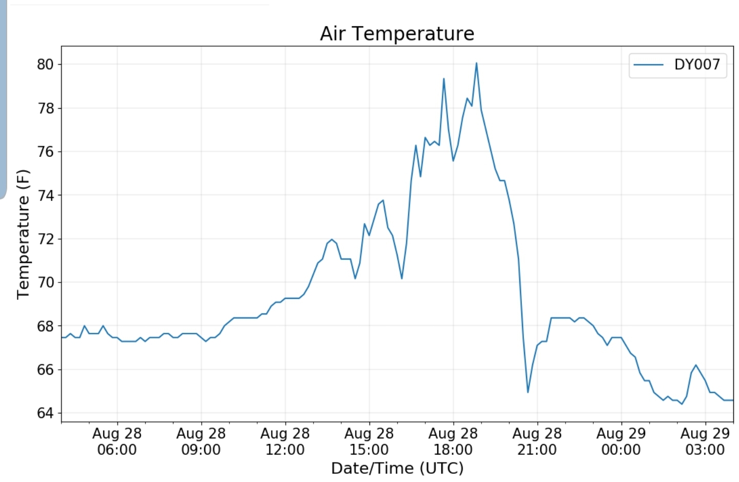
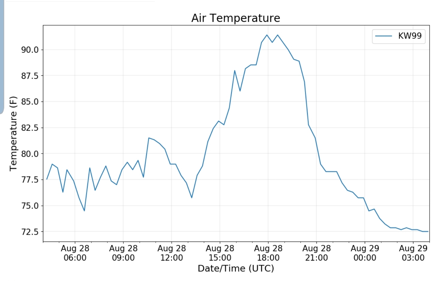
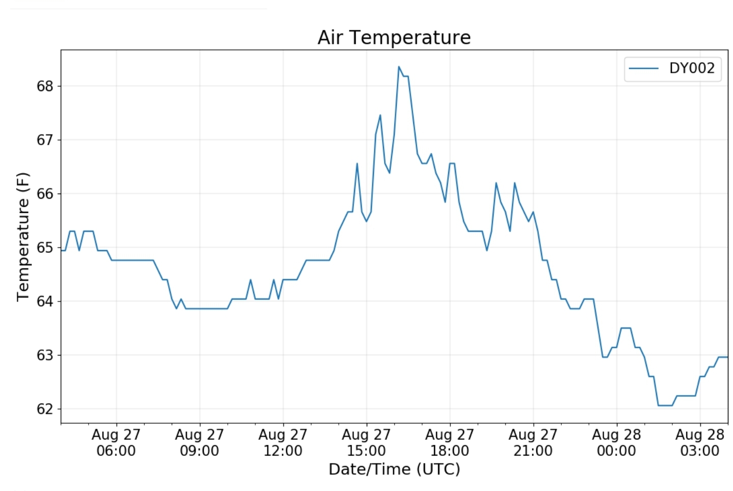
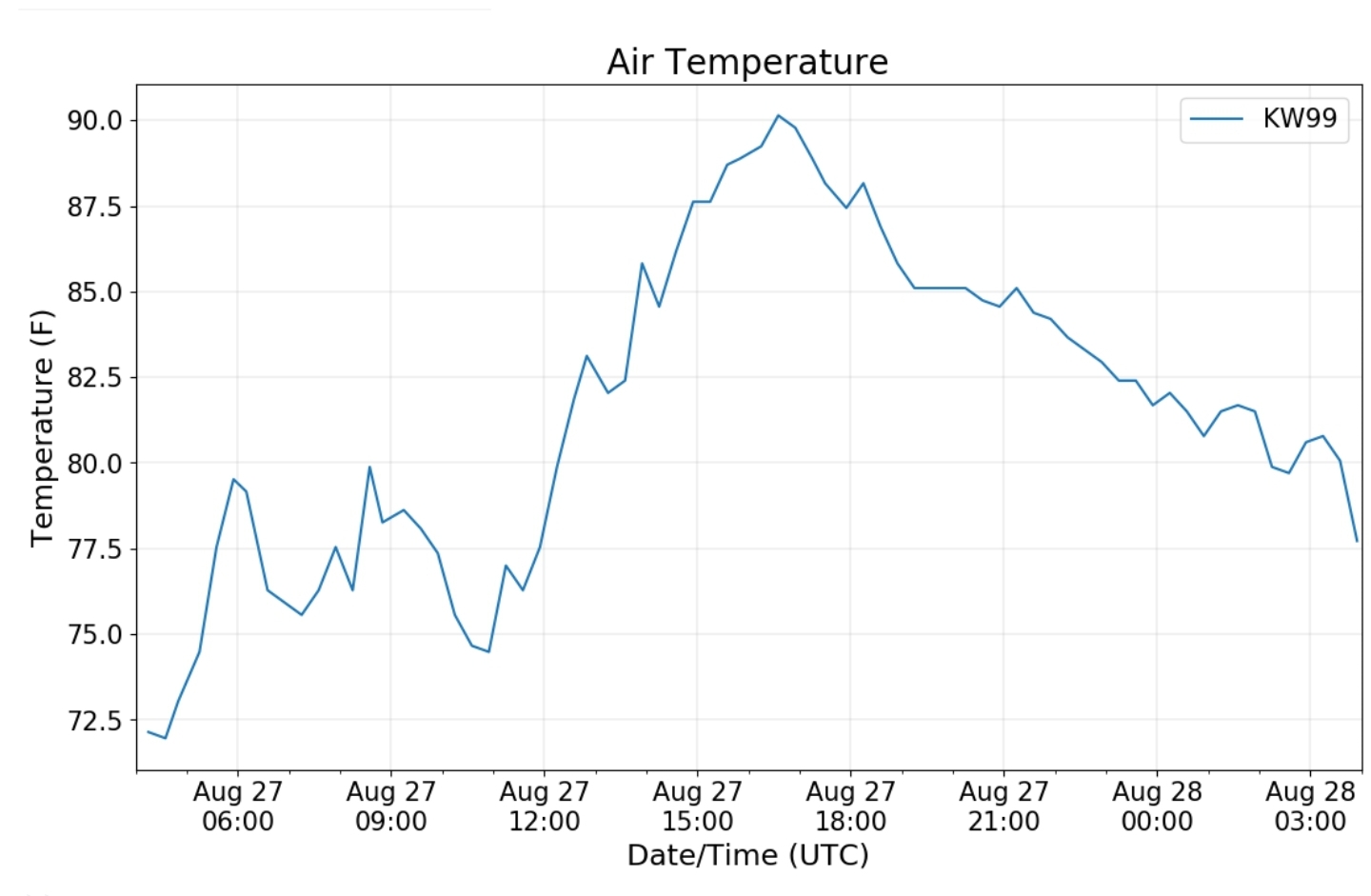
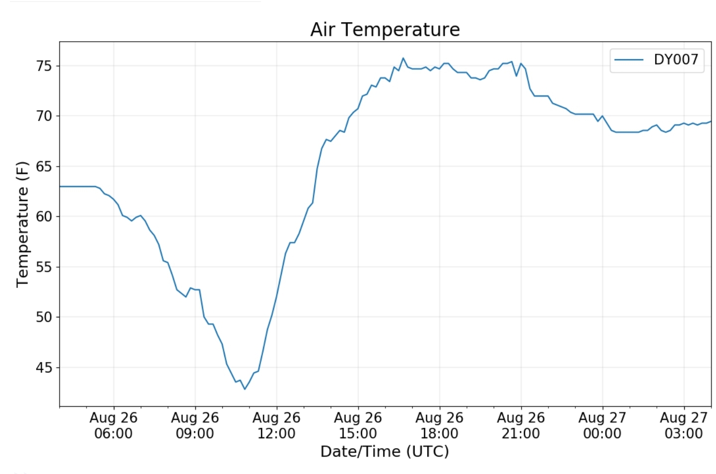
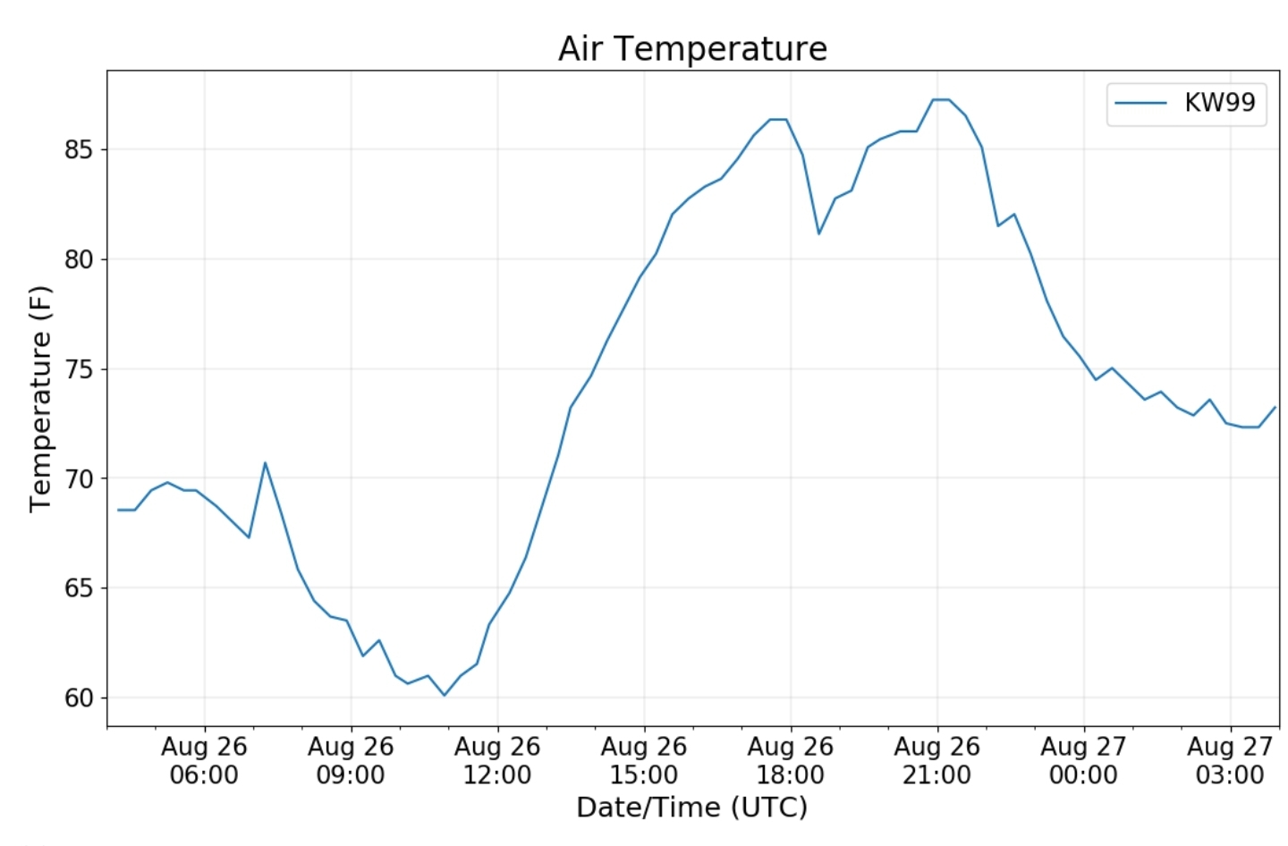
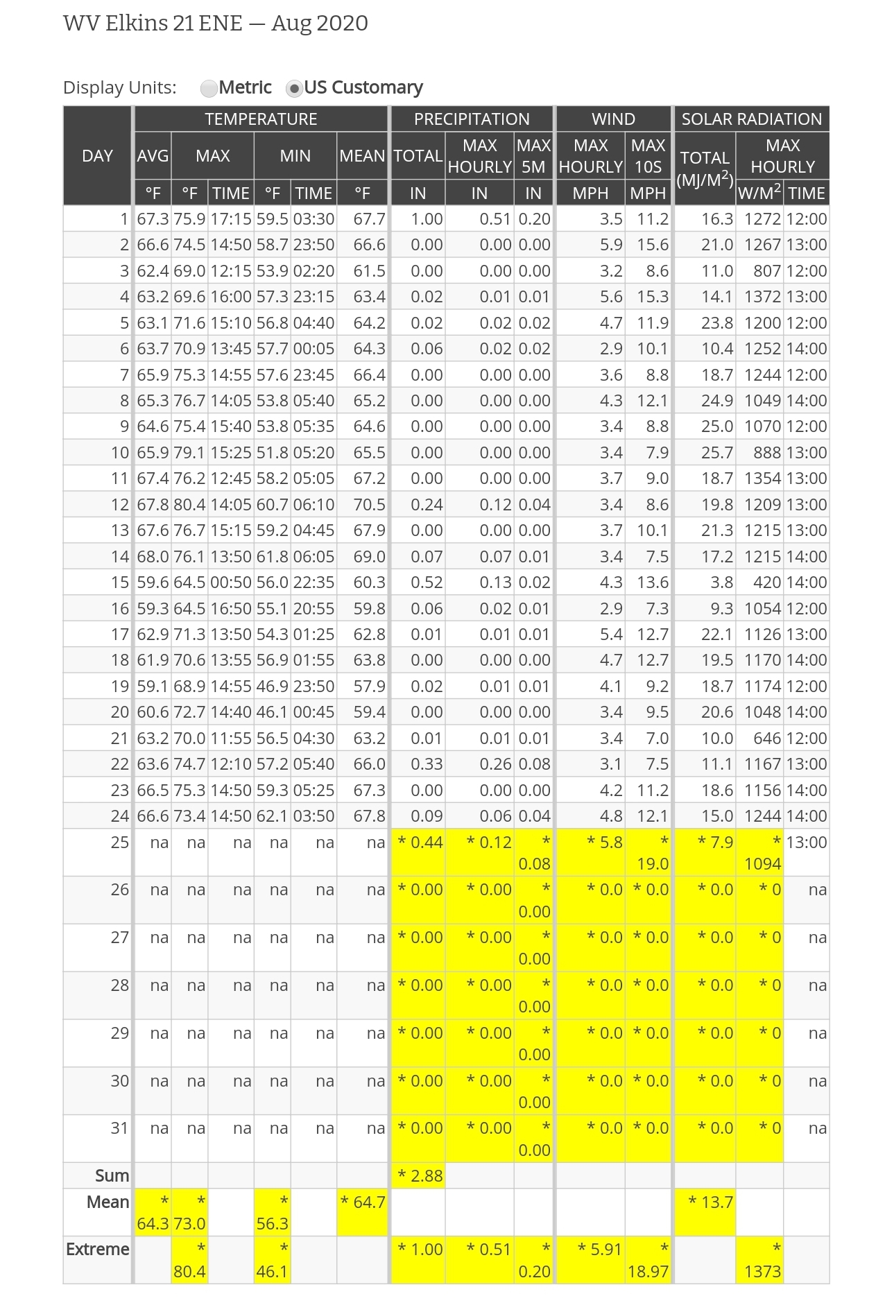
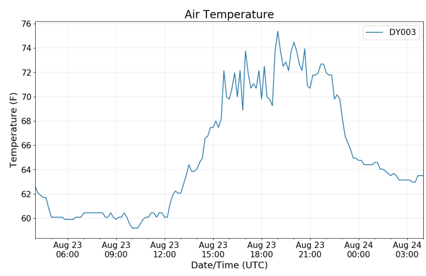
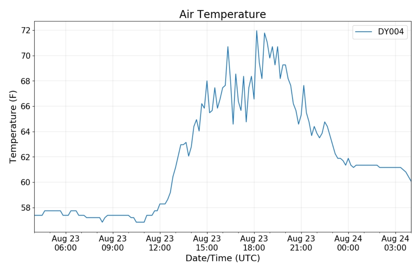
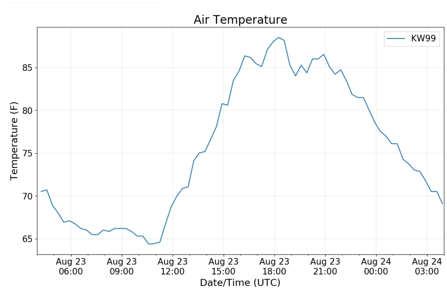
Canaan area temps

Comparison view

High Ground Comparison

Up High and Down Low

Up High, High Valley, Low Valley

RTMA

Radar

Satellite

Flow

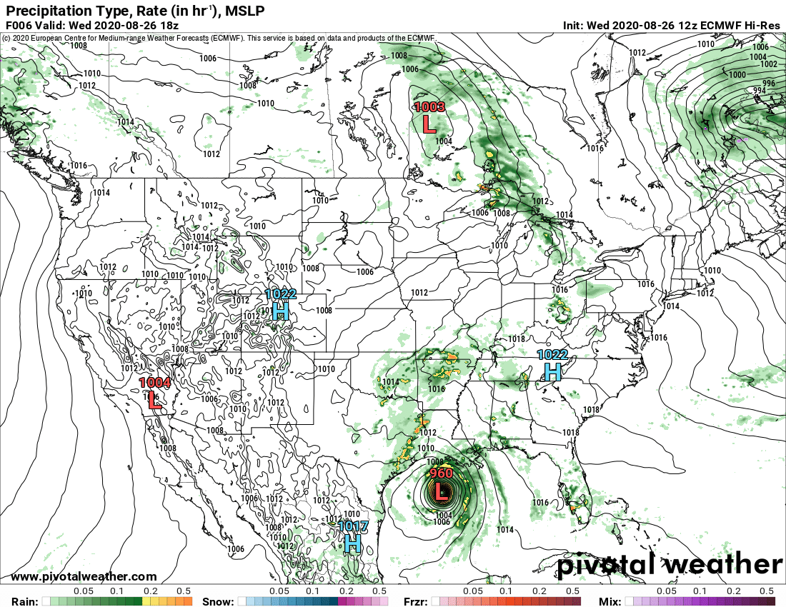
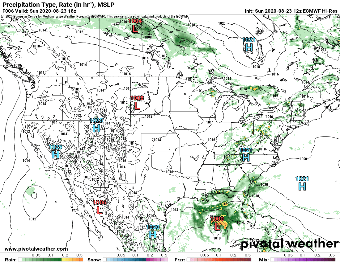
Surface features and 500mb height anomalies and flow

33 east of Harman at the divide

August 29, 2020

August 29, 2020

Aug 29(Sat)

Cloudy, wet, dreary first part of the day, windy improving later

Bittinger 2nw Valley

Will fill in asap

Bittinger 2nw Valley afternoon 8/29/20

Garrett College

Canaan Heights/Davis 3SE

Precip 1.45 7am

Year to date total precip 46.21

Comments and data by Dave Lesher at:

http://data.canaanmtnsnow.com/

” Precip total of 1.45 inches is the greatest single-day amount since 1.58 inches was measured on August 14, 2019. The last of TS Laura yesterday and today is going a long way to erasing this month’s day spell here “

Climate Reference Network Canaan

Cabin Mt at Bald Knob

Cabin Mt-Western Sods

Spruce Knob

Snowshoe

Canaan Valley Refuge

7Springs

Petersburg Grant County Airport

The Valley vs Cabin Mt

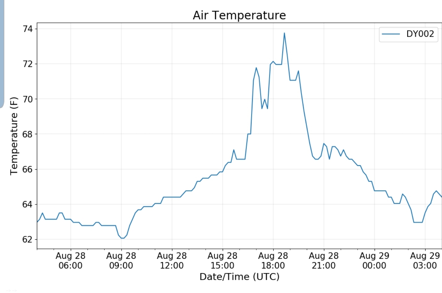
Canaan area temps

Comparison view

High Ground Comparison

Up High and Down Low

Up High, High Valley, Low Valley

RTMA

Radar

Satellite

Flow

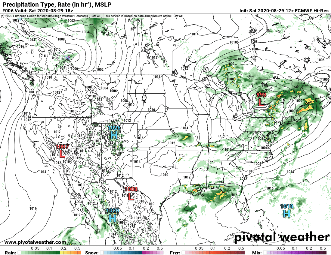
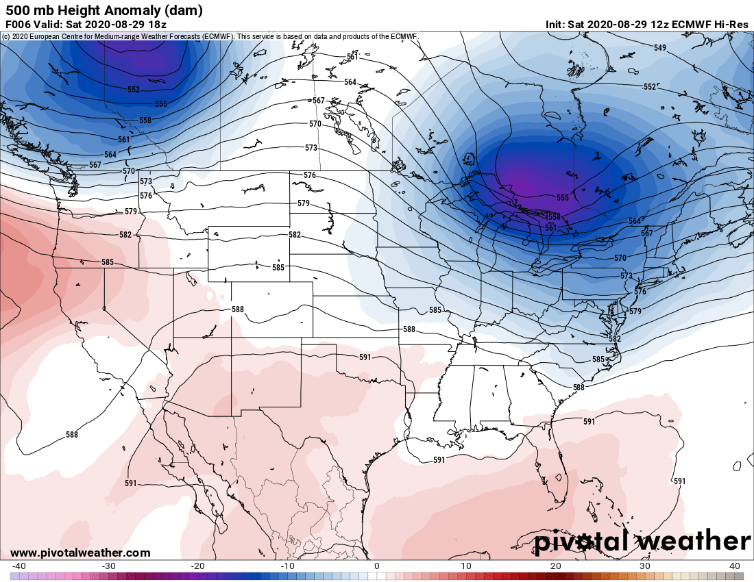
Surface features and 500mb height anomalies and flow

33 east of Harman at the divide

August 28, 2020

August 28, 2020

Aug 28(Fri)

Gloomy, showery, some heavy downpours, some fog

Bittinger 2nw Valley

Will fill in asap

west of Bittinger afternoon in between showers 8/28/20
near Bittinger 2nw afternoon 8/28/20
Bittinger 2nw Valley afternoon 8/28/20

Garrett College

Deep Creek Lake morning 8/28/20
Rock Lodge Rd morning 8/28/20
Garrett College afternoon 8/28/20
Rock Lodge Rd afternoon 8/28/20

Canaan Heights/Davis 3SE

Precip .03 7am

Year to date total precip 44.76

Comments and data by Dave Lesher at:

http://data.canaanmtnsnow.com/

Climate Reference Network Canaan

Cabin Mt at Bald Knob

Cabin Mt-Western Sods

Spruce Knob

Snowshoe

Will fill in asap

Canaan Valley Refuge

7Springs

will fill in asap

Petersburg Grant County Airport

The Valley vs Cabin Mt

Canaan area temps

Comparison view

High Ground Comparison

Up High and Down Low

Up High, High Valley, Low Valley

RTMA

Radar

Satellite

Flow

Surface features and 500mb height anomalies and flow

Cranesville to Sang Run

Cranesville morning 8/28/20
Cranesville afternoon 8/28/20
The Yough at Sang Run afternoon 8/28/20

St. Paul to Meyersdale

St Paul late afternoon 8/28/20
towards Meyersdale late afternoon 8/28/20
Meyersdale late afternoon 8/28/20

33 east of Harman at the divide

August 27, 2020

August 27, 2020

Aug 27 (Thurs)

Cloudy, some fog, areas of showers through the day, some broken skies as well.

Bittinger 2nw Valley

west of Bittinger afternoon 8/27/20
near Bittinger 2nw afternoon 8/27/20
Bittinger 2nw Valley afternoon 8/27/20

Garrett College

Garrett College afternoon 8/27/20

Canaan Heights/Davis 3SE

Precip T 7am

Year to date total precip 44.73″

Comments and data by Dave Lesher at:

http://data.canaanmtnsnow.com/

Climate Reference Network Canaan

Cabin Mt at Bald Knob

Cabin Mt-Western Sods

Spruce Knob

Snowshoe

Canaan Valley Refuge

7Springs

data currently missing

Petersburg Grant County Airport

The Valley vs Cabin Mt

Canaan area temps

Comparison view

High Ground Comparison

Up High and Down Low

Up High, High Valley, Low Valley

RTMA

Radar

Satellite

Flow

Surface features and 500mb height anomalies and flow

33 east of Harman at the divide

Keysers Ridge

August 26, 2020

August 26, 2020

Aug 26(Wed)

Clouds, some sun, areas of showers..

Bittinger 2nw Valley

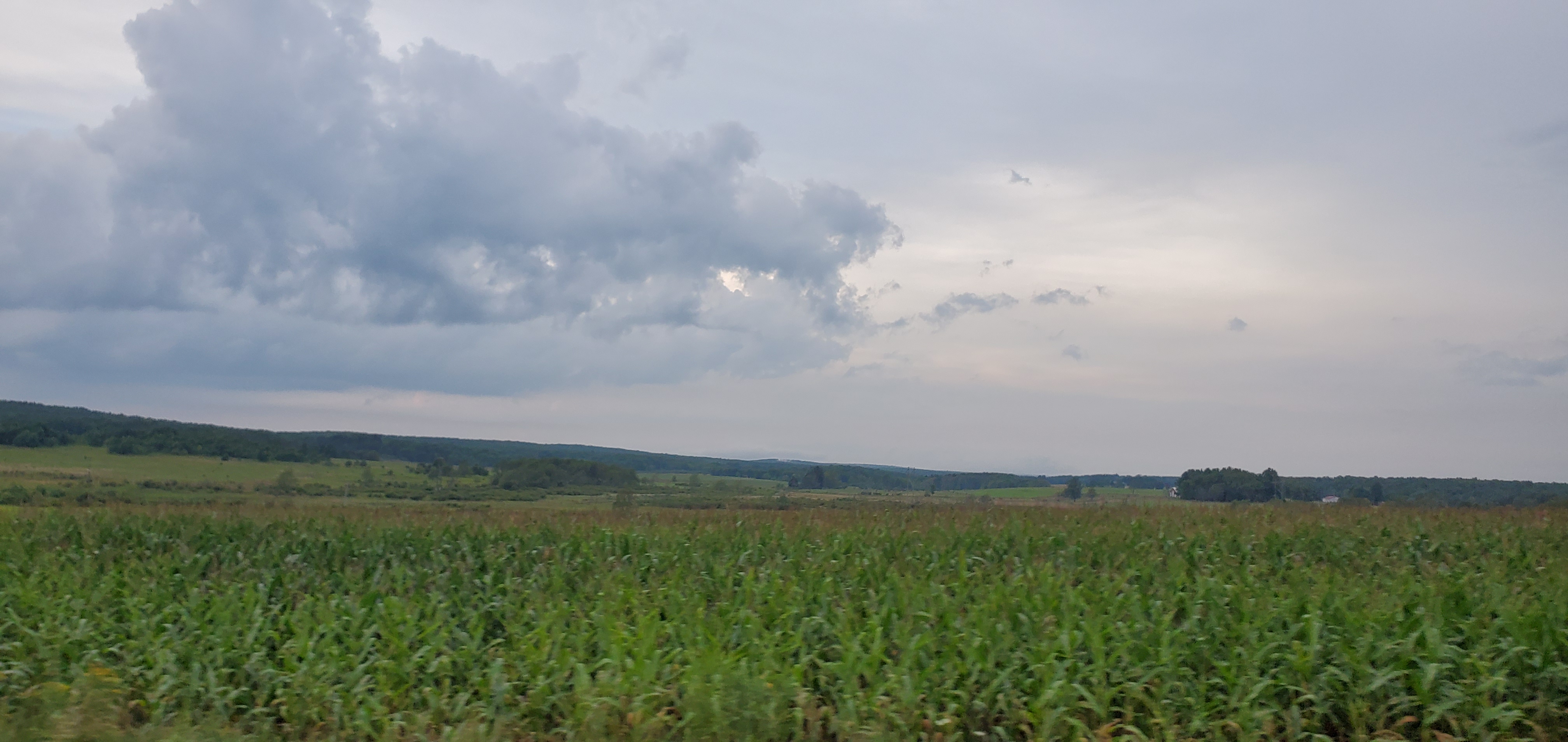
Bittinger 2nw Valley morning 8/26/20
west of Bittinger morning 8/26/20
near Bittinger 2nw morning 8/26/20
Bittinger 2nw Valley morning 8/26/20
west of Bittinger afternoon 8/26/20
near Bittinger 2nw afternoon 8/26/20
Bittinger 2nw Valley afternoon 8/26/20

Garrett College

Mchenry morning 8/26/20
McHenry morning 8/26/20
Garrett College morning 8/26/20
Cherry Creek along Mosser Rd morning 8/26/20
Rock Lodge Rd morning 8/26/20
Rock Lodge Rd north of Deep Creek morning 8/26/20
Deep Creek Lake morning 8/26/20
Rock Lodge Rd afternoon 8/26/20

Canaan Heights/Davis 3SE

Precip .21 7am

Year to date total precip 44.73

Comments and data by Dave Lesher at:

http://data.canaanmtnsnow.com/

Climate Reference Network Canaan

Cabin Mt at Bald Knob

Cabin Mt-Western Sods

Spruce Knob

Snowshoe

Canaan Valley Refuge

7Springs

Will fill in asap

Petersburg Grant County Airport

The Valley vs Cabin Mt

Canaan area temps

Comparison view

High Ground Comparison

Up High and Down Low

Up High, High Valley, Low Valley

RTMA

Radar

Satellite

Flow

Surface features and 500mb height anomalies and flow

33 east of Harman at the divide

August 25, 2020

August 25, 2020

Aug 25(Tues) Clouds, fog morning, some breaks and a round of early afternoon showers, a better organized batch in the evening.

Bittinger 2nw Valley

west of Bittinger midday 8/25/20
Bittinger 2nw Valley afternoon 8/25/20
Bittinger 2nw Valley “after the storm” evening 8/25/20

Garrett College

Deep Creek Lake morning 8/25/20
Meadow Mt State Park Rd 8/25/20
Deep Creek Lake morning 8/25/20
Mosser Rd afternoon 8/25/20
Garrett College afternoon 8/25/20
Rock Lodge Rd afternoon 8/25/20
Cherry Creek along Mosser Rd evening 8/25/20
Garrett College evening 8/25/20
Rock Lodge Rd near The Glades evening 8/25/20

Canaan Heights/Davis 3SE

Precip .11 7am

Year to date total precip 44.52

Comments and data by Dave Lesher at:

http://data.canaanmtnsnow.com/

Climate Reference Network Canaan

Cabin Mt at Bald Knob

Cabin Mt-Western Sods

Spruce Knob

Snowshoe

Canaan Valley Refuge

7Springs

Will fill in asap

Petersburg Grant County Airport

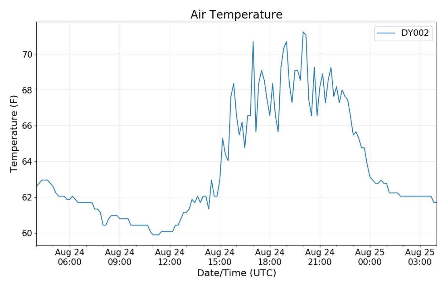
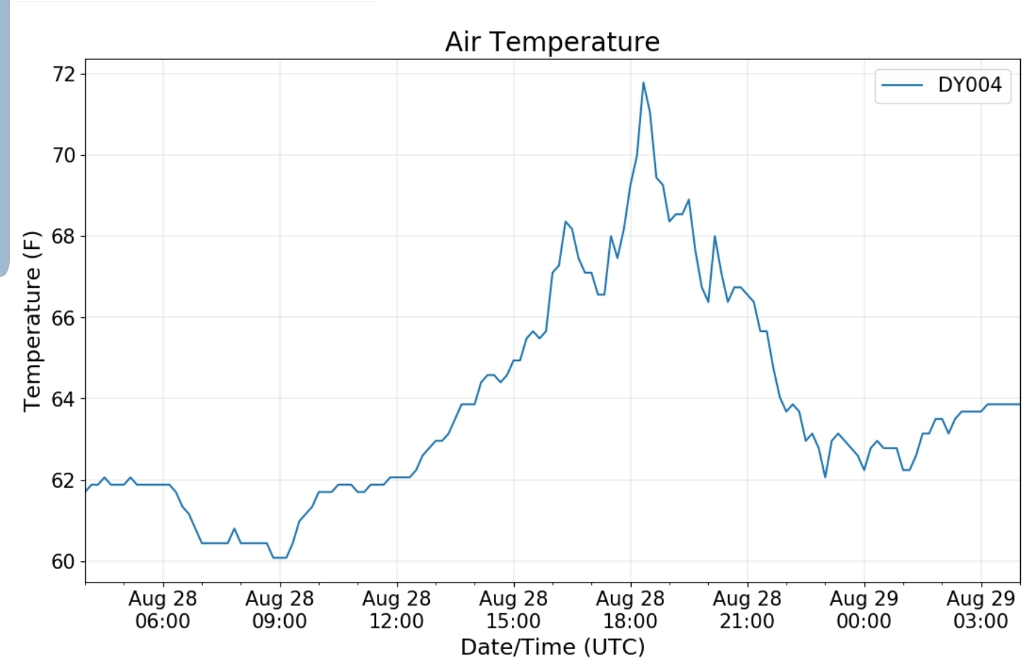
Due to a large amount of missing data this month. only a daily graph will be shown

The Valley vs Cabin Mt

Canaan area temps
Comparison view

High Ground Comparison

Up High and Down Low

Up High, High Valley, Low Valley

RTMA

Radar

Satellite

Flow

Surface features and 500mb height anomalies and flow

33 east of Harman at the divide

August 24, 2020

August 24, 2020

Aug 24(Mon)

Lots of clouds, some sun, some areas of showers n downpours. The haves and have nots.

Bittinger 2nw Valley

west of Bittinger morning 8/24/20
near Bittinger 2nw morning 8/24/20
Bittinger 2nw Valley morning 8/24/20
west of Bittinger afternoon 8/24/20
near Bittinger 2nw afternoon 8/24/20
Bittinger 2nw Valley afternoon 8/24/20

Garrett College

by Garrett College morning 8/24/20
Cherry Creek along Mosser Rd morning 8/24/20
Deep Creek Lake afternoon 8/24/20
by Garrett College afternoon 8/24/20
Cherry Creek along Mosser Rd evening 8/24/20

Canaan Heights/Davis 3SE

Precip .02 7am

Year to date total precip 44.41″

Comments and data by Dave Lesher at:

http://data.canaanmtnsnow.com/

Climate Reference Network Canaan

Cabin Mt at Bald Knob

Cabin Mt-Western Sods

Spruce Knob

Snowshoe

Canaan Valley Refuge

7Springs

Petersburg Grant County Airport

The Valley vs Cabin Mt

Canaan area temps

Comparison view

High Ground Comparison

Up High and Down Low

Up High, High Valley, Low Valley

RTMA

Radar

Satellite

Flow

Surface features and 500mb height anomalies and flow

33 east of Harman at the divide

August 23, 2020

August 23, 2020

Aug 23(Sun)

Mix of clouds n sun. Some scattered showers midday on. Minimal coverage.

Bittinger 2nw Valley

Bittinger 2nw Valley morning 8/23/20
Bittinger 2nw Valley .87 for yesterday’s rainfall
Foxtown Rd at the old strawberry farm evening 8/23/20
West of Bittinger evening 8/23/20
west of Bittinger evening 8/23/20
near Bittinger 2nw evening 8/23/20
Bittinger 2nw Valley evening 8/23/20 “quite a drop in creek already from the rainfall 24 hours ago”

Garrett College

Deep Creek Lake evening 8/23/20
Mchenry evening 8/23/20

Canaan Heights/Davis 3SE

Precip .02 7am

Year to date total precip 44.39

Comments and data by Dave Lesher at:

http://data.canaanmtnsnow.com/

Canaan Mt
up 32 from Davis
Up 32 from Davis
Up 32 from Davis
Canaan Mt Bog
Loop Rd at the bog
Cottongrass in full swing

Climate Reference Network Canaan

Cabin Mt at Bald Knob

up Bald Knob trail midday 8/23/20
Atop Bald Knob midday 8/23/20
Bald Knob afternoon 8/23/20
Bald Knob trail afternoon 8/23/20
Bald Knob afternoon 8/23/20 “brief light shower”

Cabin Mt-Western Sods

Pics from eastern Sods(Bear Rocks/South Prong Trail further below)

Spruce Knob

Snowshoe

Canaan Valley Refuge

7Springs

Petersburg Grant County Airport

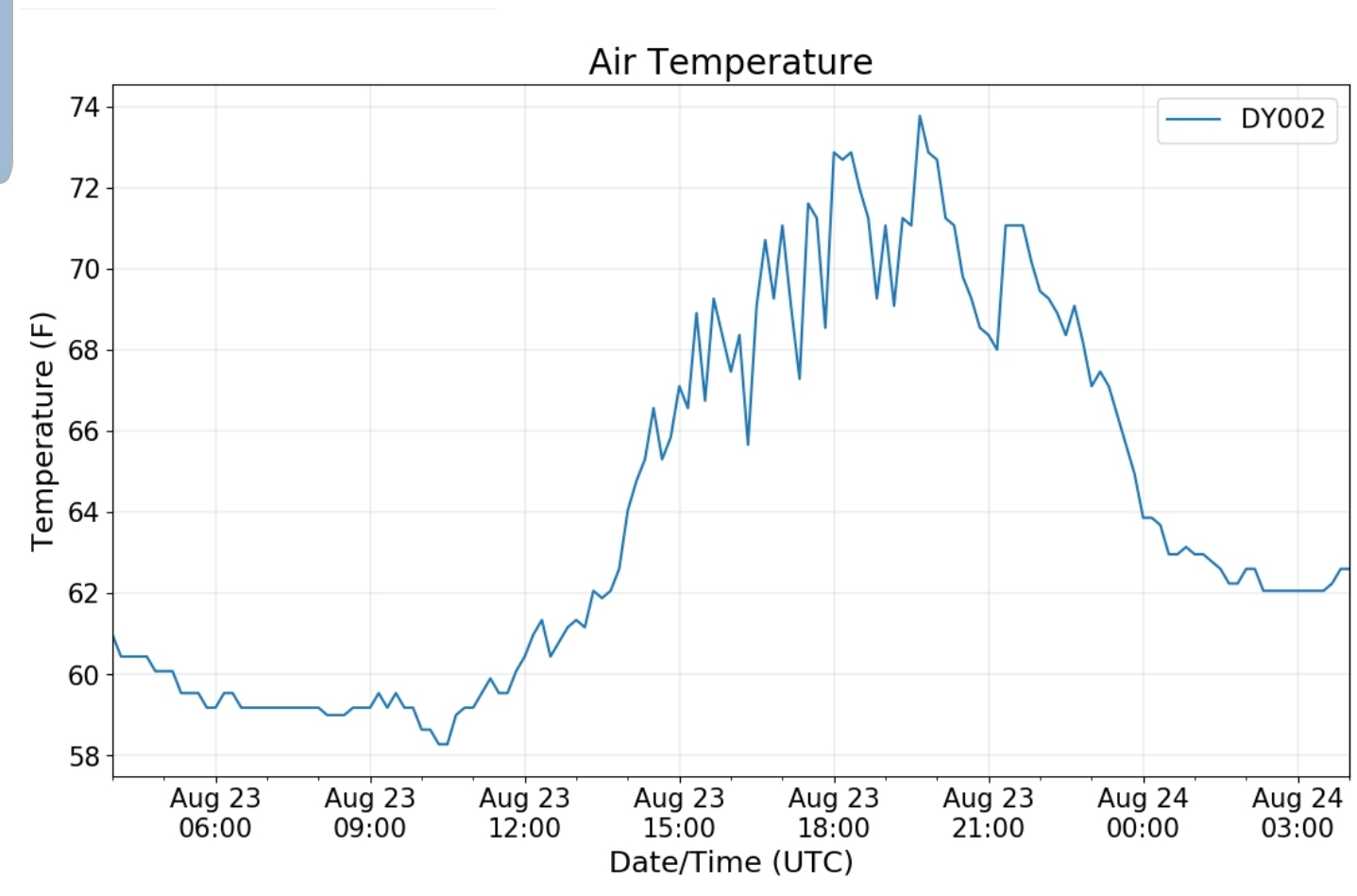
due to missing monthly data, only a daily graph will be shown

The Valley vs Cabin Mt

Canaan area temps

Comparison view

High Ground Comparison

Up High and Down Low

Up High, High Valley, Low Valley

RTMA

Radar

Satellite

Flow

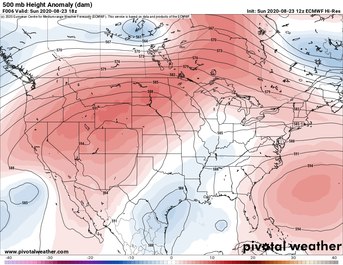
Surface features and 500mb height anomalies and flow

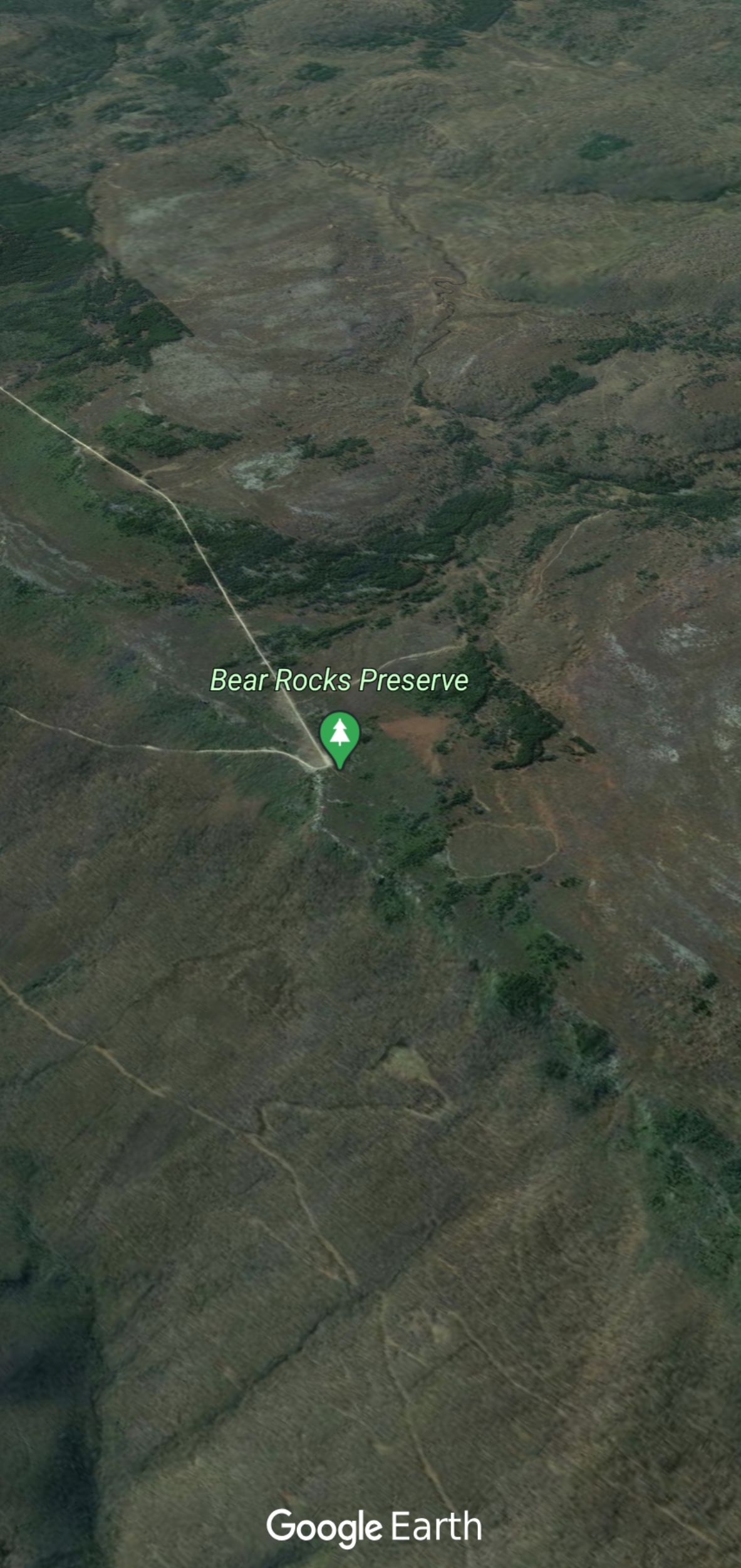
Across The Sods at Bear Rocks

FR 75 heading north
FR 75 heading north
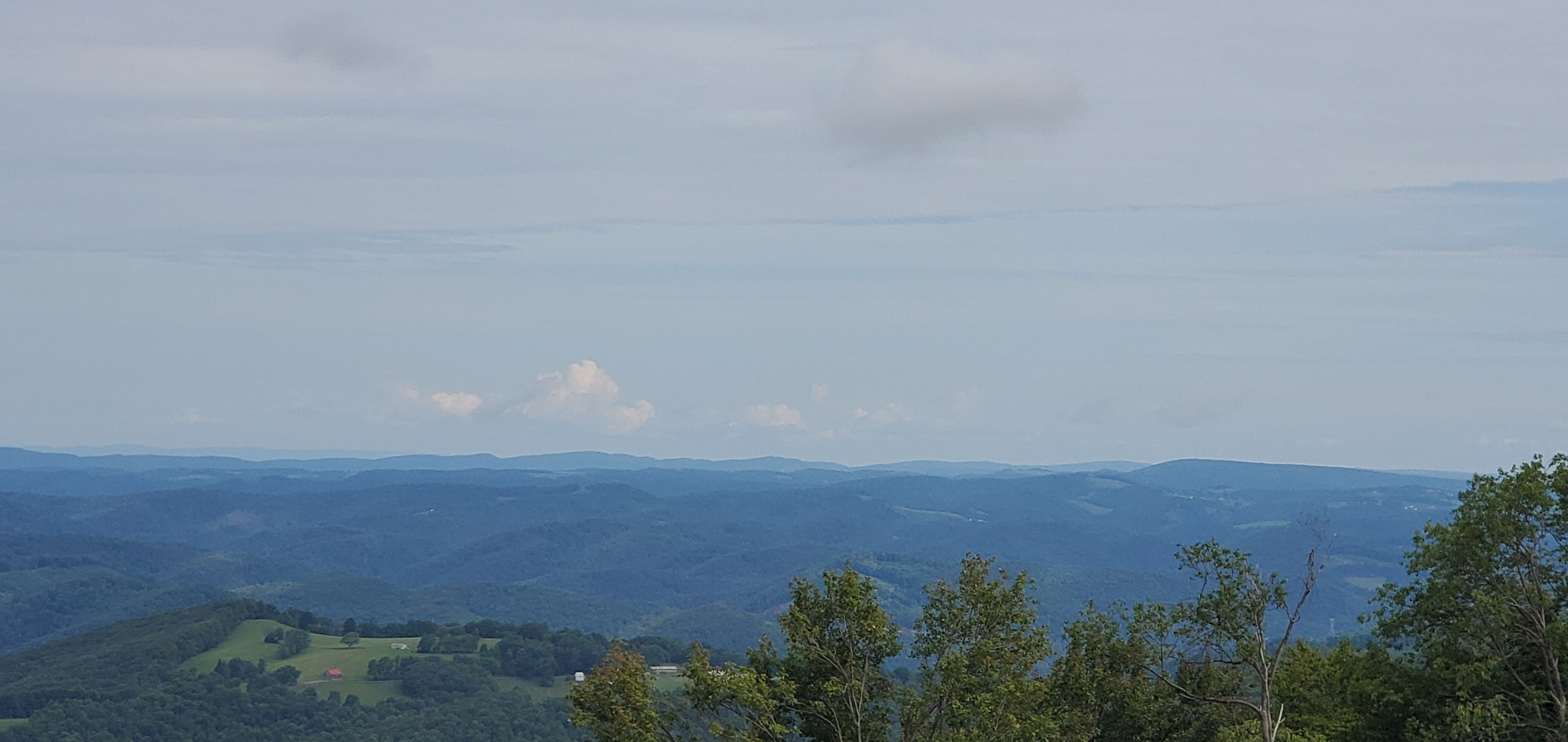
Shower in the distance

South Prong Trail

Backbone Mt

near Olson Tower
Olson Tower
219 near Tucker High
Centennial Park
Centennial Park
NW view from Centennial Park
Afternoon shower to the west

Thomas

North of Oakland to Sand Flat

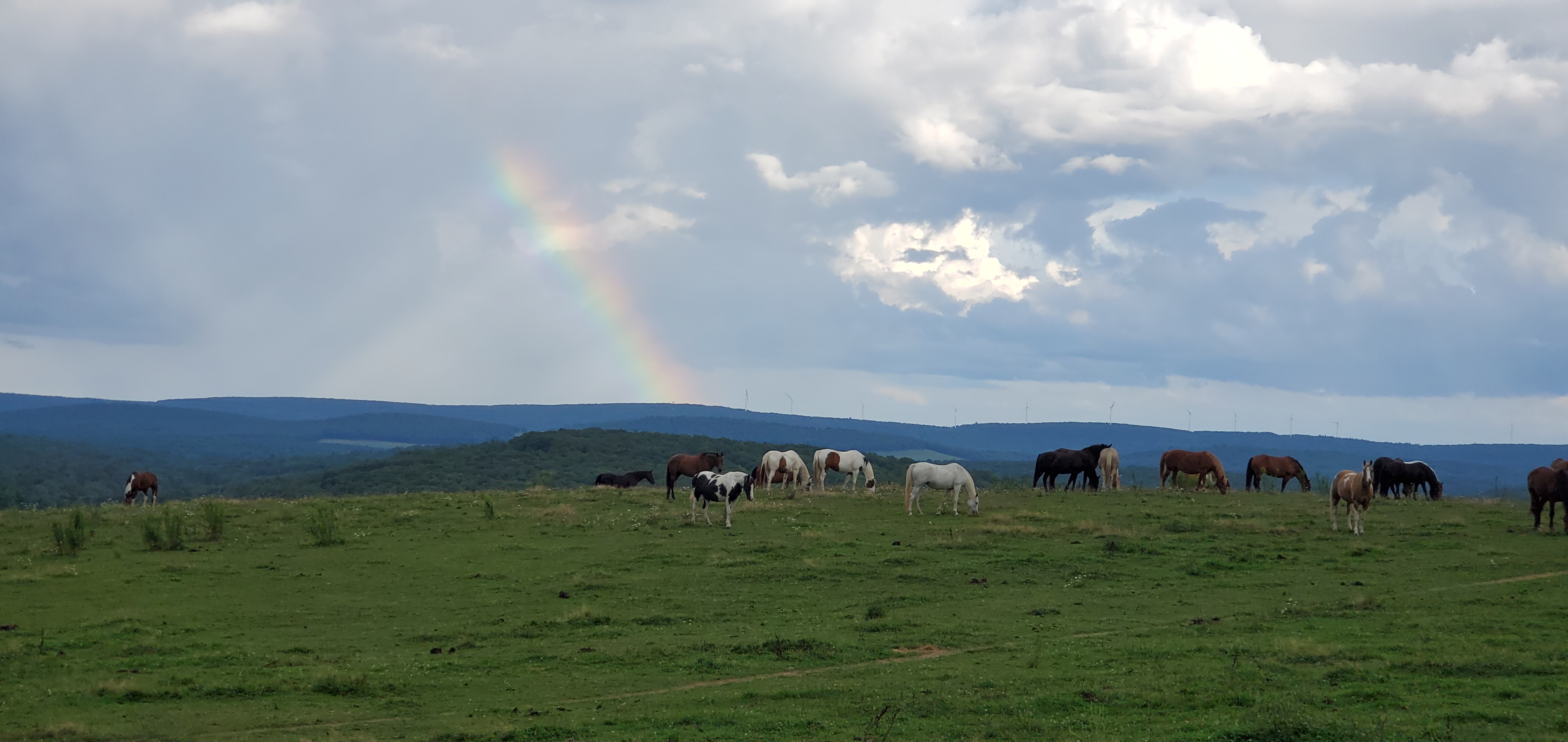
Over a hour later

the rainbow still existed

August 22, 2020

August 22, 2020

Aug 22(Sat)

Lots of clouds, some sun. Patchy morning fog afternoon areas of showers.

Bittinger 2nw Valley

Bittinger 2nw Valley morning 8/22/20
west of Bittinger morning 8/23/20
near Bittinger 2nw afternoon 8/22/20
near Bittinger 2nw Valley afternoon 8/22/20
west of Bittinger afternoon 8/22/20
Bittinger 2nw Valley evening 8/22/20
near Bittinger 2nw evening 8/22/20
west of Bittinger evening 8/22/20

Garrett College

Will fill in rest of data/pics tomorrow. Running late today

August 21, 2020

August 21, 2020

Aug 21(Fri)

Mix of clouds n sun, patchy morning fog. Some showers central/southern Alleghenies.

Bittinger 2nw Valley

west of Bittinger morning 8/21/20
near Bittinger 2nw morning 8/21/20
Bittinger 2nw Valley morning 8/21/20
west of Bittinger afternoon 8/21/20
near Bittinger 2nw afternoon 8/21/20

Garrett College

Garrett College morning 8/21/20
Mosser Rd morning 8/21/20
Cherry Creek along Mosser Rd morning 8/21/20
Rock Lodge Rd near The Glades morning 8/21/20
Deep Creek Lake morning 8/21/20
Mchenry evening 8/21/20

Canaan Heights/Davis 3SE

Precip 0 7am

Year to date total precip 44.25″

Comments and data by Dave Lesher at:

http://data.canaanmtnsnow.com/

Climate Reference Network Canaan

Cabin Mt at Bald Knob

Cabin Mt-Western Sods

Will fill in asap-check back or a proceeding date

Spruce Knob

Snowshoe

Canaan Valley Refuge

7Springs

Petersburg Grant County Airport

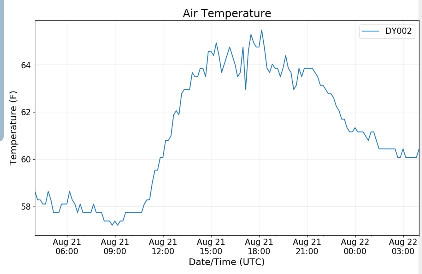
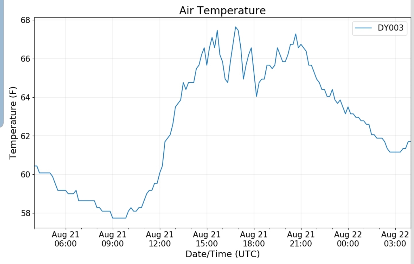
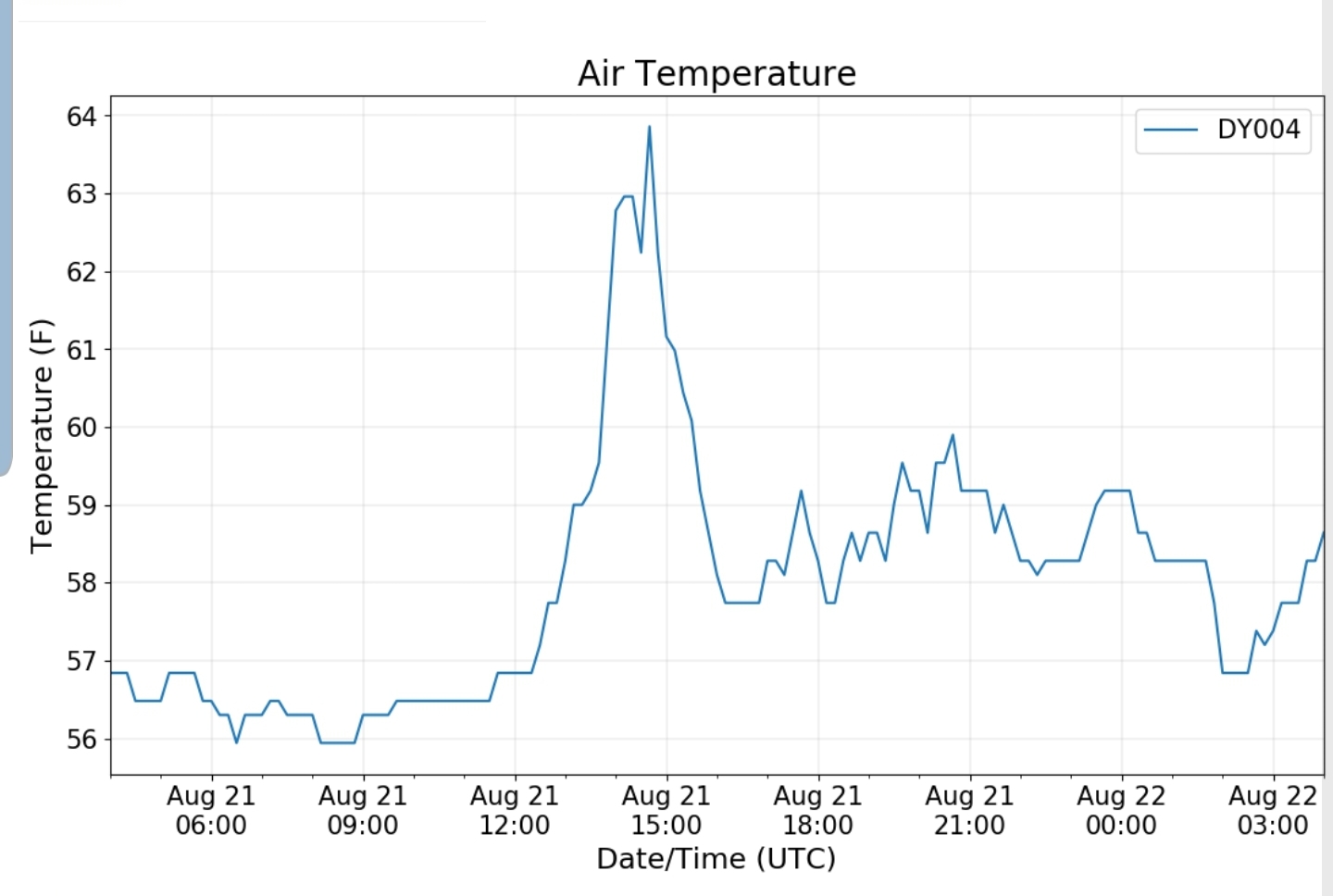
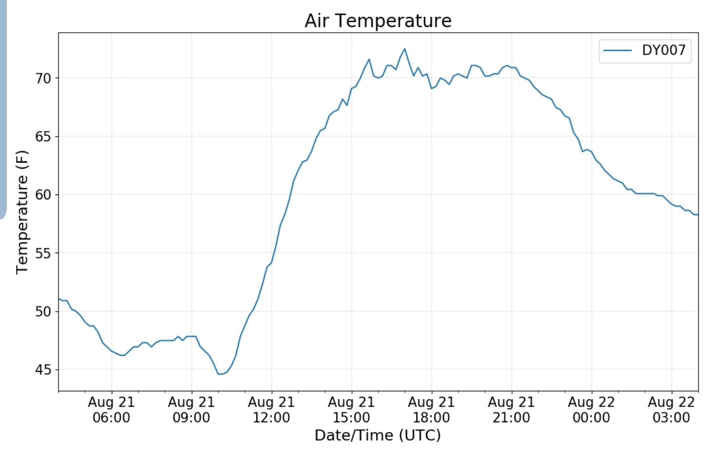
due to lack of missing daily data, monthly chart will not be included, only a daily graph

The Valley vs Cabin Mt

Canaan area temps

Comparison view

High Ground Comparison

Up High and Down Low

Up High, High Valley, Low Valley

RTMA

Radar

Satellite

Flow

Surface features and 500mb height anomalies and flow

Cranesville to Sang Run

Cranesville morning 8/21/20
The Yough at Sang Run morning 8/21/20
Sang Run afternoon 8/21/20
The Yough at Sang Run afternoon 8/21/20
Cranesville afternoon 8/21/20
The Yough at Sang Run afternoon 8/21/20

33 East of Harman at the divide

Rock Lodge Rd near Rock Lodge area