August 20, 2020

August 20, 2020

Aug 20(Thurs)

A chilly clear start. Some building clouds today, overall a very pleasant day

Bittinger 2nw Valley

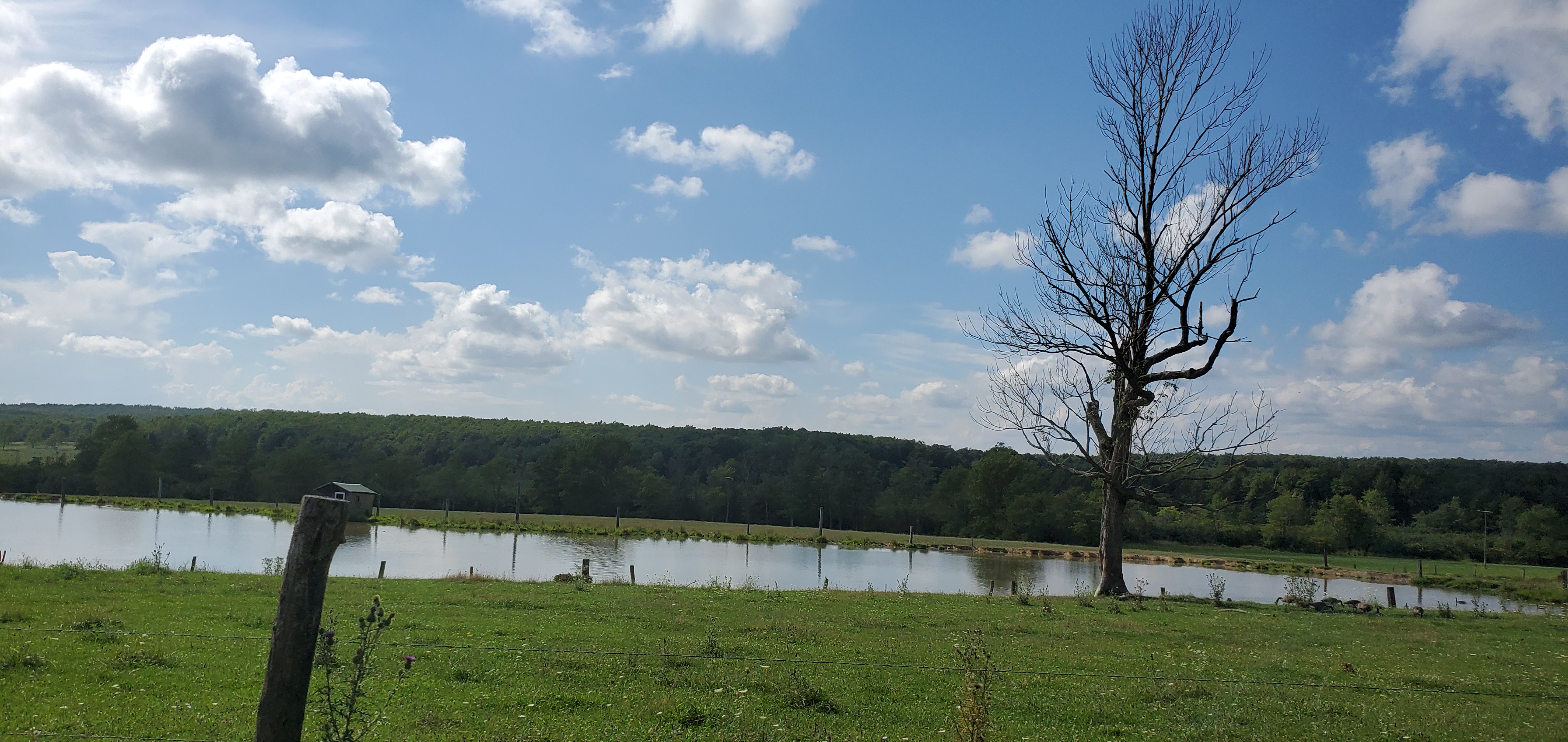
west of Bittinger afternoon 8/20/20
near Bittinger 2nw afternoon 8/20/20
Bittinger 2nw Valley afternoon 8/20/20

Garrett College

Garrett College afternoon 8/20/20
Rock Lodge Rd near The Glades evening 8/20/20

Canaan Heights/Davis 3SE

Precip 0 7am

Year to date total precip 44.25

Comments and data by Dave Lesher at:

http://data.canaanmtnsnow.com/

Climate Reference Network Canaan

Cabin Mt at Bald Knob

Cabin Mt-Western Sods

Will fill in asap

Spruce Knob

Snowshoe

Canaan Valley Refuge

7Springs

Will fill in asap

Petersburg Grant County Airport

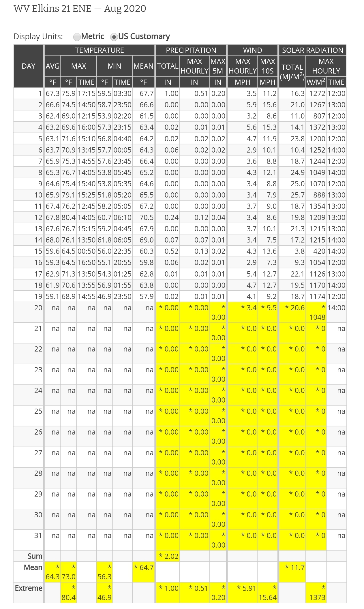
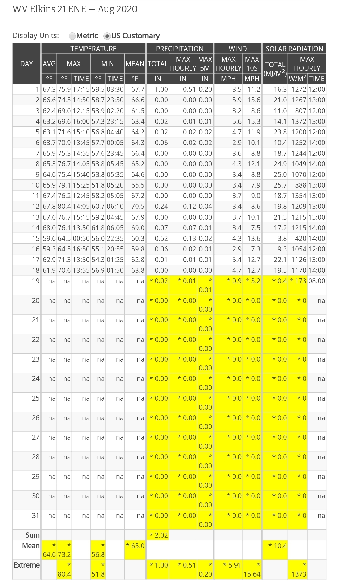
with so much missing data this month, only a daily graph will be shown

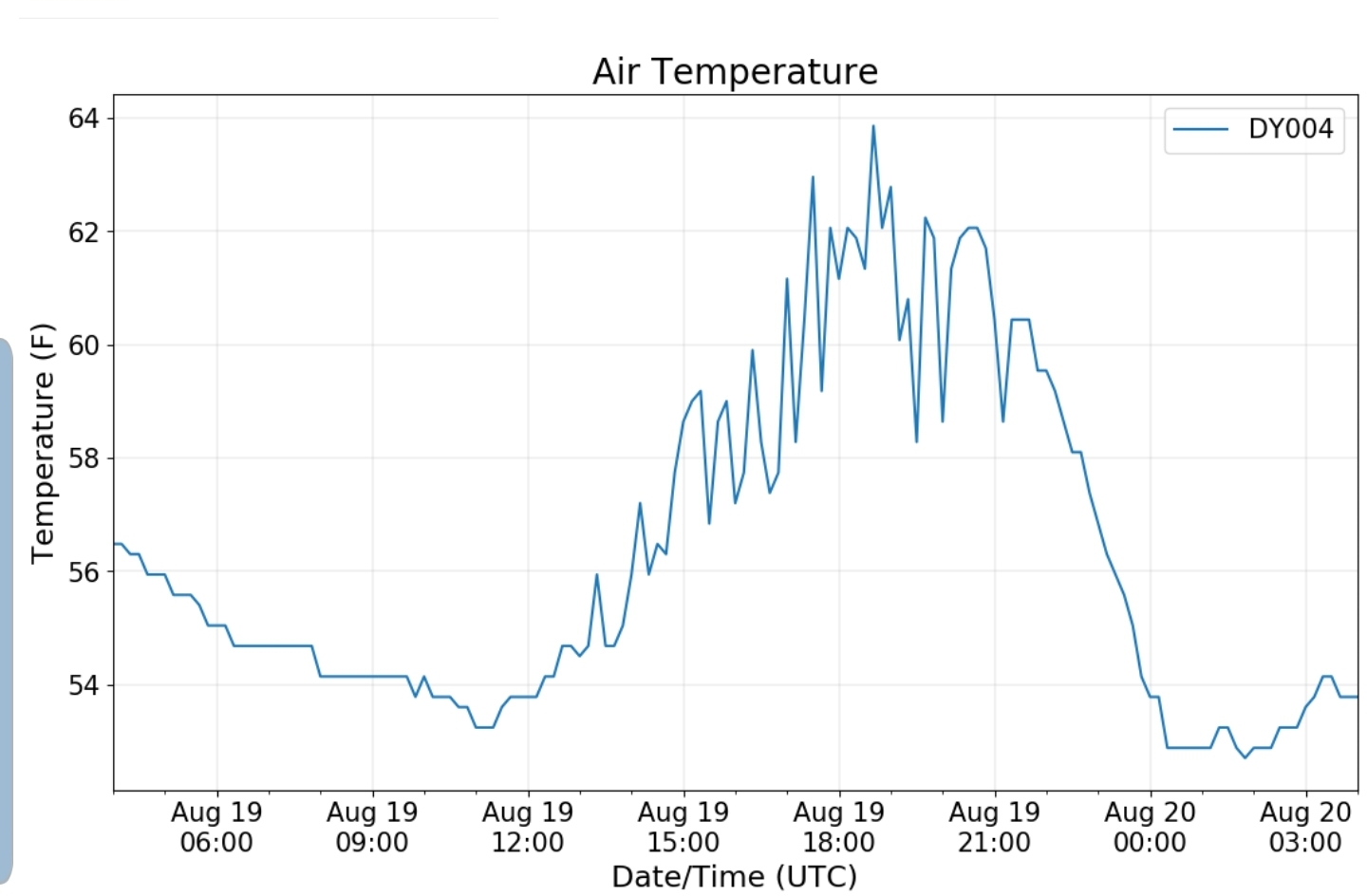
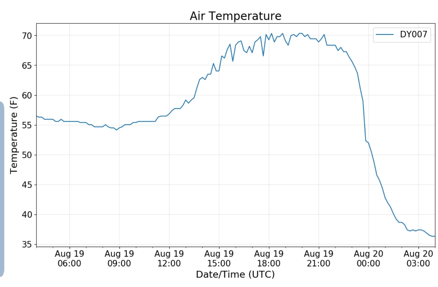
The Valley vs Cabin Mt

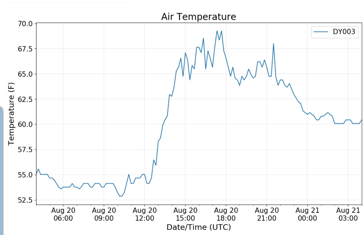
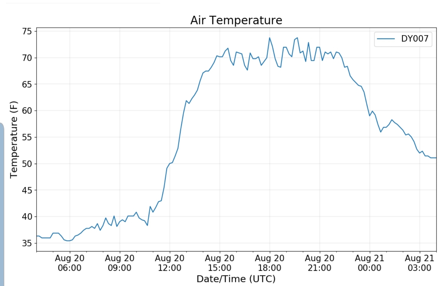
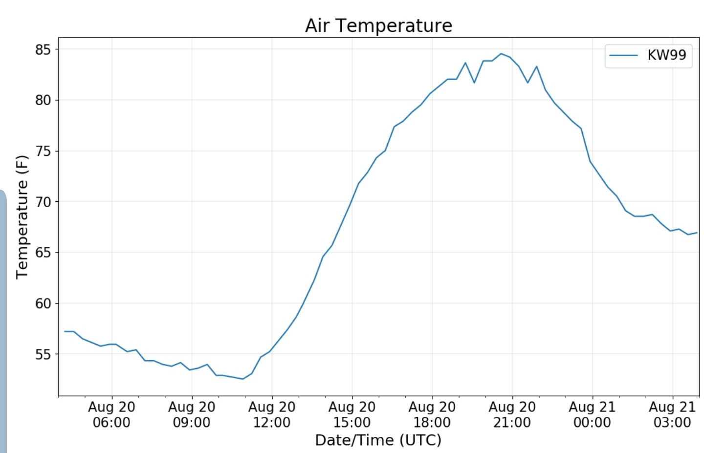
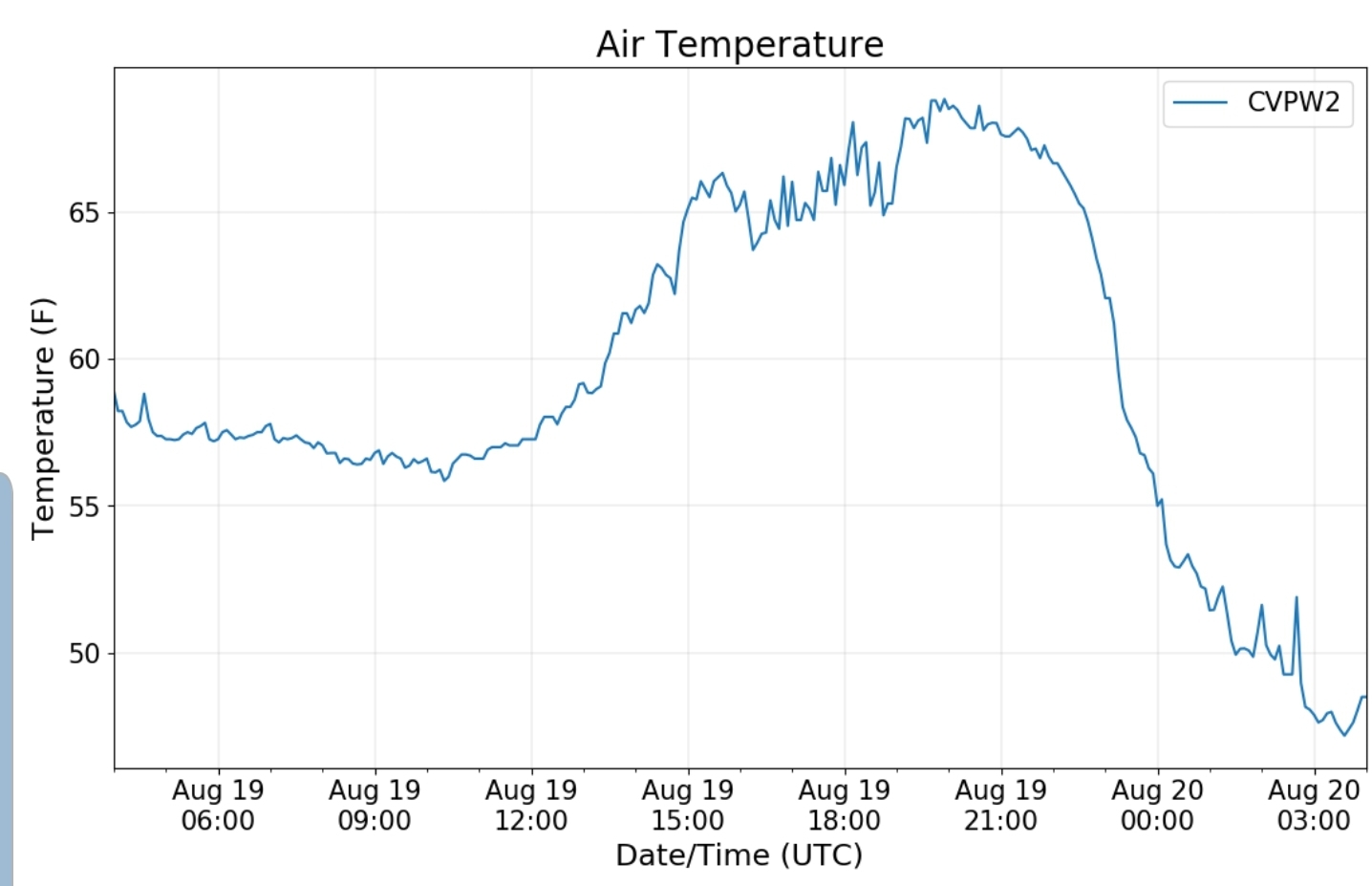
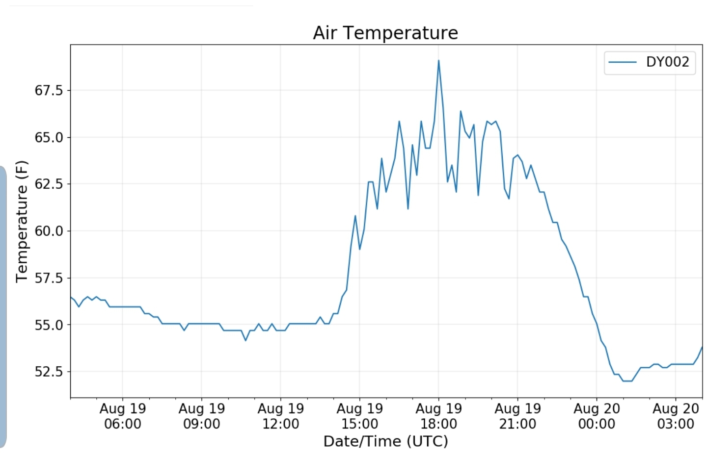
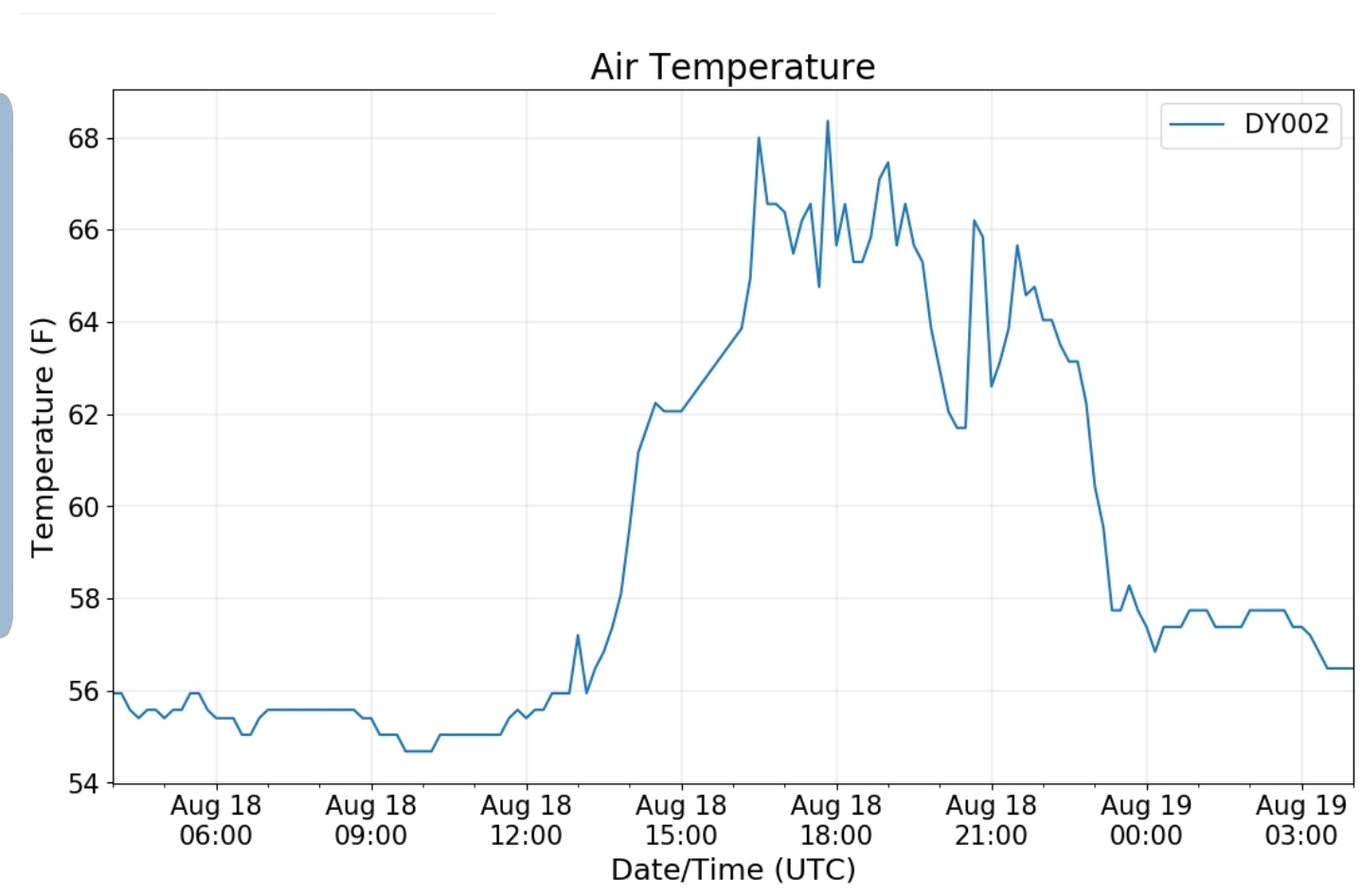
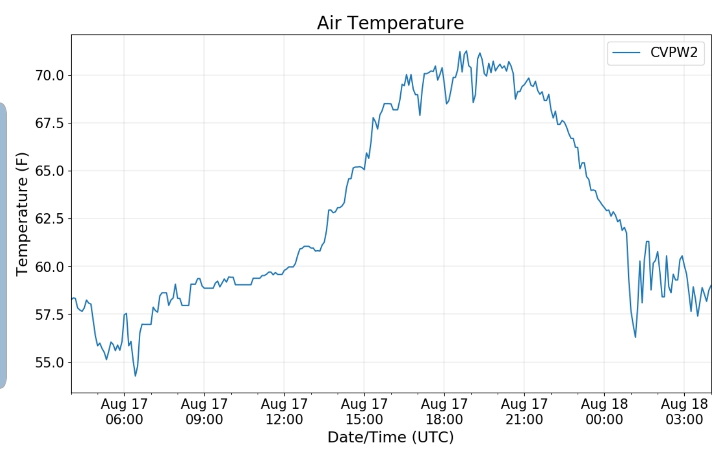
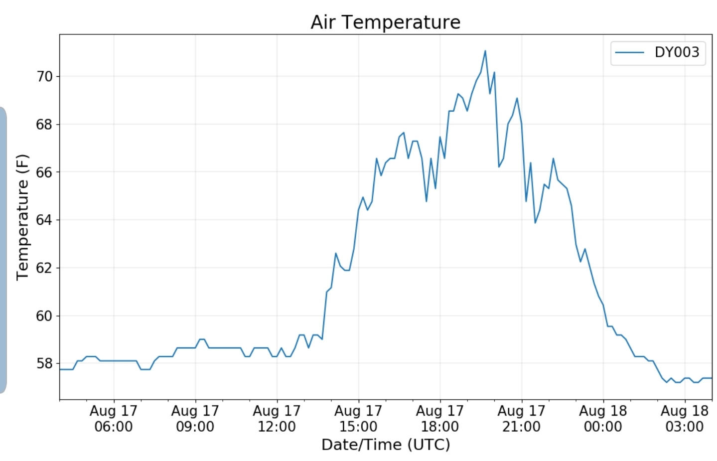
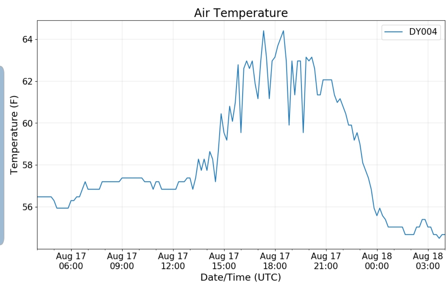
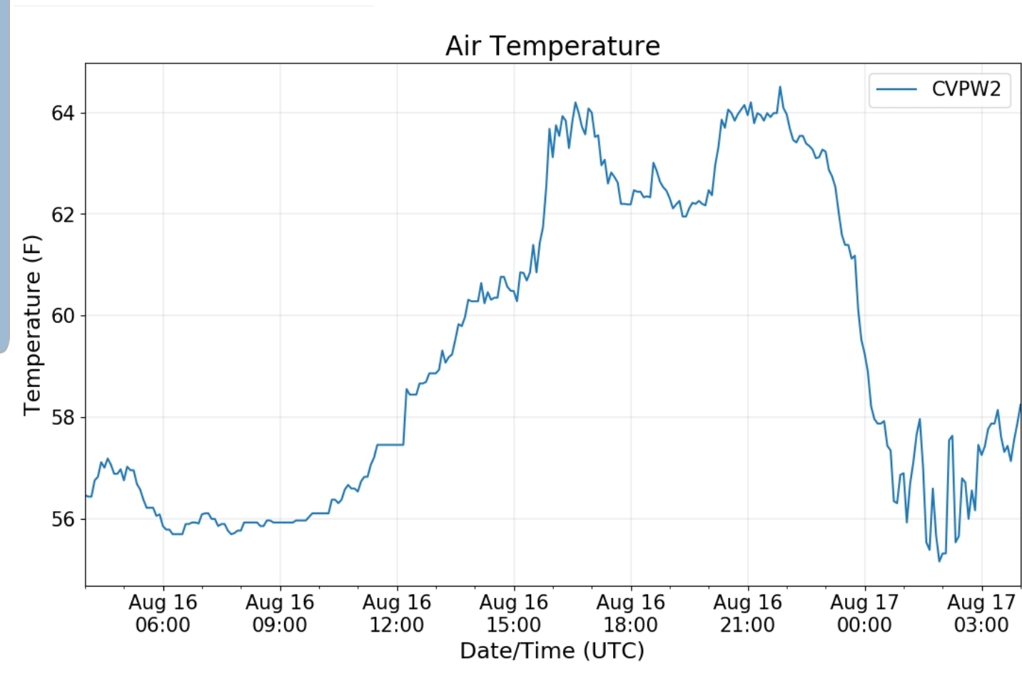
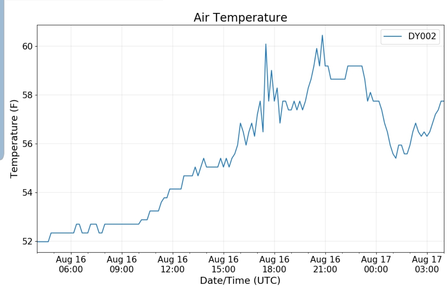
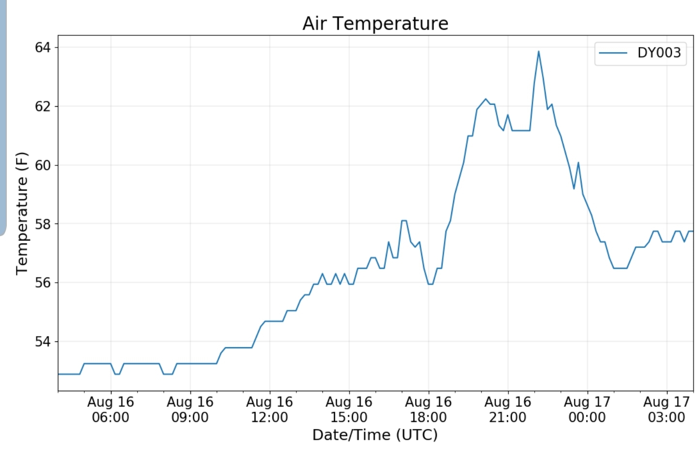
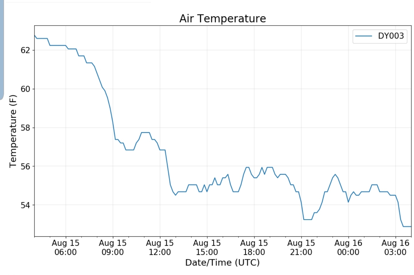
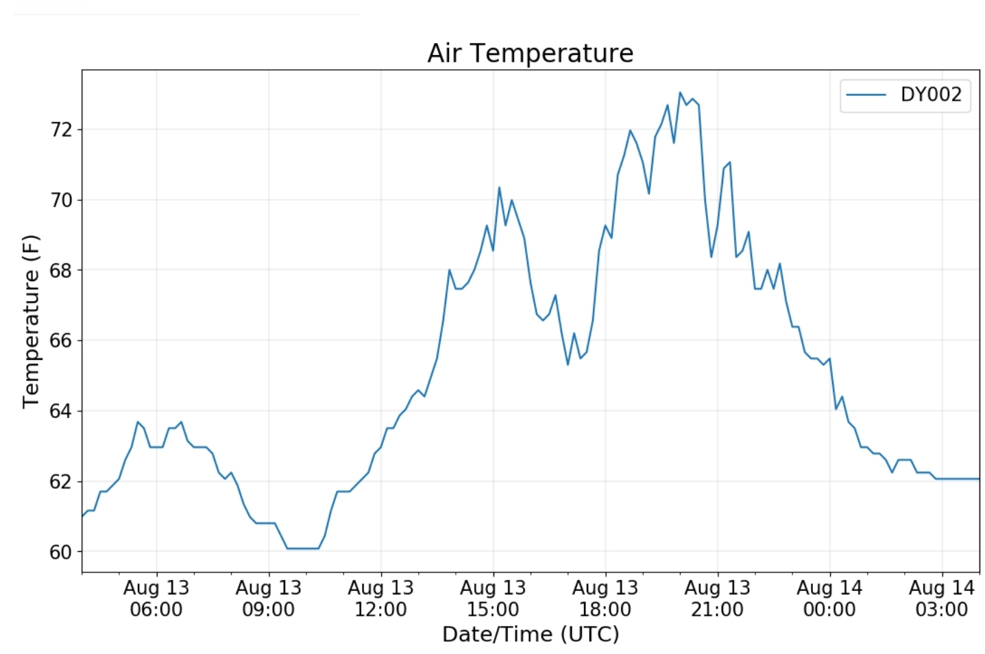
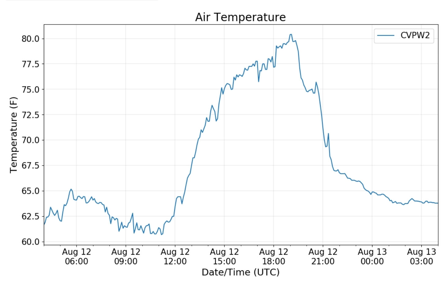
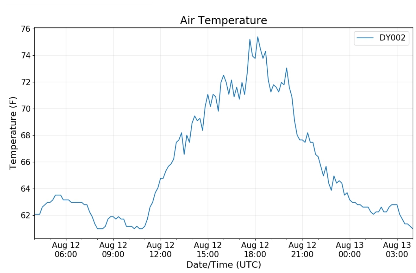
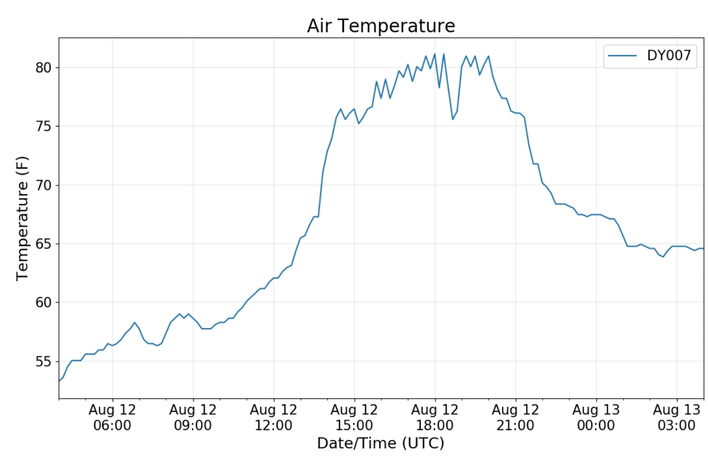
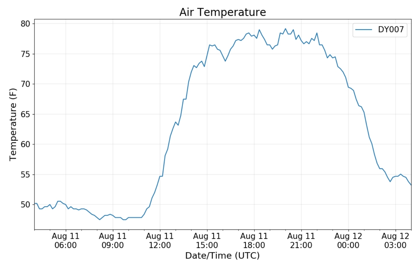
Canaan area temps

Comparison view

High Ground Comparison

Up High and Down Low

Up High, High Valley, Low Valley

RTMA

represents how poorly the RTMA displays valley areas

Radar

Satellite

Flow

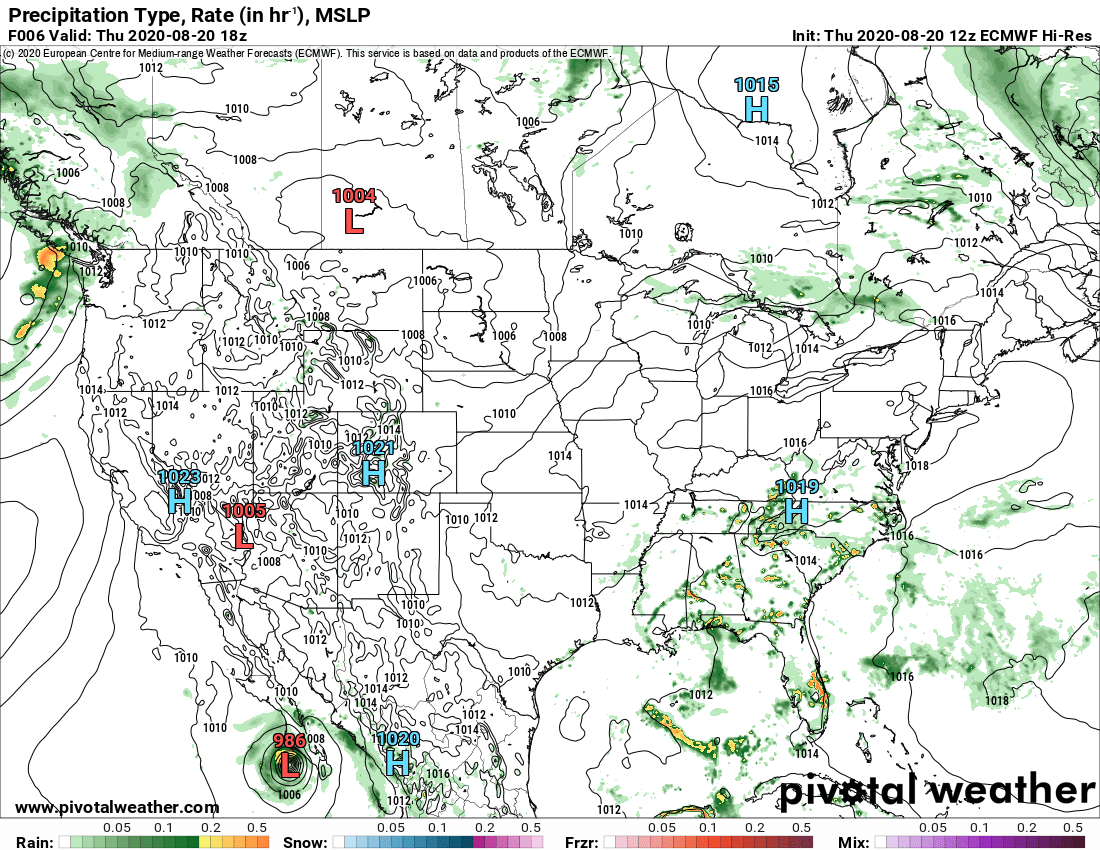
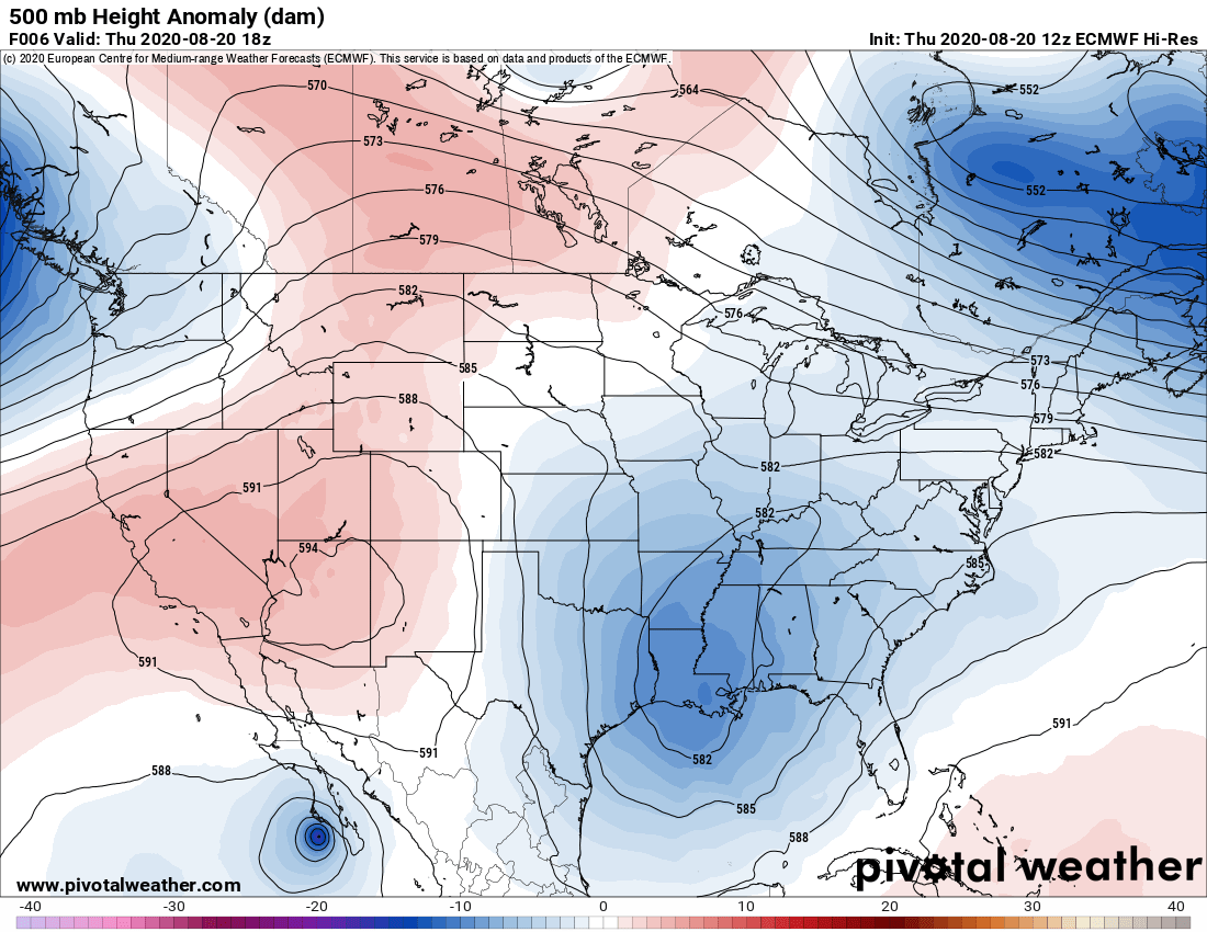
Surface features and 500mb height anomalies and flow

Sang Run to Cranesville area

Cranesville morning 8/20/20
Cranesville afternoon 8/20/20
The Yough at Sang Run afternoon 8/20/20

Oakland vicinity

near Oakland morning 8/20/20

33 east of Harman at the divide

August 19, 2020

August 19, 2020

Aug 19(Wed)

Some patchy fog early, partly cloudy, some areas of showers, mainly south.

Bittinger 2nw Valley

west of Bittinger afternoon 8/19/20
near Bittinger 2nw afternoon 8/19/20
Bittinger 2nw Valley afternoon 8/19/20

Garrett College

Cherry Creek along Mosser Rd evening 8/19/20

Canaan Heights/Davis 3SE

Precip

Year to date total precip

Comments and data by Dave Lesher at:

http://data.canaanmtnsnow.com/

Climate Reference Network Canaan

Cabin Mt at Bald Knob

Cabin Mt-Western Sods

Spruce Knob

Snowshoe

Canaan Valley Refuge

7Springs

Petersburg Grant County Airport

Due to so much missing data this month. Only a daily graph will be displayed

The Valley vs Cabin Mt

Canaan area temps

Comparison view

High Ground Comparison

Up High and Down Low

Up High, High Valley, Low Valley

RTMA

Radar

Satellite

Flow

Surface features and 500mb height anomalies and flow

Cumberland to Lavale

Cassleman Valley from Miller Hill

The Yough at Sang Run

33 east of Harman at the divide

August 18, 2020

August 18, 2020

Aug 18 (Tues)

Areas of fog to start, clouds n sun mixed

Bittinger 2nw Valley

west of Bittinger morning 8/18/20
Bittinger afternoon 8/18/20
west of Bittinger afternoon 8/18/20
near Bittinger 2nw afternoon 8/18/20
Bittinger 2nw Valley afternoon 8/18/20

Garrett College

Cherry Creek along Mosser Rd morning 8/18/20
Mchenry morning 8/18/20
Deep Creek Lake morning 8/18/20
Cherry Creek along Mosser Rd afternoon 8/18/20
Garrett College afternoon 8/18/20

Canaan Heights/Davis 3SE

Precip 0 7am

Year to date total precip 44.23″

Comments and data by Dave Lesher at:

http://data.canaanmtnsnow.com/

Climate Reference Network Canaan

Cabin Mt at Bald Knob

Cabin Mt-Western Sods

Spruce Knob

Snowshoe

Canaan Valley Refuge

7Springs

will fill in chart asap…short on time. .all manually done

Petersburg Grant County Airport

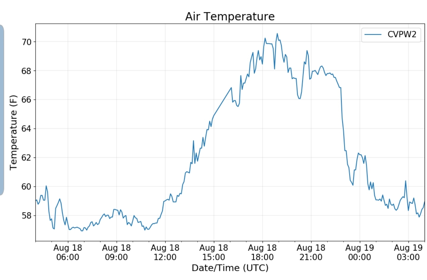
First full day back online. With weeks of data missed. I will not bother making a monthly chart, but will post the daily graph.

The Valley vs Cabin Mt

Canaan area temps

High Ground Comparison

Up High and Down Low

Up High, High Valley, Low Valley

RTMA

Radar

Satellite

Flow

Surface features and 500mb height anomalies and flow

Cranesville to Sang Run

Oakland

Morning

33 east of Harman at the divide

August 17, 2020

August 17, 2020

Aug 17(Mon)

Some early fog, some sun, widely isolated scattered afternoon showers

Bittinger 2nw Valley

Bittinger midday 8/17/20
Looking NW from Bittinger afternoon 8/17/20

Garrett College

Lots of pics to come

Canaan Heights/Davis 3SE

Precip T 7am

Year to date total precip 44.23″

Comments and data by Dave Lesher at:

http://data.canaanmtnsnow.com/

Climate Reference Network Canaan

Cabin Mt at Bald Knob

Cabin Mt-Western Sods

Spruce Knob

Will fill in remainder tomorrow

August 16, 2020

August 16, 2020

Aug 16(Sun)

Cloudy, fog, cool, some pockets of rain..clearing very late day

Bittinger 2nw Valley

Will fill in data asap

Bittinger 2nw Valley morning 8/16/20

Garrett College

Canaan Heights/Davis 3SE

Precip .46 7am

Year to date total precip 44.23

Comments and data by Dave Lesher at :

http://data.canaanmtnsnow.com/

Climate Reference Network Canaan

Cabin Mt at Bald Knob

Cabin Mt-Western Sods

Spruce Knob

Snowshoe

Will fill in asap

Canaan Valley Refuge

7Springs

Will fill in asap

Petersburg Grant County Airport

Remains offline

The Valley vs Cabin Mt

Canaan area temps

Comparison view

High Ground Comparison

Up High and Down Low

Up High, High Valley, Low Valley

RTMA

Radar

Satellite

Flow

Surface features and 500mb height anomalies and flow

Finzel Swamp

Gum trees changing to red

From there to Frostburg

Cumberland

Accident east side of Martins Mt

33 east of Harman at the divide

August 15, 2020

Aug 15(Sat)

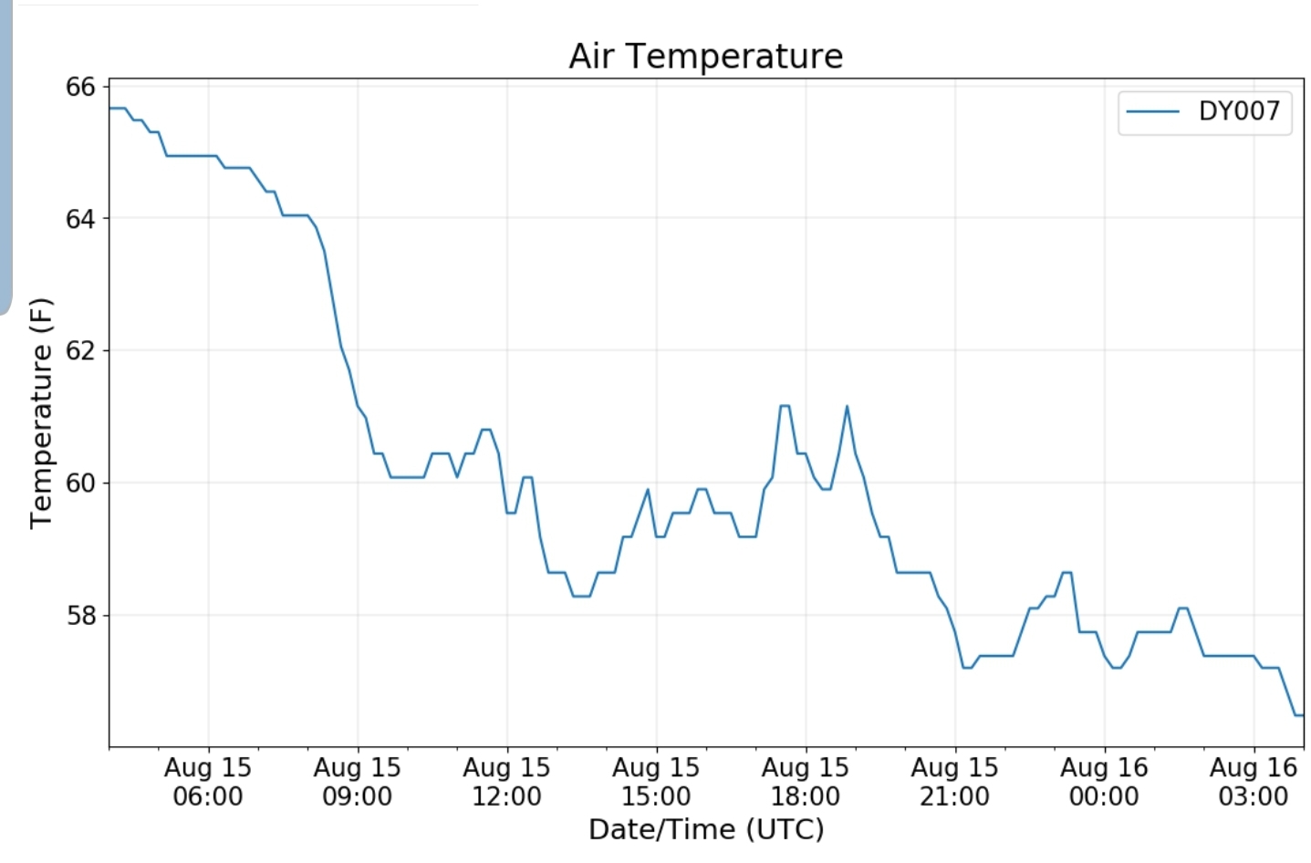
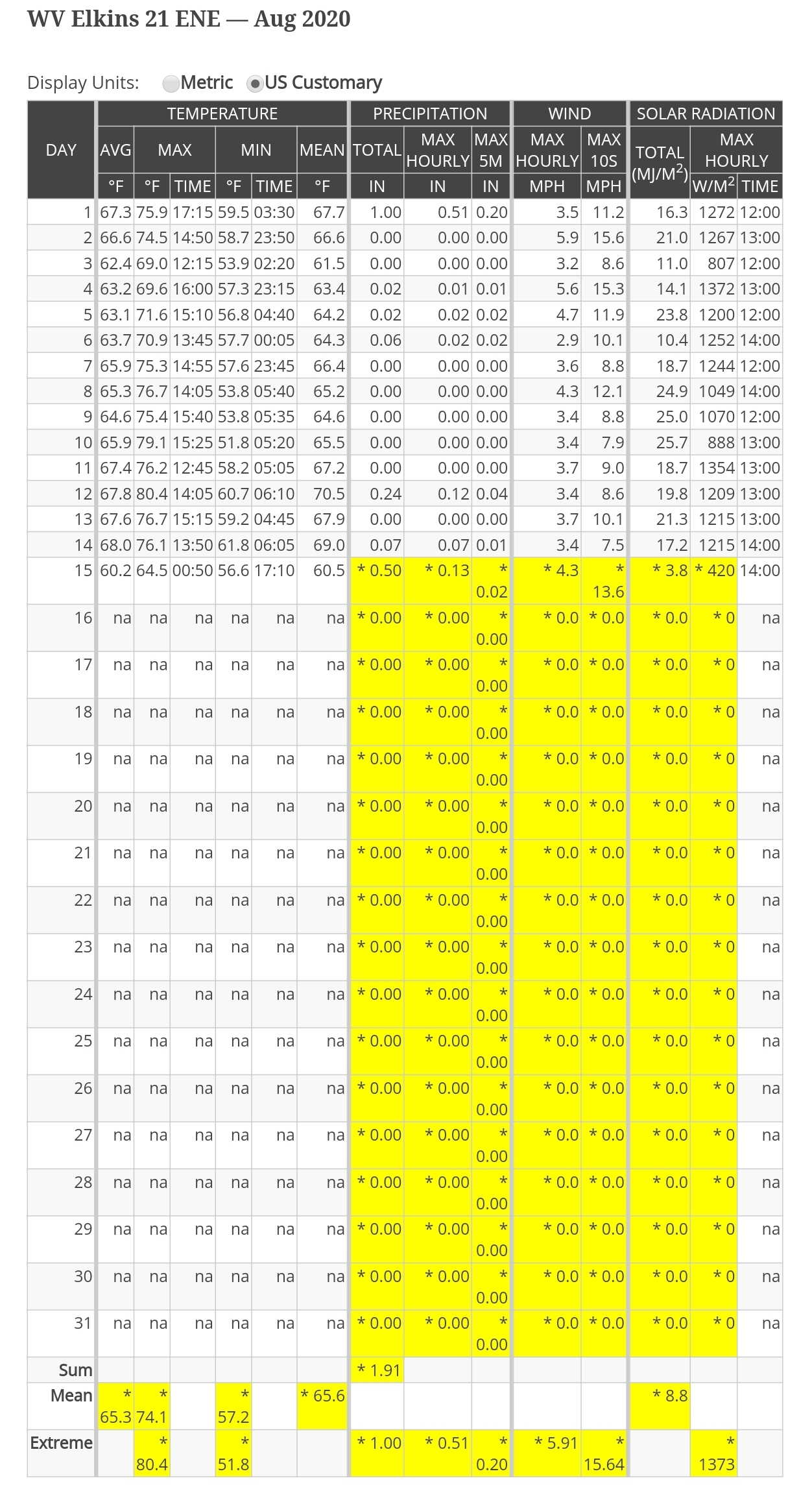
Cloudy, rainy, fog, just a cool raw day. Highs occured around midnight to shortly after. There was some breaks in the sky at sunset.

Bittinger 2nw Valley

Bittinger 2nw Valley morning 8/15/20
west of Bittinger morning 8/15/20
west of Bittinger afternoon 8/15/20
near Bittinger 2nw afternoon 8/15/20
Bittinger 2nw Valley “hints of colors on some maples” 8/15/20
On this date: 6 years ago

I do believe that temp was a few colder vs reality, however there was ice on the grass. The first of 2 mornings in a row.

Garrett College

Cherry Creek along Mosser Rd evening 8/15/20
Garrett College evening 8/15/20
Rock Lodge Rd near The Glades evening 8/15/20

Canaan Heights/Davis 3SE

Precip .26 7am

Year to date total precip 43.77

Comments and data by Dave Lesher at:

http://data.canaanmtnsnow.com/

Climate Reference Network Canaan

Cabin Mt at Bald Knob

Cabin Mt-Western Sods

Spruce Knob

Snowshoe

Canaan Valley Refuge

7Springs

Petersburg Grant County Airport

Remains offline

The Valley vs Cabin Mt

Canaan area temps

Comparison view

High Ground Comparison

Up High and Down Low

Up High, High Valley, Low Valley

RTMA

Radar

Satellite

Flow

Surface features and 500mb height anomalies and flow

33 east of Harman at the divide

August 14, 2020

August 14, 2020

Aug 14(Fri)

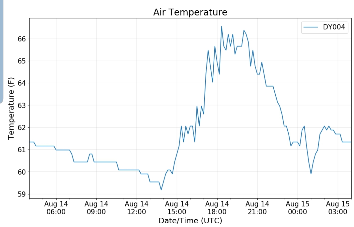
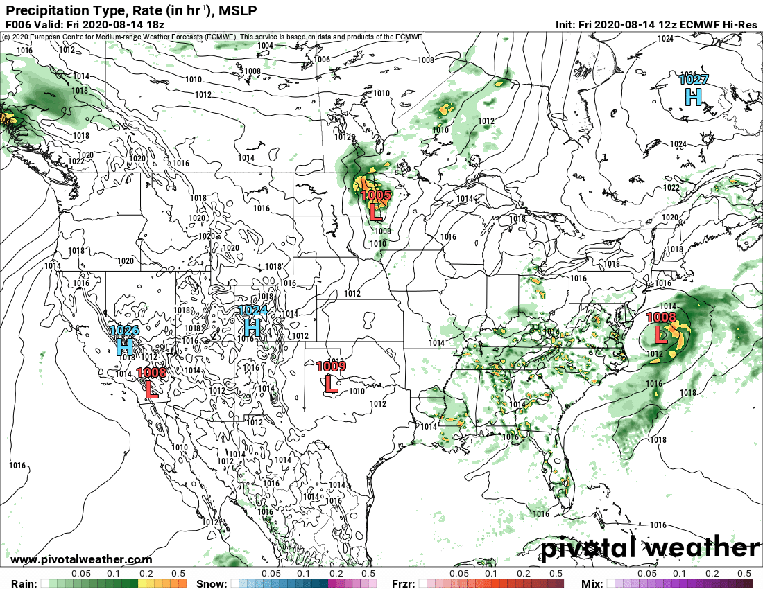
Mix of clouds and sun..rain in the central and southern Alleghenies as the day wore on. Some fog there as well.

Bittinger 2nw Valley

west of Bittinger afternoon 8/14/20
near Bittinger 2nw 8/14/20
near Bittinger 2nw afternoon 8/14/20
Bittinger 2nw Valley afternoon 8/14/20
Bittinger 2nw Valley 8/14/20
north of Bittinger evening 8/14/20
Bittinger VFD

Garrett College

by Garrett College afternoon 8/14/20
Cherry Creek along Mosser Rd evening 8/14/20

Canaan Heights/Davis 3SE

Precip T 7am

Year to date total precip 43.51

Comments and data by Dave Lesher at:

http://data.canaanmtnsnow.com/

Climate Reference Network Canaan

15th got included by saving too late

Cabin Mt at Bald Knob

Cabin Mt-Western Sods

Spruce Knob

Snowshoe

Canaan Valley Refuge

7Springs

Petersburg Grant County Airport

Remains offline

The Valley vs Cabin Mt

Canaan area temps

High Ground Comparison

Up High and Down Low

Up High, High Valley, Low Valley

RTMA

Radar

Satellite

Flow

Surface features and 500mb height anomalies and flow

Cranesville to Sang Run

Cranesville morning 8/14/20
Cranesville afternoon 8/14/20
The Yough at Sang Run afternoon 8/14/20

August 13, 2020

August 13, 2020

Aug 13(Thur)

Partly cloudy

Bittinger 2nw Valley

near Bittinger 2nw afternoon 8/13/20
Bittinger 2nw Valley afternoon 8/13/20

Garrett College

Canaan Heights/Davis 3SE

Precip .54 7am

Year to date total precip 43.51″

Comments and data by Dave Lesher at:

http://data.canaanmtnsnow.com/

Climate Reference Network Canaan

Cabin Mt at Bald Knob

Cabin Mt-Western Sods

Spruce Knob

Snowshoe

Canaan Valley Refuge

7Springs

Petersburg Grant County Airport

Remains offline

The Valley vs Cabin Mt

Canaan area temps

Comparison view

High Ground Comparison

Up High and Down Low

Up High, High Valley, Low Valley

RTMA

Radar

Satellite

Flow

Surface features and 500mb height anomalies and flow

August 12, 2020

August 12, 2020

Aug 12(Wed)

Lots of clouds, some sun…areas of heavy rain late. A case of the haves and have nots…

Bittinger 2nw Valley

Bittinger 2nw Valley morning 8/12/20
near Bittinger 2nw morning 8/12/20
West of Bittinger afternoon 8/12/20
near Bittinger 2nw afternoon 8/12/20
Bittinger 2nw Valley afternoon 8/12/20
west of Bittinger evening 8/12/20

Garrett College

Garrett College morning 8/12/20
Deep Creek Lake morning 8/12/20
Garrett College evening 8/12/20
219 McHenry north evening 8/12/20
Mchenry evening 8/12/20
Cherry Creek along Mosser Rd evening 8/12/20
by The Glades evening 8/12/20

Canaan Heights/Davis 3SE

Precip 0 7am

Year to date total precip 42.97″

Comments and data by Dave Lesher at:

http://data.canaanmtnsnow.com

Climate Reference Network Canaan

Cabin Mt at Bald Knob

Cabin Mt-Western Sods

Spruce Knob

Snowshoe

Canaan Valley Refuge

7Springs

Petersburg Grant County Airport

Remains offline

The Valley vs Cabin Mt

Canaan area temps

Comparison view

High Ground Comparison

Up High and Down Low

Up High, High Valley, Low Valley

RTMA

Radar

Satellite

Flow

Surface features and 500mb height anomalies and flow

33 east of Harman at the divide

Keysers Ridge

Oakland Flooding

Isolated and localized from a heavy cell in the evening

Captured by Lori/Garrett Dixon

August 11, 2020

August 11, 2020

Aug 11(Tues)

Mix of clouds n sun. Some pockets of showers, some heavy pockets east side of mts in spots

Bittinger 2nw Valley

west of Bittinger morning 8/11/20
west of Bittinger afternoon 8/11/20
near Bittinger 2nw afternoon 8/11/20
Bittinger 2nw Valley afternoon 8/11/20

Garrett College

Deep Creek Lake morning 8/11/20
Deep Creek Lake evening 8/11/20
Cherry Creek along Mosser Rd evening 8/11/20

Canaan Heights/Davis 3SE

Precip 0 7am

Year to date total precip 42.97

Comments and data by Dave Lesher at;

http://data.canaanmtnsnow.com

Climate Reference Network Canaan

Cabin Mt at Bald Knob

Cabin Mt-Western Sods

Spruce Knob

Snowshoe

Canaan Valley Refuge

7Springs

Petersburg Grant County Airport

Offline

The Valley vs Cabin Mt

Canaan area temps

High Ground Comparison

Up High and Down Low

Up High, High Valley, Low Valley

RTMA

Radar

Satellite

Flow

Surface features and 500mb height anomalies and flow

33 east of Harman at the divide

6 years ago today

Those images along Rock Lodge Rd near the Cherry Creek decent to Deep Creek

Today. Some color presently, dull. This is a product of stressed maples.