November 12, 2020
Nov 12(Thurs)
Cloudy, dreary start, afternoon breaks.
Bittinger 2nw Valley
Garrett College
Canaan Heights/Davis 3SE
Precip 1.58 7am
Year to date total precip 55.78
Snowfall season to date. 5″
Comments and data by Dave Lesher at:
http://data.canaanmtnsnow.com/
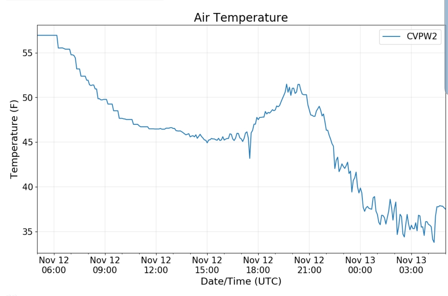
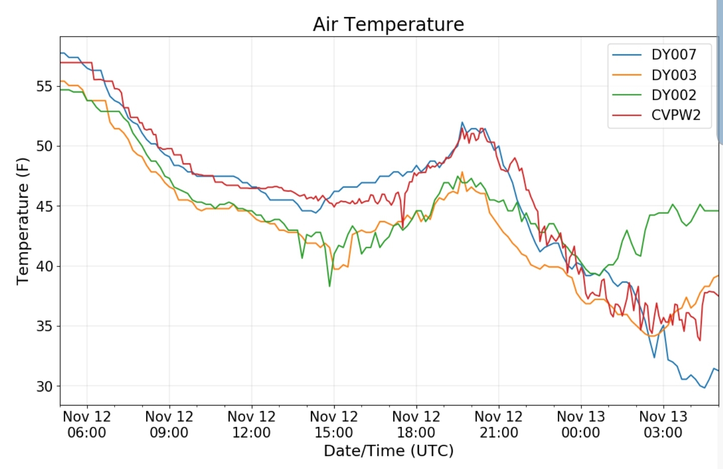
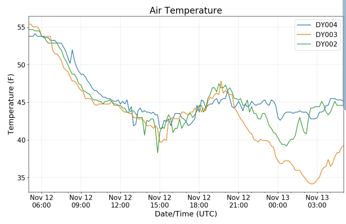
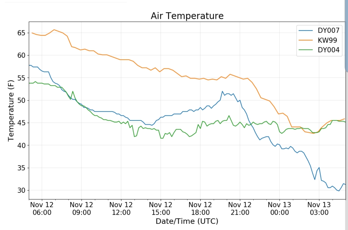
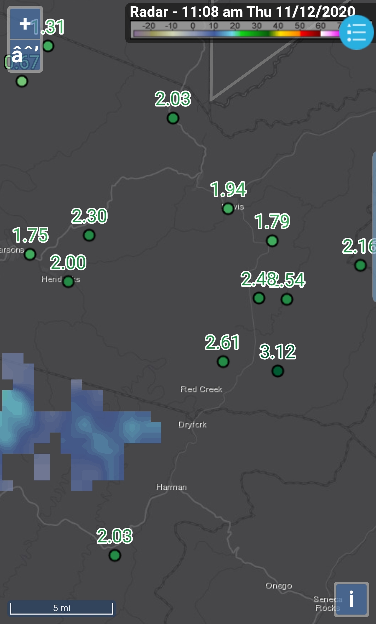
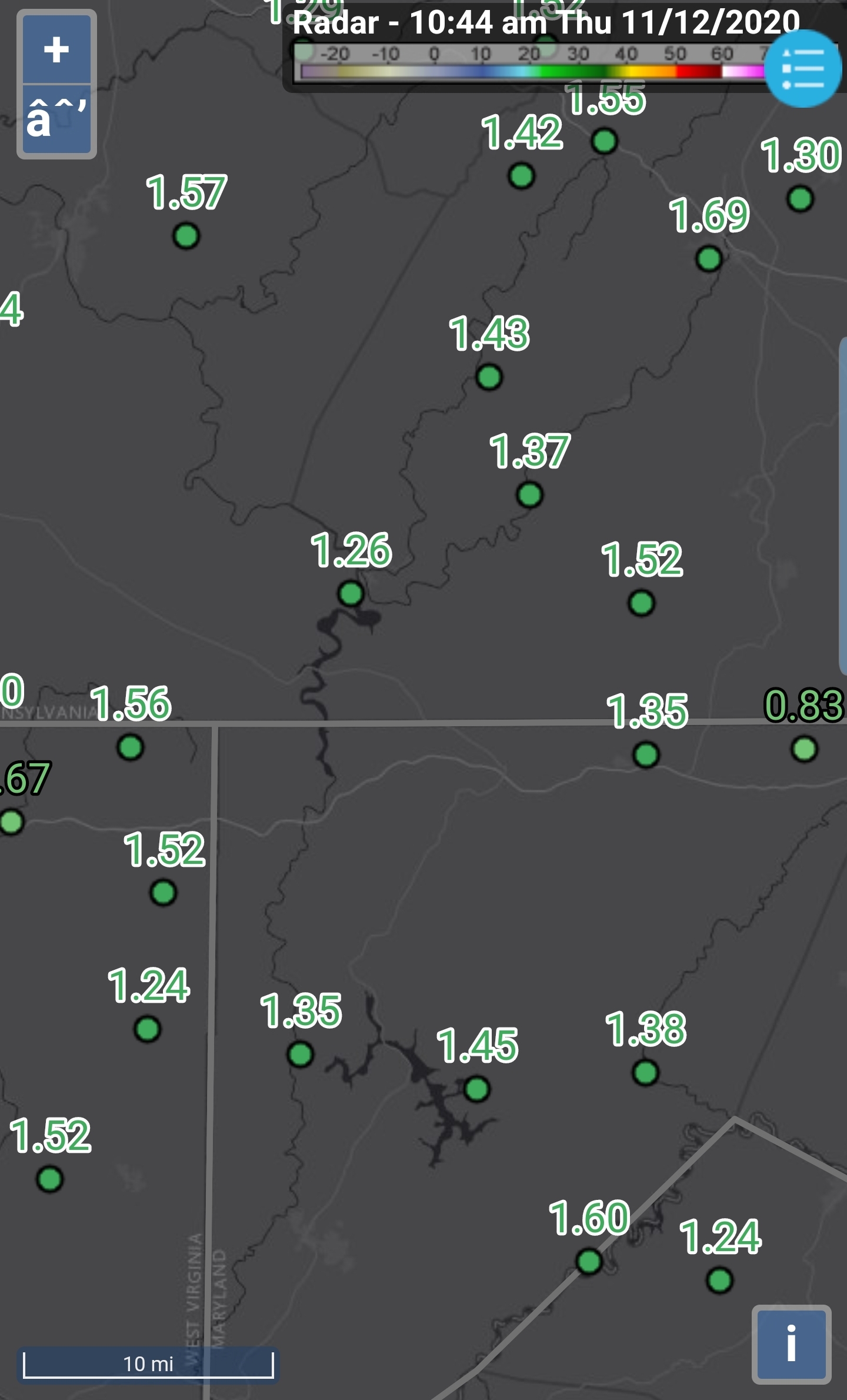
“Rain ending overnight, dense fog at daybreak. 24-hour precip of 1.58 inches is the greatest single day amount in the past 15 months. See table 13.2 below. A little sunshine broke out during the afternoon but it was a sharply cooler day as temperatures mostly hung in the 40s”
Climate Reference Network Canaan
Cabin Mt at Bald Knob
Cabin Mt-Western Sods
Spruce Knob
Canaan Valley Refuge
Dy007-Canaan Valley Refuge 3150′, Dy002-Cabin Mt at Bald Knob 4350′, Dy003-Cabin Mt/Sods 4035′, Dy004-Spruce Knob 4820′, Cvpw2-Climate Reference Network Canaan 3479′, KW99-Petersburg Grant County Airport 961′
The Valley vs Cabin Mt
Canaan area temps
Comparison view
High Ground Comparison
Up High and Down Low
Up High, High Valley, Low Valley
RTMA
Radar
Satellite
Flow
Surface features and 500mb height anomalies and flow
Rainfall amounts (48hr)


