February 10, 2021
Feb 10(Wed)
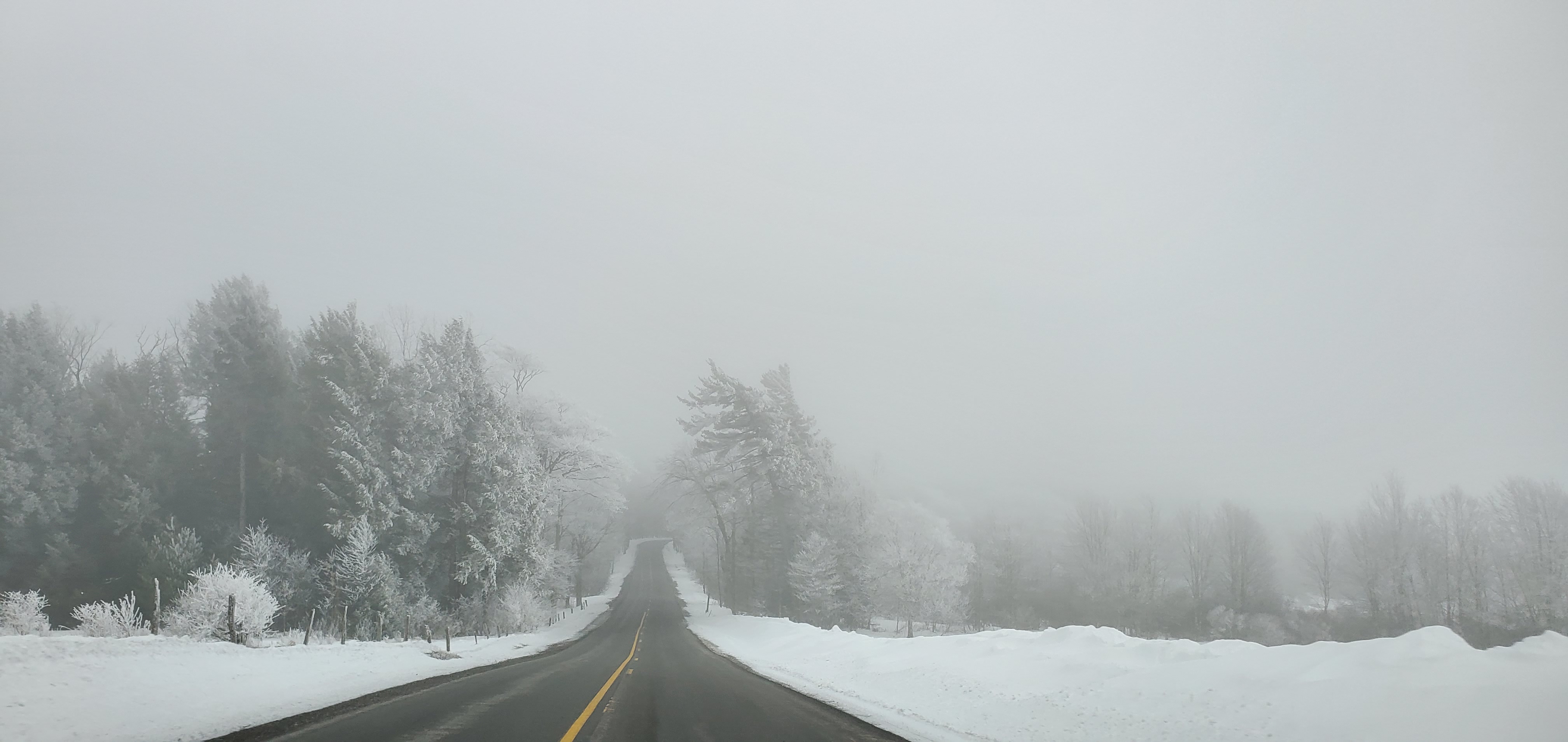
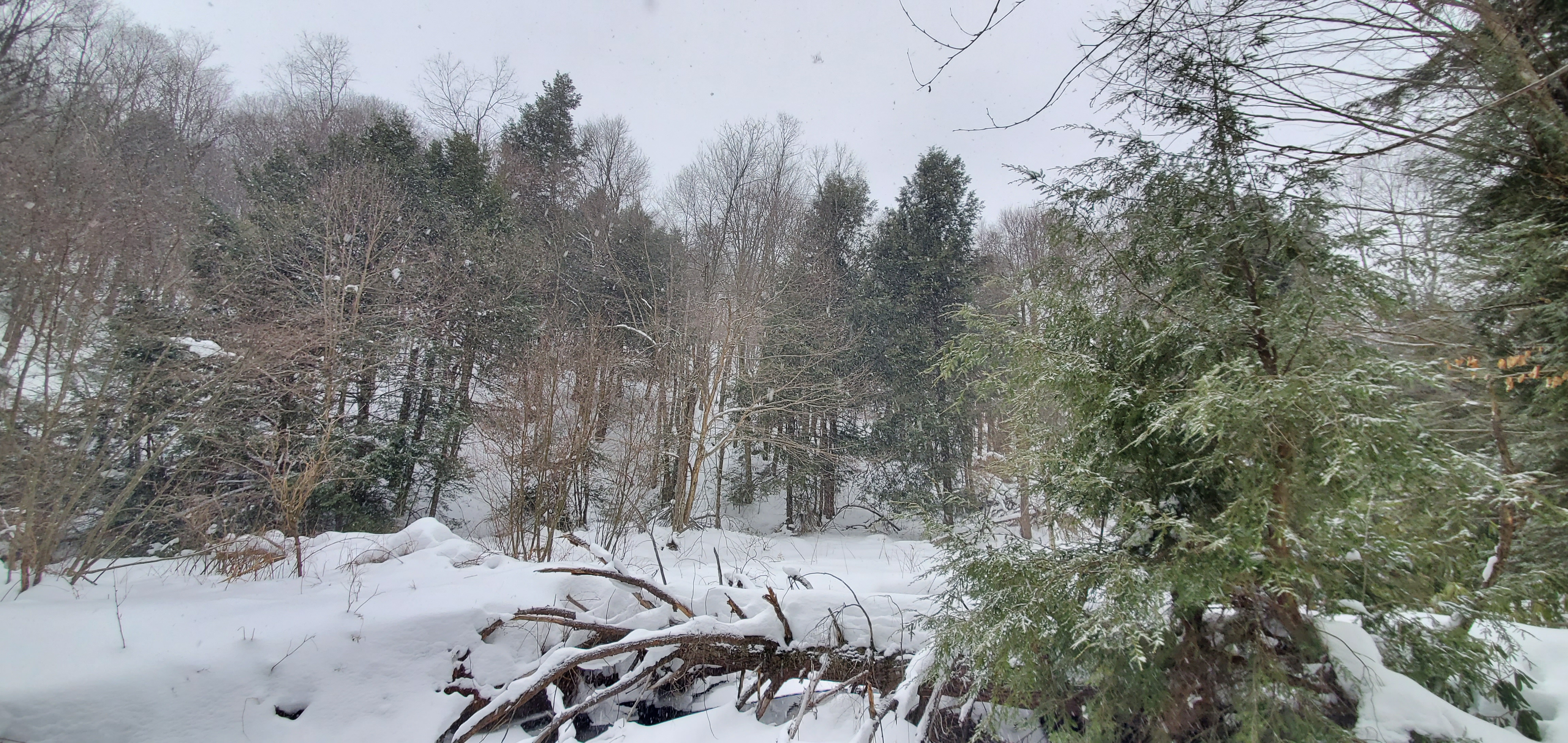
Cloudy, high ground fog, rime, afternoon period of snow, some area saw little freezing rain late evening ahead of main round of snow.
Bittinger 2nw Valley
Garrett College
Canaan Heights/Davis 3SE
precip T 7am
Year to date total precip 5.72
new snowfall T
Season to date total snowfall 86.9
comments and data by Dave Lesher at:
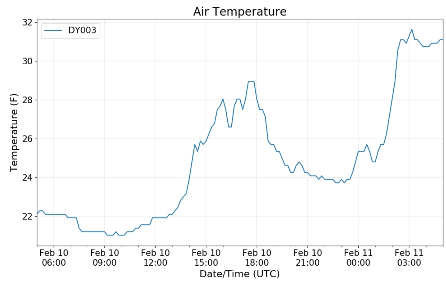
Cloudy and cold at daybreak. Light snow commenced shortly after mid day, continuing lightly but with little accumulation until late afternoon when changing to freezing rain, then back to snow mid evening
Climate Reference Network Canaan
Cabin Mt at Bald Knob
Cabin Mt-Western Sods
Spruce Knob
Canaan Valley Refuge
Mt. Davis
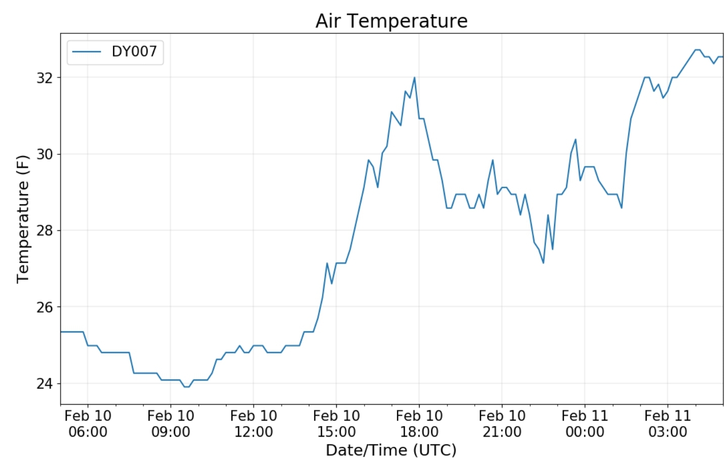
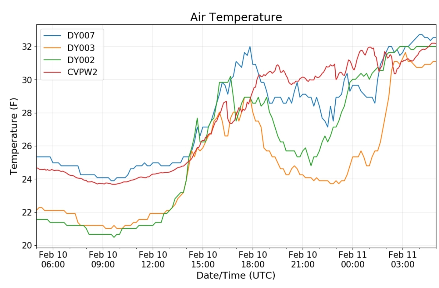
Dy007-Canaan Valley Refuge 3150′, Dy002-Cabin Mt at Bald Knob 4350′, Dy003-Cabin Mt/Sods 4035′,,Dy004-Spruce Knob 4820′, Cvpw2-Climate Reference Network Canaan 3479′, KW99-Petersburg Grant County Airport 961′
The Valley vs Cabin Mt
Canaan area temps
High Ground Comparison
Up High and Down Low
Up High, High Valley, Low Valley
RTMA
Radar
Satellite
Flow
Surface features and 500mb height anomalies and flow
Snowshoe
7Springs
Morning Update:
Post made 7:30am 2/10/21
Winter Storm Warnings out for the pink, winter weather advisories purple
A 2 part event that has lots of variances on placement of part 2 later Thursday into Friday. NWS siding with the Euro.
https://forecast.weather.gov/wwamap/wwatxtget.php?cwa=rlx&wwa=winter storm warning text details
NWS updated expectations- Charleston has upped the amounts for Randolph as it looked likely yesterday and Sterling lowered amounts Garrett, and thats heavy Euro based forecast. Sterling office leans very heavy on the Euro. Lately, it has not performed well. So we’ll see
What changed, lets look at the Euro progression of the last several runs
In most regards the Euro is the top model. Lately its been terrible in the 3 day window. The storm last week it was not good on the final piece of energy Tuesday night, Wednesday morning that brough in several inches of fluff and what turned out to be the nastiest night to date of the winte . With that event, Sterling had no advisories, nothing until 3am after the snow was mostly done. Which was mostly pointless at that time. The reason, the Euro completely missed that event once we got to within 3 days. It did have it around 3 days away then lost it. I asked the Sterling office on Sunday last week if their snow maps reflected the high ratio fluff that looks to occur Tuesday night as the snow map for Garrett and Allegany were identical. My reply was, we expect no snow in our entire forecast area Tuesday night. Then it turned out to be a nasty night.
The GFS handled that well. Now the question looms is it handling this event well as it is a bit of an outlier, but its also been the most consistent the last 3 days. The runs have barely changed and have not been weak, strong, north to south like the Euro and other modeling. Lets look at the last 5 runs of the GFS
Hows that for consistency? Even the ensemble mean has held consistent ..newest to oldest
The forecast from Charleston yesterday morning
Pitts amounts
The biggest question with this is part 2 tomorrow
overall a 5-10″ event from Cambria to Pocahontas is still my thoughts with locals Garrett to to Wv ….12+ in spots if the GFS verifies. Still like 5-10″ regardless.
After this passes by, another round over the weekend to watch, and mid next week. Mid range from the models will come with lots of run to run changes over the coming days.
mother nature will have the final say…..


