May 4, 2021
May 4(Tues)
Showers, cloudy, few storms
Bittinger 2nw Valley
Bittinger 2nw Valley afternoon 5/4/21
Bittinger 2nw Valley afternoon 5/4/21
Bittinger 2nw Valley afternoon 5/4/21 ramp watch
Bittinger 2nw Valley afternoon 5/4/21
Bittinger 2nw Valley 5/4/21 “hickory”
Bittinger 2nw Valley afternoon 5/4/21 “maple”
Bittinger 2nw Valley afternoon 5/4/21 “beech”
Bittinger 2nw Valley afternoon 5/4/21
Bittinger 2nw Valley afternoon 5/4/21 “red oak”
Bittinger 2nw Valley afternoon 5/4/21 “most of the green is cherry”
Bittinger 2nw Valley afternoon 5/4/21
Bittinger 2nw Valley afternoon 5/4/21 “birch”
Bittinger 2nw Valley evening 5/4/21
Bittinger 2nw Valley afternoon 5/4/21 “cherry”
Bittinger 2nw Valley evening 5/4/21
Bittinger 2nw Valley evening 5/4/21 “skunk cabbage”
Bittinger 2nw Valley evening 5/4/21 “Mayapple”
Garrett College
Wisp morning
Meadow Mt morning
Deep Creek Lake morning
Deep Creek Lake morning
Deep Creek Lake morning
Deep Creek Lake afternoon
Wisp 8pm
Garrett College evening
Canaan Heights/Davis 3SE
precip .65 7am
year to date total precip 18.71 7am
snowfall season to date 120.4
Comments and data by Dave Lesher at:
http://data.canaanmtnsnow.com/
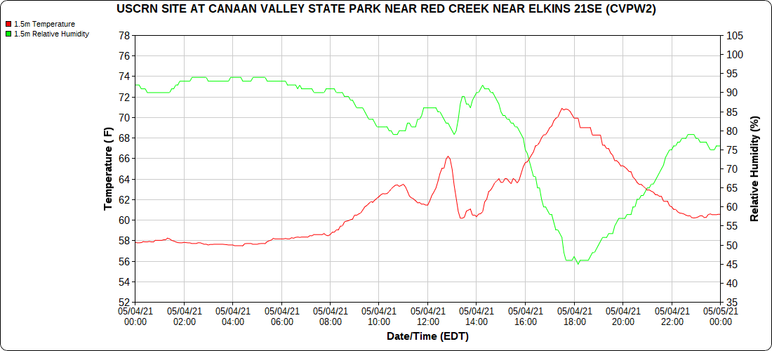
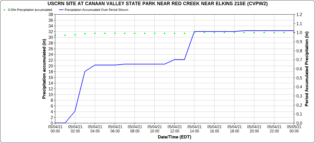
Climate Reference Network Canaan
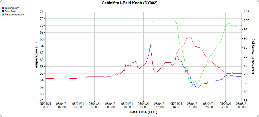
Cabin Mt at Bald Knob
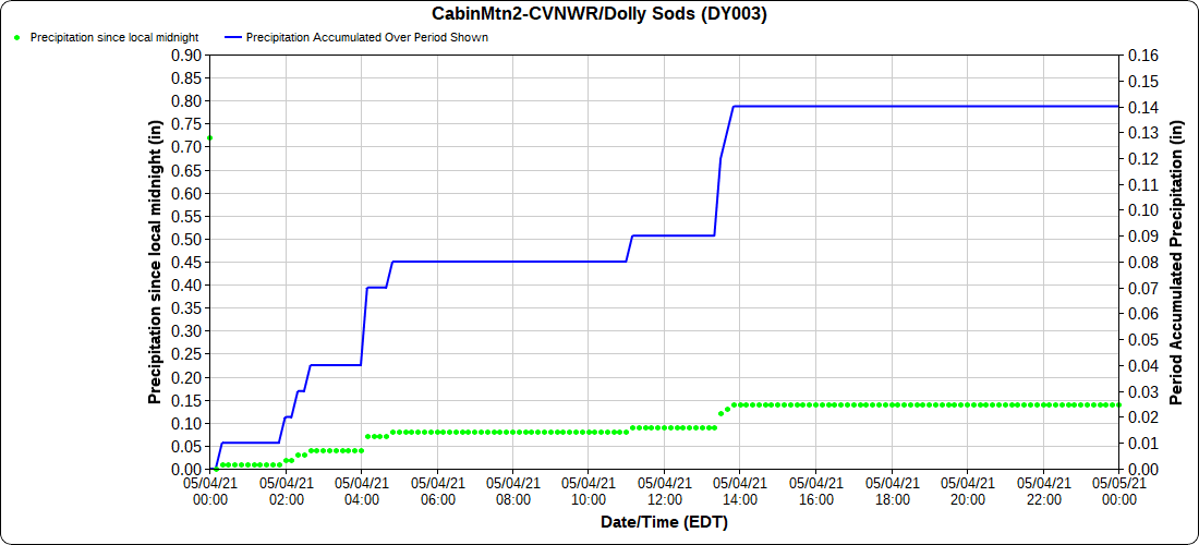
Cabin Mt-Western Sods
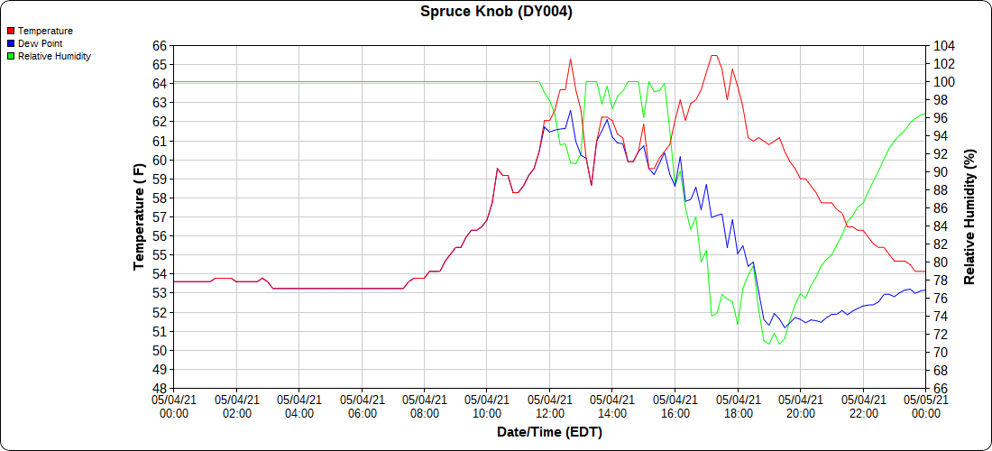
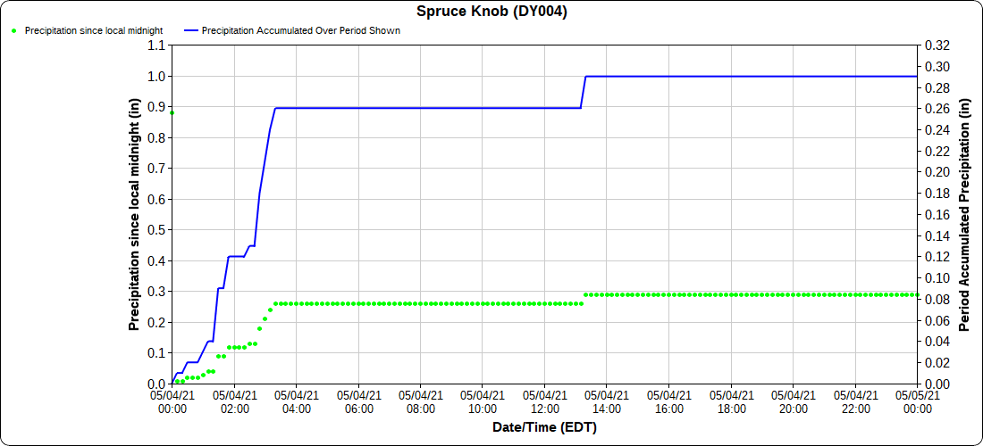
Spruce Knob
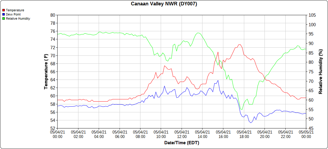
Canaan Valley Refuge
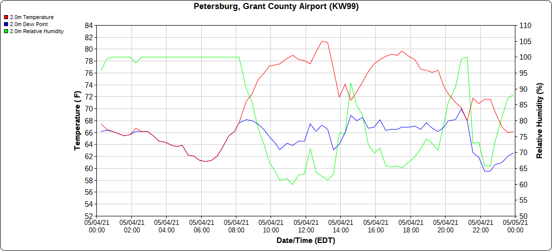
Petersburg Grant County Airport
Dy007-Canaan Valley Refuge 3150′, Dy002-Cabin Mt at Bald Knob 4350′, Dy003-Cabin Mt-Western Sods 4035′,,Dy004-Spruce Knob 4820′, Cvpw2-Climate Reference Network Canaan 3479′, KW99-Petersburg Grant County Airport 961′
The Valley vs Cabin Mt
Canaan area temps
High Ground Comparison
Up High and Down Low
Up High, High Valley, Low Valley
RTMA
Radar
Satellite
Flow
Surface features and 500mb Height anomalies and flow
7Springs
Oakland


