August 9, 2021
Forest Service Cam offline since 6/24/21
Aug 9(Mon)
sun, clouds, sprinkles, isolated shower
Bittinger 2nw Valley
Bittinger 2nw Valley late morning experimental spot 8/9/21
Bittinger 2nw Valley late morning 8/9/21
west of Bittinger afternoon 8/9/21
Bittinger 2nw Valley afternoon 8/9/21
Bittinger 2nw Valley afternoon 8/9/21
Bittinger 2nw Valley afternoon 8/9/21
Bittinger 2nw Valley afternoon 8/9/21
Bittinger 2nw Valley afternoon 8/9/21
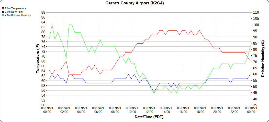
Garrett County Airport
by Garrett College afternoon
McHenry afternoon
near McHenry afternoon
McHenry afternoon
Near McHenry afternoon
near McHenry afternoon
near McHenry afternoon
Canaan Heights/Davis 3SE
(midnight to midnight data Dyacon, 7am to 7am data MMTS COOP)
Comments and data by Dave Lesher at;
http://data.canaanmtnsnow.com/
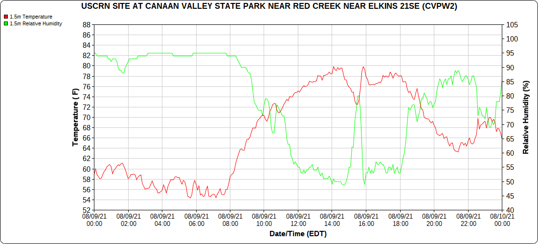
Climate Reference Network Canaan
Cabin Mt at Bald Knob
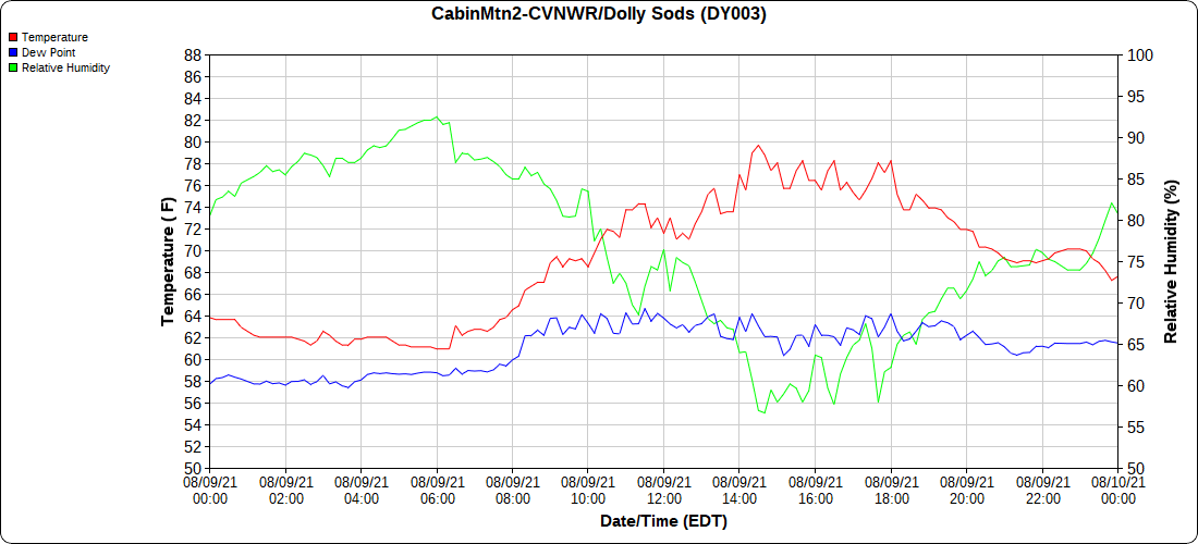
Cabin Mt-Western Sods
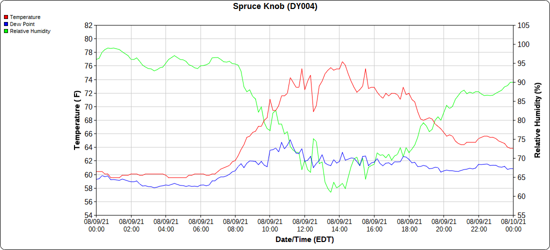
Spruce Knob
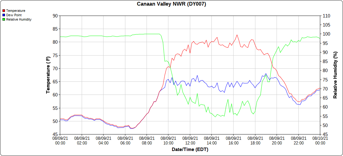
Canaan Valley Refuge
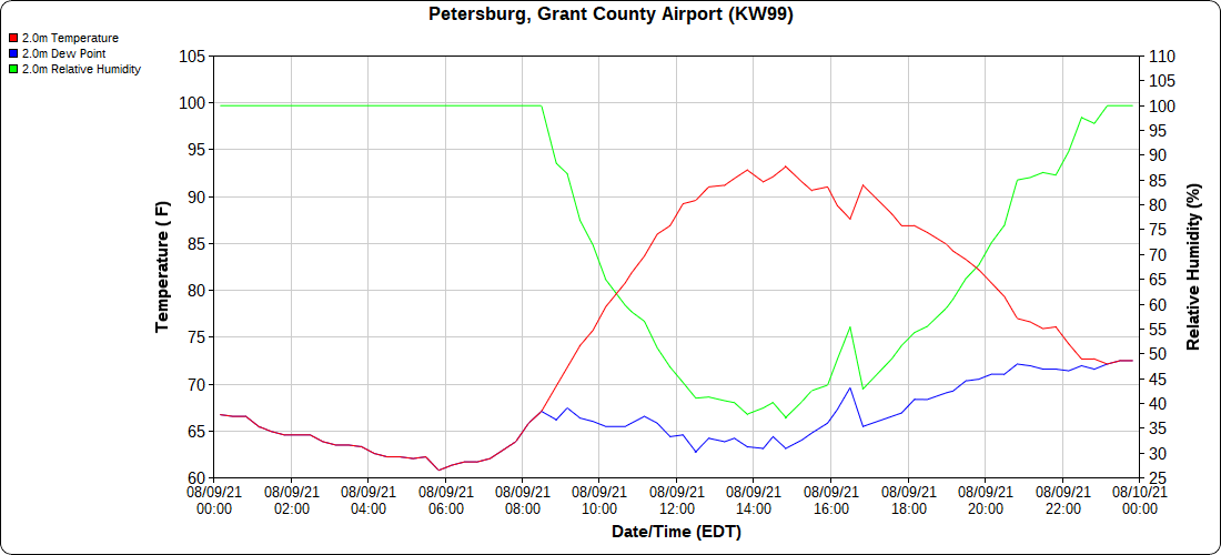
Petersburg Grant County Airport
Dy007-Canaan Valley Refuge 3150′, Dy002-Cabin Mt at Bald Knob 4350′, Dy003-Cabin Mt-Western Sods 4035′, Dy004-Spruce Knob 4820′, Cvpw2-Climate Reference Network Canaan 3479′, KW99-Petersburg Grant County Airport 961′, K2G4 Garrett County Airport 2933′
The Valley vs Cabin Mt
Canaan area temps
High Ground Comparison
Up High and Down Low
Up High, High Valley, Low Valley
RTMA
Radar
Satellite
Flow
Surface features and 500mb Height anomalies and flow
Flintstone to Rocky Gap
Justin Berks gang Md Trek 8
Frostburg
West of Grantsville
The Yough at Sang Run
Cranesville
Regional Climate Center data
Zoomed in with plotted actual avg daily maxes….with the in accurate poorly sited Oakland 1SW that reads too high on maxes.
color scheme should be…. that oddity of Negro, Meadow Mt region false warm island across the high ground continues on their maps


