July 12, 2022
Forest Service Cam offline since 6/24/21
July 12(Tues)
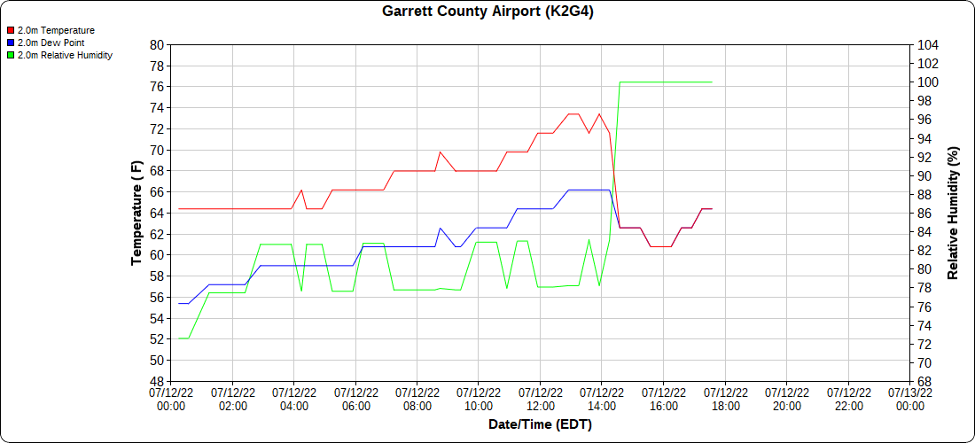
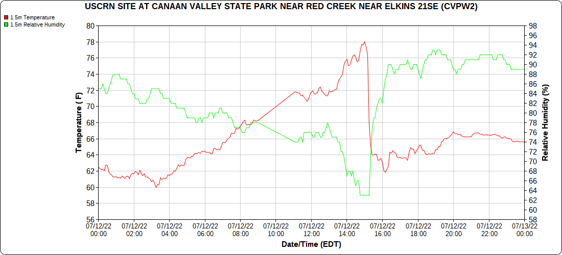
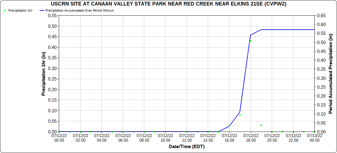
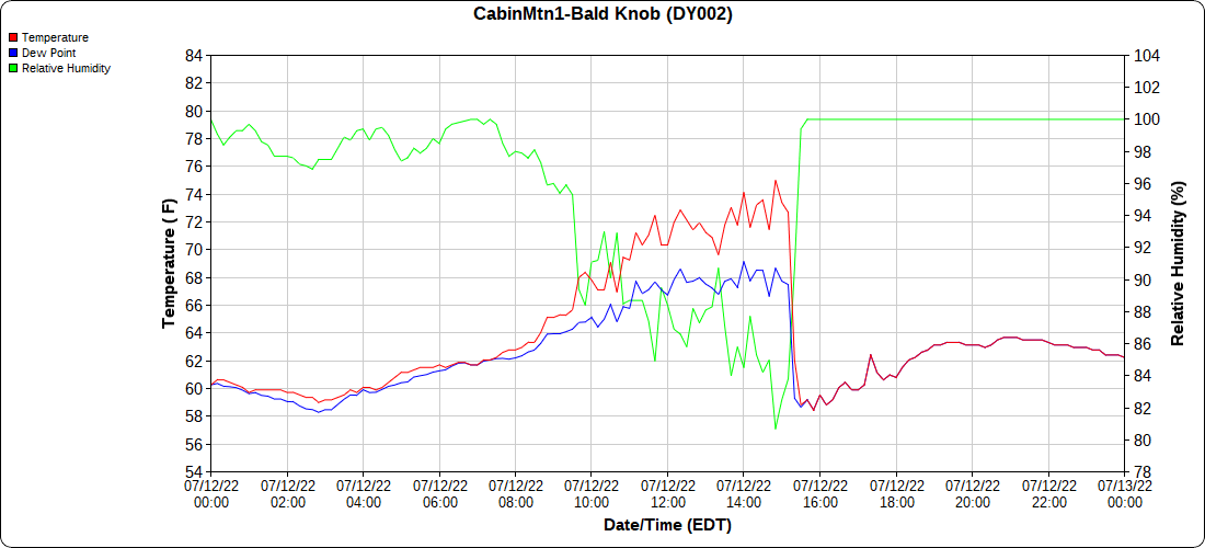
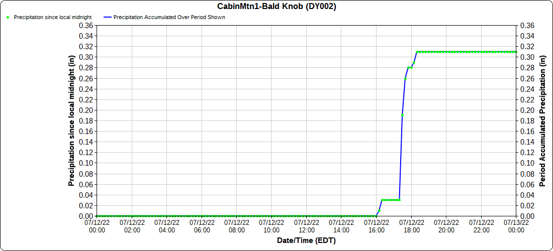
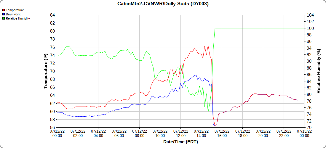
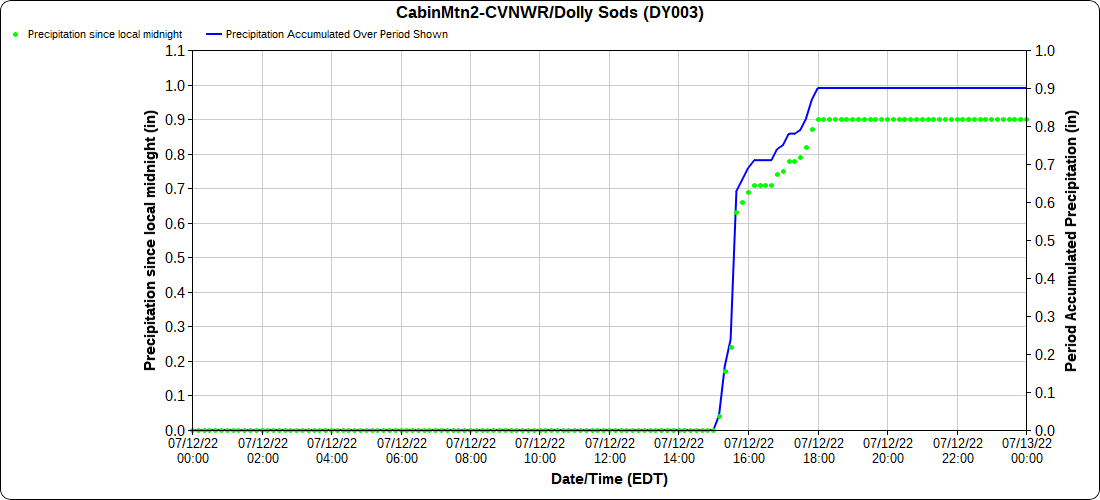
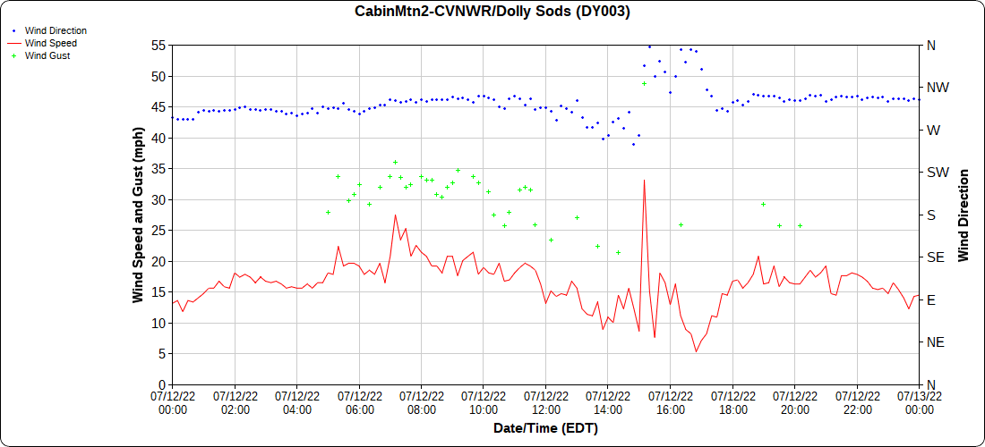
Cloudy, afternoon storms, breezy day, gusty with storms
Bittinger 2nw Valley
Garrett County Airport
Canaan Heights/Davis 3SE
comments and data by Dave Lesher at:
http://data.canaanmtnsnow.com/
Climate Reference Network Canaan
Atop Canaan Ski Area
Cabin Mt at Bald Knob
Cabin Mt-Western Sods
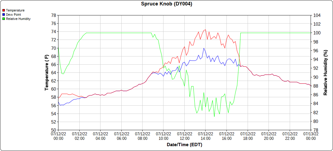
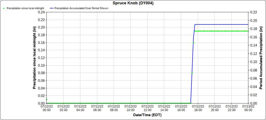
Spruce Knob
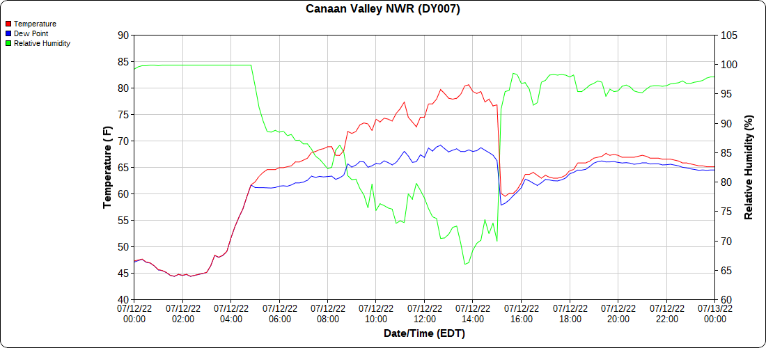
Canaan Valley Refuge
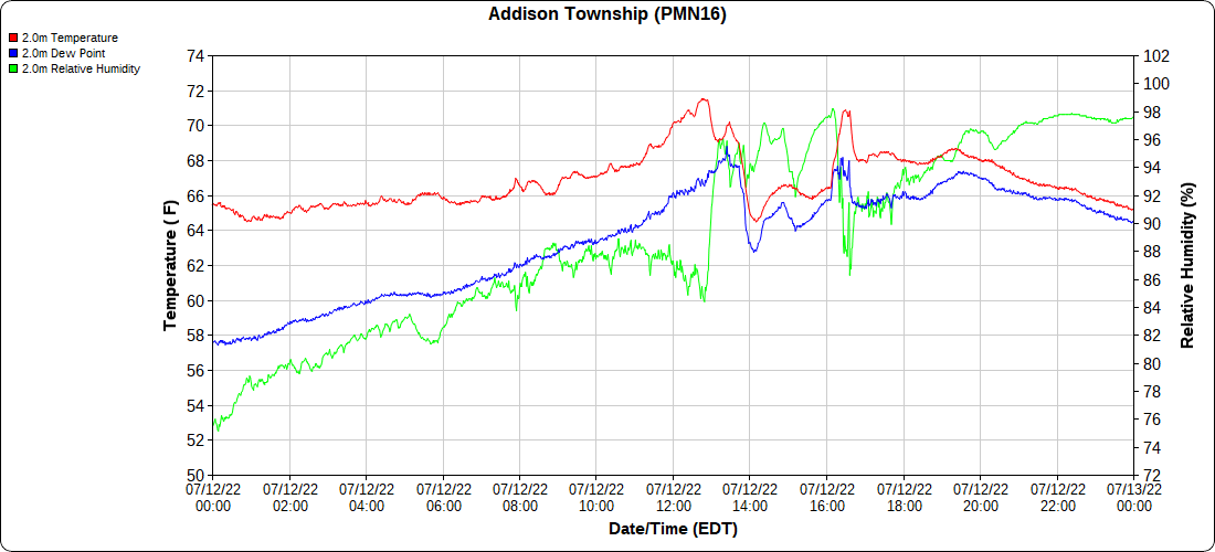
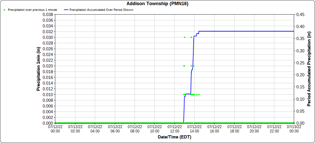
Mt Davis
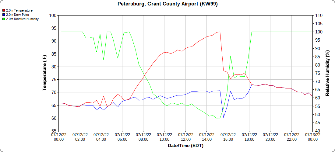
Petersburg Grant County Airport
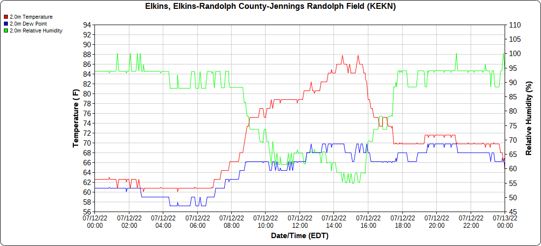
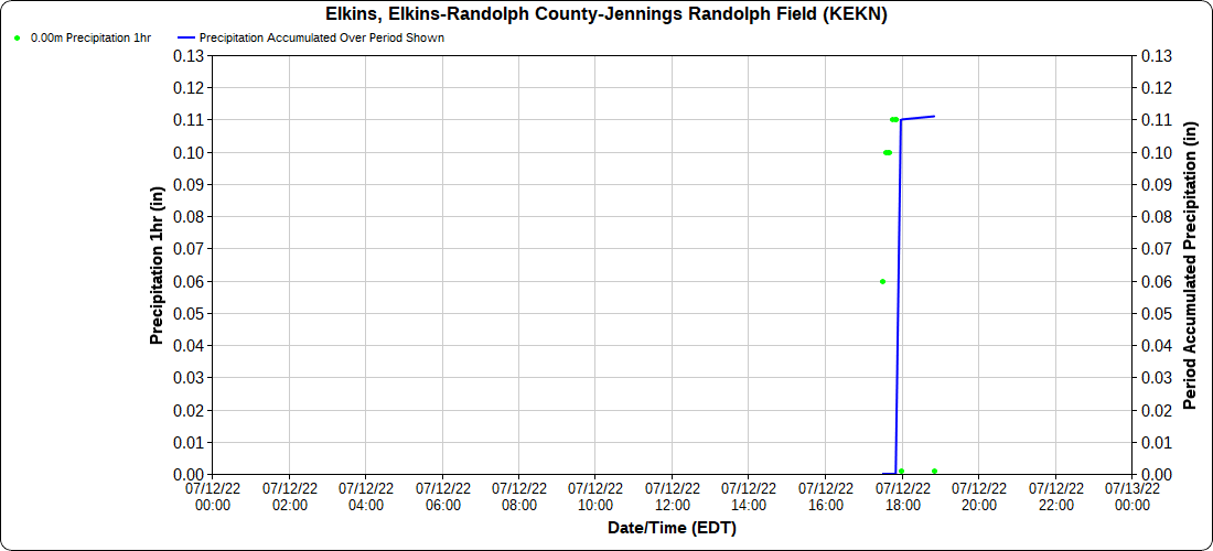
Elkins Airport
Dy007-Canaan Valley Refuge 3150′, Dy002-Cabin Mt at Bald Knob 4350′, Dy003-Cabin Mt-Western Sods 4035′, Dy004-Spruce Knob 4820′, Cvpw2-Climate Reference Network Canaan 3380′, KW99-Petersburg Grant County Airport 961, K2G4 Garrett County Airport 2933′, KCBE Cumberland Airport 774′, KEKN Elkins Airport 1985′, KMGW Morgantown Airport 1227′, PMN16 Mt Davis 3038′


