September 20, 2022
Forest Service Cam offline since 6/24/22
Sept 20(Tues)
⛅️ Clouds sun mix..areas of a.m fog
Bittinger 2nw Valley
near Bittinger 2nw morning 9/20/22
Bittinger 2nw Valley morning
west of Bittinger morning
west of Bittinger morning
west of Bittinger morning
Rock Lodge Rd near The Glades afternoon
Rock Lodge Rd afternoon near The Glades
Rock Lodge Rd just south of Beachy Rd
Rock Lodge Rd near The North Branch of The Cassleman
ditto
Rock Lodge Rd Brenneman Hill
Brennemans Grove afternoon
near Brennemans Grove afternoon
Orndorf Rd afternoon
Orndorf Rd afternoon
Orndorf Rd afternoon
west of Bittinger afternoon
west of Bittinger afternoon
west of Bittinger afternoon
west of Bittinger afternoon
Bittinger 2nw Valley afternoon
Garrett County Airport
station was offline most of the day
Rock Lodge Rd morning
Rock Lodge Rd morning
Rock Lodge Rd morning
Rock Lodge Rd morning
Deep Creek Lake morning
Deep Creek Lake morning
Deep Creek Lake afternoon
Deep Creek Lake afternoon
Rock Lodge Rd afternoon
Rock Lodge Rd afternoon
Rock Lodge Rd afternoon
Rock Lodge Rd afternoon
Top of Wisp
Canaan Heights/Davis 3SE
midnight to midnight data Dyacon
comments and data by Dave Lesher at:
http://data.canaanmtnsnow.com/
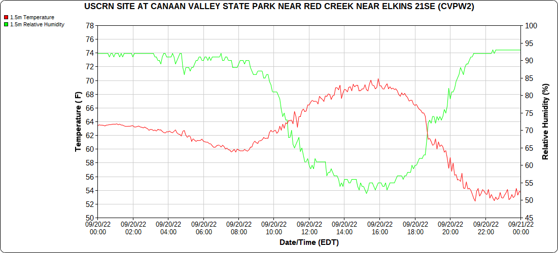
Climate Reference Network Canaan
Atop Canaan Ski area
Cabin Mt at Bald Knob
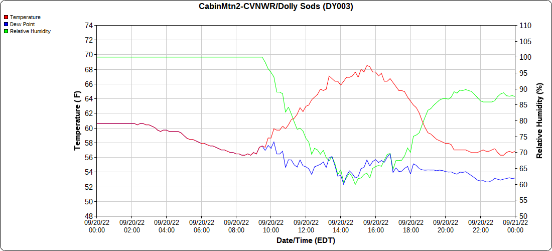
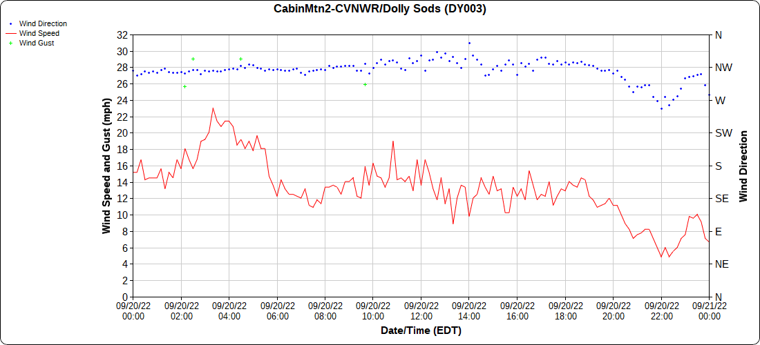
Cabin Mt-Western Sods
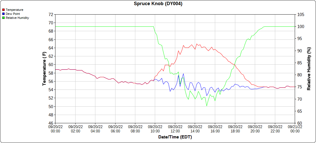
Spruce Knob
Canaan Valley Refuge
Mt.Davis
Petersburg Grant County Airport
Elkins Airport
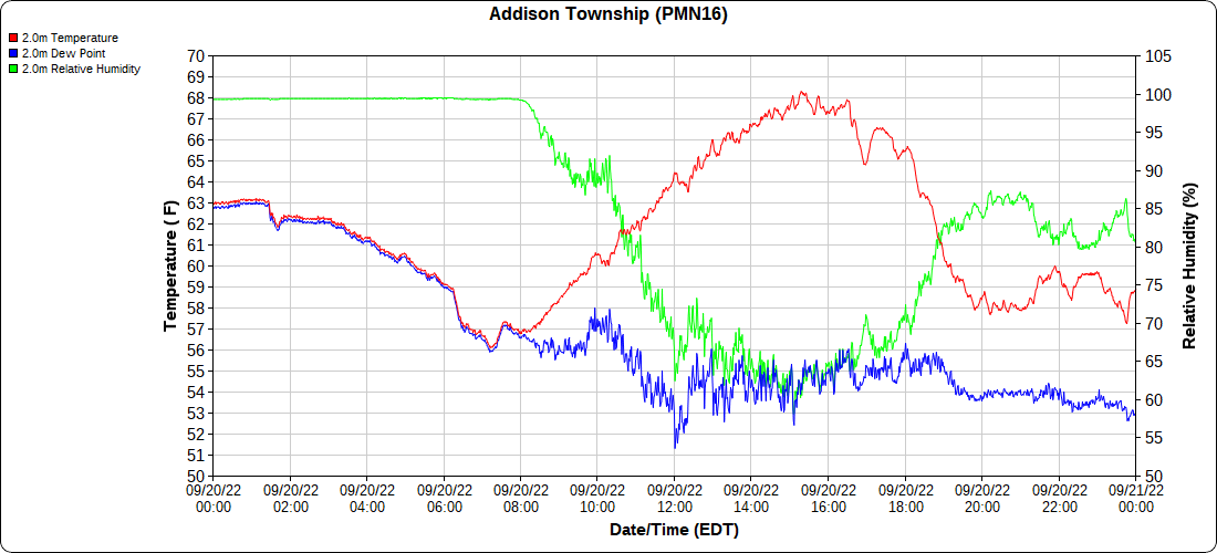
Dy007-Canaan Valley Refuge 3150′, Dy002-Cabin Mt at Bald Knob 4350′, Dy003-Cabin Mt-Western Sods 4035′, Dy004-Spruce Knob 4820′, Cvpw2-Climate Reference Network Canaan 3380′, KW99-Petersburg Grant County Airport 961, K2G4 Garrett County Airport 2933′, KCBE Cumberland Airport 774′, KEKN Elkins Airport 1985′, KMGW Morgantown Airport 1227′, PMN16-Mt.Davis 3038′
The Valley vs Cabin Mt
Canaan area temps
High Ground Comparison
Up High and Down Low
Up High, High Valley, Low Valley
The Valleys
RTMA
Radar
Satellite
Flow
Surface features and 500mb Height anomalies and flow
Oakland
Towards Savage Mt
Frostburg
Between Lavale-Cumberland


