December 20, 2022
Forest Service Cam offline since 6/24/21
Dec 20(Tues)
Clear cold start….coldest Valley a.m thus far this season. Sun today with a few intervals of clouds.
Bittinger 2nw Valley
by the Glades
Garrett County Airport
Top of Wisp
pics all from afternoon
Canaan Heights/Davis 3SE
Comments and data by Dave Lesher at:
http://data.canaanmtnsnow.com/
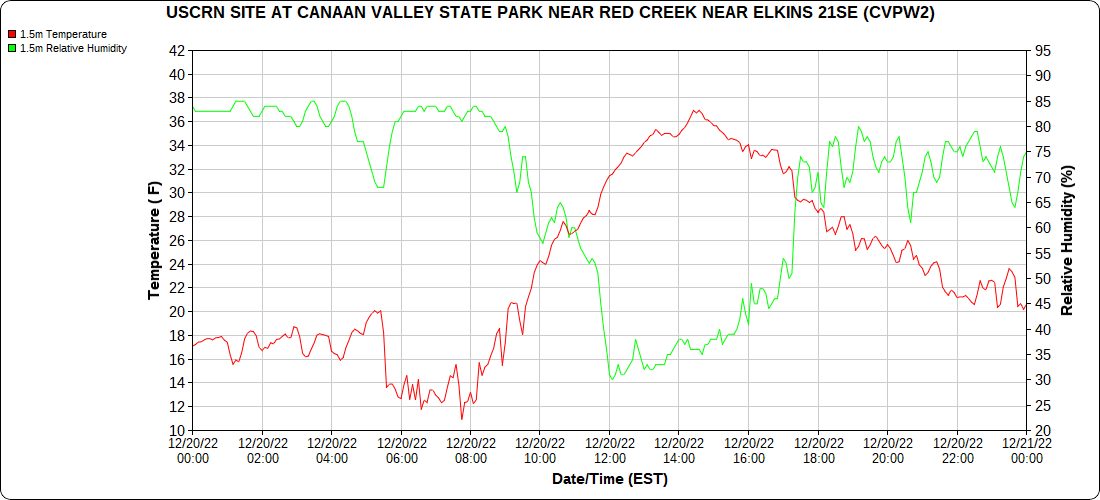
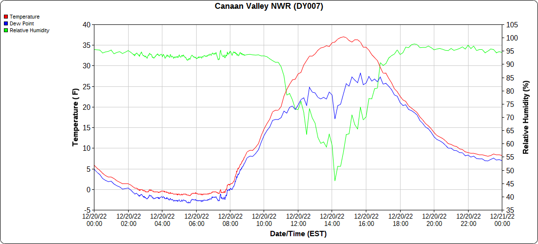
Mostly clear, calm and cold at daybreak. Down to 11F here but automated station in Canaan Valley shows -2F.~Dave |
Climate Reference Network Canaan
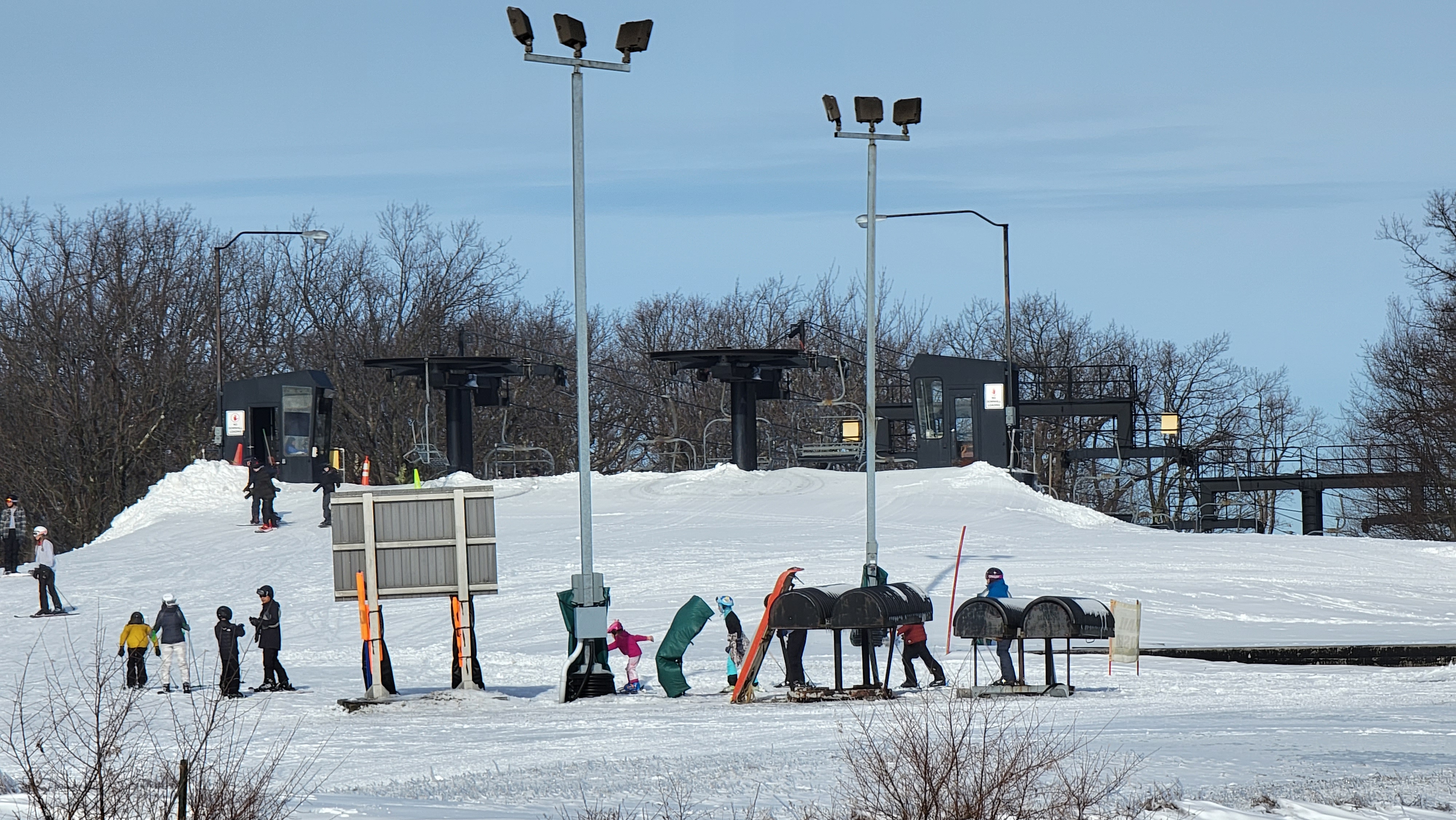
Atop Canaan Ski area
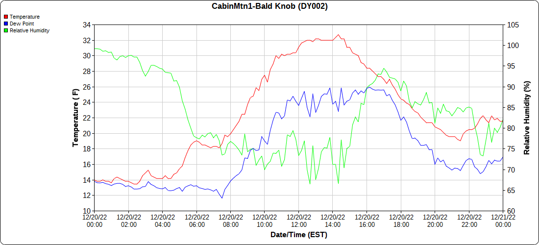
Cabin Mt at Bald Knob
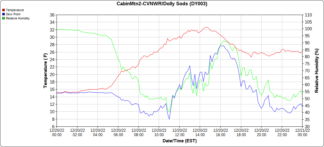
Cabin Mt-Western Sods
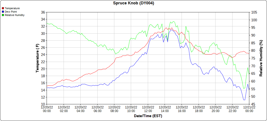
Spruce Knob
Canaan Valley Refuge
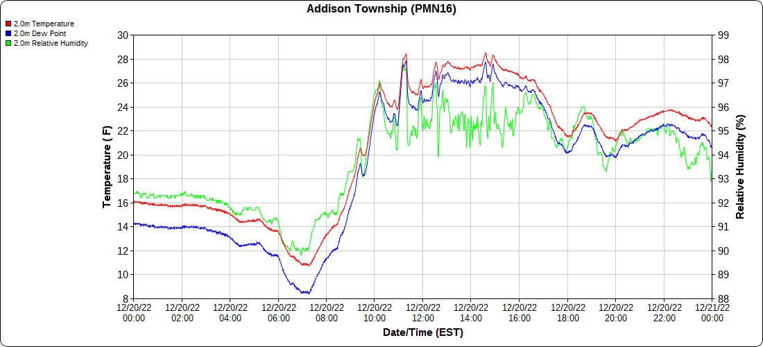
Mt.Davis
Petersburg Grant County Airport
not reporting
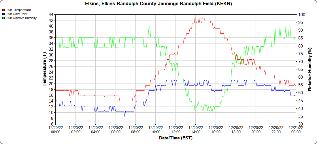
Elkins Airport
Dy007-Canaan Valley Refuge 3150′, Dy002-Cabin Mt at Bald Knob 4350′, Dy003-Cabin Mt-Western Sods 4035′, Dy004-Spruce Knob 4820′, Cvpw2-Climate Reference Network Canaan 3380′, KW99-Petersburg Grant County Airport 961, K2G4 Garrett County Airport 2933′, KCBE Cumberland Airport 774′, KEKN Elkins Airport 1985′, KMGW Morgantown Airport 1227′, PMN16-Mt.Davis 3038′, KDCA-Reagan National 15′
The Valley vs Cabin Mt
Canaan area temps
High Ground Comparison
Up High and Down Low
Up High, High Valley, Low Valley
The Valleys
Wv High Ground Cold spots vs DCA
RTMA
Radar
void


