January 6, 2023
Forest Service Cam offline since 6/24/21
Jan 6(Fri)
Cloudy, light snow…first day of some winter this month
Bittinger 2nw Valley
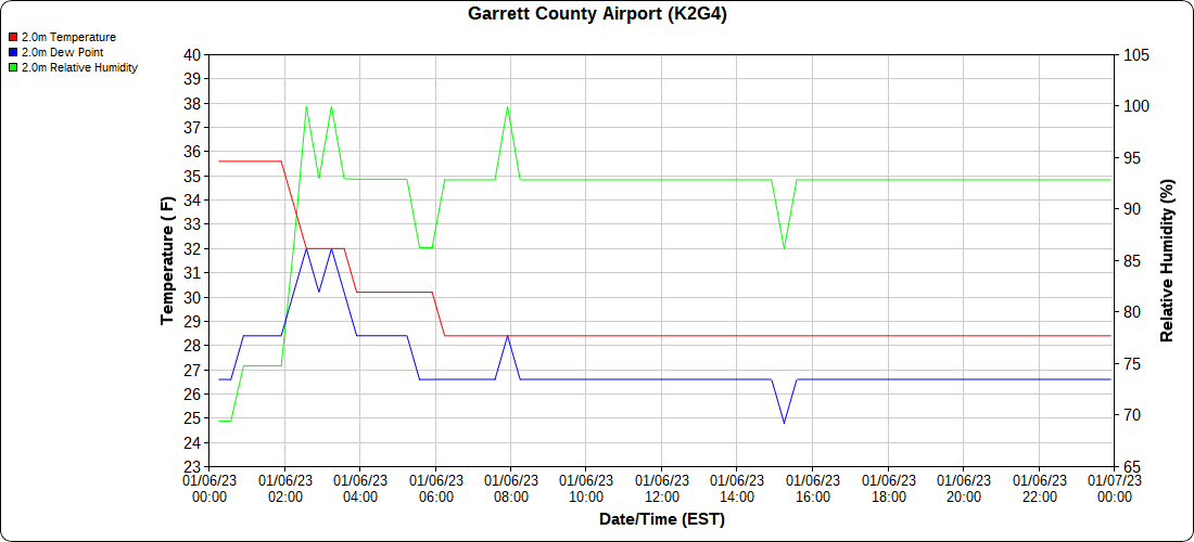
Garrett County Airport
Top of Wisp
Canaan Heights /Davis 3SE
Comments and data by Dave Lesher at:
http://data.canaanmtnsnow.com/
“Clouding over during the night with light snow commencing around 4AM and continuing through daybreak.
10AM: 26F and very light snow. Snow has been varying from light to very light. New snow since 7AM 0.2 inch. Looks like this event is nearly ended.
1PM: Snow continued after all. Currently very light snow and 26F. New snow since 7AM 0.6 in. Event total 1.5 in.
7PM: Very light snow and 25F. Off and on very light snow all afternoon. No new accumulation” ~ Dave Lesher
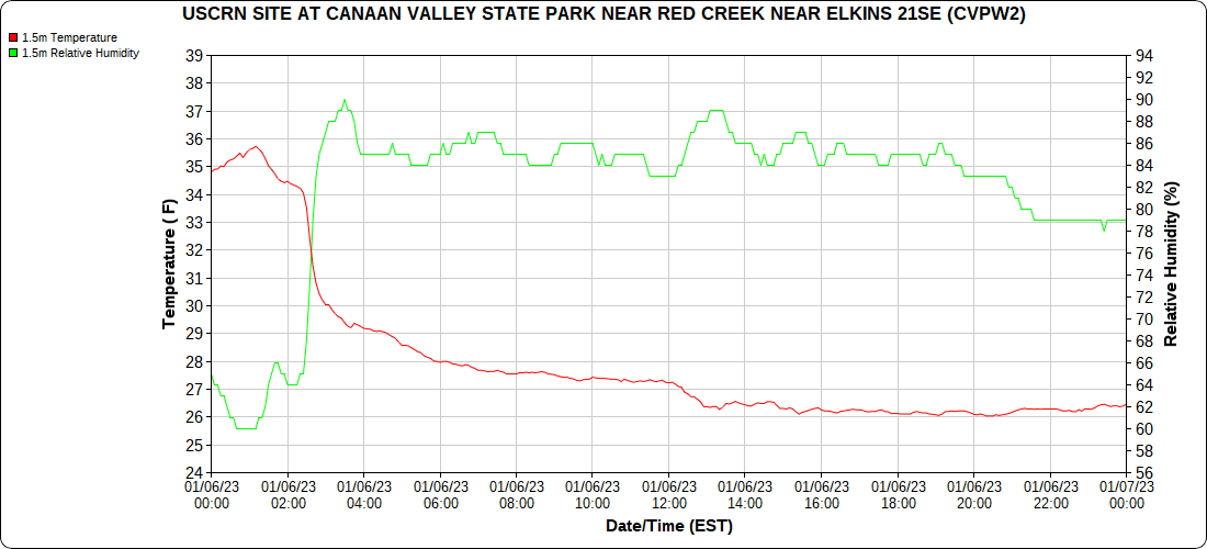
Climate Reference Network Canaan
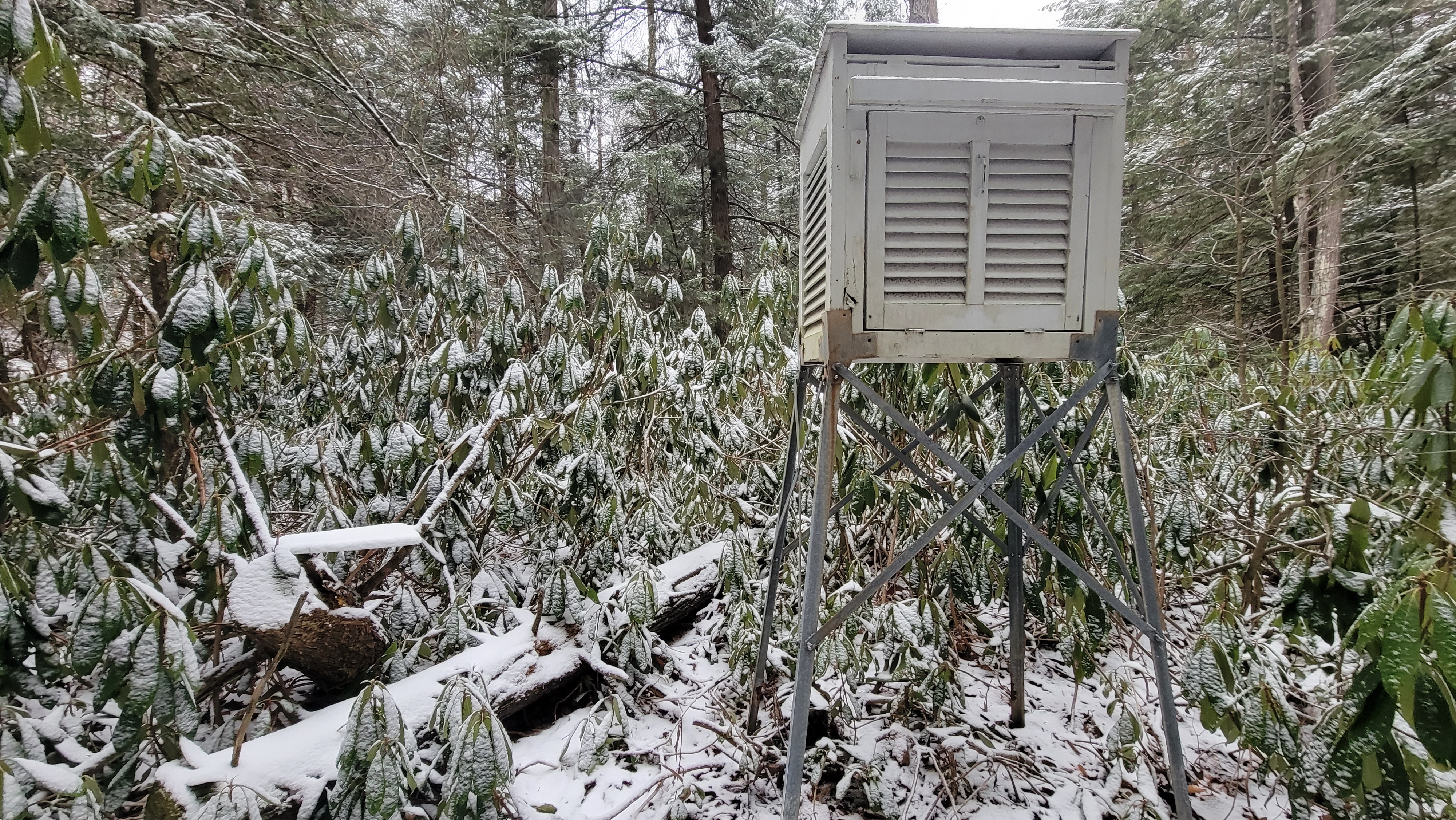
Atop Canaan Ski area
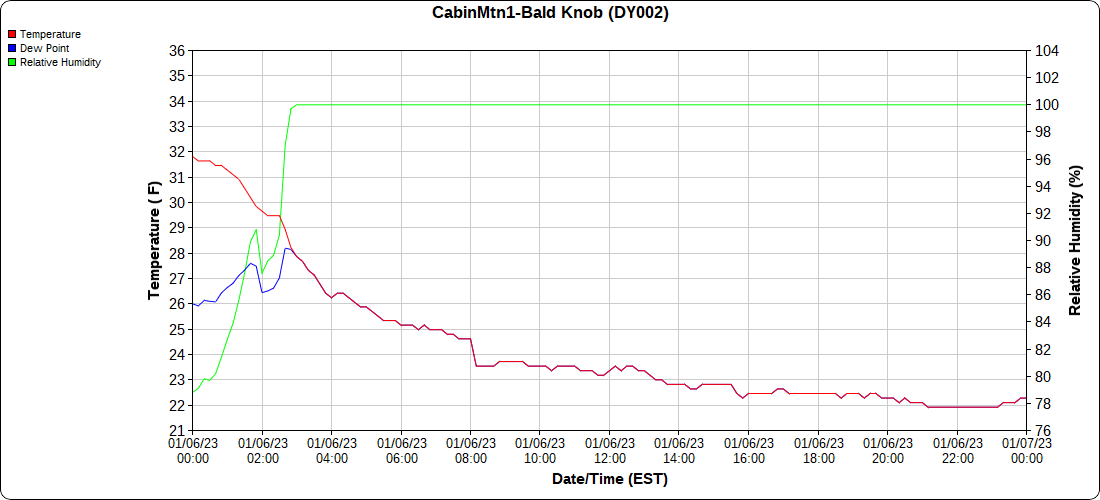
Cabin Mt at Bald Knob
Cabin Mt-Western Sods
Spruce Knob
Canaan Valley Refuge
Mt.Davis
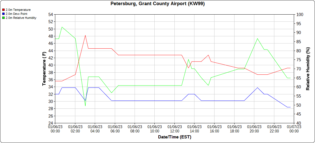
Petersburg Grant County Airport
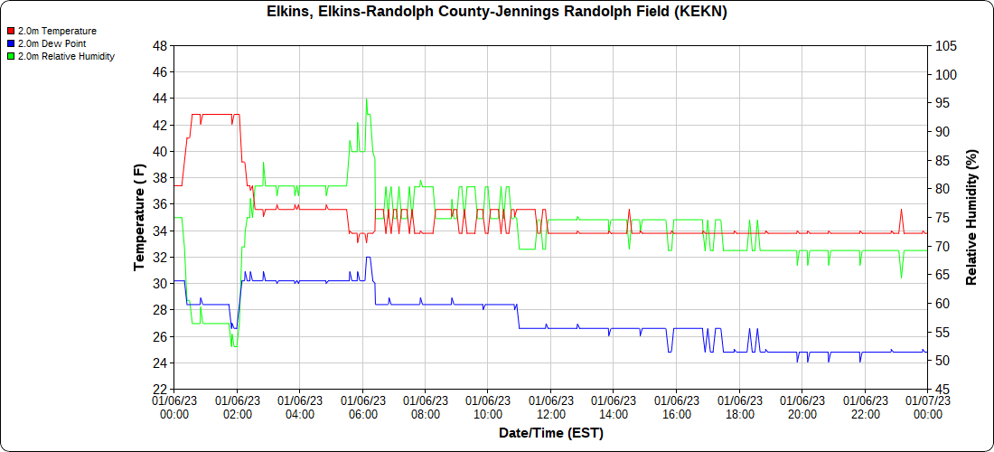
Elkins Airport
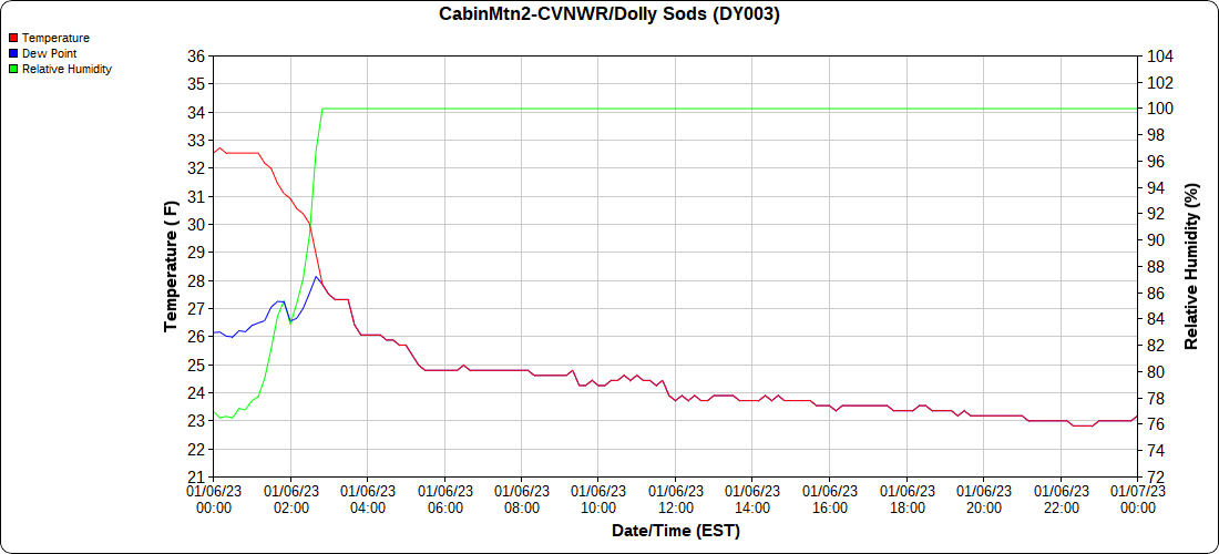
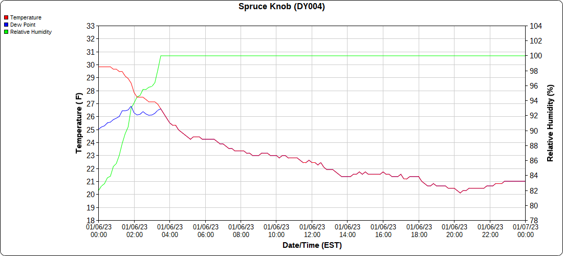
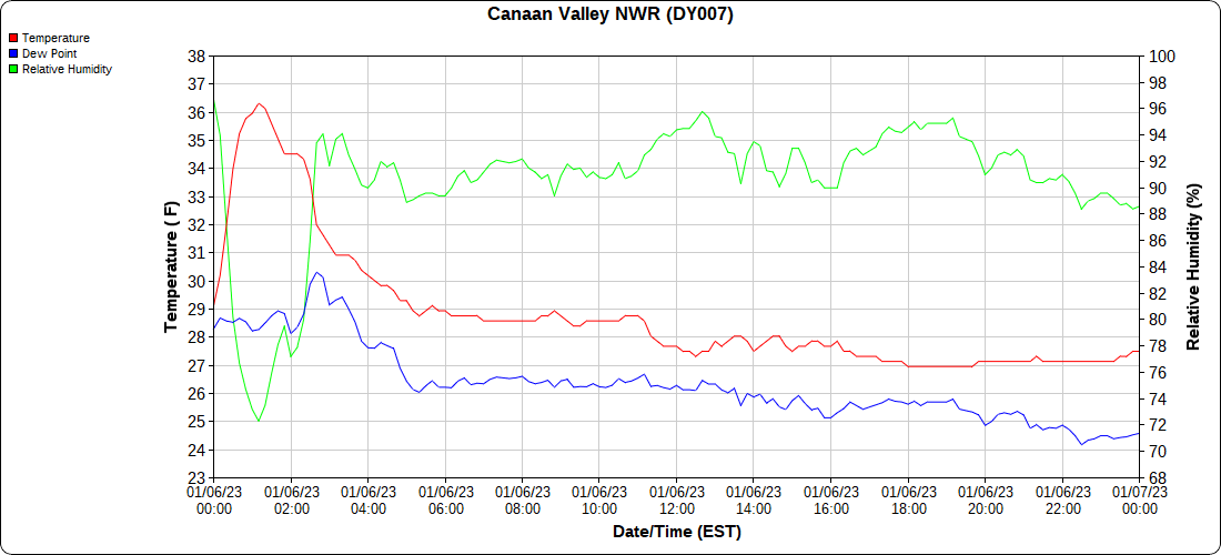
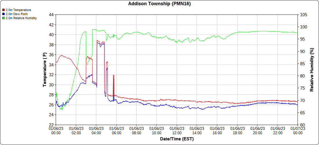
Dy007-Canaan Valley Refuge 3150′, Dy002-Cabin Mt at Bald Knob 4350′, Dy003-Cabin Mt-Western Sods 4035′, Dy004-Spruce Knob 4820′, Cvpw2-Climate Reference Network Canaan 3380′, KW99-Petersburg Grant County Airport 961, K2G4 Garrett County Airport 2933′, KCBE Cumberland Airport 774′, KEKN Elkins Airport 1985′, KMGW Morgantown Airport 1227′, PMN16-Mt.Davis 3038′, KDCA-Reagan National 15′


