February 22, 2023
Forest Service Cam offline since 6/24/21
Feb 22(Wed)
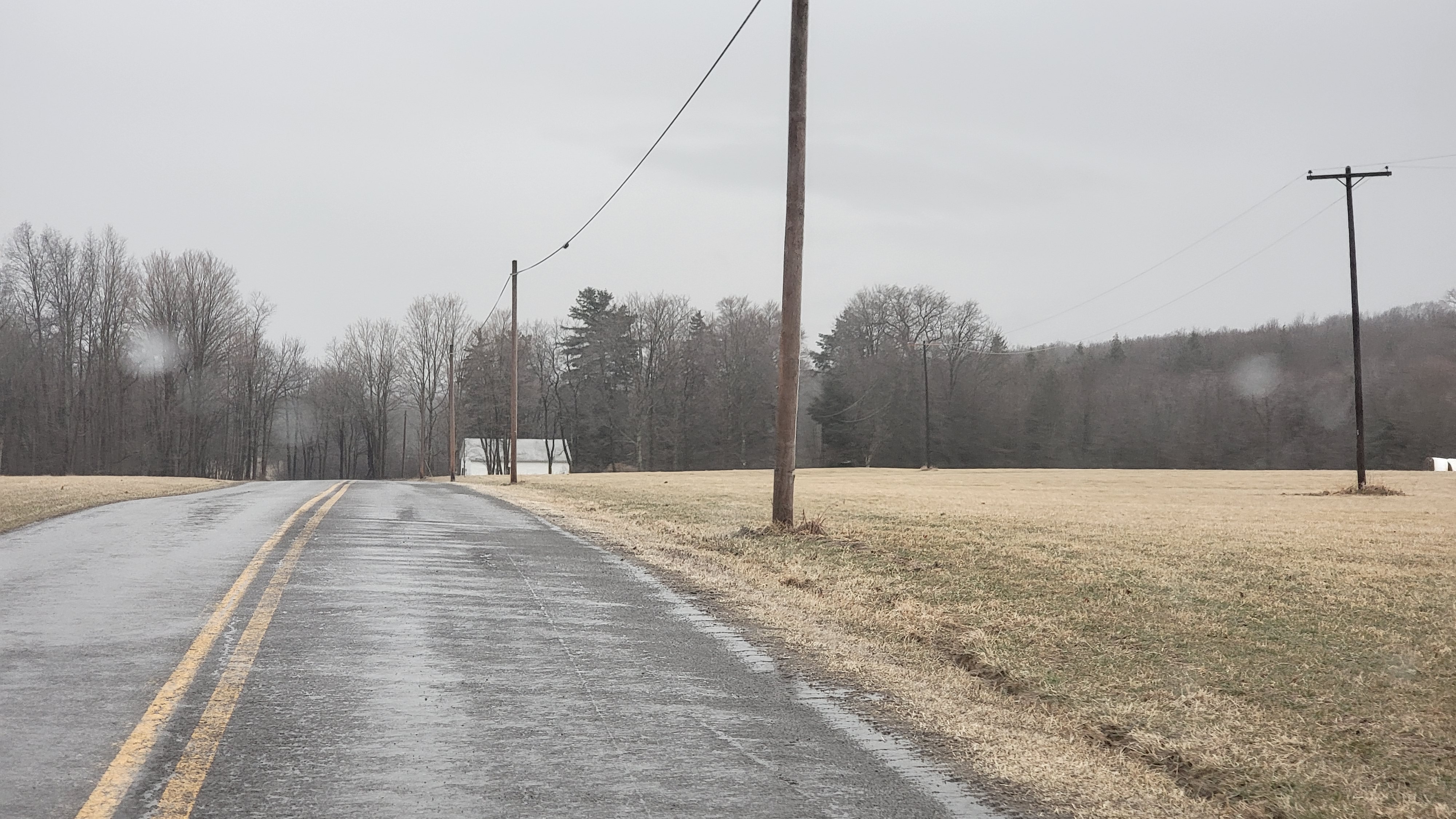
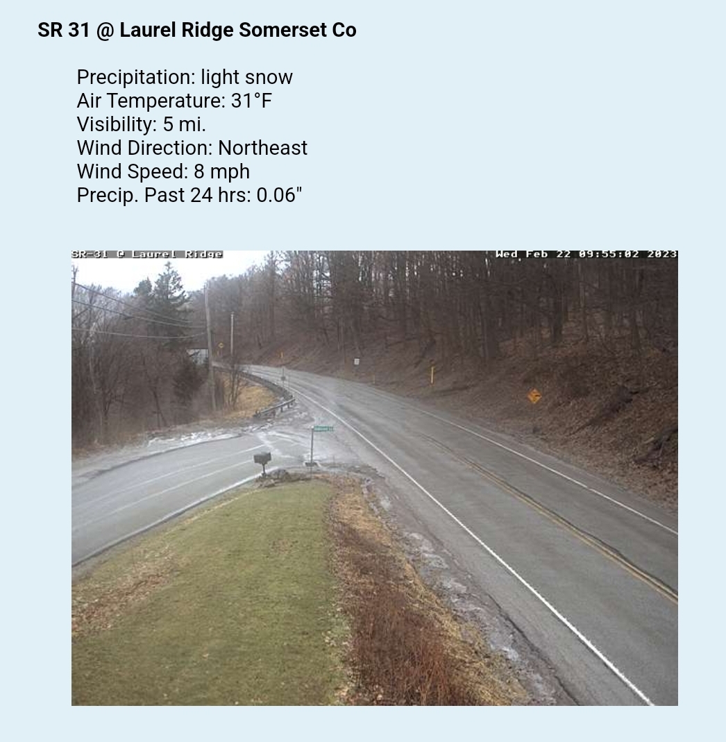
Cloudy, freezing rain, rain morning, mixed with a touch of sleet. Some snow, sleet as you went north in to PA. Just rain in Wv. Large temp contrast.
Bittinger 2nw Valley
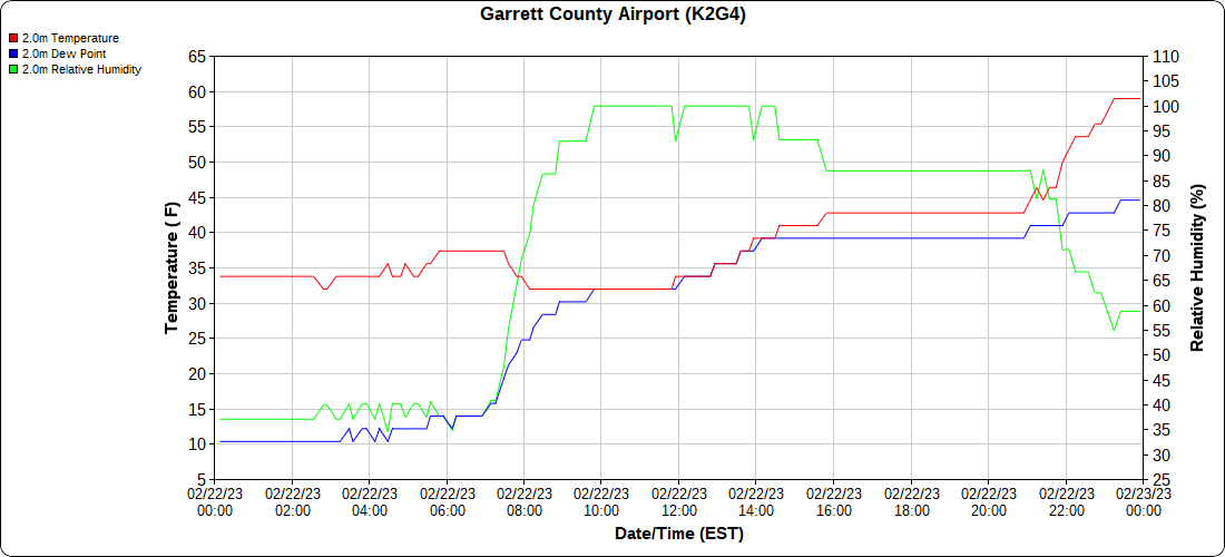
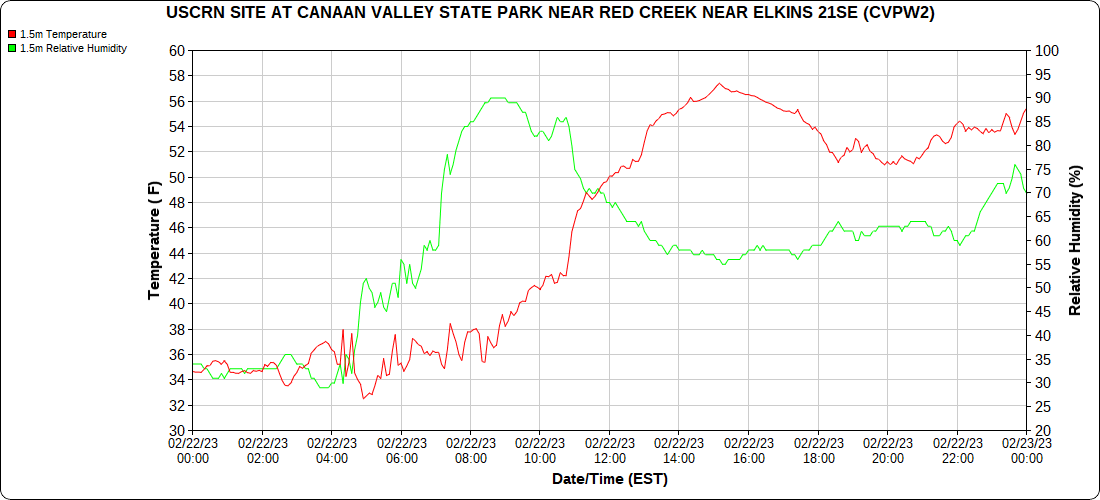
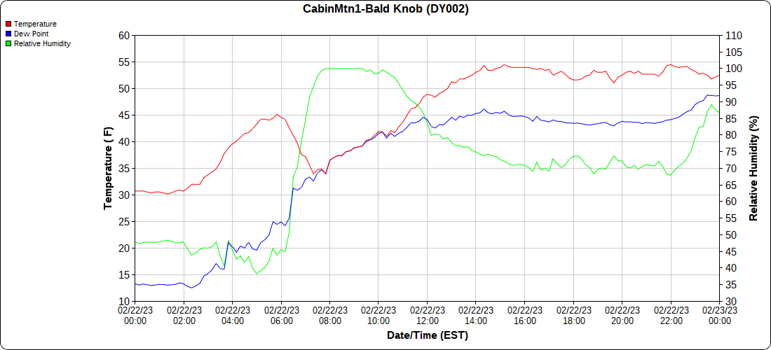
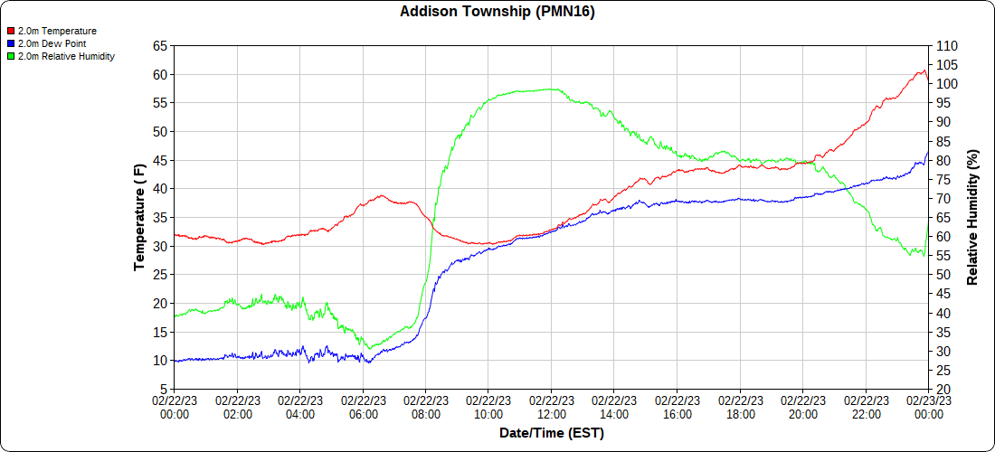
Comparing the high sheltered Valley vs the higher Ridgeline just west. Temps began to rise across the higher ground as the lower areas held the chill until post midnight as the winds picked up to push out the low laying cooler air.
K2G4 Garrett County Airport 2933′, PMN16 Mt.Davis 3038′ , BIT2NWV 2600′ west of Bittinger morning Bittinger 2nw Valley morning -remnants Bittinger 2nw Valley morning Bittinger 2nw Valley morning up from Bittinger 2nw Valley morning Bittinger 2nw Valley morning Bittinger 2nw Valley morning Bittinger 2nw Valley morning Bittinger 2nw Valley morning Bittinger 2nw Valley morning Bittinger 2nw Valley morning Bittinger 2nw Valley morning Bittinger 2nw Valley morning Bittinger 2nw Valley morning Bittinger 2nw Valley morning Bittinger 2nw Valley morning near old Cherry Glade church morning west of Bittinger morning west of Bittinger morning Foxtown Rd morning Foxtown Rd morning Foxtown Rd morning Foxtown Rd morning Foxtown Rd morning by The Glades morning by The Glades morning by The Glades morning Rock Lodge Rd morning Rock Lodge Rd morning Bittinger morning Rock Lodge Rd midday Rock Lodge Rd by The Glades midday Rock Lodge Rd by The Glades midday Rock Lodge Rd by The Glades midday Rock Lodge Rd by The Glades midday Rock Lodge Rd by The Glades midday Rock Lodge Rd by The Glades midday Rock Lodge by The Glades midday Rock Lodge Rd by The Glades midday
Garrett County Airport
Rock Lodge Rd midday Rock Lodge Rd midday Rock Lodge Rd midday Rock Lodge Rd midday Rock Lodge Rd midday Deep Creek Lake midday State Park Rd midday Deep Creek Lake midday Deep Creek Lake Midday Deep Creek Lake midday Deep Creek Lake midday Deep Creek Lake midday Mchenry evening On this date in 2015
Top of Wisp
day began with a colorful sunrise, ends with a colorful sunset Canaan Heights/Davis 3SE
7am to 7am data mmts coop midnight to midnight data Dyacon Comments and data by Dave Lesher at:
http://data.canaanmtnsnow.com/
Climate Reference Network Canaan
Atop Canaan Ski area
Cabin Mt at Bald Knob
Cabin Mt-Western Sods
Spruce Knob
Canaan Valley Refuge
Mt.Davis
Snowshoe
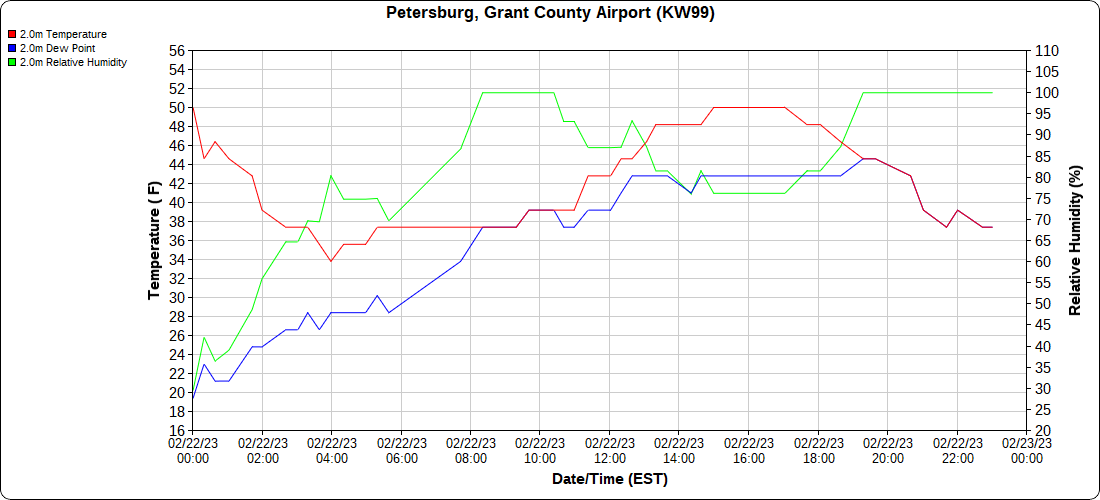
Petersburg Grant County Airport
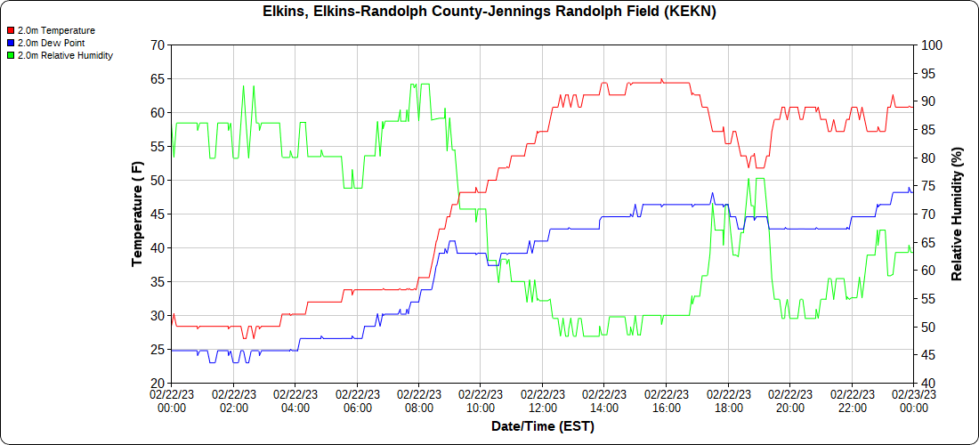
Elkins s Airport
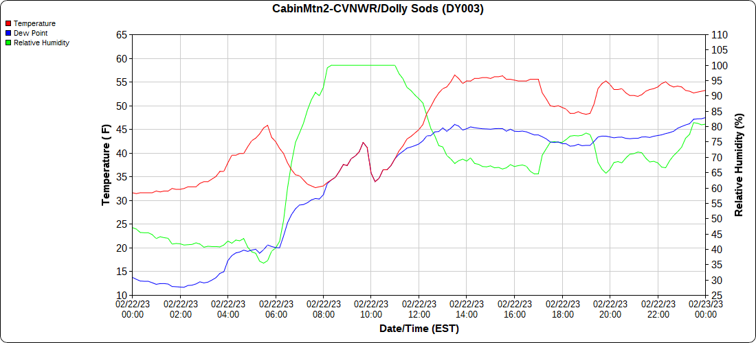
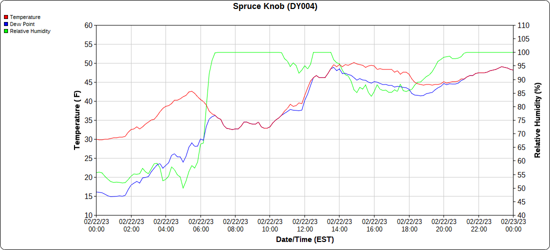
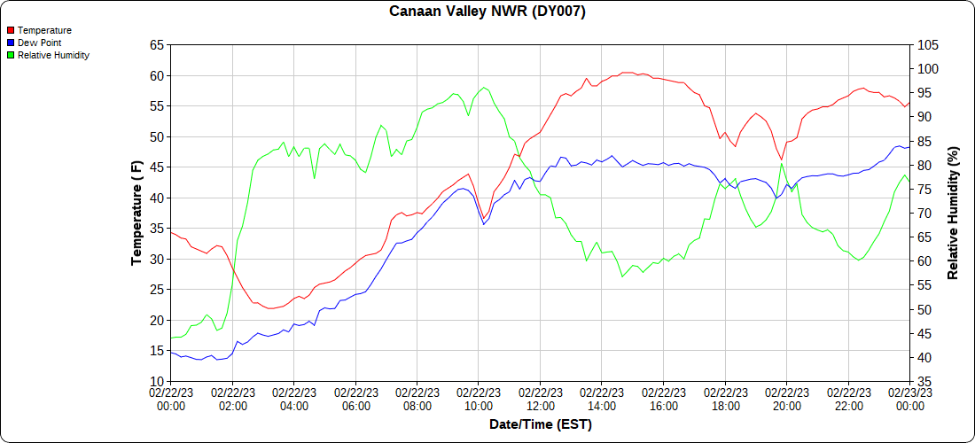
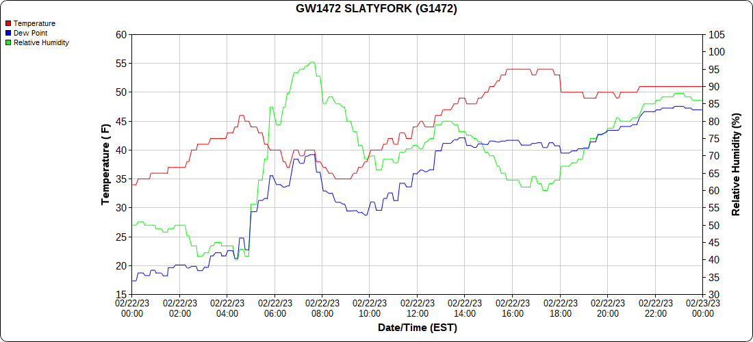
Dy007-Canaan Valley Refuge 3150′, Dy002-Cabin Mt at Bald Knob 4350′, Dy003-Cabin Mt-Western Sods 4035′, Dy004-Spruce Knob 4820′, Cvpw2-Climate Reference Network Canaan 3380′, KW99-Petersburg Grant County Airport 961, K2G4 Garrett County Airport 2933′, KCBE Cumberland Airport 774′, KEKN Elkins Airport 1985′, KMGW Morgantown Airport 1227′, PMN16-Mt.Davis 3038′, KDCA-Reagan National 15′, G1472 Snowshoe 4500′, F0183 Burkes Garden 3050′
The Valley vs Cabin Mt
Canaan area temps
High Ground Comparison
Up High and Down Low
Up High, High Valley, Low Valley
The Valleys
Wv High Ground Cold spots vs DCA
RTMA
Radar
Satellite
Flow
Surface Features and 500mb Height Anomalies and Flow
Meadow Mt at Frank Brenneman Rd
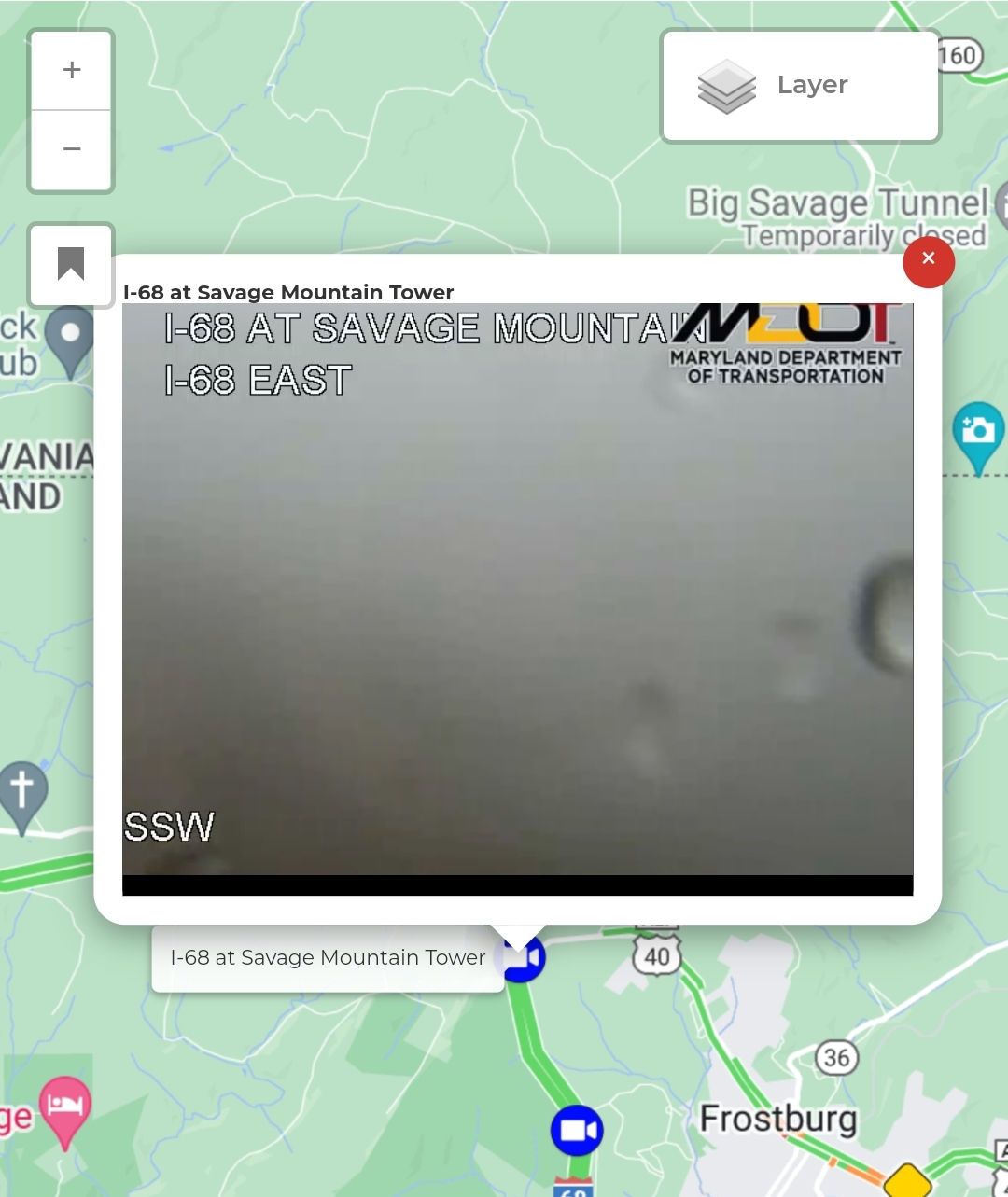
Savage Mt
in to Pa


