February 25, 2023
Forest Service Cam offline since 6/24/23
Feb 25(Sat)
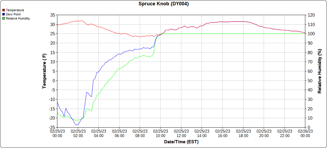
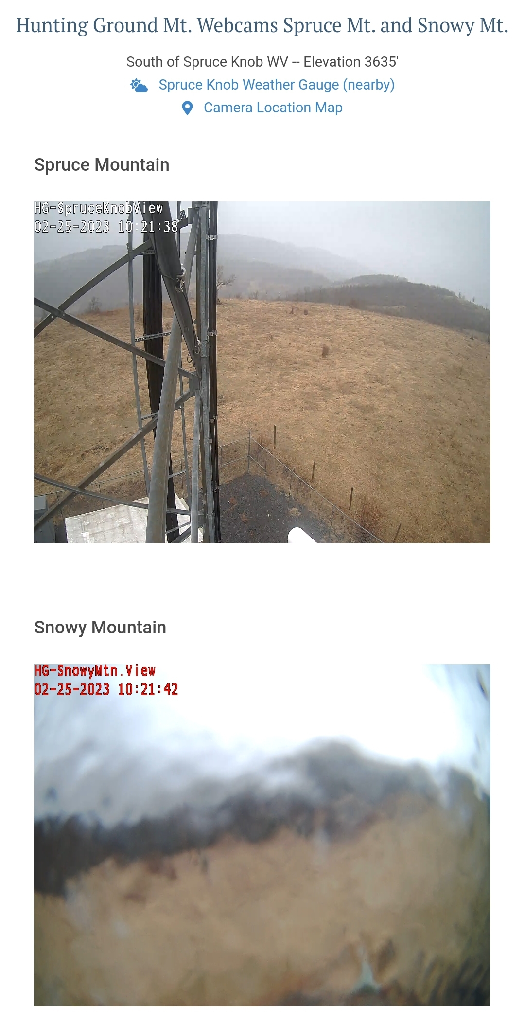
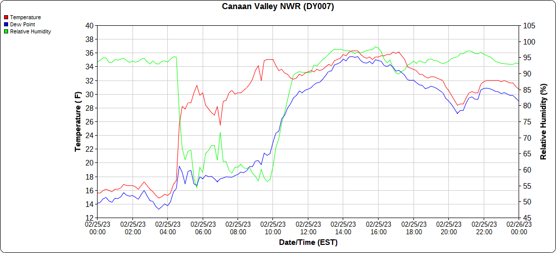
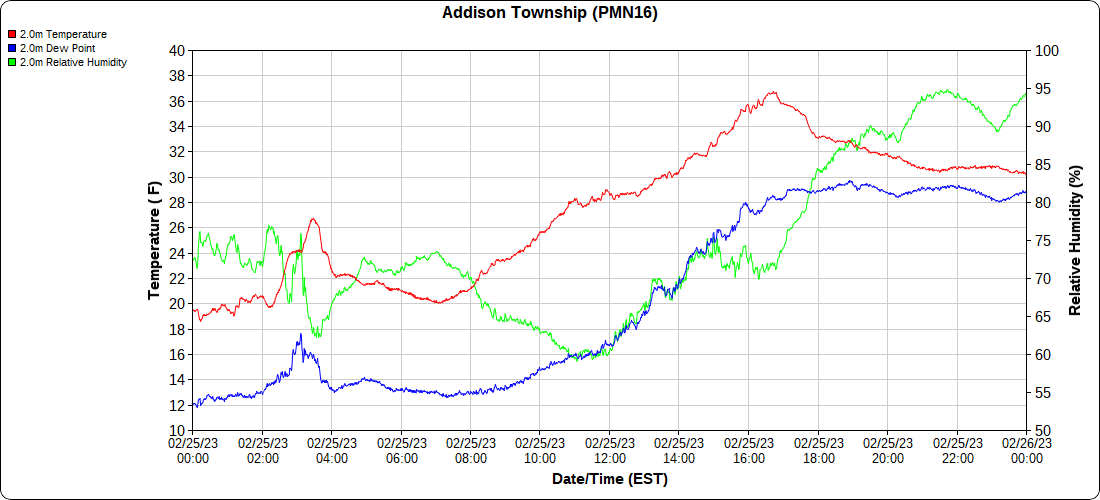
Cloudy, few flakes north and precip increased slightly as you went south. A bit more snow (coatings to quarter inch) Canaan and some freezing rain further South. Cold day.
Bittinger 2nw Valley
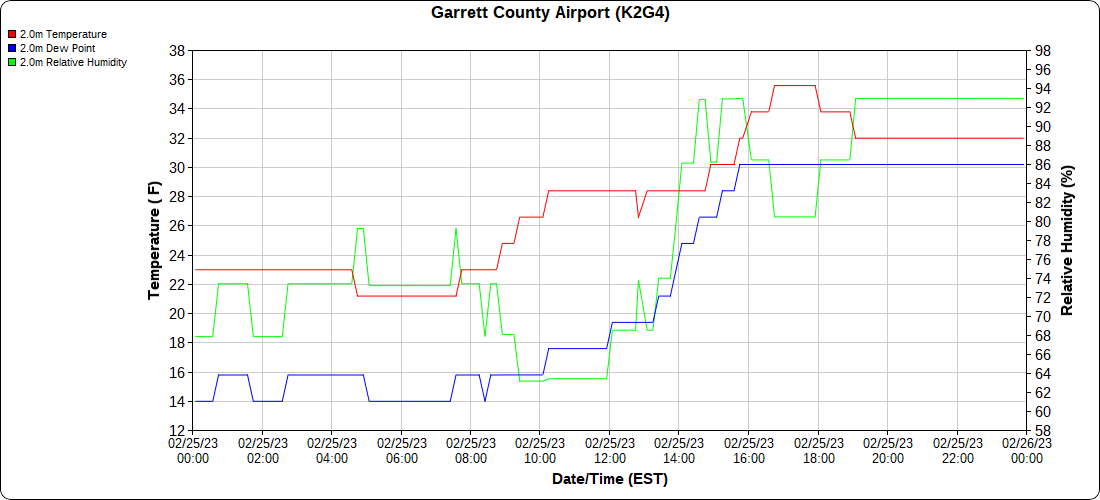
Garrett County Airport
Top of Wisp
Canaan Heights/Davis 3SE
Comments and data by Dave Lesher at:
http://data.canaanmtnsnow.com/
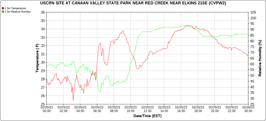
Climate Reference Network Canaan
Atop Canaan Ski area
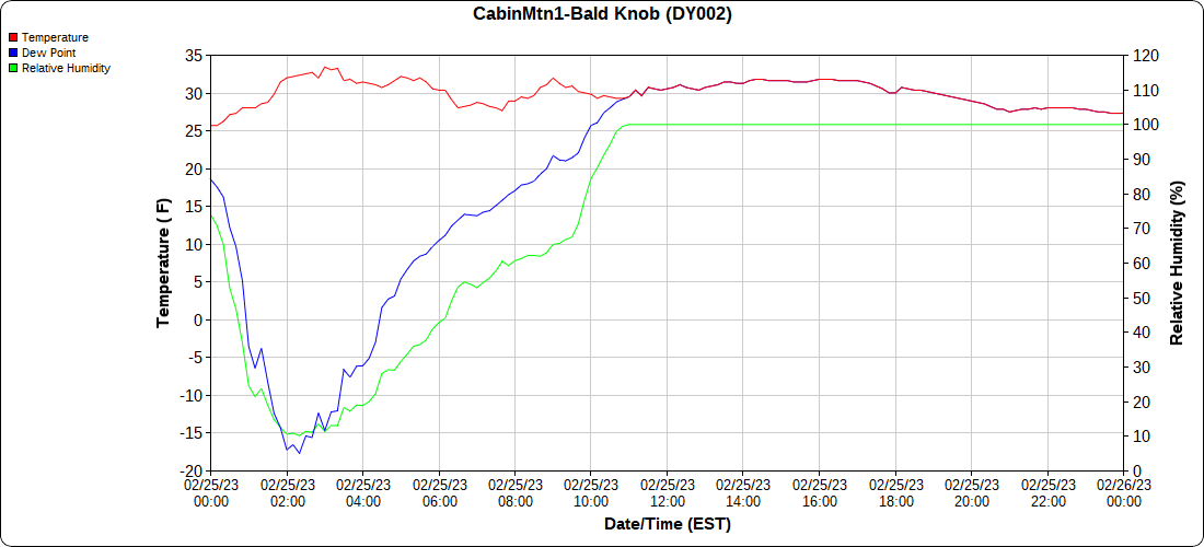
Cabin Mt at Bald Knob
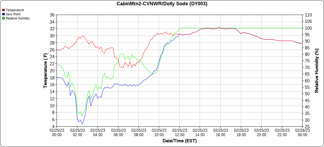
Cabin Mt-Western Sods
Spruce Knob
Canaan Valley Refuge
Mt.Davis
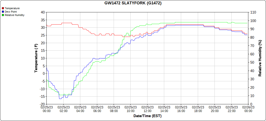
Snowshoe
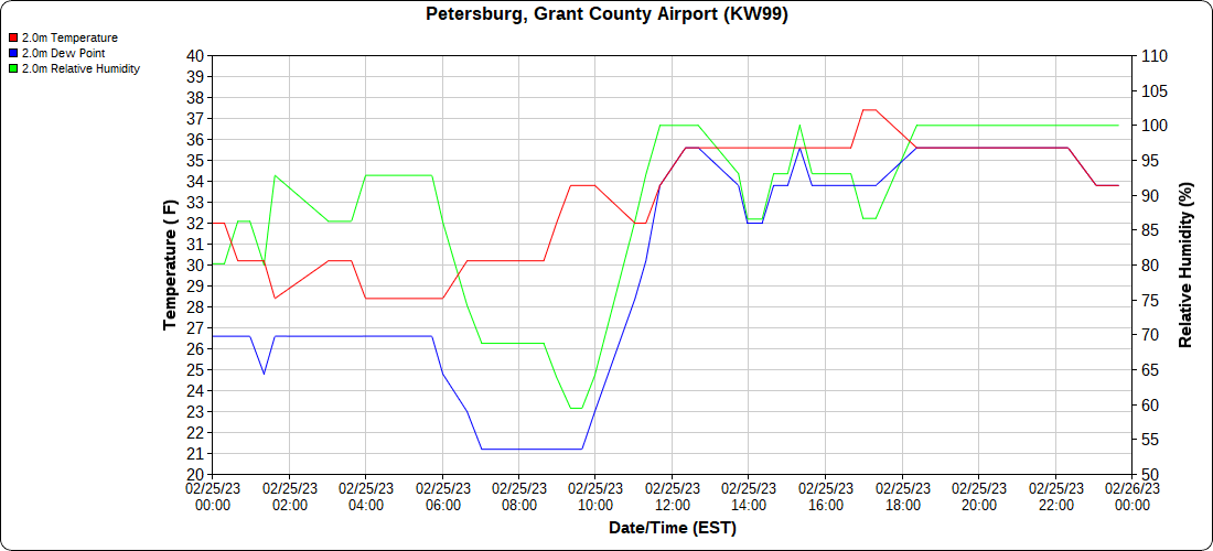
Petersburg Grant County Airport
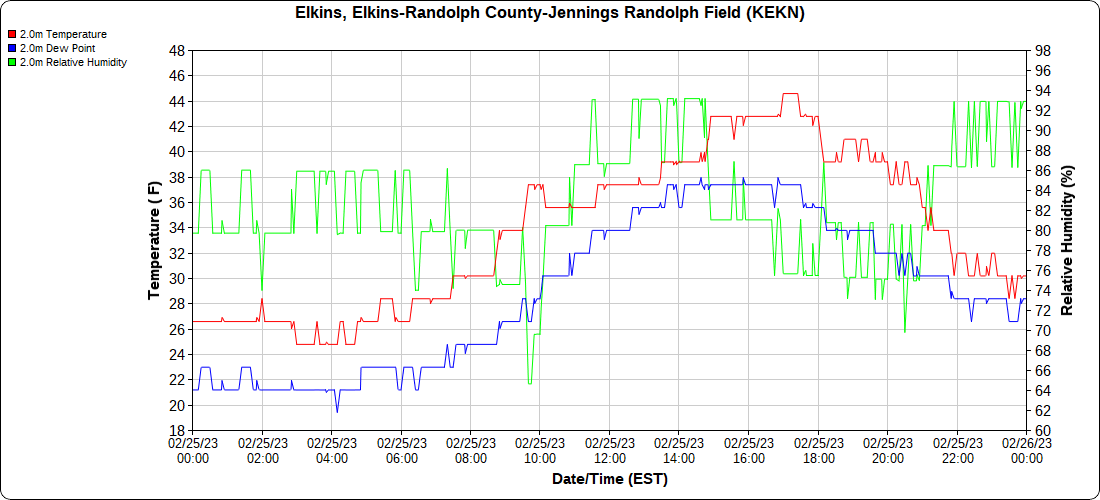
Elkins Airport
Dy007-Canaan Valley Refuge 3150′, Dy002-Cabin Mt at Bald Knob 4350′, Dy003-Cabin Mt-Western Sods 4035′, Dy004-Spruce Knob 4820′, Cvpw2-Climate Reference Network Canaan 3380′, KW99-Petersburg Grant County Airport 961, K2G4 Garrett County Airport 2933′, KCBE Cumberland Airport 774′, KEKN Elkins Airport 1985′, KMGW Morgantown Airport 1227′, PMN16-Mt.Davis 3038′, KDCA-Reagan National 15′, G1472 Snowshoe 4500′, F0183 Burkes Garden 3050′


