February 28, 2023
Forest Service Cam offline since 6/24/21
Feb 28(Tues)
Heavy rain in areas last night. Little lingering rain this a.m. OTherwise mainly cloudy with some breaks at times. Strong winds overnight in to today died some as the day wore on
Bittinger 2nw Valley
- MRD-Max Recorded Depth. I tried to capture that at what time in the day it occurred.
- T, Trace without 100 feet of recording site. I-T, Isolated trace outside of 100 feet but within 1000 feet of recording site.
- The + symbol under precip. That symbolizes precip occurred after 5pm but precip did occur on the date. If it follows a tally it simply means more occurred beyond 5pm. It also was used at time when precip was occurring at 5pm and I needed to do a melt but waited until the system was finished. On rare occasions I was not there at 5pm to record and plugged it in the following day. All precip was recorded
- The down arrow by the max represents a midnight max temp. Which occurred frequently.
- Temp recording time is midnight to midnight
- Precip recording time 5pm to 5pm
- Snowfall- boards sweeps occur at 7am and 5pm. Max daily snowfall is still captured when it occurred and not only measured at 7am and 5pm
- Some snowdrops up late month, few daffodils starting to push up in sunny areas.
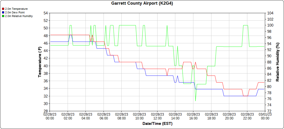
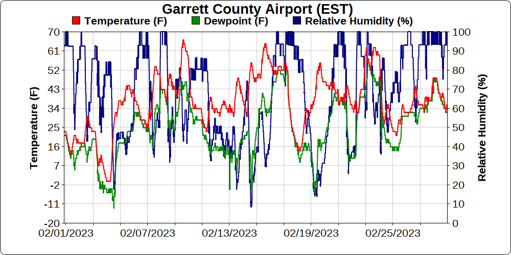
Garrett County Airport
Top of Wisp
- Rooftop station-poorly sited.
Canaan Heights/Davis 3SE
Comments and Data by Dave Lesher at:
http://data.canaanmtnsnow.com/
“This month’s total snowfall of 3.9 inches is the least February total since snowfall records commenced here in 2001. See Table 3.1 below. In reviewing snowfall data for the Canaan Valley weather station where records commenced in 1944, this was the least February snowfall total from then to now with the exception of Feb 1959 when 3.0 inches was recorded” ~ Dave Lesher
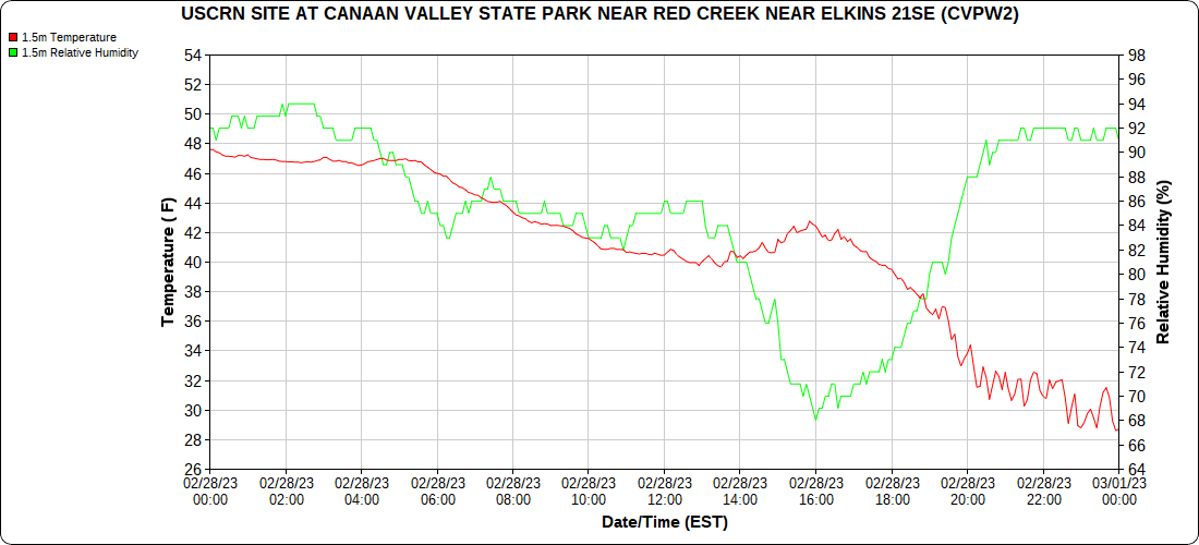
Climate Reference Network Canaan
Atop Canaan Ski area
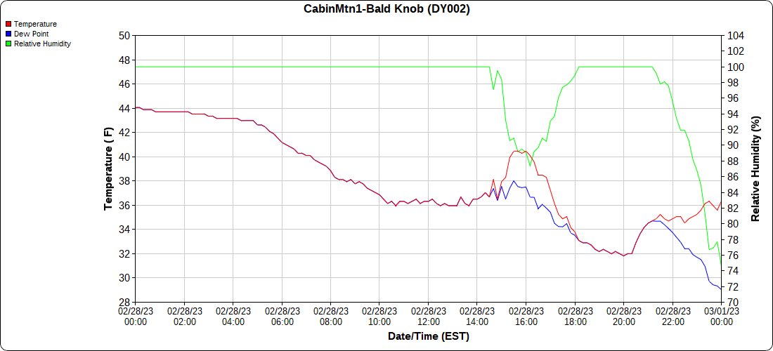
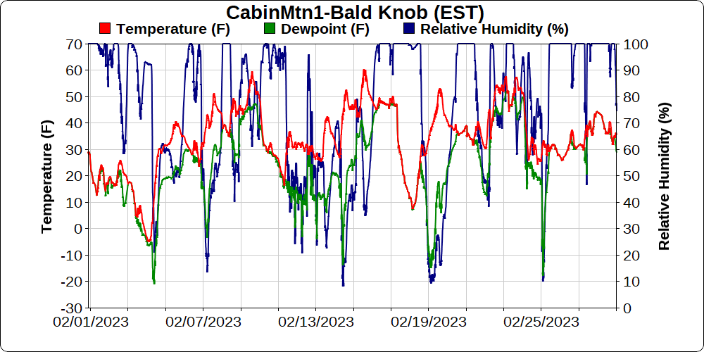
Cabin Mt at Bald Knob
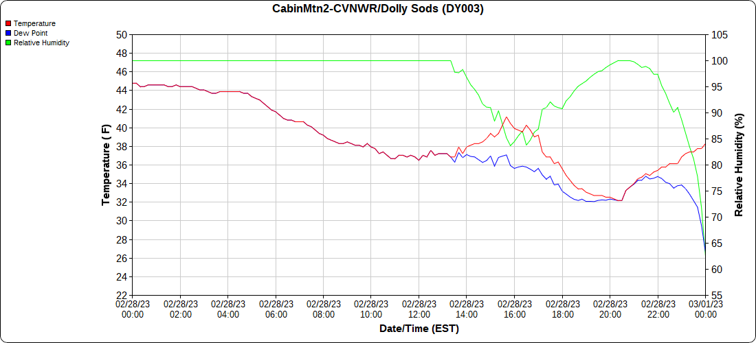
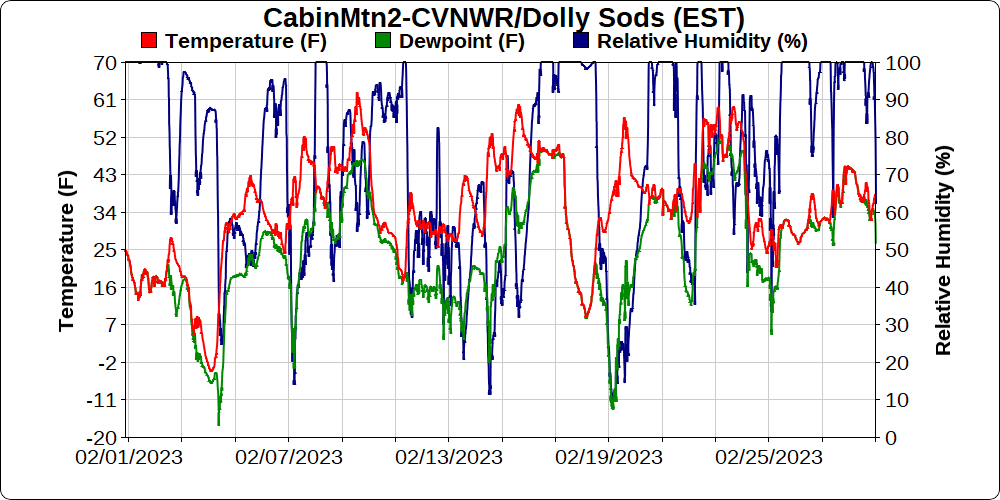
Cabin Mt-Western Sods
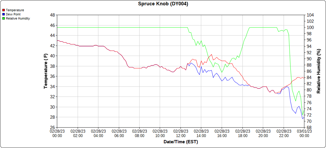
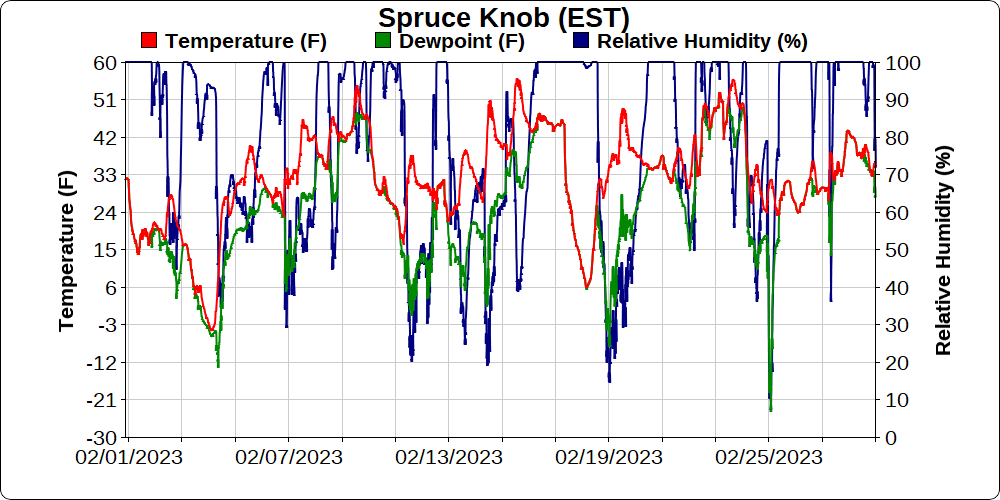
Spruce Knob
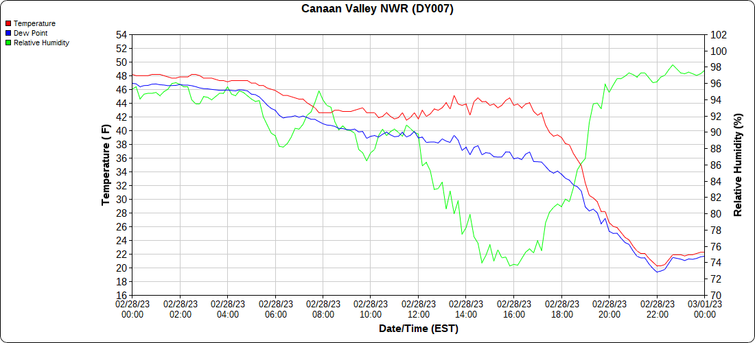
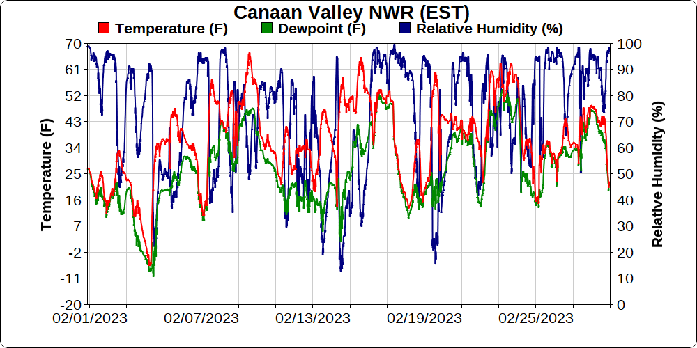
Canaan Valley Refuge
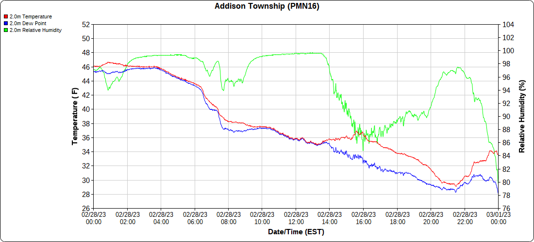
Mt.Davis
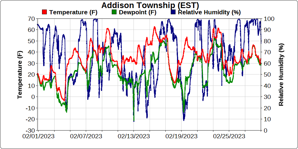
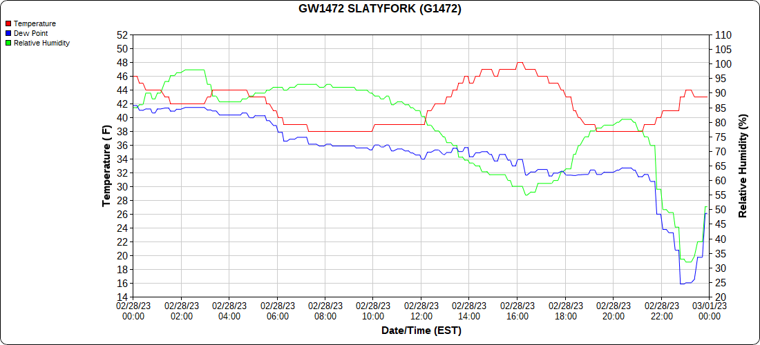
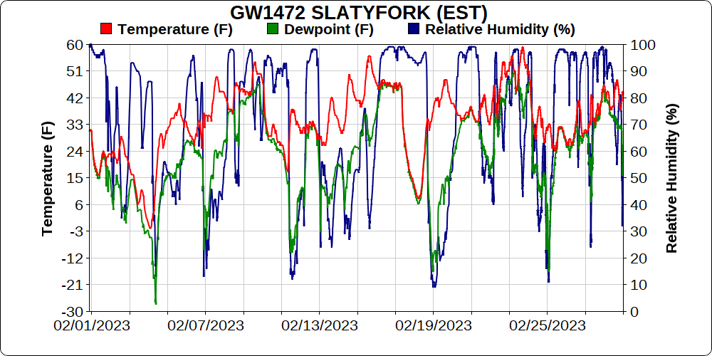
Snowshoe
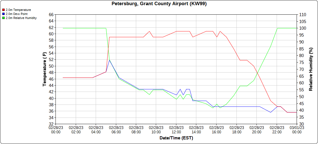
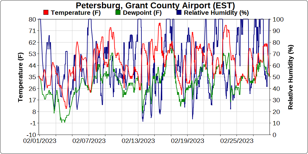
Petersburg Grant County Airport
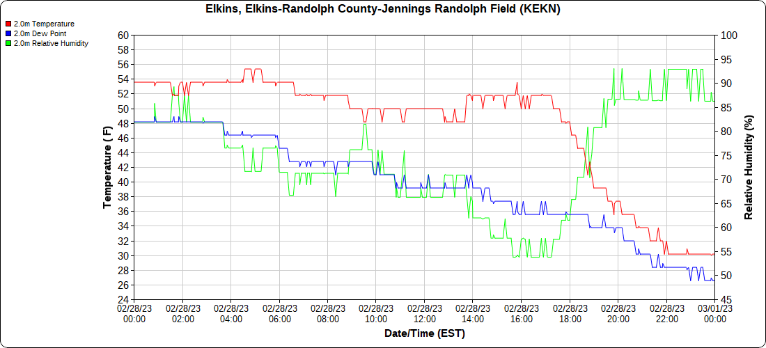
Elkins Airport
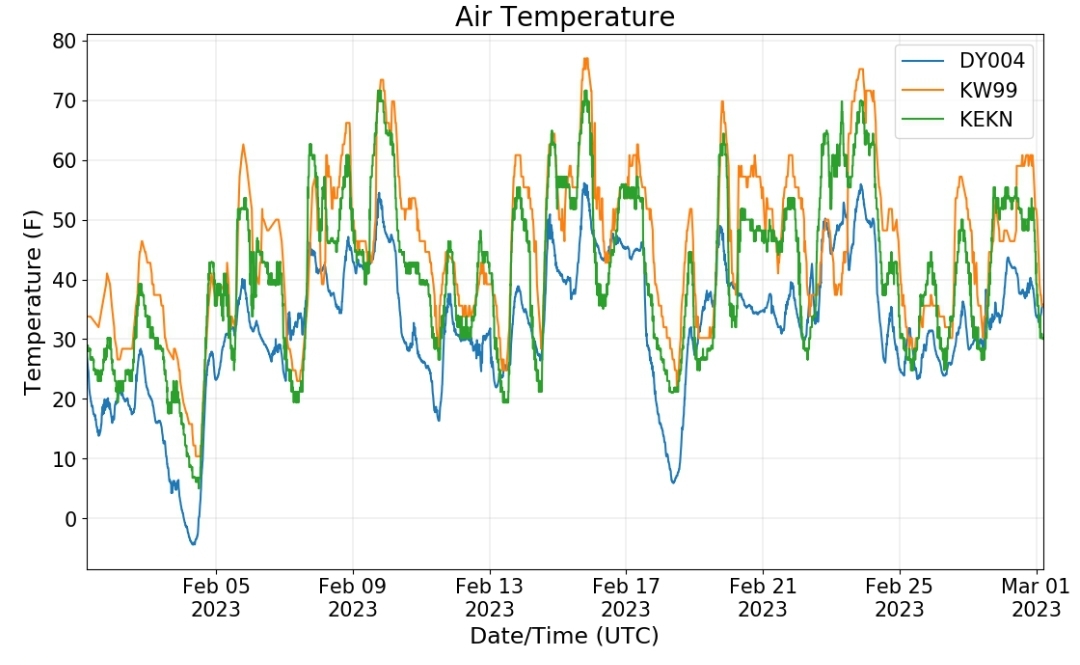
Dy007-Canaan Valley Refuge 3150′, Dy002-Cabin Mt at Bald Knob 4350′, Dy003-Cabin Mt-Western Sods 4035′, Dy004-Spruce Knob 4820′, Cvpw2-Climate Reference Network Canaan 3380′, KW99-Petersburg Grant County Airport 961, K2G4 Garrett County Airport 2933′, KCBE Cumberland Airport 774′, KEKN Elkins Airport 1985′, KMGW Morgantown Airport 1227′, PMN16-Mt.Davis 3038′, KDCA-Reagan National 15′, G1472 Snowshoe 4500′, F0183 Burkes Garden 3050′
The Valley vs Cabin Mt
Canaan area temps
High Ground Comparison
Up High and Down Low
Up High, High Valley, Low Valley
The Valleys
Wv High Ground Cold spots vs DCA
RTMA
Radar
Satellite
Flow
Surface Features and 500mb Height Anomalies and Flow
February Temps
same data different graphic color scheme with max min departure
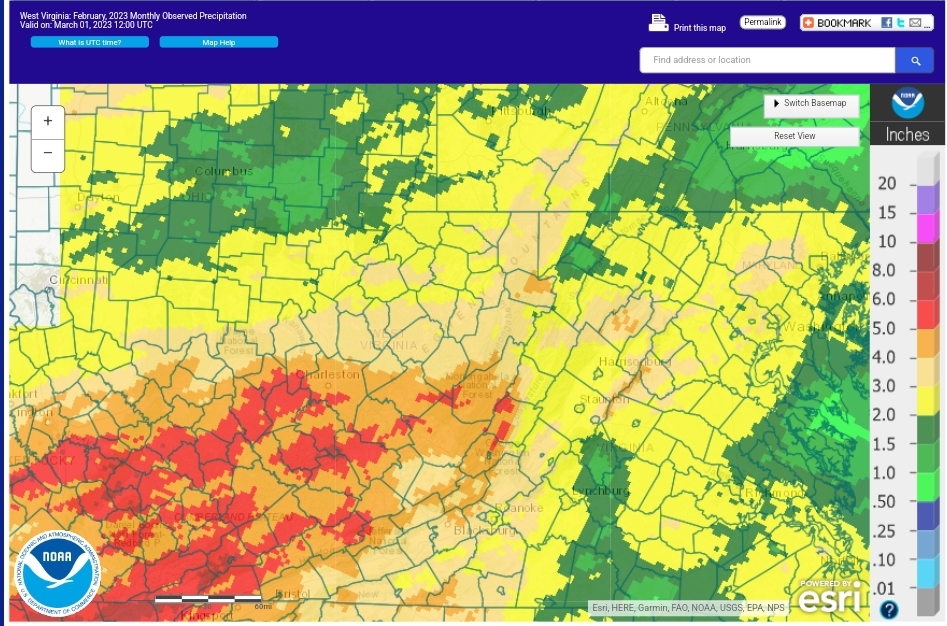
February Precip
Observed
Departure


