March 10, 2023
Forest Service Cam offline since 6/24/21
Mar 10(Fri)
Snow, sleet, to drizzle to showers back to snow later
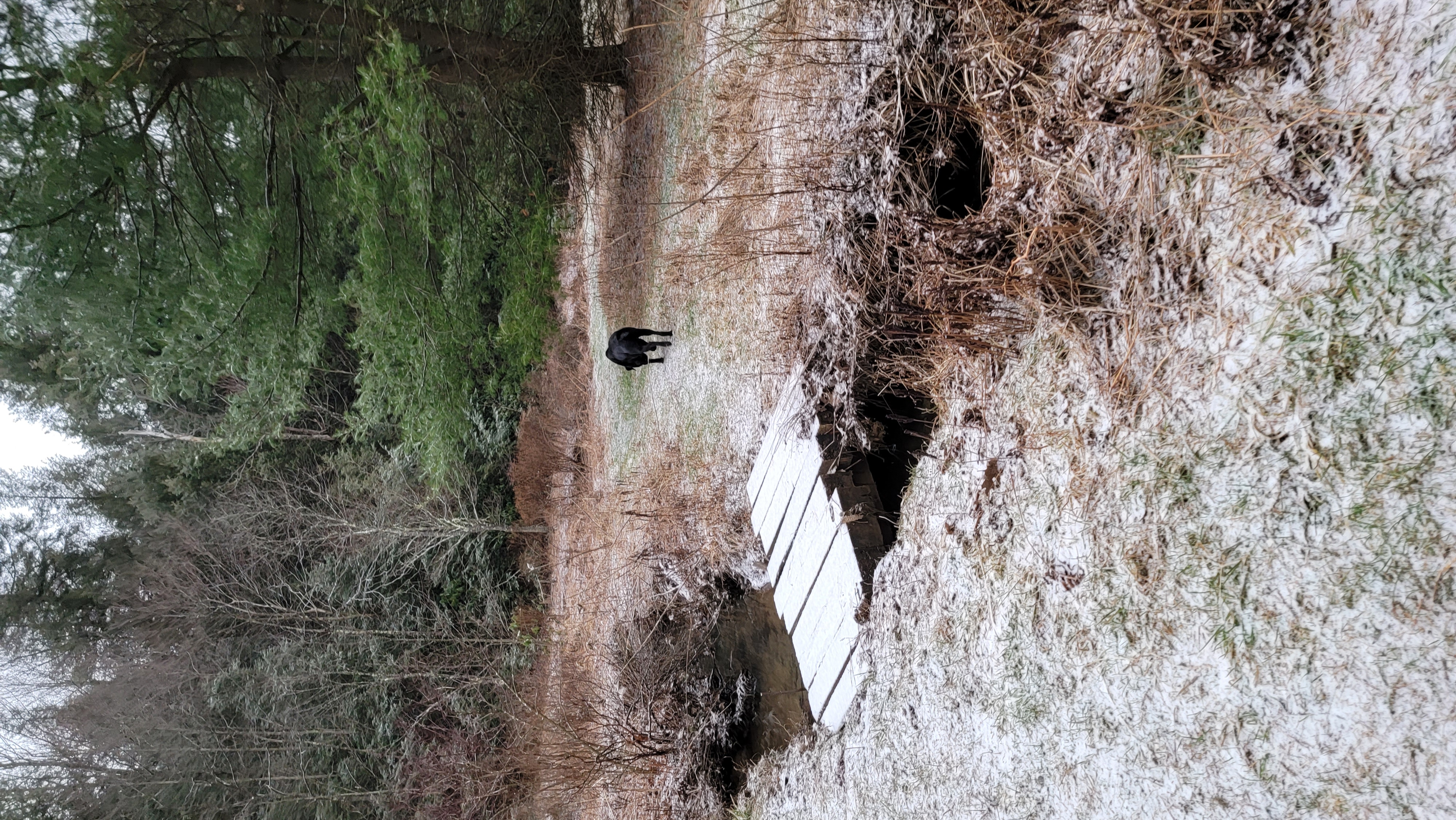
Bittinger 2nw Valley
Bittinger 2nw Valley 7am
Bittinger 2nw Valley 7am
Bittinger 2nw Valley morning
Bittinger 2nw Valley morning
Bittinger 2nw Valley morning
Bittinger 2nw Valley morning
Bittinger 2nw Valley morning
Bittinger 2nw Valley late morning
Bittinger 2nw Valley late morning
west of Bittinger midday
Bittinger 2nw Valley afternoon
Bittinger 2nw Valley afternoon
Bittinger 2nw Valley afternoon
west of Bittinger evening
Foxtown Rd evening
Rock Lodge Rd near The Glades evening
Rock Lodge Rd near The Glades evening
Rock Lodge Rd near The Glades evening
Garrett County Airport
Deep Creek Lake midday
Mosser Rd at Cherry Creek evening
Mosser Rd evening
Top of Wisp
evening
evening
Canaan Heights/Davis 3SE
7am to 7am data mmts coop
midnight to midnight data Dyavon
Comments and data by Dave Lesher at;
http://data.canaanmtnsnow.com/
Pic by Dave Lesher
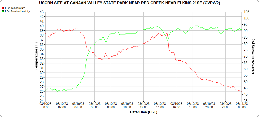
Climate Reference Network Canaan
Atop Canaan Ski area
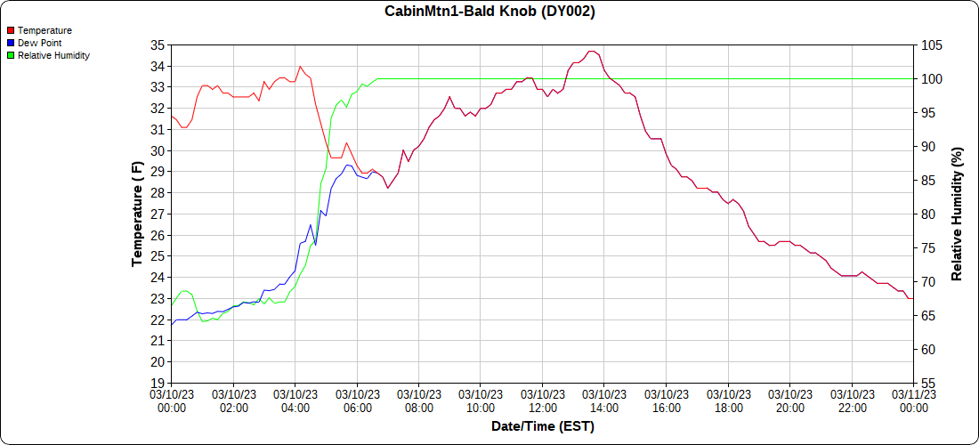
Cabin Mt at Bald Knob
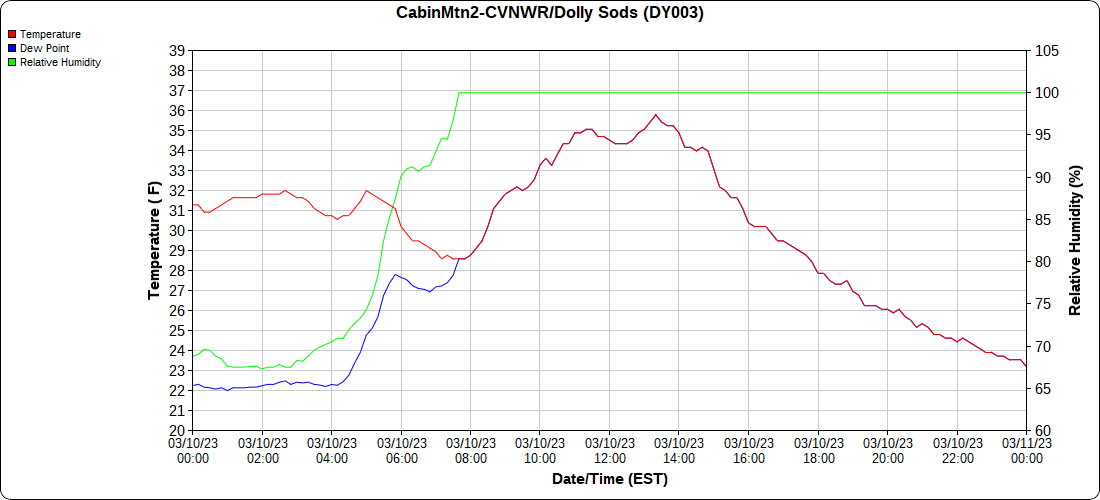
Cabin Mt-Western Sods
Spruce Knob
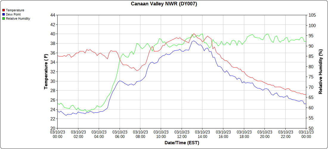
Canaan Valley Refuge
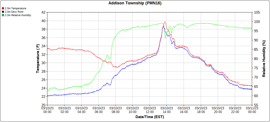
Mt.Davis
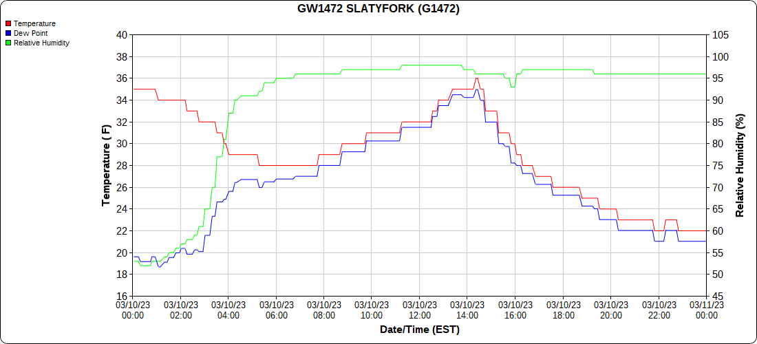
Snowshoe
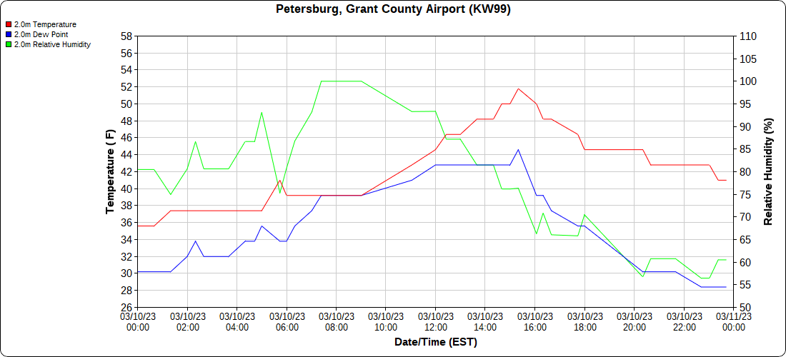
Petersburg Grant County Airport
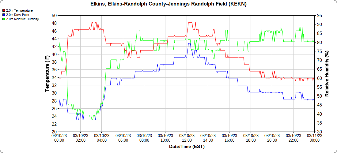
Elkins Airport
Dy007-Canaan Valley Refuge 3150′, Dy002-Cabin Mt at Bald Knob 4350′, Dy003-Cabin Mt-Western Sods 4035′, Dy004-Spruce Knob 4820′, Cvpw2-Climate Reference Network Canaan 3380′, KW99-Petersburg Grant County Airport 961, K2G4 Garrett County Airport 2933′, KCBE Cumberland Airport 774′, KEKN Elkins Airport 1985′, KMGW Morgantown Airport 1227′, PMN16-Mt.Davis 3038′, KDCA-Reagan National 15′, G1472 Snowshoe 4500′, F0183 Burkes Garden 3050′
The Valley vs Cabin Mt
Canaan area temps
High Ground Comparison
Up High and Down Low
Up High, High Valley, Low Valley
The Valleys
Wv High Ground Cold spots vs DCA
RTMA
Radar
Satellite
Flow
Surface features and 500mb Height Height and Flow
Webcams-
morning
morning…the west to east difference
mid morning
mid morning
morning
morning – west to east difference
afternoon as most spots melted off
around 2pm
219 north of Oakland


