March 24, 2023
Forest Service Cam offline since 6/24/21
Mat 24(Fri)
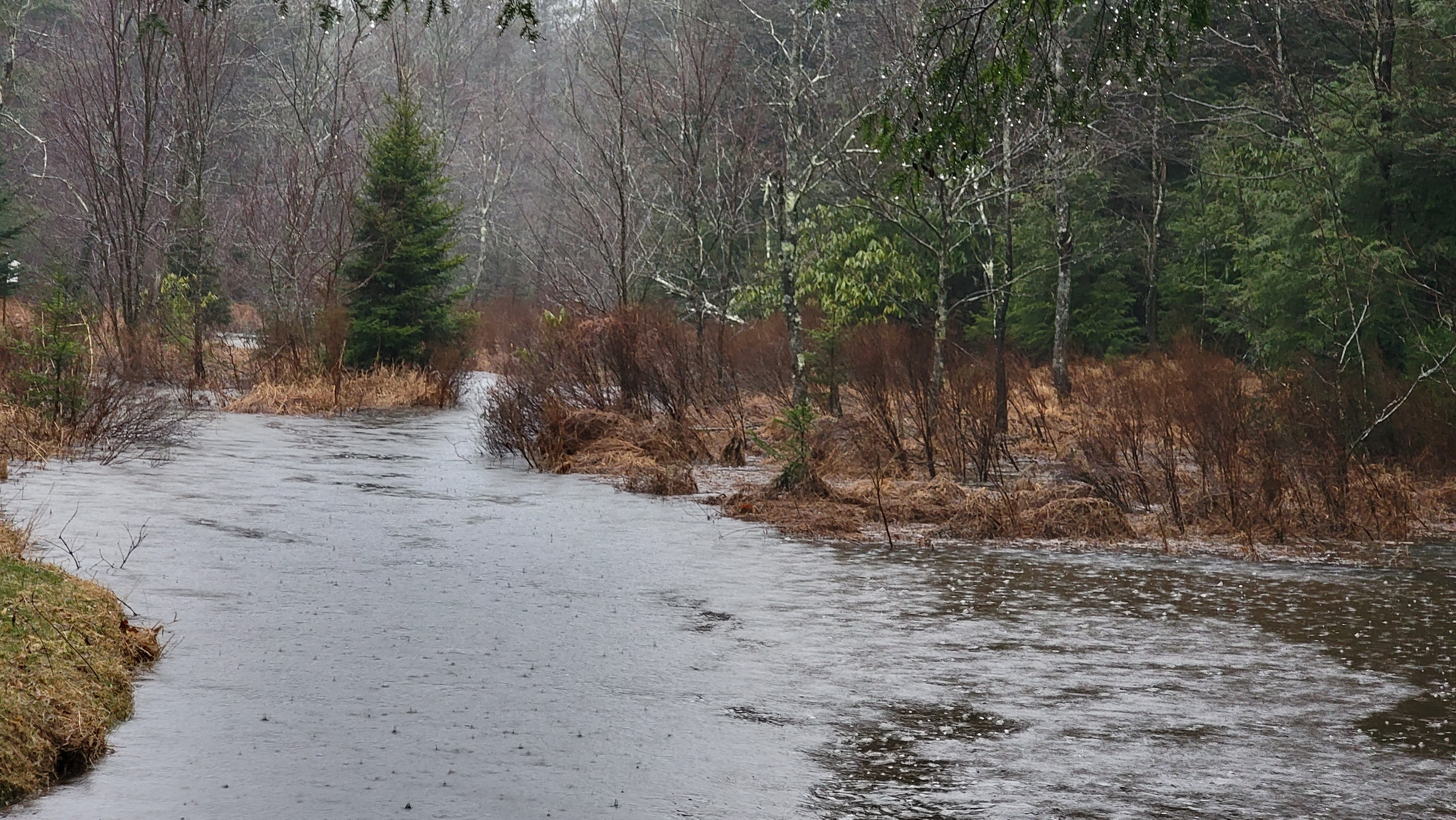
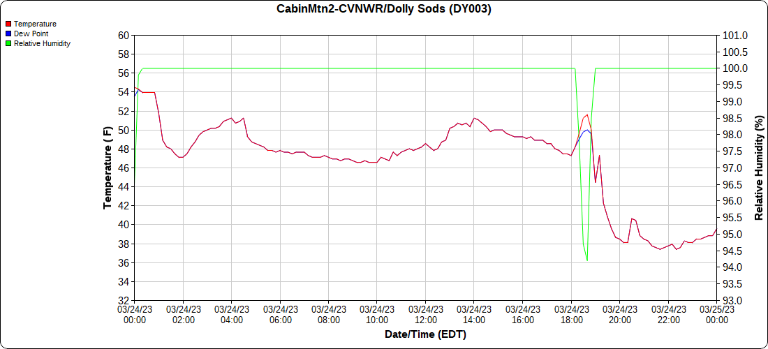
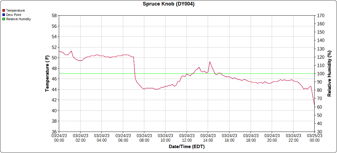
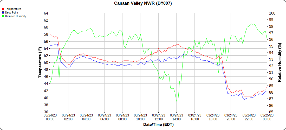
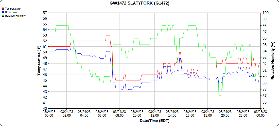
Cloudy, foggy, rainy… a interesting temp boundary
Bittinger 2nw Valley
Throwback pics on the date:
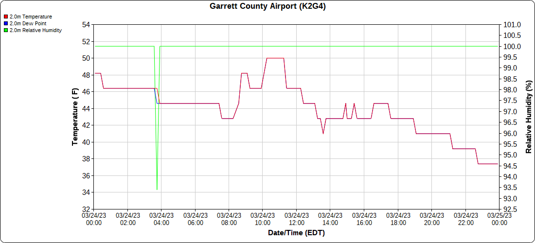
Garrett County Airport
throwback to 2015 on the date
Top of Wisp
Canaan Heights/Davis 3SE
Comments and data by Dave Lesher at:
http://data.canaanmtnsnow.com/
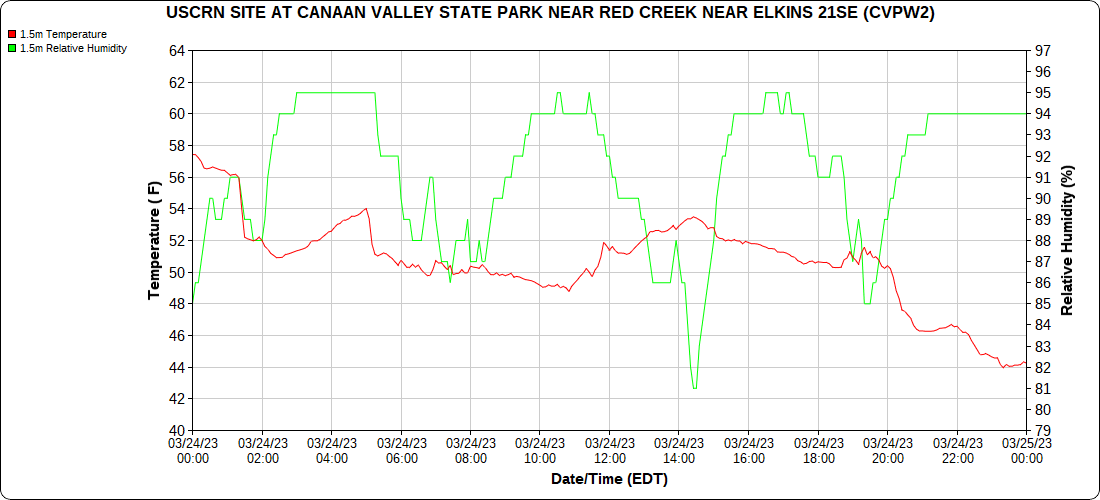
Climate Reference Network Canaan
Atop Canaan Ski area
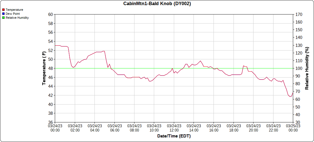
Cabin Mt at Bald Knob
Cabin Mt-Western Sods
Spruce Knob
Canaan Valley Refuge
Mt.Davis
data to be backfilled later
Snowshoe
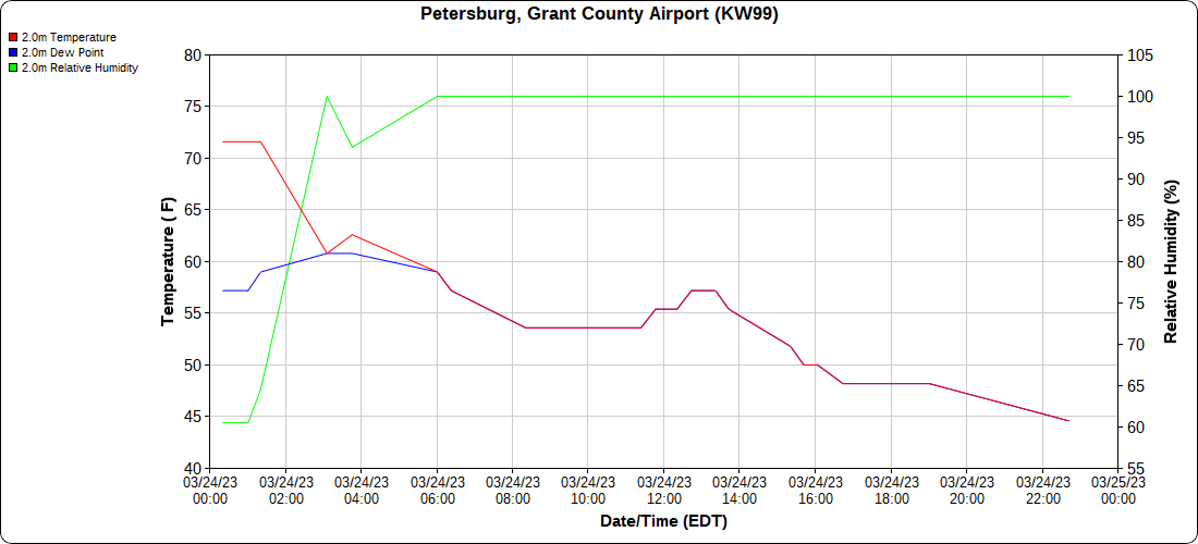
Petersburg Grant County Airport
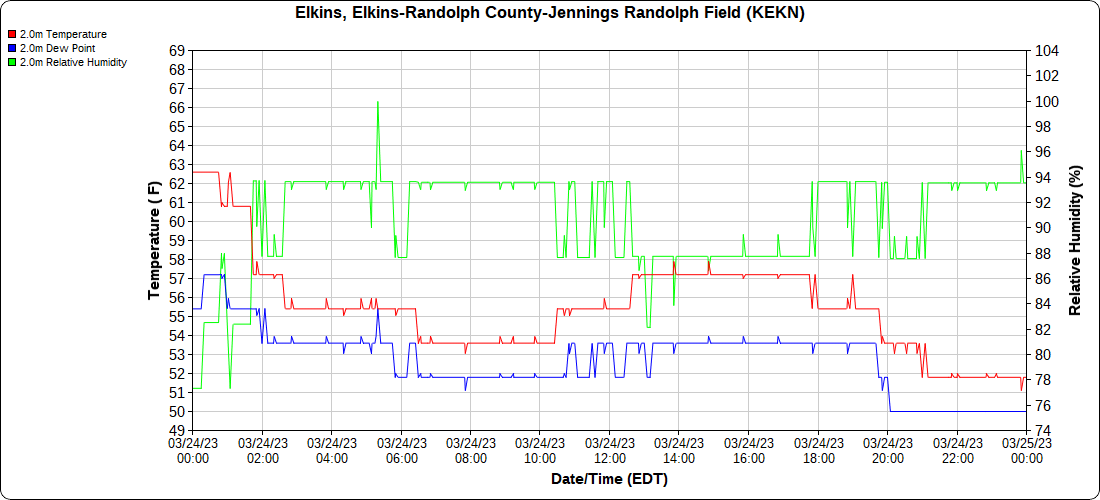
Elkins Airport
Dy007-Canaan Valley Refuge 3150′, Dy002-Cabin Mt at Bald Knob 4350′, Dy003-Cabin Mt-Western Sods 4035′, Dy004-Spruce Knob 4820′, Cvpw2-Climate Reference Network Canaan 3380′, KW99-Petersburg Grant County Airport 961, K2G4 Garrett County Airport 2933′, KCBE Cumberland Airport 774′, KEKN Elkins Airport 1985′, KMGW Morgantown Airport 1227′, PMN16-Mt.Davis 3038′, KDCA-Reagan National 15′, G1472 Snowshoe 4500′, F0183 Burkes Garden 3050′
The Valley vs Cabin Mt
Canaan area temps
High Ground Comparison
Up High and Down Low
Up High, High Valley, Low Valley
The Valleys
WV High Ground Cold Spots vs DCA
RTMA
Radar
Satellite
Flow
Current surface Features and 500mb Height Anomalies and Flow
Cranesville
Grantsville
Meadow Mt
Longstretch
Savage Mt
Frostburg
Cumberland
By Rocky Gap
Sideline Hill Creek -Northcraft
33 East of Harman at the Divide
Of Note:
A great Auroura display last night where clouds and rain weren’t an issue…all the way to North Carolina!!
From Va:

