March 25, 2023
Forest Service Cam offline since 6/24/21
Mar 25(Sat)
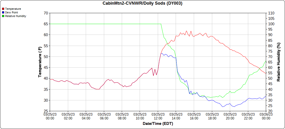
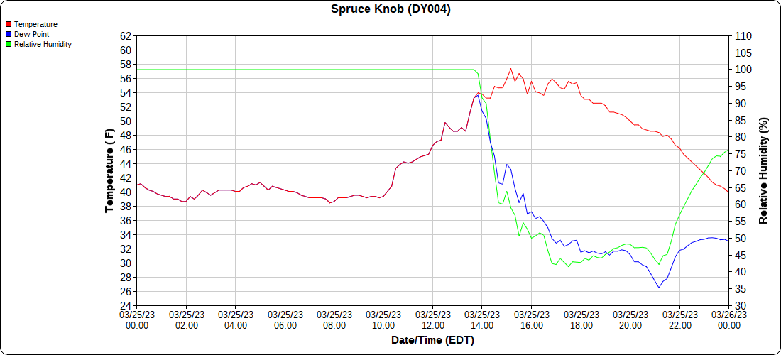
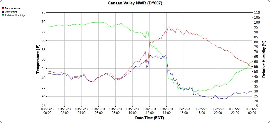
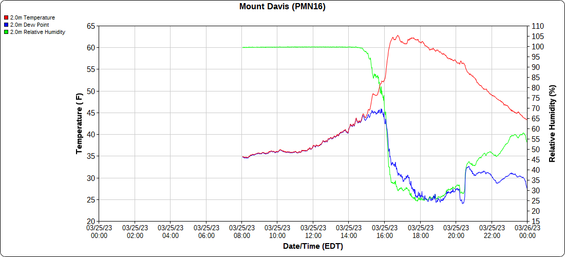
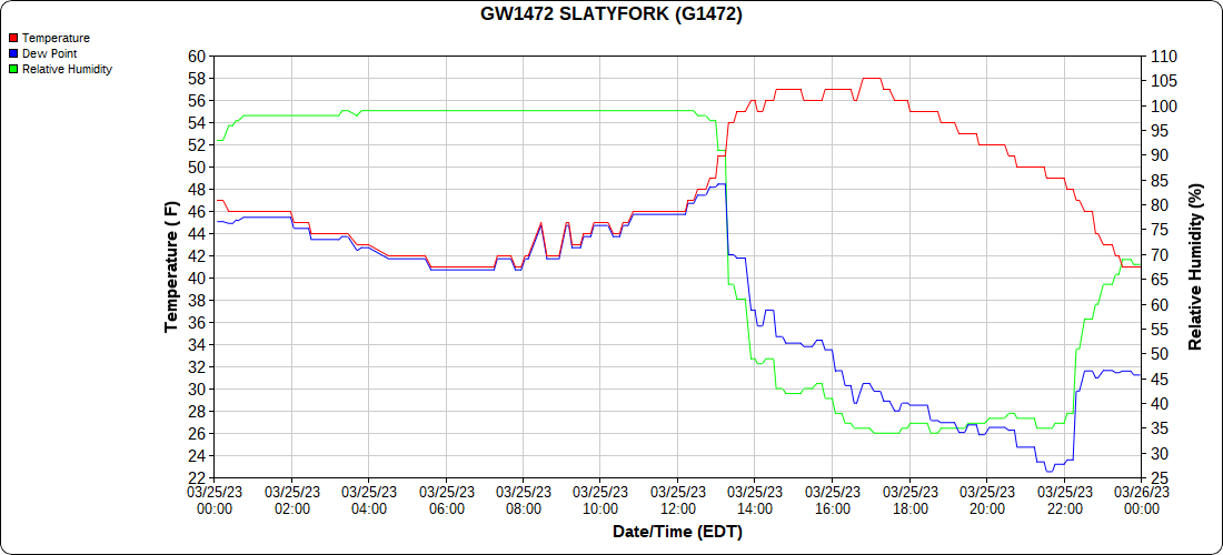
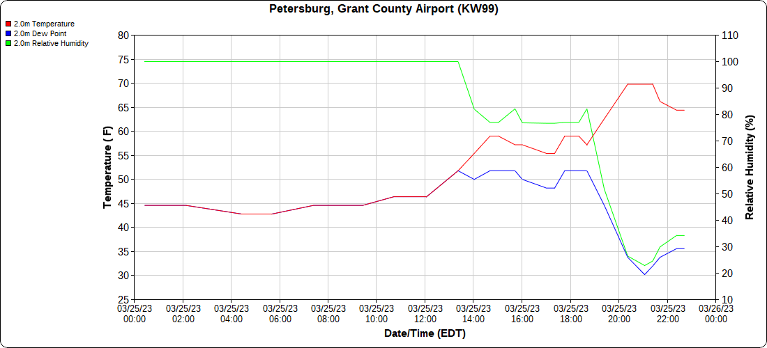
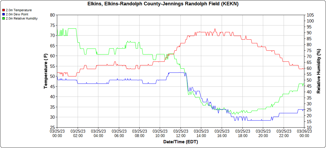
A large temp contrast today, foggy zones east, sunny west and pushing east. A wedge day.
Bittinger 2nw Valley
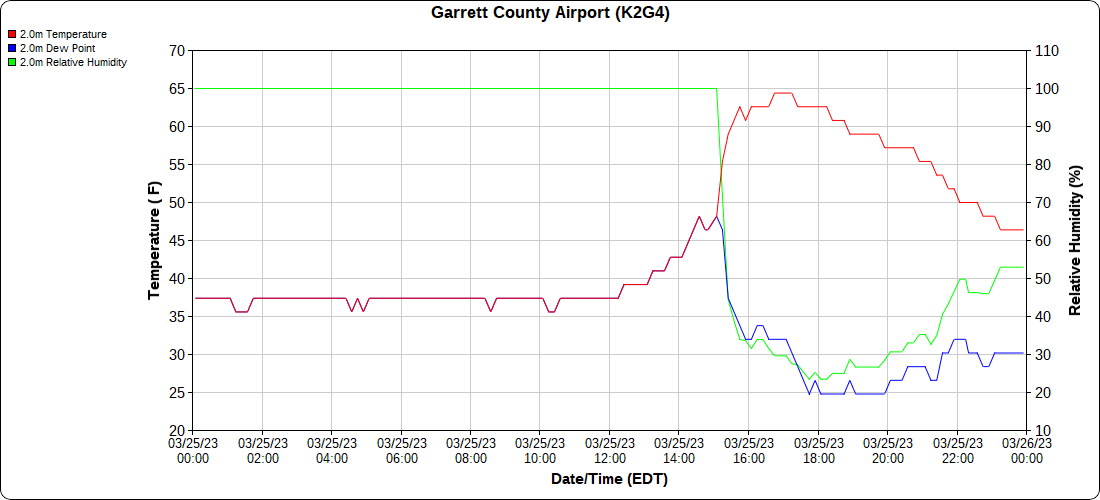
Garrett County Airport
Top of Wisp
Canaan Heights/Davis 3SE
Comments and data by Dave Lesher at:
http://data.canaanmtnsnow.com/
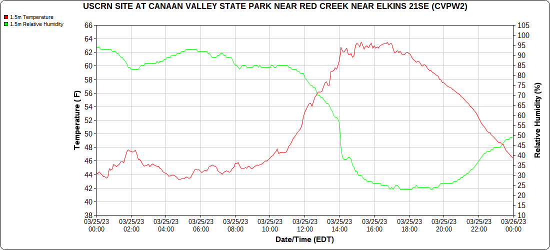
Climate Reference Network Canaan
Atop Canaan Ski area
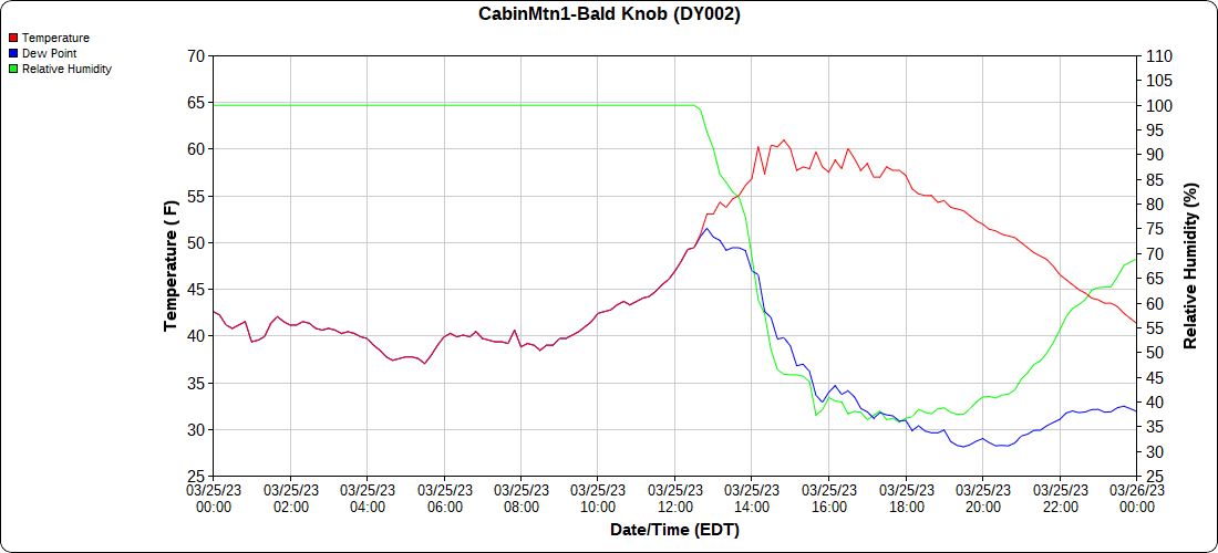
Cabin Mt at Bald Knob
Cabin Mt-Western Sods
Spruce Knob
Canaan Valley Refuge
Mt.Davis
throwback on the date:
Snowshoe
Petersburg Grant County Airport
Elkins Airport
Dy007-Canaan Valley Refuge 3150′, Dy002-Cabin Mt at Bald Knob 4350′, Dy003-Cabin Mt-Western Sods 4035′, Dy004-Spruce Knob 4820′, Cvpw2-Climate Reference Network Canaan 3380′, KW99-Petersburg Grant County Airport 961, K2G4 Garrett County Airport 2933′, KCBE Cumberland Airport 774′, KEKN Elkins Airport 1985′, KMGW Morgantown Airport 1227′, PMN16-Mt.Davis 3038′, KDCA-Reagan National 15′, G1472 Snowshoe 4500′, F0183 Burkes Garden 3050′
The Valley vs Cabin Mt
Canaan area temps
High Ground Comparison
Up High and Down Low
Up High, High Valley, Low Valley
The Valleys
WV High Ground Cold Spots vs DCA
Further east at Sideling Hill Creek
Temps maxed out on the 25th at 47…falling back in to the upper 30s down low before the modified warmer airmass pushed across after midnight…


