May 11, 2023
Forest Service Cam offline since 6/24/21
May 11(Thurs)
Clear, chilly start. Areas of frost. Sunny day with Smoky hazy sky.
Bittinger 2nw Valley
The Glades
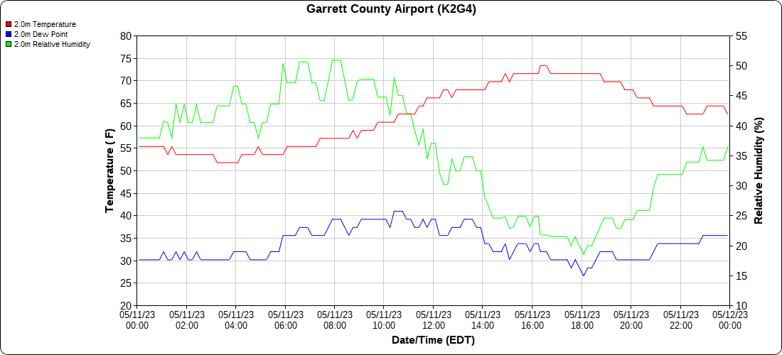
Garrett County Airport
Top of Wisp
*rooftop station
Canaan Heights/Davis 3SE
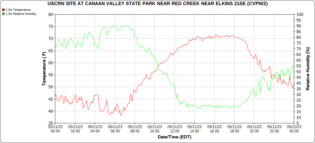
Climate Reference Network Station
Atop Canaan Ski area
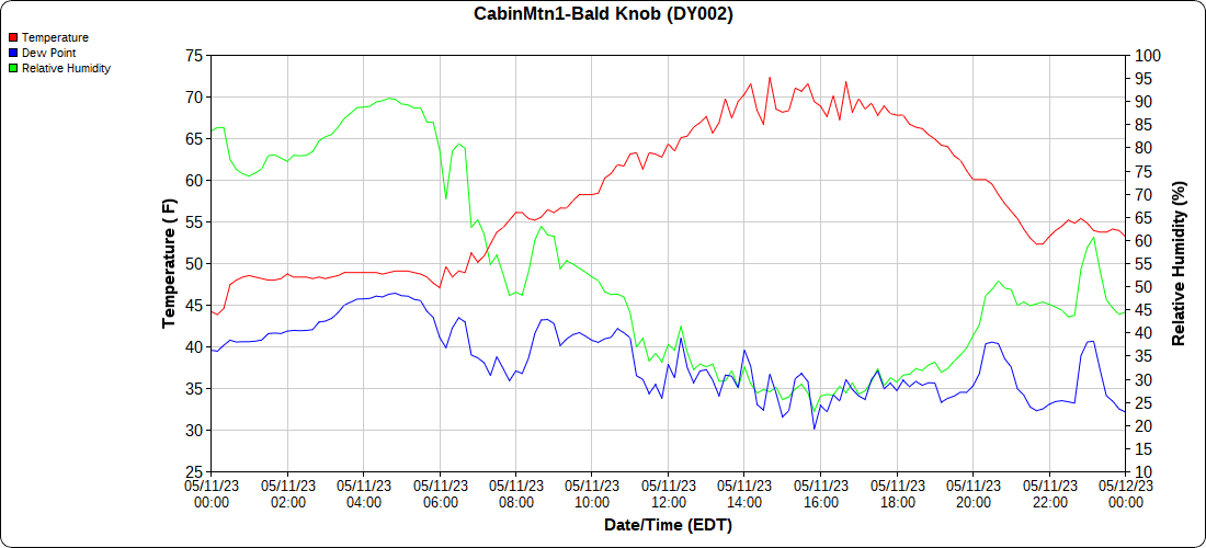
Cabin Mt at Bald Knob
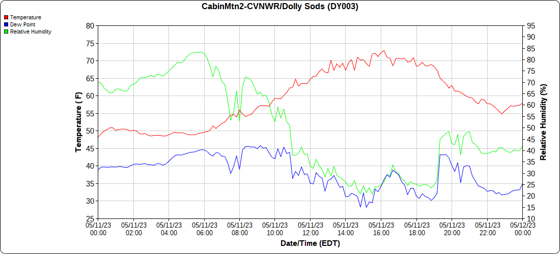
Cabin Mt-Western Sods
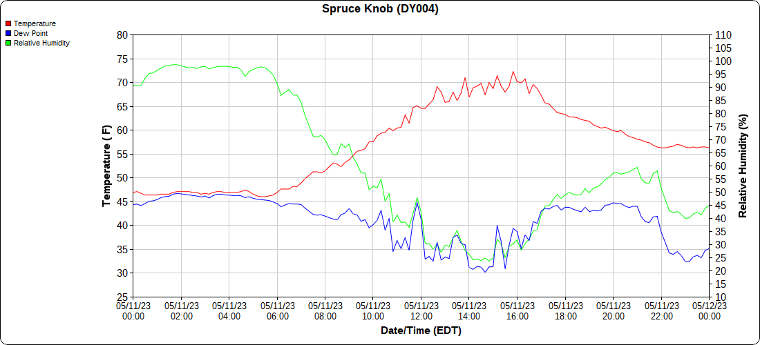
Spruce Knob
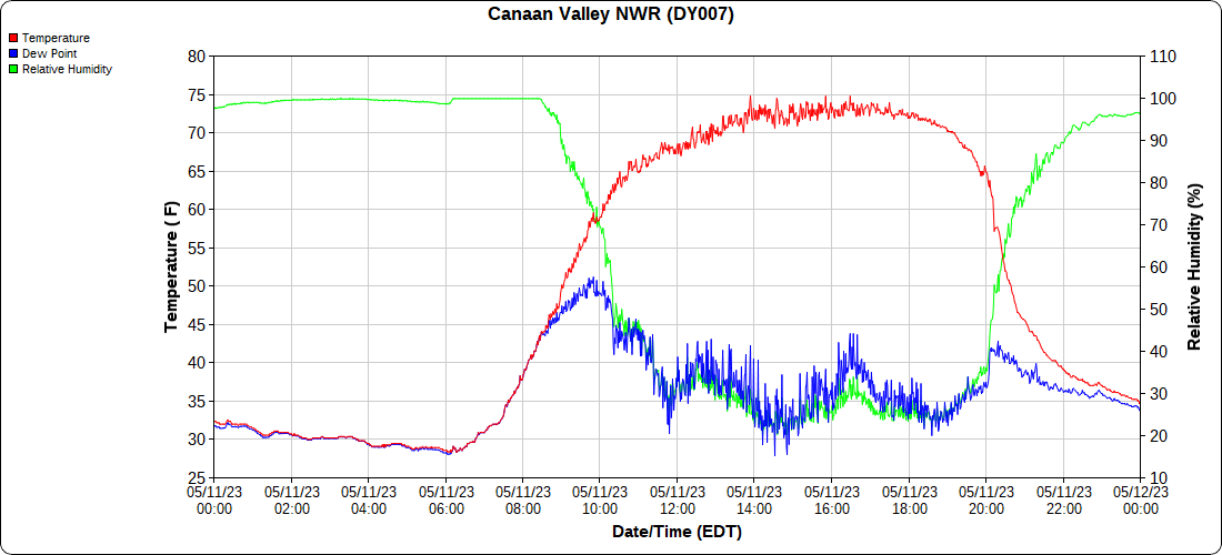
Canaan Valley Refuge
Mt.Davis
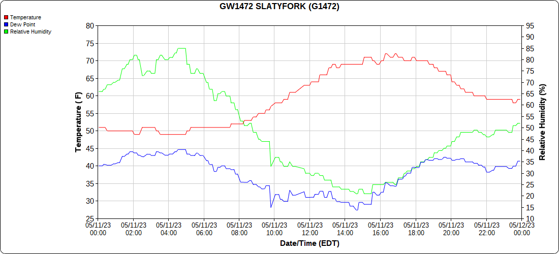
Snowshoe
Petersburg Grant County Airport
no data
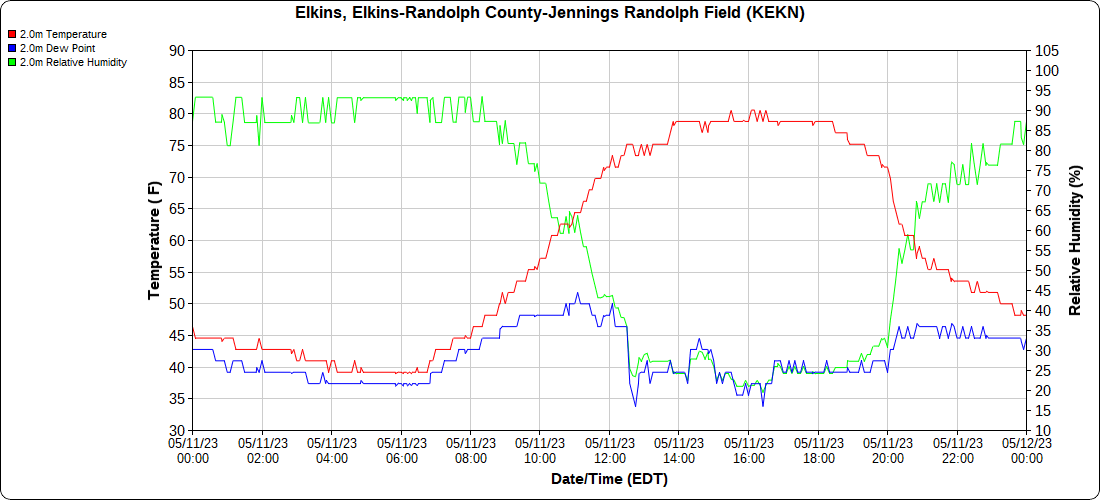
Elkins Airport
Dy007-Canaan Valley Refuge 3150′, Dy002-Cabin Mt at Bald Knob 4350′, Dy003-Cabin Mt-Western Sods 4035′, Dy004-Spruce Knob 4820′, Cvpw2-Climate Reference Network Canaan 3380′, KW99-Petersburg Grant County Airport 961, K2G4 Garrett County Airport 2933′, KCBE Cumberland Airport 774′, KEKN Elkins Airport 1985′, KMGW Morgantown Airport 1227′, PMN16-Mt.Davis 3038′, KDCA-Reagan National 15′, G1472 Snowshoe 4500′, F0183 Burkes Garden 3050′
The Valley vs Cabin Mt
Canaan area temps
High Ground Comparison
Up High and Down Low
Up High, High Valley, Low Valley
The Valleys
Wv High Ground Cold Spots vs DCA
RTMA
Radar
void


