July 31, 2023
Forest Service Cam offline since 6/24/21
July 31(Mon)
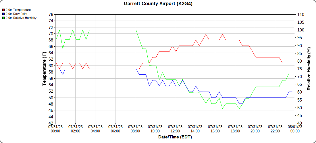
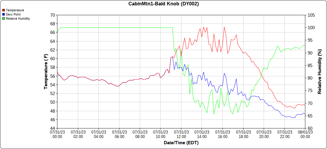
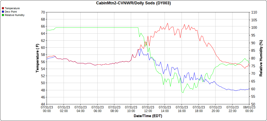
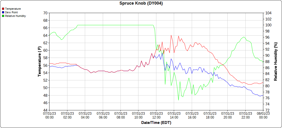
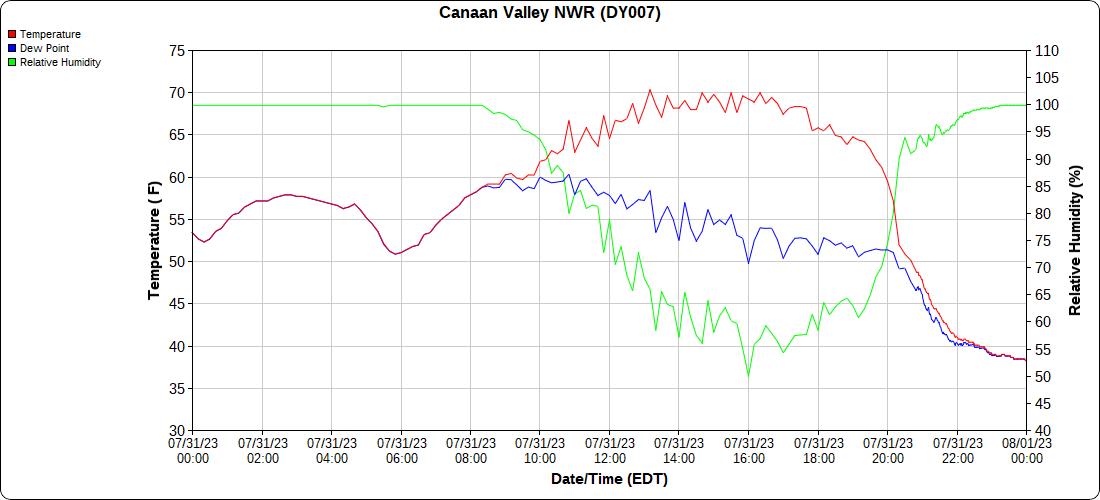
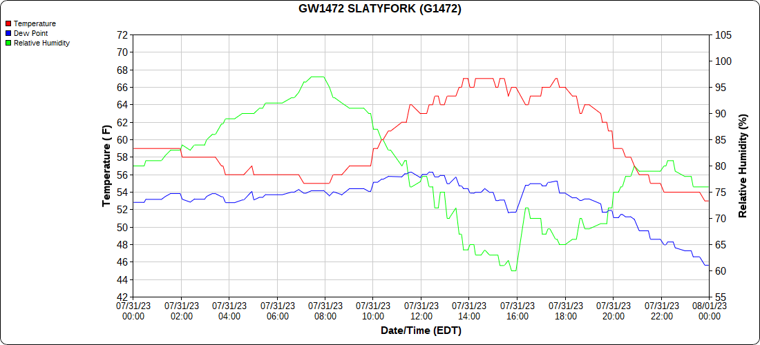
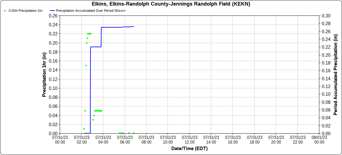
Showers last night, and pleasant almost fall like day today with clearing skies, few scattered clouds, low dewpoints
Bittinger 2nw Valley
The Glades
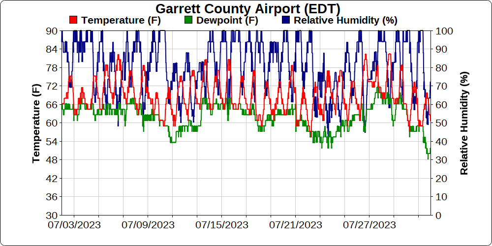
Garrett County Airport
Top of Wisp
Canaan Heights/Davis 3SE
Canaan Mt Bog
Climate Reference Network Station
Atop Canaan Ski area
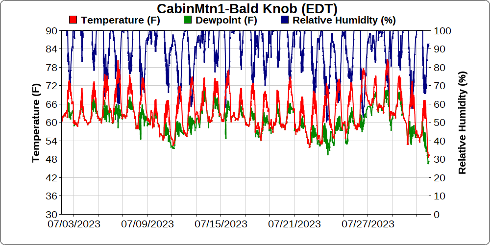
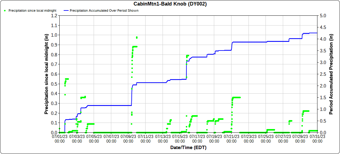
Cabin Mt at Bald Knob
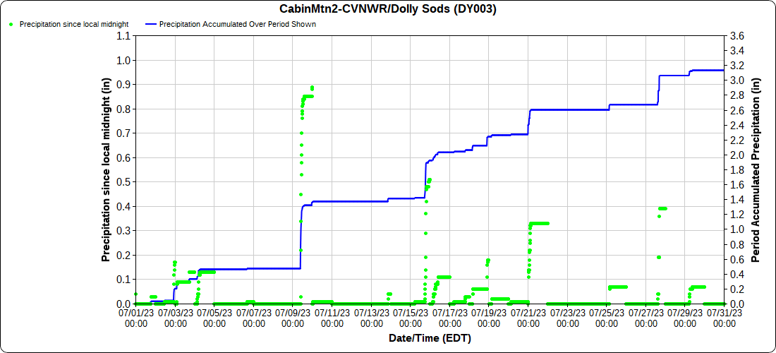
Cabin Mt-Western Sods
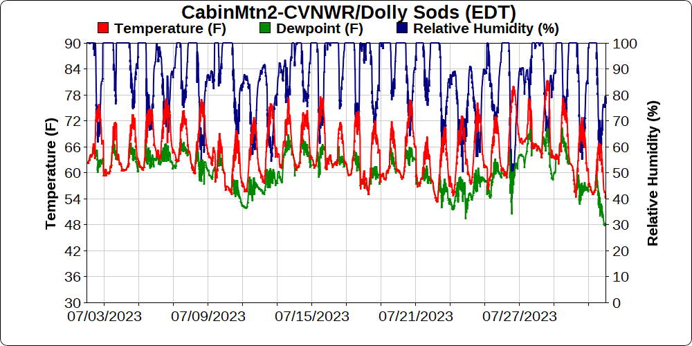
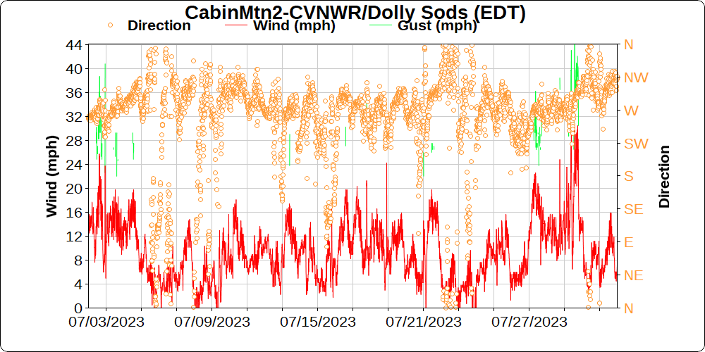
DOLLY SODS EDITION JULY 31, 2023 CLICK LINK BELOW
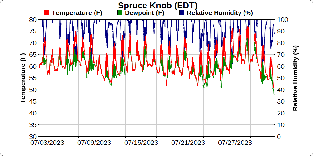
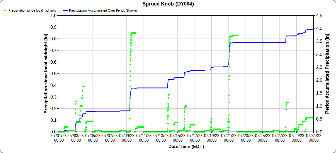
Spruce Knob
Canaan Valley Refuge
Mt.Davis
Snowshoe
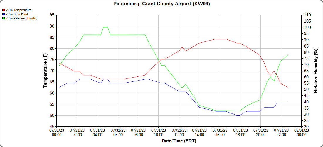
Petersburg Grant County Airport
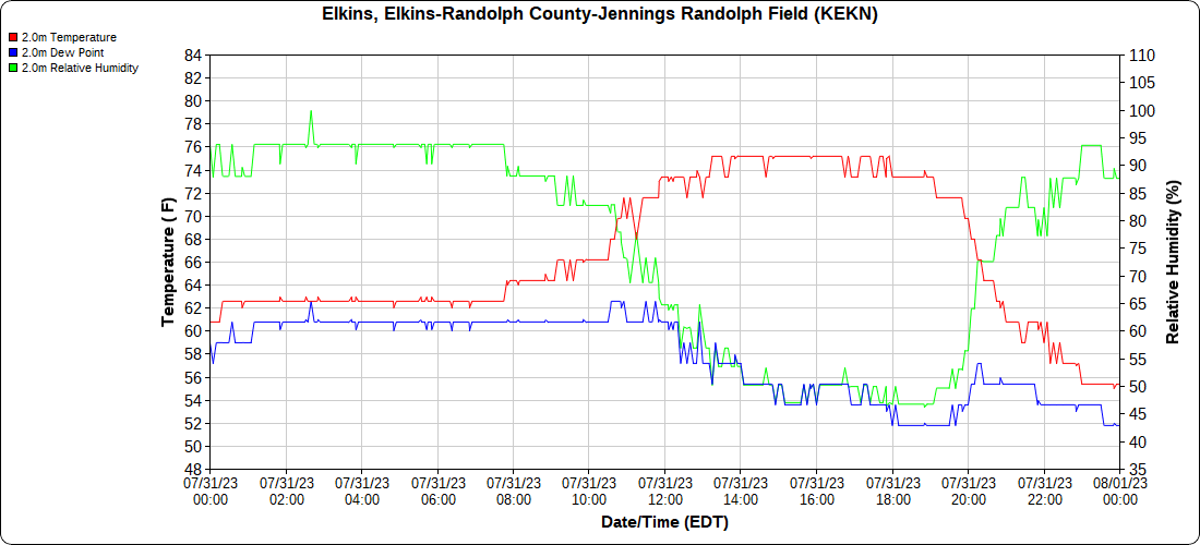
Elkins Airport
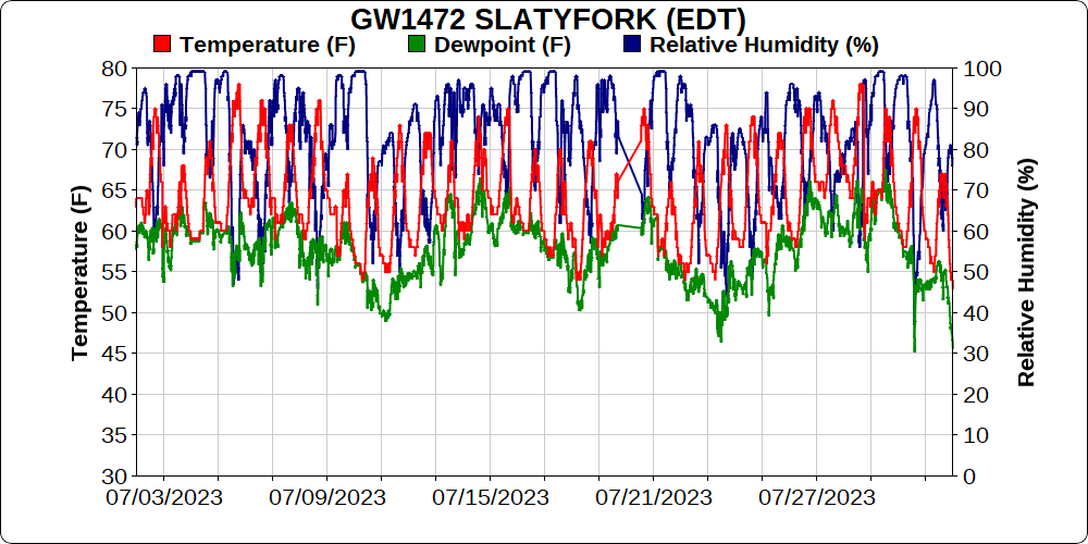
Dy007-Canaan Valley Refuge 3150′, Dy002-Cabin Mt at Bald Knob 4350′, Dy003-Cabin Mt-Western Sods 4035′, Dy004-Spruce Knob 4820′, Cvpw2-Climate Reference Network Canaan 3380′, KW99-Petersburg Grant County Airport 961, K2G4 Garrett County Airport 2933′, KCBE Cumberland Airport 774′, KEKN Elkins Airport 1985′, KMGW Morgantown Airport 1227′, PMN16-Mt.Davis 3038′, KDCA-Reagan National 15′, G1472 Snowshoe 4500′, F0183 Burkes Garden 3050′
- Single day and month comparison
The Valley vs Cabin Mt
Canaan area temps
High Ground Comparison
Up High and Down Low
Up High, High Valley, Low Valley
The Valleys
Wv High Ground Cold Spots vs DCA
RTMA
Radar
Satellite
Flow
Current Surface Features and 500mb Height Anomalies and Flow
Buck Valley
Sideling Hill Creek at Northcraft
Polish Mt
Cumberland
Frostburg
Savage Mt to Grantsville
BY SILVER LAKE
JUNE 2023
Temps
Precip
observed-
departure-


