August 1, 2023
Forest Service Cam offline since 6/24/21
Aug 1(Tues)
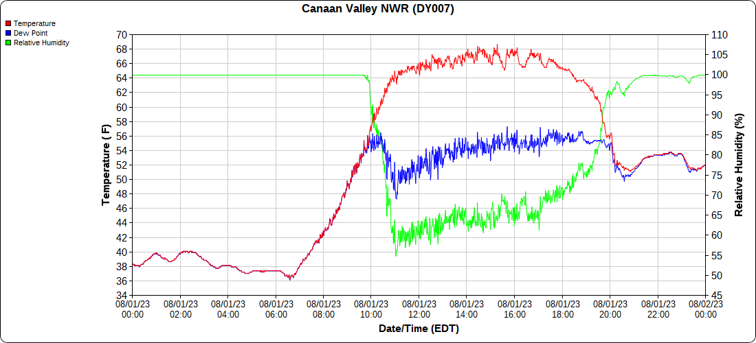
Chilly Valley start. High bog frost. Sun, clouds today with smoky haze mainly aloft.
Bittinger 2nw Valley
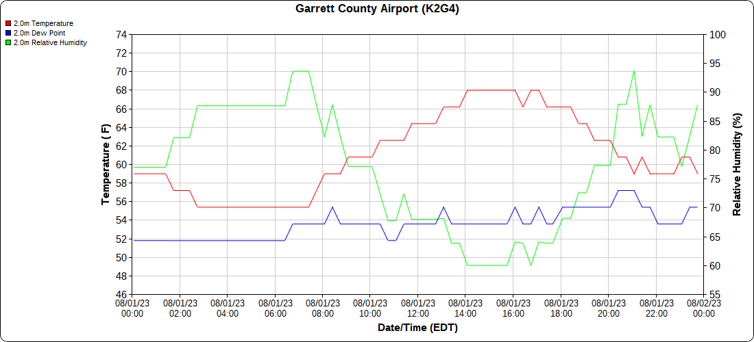
Garrett County Airport
Top of Wisp
Canaan Heights/Davis 3SE
obs transfered to William Peterson from Dave Lesher
Canaan Mt Bog
min of 33.9 this morning
Climate Reference Network Station
Atop Canaan Ski area
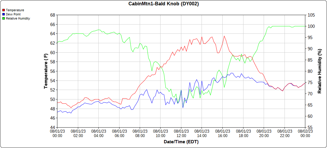
Cabin Mt at Bald Knob
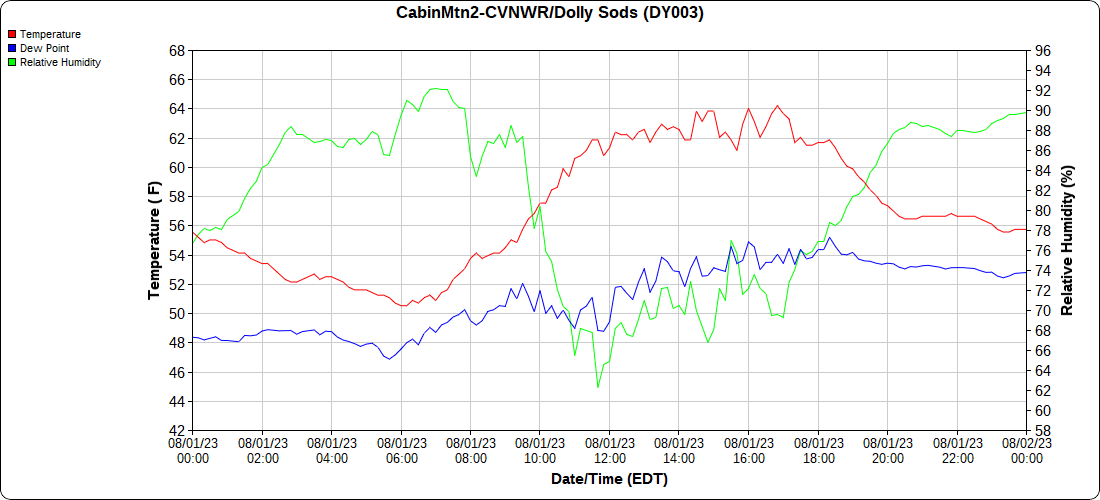
Cabin Mt-Western Sods
click link below for Sods Edition August 1with microclimate temps.
https://wordpress.com/post/alleghenymountainsweather.wordpress.com/69759
Spruce Knob
Canaan Valley Refuge
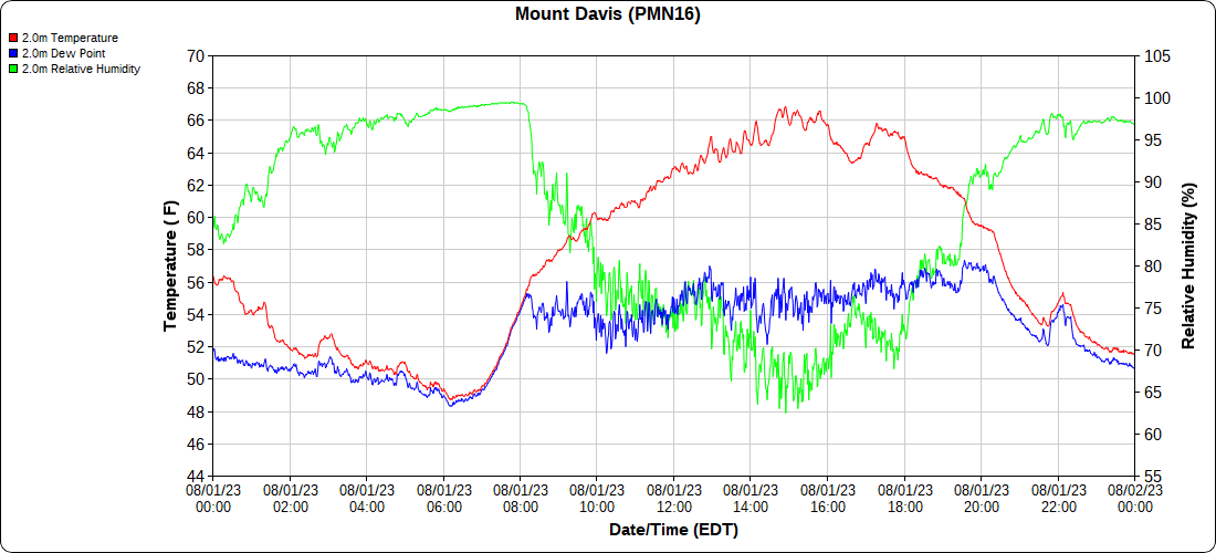
Mt.Davis
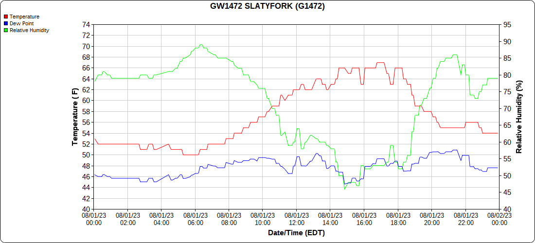
Snowshoe
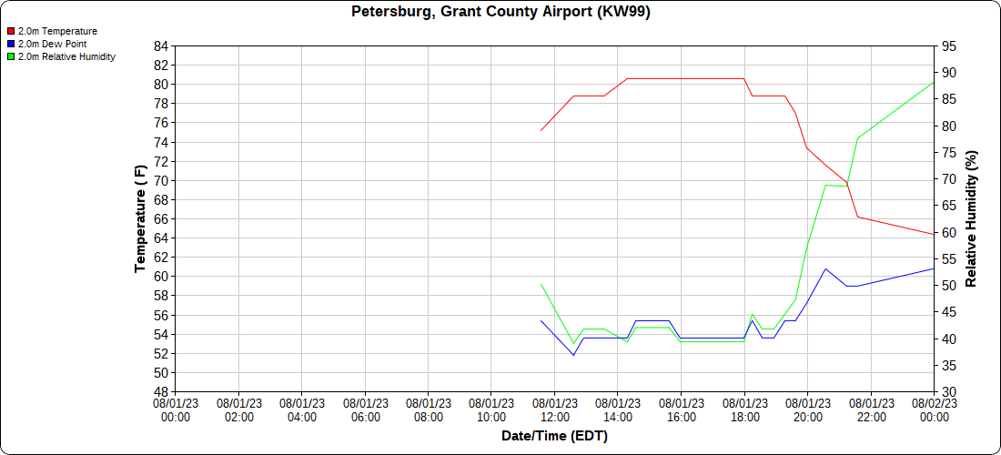
Petersburg Grant County Airport
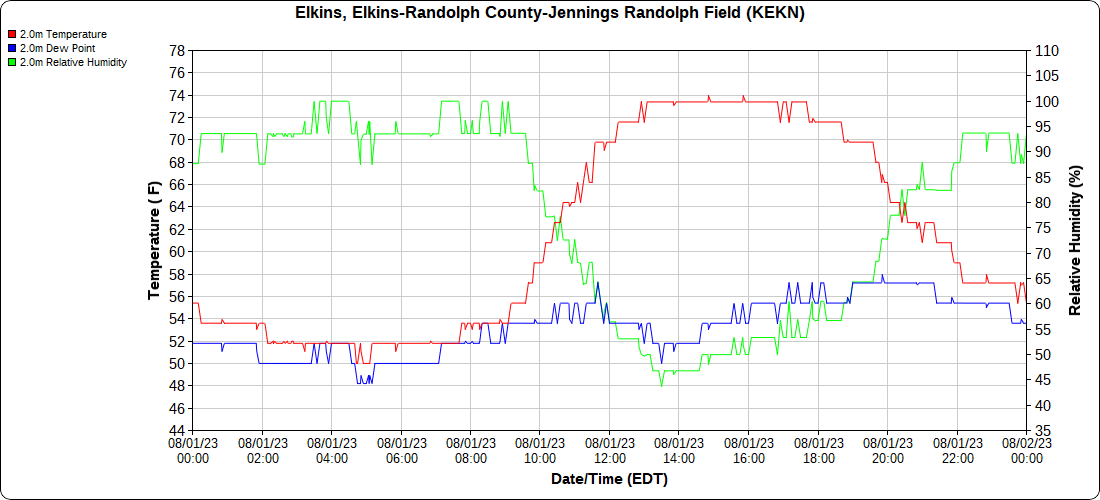
Elkins Airport
Dy007-Canaan Valley Refuge 3150′, Dy002-Cabin Mt at Bald Knob 4350′, Dy003-Cabin Mt-Western Sods 4035′, Dy004-Spruce Knob 4820′, Cvpw2-Climate Reference Network Canaan 3380′, KW99-Petersburg Grant County Airport 961, K2G4 Garrett County Airport 2933′, KCBE Cumberland Airport 774′, KEKN Elkins Airport 1985′, KMGW Morgantown Airport 1227′, PMN16-Mt.Davis 3038′, KDCA-Reagan National 15′, G1472 Snowshoe 4500′, F0183 Burkes Garden 3050′


