Grantsville, New Germany State Park technical issue and Canaan cam still down.
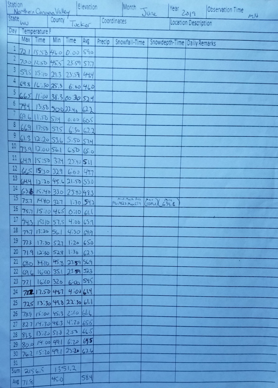
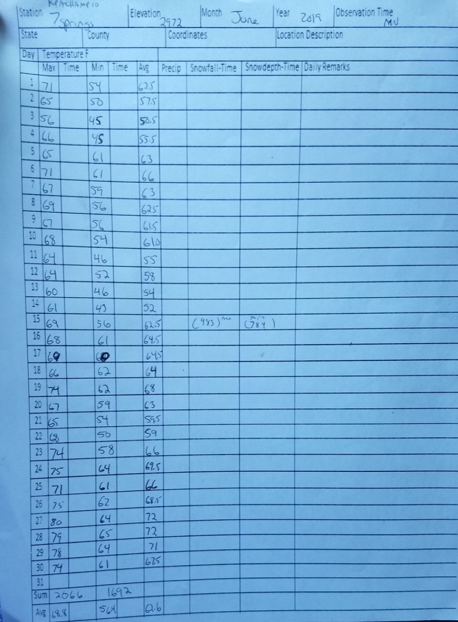
June 30(Sun) min max. avg
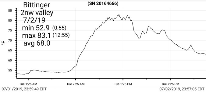
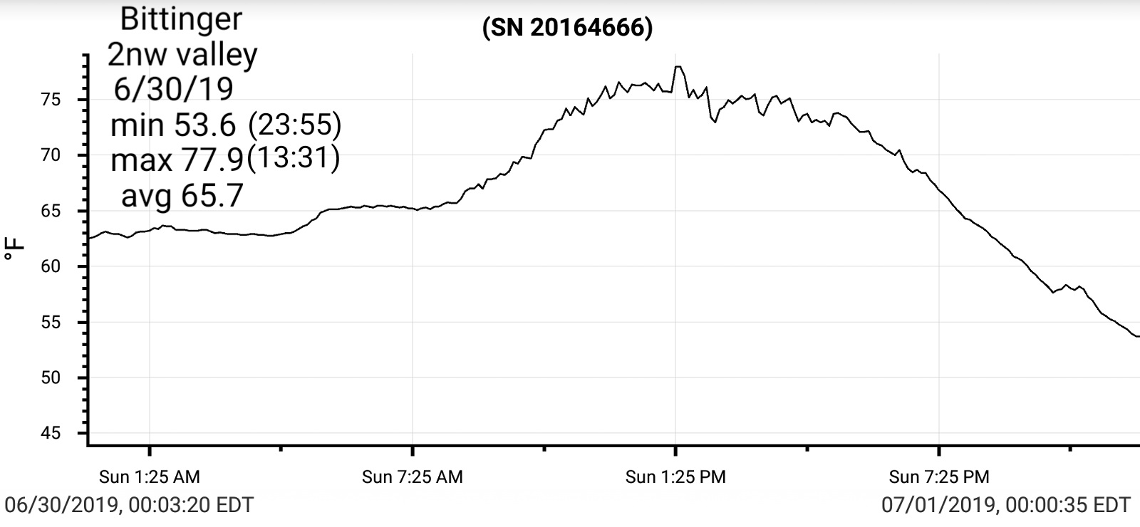
Bitt 2nw Valley 53.6 77.9 65.7
Garrett College 59.9 77.9 68.9
New Germany SP 59 79 69
Can-Heights 56 74 65
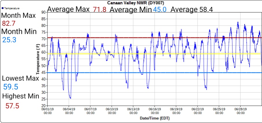
CRN-Canaan 54.1 74.3 64.2
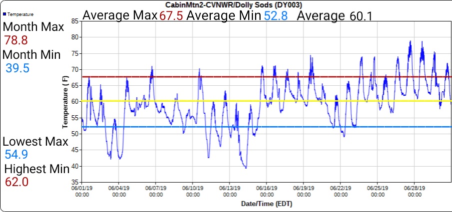
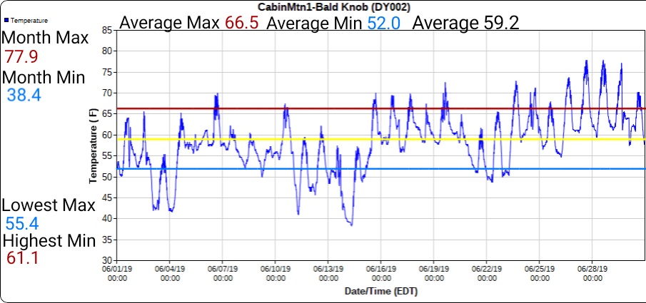
Cabin Mt 56.1 70.3 63.2
Cabin Mt N 56.8 71.9 64.3
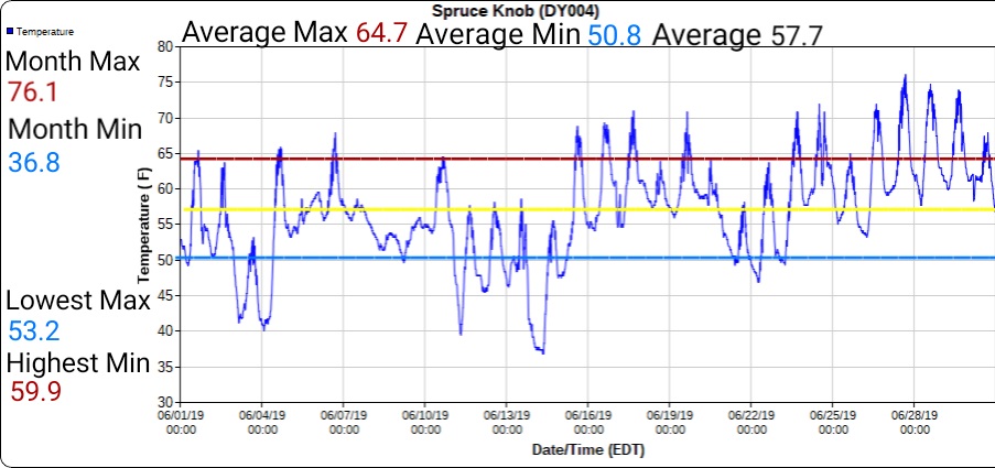
Spruce Knob 55.5 68.0 61.7
Snowshoe 59 70 64.5
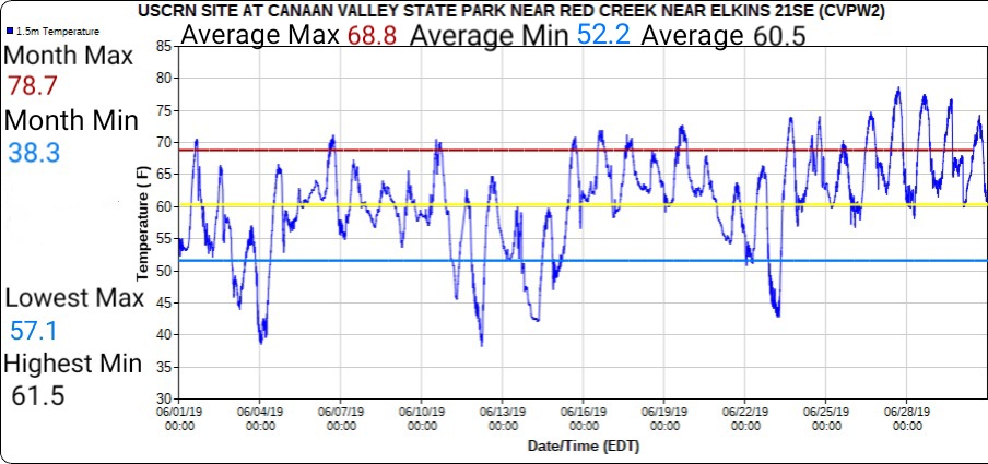
Can-Valley Floor 51.4 76.2 63.8
Can-Valley Floor N 49.1 76.2 62.6
7Springs 61 74 67.5
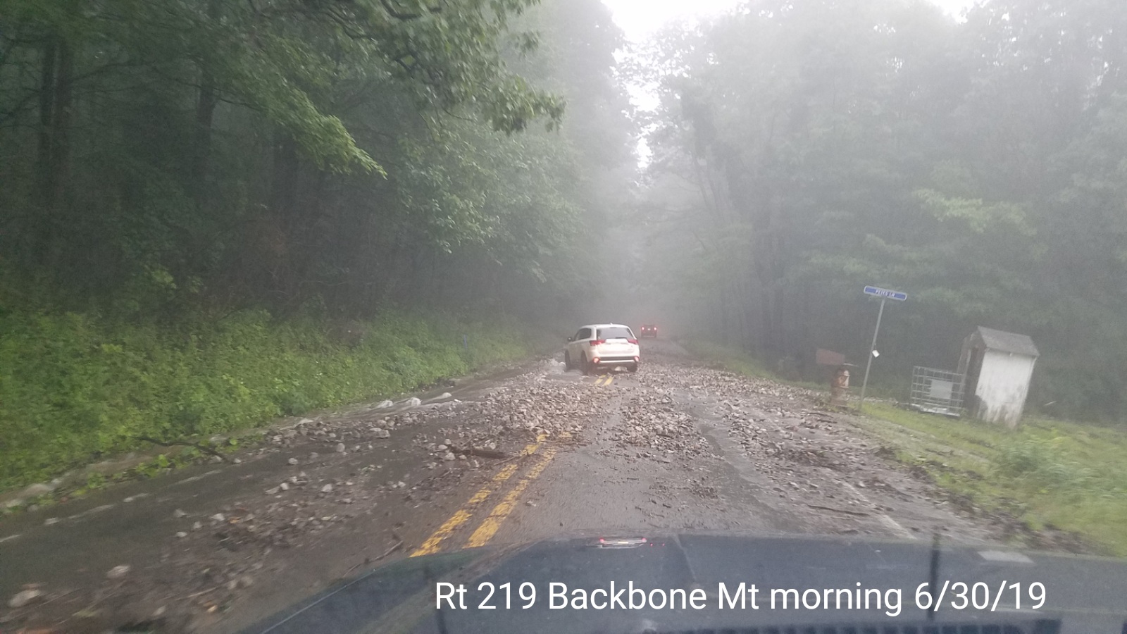
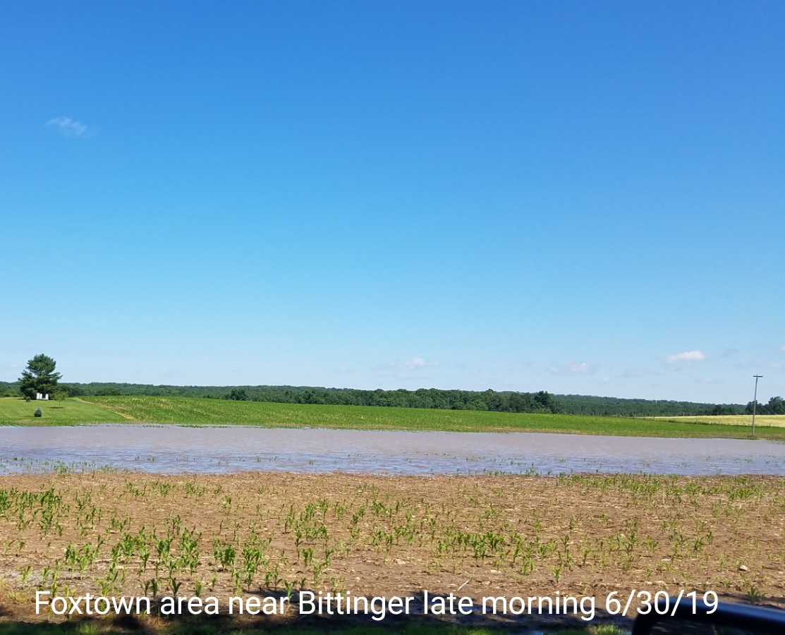
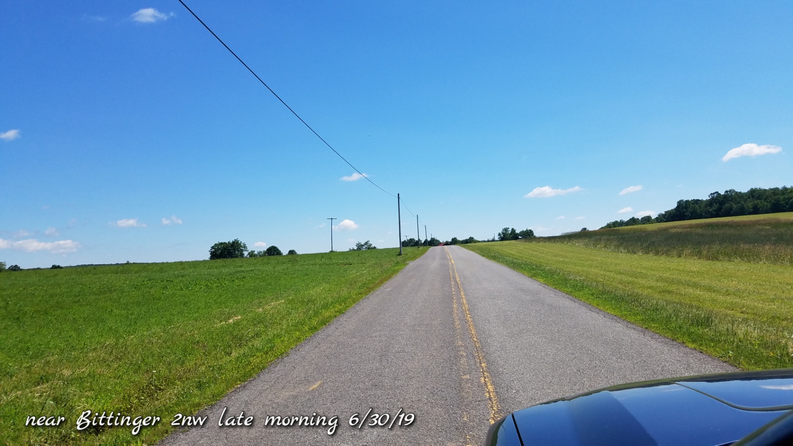
Heavy storms overnight, hardest hit southern Garrett through Tucker. The day today began cloudy, few sprinkles but skies rapidly broke and was a pleasant day.
Temp profile this afternoon
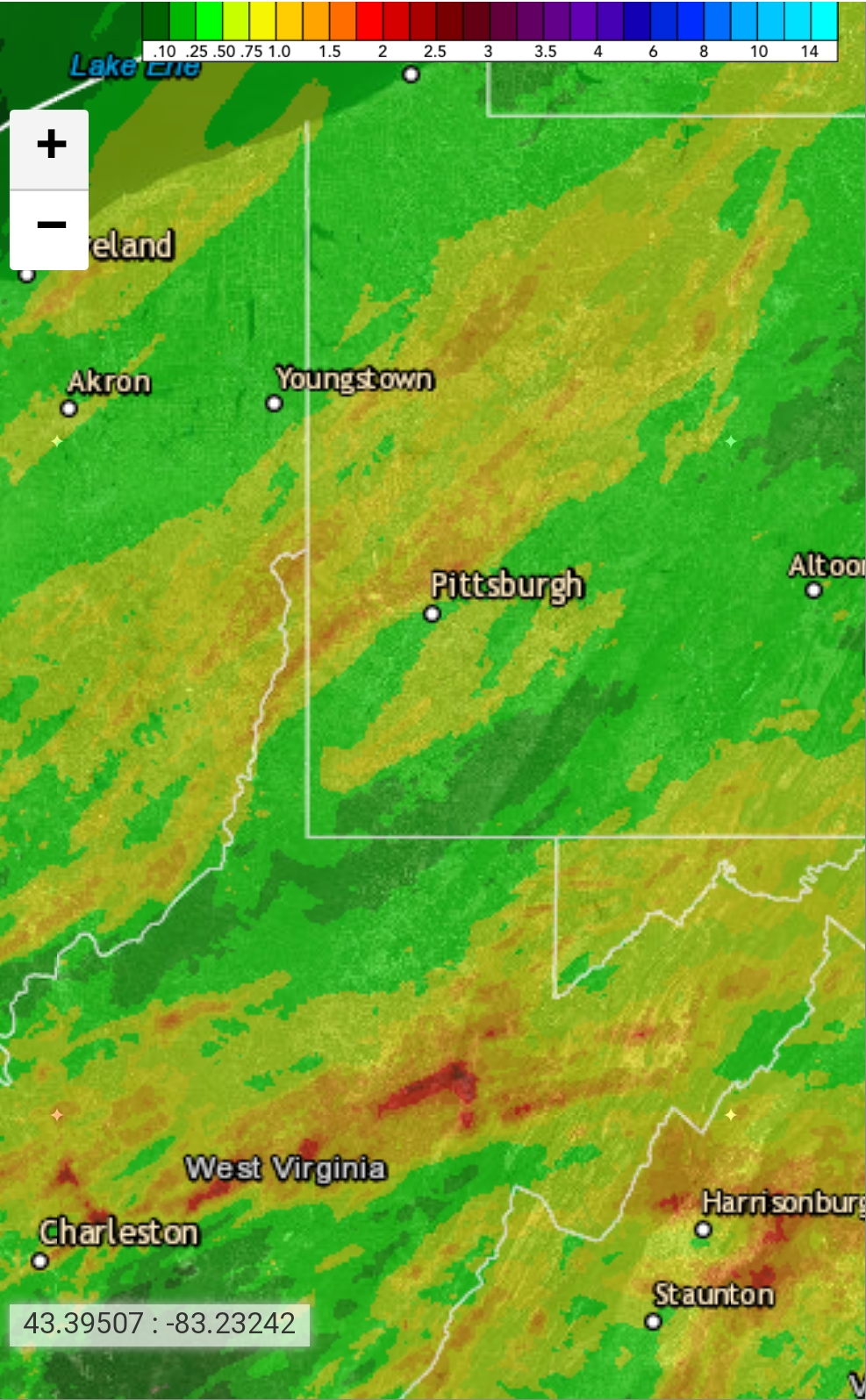
Radar views
Satellite
Flow
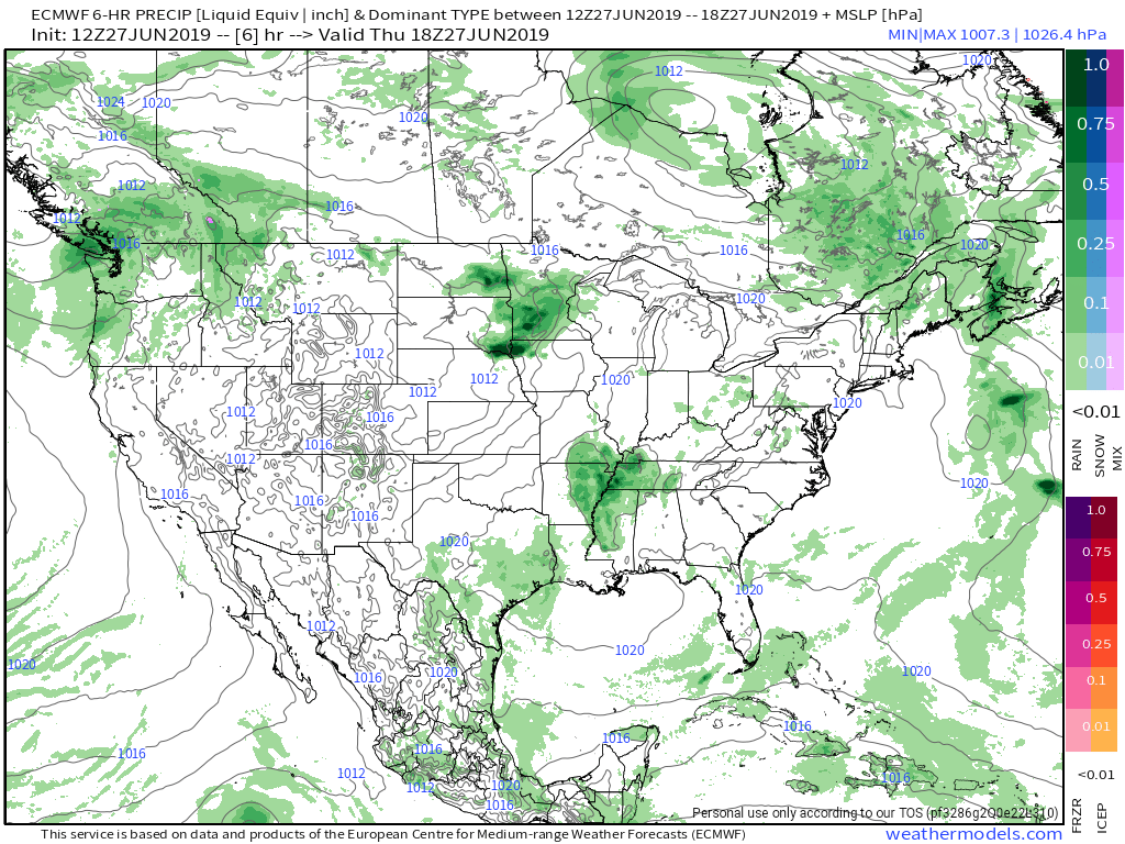
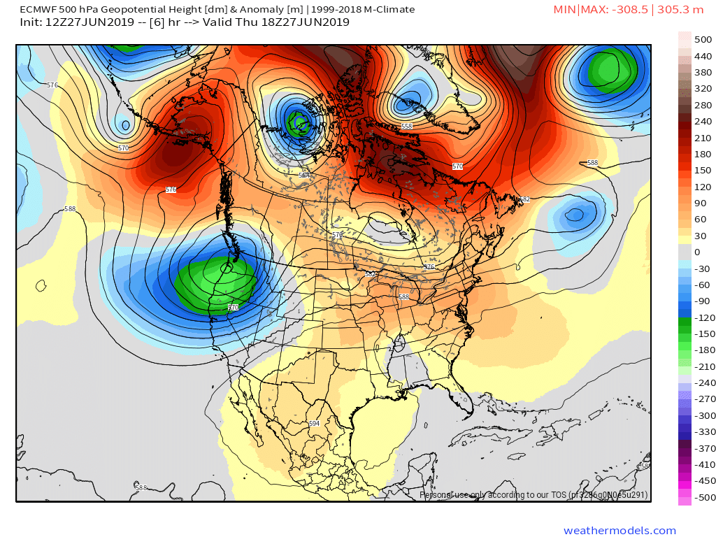
Surface features and 500mb height anomalies and flow
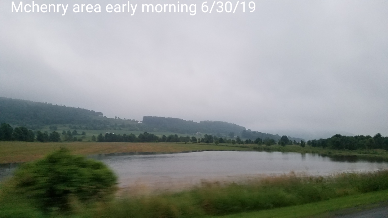
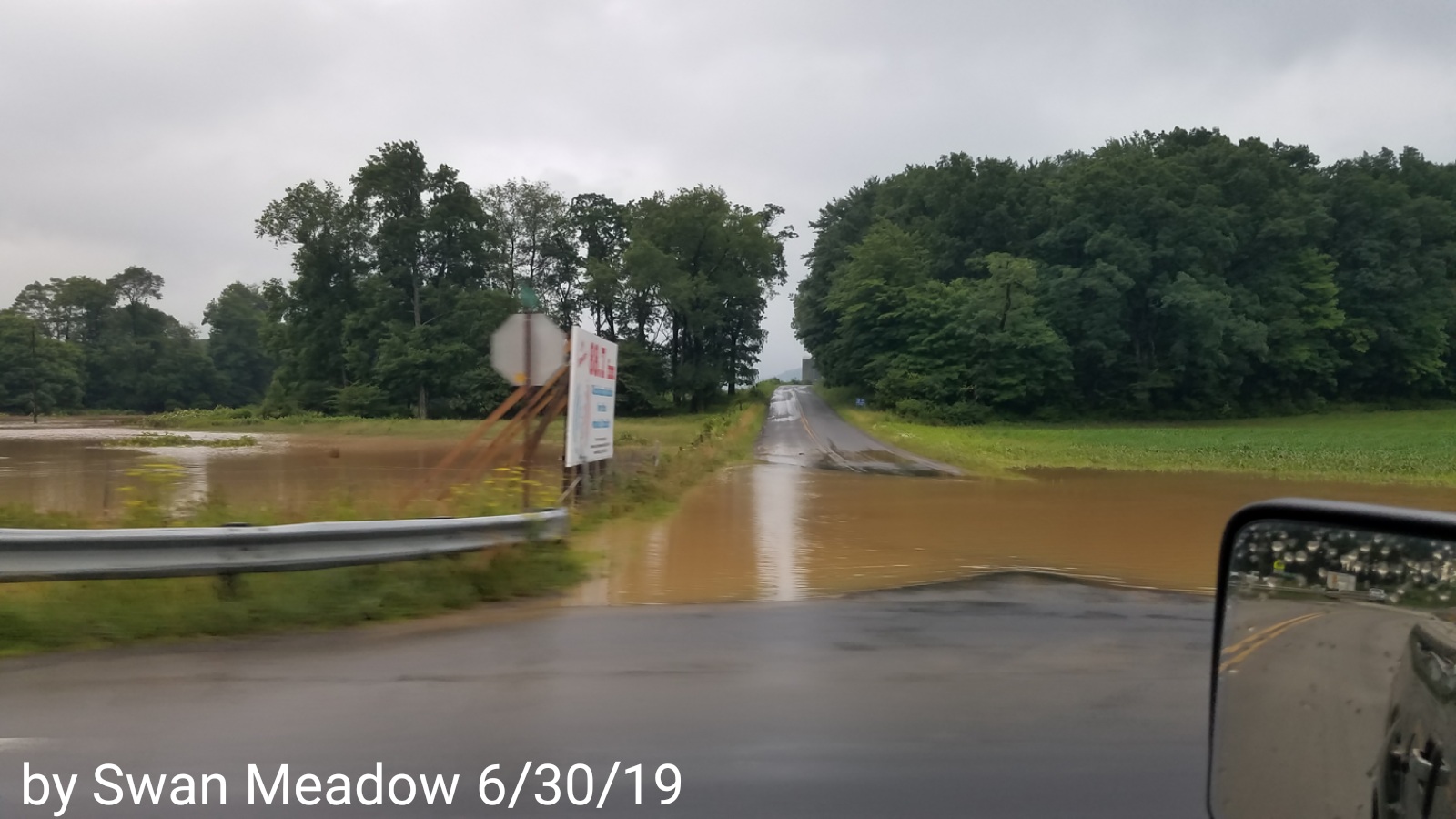
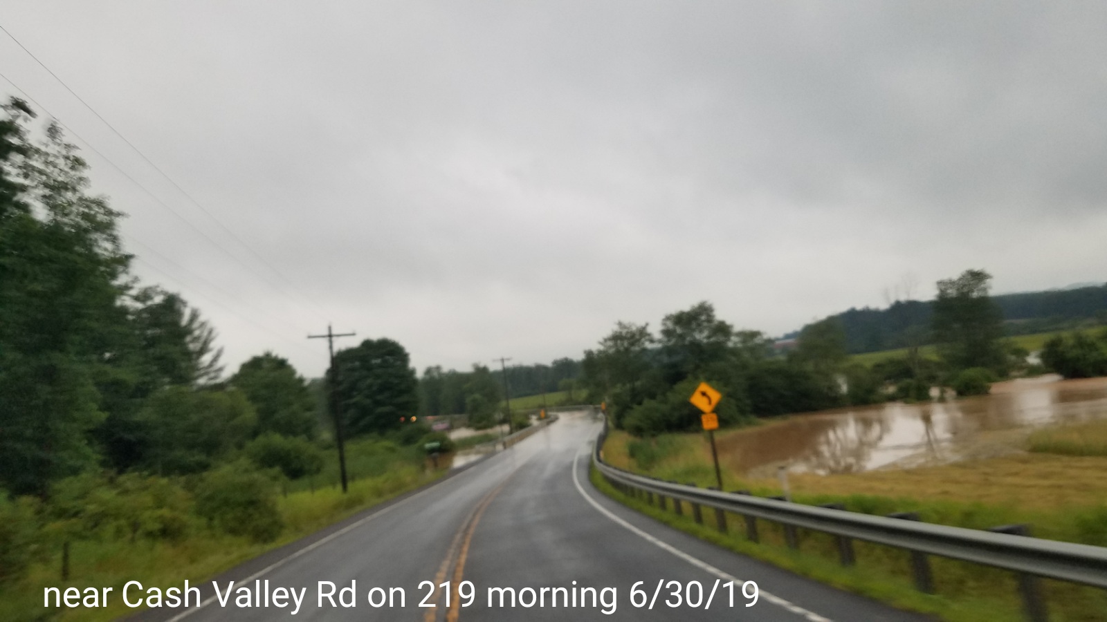
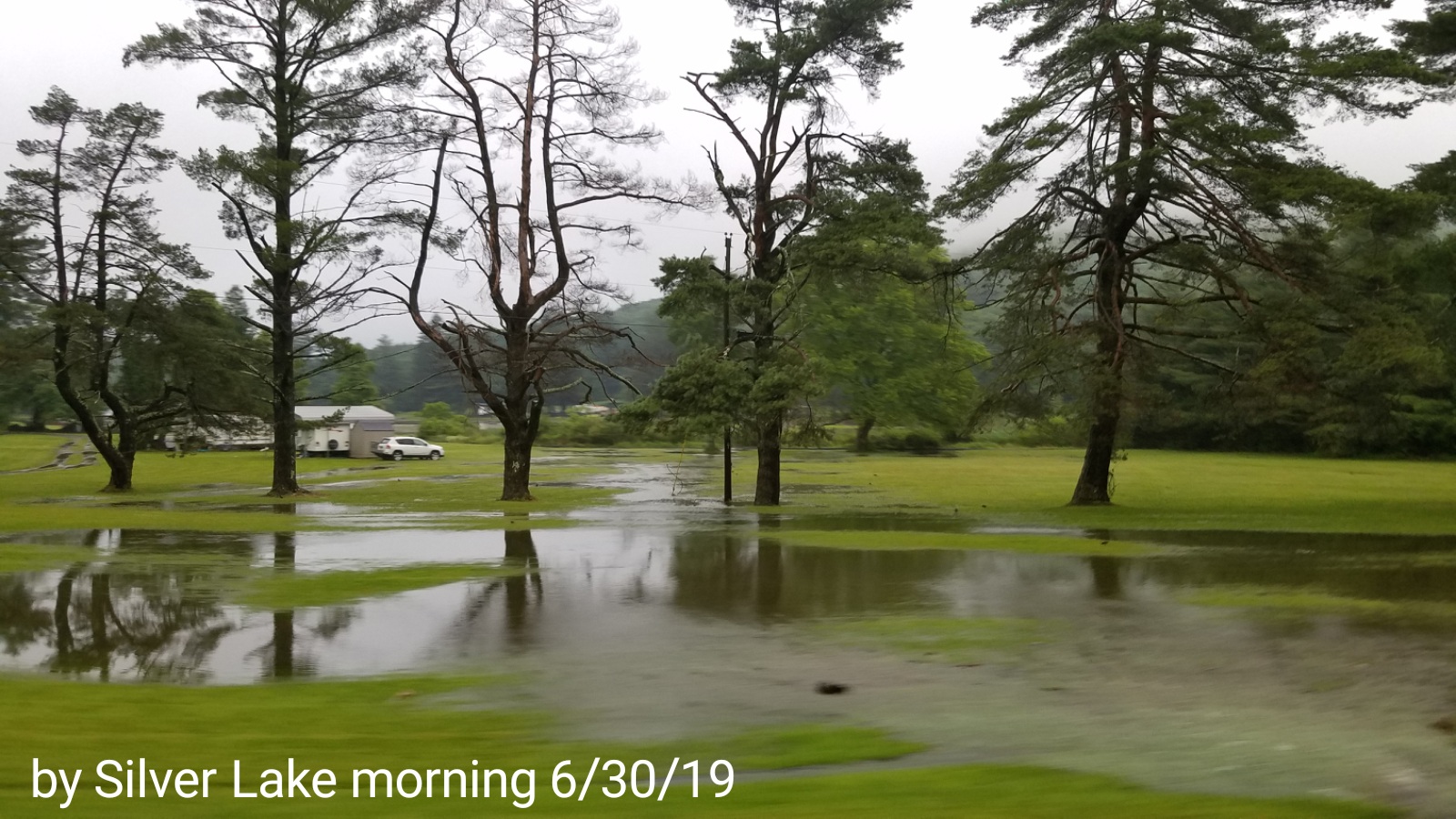
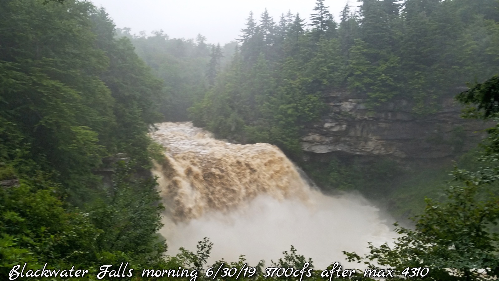
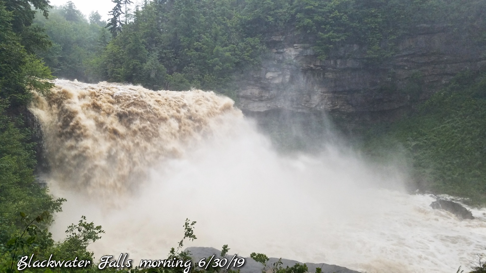
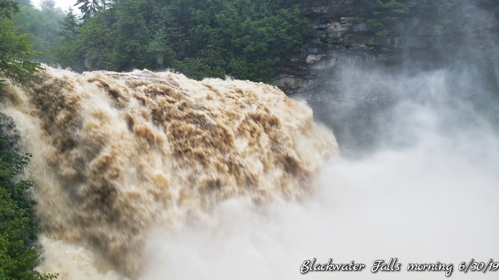
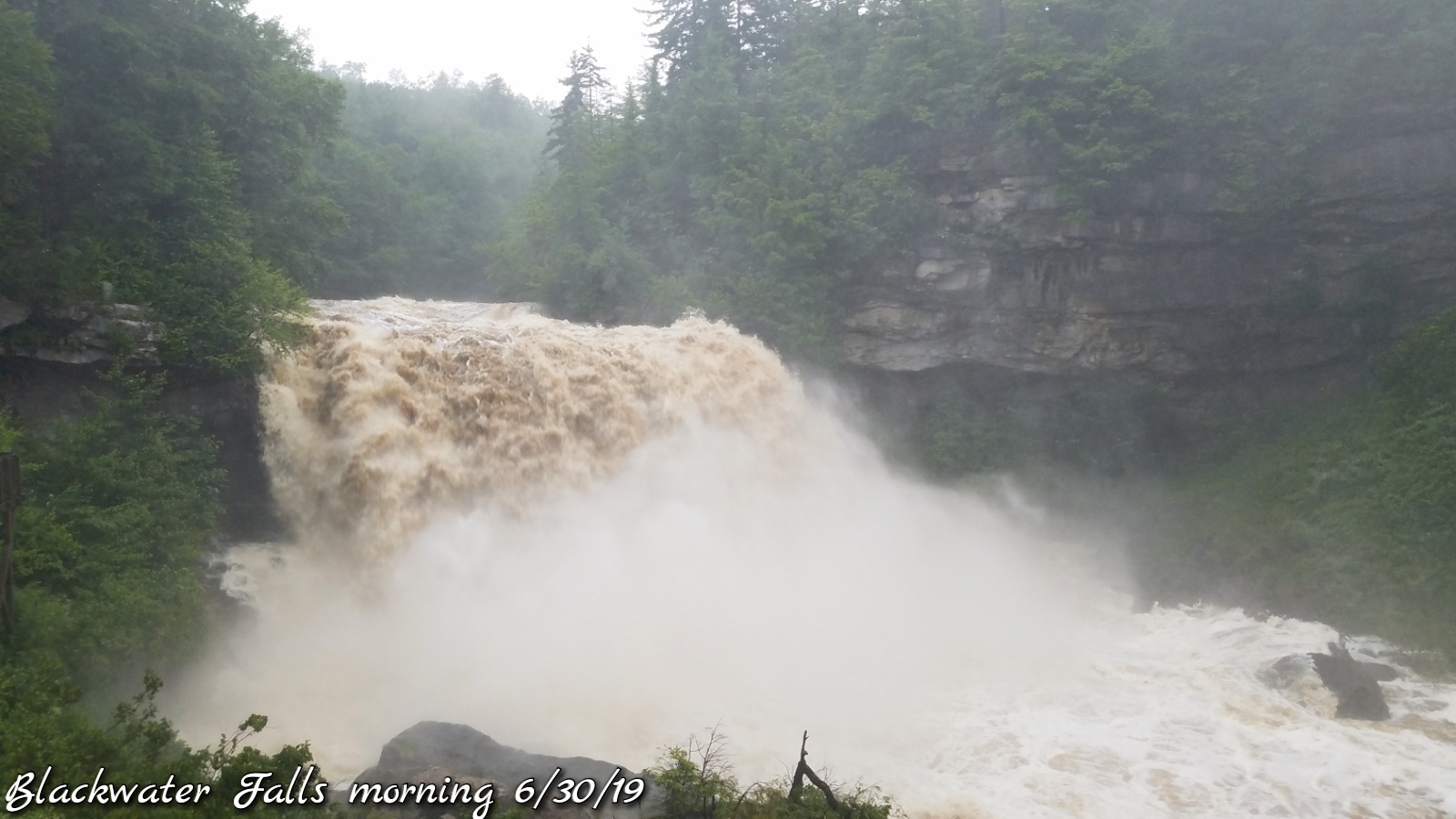
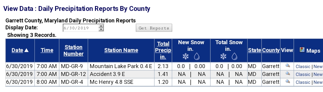
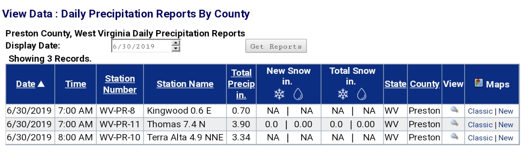
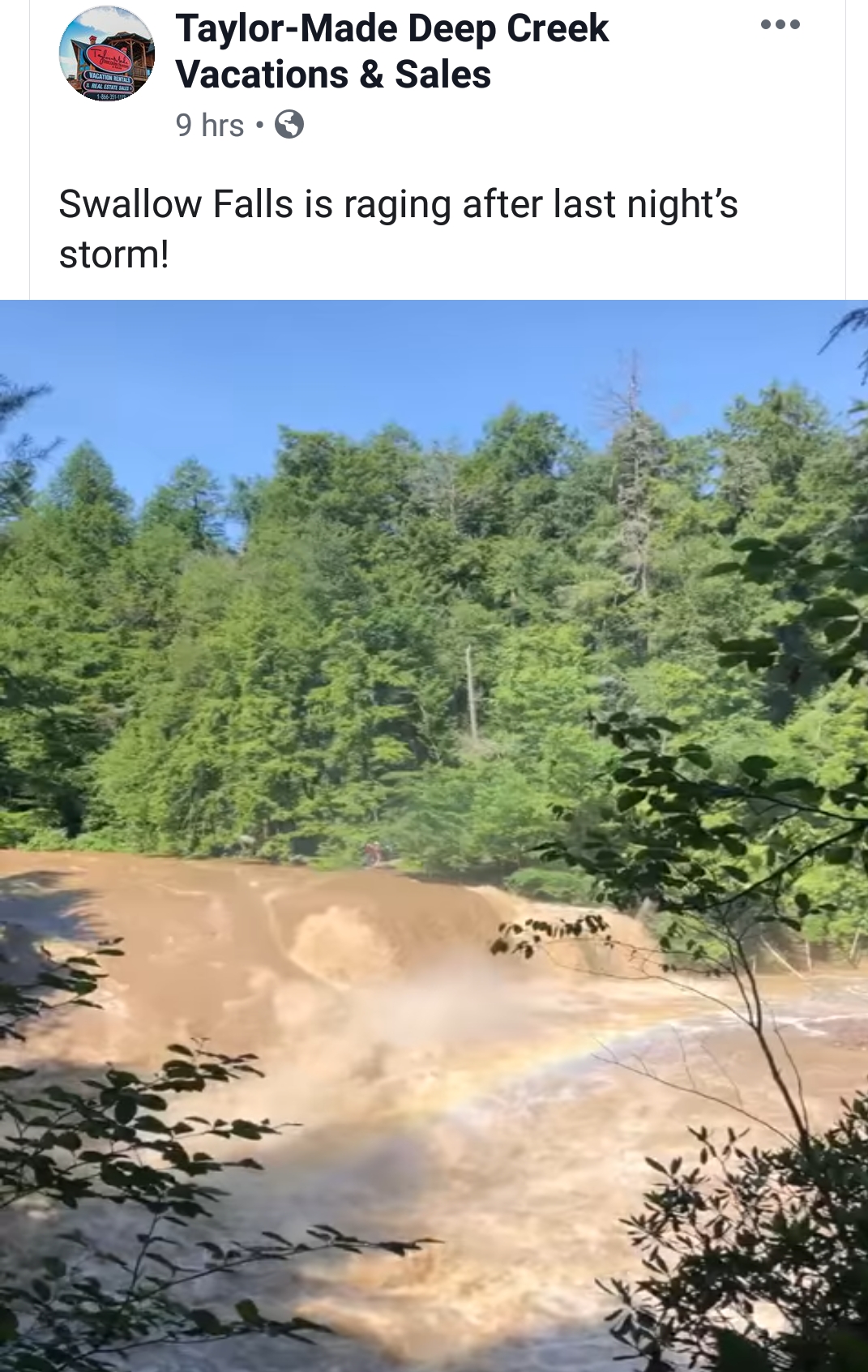
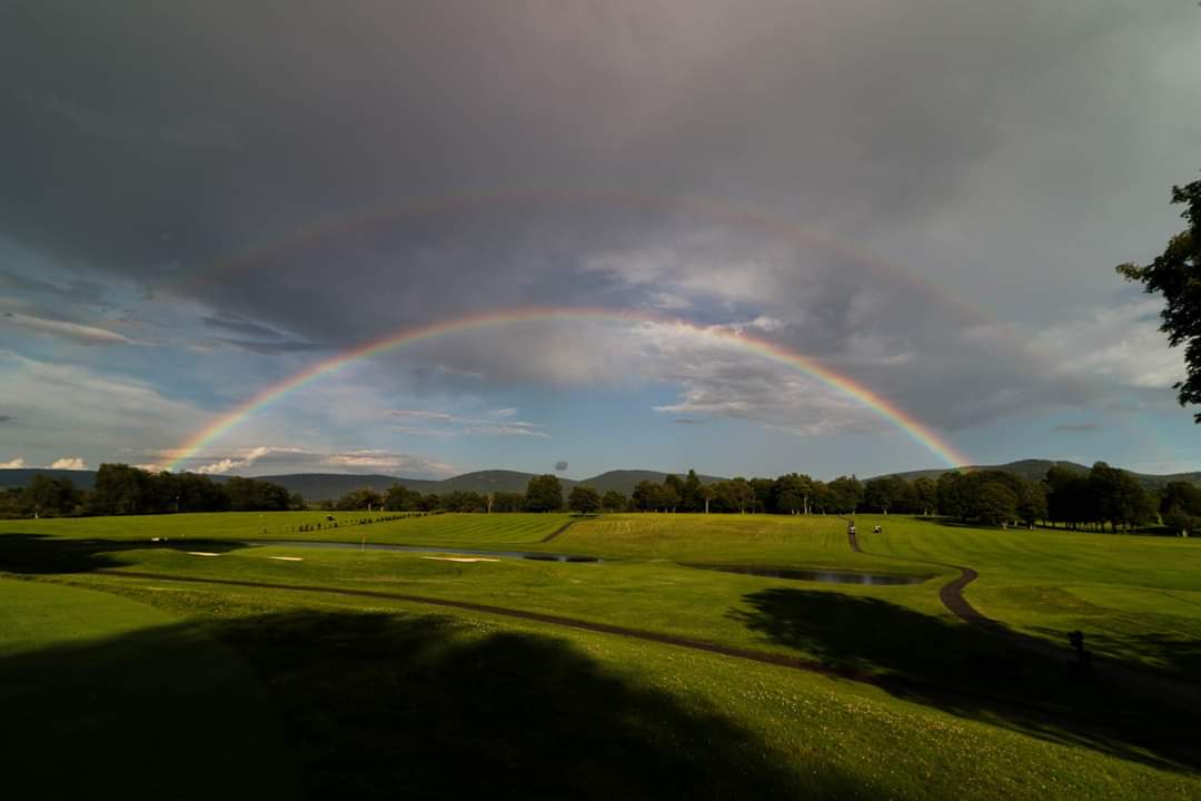
Pics-
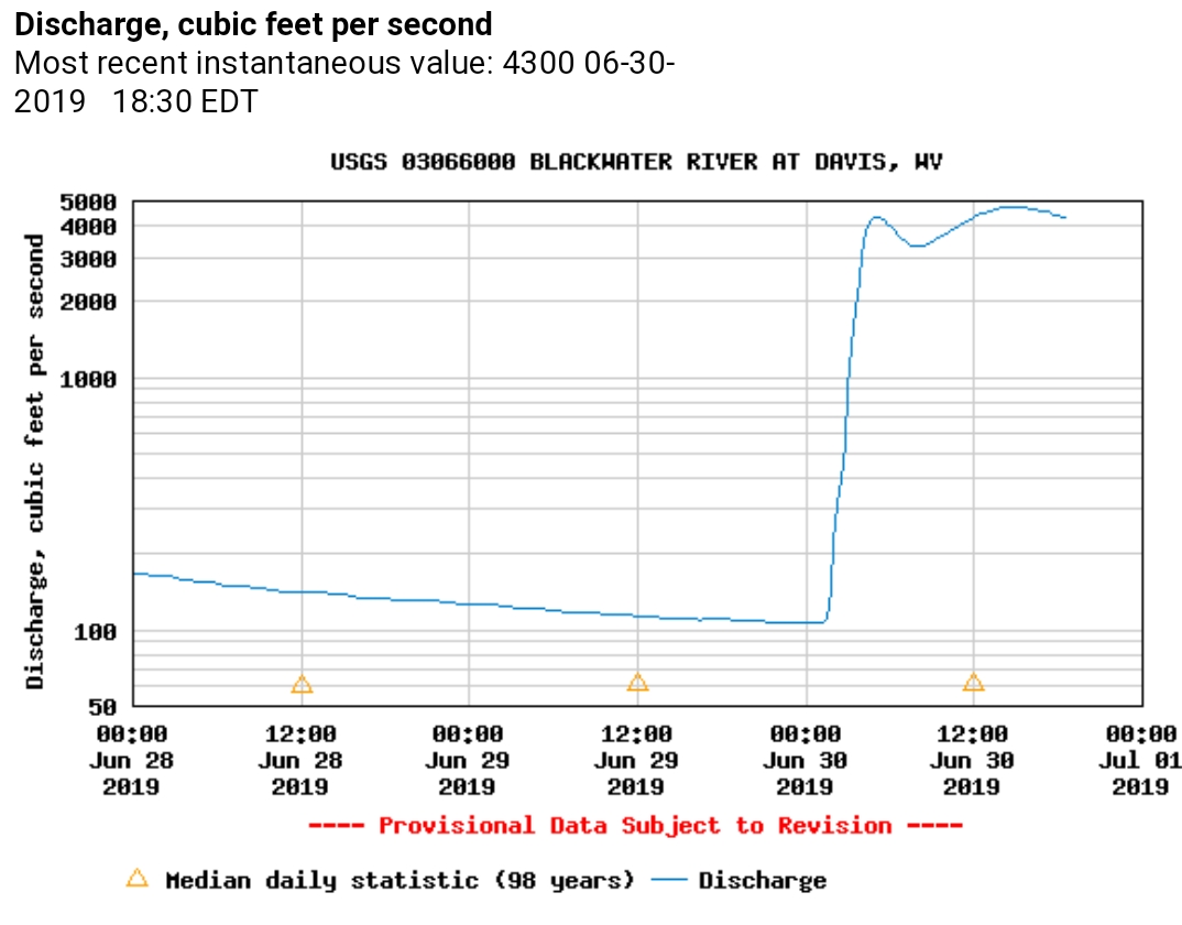
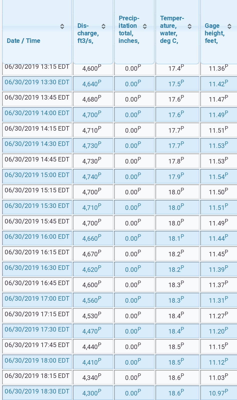
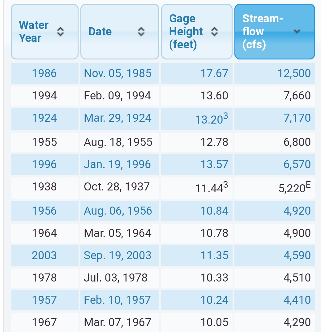
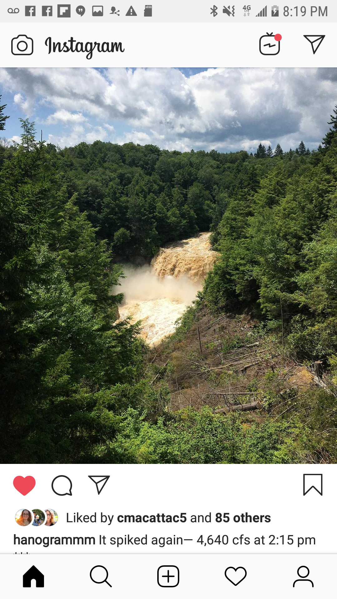
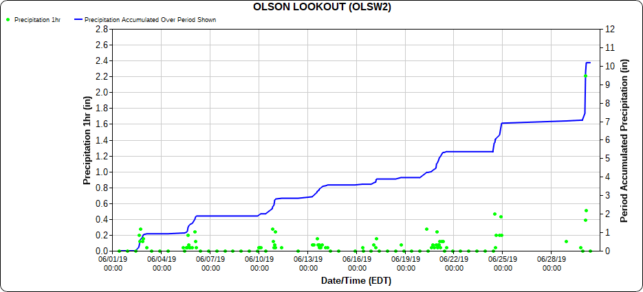
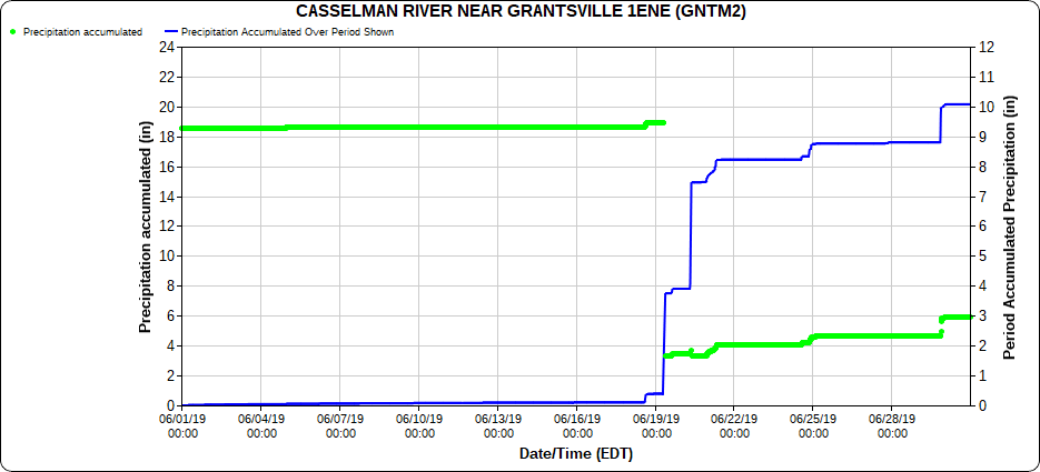
Blackwater River had 2 crest. One st 5am and a second during the afternoon. Crest one at 4310cfs, the videos above are at 3700cfs, then an afternoon crest of 4740cfs. Which ranks 9th highest in the 98 year history of the gauge.
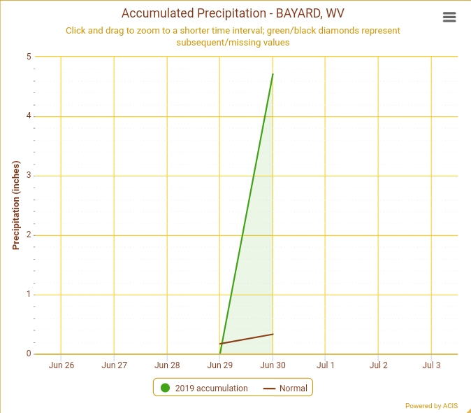
Extreme rainfall rates- Northern Cabin site picking up over 4″ in 2 hours!
Area tallies
Some social media snippets
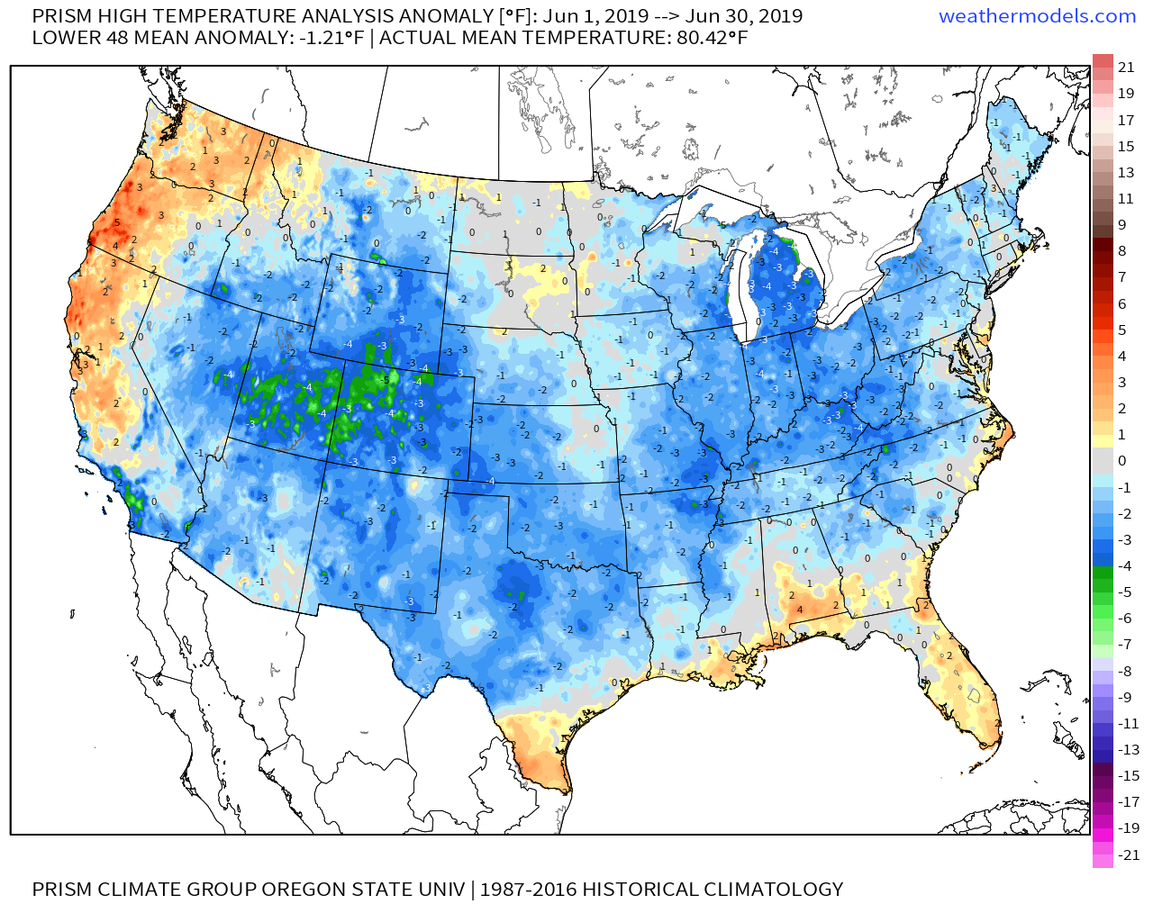
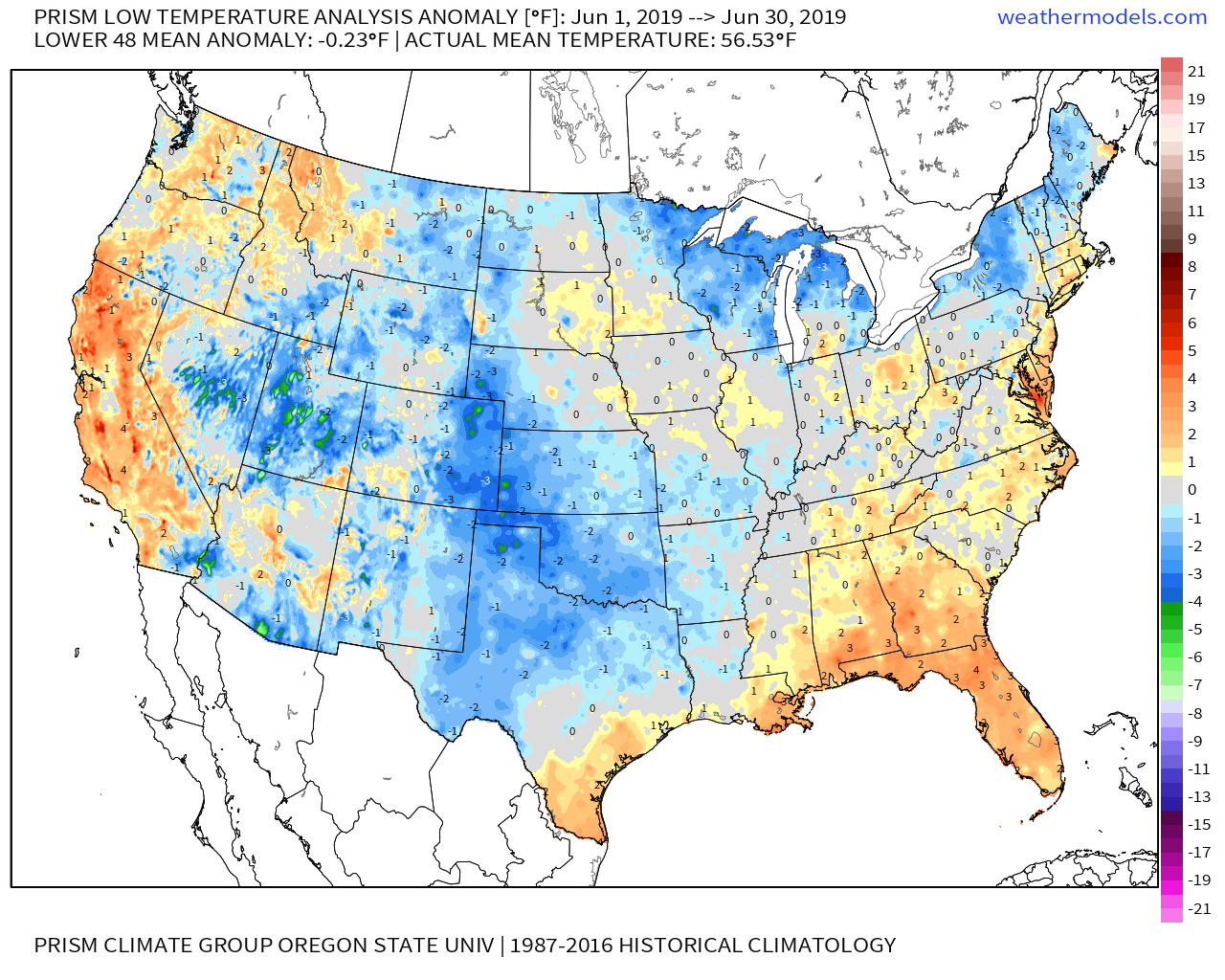
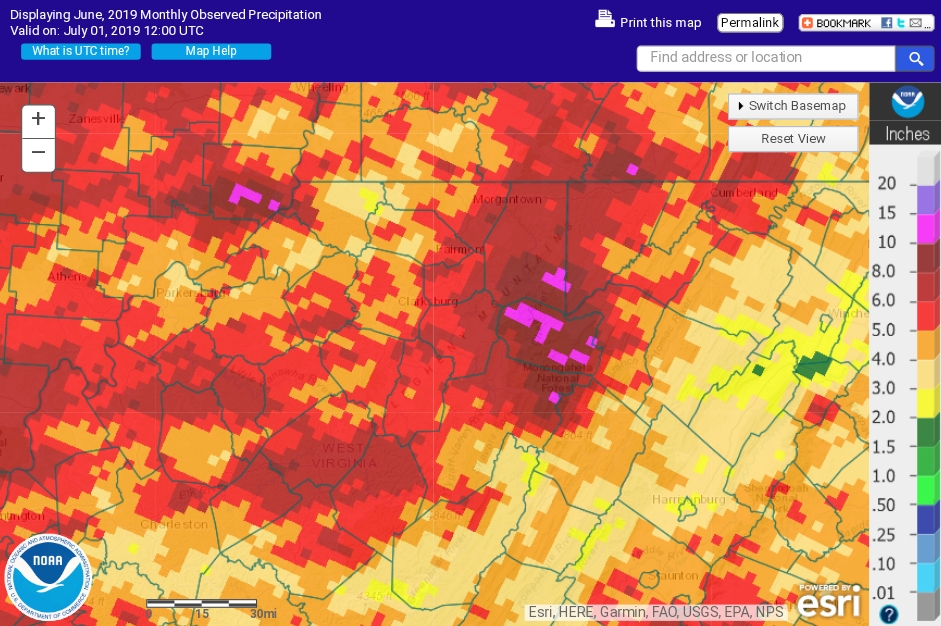
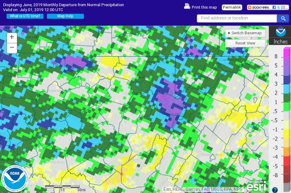
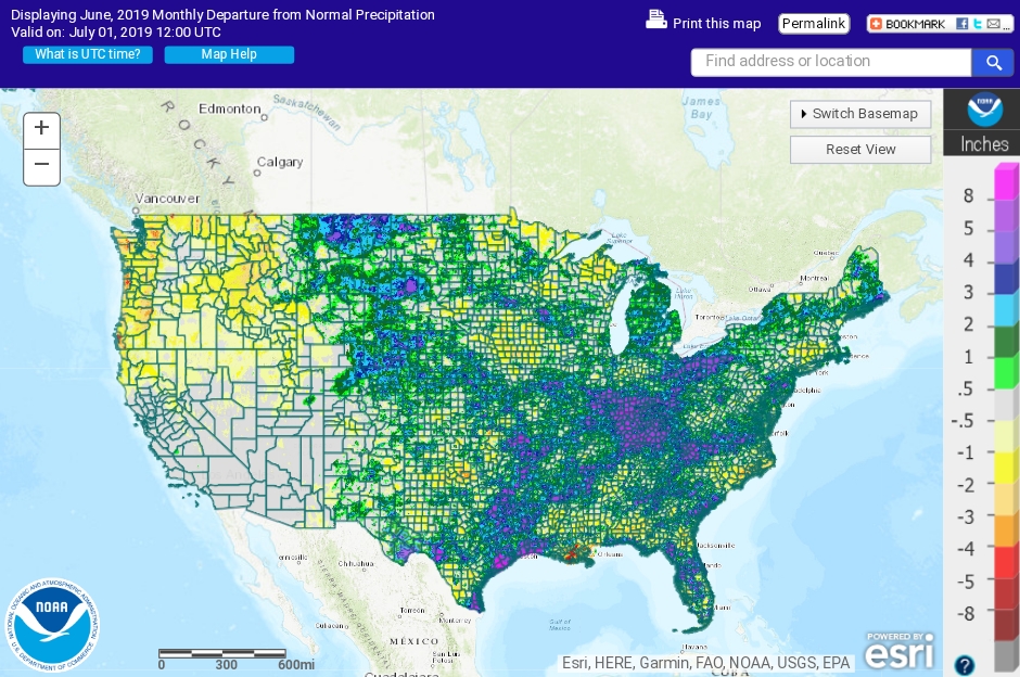
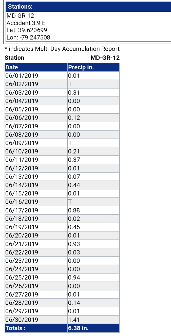
June Summary
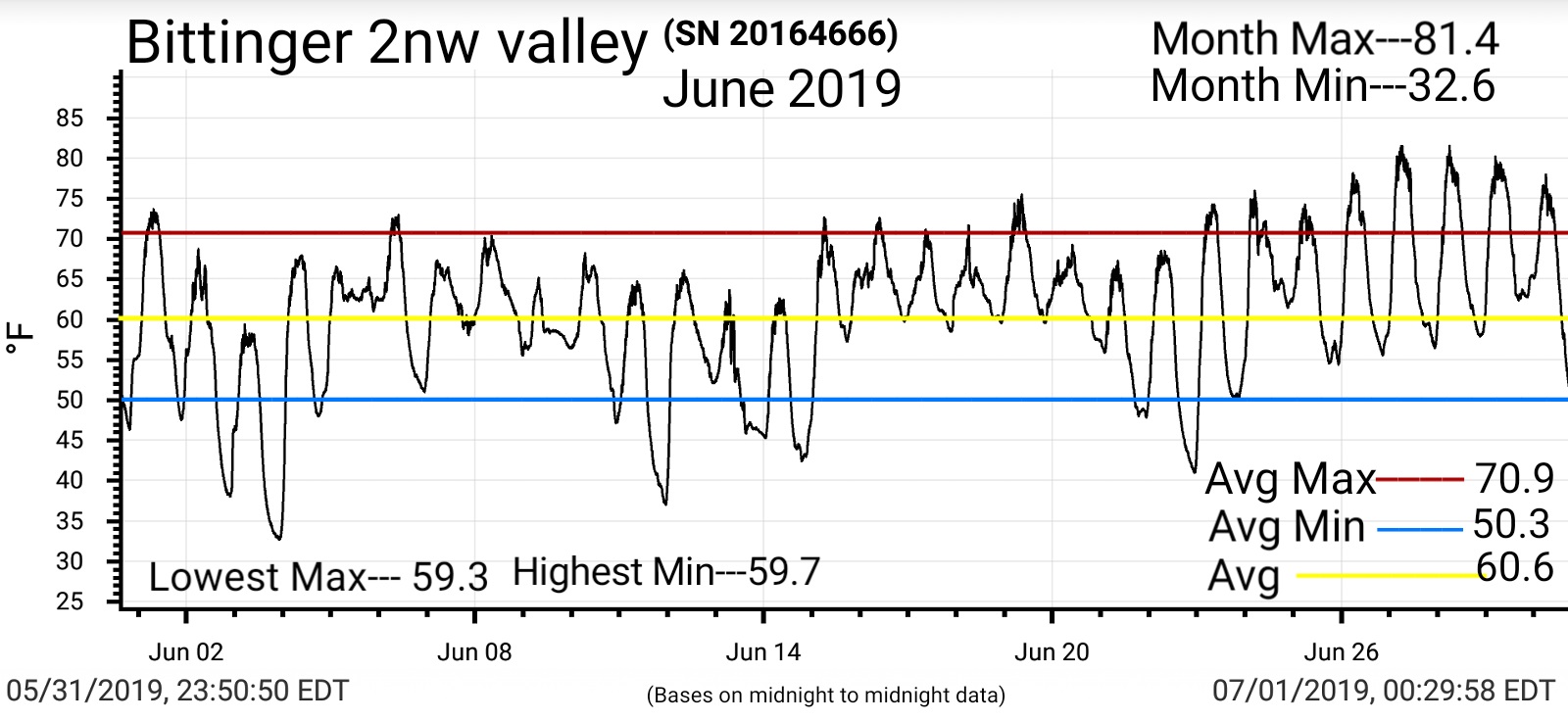
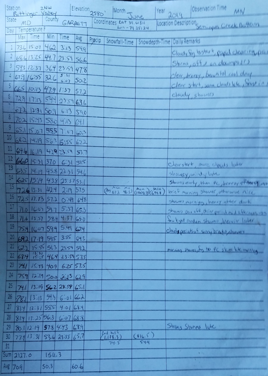
Temperatures June 2019:
Bittinger 2nw valley 1 day highs in 50s, 13 days highs in 60s, 13 days highs in 70s, 3 days highs in 80s with a month max of 81.4 on the 27th and 28th. 3 days with lows in 30s, with frost on June 4th, 9 days lows in 40s, 18 days lows in 50s with the warmest min being 59.7 on the 17th. 1st half of June average 67.2 highs, 46.3 lows, 2nd half 74.5 highs, 54.4 lows
*due to SD card issue, lost 50+ vids of vivid lightning along with today’s other pics
June 29(Sat) min. max. avg
Bitt 2nw Valley
Garrett College
New Germany SP
Can-Heights
CRN-Canaan
Cabin Mt
Cabin Mt N
Spruce Knob
Snowshoe
Can-Valley Floor
Can-Valley Floor N
7Springs
Partly cloudy day, storms North during the day, pressing south at nightfall. Vivid lightning, torrential downpours at nightfall and pressing into Tucker at midnight
Temp profile this afternoon
Radar
Satellite
Flow
Surface features and 500mb height anomalies and flow
Partly cloudy start, some showers around Oakland around 9am, and west first in Preston. Then a mostly dry day until evening storms that were hit n miss.
Temp profile this afternoon
Radar
Satellite
Flow
Surface features and 500mb height anomalies and flow
Partly cloudy day, hot East of the mts. Late day random storms. Brief light shower at Bitt 2nw Valley. Truck thermometer read 93 Cumberland, 73 at home
Temp profile this afternoon
Radar
Satellite
Flow
Surface features and 500mb height anomalies and flow
Mostly sunny day, a dry day, a dry air mass in place allowing for a significant swing in temps from the overnight mins. Northern Canaan site dropping to 32.0, mesowest read 32.0, dyacon read 32.1. Not sure why the difference. At any rate, likely some patchy frost or at least frozen dew in spots in the valley. Those coldest pockets.
Temp profile this afternoon
Radar Void of precip
Satellite
Flow
Surface features and 500mb height anomalies and flow
Temps at Canaan overnight from the Northern Valley site to atop Cabin Mt
Down east of the Alleghenies. C&O Canal at Lock 51 at Hancock